CHAPTER 3
Different circumstances under which the secondary and tertiary formations may have originated – Secondary series formed when the ocean prevailed: Tertiary during the conversion of sea into land, and the growth of a continent – Origin of interruption in the sequence of formations – The areas where new deposits take place are always varying – Causes which occasion this transference of the places of sedimentary deposition – Denudation augments the discordance in age of rocks in contact – Unconformability of overlying formations – In what manner the shifting of the areas of sedimentary deposition may combine with the gradual extinction and introduction of species to produce a series of deposits having distinct mineral and organic characters
DIFFERENT CIRCUMSTANCES UNDER WHICH THE SECONDARY AND TERTIARY FORMATIONS MAY HAVE ORIGINATED.
WE have already glanced at the origin of some of the principal points of difference in the characters of the primary and secondary rocks, and may now briefly consider the relation in which the secondary stand to the tertiary, and the causes of that succession of tertiary formations described in the last chapter.
It is evident that large parts of Europe were simultaneously submerged beneath the sea when different portions of the secondary series were formed, because we find homogeneous mineral masses, including the remains of marine animals, referrible to the secondary period, extending over great areas; whereas the detached and isolated position of tertiary groups, in basins or depressions bounded by secondary and primary rocks, favours the hypothesis of a sea interrupted by extensive tracts of dry land.
State of the Surface when the Secondary Strata Were formed.
Let us consider the changes that must be expected to accompany the gradual conversion of part of the bed of an ocean into a continent, and the different characters that might be imparted to subaqueous deposits formed during the period when the sea prevailed, as contrasted with those that might belong to the subsequent epoch when the land should predominate. First, we may suppose a vast submarine region, such as the bed of the western Atlantic, to receive for ages the turbid waters of several great rivers, like the Amazon, Orinoco, or Mississippi, each draining a considerable continent. The sediment thus introduced might be characterized by a peculiar colour and composition, and the same homogeneous mixture might be spread out over an immense area by the action of a powerful current, like the Gulf-stream. First one submarine basin, and then another, might be filled, or rendered shallow, by the influx of transported matter, the same species of animals and plants still continuing to inhabit the sea, so that the organic, as well as the mineral characters, might be constant throughout the whole series of deposits.
In another part of the same ocean, let us suppose masses of coralline and shelly limestone to grow, like those of the Pacific, simultaneously over a space several thousand miles in length, and thirty or forty degrees of latitude in breadth, while volcanic eruptions give rise, at different intervals, to igneous rocks, having a common subaqueous character in different parts of the vast area.
It is evident that, during such a state of a certain quarter of the globe, beds of limestone and other rocks might be formed, and retain a common character over spaces equal to a large portion of Europe.
State of the Surface when the Tertiary Groups were formed.
But when the area under consideration began to be converted into land, a very different condition of things would succeed. A series of subterranean movements might first give rise to small rocks and isles, and then, by subsequent elevations, to larger islands, by the junction of the former. These lands would consist partly of the mineral masses before described, whether coralline, sedimentary, or volcanic, and partly of the subjacent rocks, whatever they may have been, which constituted the original bed of the ocean. Now the degradation of these lands would commence immediately upon their emergence, the waves of the sea undermining the cliffs, and torrents flowing from the surface, so that new strata would begin to form in different places; and in proportion as the lands increased, these deposits would augment.
At length by the continued rising and sinking of different parts of the bed of the ocean, a number of distinct basins would be formed, wherein different kinds of sediment, each distinguished by some local character, might accumulate. Some of the groups of isles that had first risen would, in the course of ages, become the central mountain ranges of continents, and different lofty chains might thus be characterized by similar rocks of contemporaneous origin, the component strata having originated under analogous circumstances in the ocean before described.
Finally, when large tracts of land existed, there would be a variety of disconnected gulfs, inland seas, and lakes, each receiving the drainage of distinct hydrographical basins, and becoming the receptacles of strata distinguished by marked peculiarities of mineral composition. The organic remains would also be more varied, for in one locality fresh-water species would be imbedded, as in deposits now forming in the lakes of Switzerland and the north of Italy; in another, marine species, as in the Aral and Caspian; in a third region, gulfs of brackish water would be converted into land, like those of Bothnia and Finland in the Baltic; in a fourth, there might be great fluviatile and marine formations along the borders of a chain of inland seas, like the deltas now growing at the mouths of the Don, Danube, Nile, Po, and Rhone, along the shores of the Azof, Euxine, and Mediterranean. These deposits would each partake more or less of the peculiar mineral character of adjoining lands, the degradation of which would supply sediment to the different rivers.
Now if such be, in a great measure, the distinction between the circumstances under which the secondary and tertiary series originated, it is quite natural that particular tertiary groups should occupy areas of comparatively small extent,-that they should frequently consist of littoral and lacustrine deposits, and that they should often contain those admixtures of terrestrial, fresh-water, and marine remains, which are so rare in secondary rocks. It might also be expected, that the tertiary volcanic formations should be much less exclusively submarine, and this we accordingly find to be the case.
CAUSES OF THE SUPERPOSITION OF SUCCESSIVE FORMATIONS HAVING DISTINCT MINERAL AND ORGANIC CHARACTERS.
But we have still to account for those remarkable breaks in the series of superimposed formations, which are common both to the secondary and tertiary rocks, but are more particularly frequent in the latter.
The elucidation of this curious point is the more important, because geologists of a certain school appeal to phenomena of this kind in support of their doctrine of great catastrophes, out of the ordinary course of nature, and sudden revolutions of the globe.
It is only by carefully considering the combined action of all the causes of change now in operation, whether in the animate or inanimate world, that we can hope to explain such complicated appearances as are exhibited in the general arrangement of mineral masses. In attempting, therefore, to trace the origin of these violations of continuity, we must re-consider many of the topics treated of in our two former volumes, such as the effects of the various agents of decay and reproduction, the imbedding of organic remains, and the extinction of species.
Shifting of the Areas of Sedimentary Deposition. -- By reverting to our survey of the destroying and renovating agents, it will be seen that the surface of the terraqueous globe may be divided into two parts, one of which is undergoing repair, while the other, constituting, at anyone period, by far the largest portion of the whole, is either suffering degradation, or remaining stationary without loss or increment. The reader will assent at once to this proposition, when he reflects that the dry land is, for the most part, wasting by the action of rain, rivers, and torrents, while the effects of vegetation have, as we have shown, only a conservative tendency, being very rarely instrumental in adding new masses of mineral matter to the surface of emerged lands; and when he also reflects that part of the bed of the sea is exposed to the excavating action of currents, while the greater part, remote from continents and islands, probably receives no new deposits whatever, being covered for ages with the clear blue waters uncharged with sediment. Here the relics of organic beings, lying in the ooze of the deep, may decompose like the leaves of the forest in autumn, and leave no wreck behind, but merely supply nourishment, by their decomposition, to succeeding races of marine animals and plants.
The other part of the terraqueous surface is the receptacle of new deposits, and in this portion alone, as we pointed out in the last volume, the remains of animals and plants become fossilized. Now the position of this area, where new formations are in progress, and where alone any memorials of the state of organic life are preserved, is always varying, and must for ever continue to vary; and, for the same reason, that portion of the terraqueous globe which is undergoing waste, also shifts its position, and these fluctuations depend partly on the action of aqueous, and partly of igneous causes.
In illustration of these positions we may observe, that the sediment of the Rhone, which is thrown into the lake of Geneva, is now conveyed to a spot a mile and a half distant from that where it accumulated in the tenth century, and six miles from the point where the delta began originally to form. We may look forward to the period when the lake will be filled up, and then a sudden change will take place in the distribution of the transported matter; for the mud and sand brought down from the Alps will thenceforth, instead of being deposited near Geneva, be carried nearly two hundred miles southwards, where the Rhone enters the Mediterranean.
The additional matter thus borne down to the lower delta of the Rhone would not only accelerate its increase, but might affect the mineral character of the strata there deposited, and thus give rise to an upper group, or subdivision of beds, having a distinct character. But the filling up of a lake, and the consequent transfer of the sediment to a new place, may sometimes give rise to a more abrupt transition from one group to another; as, for example, in a gulf like that of the St. Lawrence, where no deposits are now accumulated the river being purged of all its impurities in its previous course through the Canadian lakes. Should the lowermost of these lakes be at any time filled up with sediment, or laid dry by earthquakes, the waters of the river would thenceforth become turbid, and strata would begin to be deposited in the gulf, where a new formation would immediately overlie the ancient rocks now constituting the bottom. In this case there would be an abrupt passage from the inferior and more ancient, to the newer superimposed formation.
The same sudden coming on of new sedimentary deposits, or the suspension of those which were in progress, must frequently occur in different submarine basins where there are currents which are always liable, in the course of ages, to change their direction. Suppose, for instance, a sea to be filling up in the same manner as the Adriatic, by the influx of the Po, Adige, and other rivers. The deltas, after advancing and converging, may at last come within the action of a transverse current, which may arrest the further deposition of matter, and sweep it away to a distant point. Such a current now appears to prey upon the delta of the Nile, and to carry eastward the annual accessions of sediment that once added rapidly to the plains of Egypt.
On the other hand, if a current charged with sediment vary its course, a circumstance which, as we have shown, must happen to all of them in the lapse of ages, the accumulation of transported matter will at once cease in one region, and commence in another.
Although the causes which occasion the transference of the places of sedimentary deposition are continually in action in every region, yet they are most frequent where subterranean movements alter, from time to time, the levels of land, and they must be immense during the successive elevations and depressions which must be supposed to accompany the rise of a great continent from the deep. A trifling change of level may sometimes throw a current into a new direction, or alter the course of a considerable river. Some tracts will be alternately submerged and laid dry by subterranean movements; in one place a shoal will be formed, whereby the waters will drift matter over spaces where they once threw down their burden, and new cavities will elsewhere be produced, both marine and lacustrine, which will intercept the waters bearing sediment, and thereby stop the supply once carried to some distant basin.
We have before stated, that a few earthquakes of moderate power might cause a subsidence which would connect the sea of Azof with a large part of Asia now below the level of the ocean. This vast depression, recently shown by Humboldt to extend over an area of eighteen thousand square leagues, surrounds Lake Aral and the Caspian, on the shores of which seas it sinks in some parts to the depth of three hundred feet below the level of the ocean. The whole area might thus suddenly become the receptacle of new beds of sand and shells, probably differing in mineral character from the masses previously existing in that country, for an exact correspondence could only arise from a precise identity in the whole combination of circumstances which should give rise to formations produced at different periods in the same place.
Without entering into more detailed explanations, the reader will perceive that, according to the laws now governing the aqueous and igneous causes, distinct deposits must, at different periods, be thrown down on various parts of the earth's surface, and that, in the course of ages, the same area may become, again and again, the receptacle of such dissimilar sets of strata. During intervening periods, the space may either remain unaltered, or suffer what is termed denudation, in which case a superior set of strata are removed by the power of running water, and subjacent beds are laid bare, as happens wherever a sea encroaches upon a line of coast. By such means, it is obvious that the discordance in age of rocks in contact must often be greatly increased.
The frequent unconformability in the stratification of the inferior and overlying formation is another phenomenon in their arrangement, which may be considered as a natural consequence of those movements that accompany the gradual conversion of part of an ocean into land; for by such convulsions the older set of strata may become rent, shattered, inclined, and contorted to any amount. If the movement entirely cease before a new deposit is formed in the same tract, the superior strata may repose horizontally upon the dislocated series. .But even if the subterranean convulsions continue with increasing violence, the more recent formations must remain comparatively undisturbed, because they cannot share in the immense derangement previously produced in the older beds, while the latter, on the contrary, cannot fail to participate in all the movements subsequently communicated to the newer.
Change of Species everywhere in progress. -- If, then, it be conceded, that the combined action of the volcanic and the aqueous forces would give rise to a succession of distinct formations, and that these would be sometimes unconformable, let us next inquire in what manner these groups might become characterized by different assemblages of fossil remains.
We endeavoured to show, in the last volume, that the hypothesis of the gradual extinction of certain animals and plants, and the successive introduction of new species, was quite consistent with all that is known of the existing economy of the animate world; and if it be found the only hypothesis which is reconcilable with geological phenomena, we shall have strong grounds for conceiving that such is the order of nature.
Fossilization of Plants and Animals partial. -- We have seen that the causes which limit the duration of species are not confined, at anyone time, to a particular part of the globe; and, for the same reason, if we suppose that their place is supplied, from time to time, by new species, we may suppose their introduction to be no less generally in progress. Hence, from all the foregoing premises, it would follow, that the change of species would be in simultaneous operation everywhere throughout the habitable surface of sea and land; whereas the fossilization of plants and animals must always be confined to those areas where new strata are produced. These areas, as we have proved, are always shifting their position, so that the fossilizing process, whereby the commemoration of the particular state of the organic world, at any given time, is effected, may be said to move about, visiting and revisiting different tracts in succession.
In order more distinctly to elucidate our idea of the working of this machinery, let us compare it to a somewhat analogous case that might easily be imagined to occur in the history of human affairs. Let the mortality of the population of a large country represent the successive extinction of species, and the births of new individuals the introduction of new species. While these fluctuations are gradually taking place everywhere, suppose commissioners to be appointed to visit each province of the country in succession, taking an exact account of the number, names, and individual peculiarities of all the inhabitants, and leaving in each district a register containing a record of this information. If, after the completion of one census, another is immediately made after the same plan, and then another, there will, at last, be a series of statistical documents in each province. When these are arranged in chronological order, the contents of those which stand next to each other will differ according to the length of the intervals of time between the taking of each census. If, for example, all the registers are made in a single year, the proportion of deaths and births will be so small during the interval between the compiling of two consecutive documents, that the individuals described in each will be nearly identical; whereas, if there are sixty provinces, and the survey of each requires a year, there will be an almost entire discordance between the persons enumerated in two consecutive registers.
There are undoubtedly some other causes besides the mere quantity of time which may augment or diminish the amount of discrepancy. Thus, for example. at some periods a pestilential disease may lessen the average duration of human life, or a variety of circumstances may cause the births to be unusually numerous, and the population to multiply, or, a province may be suddenly colonized by persons migrating from surrounding districts.
We must also remind the reader, that we do not propose the above case as an exact parallel to those geological phenomena which we desire to illustrate; for the commissioners are supposed to visit the different provinces in rotation, whereas the commemorating processes by which organic remains become fossilized, although they are always shifting from one area to another, are yet very irregular in their movements. They may abandon and revisit many spaces again and again, before they once approach another district; and besides this source of irregularity, it may often happen, that while the depositing process is suspended, denudation may take place, which may be compared to the occasional destruction of some of the statistical documents before mentioned. It is evident, that where such accidents occur, the want of continuity in the series may become indefinitely great, and that the monuments which follow next in succession will by no means be equidistant from each other in point of time.
If this train of reasoning be admitted, the frequent distinctness of the fossil remains, in formations immediately in contact, would be a necessary consequence of the existing laws of sedimentary deposition, accompanied by the gradual birth and death of species.
We have already stated, that we should naturally look for a change in the mineral character in strata thrown down at distant intervals in the same place; and, in like manner, we must also expect, for the reason last set forth, to meet occasionally with sudden transitions from one set of organic remains to another. But the causes which have given rise to such differences in mineral characters have no necessary connexion with those which have produced a change in the species of imbedded plants and animals.
When the lowest of two sets of strata are much dislocated over a wide area, the upper being undisturbed, there is usually a considerable discordance in the organic remains of the two groups; but this coincidence must not be ascribed to the agency of the disturbing forces, as if they had exterminated the living inhabitants of the surface. The immense lapse of time required for the development of so great a series of subterranean movements, has in these cases allowed the species also throughout the globe to vary, and hence the two phenomena are usually concomitant.
Although these inferences appear to us very obvious, we are aware that they are directly opposed to many popular theories respecting catastrophes; we shall, therefore, endeavour to place our views in a still clearer light before the reader. Suppose we had discovered two buried cities at the foot of Vesuvius, immediately superimposed upon each other, with a great mass of tuff and lava intervening, just as Portici and Resina, if now covered with ashes, would overlie Herculaneum. An antiquary might possibly be entitled to infer, from the inscriptions on public edifices, that the inhabitants of the inferior and older town were Greeks, and those of the modern, Italians. But he would reason very hastily, if he also concluded from these data, that there had been a sudden change from the Greek to the Italian language in Campania. Suppose he afterwards found three buried cities, one above the other, the intermediate one being Roman, while, as in the former example, the lowest was Greek, and the uppermost Italian, he would then perceive the fallacy of his former opinion, and would begin to suspect that the catastrophes, whereby the cities were inhumed, might have no relation whatever to the fluctuations in the language of the inhabitants; and that, as the Roman tongue had evidently intervened between the Greek and Italian, so many other dialects may have been spoken in succession, and the passage from the Greek to the Italian may have been very gradual, some terms growing obsolete, while others were introduced from time to time.
If this antiquary could have shown that the volcanic paroxysms of Vesuvius were so governed as that cities should be buried one above the other, just as often as any variation occurred in the language of the inhabitants, then, indeed, the abrupt passage from a Greek to a Roman, and from a Roman to an Italian city, would afford proof of fluctuations no less sudden in the language of the people.
So in Geology, if we could assume that it is part of the plan of nature to preserve, in every region of the globe, an unbroken series of monuments to commemorate the vicissitudes of the organic creation, we might infer the sudden extirpation of species, and the simultaneous introduction of others, as often as two formations in contact include dissimilar organic fossils. But we must shut our eyes to the whole economy of the existing causes, aqueous, igneous, and organic, if we fail to perceive that such is not the plan of Nature.
Principles of Geology, by Charles Lyell
Re: Principles of Geology, by Charles Lyell
![]() by admin » Fri Jul 17, 2015 2:00 am
by admin » Fri Jul 17, 2015 2:00 am
- admin
- Site Admin
- Posts: 36175
- Joined: Thu Aug 01, 2013 5:21 am
Re: Principles of Geology, by Charles Lyell
![]() by admin » Fri Jul 17, 2015 2:01 am
by admin » Fri Jul 17, 2015 2:01 am
CHAPTER 4
Chronological relations of mineral masses the first object in geological classification – Superposition, proof of more recent origin – Exceptions in regard to volcanic rocks – Relative age proved by included fragments of older rocks – Proofs of contemporaneous origin derived from mineral characters – Variations to which these characters are liable – Recurrence of distinct rocks at successive periods – Proofs of contemporaneous origin derived from organic remains – Zoological provinces are of limited extent, yet spread over wider areas than homogeneous mineral deposits – Different modes whereby dissimilar mineral masses and distinct groups of species may be proved to have been contemporaneous
DETERMINATION OF THE RELATIVE AGES OF ROCKS.
IN attempting to classify the mineral masses which compose the crust of the earth, the principal object which the geologist must keep in view, is to determine with accuracy their chronological relations, for it is abundantly clear, that different rocks have been formed in succession; and in order thoroughly to comprehend the manner in which they enter into the structure of our continents, we should study them with reference to the time and mode of their formation.
We shall now, therefore, consider by what characters the relative ages of different rocks may be established, whereby we may be supplied at once with sound information of the greatest practical utility, and which may throw, at the same time, the fullest light on the ancient history of the globe.
Proofs of relative age by superposition.
It is evident that where we find a series of horizontal strata, of sedimentary origin, the uppermost bed must be newer than those which it overlies, and that when we observe one distinct set of strata reposing upon another, the inferior is the older or the two. In countries where the original position of mineral masses has been disturbed, at different periods, by convulsions of extraordinary violence, as in the Alps and other mountainous districts, there are instances where the original position of strata has been reversed; but such exceptions are rare, and are usually on a small scale, and an experienced observer can generally ascertain the true relations of the rocks in question, by examining some adjoining districts where the derangement has been less extensive.
In regard to volcanic formations, if we find a stratum of tuff or ejected matter, or a stream of lava covering sedimentary strata, we may infer, with confidence, that the igneous rock is the more recent; but, on the other hand, the superposition of aqueous deposits to a volcanic mass does not always prove the former to be of newer origin. If, indeed, we discover strata of tuff with imbedded shells, or, as in the Vicentine and other places, rolled blocks of lava with adhering shells and corals, we may then be sure that these masses of volcanic origin covered the bottom of the sea. before the superincumbent strata were thrown down. But as lava rises from below, and does not always reach the surface, it may sometimes penetrate a certain number of strata, and then cool down, so as to constitute a solid mass of newer origin, although inferior in position. It is, for the most part, by the passage of veins proceeding from such igneous rocks through contiguous sedimentary strata, or by such hardening and other alteration of the overlying bed, as might be expected to result from contact with a heated mass, that we are enabled to decide whether the volcanic matter was previously consolidated, or subsequently introduced.
Proofs by included fragments of older rocks.
A Geologist is sometimes at a loss, after investigating a district composed of two distinct formations, to determine the relative ages of each, from want of sections exhibiting their superposition. In such cases, another kind of evidence, of a character no less conclusive, can sometimes be obtained. One group of strata has frequently been derived from the degradation of another in the immediate neighbourhood, and may be observed to include within it fragments of such older rocks. Thus, for example, we may find chalk with flints, and in another part of the same country, a distinct series, consisting of alternations of clay, sand, and pebbles. If some of these pebbles consist of flints, with silicified fossil-shells of the same species as those in the chalk, we may confidently infer, that the chalk is the oldest of the two formations.
We remarked in the second chapter, that some granite must have existed before the most ancient of our secondary rocks, because some of the latter contain rounded pebbles of granite. But for the existence of such evidence, we might not have felt assured that all the granite which we see had not been protruded from below in a state of fusion, subsequently to the origin of the secondary strata.
Proofs of contemporaneous origin derived from mineral characters.
When we have established the relative age of two formations in a given place, by direct superposition, or by other evidence, a far more difficult task remains, to trace the continuity of the same formation, or, in other cases, to find means of referring detached groups of rocks to a contemporaneous origin. Such identifications in age are chiefly derivable from two sources -- mineral character and organic contents; but the utmost skill and caution are required in the application of such tests, for scarcely any general rules can be laid down respecting either, that do not admit of important exceptions.
If, at certain periods of the past, rocks of peculiar mineral composition had been precipitated simultaneously upon the floor of an 'universal ocean,' so as to invest the whole earth in a succession of concentric coats, the determination of relative dates in geology might have been a matter of the greatest simplicity. To explain, indeed, the phenomenon would have been difficult, or rather impossible, as such appearances would have implied a former state of the globe, without any analogy to that now prevailing. Suppose, for example, there were three masses extending over every continent, -- the upper of chalk and chloritic sand; the next below, of blue argillaceous limestone; and the third and lowest, of red marl and sandstone; we must imagine that all the rivers and currents of the world had been charged, at the first period, with red mud and sand; at the second, with blue calcareo-argillaceous mud; and at a subsequent epoch, with chalky sediment and chloritic sand.
But if the ocean were universal, there could have been no land to waste away by the action of the sea and rivers, and, therefore, no known source whence the homogeneous sedimentary matter could have been derived. Few, perhaps, of the earlier geologists went so far as to believe implicitly in such universality of formations, but they inclined to an opinion, that they were continuous over areas almost indefinite; and since such a disposition of mineral masses would, if true, have been the least complex and most convenient for the purposes of classification, it is probable that a belief in its reality was often promoted by the hope that it might prove true. As to the objection, that such an arrangement of mineral masses could never result from any combination of causes now in action, it never weighed with the earlier cultivators of the science, since they indulged no expectation of being ever able to account for geological phenomena by reference to the known economy of nature. On the contrary, they set out, as we have already seen, with the assumption that the past and present conditions of the planet were too dissimilar to admit of exact comparison.
But if we inquire into the true composition of any stratum, or set of strata, and endeavour to pursue these continuously through a country, we often find that the character of the mass changes gradually, and becomes at length so different, that we should never have suspected its identity, if we had not been enabled to trace its passage from one form to another.
We soon discover that rocks dissimilar in mineral composition have originated simultaneously; we find, moreover, evidence in certain districts, of the recurrence of rocks of precisely the same mineral character at very different periods; as, for example, two formations of red sandstone, with a great series of other strata intervening between them. Such repetitions might have been anticipated, since these red sandstones are produced by the decomposition of granite, gneiss, and micaschist; and districts composed exclusively of these, must again and again be exposed to decomposition, and to the erosive action of running water.
But notwithstanding the variations before alluded to in the composition of one continuous set of strata, many rocks retain the same homogeneous structure and composition, throughout considerable areas, and frequently, after a change of mineral character, preserve their new peculiarities throughout another tract of great extent. Thus, for example, we may trace a limestone for a hundred miles, and then observe that it becomes more arenaceous, until it finally passes into sand or sandstone. We may then follow the last-mentioned formation throughout another district as extensive as that occupied by the limestone first examined.
Proofs of contemporaneous origin derived from organic remains.
We devoted several chapters, in the last volume, to show that the habitable surface of the sea and land may be divided into a considerable number of distinct provinces, each peopled by a peculiar assemblage of animals and plants. and we endeavoured to point out the origin of these separate divisions. It was shown that climate is only one of many causes on which they depend, and that difference of longitude, as well as latitude, is generally accompanied by a dissimilarity of indigenous species of organic beings.
As different seas, therefore, and lakes are inhabited at the same period, by different species of aquatic animals and plants, and as the lands adjoining these may be peopled by distinct terrestrial species, it follows that distinct organic remains are imbedded in contemporaneous deposits. If it were otherwise -- if the same species abounded in every climate, or even in every part of the globe where a corresponding temperature, and other conditions favourable to their existence were found, the identification of mineral masses of the same age, by means of their included organic contents, would be a matter of much greater facility.
But, fortunately, the extent of the same zoological provinces, especially those of marine animals, is very great, so that we are entitled to expect, from analogy, that the identity of fossil species, throughout large areas, will often enable us to connect together a great variety of detached and dissimilar formations.
Thus, for example, it will be seen, by reference to our first volume, that deposits now forming in different parts of the Mediterranean, as in the deltas of the Rhone and the Nile, are distinct in mineral composition; for calcareous rocks are precipitated from the waters of the former river, while pebbles are carried into its delta, and there cemented, by carbonate of lime, into a conglomerate; whereas strata of soft mud and fine sand are formed exclusively in the Nilotic delta. The Po, again, carries down fine sand and mud into the Adriatic j but since this sediment is derived from the degradation of a different assemblage of mountains from those drained by the Rhone or the Nile, we may safely assume that there will never be an exact identity in their respective deposits.
If we pass to another quarter of the Mediterranean, as, for example, to the sea on the coast of Campania, or near the base of Etna in Sicily, or to the Grecian archipelago, we find in all these localities that distinct combinations of rocks are in progress. Occasional showers of volcanic ashes are falling into the sea, and streams of lava are flowing along its bottom; and in the intervals between volcanic eruptions, beds of sand and clay are frequently derived from the waste of cliffs, or the turbid waters of rivers. Limestones, moreover, such as the Italian travertins, are here and there precipitated from the waters of mineral springs, while shells and corals accumulate in various localities. Yet the entire Mediterranean, where the above-mentioned formations are simultaneously in progress, may be considered as one zoological province; for, although certain species of testacea and zoophytes may be very local, and each region may probably have some species peculiar to it, still a considerable number are common to the whole sea. If, therefore, at some future period, the bed of this inland sea should be converted into land, the geologist might be enabled, by reference to organic remains, to prove the contemporaneous origin of various mineral masses throughout a space equal in area to a great portion of Europe. The Black Sea, moreover, is inhabited by so many identical species, that the delta of the Danube and the Don might, by the same evidence, be shown to have originated simultaneously.
Such identity of fossils, we may remark, not only enables us to refer to the same era, distinct rocks widely separated from each other in the horizontal plane, but also others which may be considerably distant in the vertical series. Thus, for example, we may find alternating beds of clay, sand, and lava, two thousand feet in thickness, the whole of which may be proved to belong to the same epoch, by the specific identity of the fossil shells dispersed throughout the whole series. It may be objected, that different species would, during the same zoological period, inhabit the sea at different depths, and that the case above supposed could never occur; but, for reasons explained in the last volume, [1] we believe that rivers and tidal currents often act upon the banks of littoral shells, so that a sea of great depth may be filled with strata, containing throughout a considerable number of the same fossils.
The reader, however, will perceive, by referring to what we have said of zoological provinces, that they are sometimes separated from each other by very narrow barriers, and for this reason contiguous rocks may be formed at the same time, differing widely both in mineral contents and organic remains. Thus, for example, the testacea, zoophytes, and fish of the Red Sea, may be considered, as a group, to be very distinct from those inhabiting the adjoining parts of the Mediterranean, although the two seas are only separated by the narrow isthmus of Suez. We shall show, in a subsequent chapter, that calcareous formations have accumulated, on a great scale, in the Red Sea, in modern times, and that fossil shells of existing species are well preserved therein; while we know that, at the mouth of the Nile, large deposits of mud are amassed, including the remains of Mediterranean species. Hence it follows, that if, at some future period, the bed of the Red Sea should be laid dry, the geologist might experience great difficulties in endeavouring to ascertain the relative age of these formations, which, although dissimilar both in organic and mineral characters, were of synchronous origin.
There might, perhaps, be no means of clearing up the obscurity of such a question, yet we must not forget that the north-western shores of the Arabian Gulf, the plains of Egypt, and the isthmus of Suez, are all parts of one province of terrestrial species. Small streams, therefore, occasional land-floods, and those winds which drift clouds of sand along the deserts, might carry down into the Red Sea the same shells of fluviatile and land testacea, which the Nile is sweeping into its delta, together with some remains of terrestrial plants. whereby the groups of strata, before alluded to, might, notwithstanding the discrepancy of their mineral composition, and marine organic fossils, be shown to have belonged to the same epoch.
In like manner, the rivers which descend into the Caribbean Sea and Gulf of Mexico on one side, and into the Pacific on the other, carry down the same fluviatile and terrestrial spoils into seas which are inhabited by different groups of marine species.
But it will much more frequently happen, that the coexistence of terrestrial species, of distinct zoological and botanical provinces, will be proved by the specific identity of the marine organic remains which inhabited the intervening space. Thus, for example, the distinct terrestrial species of the south of Europe, north of Africa, and north-west of Asia, might all be shown to have been contemporaneous, if we suppose the rivers flowing from those three countries to carry the remains of different species of the animal and vegetable kingdoms into the Mediterranean.
In like manner, the sea intervening between the northern shores of Australia and the islands of the Indian ocean, contains a great proportion of the same species of corallines and testacea, yet the land animals and plants of the two regions are very dissimilar, even the islands nearest to Australia, as Java, New Guinea, and others, being inhabited by a distinct assemblage of terrestrial species. It is well known that there are calcareous rocks, volcanic tuff, and other strata in progress, in different parts of these intermediate seas, wherein marine organic remains might be preserved and associated with the terrestrial fossils above alluded to.
As it frequently happens that the barriers between different provinces of animals and plants are not very strongly marked, especially where they are determined by differences of temperature, there will usually be a passage from one set of species to another, as in a sea extending from the temperate to the tropical zone. In such cases, we may be enabled to prove, by the fossils of intermediate deposits, the connexion between the distinct provinces, since these intervening spaces will be inhabited by many species, common both to the temperate and equatorial seas.
On the other hand, we may be sometimes able, by aid of a peculiar homogeneous deposit, to prove the former coexistence of distinct animals and plants in distant regions. Suppose, for example, that in the course of ages the sediment of a river, like that of the Red River in Louisiana, is dispersed over an area several hundred leagues in length, so as to pass from the tropics into the temperate zone, the fossil remains imbedded in red mud might indicate the different forms which inhabited, at the same period, those remote regions of the earth.
It appears, then, that mineral and organic characters, although often inconstant, may, nevertheless, enable us to establish the contemporaneous origin of formations in distant countries. As the same species of organic beings usually extend over wider areas than deposits of a homogeneous composition, they are more valuable in geological classification than mineral peculiarities; but it fortunately happens, that where the one criterion fails, we can often avail ourselves of the other. Thus, for example, sedimentary strata are as likely to preserve the same colour and composition in a part of the ocean reaching from the borders of the tropics to the temperate zone, as in any other quarter of the globe; but in such spaces the variation of species is always most considerable.
In regard to the habitations of species, the marine tribes are of more importance than the terrestrial, not only because they are liable to be fossilized in subaqueous deposits in the greatest abundance, but because they have, for the most part, a wider geographical range. Sometimes, however, it may happen, as we have shown, that the remains of species of some one province of terrestrial plants and animals may be carried down into two seas inhabited by distinct marine species; and here again we have an illustration of the principle, that when one means of identification fails, another is often at hand to assist us.
In conclusion, we may observe, that in endeavouring to prove the contemporaneous origin of strata in remote countries by organic remains, we must form our conclusions from a great number of species, since a single species may be enabled to survive vicissitudes in the earth's surface, Whereby thousands of others are exterminated. When a change of climate takes place, some may migrate and become denizens of other latitudes, and so abound there, as to characterize strata of a subsequent era. In the last volume we have stated our reasons for inferring that such migrations are never sufficiently general to interfere seriously with geological conclusions, provided we do not found our theories on the occurrence of a small number of fossil species.
_______________
Notes:
1. Chap. xvii. p. 280.
- admin
- Site Admin
- Posts: 36175
- Joined: Thu Aug 01, 2013 5:21 am
Re: Principles of Geology, by Charles Lyell
![]() by admin » Fri Jul 17, 2015 2:08 am
by admin » Fri Jul 17, 2015 2:08 am
CHAPTER 5
Classification of tertiary formations in chronological order – Comparative value of different classes of organic remains – Fossil remains of testacea the most important – Necessity of accurately determining species – Tables of shells by M. Deshayes – Four subdivisions of the Tertiary epoch – Recent formations – Newer Pliocene period – Older Pliocene period – Miocene period – Eocene period – The distinct zoological characters of these periods may not imply sudden changes in the animate creation – The recent strata form a common point of departure in distant regions – Numerical proportion of recent species of shells in different tertiary periods – Mammiferous remains of the successive tertiary eras – Synoptical Table of Recent and Tertiary formations
CLASSIFICATION OF TERTIARY FORMATIONS IN CHRONOLOGICAL ORDER.
WE explained in the last chapter the principles on which the relative ages of different formations may be ascertained, and we found the character to be chiefly derivable from superposition, mineral structure, and organic remains. It is by combining the evidence deducible from all these sources, that we determine the chronological succession of distinct formations, and this principle is well illustrated by the investigation of those European tertiary strata to the discovery of which we have already alluded.
It will be seen, that in proportion as we have extended our inquiries over a larger area, it has become necessary to intercalate new groups of an age intermediate between those first examined, and we have every reason to expect that, as the science advances, new links in the chain will be supplied, and that the passage from one period to another will become less abrupt. We may even hope, without travelling to distant regions, without even transgressing the limits of western Europe, to render the series far more complete. The fossil shells, for example, of many of the Subalpine formations, on the northern limits of the plain of the Po, have not yet been carefully collected and compared with those of other countries, and we are almost entirely ignorant of many deposits known to exist in Spain and Portugal.
The theoretical views developed in the last chapter, respecting breaks in the sequence of geological monuments, will explain our reasons for anticipating the discovery of intermediate gradations as often as new regions of great extent are explored.
Comparative value of different classes of organic remains.
In the mean time, we must endeavour to make the most systematic arrangement in our power of those formations which are already known, and in attempting to classify these in chronological order, we have already stated that we must chiefly depend on the evidence afforded by their fossil organic contents. In the execution of this task, we have first to consider what class of remains are most useful, for although every kind of fossil animal and plant is interesting, and cannot fail to throw light on the former history of the globe at a certain period, yet those classes of remains which are of rare and casual occurrence, are absolutely of no use for the purposes of general classification. If we have nothing but plants in one assemblage of strata, and the bones of mammalia in another, we can obviously draw no conclusion respecting the number of species of organic beings common to two epochs; or if we have a great variety, both of vertebrated animals and plants, in one series, and only shells in another, we can form no opinion respecting the remoteness or proximity of the two eras. We might, perhaps, draw some conclusions as to relative antiquity, if we could compare each of these monuments to a third; as, for example, if the species of shells should be almost all identical with those now living, while the plants and vertebrated animals were all extinct; for we might then infer that the shelly deposit was the most recent of the two. But in this case it will be seen that the information flows from a direct comparison of the species of corresponding orders of the animal and vegetable kingdoms, -- of plants with plants, and shells with shells; the only mode of making a systematic arrangement by reference to organic remains.
Although the bones of mammalia in the tertiary strata, and those of reptiles in the secondary, afford us instruction of the most interesting kind, yet the species are too few, and confined to too small a number of localities, to be of great importance in characterizing the minor subdivisions of geological formations. Skeletons of fish are by no means frequent in a good state of preservation, and the science of ichthyology must be farther advanced, before we can hope to determine their specific character with sufficient precision. The same may be said of fossil botany, notwithstanding the great progress that has recently been made in that department; and even in regard to zoophytes, which are so much more abundant in a fossil state than any of the classes above enumerated, we are still greatly impeded in our endeavour to classify strata by their aid, in consequence of the smallness of the number of recent species which have been examined in those tropical seas where they occur in the greatest profusion.
Fossil remains of testacea of chief importance. The testacea are by far the most important of all classes of organic beings which have left their spoils in the subaqueous deposits; they are the medals which nature has chiefly selected to record the history of the former changes of the globe. There is scarcely any great series of strata that does not contain some marine or fresh-water shells, and these fossils are often found so entire, especially in the tertiary formations, that when disengaged from the matrix, they have all the appearance of having been just procured from the sea. Their colour, indeed, is usually wanting, but the parts whereon specific characters are founded remain unimpaired; and although the animals themselves are gone, yet their form and habits can generally be inferred from the shell which covered them.
The utility of the testacea, in geological classification, is greatly enhanced by the circumstance, that some forms are proper to the sea, others to the land, and others to fresh-water. Rivers scarcely ever fail to carry down into their deltas some land shells, together with species which are at once fluviatile and lacustrine. The Rhone, for example, receives annually, from the Durance, many shells which are drifted down in an entire state from the higher Alps of Dauphiny, and these species, such as Bulimus montanus, are carried down into the delta of the Rhone to a climate far different from that of their native habitation. The young hermit crabs may often be seen on the shores of the Mediterranean, near the mouth of the Rhone, inhabiting these univalves, brought down to them from so great a distance. [1] At the same time that some fresh-water and land species are carried into the sea, other individuals of the same become fossil in inland lakes, and by this means we learn what species of fresh-water and marine testacea coexisted at particular eras; and from this again we are able to make out the connexion between various plants and mammifers imbedded in those lacustrine deposits, and the testacea which lived in the ocean at the same time.
There are two other characters of the molluscous animals which render them extremely valuable in settling chronological questions in geology. The first of these is a wide geographical range, and the second (probably a consequence of the former), is the superior duration of species in this class. It is evident that if the habitation of a species be very local, it cannot aid us greatly in establi8hing the contemporaneous origin of distant groups of strata, in the manner pointed out in the last chapter; and if a wide geographical range be useful in connecting formations far separated in space, the longevity of species is no less serviceable in establishing the relations of strata considerably distant from each other in point of time.
We shall revert in the sequel to the curious fact, that in tracing back these series of tertiary deposits, many of the existing species of testacea accompany us after the disappearance of all the recent mammalia, as well as the fossil remains of living species of several other classes. We even find the skeletons of extinct quadrupeds in deposits wherein all the land and freshwater shells are of recent species. [2]
Necessity of accurately determining species. -- The reader will already perceive that the systematic arrangement of strata, so far as it rests on organic remains, must depend essentially on the accurate determination of species, and the geologist must therefore have recourse to the ablest naturalists~ who have devoted their lives to the study of certain departments of organic nature. It is scarcely possible that they who are continually employed in laborious investigations in the field, and in ascertaining the relative position and characters of mineral masses, should have leisure to acquire a profound knowledge of fossil osteology, conchology, and other branches; but it is desirable that, in the latter science at least, they should become acquainted with the principles on which the specific characters are determined, and on which the habits of species are inferred from their peculiar forms. When the specimens are in an imperfect state of preservation, or the shells happen to belong to genera in which it is difficult to decide on the species, except when the inhabitant itself is present, or when any other grounds of ambiguity arise, we must reject, or lay small stress upon, the evidence, lest we vitiate our general results by false identifications and analogies. We cannot do better than consider the steps by which the science of botanical geography has reached its present stage of advancement, and endeavour to introduce the same severe comparison of the specific characters, in drawing all our geological inferences.
Tables of shells by M. Deshayes. -- In the Appendix the reader will find a tabular view of the results obtained by the comparison of more than three thousand tertiary shells, with nearly five thousand living species, all of which, with few exceptions, are contained in the rich collection of M. Deshayes. Having enjoyed an opportunity of examining, again and again, the specimens on which this eminent conchologist has founded his identifications, and having been witness to the great time and labour devoted by him to this arduous work, I feel confidence in the results, so far as the data given in his list will carry us. It was necessary to compare nearly forty thousand specimens, in order to construct these tables, since not only the varieties of every species required examination, but the different individuals, also, belonging to each which had been found fossil in various localities. The correctness of the localities themselves was ascertained with scrupulous exactness, together with the relative position of the strata; and if any doubts existed on these questions, the specimens were discarded as of no geological value. A large proportion of the shells were procured, by M. Deshayes himself, from the Paris basin, many were contributed by different French geologists, and some were collected by myself from different parts of Europe.
It would have been impossible to give lists of more than three thousand fossil-shells in a work not devoted exclusively to conchology; but we were desirous of presenting the reader with a catalogue of those fossils which M. Deshayes has been able to identify with living species, as also of those which are common to two distinct tertiary eras. By this means a comparison may be made of the testacea of each geological epoch, with the actual state of the organic creation, and, at the same time, the relations of different tertiary deposits to each other exhibited. The number of shells mentioned by name in the tables, in order to convey this information, is seven hundred and eighty-two, of which four hundred and twenty-six have been found both living and fossil, and three hundred and fifty-six fossil only, but in the deposits of more than one era. An exception, however, to the strictness of this rule has been made in regard to the fossil-shells common to the London and Paris basins, fifty-one of which have been enumerated by name, though these formations do not belong to different eras.
It has been more usual for geologists to give tables of characteristic shells; that is to say, of those found in the strata of one period and not common to any other. These typical species are certainly of the first importance, and some of them will be seen figured in the plates illustrative of the different tertiary eras; but we were more anxious~ in this work, to place in a clear light a point of the greatest theoretical interest, which has been often overlooked or controverted, viz., the identity of many living and fossil species, as also the connexion of the zoological remains of deposits formed at successive periods.
The value of such extensive comparisons, as those of which the annexed tables of M. Deshayes give the results, depends greatly on the circumstance, that all the identifications have been made by the same naturalist. The amount of variation which ought to determine a species is, in cases where they approach near to each other, a question of the nicest discrimination, and requires a degree of judgment and tact that can hardly be possessed by different zoologists in exactly the same degree. The standard, therefore, by which differences are to be measured, can scarcely ever be perfectly invariable, and one great object to be sought for is, that, at least, it should be uniform. If the distinctions are all made by the same naturalist, and his knowledge and skill be considerable, the results may be relied on with sufficient confidence, as far as regards our geological conclusions.
If one conchologist should inform us that out of 1122 species of fossil testacea, discovered in the Paris basin, he has only been enabled to identify thirty-eight with recent species, while another should declare, that out of two hundred and twenty-six Sicilian fossil shells, no less than two hundred and sixteen belonged to living species, we might suspect that one of these observers allowed a greater degree of latitude to the variability of the specific character than the other; but when, in both instances, the conclusions are drawn by the same eminent conchologist, we are immediately satisfied that the relations of these two groups, to the existing state of the animate creation, are as distinct as are indicated by the numerical results.
It is not pretended that the tables, to which we refer, comprise all the known tertiary shells. In the museums of Italy there are magnificent collections, to which M. Deshayes had no access, and the additions to the recent species in the cabinets of conchologists in London have been so great of late years, that in many extensive genera the number of species has been more than doubled. But as the greater part of these newly-discovered shells have been brought from the Pacific and other distant seas, it is probable that these accessions would not materially alter the results given in the tables, and it must, at all events, be remembered, that the only effect of such additional information would be, to increase the number of identifications of recent with fossil species, while the proportional number of analogues in the different periods might probably remain nearly the same.
SUBDIVISIONS OF THE TERTIARY EPOCH.
Recent formations. -- We shall now proceed to consider the subdivisions of tertiary strata which may be founded on the results of a comparison of their respective fossils, and to give names to the periods to which they each belong. The tertiary epoch has been divided into three periods in the tables; we shall, however, endeavour to establish four, all distinct from the actual period, or that which has elapsed since the earth has been tenanted by man. To the events of this latter era, which we shall term the recent, we have exclusively confined ourselves in the two preceding volumes. All sedimentary deposits, all volcanic rocks, in a word, every geological monument, whether belonging to the animate or inanimate world, which appertains to this epoch, may be termed recent. Some recent species, therefore, are found fossil in various tertiary periods, and, on the other hand, others, like the Dodo, may be extinct, for it is sufficient that they should once have coexisted with man, to make them referrible to this era.
Some authors apply the term contemporaneous to all the formations which have originated during the human epoch; but as the word is so frequently in use to express the synchronous origin of distinct formations, it would be a source of great inconvenience and ambiguity, if we were to attach to it a technical sense.
We may sometimes prove, that certain strata belong to the recent period by aid of historical evidence, as parts of the delta of the Po, Rhone, and Nile, for example; at other times, by discovering imbedded remains of man or his works; but when we have no evidence of this kind, and we hesitate whether to ascribe a particular deposit to the recent era, or that immediately preceding, we must generally incline to refer it to the latter, for it will appear in the sequel, that the changes of the historical era are quite insignificant when contrasted with those even of the newest tertiary period.
Newer Pliocene period. -- This most modern of the four subdivisions of the whole tertiary epoch, we propose to call the Newer Pliocene, which, together with the Older Pliocene, constitute one group in the annexed tables of M. Deshayes.
We derive the term Pliocene from , major, and
  recens, as the major part of the fossil testacea of this epoch are referrible to recent species. [2] Whether in all cases there may hereafter prove to be an absolute preponderance of recent species, in every group of strata assigned to this period in the tables, is very doubtful; but the proportion of living species, where least considerable, usually approaches to one-half of the total number, and appears always to exceed a third; and as our acquaintance with the testacea of the Mediterranean, and some other seas, increases, it is probable that a greater proportion will be identified.
The newer Pliocene formations, before alluded to, pass insensibly into those of the Recent epoch, and contain an immense preponderance of recent species. It will be seen that of two hundred and twenty-six species, found in the Sicilian beds, only ten are of extinct or unknown species, although the antiquity of these tertiary deposits, as contrasted with our most remote historical eras, is immensely great. In the volcanic and sedimentary strata of the district round Naples, the proportion appears to be even still smaller.
Older Pliocene period. -- These formations, therefore, and others wherein the plurality of living species is so very decided, we shall term the Newer Pliocene, while those of the tertiary period immediately preceding may be caned the Older Pliocene. To the latter belong the formations of Tuscany, and of the Subapennine hills in the north of Italy, as also the English Crag.
It appears that in the period last mentioned, the proportion of recent species varies from upwards of a third to somewhat more than half of the entire number; but it must be recollected, that this relation to the recent epoch is only one of its zoological characters, and that certain peculiar species of testacea also distinguish its deposits from all other strata. The relative position of the beds referrible to this era has been explained in diagrams Nos. 3 and 4, letter I, chapter II.
Miocene period. -- The next antecedent tertiary epoch we shall name Miocene, from minor, and
  recens, a minority only of fossil shells imbedded in the formations of this period being of recent species. The total number of Miocene shells, referred to in the annexed tables, amounts to 1021, of which one hundred and seventy-six only are recent, being in the proportion of rather less than eighteen in one hundred. Of species common to this period, and to the two divisions of the Pliocene epoch before alluded to, there are one hundred and ninety-six, whereof one hundred and fourteen are living, and the remaining eighty-two extinct, or only known as fossil.
As there are a certain number of fossil species which are characteristic of the Pliocene strata before described, so also there are many shells exclusively confined to the Miocene period. We have already stated, that in Touraine and in the South of France near Bordeaux, in Piedmont, in the basin of Vienna, and other localities, these Miocene formations are largely developed, and their relative position has been shown in diagrams Nos. 3 and 4, letter e, chapter II.
Eocene period. -- The period next antecedent we shall call Eocene, from aurora, and
  recens, because the extremely small proportion of living species contained in these strata, indicates what may be considered the first commencement, or dawn, of the existing state of the animate creation. To this era the formations first called tertiary, of the Paris and London basins, are referrible. Their position is shown in the diagrams Nos. 3 and 4, letter d, in the second chapter.
The total number of fossil shells of this period already known, is one thousand two hundred and thirty-eight, of which number forty-two only are living species, being nearly in the proportion of three and a half in one hundred. Of fossil species, not known as recent, forty- two are common to the Eocene and Miocene epochs. In the Paris basin alone, 1122 species have been found fossil, of which thirty-eight only are still living.
The geographical distribution of those recent species which are found fossil in formations of such high antiquity as those of the Paris and London basins, is a subject of the highest interest.
It will be seen by reference to the tables, that in the more modern formations, where so large a proportion of the fossil shells belong to species still living, they also belong, for the most part, to species now inhabiting the seas immediately adjoining the countries where they occur fossil; whereas the recent species, found in the older tertiary strata, are frequently inhabitants of distant latitudes, and usually of warmer climates. Of the forty-two Eocene species, which occur fossil in England, France, and Belgium, and which are still living, about half now inhabit within, or near the tropics, and almost all the rest are denizens of the more southern parts of Europe. If some Eocene species still flourish in the same latitudes where they are found fossil, they are species which, like Lucina divaricata, are now found in many seas, even those of different quarters of the globe.. and this wide geographical range indicates a capacity of enduring a variety of external circumstances, which may enable a species to survive considerable changes of climate and other revolutions of the earth's surface. One fluviatile species (Melania inquinata), fossil in the Paris basin.. is now only known in the Philippine islands, and during the lowering of the temperature of the earth's surface, may perhaps have escaped destruction by transportation to the south. We have pointed out in the second volume (chap. vii.), how rapidly the eggs of fresh-water species might, by the instrumentality of water-fowl, be transported from one region to another. Other Eocene species, which still survive and range from the temperate zone to the equator, may formerly have extended from the pole to the temperate zone.. and what was once the southern limit of their range may now be the most northern.
Even if we had not established several remarkable facts in attestation of the longevity of certain tertiary species, we might still have anticipated that the duration of the living species of aquatic and terrestrial testacea would be very unequal. For it is clear that those which now inhabit many different regions and climates, may survive the influence of destroying causes, which might extirpate the greater part of the species now living. We might expect, therefore, some species to survive several successive states of the organic world, just as Nestor was said to have outlived three generations of men.
The distinctness of periods may indicate our imperfect information. -- In regard to distinct zoological periods, the reader will understand, from our observations in the third chapter, that we consider the wide lines of demarcation that sometimes separate different tertiary epochs, as quite unconnected with extraordinary revolutions of the surface of the globe, and as arising, partly, like chasms in the history of nations, out of the present imperfect state of our information, and partly from the irregular manner in which geological memorials are preserved, as already explained. We have little doubt that it will be necessary hereafter to intercalate other periods, and that many of the deposits, now referred to a single era, will be found to have been formed at very distinct periods of time, so that, notwithstanding our separation of tertiary strata into four groups, we shall continue to use the term contemporaneous with a great deal of latitude.
We throw out these hints, because we are apprehensive lest zoological periods in geology, like artificial divisions in other branches of natural history, should acquire too much importance, from being supposed to be founded on some great interruptions in the regular series of events in the organic world, whereas, like the genera and orders in zoology and botany, we ought to regard them as invented for the convenience of systematic arrangement, always expecting to discover intermediate gradations between the boundary lines that we have first drawn.
In natural history we select a certain species as a generic type, and then arrange all its congeners in a series, according to the degrees of their deviation from that type, or according as they approach to the characters of the genus which precedes or follows. In like manner, we may select certain geological formations as typical of particular epochs; and having accomplished this step, we may then arrange the groups referred to the same period in chronological order, according as they deviate in their organic contents from the normal groups, or according as they approximate to the type of an antecedent or subsequent epoch.
If intermediate formations shall hereafter be found between the Eocene and Miocene, and between those of the last period and the Pliocene, we may still find an appropriate place for all, by forming subdivisions on the same principle as that which has determined us to separate the lower from the upper Pliocene groups. Thus, for example, we might have three divisions of the Eocene epoch, -- the older, middle, and newer; and three similar subdivisions, both of the Miocene and Pliocene epochs. In that case, the formations of the middle period must be considered as the types from which the assemblage of organic remains in the groups immediately antecedent or subsequent will diverge.
The recent strata form a common point of departure in all countries. -- We derive one great advantage from beginning our classification of formations by a comparison of the fossils of the more recent strata with the species now living, namely, the acquisition of a common point of departure in every region of the globe. Thus, for example, if strata should be discovered in India or South America, containing the same small proportion of recent shells as are found in the Paris basin, they also might be termed Eocene, and, on analogous data, an approximation might be made to the relative dates of strata placed in the arctic and tropical regions, or the comparative age ascertained of European deposits, and those which are trodden by our antipodes.
There might be no species common to the two groups; yet we might infer their synchronous origin from the common relation which they bear to the existing state of the animate creation. We may afterwards avail ourselves of the dates thus established, as eras to which the monuments of preceding periods may be referred.
Numerical proportion of recent shells in the different Tertiary periods. -- There are seventeen species of shells discovered, which are common to all the tertiary periods, thirteen of which are still living, while four are extinct, or only known as fossil. [4] These seventeen species show a connexion between all these geological epochs, whilst we have seen that a much greater number are common to the Eocene and Miocene periods, and a still greater to the Miocene and Pliocene.
We have already stated, that in the older tertiary formations, we find a very small proportion of fossil species identical with those now living, and that, as we approach the superior and newer sets of strata, we find the remains of existing animals and plants in greater abundance. It is almost as difficult to find an unknown species in some of the newer Pliocene deposits, although very ancient, and elevated at great heights above the level of the sea, as to meet with recent species in the Eocene strata.
This increase of existing species, and gradual disappearance of the extinct, as we trace the series of formations from the older to the newer, is strictly analogous, as we before observed, to the fluctuations of a population such as might be recorded at successive periods, from the time when the oldest of the individuals now living was born to the present moment. The disappearance of persons who never were contemporaries of the greater part of the present generation, would be seen to have kept pace with the birth of those who now rank amongst the oldest men living, just as the Eocene and Miocene species are observed to have given place to those Pliocene testacea which are now contemporary with man.
In reference to the organic remains of the different groups which we have named, we may say that about a thirtieth part of the Eocene shells are of recent species, about one-fifth of the Miocene, more than a third, and often more than half, of the older Pliocene, and nine- tenths of the newer Pliocene.
Mammiferous remains of the successive tertiary eras. -- But although a thirtieth part of the Eocene testacea have been identified with species now living, none of the associated mammiferous remains belong to species which now exist, either in Europe or elsewhere. Some of these equalled the horse, and others the rhinoceros, in size, and they could not possibly have escaped observation, had they survived down to our time. More than forty of these Eocene mammifers are referrible to a division of the order Pachydermata, which has now only four living representatives on the globe. Of these, not only the species but the genera are distinct from any of those which have been established for the classification of living animals.
In the Miocene mammalia we find a few of the generic forms most frequent in the Eocene strata associated with some of those now existing, and in the Pliocene we find an intermixture of extinct and recent species of quadrupeds. There is, therefore, a considerable degree of accordance between the results deducible from an examination of the fossil testacea, and those derived from the mammiferous fossils. But although the latter are more important in respect to the unequivocal evidence afforded by them of the extinction of species, yet, for reasons before explained, they are of comparatively small value in the general classification of strata in geology.
It will appear evident, from what we have said in the last volume respecting the fossilization of terrestrial species, that the imbedding of their remains depends on rare casualties, and that they are, for the most part, preserved in detached alluvions covering the emerged land, or in osseous breccias and stalagmites formed in caverns and fissures, or in isolated lacustrine formations. These fissures and caves may sometimes remain open during successive geological periods, and the alluvions, spread over the surface, may be disturbed, again and again, until the mammalia of successive epochs are mingled and confounded together. Hence we must be careful, when we endeavour to refer the remains of mammalia to certain tertiary periods, that we ascertain, not only their association with testacea of which the date is known, but also that the remains were intermixed in such a manner as to leave no doubt of the former coexistence of the species.
In the next page will be found a Synoptical Table of the Recent and Tertiary formations alluded to in this chapter.
N.B. By aid of this table, the reader will be able to refer almost all the localities of the Pliocene formations enumerated in the Tables of M. Deshayes (Appendix 1.) to the newer or older division of the Pliocene period established in the foregoing chapter.
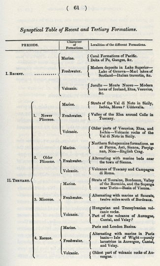
Synoptical Table of Recent and Tertiary Formations.
_______________
Notes:
1. M. Marcel de Serres pointed out this fact to me when I visited Montpellier, July, 1828.
2. See vol. i. chap,. vi.
3. In the terms Pliocene, Miocene, and Eocene, the Greek diphthongs ei and ai are changed into the vowels i and e, in conformity with the idiom of our language. Thus we have Encenia, an inaugural ceremony, derived from and
and  recens; and as examples of the conversion of ei into i, we have icosahedron.
I have been much indebted to my friend, the Rev. W. Whewell, for assisting me in inventing and anglicizing these terms, and I sincerely wish that the numerous foreign diphthongs, barbarous terminations, and Latin plurals, which have been so plentifully introduced of late years into our scientific language, had been avoided as successfully as they are by French naturalists, and as they were by the earlier English writers, when our language was more flexible than it is now. But while I commend the French for accommodating foreign terms to the structure of their own language, I must confess that no naturalists have been more unscholarlike in their mode of fabricating Greek derivatives and compounds, many of the latter being a bastard offspring of Greek and Latin.
4. See the Tables of M. Deshayes in Appendix I.
Classification of tertiary formations in chronological order – Comparative value of different classes of organic remains – Fossil remains of testacea the most important – Necessity of accurately determining species – Tables of shells by M. Deshayes – Four subdivisions of the Tertiary epoch – Recent formations – Newer Pliocene period – Older Pliocene period – Miocene period – Eocene period – The distinct zoological characters of these periods may not imply sudden changes in the animate creation – The recent strata form a common point of departure in distant regions – Numerical proportion of recent species of shells in different tertiary periods – Mammiferous remains of the successive tertiary eras – Synoptical Table of Recent and Tertiary formations
CLASSIFICATION OF TERTIARY FORMATIONS IN CHRONOLOGICAL ORDER.
WE explained in the last chapter the principles on which the relative ages of different formations may be ascertained, and we found the character to be chiefly derivable from superposition, mineral structure, and organic remains. It is by combining the evidence deducible from all these sources, that we determine the chronological succession of distinct formations, and this principle is well illustrated by the investigation of those European tertiary strata to the discovery of which we have already alluded.
It will be seen, that in proportion as we have extended our inquiries over a larger area, it has become necessary to intercalate new groups of an age intermediate between those first examined, and we have every reason to expect that, as the science advances, new links in the chain will be supplied, and that the passage from one period to another will become less abrupt. We may even hope, without travelling to distant regions, without even transgressing the limits of western Europe, to render the series far more complete. The fossil shells, for example, of many of the Subalpine formations, on the northern limits of the plain of the Po, have not yet been carefully collected and compared with those of other countries, and we are almost entirely ignorant of many deposits known to exist in Spain and Portugal.
The theoretical views developed in the last chapter, respecting breaks in the sequence of geological monuments, will explain our reasons for anticipating the discovery of intermediate gradations as often as new regions of great extent are explored.
Comparative value of different classes of organic remains.
In the mean time, we must endeavour to make the most systematic arrangement in our power of those formations which are already known, and in attempting to classify these in chronological order, we have already stated that we must chiefly depend on the evidence afforded by their fossil organic contents. In the execution of this task, we have first to consider what class of remains are most useful, for although every kind of fossil animal and plant is interesting, and cannot fail to throw light on the former history of the globe at a certain period, yet those classes of remains which are of rare and casual occurrence, are absolutely of no use for the purposes of general classification. If we have nothing but plants in one assemblage of strata, and the bones of mammalia in another, we can obviously draw no conclusion respecting the number of species of organic beings common to two epochs; or if we have a great variety, both of vertebrated animals and plants, in one series, and only shells in another, we can form no opinion respecting the remoteness or proximity of the two eras. We might, perhaps, draw some conclusions as to relative antiquity, if we could compare each of these monuments to a third; as, for example, if the species of shells should be almost all identical with those now living, while the plants and vertebrated animals were all extinct; for we might then infer that the shelly deposit was the most recent of the two. But in this case it will be seen that the information flows from a direct comparison of the species of corresponding orders of the animal and vegetable kingdoms, -- of plants with plants, and shells with shells; the only mode of making a systematic arrangement by reference to organic remains.
Although the bones of mammalia in the tertiary strata, and those of reptiles in the secondary, afford us instruction of the most interesting kind, yet the species are too few, and confined to too small a number of localities, to be of great importance in characterizing the minor subdivisions of geological formations. Skeletons of fish are by no means frequent in a good state of preservation, and the science of ichthyology must be farther advanced, before we can hope to determine their specific character with sufficient precision. The same may be said of fossil botany, notwithstanding the great progress that has recently been made in that department; and even in regard to zoophytes, which are so much more abundant in a fossil state than any of the classes above enumerated, we are still greatly impeded in our endeavour to classify strata by their aid, in consequence of the smallness of the number of recent species which have been examined in those tropical seas where they occur in the greatest profusion.
Fossil remains of testacea of chief importance. The testacea are by far the most important of all classes of organic beings which have left their spoils in the subaqueous deposits; they are the medals which nature has chiefly selected to record the history of the former changes of the globe. There is scarcely any great series of strata that does not contain some marine or fresh-water shells, and these fossils are often found so entire, especially in the tertiary formations, that when disengaged from the matrix, they have all the appearance of having been just procured from the sea. Their colour, indeed, is usually wanting, but the parts whereon specific characters are founded remain unimpaired; and although the animals themselves are gone, yet their form and habits can generally be inferred from the shell which covered them.
The utility of the testacea, in geological classification, is greatly enhanced by the circumstance, that some forms are proper to the sea, others to the land, and others to fresh-water. Rivers scarcely ever fail to carry down into their deltas some land shells, together with species which are at once fluviatile and lacustrine. The Rhone, for example, receives annually, from the Durance, many shells which are drifted down in an entire state from the higher Alps of Dauphiny, and these species, such as Bulimus montanus, are carried down into the delta of the Rhone to a climate far different from that of their native habitation. The young hermit crabs may often be seen on the shores of the Mediterranean, near the mouth of the Rhone, inhabiting these univalves, brought down to them from so great a distance. [1] At the same time that some fresh-water and land species are carried into the sea, other individuals of the same become fossil in inland lakes, and by this means we learn what species of fresh-water and marine testacea coexisted at particular eras; and from this again we are able to make out the connexion between various plants and mammifers imbedded in those lacustrine deposits, and the testacea which lived in the ocean at the same time.
There are two other characters of the molluscous animals which render them extremely valuable in settling chronological questions in geology. The first of these is a wide geographical range, and the second (probably a consequence of the former), is the superior duration of species in this class. It is evident that if the habitation of a species be very local, it cannot aid us greatly in establi8hing the contemporaneous origin of distant groups of strata, in the manner pointed out in the last chapter; and if a wide geographical range be useful in connecting formations far separated in space, the longevity of species is no less serviceable in establishing the relations of strata considerably distant from each other in point of time.
We shall revert in the sequel to the curious fact, that in tracing back these series of tertiary deposits, many of the existing species of testacea accompany us after the disappearance of all the recent mammalia, as well as the fossil remains of living species of several other classes. We even find the skeletons of extinct quadrupeds in deposits wherein all the land and freshwater shells are of recent species. [2]
Necessity of accurately determining species. -- The reader will already perceive that the systematic arrangement of strata, so far as it rests on organic remains, must depend essentially on the accurate determination of species, and the geologist must therefore have recourse to the ablest naturalists~ who have devoted their lives to the study of certain departments of organic nature. It is scarcely possible that they who are continually employed in laborious investigations in the field, and in ascertaining the relative position and characters of mineral masses, should have leisure to acquire a profound knowledge of fossil osteology, conchology, and other branches; but it is desirable that, in the latter science at least, they should become acquainted with the principles on which the specific characters are determined, and on which the habits of species are inferred from their peculiar forms. When the specimens are in an imperfect state of preservation, or the shells happen to belong to genera in which it is difficult to decide on the species, except when the inhabitant itself is present, or when any other grounds of ambiguity arise, we must reject, or lay small stress upon, the evidence, lest we vitiate our general results by false identifications and analogies. We cannot do better than consider the steps by which the science of botanical geography has reached its present stage of advancement, and endeavour to introduce the same severe comparison of the specific characters, in drawing all our geological inferences.
Tables of shells by M. Deshayes. -- In the Appendix the reader will find a tabular view of the results obtained by the comparison of more than three thousand tertiary shells, with nearly five thousand living species, all of which, with few exceptions, are contained in the rich collection of M. Deshayes. Having enjoyed an opportunity of examining, again and again, the specimens on which this eminent conchologist has founded his identifications, and having been witness to the great time and labour devoted by him to this arduous work, I feel confidence in the results, so far as the data given in his list will carry us. It was necessary to compare nearly forty thousand specimens, in order to construct these tables, since not only the varieties of every species required examination, but the different individuals, also, belonging to each which had been found fossil in various localities. The correctness of the localities themselves was ascertained with scrupulous exactness, together with the relative position of the strata; and if any doubts existed on these questions, the specimens were discarded as of no geological value. A large proportion of the shells were procured, by M. Deshayes himself, from the Paris basin, many were contributed by different French geologists, and some were collected by myself from different parts of Europe.
It would have been impossible to give lists of more than three thousand fossil-shells in a work not devoted exclusively to conchology; but we were desirous of presenting the reader with a catalogue of those fossils which M. Deshayes has been able to identify with living species, as also of those which are common to two distinct tertiary eras. By this means a comparison may be made of the testacea of each geological epoch, with the actual state of the organic creation, and, at the same time, the relations of different tertiary deposits to each other exhibited. The number of shells mentioned by name in the tables, in order to convey this information, is seven hundred and eighty-two, of which four hundred and twenty-six have been found both living and fossil, and three hundred and fifty-six fossil only, but in the deposits of more than one era. An exception, however, to the strictness of this rule has been made in regard to the fossil-shells common to the London and Paris basins, fifty-one of which have been enumerated by name, though these formations do not belong to different eras.
It has been more usual for geologists to give tables of characteristic shells; that is to say, of those found in the strata of one period and not common to any other. These typical species are certainly of the first importance, and some of them will be seen figured in the plates illustrative of the different tertiary eras; but we were more anxious~ in this work, to place in a clear light a point of the greatest theoretical interest, which has been often overlooked or controverted, viz., the identity of many living and fossil species, as also the connexion of the zoological remains of deposits formed at successive periods.
The value of such extensive comparisons, as those of which the annexed tables of M. Deshayes give the results, depends greatly on the circumstance, that all the identifications have been made by the same naturalist. The amount of variation which ought to determine a species is, in cases where they approach near to each other, a question of the nicest discrimination, and requires a degree of judgment and tact that can hardly be possessed by different zoologists in exactly the same degree. The standard, therefore, by which differences are to be measured, can scarcely ever be perfectly invariable, and one great object to be sought for is, that, at least, it should be uniform. If the distinctions are all made by the same naturalist, and his knowledge and skill be considerable, the results may be relied on with sufficient confidence, as far as regards our geological conclusions.
If one conchologist should inform us that out of 1122 species of fossil testacea, discovered in the Paris basin, he has only been enabled to identify thirty-eight with recent species, while another should declare, that out of two hundred and twenty-six Sicilian fossil shells, no less than two hundred and sixteen belonged to living species, we might suspect that one of these observers allowed a greater degree of latitude to the variability of the specific character than the other; but when, in both instances, the conclusions are drawn by the same eminent conchologist, we are immediately satisfied that the relations of these two groups, to the existing state of the animate creation, are as distinct as are indicated by the numerical results.
It is not pretended that the tables, to which we refer, comprise all the known tertiary shells. In the museums of Italy there are magnificent collections, to which M. Deshayes had no access, and the additions to the recent species in the cabinets of conchologists in London have been so great of late years, that in many extensive genera the number of species has been more than doubled. But as the greater part of these newly-discovered shells have been brought from the Pacific and other distant seas, it is probable that these accessions would not materially alter the results given in the tables, and it must, at all events, be remembered, that the only effect of such additional information would be, to increase the number of identifications of recent with fossil species, while the proportional number of analogues in the different periods might probably remain nearly the same.
SUBDIVISIONS OF THE TERTIARY EPOCH.
Recent formations. -- We shall now proceed to consider the subdivisions of tertiary strata which may be founded on the results of a comparison of their respective fossils, and to give names to the periods to which they each belong. The tertiary epoch has been divided into three periods in the tables; we shall, however, endeavour to establish four, all distinct from the actual period, or that which has elapsed since the earth has been tenanted by man. To the events of this latter era, which we shall term the recent, we have exclusively confined ourselves in the two preceding volumes. All sedimentary deposits, all volcanic rocks, in a word, every geological monument, whether belonging to the animate or inanimate world, which appertains to this epoch, may be termed recent. Some recent species, therefore, are found fossil in various tertiary periods, and, on the other hand, others, like the Dodo, may be extinct, for it is sufficient that they should once have coexisted with man, to make them referrible to this era.
Some authors apply the term contemporaneous to all the formations which have originated during the human epoch; but as the word is so frequently in use to express the synchronous origin of distinct formations, it would be a source of great inconvenience and ambiguity, if we were to attach to it a technical sense.
We may sometimes prove, that certain strata belong to the recent period by aid of historical evidence, as parts of the delta of the Po, Rhone, and Nile, for example; at other times, by discovering imbedded remains of man or his works; but when we have no evidence of this kind, and we hesitate whether to ascribe a particular deposit to the recent era, or that immediately preceding, we must generally incline to refer it to the latter, for it will appear in the sequel, that the changes of the historical era are quite insignificant when contrasted with those even of the newest tertiary period.
Newer Pliocene period. -- This most modern of the four subdivisions of the whole tertiary epoch, we propose to call the Newer Pliocene, which, together with the Older Pliocene, constitute one group in the annexed tables of M. Deshayes.
We derive the term Pliocene from
, major, and recens, as the major part of the fossil testacea of this epoch are referrible to recent species. [2] Whether in all cases there may hereafter prove to be an absolute preponderance of recent species, in every group of strata assigned to this period in the tables, is very doubtful; but the proportion of living species, where least considerable, usually approaches to one-half of the total number, and appears always to exceed a third; and as our acquaintance with the testacea of the Mediterranean, and some other seas, increases, it is probable that a greater proportion will be identified.The newer Pliocene formations, before alluded to, pass insensibly into those of the Recent epoch, and contain an immense preponderance of recent species. It will be seen that of two hundred and twenty-six species, found in the Sicilian beds, only ten are of extinct or unknown species, although the antiquity of these tertiary deposits, as contrasted with our most remote historical eras, is immensely great. In the volcanic and sedimentary strata of the district round Naples, the proportion appears to be even still smaller.
Older Pliocene period. -- These formations, therefore, and others wherein the plurality of living species is so very decided, we shall term the Newer Pliocene, while those of the tertiary period immediately preceding may be caned the Older Pliocene. To the latter belong the formations of Tuscany, and of the Subapennine hills in the north of Italy, as also the English Crag.
It appears that in the period last mentioned, the proportion of recent species varies from upwards of a third to somewhat more than half of the entire number; but it must be recollected, that this relation to the recent epoch is only one of its zoological characters, and that certain peculiar species of testacea also distinguish its deposits from all other strata. The relative position of the beds referrible to this era has been explained in diagrams Nos. 3 and 4, letter I, chapter II.
Miocene period. -- The next antecedent tertiary epoch we shall name Miocene, from
minor, and recens, a minority only of fossil shells imbedded in the formations of this period being of recent species. The total number of Miocene shells, referred to in the annexed tables, amounts to 1021, of which one hundred and seventy-six only are recent, being in the proportion of rather less than eighteen in one hundred. Of species common to this period, and to the two divisions of the Pliocene epoch before alluded to, there are one hundred and ninety-six, whereof one hundred and fourteen are living, and the remaining eighty-two extinct, or only known as fossil.As there are a certain number of fossil species which are characteristic of the Pliocene strata before described, so also there are many shells exclusively confined to the Miocene period. We have already stated, that in Touraine and in the South of France near Bordeaux, in Piedmont, in the basin of Vienna, and other localities, these Miocene formations are largely developed, and their relative position has been shown in diagrams Nos. 3 and 4, letter e, chapter II.
Eocene period. -- The period next antecedent we shall call Eocene, from
aurora, and recens, because the extremely small proportion of living species contained in these strata, indicates what may be considered the first commencement, or dawn, of the existing state of the animate creation. To this era the formations first called tertiary, of the Paris and London basins, are referrible. Their position is shown in the diagrams Nos. 3 and 4, letter d, in the second chapter.The total number of fossil shells of this period already known, is one thousand two hundred and thirty-eight, of which number forty-two only are living species, being nearly in the proportion of three and a half in one hundred. Of fossil species, not known as recent, forty- two are common to the Eocene and Miocene epochs. In the Paris basin alone, 1122 species have been found fossil, of which thirty-eight only are still living.
The geographical distribution of those recent species which are found fossil in formations of such high antiquity as those of the Paris and London basins, is a subject of the highest interest.
It will be seen by reference to the tables, that in the more modern formations, where so large a proportion of the fossil shells belong to species still living, they also belong, for the most part, to species now inhabiting the seas immediately adjoining the countries where they occur fossil; whereas the recent species, found in the older tertiary strata, are frequently inhabitants of distant latitudes, and usually of warmer climates. Of the forty-two Eocene species, which occur fossil in England, France, and Belgium, and which are still living, about half now inhabit within, or near the tropics, and almost all the rest are denizens of the more southern parts of Europe. If some Eocene species still flourish in the same latitudes where they are found fossil, they are species which, like Lucina divaricata, are now found in many seas, even those of different quarters of the globe.. and this wide geographical range indicates a capacity of enduring a variety of external circumstances, which may enable a species to survive considerable changes of climate and other revolutions of the earth's surface. One fluviatile species (Melania inquinata), fossil in the Paris basin.. is now only known in the Philippine islands, and during the lowering of the temperature of the earth's surface, may perhaps have escaped destruction by transportation to the south. We have pointed out in the second volume (chap. vii.), how rapidly the eggs of fresh-water species might, by the instrumentality of water-fowl, be transported from one region to another. Other Eocene species, which still survive and range from the temperate zone to the equator, may formerly have extended from the pole to the temperate zone.. and what was once the southern limit of their range may now be the most northern.
Even if we had not established several remarkable facts in attestation of the longevity of certain tertiary species, we might still have anticipated that the duration of the living species of aquatic and terrestrial testacea would be very unequal. For it is clear that those which now inhabit many different regions and climates, may survive the influence of destroying causes, which might extirpate the greater part of the species now living. We might expect, therefore, some species to survive several successive states of the organic world, just as Nestor was said to have outlived three generations of men.
The distinctness of periods may indicate our imperfect information. -- In regard to distinct zoological periods, the reader will understand, from our observations in the third chapter, that we consider the wide lines of demarcation that sometimes separate different tertiary epochs, as quite unconnected with extraordinary revolutions of the surface of the globe, and as arising, partly, like chasms in the history of nations, out of the present imperfect state of our information, and partly from the irregular manner in which geological memorials are preserved, as already explained. We have little doubt that it will be necessary hereafter to intercalate other periods, and that many of the deposits, now referred to a single era, will be found to have been formed at very distinct periods of time, so that, notwithstanding our separation of tertiary strata into four groups, we shall continue to use the term contemporaneous with a great deal of latitude.
We throw out these hints, because we are apprehensive lest zoological periods in geology, like artificial divisions in other branches of natural history, should acquire too much importance, from being supposed to be founded on some great interruptions in the regular series of events in the organic world, whereas, like the genera and orders in zoology and botany, we ought to regard them as invented for the convenience of systematic arrangement, always expecting to discover intermediate gradations between the boundary lines that we have first drawn.
In natural history we select a certain species as a generic type, and then arrange all its congeners in a series, according to the degrees of their deviation from that type, or according as they approach to the characters of the genus which precedes or follows. In like manner, we may select certain geological formations as typical of particular epochs; and having accomplished this step, we may then arrange the groups referred to the same period in chronological order, according as they deviate in their organic contents from the normal groups, or according as they approximate to the type of an antecedent or subsequent epoch.
If intermediate formations shall hereafter be found between the Eocene and Miocene, and between those of the last period and the Pliocene, we may still find an appropriate place for all, by forming subdivisions on the same principle as that which has determined us to separate the lower from the upper Pliocene groups. Thus, for example, we might have three divisions of the Eocene epoch, -- the older, middle, and newer; and three similar subdivisions, both of the Miocene and Pliocene epochs. In that case, the formations of the middle period must be considered as the types from which the assemblage of organic remains in the groups immediately antecedent or subsequent will diverge.
The recent strata form a common point of departure in all countries. -- We derive one great advantage from beginning our classification of formations by a comparison of the fossils of the more recent strata with the species now living, namely, the acquisition of a common point of departure in every region of the globe. Thus, for example, if strata should be discovered in India or South America, containing the same small proportion of recent shells as are found in the Paris basin, they also might be termed Eocene, and, on analogous data, an approximation might be made to the relative dates of strata placed in the arctic and tropical regions, or the comparative age ascertained of European deposits, and those which are trodden by our antipodes.
There might be no species common to the two groups; yet we might infer their synchronous origin from the common relation which they bear to the existing state of the animate creation. We may afterwards avail ourselves of the dates thus established, as eras to which the monuments of preceding periods may be referred.
Numerical proportion of recent shells in the different Tertiary periods. -- There are seventeen species of shells discovered, which are common to all the tertiary periods, thirteen of which are still living, while four are extinct, or only known as fossil. [4] These seventeen species show a connexion between all these geological epochs, whilst we have seen that a much greater number are common to the Eocene and Miocene periods, and a still greater to the Miocene and Pliocene.
We have already stated, that in the older tertiary formations, we find a very small proportion of fossil species identical with those now living, and that, as we approach the superior and newer sets of strata, we find the remains of existing animals and plants in greater abundance. It is almost as difficult to find an unknown species in some of the newer Pliocene deposits, although very ancient, and elevated at great heights above the level of the sea, as to meet with recent species in the Eocene strata.
This increase of existing species, and gradual disappearance of the extinct, as we trace the series of formations from the older to the newer, is strictly analogous, as we before observed, to the fluctuations of a population such as might be recorded at successive periods, from the time when the oldest of the individuals now living was born to the present moment. The disappearance of persons who never were contemporaries of the greater part of the present generation, would be seen to have kept pace with the birth of those who now rank amongst the oldest men living, just as the Eocene and Miocene species are observed to have given place to those Pliocene testacea which are now contemporary with man.
In reference to the organic remains of the different groups which we have named, we may say that about a thirtieth part of the Eocene shells are of recent species, about one-fifth of the Miocene, more than a third, and often more than half, of the older Pliocene, and nine- tenths of the newer Pliocene.
Mammiferous remains of the successive tertiary eras. -- But although a thirtieth part of the Eocene testacea have been identified with species now living, none of the associated mammiferous remains belong to species which now exist, either in Europe or elsewhere. Some of these equalled the horse, and others the rhinoceros, in size, and they could not possibly have escaped observation, had they survived down to our time. More than forty of these Eocene mammifers are referrible to a division of the order Pachydermata, which has now only four living representatives on the globe. Of these, not only the species but the genera are distinct from any of those which have been established for the classification of living animals.
In the Miocene mammalia we find a few of the generic forms most frequent in the Eocene strata associated with some of those now existing, and in the Pliocene we find an intermixture of extinct and recent species of quadrupeds. There is, therefore, a considerable degree of accordance between the results deducible from an examination of the fossil testacea, and those derived from the mammiferous fossils. But although the latter are more important in respect to the unequivocal evidence afforded by them of the extinction of species, yet, for reasons before explained, they are of comparatively small value in the general classification of strata in geology.
It will appear evident, from what we have said in the last volume respecting the fossilization of terrestrial species, that the imbedding of their remains depends on rare casualties, and that they are, for the most part, preserved in detached alluvions covering the emerged land, or in osseous breccias and stalagmites formed in caverns and fissures, or in isolated lacustrine formations. These fissures and caves may sometimes remain open during successive geological periods, and the alluvions, spread over the surface, may be disturbed, again and again, until the mammalia of successive epochs are mingled and confounded together. Hence we must be careful, when we endeavour to refer the remains of mammalia to certain tertiary periods, that we ascertain, not only their association with testacea of which the date is known, but also that the remains were intermixed in such a manner as to leave no doubt of the former coexistence of the species.
In the next page will be found a Synoptical Table of the Recent and Tertiary formations alluded to in this chapter.
N.B. By aid of this table, the reader will be able to refer almost all the localities of the Pliocene formations enumerated in the Tables of M. Deshayes (Appendix 1.) to the newer or older division of the Pliocene period established in the foregoing chapter.
Synoptical Table of Recent and Tertiary Formations.
_______________
Notes:
1. M. Marcel de Serres pointed out this fact to me when I visited Montpellier, July, 1828.
2. See vol. i. chap,. vi.
3. In the terms Pliocene, Miocene, and Eocene, the Greek diphthongs ei and ai are changed into the vowels i and e, in conformity with the idiom of our language. Thus we have Encenia, an inaugural ceremony, derived from
and recens; and as examples of the conversion of ei into i, we have icosahedron.I have been much indebted to my friend, the Rev. W. Whewell, for assisting me in inventing and anglicizing these terms, and I sincerely wish that the numerous foreign diphthongs, barbarous terminations, and Latin plurals, which have been so plentifully introduced of late years into our scientific language, had been avoided as successfully as they are by French naturalists, and as they were by the earlier English writers, when our language was more flexible than it is now. But while I commend the French for accommodating foreign terms to the structure of their own language, I must confess that no naturalists have been more unscholarlike in their mode of fabricating Greek derivatives and compounds, many of the latter being a bastard offspring of Greek and Latin.
4. See the Tables of M. Deshayes in Appendix I.
- admin
- Site Admin
- Posts: 36175
- Joined: Thu Aug 01, 2013 5:21 am
Re: Principles of Geology, by Charles Lyell
![]() by admin » Fri Jul 17, 2015 2:12 am
by admin » Fri Jul 17, 2015 2:12 am
CHAPTER 6
Newer Pliocene formations – Reasons for considering in the first place the more modern periods – Geological structure of Sicily – Formations of the Val di Noto of newer Pliocene period – Divisible into three groups – Great limestone – Schistose and arenaceous limestone – Blue marl with shells – Strata subjacent to the above – Volcanic rocks of the Val di Noto – Dikes – Tuffs and Peperinos – Volcanic conglomerates – Proofs of long intervals between volcanic eruptions – Dip and direction of newer Pliocene strata of Sicily
NEWER PLIOCENE FORMATIONS.
HAVING endeavoured, in the last chapter, to explain the principles on which the different tertiary formations may be arranged in chronological order, we shall now proceed to consider the newest division of formations, or that which we have named the newer Pliocene.
It may appear to some of our readers, that we reverse the natural order of historical research by thus describing, in the first place, the monuments of a period which immediately preceded our own era, and passing afterwards to the events of antecedent ages. But, in the present state of our science, this retrospective order of inquiry is the only one which can conduct us gradually from the known to the unknown, from the simple to the more complex phenomena. We have already explained our reasons for beginning this work with an examination, in the first two volumes, of the events of the recent epoch, from which the greater number of rules of interpretation in geology may be derived. The formations of the newer Pliocene period will be considered next in order, because these have undergone the least degree of alteration, both in position and internal structure, subsequently to their origin. They are monuments of which the characters are more easily deciphered than those belonging to more remote periods, for they have been less mutilated by the hand of time. The organic remains, more especially of this era, are most important, not only as being in a more perfect state of preservation, but also as being chiefly referrible to species now living; so that their habits are known to us by direct comparison, and not merely by inference from analogy, as in the case of extinct species.
Geological structure of Sicily. -- We shall first describe an extensive district in Sicily, where the newer Pliocene strata are largely developed, and where they are raised to considerable heights above the level of the sea. After presenting the reader with a view of these formations, we shall endeavour to explain the manner in which they originated, and speculate on the subterranean changes of which their present position affords evidence.
The island of Sicily consists partly of primary and secondary rocks, which occupy, perhaps, about two-thirds of its superficial area, [1] and the remaining part is covered by tertiary formations, which are of great extent in the southern and central parts of the island, while portions are found bordering nearly the whole of the coasts.
Formations of the Val di Noto. -- If we first turn our attention to the Val di Nota, a district which intervenes between Etna and the southern promontory of Sicily, we find a considerable tract, containing within it hills which are from one to two thousand feet in height, entirely composed of limestone, marl, sandstone, and associated volcanic rocks, which belong to the newer Pliocene era. The recent shells of the Mediterranean abound throughout the sedimentary strata, and there are abundant proofs that the igneous rocks were the produce of successive submarine eruptions, repeated at intervals during the time when the subaqueous formations were in progress.
These rising grounds of the Val di Noto are separated from the cone of Etna, and the marine strata whereon it rests, by the low level plain of Catania, just elevated above the level of the sea, and watered by the Simeto. The traveller who passes from Catania to Syracuse, has an opportunity of observing, on the sides of the valley, many deep sections of the modern formations above described, especially if he makes a slight detour by Sortino and the Valley of Pentalica.
The whole series of strata, in the Val di Noto, is divisible into three principal groups, exclusive of the associated volcanic rocks. The uppermost mass consists of limestone, which sometimes acquires the enormous thickness of seven or eight hundred feet, below which is a series much inferior in thickness, consisting of a calcareous sandstone, conglomerate and schistose limestone, and beneath this again, blue marl. The whole of the above groups contain shells and zoophytes, nearly all of which are referrible to species now inhabiting the contiguous sea.
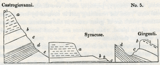
No. 5: Castrogiovanni, Syracuse, Girgenti
a, Great limestone of Val di Noto.
b, Schistose and arenaceous limestone of Florida, &c.
c, Blue marl with shells.
d, White laminated marl.
e, Blue clay and gypsum, &c. without shells.
Great limestone formation (a, diagram No. 5). -- In mineral character this rock often corresponds to the yellowish white building-stone of Paris, well known by the name of Calcaire grossier, but it often passes into a much more compact stone. In the deep ravine-like valleys of Sortino and Pentalica, it is seen in nearly horizontal strata, as solid and as regularly bedded as the greater part of our ancient secondary formations. It abounds in natural caverns, which, in many places, as in the valley of Pentalica, have been enlarged and multiplied by artificial excavations.
The shells in the limestone are often very indistinct, sometimes nothing but casts remaining, but in many localities, especially where there is a slight intermixture of volcanic sand, they are more entire, and, as we have already stated, can almost all be identified with recent Mediterranean testacea. Several species of the genus Pecten are exceedingly numerous, particularly the large scallop (P. Jacobaeus), now so common on the coasts of Sicily. The shells which I collected from this limestone at Syracuse, Villasmonde, Militello (V. di Noto), and Girgenti. have been examined by M. Deshayes, and found to be all referrible to species now living, with three or four exceptions. [2]
The mineral characters of this great calcareous formation vary considerably in different parts of the island. In the south, near the town of Noto, the rock puts on the compactness, together with the spheroidal concretionary structure of some of the Italian travertins. At the same place, also, it contains the leaves of plants and reeds, as if a stream of fresh-water, charged with carbonate of lime and terrestrial vegetable remains, had entered the sea in the neighbourhood. At Spaccaforno, and other places in the south of Sicily, a similar compact variety of the limestone occurs, where it is for the most part pure white, often very thick bedded, and occasionally without any lines of stratification. This hard white rock is often four or five hundred feet in thickness, and appears to contain no fossil shells. It has much the appearance of having been precipitated from the waters of mineral springs. such as frequently rise up at the bottom of the sea in the volcanic regions of the Mediterranean. As these springs give out an equal quantity of mineral matter at all seasons, they are much more likely to give rise to unstratified masses, than a river which is swoln and charged with sedimentary matter of different kinds, and in unequal quantities, at particular seasons of the year.
The great limestone above mentioned prevails not only in the Val di Noto, but re-appears in the centre of the island, capping the hill of Castrogiovanni, at the height of three thousand feet above the level of the sea. It is cavernous there, as at Sortino and Syracuse, and contains fossil shells and casts of shells of the same species. [3]
Schistose and arenaceous limestone, &c. (b, diagram No. 5.) -- The limestone above-mentioned passes downwards into a white calcareous sand, which has sometimes a tendency to an oolitic and pisolitic structure, analogous to that which we have described when speaking of the travertin of Tivoli. [4] At Florida, near Syracuse, it contains a sufficient number of small calcareous pebbles to constitute a conglomerate, where also beds of sandy limestone are associated, replete with numerous fragments of shells, and much resembling, in structure, the English cornbrash. A diagonal lamination is often observable in the calcareous sandy beds analogous to that represented in the first volume (chap. xiv. diagram No. 6), and to that exhibited in many sections of the English crag, to which we shall afterwards allude.
In some parts of the island this sandy calcareous division b, seems to be represented by yellow sand, exactly resembling that so frequently superimposed on the blue shelly marl of the Subapennines in the Italian peninsula. Thus, near Grammichele, on the road to Caltagirone, beds of incoherent yellow sand, several hundred feet in thickness, with occasional layers of shells, repose upon the blue shelly marl of Caltagirone.
When we consider the arenaceous character of this formation, the disposition of the laminae, and the broken shells sometimes imbedded in it, it is difficult not to suspect that it was formed in shallower water, and nearer the action of superficial currents, than the superincumbent limestone, which was evidently accumulated in a sea of considerable depth. If we adopt this view, we must suppose a considerable subsidence of the bed of the sea, subsequent to the deposition of the arenaceous beds in the Val di Noto.
Blue marl with shells (c, diagram No. 5). -- Under the sandy beds last mentioned is found an argillaceous deposit of variable thickness, called Creta in Sicily. It resembles the blue marl of the Subapennine hills, and, like it, encloses fossil shells and corals in a beautiful state of preservation. Of these I collected a great abundance from the clay, on the south side of the harbour of Syracuse, and twenty species in the environs of Caltanisetta, all of which, with three exceptions, M. Deshayes was able to identify with recent species. [5] From similar blue marl, alternating with yellow sand, at Caltagirone, at an elevation of about five hundred feet above the level of the sea, I obtained forty species of shells, of which all but six were recognized as identical with recent species. [6] The position of this argillaceous formation is well seen at Castrogiovanni and Girgenti, as represented in the sections, diagram No. 5. In both of these localities, the limestone of the Val di Noto reappears, passing downwards into a calcareous sandstone, below which is a shelly blue clay.
Strata beneath the blue marl. -- The clay rests, in both localities, on an older series of white and blue marls, probably belonging to the tertiary period, but of which I was unable to determine the age, having procured from it no organic remains save the skeletons of fish which I found in the white thinly-laminated marls. [7]
The marls are sometimes gypseous, and belong to a great argillaceous formation which stretches over a considerable part of Sicily, and contains sulphur and salt in great abundance. The strata of this group have been in some places contorted in the most extraordinary manner, their convolutions often resembling those seen in the most disturbed districts of primary clay slate.
But we wish, at present, to direct the reader's exclusive attention to strata decidedly referrible to the newer Pliocene era, and we have yet to mention the igneous rocks associated with the sedimentary formations already alluded to.
Volcanic Rocks of the Val di Noto. -- The volcanic rocks occasionally associated with the limestones, sands, and marls already described. constitute a very prominent feature throughout the Val di Noto. Great confusion might have been expected to prevail, where lava and ejected sand and scoriae are intermixed with the marine strata, and, accordingly, we find it often impossible to recognize the exact part of the series to which the beds thus interfered with belong.
Sometimes there are proofs of the posterior origin of the lava, and sometimes of the newer date of the stratified rock, for we find dikes of' lava intersecting both the marl and limestone, while, in other places, calcareous beds repose upon Java, and are unaltered at the point of contact. Thus the shelly limestone of Capo Santa Croce rests in horizontal strata upon a mass of lava, which had evidently been long exposed to the action of the waves, so that the surface has been worn perfectly smooth, The limestone is unchanged at its junction with the igneous rock, and incloses within it pebbles of the lava. [8]
The volcanic formations of the Val di Noto usually consist of the most ordinary variety of basalt with or without olivine. The rock is sometimes compact, often very vesicular. The vesicles are occasionally empty, both in dikes and currents, and are in some localities filled with calcareous spar, arragonite, and zeolites. The structure is, in some places, spheroidal, in others, though rarely, columnar. I found dykes of amygdaloid, wacke, and prismatic basalt, intersecting the limestone at the bottom of the hollow, called Gozzo degli Martiri, below MelilIi.
Dikes. -- Dikes of vesicular and amygdaloidal lava are also seen traversing peperino, west of Palagonia, near a mill by the road side.
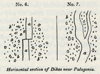
No. 6, No. 7: Horizontal section of Dikes near Patagonia.
a, Lava.
b, Peperino, consisting of volcanic sand, mixed with fragments of lava and of limestone.
In this case we may suppose the peperino to have resulted from showers of volcanic sand and scoriae, together with fragments of limestone thrown out by a submarine explosion, similar to that which lately gave rise to the volcanic island off Sciacca. When the mass was, to a certain degree, consolidated, it may have been rent open, so that the lava ascended through fissures, the walls of which were perfectly even and parallel. After the melted matter that filled the rent had cooled down, it must have been fractured and shifted horizontally by a lateral movement.
In the second figure, No. 7, the lava has more the appearance of a vein which forced its way through the peperino, availing itself, perhaps, of a slight passage opened by rents caused by earthquakes. Some of the pores of the lava, in these dikes, are empty, while others are filled with carbonate of lime.
The annexed diagrams (Nos. 6 and 7) represent a ground plan of the rocks as they are exposed to view on a horizontal surface. We think it highly probable that similar appearances would be seen, if we could examine the floor of the sea in that part of the Mediterranean where the waves have recently washed away the new volcanic island, for when a superincumbent mass of ejected fragments has been removed by denudation, we may expect to see sections of dikes traversing tuff, or, in other words, sections of the channels of communication by which the subterranean lavas reached the surface.
On the summit of the limestone platform of the Val di Noto, I more than once saw analogous dikes, not only of lava but of volcanic tuff, rising vertically through the horizontal strata, and having no connexion with any igneous masses now apparent on the surface. In regard to the dikes of tuff or peperino, we may suppose them to have been open fissures at the bottom of the sea, into which volcanic sand and scoriae were drifted by a current.
Tuffs and Peperinos. -- In the hill of Novera, between Vizzini and Militelli, a mass of limestone, horizontally stratified, comes in contact with inclined strata of tuff (see diagram No.8), while a mixed calcareous and volcanic breccia, a a, supports the inclined layers of tuff, c. The vertical fissure, b b, is filled with volcanic sand of a different colour. An inspection of this section will convince the reader that the limestone must have been greatly dislocated during the time that the submarine eruptions were taking place.
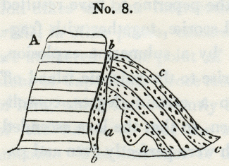
No. 8.
A, Limestone.
aa, Calcareous breccia with fragments of lava.
b, Black tuff.
c, Tuff.
At the town of Vizzini, a dike of lava intersects the argillaceous strata, and converts them into siliceous schist, which has been contorted and shivered into an immense number of fragments.
We have stated that the beds of limestone, clay, and sand, in the Val di Noto, are often partially intermixed with volcanic ejections, such as may have been showered down into the sea during eruptions, or may have been swept by rivers from the land. When the volcanic matter predominates, these compound rocks constitute the peperinos of the Italian mineralogists, some of which are highly calcareous, full of shells, and extremely hard, being capable of a high polish like marble. In some parts of the Val di Noto they are variously mottled with spots of red and yellow, and contain small angular fragments, similar to the lapilli thrown from volcanos.
It is recorded that, during the late eruption off the southern coast of Sicily, opposite Sciacca, the sea was in a state of violent ebullition, and filled, for several weeks continuously, with red or chocolate-coloured mud, consisting of finely-comminuted scoriae. During this period, it is clear that the waves and currents that have since had power to sweep away the island, and disperse its materials far and wide over the bed of the sea, must with still greater ease have carried to vast distances the fine red mud, which was seen boiling up from the bottom, so that it may have entered largely into the composition of modern peperinos.
Professor Hoffman relates that, during the eruption (June, 1881), the surface of the sea was strewed over, at the distance of thirty miles from the new volcano, with so dense a covering of scoriae, that the fishermen were obliged to part it with their oars, in order to propel their boats through the water. It is, therefore, quite consistent with analogy, that we should find the ancient tuffs and peperinos so much more generally distributed than the submarine lavas.
In the road which leads from Palagonia to Lago Naftia, and at the distance of about a mile and a half from the former place, there. is a small pass where the hills, on both sides, consist of a calcareous grit, intermixed with some grains of volcanic sand.
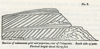
No. 9: Section of calcareous grit and peperino, east of Palagonia. South side of pass. Vertical height about thirty feet
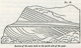
No. 10: Section of the same beds on the north side of the pass.
The disposition of the strata, on both sides of the pass, is most singular, and remarkably well exposed, as the harder layers have resisted the weathering of the atmosphere and project in relief. The sections exhibited on both sides of the pass are nearly vertical, and do not exactly correspond, as will be seen in the annexed diagrams (Nos. 9 and 10). It is somewhat difficult to conceive in what manner this arrangement of the layers was occasioned, but we may, perhaps, suppose it to have arisen from the throwing down of calcareous sand and volcanic matter, upon steep slanting banks at the bottom of the sea, in which case they might have accumulated at various angles of between thirty and fifty degrees, as may be frequently seen in the sections of volcanic cones in Ischia and elsewhere. The denuding power of the waves may, then, have cut off the upper portion of these banks, so that nearly horizontal layers may have been superimposed unconformably, after which another bank may have been formed in a similar manner to the first.
Volcanic conglomerates. -- In the Val di Noto we sometimes meet with conglomerates entirely composed of volcanic pebbles. They usually occur in the neighbourhood of masses of lava, and may, perhaps, have been the shingle produced by the wasting cliffs of small islands in a volcanic archipelago. The formation of similar beds of volcanic pebbles may now be seen in progress on the beach north of Catania, where the waves are under... mining one of the modern lavas of Etna; and the same may also be seen on the shores of Ischia.
Proofs of gradual accumulation. -- In one part of the great limestone formation near Lentini, I found some imbedded volcanic pebbles, covered with full-grown serpulae, supplying a beautiful proof of a considerable interval of time having elapsed between the rounding of these pebbles and their inclosure in a solid stratum. I also observed, not far from Vizzini, a very striking illustration of the length of the intervals which occasionally separated the flows of distinct lava-currents. A bed of oysters, perfectly identifiable with our common eatable species, no less than twenty feet in thickness, is there seen resting upon a current of basaltic lava; upon the oyster-bed again is superimposed a second mass of lava, together with tuff or peperino. Near Galieri, not far from the same locality, a horizontal bed, about a foot and a half in thickness, composed entirely of a common Mediterranean coral (Caryophyllia cespitosa, Lam.), is also seen in the midst of the same series of alternating igneous and aqueous formations. These corals stand erect as they grew, and after being traced for hundreds of yards, are again found at a corresponding height on the opposite side of the valley.
Dip and direction. -- The disturbance which the newer Pliocene strata have undergone in Sicily, subsequent to their deposition, differs greatly in different places; in general, however, the beds are nearly horizontal, and are not often highly inclined. The calcareous schists, on which part of the town of Lentini is built, are much fractured, and dip at an angle of twenty-five degrees to the north-west. In some of the valleys in the neighbourhood an anticlinal dip is seen, the beds on one side being inclined to the north-west, and on the other to the south-east.
Throughout a considerable part of Sicily which I examined, the dips of the tertiary strata were north-east and south-west; as, for example, in the district included between Terranuova, Girgenti, Caltanisetta, and Piazza, where there are several parallel lines, or ridges of elevation, which run north-west and south-east.
_______________
Notes:
1. We may shortly expect a full account of the Geology of this island from Professor Hoffmann, who has devoted more than a year to its examination.
2. For lists of these see Appendix II. I procured at Villasmonde, seven species; at Militello, ten; in the limestone of Girgenti, of which the ancient temples are built, ten species; from the limestone and subjacent clay at Syracuse, twenty-six species; in the limestone and clay near Palermo, also belonging to the newer Pliocene formation, one hundred shells.
3. Dr. Daubeny correctly identified the Val di Noto limestone or Syracuse with that or the summit or Castrogiovanni. -- Jameson, Ed. Phil. Journ., No. xxv. p. 107, July, 1825.
4. Vol. i. chap. xii.
5. See list of these shells, Appendix II.
6. See Appendix II.
7. I found these fossil fish in great abundance on the road, half a mile northwest of Radusa, on the road to Castrogiovanni, where the marls are fetid, and near Castrogiovanni in gypseous marls, at the mile-stone No. 88, and between that and No. 89. Lord Northampton has since presented to the Geological Society some which he obtained from the same localities, but I have met with no zoologists
who could name the species.
8. This locality is described by Professor Hoffman, Archiv fur Mineralogie, &c, Berlin, 1831.
Newer Pliocene formations – Reasons for considering in the first place the more modern periods – Geological structure of Sicily – Formations of the Val di Noto of newer Pliocene period – Divisible into three groups – Great limestone – Schistose and arenaceous limestone – Blue marl with shells – Strata subjacent to the above – Volcanic rocks of the Val di Noto – Dikes – Tuffs and Peperinos – Volcanic conglomerates – Proofs of long intervals between volcanic eruptions – Dip and direction of newer Pliocene strata of Sicily
NEWER PLIOCENE FORMATIONS.
HAVING endeavoured, in the last chapter, to explain the principles on which the different tertiary formations may be arranged in chronological order, we shall now proceed to consider the newest division of formations, or that which we have named the newer Pliocene.
It may appear to some of our readers, that we reverse the natural order of historical research by thus describing, in the first place, the monuments of a period which immediately preceded our own era, and passing afterwards to the events of antecedent ages. But, in the present state of our science, this retrospective order of inquiry is the only one which can conduct us gradually from the known to the unknown, from the simple to the more complex phenomena. We have already explained our reasons for beginning this work with an examination, in the first two volumes, of the events of the recent epoch, from which the greater number of rules of interpretation in geology may be derived. The formations of the newer Pliocene period will be considered next in order, because these have undergone the least degree of alteration, both in position and internal structure, subsequently to their origin. They are monuments of which the characters are more easily deciphered than those belonging to more remote periods, for they have been less mutilated by the hand of time. The organic remains, more especially of this era, are most important, not only as being in a more perfect state of preservation, but also as being chiefly referrible to species now living; so that their habits are known to us by direct comparison, and not merely by inference from analogy, as in the case of extinct species.
Geological structure of Sicily. -- We shall first describe an extensive district in Sicily, where the newer Pliocene strata are largely developed, and where they are raised to considerable heights above the level of the sea. After presenting the reader with a view of these formations, we shall endeavour to explain the manner in which they originated, and speculate on the subterranean changes of which their present position affords evidence.
The island of Sicily consists partly of primary and secondary rocks, which occupy, perhaps, about two-thirds of its superficial area, [1] and the remaining part is covered by tertiary formations, which are of great extent in the southern and central parts of the island, while portions are found bordering nearly the whole of the coasts.
Formations of the Val di Noto. -- If we first turn our attention to the Val di Nota, a district which intervenes between Etna and the southern promontory of Sicily, we find a considerable tract, containing within it hills which are from one to two thousand feet in height, entirely composed of limestone, marl, sandstone, and associated volcanic rocks, which belong to the newer Pliocene era. The recent shells of the Mediterranean abound throughout the sedimentary strata, and there are abundant proofs that the igneous rocks were the produce of successive submarine eruptions, repeated at intervals during the time when the subaqueous formations were in progress.
These rising grounds of the Val di Noto are separated from the cone of Etna, and the marine strata whereon it rests, by the low level plain of Catania, just elevated above the level of the sea, and watered by the Simeto. The traveller who passes from Catania to Syracuse, has an opportunity of observing, on the sides of the valley, many deep sections of the modern formations above described, especially if he makes a slight detour by Sortino and the Valley of Pentalica.
The whole series of strata, in the Val di Noto, is divisible into three principal groups, exclusive of the associated volcanic rocks. The uppermost mass consists of limestone, which sometimes acquires the enormous thickness of seven or eight hundred feet, below which is a series much inferior in thickness, consisting of a calcareous sandstone, conglomerate and schistose limestone, and beneath this again, blue marl. The whole of the above groups contain shells and zoophytes, nearly all of which are referrible to species now inhabiting the contiguous sea.
No. 5: Castrogiovanni, Syracuse, Girgenti
a, Great limestone of Val di Noto.
b, Schistose and arenaceous limestone of Florida, &c.
c, Blue marl with shells.
d, White laminated marl.
e, Blue clay and gypsum, &c. without shells.
Great limestone formation (a, diagram No. 5). -- In mineral character this rock often corresponds to the yellowish white building-stone of Paris, well known by the name of Calcaire grossier, but it often passes into a much more compact stone. In the deep ravine-like valleys of Sortino and Pentalica, it is seen in nearly horizontal strata, as solid and as regularly bedded as the greater part of our ancient secondary formations. It abounds in natural caverns, which, in many places, as in the valley of Pentalica, have been enlarged and multiplied by artificial excavations.
The shells in the limestone are often very indistinct, sometimes nothing but casts remaining, but in many localities, especially where there is a slight intermixture of volcanic sand, they are more entire, and, as we have already stated, can almost all be identified with recent Mediterranean testacea. Several species of the genus Pecten are exceedingly numerous, particularly the large scallop (P. Jacobaeus), now so common on the coasts of Sicily. The shells which I collected from this limestone at Syracuse, Villasmonde, Militello (V. di Noto), and Girgenti. have been examined by M. Deshayes, and found to be all referrible to species now living, with three or four exceptions. [2]
The mineral characters of this great calcareous formation vary considerably in different parts of the island. In the south, near the town of Noto, the rock puts on the compactness, together with the spheroidal concretionary structure of some of the Italian travertins. At the same place, also, it contains the leaves of plants and reeds, as if a stream of fresh-water, charged with carbonate of lime and terrestrial vegetable remains, had entered the sea in the neighbourhood. At Spaccaforno, and other places in the south of Sicily, a similar compact variety of the limestone occurs, where it is for the most part pure white, often very thick bedded, and occasionally without any lines of stratification. This hard white rock is often four or five hundred feet in thickness, and appears to contain no fossil shells. It has much the appearance of having been precipitated from the waters of mineral springs. such as frequently rise up at the bottom of the sea in the volcanic regions of the Mediterranean. As these springs give out an equal quantity of mineral matter at all seasons, they are much more likely to give rise to unstratified masses, than a river which is swoln and charged with sedimentary matter of different kinds, and in unequal quantities, at particular seasons of the year.
The great limestone above mentioned prevails not only in the Val di Noto, but re-appears in the centre of the island, capping the hill of Castrogiovanni, at the height of three thousand feet above the level of the sea. It is cavernous there, as at Sortino and Syracuse, and contains fossil shells and casts of shells of the same species. [3]
Schistose and arenaceous limestone, &c. (b, diagram No. 5.) -- The limestone above-mentioned passes downwards into a white calcareous sand, which has sometimes a tendency to an oolitic and pisolitic structure, analogous to that which we have described when speaking of the travertin of Tivoli. [4] At Florida, near Syracuse, it contains a sufficient number of small calcareous pebbles to constitute a conglomerate, where also beds of sandy limestone are associated, replete with numerous fragments of shells, and much resembling, in structure, the English cornbrash. A diagonal lamination is often observable in the calcareous sandy beds analogous to that represented in the first volume (chap. xiv. diagram No. 6), and to that exhibited in many sections of the English crag, to which we shall afterwards allude.
In some parts of the island this sandy calcareous division b, seems to be represented by yellow sand, exactly resembling that so frequently superimposed on the blue shelly marl of the Subapennines in the Italian peninsula. Thus, near Grammichele, on the road to Caltagirone, beds of incoherent yellow sand, several hundred feet in thickness, with occasional layers of shells, repose upon the blue shelly marl of Caltagirone.
When we consider the arenaceous character of this formation, the disposition of the laminae, and the broken shells sometimes imbedded in it, it is difficult not to suspect that it was formed in shallower water, and nearer the action of superficial currents, than the superincumbent limestone, which was evidently accumulated in a sea of considerable depth. If we adopt this view, we must suppose a considerable subsidence of the bed of the sea, subsequent to the deposition of the arenaceous beds in the Val di Noto.
Blue marl with shells (c, diagram No. 5). -- Under the sandy beds last mentioned is found an argillaceous deposit of variable thickness, called Creta in Sicily. It resembles the blue marl of the Subapennine hills, and, like it, encloses fossil shells and corals in a beautiful state of preservation. Of these I collected a great abundance from the clay, on the south side of the harbour of Syracuse, and twenty species in the environs of Caltanisetta, all of which, with three exceptions, M. Deshayes was able to identify with recent species. [5] From similar blue marl, alternating with yellow sand, at Caltagirone, at an elevation of about five hundred feet above the level of the sea, I obtained forty species of shells, of which all but six were recognized as identical with recent species. [6] The position of this argillaceous formation is well seen at Castrogiovanni and Girgenti, as represented in the sections, diagram No. 5. In both of these localities, the limestone of the Val di Noto reappears, passing downwards into a calcareous sandstone, below which is a shelly blue clay.
Strata beneath the blue marl. -- The clay rests, in both localities, on an older series of white and blue marls, probably belonging to the tertiary period, but of which I was unable to determine the age, having procured from it no organic remains save the skeletons of fish which I found in the white thinly-laminated marls. [7]
The marls are sometimes gypseous, and belong to a great argillaceous formation which stretches over a considerable part of Sicily, and contains sulphur and salt in great abundance. The strata of this group have been in some places contorted in the most extraordinary manner, their convolutions often resembling those seen in the most disturbed districts of primary clay slate.
But we wish, at present, to direct the reader's exclusive attention to strata decidedly referrible to the newer Pliocene era, and we have yet to mention the igneous rocks associated with the sedimentary formations already alluded to.
Volcanic Rocks of the Val di Noto. -- The volcanic rocks occasionally associated with the limestones, sands, and marls already described. constitute a very prominent feature throughout the Val di Noto. Great confusion might have been expected to prevail, where lava and ejected sand and scoriae are intermixed with the marine strata, and, accordingly, we find it often impossible to recognize the exact part of the series to which the beds thus interfered with belong.
Sometimes there are proofs of the posterior origin of the lava, and sometimes of the newer date of the stratified rock, for we find dikes of' lava intersecting both the marl and limestone, while, in other places, calcareous beds repose upon Java, and are unaltered at the point of contact. Thus the shelly limestone of Capo Santa Croce rests in horizontal strata upon a mass of lava, which had evidently been long exposed to the action of the waves, so that the surface has been worn perfectly smooth, The limestone is unchanged at its junction with the igneous rock, and incloses within it pebbles of the lava. [8]
The volcanic formations of the Val di Noto usually consist of the most ordinary variety of basalt with or without olivine. The rock is sometimes compact, often very vesicular. The vesicles are occasionally empty, both in dikes and currents, and are in some localities filled with calcareous spar, arragonite, and zeolites. The structure is, in some places, spheroidal, in others, though rarely, columnar. I found dykes of amygdaloid, wacke, and prismatic basalt, intersecting the limestone at the bottom of the hollow, called Gozzo degli Martiri, below MelilIi.
Dikes. -- Dikes of vesicular and amygdaloidal lava are also seen traversing peperino, west of Palagonia, near a mill by the road side.
No. 6, No. 7: Horizontal section of Dikes near Patagonia.
a, Lava.
b, Peperino, consisting of volcanic sand, mixed with fragments of lava and of limestone.
In this case we may suppose the peperino to have resulted from showers of volcanic sand and scoriae, together with fragments of limestone thrown out by a submarine explosion, similar to that which lately gave rise to the volcanic island off Sciacca. When the mass was, to a certain degree, consolidated, it may have been rent open, so that the lava ascended through fissures, the walls of which were perfectly even and parallel. After the melted matter that filled the rent had cooled down, it must have been fractured and shifted horizontally by a lateral movement.
In the second figure, No. 7, the lava has more the appearance of a vein which forced its way through the peperino, availing itself, perhaps, of a slight passage opened by rents caused by earthquakes. Some of the pores of the lava, in these dikes, are empty, while others are filled with carbonate of lime.
The annexed diagrams (Nos. 6 and 7) represent a ground plan of the rocks as they are exposed to view on a horizontal surface. We think it highly probable that similar appearances would be seen, if we could examine the floor of the sea in that part of the Mediterranean where the waves have recently washed away the new volcanic island, for when a superincumbent mass of ejected fragments has been removed by denudation, we may expect to see sections of dikes traversing tuff, or, in other words, sections of the channels of communication by which the subterranean lavas reached the surface.
On the summit of the limestone platform of the Val di Noto, I more than once saw analogous dikes, not only of lava but of volcanic tuff, rising vertically through the horizontal strata, and having no connexion with any igneous masses now apparent on the surface. In regard to the dikes of tuff or peperino, we may suppose them to have been open fissures at the bottom of the sea, into which volcanic sand and scoriae were drifted by a current.
Tuffs and Peperinos. -- In the hill of Novera, between Vizzini and Militelli, a mass of limestone, horizontally stratified, comes in contact with inclined strata of tuff (see diagram No.8), while a mixed calcareous and volcanic breccia, a a, supports the inclined layers of tuff, c. The vertical fissure, b b, is filled with volcanic sand of a different colour. An inspection of this section will convince the reader that the limestone must have been greatly dislocated during the time that the submarine eruptions were taking place.
No. 8.
A, Limestone.
aa, Calcareous breccia with fragments of lava.
b, Black tuff.
c, Tuff.
At the town of Vizzini, a dike of lava intersects the argillaceous strata, and converts them into siliceous schist, which has been contorted and shivered into an immense number of fragments.
We have stated that the beds of limestone, clay, and sand, in the Val di Noto, are often partially intermixed with volcanic ejections, such as may have been showered down into the sea during eruptions, or may have been swept by rivers from the land. When the volcanic matter predominates, these compound rocks constitute the peperinos of the Italian mineralogists, some of which are highly calcareous, full of shells, and extremely hard, being capable of a high polish like marble. In some parts of the Val di Noto they are variously mottled with spots of red and yellow, and contain small angular fragments, similar to the lapilli thrown from volcanos.
It is recorded that, during the late eruption off the southern coast of Sicily, opposite Sciacca, the sea was in a state of violent ebullition, and filled, for several weeks continuously, with red or chocolate-coloured mud, consisting of finely-comminuted scoriae. During this period, it is clear that the waves and currents that have since had power to sweep away the island, and disperse its materials far and wide over the bed of the sea, must with still greater ease have carried to vast distances the fine red mud, which was seen boiling up from the bottom, so that it may have entered largely into the composition of modern peperinos.
Professor Hoffman relates that, during the eruption (June, 1881), the surface of the sea was strewed over, at the distance of thirty miles from the new volcano, with so dense a covering of scoriae, that the fishermen were obliged to part it with their oars, in order to propel their boats through the water. It is, therefore, quite consistent with analogy, that we should find the ancient tuffs and peperinos so much more generally distributed than the submarine lavas.
In the road which leads from Palagonia to Lago Naftia, and at the distance of about a mile and a half from the former place, there. is a small pass where the hills, on both sides, consist of a calcareous grit, intermixed with some grains of volcanic sand.
No. 9: Section of calcareous grit and peperino, east of Palagonia. South side of pass. Vertical height about thirty feet
No. 10: Section of the same beds on the north side of the pass.
The disposition of the strata, on both sides of the pass, is most singular, and remarkably well exposed, as the harder layers have resisted the weathering of the atmosphere and project in relief. The sections exhibited on both sides of the pass are nearly vertical, and do not exactly correspond, as will be seen in the annexed diagrams (Nos. 9 and 10). It is somewhat difficult to conceive in what manner this arrangement of the layers was occasioned, but we may, perhaps, suppose it to have arisen from the throwing down of calcareous sand and volcanic matter, upon steep slanting banks at the bottom of the sea, in which case they might have accumulated at various angles of between thirty and fifty degrees, as may be frequently seen in the sections of volcanic cones in Ischia and elsewhere. The denuding power of the waves may, then, have cut off the upper portion of these banks, so that nearly horizontal layers may have been superimposed unconformably, after which another bank may have been formed in a similar manner to the first.
Volcanic conglomerates. -- In the Val di Noto we sometimes meet with conglomerates entirely composed of volcanic pebbles. They usually occur in the neighbourhood of masses of lava, and may, perhaps, have been the shingle produced by the wasting cliffs of small islands in a volcanic archipelago. The formation of similar beds of volcanic pebbles may now be seen in progress on the beach north of Catania, where the waves are under... mining one of the modern lavas of Etna; and the same may also be seen on the shores of Ischia.
Proofs of gradual accumulation. -- In one part of the great limestone formation near Lentini, I found some imbedded volcanic pebbles, covered with full-grown serpulae, supplying a beautiful proof of a considerable interval of time having elapsed between the rounding of these pebbles and their inclosure in a solid stratum. I also observed, not far from Vizzini, a very striking illustration of the length of the intervals which occasionally separated the flows of distinct lava-currents. A bed of oysters, perfectly identifiable with our common eatable species, no less than twenty feet in thickness, is there seen resting upon a current of basaltic lava; upon the oyster-bed again is superimposed a second mass of lava, together with tuff or peperino. Near Galieri, not far from the same locality, a horizontal bed, about a foot and a half in thickness, composed entirely of a common Mediterranean coral (Caryophyllia cespitosa, Lam.), is also seen in the midst of the same series of alternating igneous and aqueous formations. These corals stand erect as they grew, and after being traced for hundreds of yards, are again found at a corresponding height on the opposite side of the valley.
Dip and direction. -- The disturbance which the newer Pliocene strata have undergone in Sicily, subsequent to their deposition, differs greatly in different places; in general, however, the beds are nearly horizontal, and are not often highly inclined. The calcareous schists, on which part of the town of Lentini is built, are much fractured, and dip at an angle of twenty-five degrees to the north-west. In some of the valleys in the neighbourhood an anticlinal dip is seen, the beds on one side being inclined to the north-west, and on the other to the south-east.
Throughout a considerable part of Sicily which I examined, the dips of the tertiary strata were north-east and south-west; as, for example, in the district included between Terranuova, Girgenti, Caltanisetta, and Piazza, where there are several parallel lines, or ridges of elevation, which run north-west and south-east.
_______________
Notes:
1. We may shortly expect a full account of the Geology of this island from Professor Hoffmann, who has devoted more than a year to its examination.
2. For lists of these see Appendix II. I procured at Villasmonde, seven species; at Militello, ten; in the limestone of Girgenti, of which the ancient temples are built, ten species; from the limestone and subjacent clay at Syracuse, twenty-six species; in the limestone and clay near Palermo, also belonging to the newer Pliocene formation, one hundred shells.
3. Dr. Daubeny correctly identified the Val di Noto limestone or Syracuse with that or the summit or Castrogiovanni. -- Jameson, Ed. Phil. Journ., No. xxv. p. 107, July, 1825.
4. Vol. i. chap. xii.
5. See list of these shells, Appendix II.
6. See Appendix II.
7. I found these fossil fish in great abundance on the road, half a mile northwest of Radusa, on the road to Castrogiovanni, where the marls are fetid, and near Castrogiovanni in gypseous marls, at the mile-stone No. 88, and between that and No. 89. Lord Northampton has since presented to the Geological Society some which he obtained from the same localities, but I have met with no zoologists
who could name the species.
8. This locality is described by Professor Hoffman, Archiv fur Mineralogie, &c, Berlin, 1831.
- admin
- Site Admin
- Posts: 36175
- Joined: Thu Aug 01, 2013 5:21 am
Re: Principles of Geology, by Charles Lyell
![]() by admin » Fri Jul 17, 2015 2:17 am
by admin » Fri Jul 17, 2015 2:17 am
CHAPTER 7
Marine and volcanic formations at the base of Etna – Their connexion with the strata of the Val di Noto – Bay of Trezza – Cyclopian isles – Fossil shells of recent species – Basalt and altered rocks in the Isle of Cyclops – Submarine lavas of the bay of Trezza not currents from Etna – Internal structure of the cone of Etna – Val di Calanna – Val del Bove not an ancient crater – Its precipices intersected by countless dikes – Scenery of the Val del Bove – Form, composition, and origin of the dikes – Lavas and breccias intersected by them
MARINE AND VOLCANIC FORMATIONS AT THE BASE OF ETNA.
THE phenomena considered in the last chapter suggest many theoretical views of the highest interest in Geology; but before we enter upon these topics we are desirous of describing some formations in Valdemone, which are analogous to those of the Val di Noto, and to point out the relation of such rocks to the modern lavas of Etna.
If the traveller passes along the table-land, formed by the great limestone of the Val di Noto, until it terminates suddenly near Primosole, he there sees the plain of Catania at his feet, and before him, to the north, the cone of Etna (see diagram No. 11). At the base of the cone he beholds a low line of hills e, e (No. 11), formed of clays and marls, associated with yellowish sand, similar to the formation provincially termed 'Creta,' in various parts of Sicily.
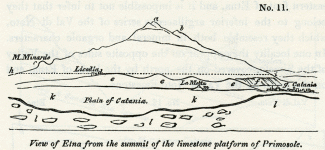
No. 11: View of Etna from the summit of the limestone platform of Primosole.
a, Highest cone. b, Montagnuola. c, Monte Minardo, with smaller lateral cones above. d, Town of Licodia dei Monaci. e, Marine formation called creta, argillaceous and sandy beds with a few shells, and associated volcanic rocks. f, Escarpment of stratified subaqueous volcanic tuff, &c., north-west of Catania. g, Town of Catania. h, i, Dotted line expressing the highest boundary along which the marine strata are occasionally seen. k, Plain of Catania. l, Limestone platform of Primosole of the newer Pliocene. m, La Motta di Catania.
This marine formation, which is composed partly of volcanic and partly of sedimentary rocks, is seen to underlie the modern lavas of Etna. To what extent it forms the base of the mountain cannot be observed, for want of sections of the lower part of the cone, but the marine sub-Etnean beds are not observed to rise to a greater elevation than eight hundred, or, at the utmost, one thousand feet above the level of the sea. We should remind the reader, that the annexed drawing is not a section, but an outline view of Etna, as seen from Primosole, so that the proportional height of the volcanic cone, which is, in reality, ten times greater than that of the hills of 'Creta,' at its base, is not represented, the summit of the cone being ten or twelve miles more distant from the plain of Catania, than Licodia.
Connexion of the sub-Etnean strata with those of the Val di Noto. -- These marine strata are found both on the southern and eastern foot of Etna, and it is impossible not to infer that they belong to the inferior argillaceous series of the Val di Nota, which they resemble both in mineral and organic characters. In one locality they appear on the opposite sides of the Valley of the Simeto, covered on the north by the lavas of Etna, and on the south by the Val di Noto limestone.
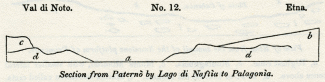
No. 12: Val di Noto, Etna. Section from Paterno by Lago di Naftia to Patagonia.
a, Plain of the Simeto. b, Base of the cone of Etna, composed of modern lavas. c, Limestone of the Val di Noto. d, Clay, sand, and associated submarine volcanic rocks.
If in the country adjacent to the Lago di Naftia, through which the annexed section is drawn, and in several other districts where the 'creta' prevails, together with associated submarine lavas, and where there is no limestone capping, a volcano should now burst forth, and give rise to a great cone, the position of such a cone would exactly correspond to that of the modern Etna, with relation to the rocks on which it rests.
Southern base of Etna. -- The marine strata of clay and sand already alluded to, alternate in thin layers at the southern base of Etna, sometimes attaining a thickness of three hundred feet" or more, without any intermixture of volcanic matter. Crystals of selenite are dispersed through the clay, accompanied by a few shells, almost entirely of recent Mediterranean species. This formation of blue marl and yellow sand greatly resembles in character that of the Italian Subapennine beds, and, like them, often presents a surface denuded of vegetation, in consequence of the action of the rains on soft incoherent materials.
In travelling by Paterno, Misterbianco, and La Motta, we pass through deep narrow valleys excavated through these beds, which are sometimes capped, as at La Motta, by columnar basalt, accompanied by strata of tuff and volcanic conglomerate. (Diagram No. 13.)
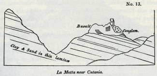
No. 13: La Motta near Catania.
The latter rock is composed of rolled masses of basalt, which may either have originated when first the lava was produced in a volcanic archipelago, or subsequently when the whole country was rising from beneath the level of the sea. Its occurrence in this situation is striking, as not a single pebble can be observed in the entire thickness of subjacent beds of sand and clay.
The dip of the marine strata, at the base of Etna, is by no means uniform; on the eastern side, for example, they are sometimes inclined towards the sea, and at others towards the mountain. Near the aqueduct at Aderno, on the southern side, I observed two sections, in quarries not far distant from each other, where beds of clay and yellow sand dipped, in one locality, at an angle of forty-five degrees to the east-south-east, and in the other at a much higher inclination in the opposite direction. These facts would be of small interest, if an attempt had not been made to represent these mixed marine and volcanic deposits which encircle part of the base of Etna, as the outer margin of a so-called 'elevation crater.' [1]
Near Catania the marine formation, consisting chiefly of volcanic tuff thinly laminated, terminates in a steep inland cliff, or escarpment, which is from six hundred to eight hundred feet in height. A low flat, composed of recent lava and volcanic sand, intervenes between the sea and the base of this escarpment, which may be well seen at Fasano. (f, diagram No. 11.)
Eastern side of Etna -- Bay of Trezza. -- Proceeding northwards from Catania, we have opportunities of examining the same sub-Etnean formations laid open more distinctly in the modern sea-cliffs, especially in the Bay of Trezza and in the Cyclopian islands (Dei Faraglioni), which may be regarded as the extremity of a promontory severed from the main land. Numerous are the proofs of submarine eruptions of high antiquity in this spot, where the argillaceous and sandy beds have been invaded and intersected by lava, and where those peculiar tufaceous breccias occur which result from ejections of fragmentary matter, projected from a volcanic vent. I observed many angular and hardened fragments of laminated clay (creta), in different states of alteration, between La Trezza and Nizzitta, and in the hills above Aci Castello, a town on the main land contiguous to the Cyclopian isles, which could not be mistaken by one familiar with Somma and the minor cones of Ischia, for anything but masses thrown out by volcanic explosions. From the tuffs and marls of this district I collected a great variety of marine shells, [2] almost all of which have been identified with species now inhabiting the Mediterranean, and, for the most part, now frequent on the coast immediately adjacent. Some few of these fossil shells retain part of their colour, which is the same as in their living analogues.
The largest of the Cyclopian islets, or rather rocks, is distant two hundred yards from the land, and is only three hundred yards in circumference, and about two hundred feet in height. The summit and northern sides are formed of a mass of stratified marl (creta), the laminae of which are occasionally subdivided by thin arenaceous layers. These strata rest on a mass of columnar lava (see wood-cut, No. 14), [3] which appears to have forced itself into, and to have heaved up the stratified mass. This theory of the intrusion of the basalt is confirmed by the fact, that in some places the clay has been greatly altered, and hardened by the action of heat, and occasionally contorted in the most extraordinary manner, the lamination not having been obliterated, but, on the contrary, rendered much more conspicuous by the indurating process.
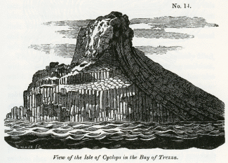
No. 14: View of the Isle of Cyclops in the Bay of Trezza.
The annexed wood-cut (No. 15) is a careful representation of a portion of the altered rock, a few feet square, where the alternate thin laminae of sand and clay have put on the appearance which we often observe in some of the most contorted of the primary schists.
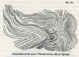
No. 15: Contortions in the newer Pliocene strata, Isle of Cyclops.
A great fissure, running from east to west, nearly divides the island into two parts, and lays open its internal structure. In the section thus exhibited, a dike of lava is seen, first cutting through an older mass of lava, and then penetrating the superincumbent tertiary strata. In one locality. the lava ramifies and terminates in thin veins, from a few feet to a few inches in thickness (see diagram No. 16).
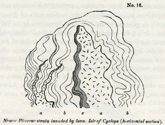
No. 16: Newer Pliocene strata invaded by lava. Isle of Cyclops (horizontal section).
a, Lava. b, laminated clay and sand. c, the same altered.
The arenaceous laminae are much hardened at the point of contact, and the clays are converted into siliceous schist. In this island the altered rocks assume a honeycombed structure on their weathered surface, singularly contrasted with the smooth and even outline which the same beds present in their usual soft and yielding state.
The pores of the lava are sometimes coated, or entirely filled, with carbonate of lime, and with a zeolite resembling analcime, which has been called cyc1opite. The latter mineral has also been found in small fissures traversing the altered marl, showing that the same cause which introduced the minerals into the cavities of the lava, whether we suppose sublimation or aqueous infiltration, conveyed it also into the open rents of the contiguous sedimentary strata.
Lavas of the Cyclopian Isles not currents from Etna. -- The phenomena of the Bay of Trezza are very important, for it is evident that the submarine lavas were produced by eruptions on the spot, an inference which follows not only from the presence of dikes and veins, but from those tuffs above Castello d'Aci, which contain angular fragments of hardened marl, evidently thrown up, together with the sand and scoriae, by volcanic explosions. We may, therefore, suppose this volcanic action to have been as independent of the modern vents of Etna, as that which gave rise to the analogous formations in the Val di Noto. It is quite evident that the lavas of the Cyclopian isles are not the lower extremities of currents which flowed down from the highest crater of Etna, or from the region where lateral eruptions are now frequent, -- lavas which, after entering the sea, were afterwards upraised into their present position. It is more probable that the basalts of the Bay of Trezza" and those along the southern foot of Etna, at La Motta, Aderno, Paterno, Licodia, and other places, originated in the same sea in which the eruptions of the Val di Noto took place.
There are, however, as we have observed, no sections to prove that the central and oldest parts of Etna repose on similar submarine formations. The modern lavas of the volcano are continually extending their area, and covering, from time to time, a larger portion of the marine strata; but we know not where this operation commenced, so that we cannot demonstrate the posteriority of the whole cone to these newer Pliocene strata.
We might imagine that when the volcanos of the Val di Noto were in activity, and when the eruptions of the Bay of Trezza were taking place, Etna already existed as a volcano, the upper part only of the cone projecting above the level of the waters, as in the case of Stromboli at present. By such an hypothesis, we might refer the origin of the older part of Etna to the same period as that of the sedimentary strata and volcanic rocks of the Val di Noto.
But, for our own part, we see no grounds for inclining to such a theory, since we must admit that a sufficient series of ages has elapsed since the limestone of the Val di Noto was deposited, to allow the same to be elevated to the height of from two thousand to three thousand feet, in which case there may also have been sufficient time for the growth of a volcanic pile like Etna, since the newer Pliocene strata now seen at the base of the volcano originated.
INTERNAL STRUCTURE OF THE CONE OF ETNA.
In our first volume we merely described that part of Etna which has been formed during the historical era; an insignificant portion of the whole mass. Nearly all the remainder may be referred to the tertiary period immediately antecedent to the recent epoch. We before stated, that the great cone is, in general, of a very symmetrical form, but is broken, on its eastern side, by a deep valley, called the Val del Bove, [4] which, commencing near the summit of the mountain, descends into the woody region, and is then continued, on one side, by a second and narrower valley, called the Val di Calanna. Below the latter another, named the Val di St. Giacomo, begins, -- a long narrow ravine, which is prolonged to the neighbourhood of Zaffarana (e, No. 17), on the confines of the fertile region. These natural incisions, into the side of the volcano, are of such depth, that they expose to view a great part of the structure of the entire mass, which, in the Val del Bove, is laid open to the depth of from four thousand to five thousand feet from the summit of Etna. The geologist thus enjoys an opportunity of ascertaining how far the internal conformation of the cone corresponds with what he might have anticipated as the result of that mode of increase which has been witnessed during the historical era.
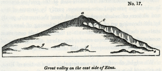
No. 17: Great valley on the east side of Etna.
a, highest cone. b, Montagnuola. c, Head of Val del Bove. d, d, Serre del Solfizio. e, Zaffarana. f, One of the lateral cones. g, Monti Rossi.
It is clear, from what we before said of the gradual manner in which the principal cone increases, partly by streams of lava and showers of volcanic ashes ejected from the summit, partly by the throwing up of minor hills and the issuing of lava-currents on the flanks of the mountain, that the whole cone must consist of a series of cones enveloping others, the regularity of each being only interrupted by the interference of the lateral volcanos.
We might, therefore, have anticipated that a section of Etna, as exposed in a ravine which should begin near the summit and extend nearly to the sea, would correspond very closely to the section of the ancient Vesuvius, commencing with the escarpment of Somma, and ending with the Fossa Grande; but with this difference, that where the ravine intersects the woody region of Etna, indications must appear of changes brought about by lateral eruptions. Now the section before alluded to, which can be traced from the head of the Val del Rove to the inferior borders of the woody region, fully answers such expectations. We find, almost everywhere, a series of layers of tuff and breccia interstratified with lavas, which slope gently to the sea, at an angle of from twenty to thirty degrees; and as we rise to the parallel of the zone of lateral eruptions, and still more as we approach the summit, we discover indications of disturbances, occasioned by the passage of lava from below, and the successive inhumation of lateral cones.
Val di Calanna. -- On leaving Zaffarana, on the borders of the fertile region, we enter the ravine-like valley of St. Giacomo, and see on the north side, or on our right as we ascend, rising ground composed of the modern lavas of Etna. On our left, a lofty cliff, wherein a regular series of beds is exhibited, composed of tuffs and lavas, descending with a gentle inclination towards the sea. In this lower part of the section there are no intersecting dikes, nor any signs of minor cones interfering with the regular slope of the alternating vol. canic products. If we then pass upwards through a defile, called the 'Portello di Calanna,' we enter a second valley, that of Calanna, resembling the ravine before mentioned, but wider and much deeper. Here again we find, on our right, many currents of modern lava, piled one upon the other, and on our left a continuation of our former section, in a perpendicular cliff from four hundred to five hundred feet high. As this lofty wall sweeps in a curve, it has very much the appearance of the escarpment which Somma presents towards Vesuvius, and this resemblance is increased by the occurrence of two or three vertical dikes which traverse the gently-inclined volcanic beds. When I first beheld this precipice, I fancied that I had entered a lateral crater, but was soon undeceived, by discovering that on all sides, both at the head of the valley, in the hill of Zocolaro, and at its side and lower extremity, the dip of the beds was always in the same direction, all slanting to the east, or towards the sea, instead of sloping to the north, east, and south, as would have been the case had they constituted three walls of an ancient crater.
It is not difficult to explain how the valleys of St. Giacomo and Calanna originated, when once the line of lofty precipices on the north side of them had been formed. Many lava-currents flowing down successively from the higher regions of Etna, along the foot of a great escarpment of volcanic rock, have at length been turned by a promontory at the head of the valley of Calanna, which runs out at right angles, to the great line of precipices. This promontory consists of the hills called Zocolaro and Calanna, and of a ridge of inferior height which connects them. (See diagram No. 18.)
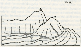
No. 18.
A, Zocolaro. B, Monte di Calanna. C, Plain at the head of the Valley of Calanna. a, Lava of 1819 descending the precipice and flowing through the valley. b, Lavas of 1811 and 1819 flowing round the hill of Calanna.
The flows of melted matter have been deflected from their course by this projecting mass, just as a tidal current, after setting against a line of sea-cliffs, is often thrown off into a new direction by some rocky headland.
Lava-streams, it is well known, become solid externally, even while yet in motion, and their sides may be compared to two rocky walls, which are sometimes inclined at an angle of forty-five degrees. When such streams descend a considerable slope at the base of a line of precipices, and are turned from their course by a projecting rock, they move right onwards in a new direction, so as to leave a considerable space (as in the Valley of Calanna) between them and the cliffs which may be continuous below the point of deflection.
It happened in 1811 and 1819, that the flows of lava overtopped the ridge intervening between the hills of Zocolaro and Calanna, so that they fell in a cascade over a lofty precipice, and began to fill up the valley. (See letter a, diagram No. 18.)
The narrow cavity of St. Giacomo will admit of an explanation precisely similar to that already offered for Calanna.
Val del Bove. -- After passing up through the defile, called the 'Rocca di Calanna," we enter a third valley of truly magnificent dimensions -- the Val del Bove -- a vast amphitheatre four or five miles in diameter, surrounded by nearly vertical precipices, varying from one thousand to above three thousand feet in height, the loftiest being at the upper end, and the height gradually diminishing on both sides. The feature which first strikes the geologist as distinguishing this valley from those before mentioned, is the prodigious multitudes of vertical dikes, which are seen in all directions traversing the volcanic beds. The circular form of this great chasm, and the occurrence of these countless dikes, amounting perhaps to several thousands in number, so forcibly recalled to my mind the phenomena of the Atrio del Cavallo, on Vesuvius, that I imagined once more that I had entered a vast crater, on a scale as far exceeding that of Somma, as Etna surpasses Vesuvius in magnitude.
But having already been deceived in regard to the crescent-shaped precipice of the valley of Calanna, I began attentively to explore the different sides of the great amphitheatre, in order to satisfy myself whether the semicircular wall of the Val del Bove had ever formed the boundary of a crater, and whether the beds had the same quaqua-versal dip which is so beautifully exhibited in the escarpment of Somma. If the supposed analogy between Somma and the Val del Bove should hold true, the tuffs and lavas, at the head of the valley, would dip to the west, those on the north side towards the north, and those on the southern side to the south. But such I did not find to be the inclination of the beds; they all dip towards the sea, or nearly east, as was before seen to be the case in the Valley of Calanna.
There are undoubtedly exceptions to this general rule, which might deceive a geologist who was strongly prepossessed with a belief that he had discovered the hollow of an ancient crater. It is evident that, wherever lateral cones are intersected in the precipices, a series of tuffs and lavas, very similar to those which enter into the structure of the great cone, will be seen dipping at a much more rapid angle.
The lavas and tuffs, which have conformed to the sides of Etna, dip at angles of from fifteen to twenty-five degrees, while the slope of the lateral cones is from thirty-five to fifty degrees. Now, wherever we meet with sections of these buried cones in the precipices bordering the Val del Hove, (and they are frequent in the cliffs called the Serre del Solfizio, and in those near the head of the valley not far from the rock of Musara,) we find the beds dipping at high angles and inclined in various directions. [5]
Scenery of the Val del Bove. -- Without entering at present into any further discussions respecting the origin of the Val del Bove, we shall proceed to describe some of its most remarkable features. Let the reader picture to himself a large amphitheatre, five miles in diameter, and surrounded on three sides by precipices from two thousand to three thousand feet in height. If he has beheld that most picturesque scene in the chain of the Pyrenees, the celebrated 'cirque of Gavarnie,' he may form some conception of the magnificent circle of precipitous rocks which inclose, on three sides, the great plain of the Val del Hove. This plain has been deluged by repeated streams of lava, and although it appears almost level when viewed from a distance, it is, in fact, more uneven than the surface of the most tempestuous sea. Besides the minor irregularities of the lava, the valley is in one part interrupted by a ridge of rocks, two of which, Musara and Capra, are very prominent. It can hardly be said that they
for although, like the Trosachs, they are of gigantic dimensions, and appear almost isolated as seen from many points, yet the stern and severe grandeur of the scenery which they adorn is not such as would be selected by a poet for a vale of enchantment. The character of the scene would accord far better with Milton's picture of the infernal world; and if we imagine ourselves to behold in motion, in the darkness of the night, one of those fiery currents, which have so often traversed the great valley, we may well recall
The face of the precipices already mentioned is broken in the most picturesque manner by the vertical walls of lava which traverse them. These masses usually stand out in relief, are exceedingly diversified in form, and often of immense altitude. In the autumn, their black outline may often be seen relieved by clouds of fleecy vapour which settle behind them, and do not disperse until midday, continuing to fill the valley while the sun is shining on every other part of Sicily, and on the higher regions of Etna.
As soon as the vapours begin to rise, the changes of scene are varied in the highest degree, different rocks being unveiled and hidden by turns, and the summit of Etna often breaking through the clouds for a moment with its dazzling snows, and being then as suddenly withdrawn from the view.
An unusual silence prevails, for there are no torrents dashing from the rocks, nor any movement of running water in this valley, such as may almost invariably be heard in mountainous regions. Every drop of water that falls from the heavens, or flows from the melting ice and snow, is instantly absorbed by the porous lava; and such is the dearth of springs, that the herdsman is compelled to supply his flocks, during the hot season, from stores of snow laid up in hollows of the mountain during winter.
The strips of green herbage and forest-land, which have here and there escaped the burning lavas, serve, by contrast, to heighten the desolation of the scene. When I visited the valley, nine years after the eruption of 1819, I saw hundreds of trees, or rather the white skeletons of trees, on the borders of the black lava, the trunks and branches being all leafless, and deprived of their bark by the scorching heat emitted from the melted rock; an image recalling those beautiful lines --
Form, composition, and origin of the Dikes. -- But without indulging the imagination any longer in descriptions of scenery, we may observe, that the dikes before mentioned form unquestionably the most interesting geological phenomenon in the Val del Bove.
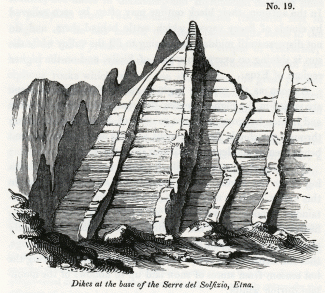
No. 19: Dikes at the base of the Serre del Solfizio, Etna.
Some of these are composed of trachyte, others of compact blue basalt with olivine. They vary in breadth from two to twenty feet and upwards, and usually project from the face of the cliffs, as represented in the annexed drawing (No. 19). They consist of harder materials than the strata which they traverse, and therefore waste away less rapidly under the influence of that repeated congelation and thawing to which the rocks in this zone of Etna are exposed. The dikes are, for the most part, vertical, but sometimes they run in a tortuous course through the tuffs and breccias, as represented in diagram, No. 20. In the escarpment of Somma where, as we be- fore observed, similar walls of lava cut through alternating beds of sand and scoriae, a coating of coal-black rock, approaching in its nature and appearance to pitch-stone, is seen at the contact of the dike with the intersected beds. I did not observe such parting layers at the junction of the Etnean dikes which I examined, but they may perhaps be discoverable.
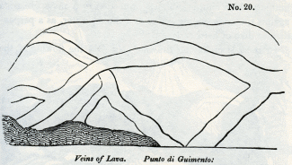
No. 20: Veins of Lava. Punta di Guimento:
The geographical position of these dikes is most interesting, as they occur in that zone of the mountain where lateral eruptions are frequent; whereas, in the valley of Calanna, which is below that parallel, and in a region where lateral eruptions are extremely rare, scarcely any dikes are seen, and none whatever still lower in the valley of St. Giacomo. This is precisely what we should have expected, if we consider the vertical fissures now filled with rock to have been the feeders of lateral cones, or, in other words, the channels which gave passage to the lava-currents and scoriae that have issued from vents in the forest-zone.
Some fissures may have been filled from above, but I did not see any which, by terminating downwards, gave proof of such an origin. Almost all the isolated masses in the Val del Hove, such as Capra, Musara, and others, are traversed by dikes, and may, perhaps, have partly owed their preservation to that circumstance, if at least the action of occasional floods has been one of the destroying causes in the Val del Hove; for there is nothing which affords so much protection to a mass of strata against the undermining action of running water, as a perpendicular dike of hard rock.
In the accompanying drawing (No. 21) the flowing of the lavas of 1811 and 1819, between the rocks Finochio, Capra, and Musara, is represented. The height of the two last-mentioned isolated masses has been much diminished by the elevation of their base, caused by these currents. They may, perhaps, be the remnants of cones, which existed before the Val del Bove was formed, and may hereafter be once more buried by the lavas that are now accumulating in the valley.
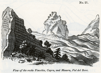
No. 21: View of the rock, Finochio, Capra, and Musara, Val del Bove.
From no point of view are the dikes more conspicuous than from the summit of the highest cone of Etna; a view of some of them is given in the annexed drawing. [6]
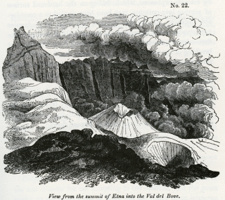
No. 22: View from the summit of Etna into the Val del Bove.
The small cone and crater immediately below were among those formed during the eruptions of 1810 and 1811.
Lavas and breccias. -- In regard to the volcanic masses which are intersected by dikes in the Val del Hove, they consist, in great part, of graystone lavas, of an intermediate character between basalt and trachyte, and partly of the trachytic varieties of lava. Beds of scoriae and sand, also, are very numerous, alternating with breccias formed of angular blocks of igneous rock. It is possible that some of the breccias may be referred to aqueous causes, as we have before seen that great floods do occasionally sweep down the Banks of Etna when eruptions take place in winter, and when the snows are melted by lava.
Many of the angular fragments may have been thrown out by volcanic explosions, which, falling on the hardened surface of moving lava-currents, may have been carried to a considerable distance. It may also happen, that when lava advances very slowly, in the manner of the flow of 1819, described in the first volume, [7] the angular masses resulting from the frequent breaking of the mass as it rolls over upon itself, may produce these breccias. It is at least certain, that the upper portion of the lava-currents of 1811 and 1819, now consist of angular masses, to the depth of many yards.
D'Aubuisson has compared the surface of one of the ancient lavas of Auvergne to that of a river suddenly frozen over by the stoppage of immense fragments of drift-ice, a description perfectly applicable to these modern Etnean Bows.
_______________
Notes:
1. See vol. i. chap. xxii.
2. See, in Appendix No. II., a list, by M. Deshayes, of sixty-five species, which I procured from the hills called Monte Cavalaccio, Rocca di Ferro, and Rocca di Bempolere (or Borgia).
3. This cut is from an original drawing by my friend Capt. W. H. Smyth, R. N.
4. In the provincial dialect of the peasants called 'Val del Bue,' for here the herdsmen
Dr. Buckland was, I believe, the first English geologist who examined this valley with attention, and I am indebted to him for having described it to me, before my visit to Sicily, as more worthy of attention than any single spot in that island, or perhaps in Europe. I have already stated, that the view of this valley, which I have given in the frontispiece or the second volume, does not pretend to convey any idea of the grandeur of the scene.
5. I perceive that Professor Hoffmann, who visited the Val del Bove after me (in January, 1831), has speculated on its structure as corresponding to that of the so-called elevation craters, which hypothesis would require that there should be a quaqua-versal dip, such as I have above alluded to. I can only account for this difference of opinion, by supposing the Professor to have overlooked the phenomena or the buried cones. -- Archiv. fur Mineralogie, &c. Berlin, 1831.
6. This drawing is part of a panoramic sketch which I made from the summit of the cone, December 1st, 1828, when every part of Etna was free from clouds except the Val del Bove.
7. Chap. xxi.
Marine and volcanic formations at the base of Etna – Their connexion with the strata of the Val di Noto – Bay of Trezza – Cyclopian isles – Fossil shells of recent species – Basalt and altered rocks in the Isle of Cyclops – Submarine lavas of the bay of Trezza not currents from Etna – Internal structure of the cone of Etna – Val di Calanna – Val del Bove not an ancient crater – Its precipices intersected by countless dikes – Scenery of the Val del Bove – Form, composition, and origin of the dikes – Lavas and breccias intersected by them
MARINE AND VOLCANIC FORMATIONS AT THE BASE OF ETNA.
THE phenomena considered in the last chapter suggest many theoretical views of the highest interest in Geology; but before we enter upon these topics we are desirous of describing some formations in Valdemone, which are analogous to those of the Val di Noto, and to point out the relation of such rocks to the modern lavas of Etna.
If the traveller passes along the table-land, formed by the great limestone of the Val di Noto, until it terminates suddenly near Primosole, he there sees the plain of Catania at his feet, and before him, to the north, the cone of Etna (see diagram No. 11). At the base of the cone he beholds a low line of hills e, e (No. 11), formed of clays and marls, associated with yellowish sand, similar to the formation provincially termed 'Creta,' in various parts of Sicily.
No. 11: View of Etna from the summit of the limestone platform of Primosole.
a, Highest cone. b, Montagnuola. c, Monte Minardo, with smaller lateral cones above. d, Town of Licodia dei Monaci. e, Marine formation called creta, argillaceous and sandy beds with a few shells, and associated volcanic rocks. f, Escarpment of stratified subaqueous volcanic tuff, &c., north-west of Catania. g, Town of Catania. h, i, Dotted line expressing the highest boundary along which the marine strata are occasionally seen. k, Plain of Catania. l, Limestone platform of Primosole of the newer Pliocene. m, La Motta di Catania.
This marine formation, which is composed partly of volcanic and partly of sedimentary rocks, is seen to underlie the modern lavas of Etna. To what extent it forms the base of the mountain cannot be observed, for want of sections of the lower part of the cone, but the marine sub-Etnean beds are not observed to rise to a greater elevation than eight hundred, or, at the utmost, one thousand feet above the level of the sea. We should remind the reader, that the annexed drawing is not a section, but an outline view of Etna, as seen from Primosole, so that the proportional height of the volcanic cone, which is, in reality, ten times greater than that of the hills of 'Creta,' at its base, is not represented, the summit of the cone being ten or twelve miles more distant from the plain of Catania, than Licodia.
Connexion of the sub-Etnean strata with those of the Val di Noto. -- These marine strata are found both on the southern and eastern foot of Etna, and it is impossible not to infer that they belong to the inferior argillaceous series of the Val di Nota, which they resemble both in mineral and organic characters. In one locality they appear on the opposite sides of the Valley of the Simeto, covered on the north by the lavas of Etna, and on the south by the Val di Noto limestone.
No. 12: Val di Noto, Etna. Section from Paterno by Lago di Naftia to Patagonia.
a, Plain of the Simeto. b, Base of the cone of Etna, composed of modern lavas. c, Limestone of the Val di Noto. d, Clay, sand, and associated submarine volcanic rocks.
If in the country adjacent to the Lago di Naftia, through which the annexed section is drawn, and in several other districts where the 'creta' prevails, together with associated submarine lavas, and where there is no limestone capping, a volcano should now burst forth, and give rise to a great cone, the position of such a cone would exactly correspond to that of the modern Etna, with relation to the rocks on which it rests.
Southern base of Etna. -- The marine strata of clay and sand already alluded to, alternate in thin layers at the southern base of Etna, sometimes attaining a thickness of three hundred feet" or more, without any intermixture of volcanic matter. Crystals of selenite are dispersed through the clay, accompanied by a few shells, almost entirely of recent Mediterranean species. This formation of blue marl and yellow sand greatly resembles in character that of the Italian Subapennine beds, and, like them, often presents a surface denuded of vegetation, in consequence of the action of the rains on soft incoherent materials.
In travelling by Paterno, Misterbianco, and La Motta, we pass through deep narrow valleys excavated through these beds, which are sometimes capped, as at La Motta, by columnar basalt, accompanied by strata of tuff and volcanic conglomerate. (Diagram No. 13.)
No. 13: La Motta near Catania.
The latter rock is composed of rolled masses of basalt, which may either have originated when first the lava was produced in a volcanic archipelago, or subsequently when the whole country was rising from beneath the level of the sea. Its occurrence in this situation is striking, as not a single pebble can be observed in the entire thickness of subjacent beds of sand and clay.
The dip of the marine strata, at the base of Etna, is by no means uniform; on the eastern side, for example, they are sometimes inclined towards the sea, and at others towards the mountain. Near the aqueduct at Aderno, on the southern side, I observed two sections, in quarries not far distant from each other, where beds of clay and yellow sand dipped, in one locality, at an angle of forty-five degrees to the east-south-east, and in the other at a much higher inclination in the opposite direction. These facts would be of small interest, if an attempt had not been made to represent these mixed marine and volcanic deposits which encircle part of the base of Etna, as the outer margin of a so-called 'elevation crater.' [1]
Near Catania the marine formation, consisting chiefly of volcanic tuff thinly laminated, terminates in a steep inland cliff, or escarpment, which is from six hundred to eight hundred feet in height. A low flat, composed of recent lava and volcanic sand, intervenes between the sea and the base of this escarpment, which may be well seen at Fasano. (f, diagram No. 11.)
Eastern side of Etna -- Bay of Trezza. -- Proceeding northwards from Catania, we have opportunities of examining the same sub-Etnean formations laid open more distinctly in the modern sea-cliffs, especially in the Bay of Trezza and in the Cyclopian islands (Dei Faraglioni), which may be regarded as the extremity of a promontory severed from the main land. Numerous are the proofs of submarine eruptions of high antiquity in this spot, where the argillaceous and sandy beds have been invaded and intersected by lava, and where those peculiar tufaceous breccias occur which result from ejections of fragmentary matter, projected from a volcanic vent. I observed many angular and hardened fragments of laminated clay (creta), in different states of alteration, between La Trezza and Nizzitta, and in the hills above Aci Castello, a town on the main land contiguous to the Cyclopian isles, which could not be mistaken by one familiar with Somma and the minor cones of Ischia, for anything but masses thrown out by volcanic explosions. From the tuffs and marls of this district I collected a great variety of marine shells, [2] almost all of which have been identified with species now inhabiting the Mediterranean, and, for the most part, now frequent on the coast immediately adjacent. Some few of these fossil shells retain part of their colour, which is the same as in their living analogues.
The largest of the Cyclopian islets, or rather rocks, is distant two hundred yards from the land, and is only three hundred yards in circumference, and about two hundred feet in height. The summit and northern sides are formed of a mass of stratified marl (creta), the laminae of which are occasionally subdivided by thin arenaceous layers. These strata rest on a mass of columnar lava (see wood-cut, No. 14), [3] which appears to have forced itself into, and to have heaved up the stratified mass. This theory of the intrusion of the basalt is confirmed by the fact, that in some places the clay has been greatly altered, and hardened by the action of heat, and occasionally contorted in the most extraordinary manner, the lamination not having been obliterated, but, on the contrary, rendered much more conspicuous by the indurating process.
No. 14: View of the Isle of Cyclops in the Bay of Trezza.
The annexed wood-cut (No. 15) is a careful representation of a portion of the altered rock, a few feet square, where the alternate thin laminae of sand and clay have put on the appearance which we often observe in some of the most contorted of the primary schists.
No. 15: Contortions in the newer Pliocene strata, Isle of Cyclops.
A great fissure, running from east to west, nearly divides the island into two parts, and lays open its internal structure. In the section thus exhibited, a dike of lava is seen, first cutting through an older mass of lava, and then penetrating the superincumbent tertiary strata. In one locality. the lava ramifies and terminates in thin veins, from a few feet to a few inches in thickness (see diagram No. 16).
No. 16: Newer Pliocene strata invaded by lava. Isle of Cyclops (horizontal section).
a, Lava. b, laminated clay and sand. c, the same altered.
The arenaceous laminae are much hardened at the point of contact, and the clays are converted into siliceous schist. In this island the altered rocks assume a honeycombed structure on their weathered surface, singularly contrasted with the smooth and even outline which the same beds present in their usual soft and yielding state.
The pores of the lava are sometimes coated, or entirely filled, with carbonate of lime, and with a zeolite resembling analcime, which has been called cyc1opite. The latter mineral has also been found in small fissures traversing the altered marl, showing that the same cause which introduced the minerals into the cavities of the lava, whether we suppose sublimation or aqueous infiltration, conveyed it also into the open rents of the contiguous sedimentary strata.
Lavas of the Cyclopian Isles not currents from Etna. -- The phenomena of the Bay of Trezza are very important, for it is evident that the submarine lavas were produced by eruptions on the spot, an inference which follows not only from the presence of dikes and veins, but from those tuffs above Castello d'Aci, which contain angular fragments of hardened marl, evidently thrown up, together with the sand and scoriae, by volcanic explosions. We may, therefore, suppose this volcanic action to have been as independent of the modern vents of Etna, as that which gave rise to the analogous formations in the Val di Noto. It is quite evident that the lavas of the Cyclopian isles are not the lower extremities of currents which flowed down from the highest crater of Etna, or from the region where lateral eruptions are now frequent, -- lavas which, after entering the sea, were afterwards upraised into their present position. It is more probable that the basalts of the Bay of Trezza" and those along the southern foot of Etna, at La Motta, Aderno, Paterno, Licodia, and other places, originated in the same sea in which the eruptions of the Val di Noto took place.
There are, however, as we have observed, no sections to prove that the central and oldest parts of Etna repose on similar submarine formations. The modern lavas of the volcano are continually extending their area, and covering, from time to time, a larger portion of the marine strata; but we know not where this operation commenced, so that we cannot demonstrate the posteriority of the whole cone to these newer Pliocene strata.
We might imagine that when the volcanos of the Val di Noto were in activity, and when the eruptions of the Bay of Trezza were taking place, Etna already existed as a volcano, the upper part only of the cone projecting above the level of the waters, as in the case of Stromboli at present. By such an hypothesis, we might refer the origin of the older part of Etna to the same period as that of the sedimentary strata and volcanic rocks of the Val di Noto.
But, for our own part, we see no grounds for inclining to such a theory, since we must admit that a sufficient series of ages has elapsed since the limestone of the Val di Noto was deposited, to allow the same to be elevated to the height of from two thousand to three thousand feet, in which case there may also have been sufficient time for the growth of a volcanic pile like Etna, since the newer Pliocene strata now seen at the base of the volcano originated.
INTERNAL STRUCTURE OF THE CONE OF ETNA.
In our first volume we merely described that part of Etna which has been formed during the historical era; an insignificant portion of the whole mass. Nearly all the remainder may be referred to the tertiary period immediately antecedent to the recent epoch. We before stated, that the great cone is, in general, of a very symmetrical form, but is broken, on its eastern side, by a deep valley, called the Val del Bove, [4] which, commencing near the summit of the mountain, descends into the woody region, and is then continued, on one side, by a second and narrower valley, called the Val di Calanna. Below the latter another, named the Val di St. Giacomo, begins, -- a long narrow ravine, which is prolonged to the neighbourhood of Zaffarana (e, No. 17), on the confines of the fertile region. These natural incisions, into the side of the volcano, are of such depth, that they expose to view a great part of the structure of the entire mass, which, in the Val del Bove, is laid open to the depth of from four thousand to five thousand feet from the summit of Etna. The geologist thus enjoys an opportunity of ascertaining how far the internal conformation of the cone corresponds with what he might have anticipated as the result of that mode of increase which has been witnessed during the historical era.
No. 17: Great valley on the east side of Etna.
a, highest cone. b, Montagnuola. c, Head of Val del Bove. d, d, Serre del Solfizio. e, Zaffarana. f, One of the lateral cones. g, Monti Rossi.
It is clear, from what we before said of the gradual manner in which the principal cone increases, partly by streams of lava and showers of volcanic ashes ejected from the summit, partly by the throwing up of minor hills and the issuing of lava-currents on the flanks of the mountain, that the whole cone must consist of a series of cones enveloping others, the regularity of each being only interrupted by the interference of the lateral volcanos.
We might, therefore, have anticipated that a section of Etna, as exposed in a ravine which should begin near the summit and extend nearly to the sea, would correspond very closely to the section of the ancient Vesuvius, commencing with the escarpment of Somma, and ending with the Fossa Grande; but with this difference, that where the ravine intersects the woody region of Etna, indications must appear of changes brought about by lateral eruptions. Now the section before alluded to, which can be traced from the head of the Val del Rove to the inferior borders of the woody region, fully answers such expectations. We find, almost everywhere, a series of layers of tuff and breccia interstratified with lavas, which slope gently to the sea, at an angle of from twenty to thirty degrees; and as we rise to the parallel of the zone of lateral eruptions, and still more as we approach the summit, we discover indications of disturbances, occasioned by the passage of lava from below, and the successive inhumation of lateral cones.
Val di Calanna. -- On leaving Zaffarana, on the borders of the fertile region, we enter the ravine-like valley of St. Giacomo, and see on the north side, or on our right as we ascend, rising ground composed of the modern lavas of Etna. On our left, a lofty cliff, wherein a regular series of beds is exhibited, composed of tuffs and lavas, descending with a gentle inclination towards the sea. In this lower part of the section there are no intersecting dikes, nor any signs of minor cones interfering with the regular slope of the alternating vol. canic products. If we then pass upwards through a defile, called the 'Portello di Calanna,' we enter a second valley, that of Calanna, resembling the ravine before mentioned, but wider and much deeper. Here again we find, on our right, many currents of modern lava, piled one upon the other, and on our left a continuation of our former section, in a perpendicular cliff from four hundred to five hundred feet high. As this lofty wall sweeps in a curve, it has very much the appearance of the escarpment which Somma presents towards Vesuvius, and this resemblance is increased by the occurrence of two or three vertical dikes which traverse the gently-inclined volcanic beds. When I first beheld this precipice, I fancied that I had entered a lateral crater, but was soon undeceived, by discovering that on all sides, both at the head of the valley, in the hill of Zocolaro, and at its side and lower extremity, the dip of the beds was always in the same direction, all slanting to the east, or towards the sea, instead of sloping to the north, east, and south, as would have been the case had they constituted three walls of an ancient crater.
It is not difficult to explain how the valleys of St. Giacomo and Calanna originated, when once the line of lofty precipices on the north side of them had been formed. Many lava-currents flowing down successively from the higher regions of Etna, along the foot of a great escarpment of volcanic rock, have at length been turned by a promontory at the head of the valley of Calanna, which runs out at right angles, to the great line of precipices. This promontory consists of the hills called Zocolaro and Calanna, and of a ridge of inferior height which connects them. (See diagram No. 18.)
No. 18.
A, Zocolaro. B, Monte di Calanna. C, Plain at the head of the Valley of Calanna. a, Lava of 1819 descending the precipice and flowing through the valley. b, Lavas of 1811 and 1819 flowing round the hill of Calanna.
The flows of melted matter have been deflected from their course by this projecting mass, just as a tidal current, after setting against a line of sea-cliffs, is often thrown off into a new direction by some rocky headland.
Lava-streams, it is well known, become solid externally, even while yet in motion, and their sides may be compared to two rocky walls, which are sometimes inclined at an angle of forty-five degrees. When such streams descend a considerable slope at the base of a line of precipices, and are turned from their course by a projecting rock, they move right onwards in a new direction, so as to leave a considerable space (as in the Valley of Calanna) between them and the cliffs which may be continuous below the point of deflection.
It happened in 1811 and 1819, that the flows of lava overtopped the ridge intervening between the hills of Zocolaro and Calanna, so that they fell in a cascade over a lofty precipice, and began to fill up the valley. (See letter a, diagram No. 18.)
The narrow cavity of St. Giacomo will admit of an explanation precisely similar to that already offered for Calanna.
Val del Bove. -- After passing up through the defile, called the 'Rocca di Calanna," we enter a third valley of truly magnificent dimensions -- the Val del Bove -- a vast amphitheatre four or five miles in diameter, surrounded by nearly vertical precipices, varying from one thousand to above three thousand feet in height, the loftiest being at the upper end, and the height gradually diminishing on both sides. The feature which first strikes the geologist as distinguishing this valley from those before mentioned, is the prodigious multitudes of vertical dikes, which are seen in all directions traversing the volcanic beds. The circular form of this great chasm, and the occurrence of these countless dikes, amounting perhaps to several thousands in number, so forcibly recalled to my mind the phenomena of the Atrio del Cavallo, on Vesuvius, that I imagined once more that I had entered a vast crater, on a scale as far exceeding that of Somma, as Etna surpasses Vesuvius in magnitude.
But having already been deceived in regard to the crescent-shaped precipice of the valley of Calanna, I began attentively to explore the different sides of the great amphitheatre, in order to satisfy myself whether the semicircular wall of the Val del Bove had ever formed the boundary of a crater, and whether the beds had the same quaqua-versal dip which is so beautifully exhibited in the escarpment of Somma. If the supposed analogy between Somma and the Val del Bove should hold true, the tuffs and lavas, at the head of the valley, would dip to the west, those on the north side towards the north, and those on the southern side to the south. But such I did not find to be the inclination of the beds; they all dip towards the sea, or nearly east, as was before seen to be the case in the Valley of Calanna.
There are undoubtedly exceptions to this general rule, which might deceive a geologist who was strongly prepossessed with a belief that he had discovered the hollow of an ancient crater. It is evident that, wherever lateral cones are intersected in the precipices, a series of tuffs and lavas, very similar to those which enter into the structure of the great cone, will be seen dipping at a much more rapid angle.
The lavas and tuffs, which have conformed to the sides of Etna, dip at angles of from fifteen to twenty-five degrees, while the slope of the lateral cones is from thirty-five to fifty degrees. Now, wherever we meet with sections of these buried cones in the precipices bordering the Val del Hove, (and they are frequent in the cliffs called the Serre del Solfizio, and in those near the head of the valley not far from the rock of Musara,) we find the beds dipping at high angles and inclined in various directions. [5]
Scenery of the Val del Bove. -- Without entering at present into any further discussions respecting the origin of the Val del Bove, we shall proceed to describe some of its most remarkable features. Let the reader picture to himself a large amphitheatre, five miles in diameter, and surrounded on three sides by precipices from two thousand to three thousand feet in height. If he has beheld that most picturesque scene in the chain of the Pyrenees, the celebrated 'cirque of Gavarnie,' he may form some conception of the magnificent circle of precipitous rocks which inclose, on three sides, the great plain of the Val del Hove. This plain has been deluged by repeated streams of lava, and although it appears almost level when viewed from a distance, it is, in fact, more uneven than the surface of the most tempestuous sea. Besides the minor irregularities of the lava, the valley is in one part interrupted by a ridge of rocks, two of which, Musara and Capra, are very prominent. It can hardly be said that they
--'like giants stand
To sentiuel enchanted land;'
for although, like the Trosachs, they are of gigantic dimensions, and appear almost isolated as seen from many points, yet the stern and severe grandeur of the scenery which they adorn is not such as would be selected by a poet for a vale of enchantment. The character of the scene would accord far better with Milton's picture of the infernal world; and if we imagine ourselves to behold in motion, in the darkness of the night, one of those fiery currents, which have so often traversed the great valley, we may well recall
-- 'yon dreary plain, forlorn and wild,
The seat of desolation, void of light
Save what the glimmering of these livid flames
Cast pale and dreadful.'
The face of the precipices already mentioned is broken in the most picturesque manner by the vertical walls of lava which traverse them. These masses usually stand out in relief, are exceedingly diversified in form, and often of immense altitude. In the autumn, their black outline may often be seen relieved by clouds of fleecy vapour which settle behind them, and do not disperse until midday, continuing to fill the valley while the sun is shining on every other part of Sicily, and on the higher regions of Etna.
As soon as the vapours begin to rise, the changes of scene are varied in the highest degree, different rocks being unveiled and hidden by turns, and the summit of Etna often breaking through the clouds for a moment with its dazzling snows, and being then as suddenly withdrawn from the view.
An unusual silence prevails, for there are no torrents dashing from the rocks, nor any movement of running water in this valley, such as may almost invariably be heard in mountainous regions. Every drop of water that falls from the heavens, or flows from the melting ice and snow, is instantly absorbed by the porous lava; and such is the dearth of springs, that the herdsman is compelled to supply his flocks, during the hot season, from stores of snow laid up in hollows of the mountain during winter.
The strips of green herbage and forest-land, which have here and there escaped the burning lavas, serve, by contrast, to heighten the desolation of the scene. When I visited the valley, nine years after the eruption of 1819, I saw hundreds of trees, or rather the white skeletons of trees, on the borders of the black lava, the trunks and branches being all leafless, and deprived of their bark by the scorching heat emitted from the melted rock; an image recalling those beautiful lines --
-- 'As when heaven's fire
Hath scath'd the forest oaks, or mountain pines,
With singed top their stately growth, though bare,
Stands on the blasted heath.'
Form, composition, and origin of the Dikes. -- But without indulging the imagination any longer in descriptions of scenery, we may observe, that the dikes before mentioned form unquestionably the most interesting geological phenomenon in the Val del Bove.
No. 19: Dikes at the base of the Serre del Solfizio, Etna.
Some of these are composed of trachyte, others of compact blue basalt with olivine. They vary in breadth from two to twenty feet and upwards, and usually project from the face of the cliffs, as represented in the annexed drawing (No. 19). They consist of harder materials than the strata which they traverse, and therefore waste away less rapidly under the influence of that repeated congelation and thawing to which the rocks in this zone of Etna are exposed. The dikes are, for the most part, vertical, but sometimes they run in a tortuous course through the tuffs and breccias, as represented in diagram, No. 20. In the escarpment of Somma where, as we be- fore observed, similar walls of lava cut through alternating beds of sand and scoriae, a coating of coal-black rock, approaching in its nature and appearance to pitch-stone, is seen at the contact of the dike with the intersected beds. I did not observe such parting layers at the junction of the Etnean dikes which I examined, but they may perhaps be discoverable.
No. 20: Veins of Lava. Punta di Guimento:
The geographical position of these dikes is most interesting, as they occur in that zone of the mountain where lateral eruptions are frequent; whereas, in the valley of Calanna, which is below that parallel, and in a region where lateral eruptions are extremely rare, scarcely any dikes are seen, and none whatever still lower in the valley of St. Giacomo. This is precisely what we should have expected, if we consider the vertical fissures now filled with rock to have been the feeders of lateral cones, or, in other words, the channels which gave passage to the lava-currents and scoriae that have issued from vents in the forest-zone.
Some fissures may have been filled from above, but I did not see any which, by terminating downwards, gave proof of such an origin. Almost all the isolated masses in the Val del Hove, such as Capra, Musara, and others, are traversed by dikes, and may, perhaps, have partly owed their preservation to that circumstance, if at least the action of occasional floods has been one of the destroying causes in the Val del Hove; for there is nothing which affords so much protection to a mass of strata against the undermining action of running water, as a perpendicular dike of hard rock.
In the accompanying drawing (No. 21) the flowing of the lavas of 1811 and 1819, between the rocks Finochio, Capra, and Musara, is represented. The height of the two last-mentioned isolated masses has been much diminished by the elevation of their base, caused by these currents. They may, perhaps, be the remnants of cones, which existed before the Val del Bove was formed, and may hereafter be once more buried by the lavas that are now accumulating in the valley.
No. 21: View of the rock, Finochio, Capra, and Musara, Val del Bove.
From no point of view are the dikes more conspicuous than from the summit of the highest cone of Etna; a view of some of them is given in the annexed drawing. [6]
No. 22: View from the summit of Etna into the Val del Bove.
The small cone and crater immediately below were among those formed during the eruptions of 1810 and 1811.
Lavas and breccias. -- In regard to the volcanic masses which are intersected by dikes in the Val del Hove, they consist, in great part, of graystone lavas, of an intermediate character between basalt and trachyte, and partly of the trachytic varieties of lava. Beds of scoriae and sand, also, are very numerous, alternating with breccias formed of angular blocks of igneous rock. It is possible that some of the breccias may be referred to aqueous causes, as we have before seen that great floods do occasionally sweep down the Banks of Etna when eruptions take place in winter, and when the snows are melted by lava.
Many of the angular fragments may have been thrown out by volcanic explosions, which, falling on the hardened surface of moving lava-currents, may have been carried to a considerable distance. It may also happen, that when lava advances very slowly, in the manner of the flow of 1819, described in the first volume, [7] the angular masses resulting from the frequent breaking of the mass as it rolls over upon itself, may produce these breccias. It is at least certain, that the upper portion of the lava-currents of 1811 and 1819, now consist of angular masses, to the depth of many yards.
D'Aubuisson has compared the surface of one of the ancient lavas of Auvergne to that of a river suddenly frozen over by the stoppage of immense fragments of drift-ice, a description perfectly applicable to these modern Etnean Bows.
_______________
Notes:
1. See vol. i. chap. xxii.
2. See, in Appendix No. II., a list, by M. Deshayes, of sixty-five species, which I procured from the hills called Monte Cavalaccio, Rocca di Ferro, and Rocca di Bempolere (or Borgia).
3. This cut is from an original drawing by my friend Capt. W. H. Smyth, R. N.
4. In the provincial dialect of the peasants called 'Val del Bue,' for here the herdsmen
--'in reducta valle mugientium
Prospectat errantes greges.--'
Dr. Buckland was, I believe, the first English geologist who examined this valley with attention, and I am indebted to him for having described it to me, before my visit to Sicily, as more worthy of attention than any single spot in that island, or perhaps in Europe. I have already stated, that the view of this valley, which I have given in the frontispiece or the second volume, does not pretend to convey any idea of the grandeur of the scene.
5. I perceive that Professor Hoffmann, who visited the Val del Bove after me (in January, 1831), has speculated on its structure as corresponding to that of the so-called elevation craters, which hypothesis would require that there should be a quaqua-versal dip, such as I have above alluded to. I can only account for this difference of opinion, by supposing the Professor to have overlooked the phenomena or the buried cones. -- Archiv. fur Mineralogie, &c. Berlin, 1831.
6. This drawing is part of a panoramic sketch which I made from the summit of the cone, December 1st, 1828, when every part of Etna was free from clouds except the Val del Bove.
7. Chap. xxi.
- admin
- Site Admin
- Posts: 36175
- Joined: Thu Aug 01, 2013 5:21 am
Re: Principles of Geology, by Charles Lyell
![]() by admin » Fri Jul 17, 2015 2:18 am
by admin » Fri Jul 17, 2015 2:18 am
CHAPTER 8
Speculations on the origin of the Val del Bove on Etna – Subsidences – Antiquity of the cone of Etna – Mode of computing the age of volcanos – Their growth analogous to that of exogenous trees – Period required for the production of the lateral cones of Etna – Whether signs of Diluvial Waves are observable on Etna
ORIGIN OF THE VAL DEL BOVE.
BEFORE concluding our observations on the cone of Etna, the structure of which was considered in the last chapter, we desire to call the reader's attention to several questions: -- first, in regard to the probable origin of the great valley already described; secondly, whether any estimate can be made of the length of the period required for the accumulation of the great cone; and, thirdly, whether there are any signs on the surface of the older parts of the mountain, of those devastating waves which, according to the theories of some geologists, have swept again and again over our continents.
Origin of the Val del Bove. -- We explained our reasons in the last chapter for not assenting to the opinion, that the great cavity on the eastern side of Etna was the hollow of an immense crater, from which the volcanic masses of the surrounding walls were produced. On the other hand, we think it impossible to ascribe the valley to the action of running water alone; for if it had been excavated exclusively by that power, its depth would have increased in the descent; whereas, on the contrary, the precipices are most lofty at the upper extremity, and diminish gradually on approaching the lower region of the volcano.
The structure of the surrounding walls is such as we should expect to see exhibited on any other side of Etna, if a cavity of equal depth should be caused, whether by subsidence, or by the blowing up of part of the flanks of the volcano, or by either of these causes cooperating with the removing action of running water.
It is recorded, as we have already seen in our history of earthquakes, that in the year 1772 an immense subsidence took place on Papandayang, the largest volcano in the island of Java, and that, during the catastrophe, an extent of ground, fifteen miles in length and six in breadth, gave way, so that no less than forty villages were engulphed, and the cone lost no less than four thousand feet of its height. [1]
Now we might imagine a similar event, or a series of subsidences to have formerly occurred on the eastern side of Etna, although such catastrophes have not been witnessed in modern times, or only on a very trifling scale. A narrow ravine, about a mile long, twenty feet wide, and from twenty to thirty-six in depth, has been formed, within the historical era, on the flanks of the volcano, near the town of Mascalucia; and a small circular tract, called the Cisterna, near the summit, sank down in the year 1792, to the depth of about forty feet, and left on all sides of the chasm a vertical section of the beds, exactly resembling those which are seen in the precipices of the Val del Bove. At some remote periods, therefore, we might suppose more extensive portions of the mountain to have fallen in during great earthquakes.
But some geologists will, perhaps, incline to the opinion, that the removed mass was blown up by paroxysmal explosions, such as that which, in the year 79, destroyed the ancient cone of Vesuvius, and gave rise to the escarpment of Somma. The Val del Bove, it will be remembered, lies within the zone of lateral eruptions, so that a repetition of volcanic explosions might have taken place, after which the action of running water may have contributed powerfully to degrade the rocks, and to transport the materials to the sea. We have before alluded to the effects of a violent flood, which swept through the Val del Bove in the year 1755, when a fiery torrent of lava had suddenly overflowed a great depth of snow in winter. [2]
In the present imperfect state of our knowledge of the history of volcanos, we have some difficulty in deciding on the relative probability of these hypotheses; but if we embrace the theory of explosions from below, the cavity would not constitute a crater in the ordinary acceptation of that term, still less would it accord with the notion of the so-called 'elevation craters.'
ANTIQUITY OF THE CONE OF ETNA.
We have stated in a former volume, that confined notions in regard to the quantity of past time, have tended, more than any other prepossessions, to retard the progress of sound theoretical views in Geology; the inadequacy of our conceptions of the earth's antiquity having cramped the freedom of our speculations in this science, very much in the same way as a belief in the existence of a vaulted firmament once retarded the progress of astronomy. It was not until Descartes assumed the indefinite extent of the celestial spaces, and removed the supposed boundaries of the universe, that just opinions began to be entertained of the relative distances of the heavenly bodies; and until we habituate ourselves to contemplate the possibility of an indefinite lapse of ages having been comprised within each of the more modern periods of the earth's history, we shall be in danger of forming most erroneous and partial views in Geology.
Mode of computing the age of volcanos. -- If history had bequeathed to us a faithful record of the eruptions of Etna, and a hundred other of the principal active volcanos of the globe, during the last three thousand years, -- if we had an exact account of the volume of lava and matter ejected during that period, and the times of their production, -- we might, perhaps, be able to form a correct estimate of the average rate of the growth of a volcanic cone. For we might obtain a mean result from the comparison of the eruptions of so great a number of vents, however irregular might be the development of the igneous action in anyone of them, if contemplated singly during a brief period.
It would be necessary to balance protracted periods of inaction against the occasional outburst of paroxysmal explosions. Sometimes we should have evidence of a repose of seventeen centuries, like that which was interposed in Ischia, between the end of the fourth century, B. C., and the beginning of the fourteenth century of our era. [3] Occasionally a tremendous eruption, like that of Jorullo, would be recorded, giving rise, at once, to a considerable mountain.
If we desire to approximate to the age of a cone such as Etna, we ought first to obtain some data in regard to the thickness of matter which has been added during the historical era, and then endeavour to estimate the time required for the accumulation of such alternating lavas and beds of sand and scoriae as are superimposed upon each other in the Val del Bove; afterwards we should try to deduce, from observations on other volcanos, the more or less rapid increase of burning mountains in a11 the different stages of their growth.
Mode of increase of volcanos analogous to that of exogenous trees. -- There is a considerable analogy between the mode of increase of a volcanic cone and that of trees of exogenous growth. These trees augment, both in height and diameter, by the successive application externally of cone upon cone of new ligneous matter, so that if we make a transverse section near the base of the trunk, we intersect a much greater number of layers than nearer to the summit. When branches occasionally shoot out from the trunk they first pierce the bark, and then, after growing to a certain size, if they chance to be broken off, they may become inclosed in the body of the tree, as it augments in size, forming knots in the wood, which are themselves composed of layers of ligneous matter, cone within cone.
In like manner a volcanic mountain, as we have seen, consists of a succession of conical masses enveloping others, while lateral cones, having a similar internal structure, often project, in the first instance, like branches from the surface of the main cone, and then becoming buried again, are hidden like the knots of a tree.
We can ascertain the age of an oak or pine, by counting the number of concentric rings of annual growth, seen in a transverse section near the base, so that we may know the date at which the seedling began to vegetate. The Baobab-tree of Senegal (Adansonia digitata) is supposed to exceed almost any other in longevity; Adanson inferred that one which he measured, and found to be thirty feet in diameter" had attained the age of 5150 years. Having made an incision to a certain depth, he first counted three hundred rings of annual growth, and observed what thickness the tree had gained in that period. The average rate of growth of younger trees "of the same species" was then ascertained, and the calculation made according to a supposed mean rate of increase. De Candolle considers it not improbable, that the celebrated Taxodium of Chapultepec, in Mexico (Cupressus disticha, Linn.), which is one hundred and seventeen feet in circumference, may be still more aged. [4]
It is, however, impossible, until more data are collected respecting the average intensity of the volcanic action, to make anything like an approximation to the age of a cone like Etna, because, in this case, the successive envelopes of lava and scoriae are not continuous, like the layers of wood in a tree, and afford us no definite measure of time. Each conical envelope is made up of a great number of distinct lava-currents and showers of sand and scoriae" differing in quantity, and which may have been accumulated in unequal periods of time. Yet we cannot fail to form the most exalted conception of the antiquity of this mountain, when we consider that its base is about ninety miles in circumference; so that it would require ninety flows of lava, each a mile in breadth at their termination, to raise the present foot of the volcano as much as the average height of one lava-current.
There are no records within the historical era which lead to the opinion, that the altitude of Etna has materially varied within the last two thousand years. Of the eighty most conspicuous minor cones which adorn its flanks, only one of the largest, Monti Rossi, has been produced within the times of authentic history. Even this hill, thrown up in the year 1669, although 450 feet in height, only ranks as a cone of second magnitude. Monte Minardo, near Bronte, rises, even now, to the height of 750 feet, although its base has been elevated by more modern lavas and ejections. The dimensions of these larger cones appear to bear testimony to paroxysms of volcanic activity, after which we may conclude, from analogy, that the fires of Etna remained dormant for many years-since nearly a century of rest has sometimes followed a violent eruption in the historical era. It must also be remembered, that of the small number of eruptions which occur in a century, one only is estimated to issue from the summit of Etna for every two that proceed from the sides. Nor do all the lateral eruptions give rise to such cones as would be enumerated amongst the smallest of the eighty hills above enumerated; some produce merely insignificant monticules, soon destined to be buried, as we before explained.
How many years then must we not suppose to have been expended in the formation of the eighty cones? It is difficult to imagine that a fourth part of them have originated during the last thirty centuries, But if we conjecture the whole of them to have been formed in twelve thousand years, how inconsiderable an era would this portion of time constitute in the history of the volcano! If we could strip off from Etna all the lateral monticules now visible, together with the lavas and scoriae that have been poured out from them, and from the highest crater, during the period of their growth, the diminution of the entire mass would be extremely slight! Etna might lose, perhaps, several miles in diameter at its base, and some hundreds of feet in elevation, but it would still be the loftiest of Sicilian mountains, studded with other cones, which would be recalled, as it were, into existence by the removal of the rocks under which they are now buried.
There seems nothing in the deep sections of the Val del Bove, to indicate that the lava currents of remote periods were greater in volume than those of modern times; and there are abundant proofs that the countless beds of solid rock and scoriae were accumulated, as now, in succession. On the grounds, therefore, already explained, we must infer that a mass, eight thousand or nine thousand feet in thickness, must have required an immense series of ages anterior to our historical periods, for its growth; yet the whole must be regarded as the product of a modern portion of the newer Pliocene epoch. Such, at least, is the conclusion that we draw from the geological data already detailed, which show that the oldest parts of the mountain, if not of posterior date to the marine strata which are visible around its base, were at least of coeval origin.
Whether signs of Diluvial Waves are observable on Etna. -- Some geologists contend, that the sudden elevation of large continents from beneath the waters of the sea, have again and again produced waves which have swept over vast regions of the earth, and left enormous rolled blocks strewed over the surface. [5] That there are signs of local floods of extreme violence, on various parts of the surface of the dry land, is incontrovertible, and in the former volumes we have pointed out causes which must for ever continue to give rise to such phenomena; but for the proofs of these general cataclysms we have searched in vain. It is clear that no devastating wave has passed over the forest zone of Etna, since any of the lateral cones before mentioned were thrown up; for none of these heaps of loose sand and scoriae could have resisted for a moment the denuding action of a violent flood.
To some, perhaps, it may appear that hills of such incoherent materials cannot be of immense antiquity, because the mere action of the atmosphere must, in the course of several thousand years, have obliterated their original forms. But there is no weight in this objection, for the older hills are covered with trees and herbage, which protect them from waste; and in regard to the newer ones, such is the porosity of their component materials, that the rain which falls upon them is instantly absorbed, and, for the same reason that the rivers on Etna have a subterranean course, there are none descending the sides of the minor cones.
No sensible alteration has been observed in the form of these cones since the earliest periods of which there are memorials; and we see no reason for anticipating, that in the course of the next ten thousand or twenty thousand years they will undergo any great alteration in their appearance, unless they should be shattered by earthquakes, or covered by volcanic ejections.
We shall afterwards point out, that, in other parts of Europe, similar loose cones of scoriae, which we believe to be of higher antiquity than the whole mass of Etna, stand uninjured at inferior elevations above the level of the sea.
_______________
Notes:
1. Vol. i. chap. xxv.
2. See vol. i. chap. xxi.
3. See vol. i. chap. xix.
4. On the Longevity of Trees, Bibliot. Univ., May, 1831.
5. Sedgwick, Anniv. Address to the Geol. Soc., p. 35. Feb. 1831.
- admin
- Site Admin
- Posts: 36175
- Joined: Thu Aug 01, 2013 5:21 am
Re: Principles of Geology, by Charles Lyell
![]() by admin » Fri Jul 17, 2015 2:19 am
by admin » Fri Jul 17, 2015 2:19 am
CHAPTER 9
Origin of the newer Pliocene strata of Sicily – Growth of submarine formations gradual – Rise of the same above the level of the sea probably caused by subterranean lava – Igneous newer Pliocene rocks formed at great depths, exceed in volume the lavas of Etna – Probable structure of these recent subterranean rocks – Changes which they may have superinduced upon strata in contact – Alterations of the surface during and since the emergence of the newer Pliocene strata – Forms of the Sicilian valleys – Sea cliffs – Proofs of successive elevation – Why the valleys in the newer Pliocene districts correspond in form to those in regions of higher antiquity – Migrations of animals and plants since the emergence of the newer Pliocene strata – Some species older than the stations they inhabit – Recapitulation
ORIGIN OF THE NEWER PLIOCENE STRATA OF SICILY.
HAVING in the last two chapters described the tertiary formations of the Val di Noto and Valdemone, both igneous and aqueous, we shall now proceed more fully to consider their origin, and the manner in which they may be supposed to have assumed their present position. The consideration of this subject may be naturally divided into three parts: first, we shall inquire in what manner the submarine formations were accumulated beneath the waters; secondly, whether they emerged slowly or suddenly, and what modifications in the earth's crust, at considerable depths below the surface, may be indicated by their rise; thirdly, the mutations which the surface and its inhabitants have undergone during and since the period of emergence.
Growth of Submarine formations. -- First, then, we are to inquire in what manner the subaqueous masses, whether volcanic or sedimentary, may have been formed. On this subject we have but few observations to make, for by reference to our former volumes, the reader will learn how a single stratum, whether of sand, clay, or limestone, may be thrown down at the bottom of the sea, and how shells and other organic remains may become imbedded therein. He will also understand how one sheet of lava. or bed of scoriae and volcanic sand, may be spread out over a wide area, and how, at a subsequent period, a second bed of' sand, clay, or limestone, or a second lavastream may be superimposed, so that in the lapse of ages a mountain mass may be produced.
It is enough that we should behold a single course of bricks or stones laid by the mason upon another, in order to comprehend how a massive edifice, such as the Coliseum at Rome, was erected; and we can have no difficulty in conceiving that a sea, three hundred or four hundred fathoms deep, might be filled up by sediment and lava, provided we admit an indefinite lapse of ages for the accumulation of the materials.
The sedimentary and volcanic masses of the newer Pliocene era, which, in the Val di Noto, attain the thickness of two thousand feet, are subdivided into a vast number of strata and lava-streams, each of which were originally formed on the subaqueous surface, just as the tuffs and lavas whereof sections are laid open in the Val del Bove, were each in their turn external additions to the Etnean cone.
It is also clear, that before any part of the mass of submarine origin began to rise above the waters, the uppermost stratum of the whole must have been deposited; so that if the date of the origin of these masses be comparatively recent, still more so is the period of their rise above the level of the sea.
Subaqueous formations how raised. -- In what manner, then, and by what agency, did this rise of the subaqueous formations take place? We have seen that since the commencement of the present century, an immense tract of country in Cutch, more than fifty miles long and sixteen broad, was permanently upraised to the height of ten feet above its former position, and the earthquake which accompanied this wonderful variation of level, is reported to have terminated by a volcanic eruption at Bhooi. We have also seen [1] that when the Monte Nuovo was thrown up, in the year 1538, a large fissure approached the small town of Tripergola, emitting a vivid light, and throwing out ignited sand and scoriae. At length this opening reached a shallow part of the sea close to the shore, and then widened into a large chasm, out of which were discharged blocks of lava, pumice, and ashes. But no current of melted matter flowed from the orifice, although it is perfectly evident that lava existed below in a fluid state, since so many portions of it were cast up in the form of scoriae into the air. We have shown that the coast near Puzzuoli rose, at that time, to the height of more than twenty feet above its former level, and that it has remained permanently upheaved to this day. [2]
On a review of the whole phenomena, it appears most probable that the elevated country was forced upwards by lava which did not escape, but which, after causing violent earthquakes, during several preceding months, produced at length a fissure from whence it discharged gaseous fluids, together with sand and scoriae. The intruded mass then cooled down at a certain distance below the uplifted surface, and constituted a solid and permanent foundation.
If an habitual vent had previously existed near Puzzuoli, such as we may suppose to remain always open in the principal ducts of Vesuvius or Etna, the lava might, perhaps, have flowed over upon the surface, instead of heaving upwards the superficial strata. In that case, there might have been the same conversion of sea into land, the only difference being, that the lava would have been uppermost, instead of the tufaceous strata containing shells, now seen in the plain of La Starza, and on the site of the Temple of Serapis.
Subterranean lava the upheaving cause. -- The only feasible theory, indeed, that has yet been proposed, respecting the causes of the permanent rise of the bed of the sea, is that which refers the phenomenon to the generation of subterranean lava. We have stated, in the first volume, that the regions now habitually convulsed by earthquakes, include within them the site of all the active volcanos. We know that the expansive force of volcanic heat is sufficiently great to overcome the resistance of columns of lava, several miles or leagues in height, forcing them up from great depths, and causing the fluid matter to flow out upon the surface. To imagine, therefore. that this same power, which is so frequently exerted in different parts of the globe, should occasionally propel a column of lava to a considerable height, yet be unable to force it through the superincumbent rocks, is quite natural.
Whenever the superimposed masses happen to be of a yielding and elastic nature. they will bend, and instead of breaking, so as to afford an escape to the melted matter through a fissure, they will allow it to accumulate in large quantities beneath the surface, sometimes in amorphous masses, and sometimes in horizontal sheets. So long as such sheets of matter retain their fluidity, and communicate with the column of lava which is still urged upwards, they must exert an enormous hydrostatic pressure on the overlying mass, tending to elevate it, and an equal force on the subjacent beds pressing them down, and probably rendering them more compact. If we consider how great is the volume of lava that sometimes flows out on the surface from volcanic vents, we must expect that it will produce great changes of level so often as its escape is impeded.
Let us only reflect on the magnitude of Iceland, an island two hundred and sixty miles long by two hundred in breadth, and which rises, at some points, to the height of six thousand feet above the level of the sea. Nearly the entire mass is represented to be of volcanic origin; but even if we suppose some parts to consist of aqueous deposits, still that portion may be more than compensated by the great volume of lava which must have been poured out upon the bottom of the surrounding sea during the growth of the entire island; for we know that submarine eruptions have been considerable near the coast during the historical era. Now if the whole of this lava had been prevented from reaching the surface, by the weight and tenacity of certain overlying rocks, it might have given rise to the gradual elevation of a tract of land nearly as large as Iceland. We say nearly, because the lava which cooled down beneath the surface, and under considerable pressure, would be more compact than the same when poured out in the open air, or in a sea of moderate depth, or shot up into the atmosphere by the explosive force of elastic vapours, and thus converted into sand and scoriae.
According to this theory, we must suppose the action of the upheaving power to be intermittent, and, like ordinary volcanic eruptions, to be reiterated again and again in the same region, at unequal intervals of time and with unequal degrees of force.
If we follow this train of induction, which appears so easy and natural, to what important conclusions are we led! The reader will bear in mind that the tertiary strata have attained in the central parts of Sicily, as at Castrogiovanni, for example, an elevation of about three thousand feet above the level of the sea, and a height of from fifty to two thousand feet in different parts of the Val di Noto. In this country, therefore, we must suppose a solid support of igneous rock to have been successively introduced into part of the earth's crust immediately subjacent, equal in volume to the upraised tract, and this generation of subterranean rock must have taken place during the latter part of the newer Pliocene period. The dimensions of the Etnean cone shrink into insignificance, in comparison to the volume of this subterranean lava; and, however staggering the inference might at first appear, that the oldest foundations of Etna were laid subsequently to the period when the Mediterranean became inhabited by the living species of testacea and zoophytes, yet we may be reconciled to such conclusions, when we find incontestable proofs of still greater revolutions beneath the surface within the same modern period.
Probable structure of the recent subterranean rocks of fusion. -- Let us now inquire what form these unerupted newer Pliocene lavas of Sicily have assumed? For reasons already explained, we may infer that they cannot have been converted into tuff's and peperinos, nor can we imagine that, under enormous pressure, they could have become porous, since we observe, that the lava which has cooled down under a moderate degree of pressure, in the dikes of Etna and Vesuvius, has a compact and porphyritic texture, and is very rarely porous or cellular. No signs of volcanic sand, scoriae, breccia, or conglomerate are to be looked for, nor any of stratification, for all these imply formation in the atmosphere, or by the agency of water. The only proofs that we can expect to find of the successive origin of different parts of the fused mass, will be confined to the occasional passage of veins through portions previously consolidated. This consolidation would take place with extreme slowness, when nearer the source of volcanic heat and under enormous pressure, so that we must anticipate a perfectly crystalline and compact texture in all these subterranean products.
Now geologists have discovered, as we before stated, great abundance of crystalline and unstratified rocks in various parts of the globe, and these masses are particularly laid open to our view in those mountainous districts where the crust of the earth has undergone the greatest derangement. These rocks vary considerably in composition, and have received many names, such as granite, syenite, porphyry, and others. That they must have been formed by igneous fusion, and at many distinct eras, is now admitted; and their highly crystalline texture is such as might result from cooling down slowly from an intensely-heated state. They answer, therefore, admirably to the conditions required by the above hypothesis, and we therefore deem it probable that similar rocks have originated in the nether regions below the island of Sicily, and have attained a thickness of from one thousand to three thousand feet, since the newer Pliocene strata were deposited.
It is, moreover, very probable, that these fused masses have come into contact with subaqueous deposits far below the surface, in which case they may, in the course of ages, have greatly altered their structure, just as dikes of lava render more crystalline the stratified masses which they traverse, and obliterate all traces of their organic remains.
Suppose some of these changes to have been superinduced upon subaqueous deposits underlying the tertiary formations of Sicily, it is important to reflect that in that case no geological proofs would remain of the era when the alterations had taken place; and if, at some future period, the whole island should be uplifted, and these rocks of fusion, together with the altered strata, should be brought up to the surface, it would not be apparent that they had assumed their crystalline texture in the newer Pliocene period. For aught that would then appear, they might have acquired their peculiar mineral texture at epochs long anterior, and might be supposed to have been formed before the planet was inhabited by living beings; instead of having originated at an era long subsequent to the introduction of the existing species.
CHANGES OF THE SURFACE DURING AND SINCE THE EMERGENCE OF THE NEWER PLIOCENE STRATA.
Valleys. -- Geologists who are accustomed to attribute a great portion of the inequalities of the earth's surface to the excavating power of running water during a long series of ages, will probably look for the signs of remarkable freshness in the aspect of countries so recently elevated as the parts of Sicily already described. There is, however, nothing in the external configuration of that country which would strike the eye of the most practised observer, as peculiar and distinct in character from many other districts in Europe which are of much higher antiquity. The general outline of the hills and valleys would accord perfectly well with what may often be observed in regard to other regions of equal altitude above the level of the sea.
It is true that, towards the central parts of the island where the argillaceous deposits are of great thickness, as around Castrogiovanni, Caltanisetta, and Piazza, the torrents are observed annually to deepen the ravines in which they flow, and the traveller occasionally finds that the narrow mule-path, instead of winding round the head of a ravine, terminates abruptly in a deep trench which has been hollowed out, during the preceding winter, through soft clay. But throughout a great part of Italy, where the marls and sands of the Subapennine hills are elevated to considerable heights, the same rapid degradation is often perceived.
In the limestone districts of the Val di Noto, the strata are for the most part nearly horizontal, and on each side of the valley form a succession of ledges or small terraces, instead of descending in a gradual slope towards the river-plain in the manner of the argillaceous formations. When there is a bend in the valley, the exact appearance of an amphitheatre with a range of marble seats is produced. A good example of this configuration occurs near the town of Melilli, in the Val di Noto, as seen in the annexed view (No. 23). In the south of the island, as near Spaccaforno, Scicli and Modica, precipitous rocks of white limestone, ascending to the height of five hundred feet, have been carved out into the same form.
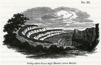
No. 23.
Valley called Gozzo degli Martiri, below Melilli.
A careful examination of the mode of decomposition of the rock would be requisite, in order fully to explain this phenomenon. There is probably a tendency to a vertical fracture in this as in many other limestones, which, when exposed to the action of frost, scale off in small fragments at right angles to the plane of stratification. It might have been expected that, in this case, a talus composed of a breccia of the limestone would be found on each ledge, so that the slope would become gradual, but perhaps the fragments, instead of accumulating, may decompose and be washed away by the heavy rains.
The line of some of the valleys near Lentini has evidently been determined mainly by the direction of the elevatory force, as there is an anticlinal dip in the strata on either side of the valley. The same is, probably, the case in regard to the great valley of the Anapo, which terminates at Syracuse.
Sea-cliffs -- proofs of successive elevation. -- No decisive evidence could be looked for in the form of the valleys to determine the question, whether the subterranean movements which upheaved the newer Pliocene strata in Sicily were very numerous or few in number. But we find the signs of two periods of elevation in a long range of inland cliff on the east side of the Val di Noto, both to the north of Syracuse, beyond Melilli, and to the south beyond the town of Noto. The great limestone formation before mentioned, terminates suddenly towards the sea in a lofty precipice, a, b, which varies in height from five hundred to seven hundred feet, and may remind the English geologist of some of the most perpendicular escarpments of our chalk and oolite. Between the base of the precipice a, b, and the sea, is an inferior platform, c, b, consisting of similar white limestone. All the strata dip towards the sea, but are usually inclined at a very slight angle; they are seen to extend uninterruptedly from the base of the escarpment into the platform, showing distinctly that the lofty cliff was not produced by a fault or vertical shift of the beds, but by the removal of a considerable mass of rock. Hence we must conclude that the sea, which is now undermining the cliffs of the Sicilian coast, reached at some former period the base of the precipice a, b, at which time the surface of the terrace c, b, must have constituted the bottom of the Mediterranean. Here, then, we have proofs of at least two elevations, but there may have been fifty others, for the encroachment of the sea tends to obliterate all signs of a succession of cliffs.
No. 24.
Suppose, for example, that a series of escarpments e, f, g, h, once existed, and that during a long interval, free from subterranean movements, the sea had time to advance along the line c, b, all those ancient cliffs must then have been swept away one after the other, and reduced to the single precipice a, b. There may have been an antecedent period when the sea advanced along the line h, l, substituting the single cliff e, l, for the series e, f, g.
We may also imagine that the present cliffs may be the result of the union of several lines of smaller cliffs and terraces, which may once have been produced by a succession of elevatory movements. For example, the waves may have carried away the cliffs k, i, in advancing to c, d. In the same manner they may ultimately remove the mass c, b, m, d, and then the platform c, b, will disappear, and the precipice a, m, will be substituted for a, b.
We have stated, in the first volume, that the waves washed the base of the inland cliff near Puzzuoli, in the Bay of Baiae, within the historical era, and that the retiring of the sea was caused, in the sixteenth century, by an upheaving of the land to an elevation of twenty feet above its original level. At that period, a terrace twenty feet high in some parts, was laid dry between the sea and the cliff, but the Mediterranean is hastening to resume its former position, when the terrace will be destroyed, and every trace of the successive rise of the land will be obliterated.
We have been led into these observations, in order to show that the principal features in the physical geography of Sicily are by no means inconsistent with the hypothesis of the successive elevation of the country by the intermittent action of ordinary earthquakes. [3] On the other hand, we consider the magnitude of the valleys, and their correspondence in form with those of other parts of the globe, to lend countenance to the theory of the slow and gradual rise of subaqueous strata.
We have remarked in the first volume, [4] that the excavation of valleys must always proceed with the greatest rapidity when the levels of a country are undergoing alteration from time to time by earthquakes, and that it is principally when a country is rising or sinking by successive movements, that the power of aqueous causes, such as tides, currents, rivers, and land-floods, is exerted with the fullest energy.
In order to explain the present appearance of the surface, we must first go back to the time when the Sicilian formations were mere shoals at the bottom of the sea, in which the currents may have scooped out channels here and there. We must next suppose these shoals to have become small islands of which the cliffs were thrown down from time to time, as were those of Gian Greco, in Calabria, during the earthquake of 1783. The waves and currents would then continue their denuding action during the emergence of these islands, until at length, when the intervening channels were laid dry, and rivers began to flow, the deepening and widening of the valleys by rivers and land-floods would proceed in the same manner as in modern times in Calabria, according to our former description. [5]
Before a tract could be upraised to the height of several thousand feet above the level of the sea, the joint operation of running water and subterranean movements must greatly modify the physical geography; but when the action of the volcanic forces has been suspended, when a period of tranquillity succeeds, and the levels of the land remain fixed and stationary, the erosive power of water must soon be reduced to a state of comparative equilibrium. For this reason, a country that has been raised at a very remote period to a considerable height above the level of the sea, may present nearly the same external con6guration as one that has been more recently uplifted to the same height.
In other words, the time required for the raising of a mass of land to the height of several hundred yards must usually be so enormous (assuming as we do that the operation is effected by ordinary volcanic forces), that the aqueous and igneous agents will have time before the elevation is completed to modify the surface, and imprint thereon the ordinary forms of hill and valley, by which our continents are diversified. But after the cessation of earthquakes these causes of change will remain dormant, or nearly so. The greater part, therefore, of the earth's surface will at each period be at rest, simply retaining the features already imparted to it, while smaller tracts will assume, as they rise successively from the deep, a configuration perfectly analogous to that by which the more ancient lands were previously distinguished.
Migration of animals and plants. -- The changes which, according to the views already explained, have been brought about in the earth's crust by the agency of volcanic heat, cannot fail to strike the imagination, when we consider how recent in the calendar of nature is the epoch to which we refer them. But if we turn our thoughts to the organic world, we shall feel, perhaps, no less surprise at the great vicissitude which it has undergone during the same period.
We have seen that a large portion of Sicily has been converted from sea to land since the Mediterranean was peopled with the living species of testacea and zoophytes. The newly emerged surface, therefore, must, during this modern zoological epoch, have been inhabited for the first time with the terrestrial plants and animals which now abound in Sicily. It is fair to infer, that the existing terrestrial species are, for the most part, of as high antiquity as the marine, and if this be the case, a large proportion of the plants and animals, now found in the tertiary districts in Sicily, must have inhabited the earth before the newer Pliocene strata were raised above the waters. The plants of the Flora of Sicily are common, almost without exception, to Italy or Africa, or some of the countries surrounding the Mediterranean, [6] so that we may suppose the greater part of them to have migrated from pre-existing lands, just as the plants and animals of the Phlegraean fields have colonized Monte Nuovo, since that mountain was thrown up in the sixteenth century.
We are brought, therefore, to admit the curious result, that the flora and fauna of the Val di Noto, and some other mountainous regions of Sicily, are of higher antiquity than the country itself, having not only flourished before the lands were raised from the deep, but even before they were deposited beneath the waters. Such conclusions throw a new light on the adaptation of the attributes and migratory habits of animals and plants, to the changes which are unceasingly in progress in the inanimate world. It is clear that the duration of species is so great, that they are destined to outlive many important revolutions in the physical geography of the earth, and hence those innumerable contrivances for enabling the subjects of the animal and vegetable creation to extend their range, the inhabitants of the land being often carried across the ocean, and the aquatic tribes over great continental spaces. [7] It is obviously expedient that the terrestrial and fluviatile species should not only be fitted for the rivers, valleys, plains, and mountains which exist at the era of their creation, but for others that are destined to be formed before the species shall become extinct; and, in like manner, the marine species are not only made for the deep or shallow regions of the ocean at the time when they are called into being, but for tracts that may be submerged or variously altered in depth during the time that is allotted for their continuance on the globe.
Recapitulation. -- We may now briefly recapitulate some of the most striking results which we have deduced from our investigation of a single district where the newer Pliocene strata are largely developed.
In the first place, we have seen that a stratified mass of solid limestone, attaining sometimes a thickness of eight hundred feet and upwards, has been gradually deposited at the bottom of the sea, the imbedded fossil shells and corallines being almost all of recent species. Yet these fossils are frequently in the state of mere casts, so that in appearance they correspond very closely to organic remains found in limestones of very ancient date.
2dly. In some localities the limestone above-mentioned alternates with volcanic rocks such as have been formed by submarine eruptions, recurring again and again at distant intervals of time.
3dly. Argillaceous and sandy deposits have also been produced during the same period, and their accumulation has also been accompanied by submarine eruptions. Masses of mixed sedimentary and igneous origin, at least two thousand feet in thickness, can thus be shown to have accumulated since the sea was peopled with the greater number of the aquatic species now living.
4thly. These masses of submarine origin have, since their formation, been raised to the height of two thousand or three thousand feet above the level of the sea, and this elevation implies an extraordinary modification in the state of the earth's crust at some unknown depth beneath the tract so upheaved.
5thly. The most probable hypothesis in regard to the nature of this change, is the successive generation and forcible intrusion into the inferior parts of the earth's crust of lava which, after cooling down, may have assumed the form of crystalline unstratified rock, such as is frequently exhibited in those mountainous parts of the globe where the greatest alterations of level have taken place.
6thly. Great inequalities must have been caused on the surface of the new-raised lands during the emergence of the newer Pliocene strata, by the action of tides, currents, and rivers, combined with the disturbing and dislocating force of the elevatory movements.
7thly. There are no features in the forms of the valleys and sea-cliff's thus recently produced, which indicate the sudden rise of the strata to the whole or the greater part of their present altitude, while there are some proofs of distinct elevations at successive periods.
8thly. We may infer that the species of terrestrial and fluviatile animals and plants which now inhabit extensive districts, formed during the newer Pliocene era, were in existence not only before the new strata were raised, but before their materials were brought together at the bottom of the sea.
_______________
Notes:
1. Vol. i. chap. xix.
2. Vol. i. chap. xxv.
3. Since writing the above I have read the excellent memoir of M. Boblaye, on the alterations produced by the sea on calcareous rocks on the shores of Greece. By examining the line of littoral caverns worn by the waves in cliffs composed of the harder limestones, together with the modes of decomposition of the rock, acted upon by the spray and sea air, as well as lithodomous perforations, and other markings, he has proved that there are four or five distinct ranges of ancient sea cliffs, one above the other, at various elevations in the Morea, which attest as many successive elevations of the country. Journal de Geologie, No. 10. Feb. 1831.
4. Chap. xxiv.
5. Chap. xxiv.
6. Professor Viviani of Genoa informed me, that, considering the great extent or Sicily, it was remarkable that its flora produced scarcely any, if any peculiar indigenous species, whereas there are several in Corsica, and some other Mediterranean islands.
7. See vol. ii., chapters v., vi., and vii.
Origin of the newer Pliocene strata of Sicily – Growth of submarine formations gradual – Rise of the same above the level of the sea probably caused by subterranean lava – Igneous newer Pliocene rocks formed at great depths, exceed in volume the lavas of Etna – Probable structure of these recent subterranean rocks – Changes which they may have superinduced upon strata in contact – Alterations of the surface during and since the emergence of the newer Pliocene strata – Forms of the Sicilian valleys – Sea cliffs – Proofs of successive elevation – Why the valleys in the newer Pliocene districts correspond in form to those in regions of higher antiquity – Migrations of animals and plants since the emergence of the newer Pliocene strata – Some species older than the stations they inhabit – Recapitulation
ORIGIN OF THE NEWER PLIOCENE STRATA OF SICILY.
HAVING in the last two chapters described the tertiary formations of the Val di Noto and Valdemone, both igneous and aqueous, we shall now proceed more fully to consider their origin, and the manner in which they may be supposed to have assumed their present position. The consideration of this subject may be naturally divided into three parts: first, we shall inquire in what manner the submarine formations were accumulated beneath the waters; secondly, whether they emerged slowly or suddenly, and what modifications in the earth's crust, at considerable depths below the surface, may be indicated by their rise; thirdly, the mutations which the surface and its inhabitants have undergone during and since the period of emergence.
Growth of Submarine formations. -- First, then, we are to inquire in what manner the subaqueous masses, whether volcanic or sedimentary, may have been formed. On this subject we have but few observations to make, for by reference to our former volumes, the reader will learn how a single stratum, whether of sand, clay, or limestone, may be thrown down at the bottom of the sea, and how shells and other organic remains may become imbedded therein. He will also understand how one sheet of lava. or bed of scoriae and volcanic sand, may be spread out over a wide area, and how, at a subsequent period, a second bed of' sand, clay, or limestone, or a second lavastream may be superimposed, so that in the lapse of ages a mountain mass may be produced.
It is enough that we should behold a single course of bricks or stones laid by the mason upon another, in order to comprehend how a massive edifice, such as the Coliseum at Rome, was erected; and we can have no difficulty in conceiving that a sea, three hundred or four hundred fathoms deep, might be filled up by sediment and lava, provided we admit an indefinite lapse of ages for the accumulation of the materials.
The sedimentary and volcanic masses of the newer Pliocene era, which, in the Val di Noto, attain the thickness of two thousand feet, are subdivided into a vast number of strata and lava-streams, each of which were originally formed on the subaqueous surface, just as the tuffs and lavas whereof sections are laid open in the Val del Bove, were each in their turn external additions to the Etnean cone.
It is also clear, that before any part of the mass of submarine origin began to rise above the waters, the uppermost stratum of the whole must have been deposited; so that if the date of the origin of these masses be comparatively recent, still more so is the period of their rise above the level of the sea.
Subaqueous formations how raised. -- In what manner, then, and by what agency, did this rise of the subaqueous formations take place? We have seen that since the commencement of the present century, an immense tract of country in Cutch, more than fifty miles long and sixteen broad, was permanently upraised to the height of ten feet above its former position, and the earthquake which accompanied this wonderful variation of level, is reported to have terminated by a volcanic eruption at Bhooi. We have also seen [1] that when the Monte Nuovo was thrown up, in the year 1538, a large fissure approached the small town of Tripergola, emitting a vivid light, and throwing out ignited sand and scoriae. At length this opening reached a shallow part of the sea close to the shore, and then widened into a large chasm, out of which were discharged blocks of lava, pumice, and ashes. But no current of melted matter flowed from the orifice, although it is perfectly evident that lava existed below in a fluid state, since so many portions of it were cast up in the form of scoriae into the air. We have shown that the coast near Puzzuoli rose, at that time, to the height of more than twenty feet above its former level, and that it has remained permanently upheaved to this day. [2]
On a review of the whole phenomena, it appears most probable that the elevated country was forced upwards by lava which did not escape, but which, after causing violent earthquakes, during several preceding months, produced at length a fissure from whence it discharged gaseous fluids, together with sand and scoriae. The intruded mass then cooled down at a certain distance below the uplifted surface, and constituted a solid and permanent foundation.
If an habitual vent had previously existed near Puzzuoli, such as we may suppose to remain always open in the principal ducts of Vesuvius or Etna, the lava might, perhaps, have flowed over upon the surface, instead of heaving upwards the superficial strata. In that case, there might have been the same conversion of sea into land, the only difference being, that the lava would have been uppermost, instead of the tufaceous strata containing shells, now seen in the plain of La Starza, and on the site of the Temple of Serapis.
Subterranean lava the upheaving cause. -- The only feasible theory, indeed, that has yet been proposed, respecting the causes of the permanent rise of the bed of the sea, is that which refers the phenomenon to the generation of subterranean lava. We have stated, in the first volume, that the regions now habitually convulsed by earthquakes, include within them the site of all the active volcanos. We know that the expansive force of volcanic heat is sufficiently great to overcome the resistance of columns of lava, several miles or leagues in height, forcing them up from great depths, and causing the fluid matter to flow out upon the surface. To imagine, therefore. that this same power, which is so frequently exerted in different parts of the globe, should occasionally propel a column of lava to a considerable height, yet be unable to force it through the superincumbent rocks, is quite natural.
Whenever the superimposed masses happen to be of a yielding and elastic nature. they will bend, and instead of breaking, so as to afford an escape to the melted matter through a fissure, they will allow it to accumulate in large quantities beneath the surface, sometimes in amorphous masses, and sometimes in horizontal sheets. So long as such sheets of matter retain their fluidity, and communicate with the column of lava which is still urged upwards, they must exert an enormous hydrostatic pressure on the overlying mass, tending to elevate it, and an equal force on the subjacent beds pressing them down, and probably rendering them more compact. If we consider how great is the volume of lava that sometimes flows out on the surface from volcanic vents, we must expect that it will produce great changes of level so often as its escape is impeded.
Let us only reflect on the magnitude of Iceland, an island two hundred and sixty miles long by two hundred in breadth, and which rises, at some points, to the height of six thousand feet above the level of the sea. Nearly the entire mass is represented to be of volcanic origin; but even if we suppose some parts to consist of aqueous deposits, still that portion may be more than compensated by the great volume of lava which must have been poured out upon the bottom of the surrounding sea during the growth of the entire island; for we know that submarine eruptions have been considerable near the coast during the historical era. Now if the whole of this lava had been prevented from reaching the surface, by the weight and tenacity of certain overlying rocks, it might have given rise to the gradual elevation of a tract of land nearly as large as Iceland. We say nearly, because the lava which cooled down beneath the surface, and under considerable pressure, would be more compact than the same when poured out in the open air, or in a sea of moderate depth, or shot up into the atmosphere by the explosive force of elastic vapours, and thus converted into sand and scoriae.
According to this theory, we must suppose the action of the upheaving power to be intermittent, and, like ordinary volcanic eruptions, to be reiterated again and again in the same region, at unequal intervals of time and with unequal degrees of force.
If we follow this train of induction, which appears so easy and natural, to what important conclusions are we led! The reader will bear in mind that the tertiary strata have attained in the central parts of Sicily, as at Castrogiovanni, for example, an elevation of about three thousand feet above the level of the sea, and a height of from fifty to two thousand feet in different parts of the Val di Noto. In this country, therefore, we must suppose a solid support of igneous rock to have been successively introduced into part of the earth's crust immediately subjacent, equal in volume to the upraised tract, and this generation of subterranean rock must have taken place during the latter part of the newer Pliocene period. The dimensions of the Etnean cone shrink into insignificance, in comparison to the volume of this subterranean lava; and, however staggering the inference might at first appear, that the oldest foundations of Etna were laid subsequently to the period when the Mediterranean became inhabited by the living species of testacea and zoophytes, yet we may be reconciled to such conclusions, when we find incontestable proofs of still greater revolutions beneath the surface within the same modern period.
Probable structure of the recent subterranean rocks of fusion. -- Let us now inquire what form these unerupted newer Pliocene lavas of Sicily have assumed? For reasons already explained, we may infer that they cannot have been converted into tuff's and peperinos, nor can we imagine that, under enormous pressure, they could have become porous, since we observe, that the lava which has cooled down under a moderate degree of pressure, in the dikes of Etna and Vesuvius, has a compact and porphyritic texture, and is very rarely porous or cellular. No signs of volcanic sand, scoriae, breccia, or conglomerate are to be looked for, nor any of stratification, for all these imply formation in the atmosphere, or by the agency of water. The only proofs that we can expect to find of the successive origin of different parts of the fused mass, will be confined to the occasional passage of veins through portions previously consolidated. This consolidation would take place with extreme slowness, when nearer the source of volcanic heat and under enormous pressure, so that we must anticipate a perfectly crystalline and compact texture in all these subterranean products.
Now geologists have discovered, as we before stated, great abundance of crystalline and unstratified rocks in various parts of the globe, and these masses are particularly laid open to our view in those mountainous districts where the crust of the earth has undergone the greatest derangement. These rocks vary considerably in composition, and have received many names, such as granite, syenite, porphyry, and others. That they must have been formed by igneous fusion, and at many distinct eras, is now admitted; and their highly crystalline texture is such as might result from cooling down slowly from an intensely-heated state. They answer, therefore, admirably to the conditions required by the above hypothesis, and we therefore deem it probable that similar rocks have originated in the nether regions below the island of Sicily, and have attained a thickness of from one thousand to three thousand feet, since the newer Pliocene strata were deposited.
It is, moreover, very probable, that these fused masses have come into contact with subaqueous deposits far below the surface, in which case they may, in the course of ages, have greatly altered their structure, just as dikes of lava render more crystalline the stratified masses which they traverse, and obliterate all traces of their organic remains.
Suppose some of these changes to have been superinduced upon subaqueous deposits underlying the tertiary formations of Sicily, it is important to reflect that in that case no geological proofs would remain of the era when the alterations had taken place; and if, at some future period, the whole island should be uplifted, and these rocks of fusion, together with the altered strata, should be brought up to the surface, it would not be apparent that they had assumed their crystalline texture in the newer Pliocene period. For aught that would then appear, they might have acquired their peculiar mineral texture at epochs long anterior, and might be supposed to have been formed before the planet was inhabited by living beings; instead of having originated at an era long subsequent to the introduction of the existing species.
CHANGES OF THE SURFACE DURING AND SINCE THE EMERGENCE OF THE NEWER PLIOCENE STRATA.
Valleys. -- Geologists who are accustomed to attribute a great portion of the inequalities of the earth's surface to the excavating power of running water during a long series of ages, will probably look for the signs of remarkable freshness in the aspect of countries so recently elevated as the parts of Sicily already described. There is, however, nothing in the external configuration of that country which would strike the eye of the most practised observer, as peculiar and distinct in character from many other districts in Europe which are of much higher antiquity. The general outline of the hills and valleys would accord perfectly well with what may often be observed in regard to other regions of equal altitude above the level of the sea.
It is true that, towards the central parts of the island where the argillaceous deposits are of great thickness, as around Castrogiovanni, Caltanisetta, and Piazza, the torrents are observed annually to deepen the ravines in which they flow, and the traveller occasionally finds that the narrow mule-path, instead of winding round the head of a ravine, terminates abruptly in a deep trench which has been hollowed out, during the preceding winter, through soft clay. But throughout a great part of Italy, where the marls and sands of the Subapennine hills are elevated to considerable heights, the same rapid degradation is often perceived.
In the limestone districts of the Val di Noto, the strata are for the most part nearly horizontal, and on each side of the valley form a succession of ledges or small terraces, instead of descending in a gradual slope towards the river-plain in the manner of the argillaceous formations. When there is a bend in the valley, the exact appearance of an amphitheatre with a range of marble seats is produced. A good example of this configuration occurs near the town of Melilli, in the Val di Noto, as seen in the annexed view (No. 23). In the south of the island, as near Spaccaforno, Scicli and Modica, precipitous rocks of white limestone, ascending to the height of five hundred feet, have been carved out into the same form.
No. 23.
Valley called Gozzo degli Martiri, below Melilli.
A careful examination of the mode of decomposition of the rock would be requisite, in order fully to explain this phenomenon. There is probably a tendency to a vertical fracture in this as in many other limestones, which, when exposed to the action of frost, scale off in small fragments at right angles to the plane of stratification. It might have been expected that, in this case, a talus composed of a breccia of the limestone would be found on each ledge, so that the slope would become gradual, but perhaps the fragments, instead of accumulating, may decompose and be washed away by the heavy rains.
The line of some of the valleys near Lentini has evidently been determined mainly by the direction of the elevatory force, as there is an anticlinal dip in the strata on either side of the valley. The same is, probably, the case in regard to the great valley of the Anapo, which terminates at Syracuse.
Sea-cliffs -- proofs of successive elevation. -- No decisive evidence could be looked for in the form of the valleys to determine the question, whether the subterranean movements which upheaved the newer Pliocene strata in Sicily were very numerous or few in number. But we find the signs of two periods of elevation in a long range of inland cliff on the east side of the Val di Noto, both to the north of Syracuse, beyond Melilli, and to the south beyond the town of Noto. The great limestone formation before mentioned, terminates suddenly towards the sea in a lofty precipice, a, b, which varies in height from five hundred to seven hundred feet, and may remind the English geologist of some of the most perpendicular escarpments of our chalk and oolite. Between the base of the precipice a, b, and the sea, is an inferior platform, c, b, consisting of similar white limestone. All the strata dip towards the sea, but are usually inclined at a very slight angle; they are seen to extend uninterruptedly from the base of the escarpment into the platform, showing distinctly that the lofty cliff was not produced by a fault or vertical shift of the beds, but by the removal of a considerable mass of rock. Hence we must conclude that the sea, which is now undermining the cliffs of the Sicilian coast, reached at some former period the base of the precipice a, b, at which time the surface of the terrace c, b, must have constituted the bottom of the Mediterranean. Here, then, we have proofs of at least two elevations, but there may have been fifty others, for the encroachment of the sea tends to obliterate all signs of a succession of cliffs.
No. 24.
Suppose, for example, that a series of escarpments e, f, g, h, once existed, and that during a long interval, free from subterranean movements, the sea had time to advance along the line c, b, all those ancient cliffs must then have been swept away one after the other, and reduced to the single precipice a, b. There may have been an antecedent period when the sea advanced along the line h, l, substituting the single cliff e, l, for the series e, f, g.
We may also imagine that the present cliffs may be the result of the union of several lines of smaller cliffs and terraces, which may once have been produced by a succession of elevatory movements. For example, the waves may have carried away the cliffs k, i, in advancing to c, d. In the same manner they may ultimately remove the mass c, b, m, d, and then the platform c, b, will disappear, and the precipice a, m, will be substituted for a, b.
We have stated, in the first volume, that the waves washed the base of the inland cliff near Puzzuoli, in the Bay of Baiae, within the historical era, and that the retiring of the sea was caused, in the sixteenth century, by an upheaving of the land to an elevation of twenty feet above its original level. At that period, a terrace twenty feet high in some parts, was laid dry between the sea and the cliff, but the Mediterranean is hastening to resume its former position, when the terrace will be destroyed, and every trace of the successive rise of the land will be obliterated.
We have been led into these observations, in order to show that the principal features in the physical geography of Sicily are by no means inconsistent with the hypothesis of the successive elevation of the country by the intermittent action of ordinary earthquakes. [3] On the other hand, we consider the magnitude of the valleys, and their correspondence in form with those of other parts of the globe, to lend countenance to the theory of the slow and gradual rise of subaqueous strata.
We have remarked in the first volume, [4] that the excavation of valleys must always proceed with the greatest rapidity when the levels of a country are undergoing alteration from time to time by earthquakes, and that it is principally when a country is rising or sinking by successive movements, that the power of aqueous causes, such as tides, currents, rivers, and land-floods, is exerted with the fullest energy.
In order to explain the present appearance of the surface, we must first go back to the time when the Sicilian formations were mere shoals at the bottom of the sea, in which the currents may have scooped out channels here and there. We must next suppose these shoals to have become small islands of which the cliffs were thrown down from time to time, as were those of Gian Greco, in Calabria, during the earthquake of 1783. The waves and currents would then continue their denuding action during the emergence of these islands, until at length, when the intervening channels were laid dry, and rivers began to flow, the deepening and widening of the valleys by rivers and land-floods would proceed in the same manner as in modern times in Calabria, according to our former description. [5]
Before a tract could be upraised to the height of several thousand feet above the level of the sea, the joint operation of running water and subterranean movements must greatly modify the physical geography; but when the action of the volcanic forces has been suspended, when a period of tranquillity succeeds, and the levels of the land remain fixed and stationary, the erosive power of water must soon be reduced to a state of comparative equilibrium. For this reason, a country that has been raised at a very remote period to a considerable height above the level of the sea, may present nearly the same external con6guration as one that has been more recently uplifted to the same height.
In other words, the time required for the raising of a mass of land to the height of several hundred yards must usually be so enormous (assuming as we do that the operation is effected by ordinary volcanic forces), that the aqueous and igneous agents will have time before the elevation is completed to modify the surface, and imprint thereon the ordinary forms of hill and valley, by which our continents are diversified. But after the cessation of earthquakes these causes of change will remain dormant, or nearly so. The greater part, therefore, of the earth's surface will at each period be at rest, simply retaining the features already imparted to it, while smaller tracts will assume, as they rise successively from the deep, a configuration perfectly analogous to that by which the more ancient lands were previously distinguished.
Migration of animals and plants. -- The changes which, according to the views already explained, have been brought about in the earth's crust by the agency of volcanic heat, cannot fail to strike the imagination, when we consider how recent in the calendar of nature is the epoch to which we refer them. But if we turn our thoughts to the organic world, we shall feel, perhaps, no less surprise at the great vicissitude which it has undergone during the same period.
We have seen that a large portion of Sicily has been converted from sea to land since the Mediterranean was peopled with the living species of testacea and zoophytes. The newly emerged surface, therefore, must, during this modern zoological epoch, have been inhabited for the first time with the terrestrial plants and animals which now abound in Sicily. It is fair to infer, that the existing terrestrial species are, for the most part, of as high antiquity as the marine, and if this be the case, a large proportion of the plants and animals, now found in the tertiary districts in Sicily, must have inhabited the earth before the newer Pliocene strata were raised above the waters. The plants of the Flora of Sicily are common, almost without exception, to Italy or Africa, or some of the countries surrounding the Mediterranean, [6] so that we may suppose the greater part of them to have migrated from pre-existing lands, just as the plants and animals of the Phlegraean fields have colonized Monte Nuovo, since that mountain was thrown up in the sixteenth century.
We are brought, therefore, to admit the curious result, that the flora and fauna of the Val di Noto, and some other mountainous regions of Sicily, are of higher antiquity than the country itself, having not only flourished before the lands were raised from the deep, but even before they were deposited beneath the waters. Such conclusions throw a new light on the adaptation of the attributes and migratory habits of animals and plants, to the changes which are unceasingly in progress in the inanimate world. It is clear that the duration of species is so great, that they are destined to outlive many important revolutions in the physical geography of the earth, and hence those innumerable contrivances for enabling the subjects of the animal and vegetable creation to extend their range, the inhabitants of the land being often carried across the ocean, and the aquatic tribes over great continental spaces. [7] It is obviously expedient that the terrestrial and fluviatile species should not only be fitted for the rivers, valleys, plains, and mountains which exist at the era of their creation, but for others that are destined to be formed before the species shall become extinct; and, in like manner, the marine species are not only made for the deep or shallow regions of the ocean at the time when they are called into being, but for tracts that may be submerged or variously altered in depth during the time that is allotted for their continuance on the globe.
Recapitulation. -- We may now briefly recapitulate some of the most striking results which we have deduced from our investigation of a single district where the newer Pliocene strata are largely developed.
In the first place, we have seen that a stratified mass of solid limestone, attaining sometimes a thickness of eight hundred feet and upwards, has been gradually deposited at the bottom of the sea, the imbedded fossil shells and corallines being almost all of recent species. Yet these fossils are frequently in the state of mere casts, so that in appearance they correspond very closely to organic remains found in limestones of very ancient date.
2dly. In some localities the limestone above-mentioned alternates with volcanic rocks such as have been formed by submarine eruptions, recurring again and again at distant intervals of time.
3dly. Argillaceous and sandy deposits have also been produced during the same period, and their accumulation has also been accompanied by submarine eruptions. Masses of mixed sedimentary and igneous origin, at least two thousand feet in thickness, can thus be shown to have accumulated since the sea was peopled with the greater number of the aquatic species now living.
4thly. These masses of submarine origin have, since their formation, been raised to the height of two thousand or three thousand feet above the level of the sea, and this elevation implies an extraordinary modification in the state of the earth's crust at some unknown depth beneath the tract so upheaved.
5thly. The most probable hypothesis in regard to the nature of this change, is the successive generation and forcible intrusion into the inferior parts of the earth's crust of lava which, after cooling down, may have assumed the form of crystalline unstratified rock, such as is frequently exhibited in those mountainous parts of the globe where the greatest alterations of level have taken place.
6thly. Great inequalities must have been caused on the surface of the new-raised lands during the emergence of the newer Pliocene strata, by the action of tides, currents, and rivers, combined with the disturbing and dislocating force of the elevatory movements.
7thly. There are no features in the forms of the valleys and sea-cliff's thus recently produced, which indicate the sudden rise of the strata to the whole or the greater part of their present altitude, while there are some proofs of distinct elevations at successive periods.
8thly. We may infer that the species of terrestrial and fluviatile animals and plants which now inhabit extensive districts, formed during the newer Pliocene era, were in existence not only before the new strata were raised, but before their materials were brought together at the bottom of the sea.
_______________
Notes:
1. Vol. i. chap. xix.
2. Vol. i. chap. xxv.
3. Since writing the above I have read the excellent memoir of M. Boblaye, on the alterations produced by the sea on calcareous rocks on the shores of Greece. By examining the line of littoral caverns worn by the waves in cliffs composed of the harder limestones, together with the modes of decomposition of the rock, acted upon by the spray and sea air, as well as lithodomous perforations, and other markings, he has proved that there are four or five distinct ranges of ancient sea cliffs, one above the other, at various elevations in the Morea, which attest as many successive elevations of the country. Journal de Geologie, No. 10. Feb. 1831.
4. Chap. xxiv.
5. Chap. xxiv.
6. Professor Viviani of Genoa informed me, that, considering the great extent or Sicily, it was remarkable that its flora produced scarcely any, if any peculiar indigenous species, whereas there are several in Corsica, and some other Mediterranean islands.
7. See vol. ii., chapters v., vi., and vii.
- admin
- Site Admin
- Posts: 36175
- Joined: Thu Aug 01, 2013 5:21 am
Re: Principles of Geology, by Charles Lyell
![]() by admin » Fri Jul 17, 2015 2:21 am
by admin » Fri Jul 17, 2015 2:21 am
CHAPTER 10
Tertiary formations of Campania – Comparison of the recorded changes in this region with those commemorated by geological monuments – Differences in the composition of Somma and Vesuvius – Dikes of Somma, their origin – Cause of the parallelism of their opposite sides – Why coarser grained in the centre – Minor cones of the Phlegraean Fields – Age of the volcanic and associated rocks of Campania – Organic remains – External configuration of the country, how produced – No signs of diluvial waves – Marine Newer Pliocene strata visible only in countries of earthquakes – Illustrations from Chili – Peru – Parallel roads of Coquirnbo – West-Indian archipelago – Honduras – East-Indian archipelago – Red Sea
TERTIARY FORMATIONS OF CAMPANIA.
Comparison of recorded changes with those commemorated by geological monuments. -- IN the first volume we traced the various changes which the volcanic region of Naples is known to have undergone during the last 2000 years, and, imperfect as are our historical records, the aggregate effect of igneous and aqueous agency, during that period, was shown to be far from insignificant. The rise of the modern cone of Vesuvius, since the year 79, was the most memorable event during those twenty centuries; but in addition to this remarkable phenomenon, we enumerated the production of several new minor cones in Ischia, and of the Monte Nuovo, in the year 1538. We described the flowing of lava-currents upon the land and along the bottom of the sea, the showering down of volcanic sand, pumice, and scoriae, in such abundance that whole cities were buried, -- the filling up or shoaling of certain tracts of the sea, and the transportation of tufaceous sediment by rivers and land-floods. We also explained the evidence in proof of a permanent alteration of the relative levels of the land and sea in several localities, and of the same tract having, near Puzzuoli, been alternately upheaved, and depressed, to the amount of more than 20 feet. In connexion with these convulsions, we pointed out that, on the shores of the Bay of Baiae, there are recent tufaceous strata filled with fabricated articles, min gled with marine shells. It was also shown that the sea has been making gradual advances upon the coast, not only sweep ing away the 80ft tuffs of the Bay of Baire, but excavating preoipitous cliffs, where the hard Ischian and Vesuvian lavas have flowed down into the deep.
These events, we shall be told, although interesting, are the results of operations on a very inferior scale to those indicated by geological monuments. When we examine this same region, it will be said, we find that the ancient cone of Vesuvius, called Somma, is larger than the modern cone, and is intersected by a greater number of dikes, -- the hills of unknown antiquity, such as Astroni, the Solfatara, and Monte Barbaro, formed by separate eruptions, in different parts of the Phlegraean fields, far outnumber those of similar origin, which are recorded to have been thrown up within the historical era. In place of modern tuffs of slight thickness, and single flows of lava, we find, amongst the older formations, hills from 500 to more than 2000 feet in height, composed of an immense series of tufaceous strata; alternating with distinct lava-currents. We have evidence that in the lapse of past ages, districts, not merely a few miles square, were upraised to the height of 20 or 30 feet above their former level, but extensive and mountainous countries were uplifted to an elevation of more than 1000 feet, and at some points more than 2000 feet above the level of the sea.
These and similar objections are made by those who compare the modern effects of igneous and aqueous causes, not with a part but with the whole results of the same agency in antecedent ages. Thus viewed in the aggregate, the leading geological features of each district must always appear to be on a colossal scale, just as a large edifice of striking architectural beauty seems an effort of superhuman power, until we reflect on the innumerable minute parts of which it is com posed. A mountain mass, so long as the imagination is occu pied in contemplating the gigantic whole, must appear the work of extraordinary causes, but when the separate portions of which it is made up are carefully studied, they are seen to have been formed successively, and the dimensions of each part, considered singly, are soon recognized to be comparatively insignificant, and it appears no longer extravagant to liken them to the recorded effects of ordinary causes.
Difference in the composition of Somma and Vesuvius.
As no traditional accounts have been handed down to us of the eruptions of the ancient Vesuvius, from the times of the earliest Greek colonists, the volcano must have been dormant for many centuries, perhaps for thousands of years, previous to the great eruption in the reign of Titus. But we shall afterwards show that there are sufficient grounds for presuming this mountain, and the other igneous products of Campania, to have been produced during the Newer Pliocene period.
We stated in the first volume, [1] that the ancient and modern cones of Vesuvius were each a counterpart of the other in structure; we may now remark that the principal point of difference consists in the greater abundance in the older cone of fragments of stratified rocks ejected during eruptions. We may easily conceive that the first explosions would act with the greatest violence, rending and shattering whatever solid masses obstructed the escape of lava and the accompanying gases, so that great heaps of ejected pieces of sedimentary rock would naturally occur in the tufaceous breccias formed by the earliest eruptions. But when a passage had once been opened and an habitual vent established, the materials thrown out would consist of liquid lava, which would take the form of sand and scoriae, or of angular fragments of such solid lavas as may have choked up the vent.
Among the angular fragments of solid rock which abound in the tufaceous breccias of Somma, none are more common than a saccharoid dolomite, supposed to have been derived from an ordinary limestone altered by heat and volcanic vapours.
Carbonate of lime enters into the composition of so many of the simple minerals found in Somma, that M. Mitscherlich, with much probability, ascribes their great variety to the action of the volcanic heat on subjacent masses of limestone.
Dikes of Somma. -- The dikes seen in the great escarpment which Somma presents towards the modern cone of Vesuvius are very numerous. They are for the most part vertical, and traverse at right angles the beds of lava, scoriae, volcanic breccia, and sand, of which the ancient cone is composed. They project in relief several inches, or sometimes feet, from the face of the cliff, like the dikes of Etna already described (see woodcut No. 19), being, like them, extremely compact, and less destructible than the intersected tuffs and porous lavas. In height they vary from a few yards to 500 feet, and in breadth from one to twelve feet. Many of them cut all the inclined beds in the escarpment of Somma from top to bottom, others stop short before they ascend above half way, and a few terminate at both ends, either in a point or abruptly. In mineral composition they scarcely differ from the lavas of Somma, the rock consisting of a base of leucite and augite, through which large crystals of augite and some of leucite are scattered. [2] Examples are not rare of one dike cutting through another, and in one instance a shift or fault is seen at the point of intersection. We observed before, [3] when speaking of the dikes of the modern cone of Vesuvius, that they must have been produced by the filling up of open fissures by liquid lava. In some examples, however, the rents seem to have been filled laterally.
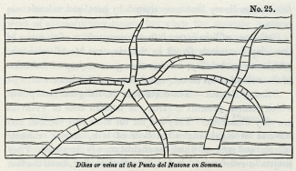
No. 25: Dikes or veins at the Punto del Nasone on Somma.
The reader will remember our description of the manner in which the plain of Jerocarne, in Calabria, was fissured by the earthquake of 1783, [4] so that the Academicians compared it to the cracks in a broken pane of glass. If we suppose the side walls of the ancient crater of Vesuvius to have been cracked in like manner, and the lava to have entered the rents and become consolidated, we can explain the singular form of the veins figured in the accompanying wood-cut. [5]
Parallelism of their opposite sides. -- Nothing is more remarkable than the parallelism of the opposite sides of the dikes; which usually correspond with as much regularity as the two opposite faces of a wall of masonry. This character appears at first the more inexplicable, when we consider how jagged and uneven are the rents caused by earthquakes in masses of heterogeneous composition like those composing the cone of Somma; but M. Necker has offered an ingenious and, we think, satisfactory explanation of the phenomenon. He refers us to Sir W. Hamilton's account of an eruption of Vesuvius in the year 1779, who records the following facts. 'The lavas, when they either boiled over the crater, or broke out from the conical parts of the volcano, constantly formed channels as regular as if they had been cut by art, down the steep part of the mountain, and, whilst in a state of perfect fusion, continued their course in those channels, which were sometimes full to the brim, and at other times more or less so according to the quantity of matter in motion.
'These channels, upon examination after an eruption, I have found to be in general from two to five or six feet wide, and seven or eight feet deep. They were often hid from the sight by a quantity of scoriae that had formed a crust over them, and the lava, having been conveyed in a covered way for some yards, came out fresh again into an open channel. After an eruption I have walked in some of those subterraneous or covered galleries, which were exceedingly curious, the sides, top, and bottom, being worn perfectly smooth and even in most parts, by the violence of the currents of the red-hot lavas, which they had conveyed for many weeks successively.'
In another place; in the same memoir, he describes the liquid and red-hot matter as being received' into a regular channel, raised upon a sort of wall of scoriae and cinders, almost perpendicularly, of about the height of eight or ten feet, resembling much an ancient aqueduct. [6]
Now, if the lava in these instances had not run out from the covered channel, in consequence of the declivity whereon it was placed-if, instead of the space being left empty, the lava had been retained within until it cooled and consolidated, it would then have constituted a small dike with parallel sides. But the walls of a vertical fissure through which lava has ascended in its way to a volcanic vent, must have been exposed to the same erosion as the four sides of the channels before adverted to. The prolonged and uniform friction of the heavy fluid as it flows upwards cannot fail to wear and smooth down the surfaces on which it rubs, and the intense heat must melt all such masses as project and obstruct the passage of the incandescent fluid.
We do not mean to assert that the sides of fissures caused by earthquakes are never smooth and parallel, but they are usually uneven, and are often seen to have been so where volcanic or trap dikes are as regular in shape as those of Somma. The solution, therefore, of this problem, in reference to the modern dikes, is most interesting, as being of very general application in geology.
Varieties in their texture. -- Having explained the origin of the parallelism of the sides of a dike, we have next to consider the difference of its texture at the edges and in the middle. Towards the centre, observes M. Necker, the rock is coarser grained, the component elements being in a far more crystalline state, while at the edge the lava is sometimes vitreous and always finer grained. A thin parting band, approaching in its character to pitchstone, occasionally intervenes on the contact of the vertical dike and intersected beds. M. Necker mentions one of these at the place called Primo Monte, in the Atrio del Cavallo; I saw three or four others in different parts of the great escarpment. These phenomena are in perfect harmony with the results of the experiments of Sir James Hall and Mr. Gregory Watt, which have shown that a glassy texture is the effect of sudden cooling, and that, on the contrary, a crystalline grain is produced where fused minerals are allowed to consolidate slowly and tranquilly under high pressure.
It is evident that the central portion of the lava in a fissure would, during consolidation, part with its heat more slowly than the sides, although the contrast of circumstances would not be so great as when we compare the lava at the bottom and at the surface of a current flowing in the open air. In this case the uppermost part, where it has been ill contact with the atmosphere, and where refrigeration has been most rapid, is always found to consist of scoriform, vitreous, and porous lava, while at a greater depth the mass assumes a more lithoidal structure, and then becomes more and more stony as we descend, until at length we are able to recognize with a magnifying glass the simple minerals of which the rock is composed. On penetrating still deeper, we can detect the constituent parts by the naked eye, and in the Vesuvian currents distinct crystals of augite and leucite become apparent.
The same phenomenon, observes M. Necker, may readily be exhibited on a smaller scale, if we detach a piece of liquid lava from a moving current. The fragment cools instantly, and we find the surface covered with a vitreous coat, while the interior, although extremely fine grained, has a more stony appearance.
It must, however, be observed, that although the lateral portions of the dikes are finer grained than the central, yet the vitreous parting layer before alluded to is extremely rare. This may, perhaps, be accounted for, as the above-mentioned author suggests, by the great heat which the walls of a fissure may acquire before the fluid mass begins to consolidate, in which case the lava, even at the sides, would cool very slowly. Some fissures, also, may be filled from above; and in this case the refrigeration at the sides would be more rapid than when the melted matter flowed upwards from the volcanic foci, in an intensely-heated state.
The rock composing the dikes of Somma is far more compact than that of ordinary lava, for the column of melted matter in a fissure greatly exceeds an ordinary stream of lava in weight, and the great pressure checks the expansion of those gases which give rise to vesicles in lava.
There is a tendency in almost all the Vesuvian dikes to divide into horizontal prisms, which are at right angles to the cooling surfaces, [7] a phenomenon in accordance with the formation of vertical columns in horizontal beds of lava.
Minor cones of the Phlegraean Fields. -- In the volcanic district of Naples there are a great number of conical hills with craters on their summits, which have evidently been produced by one or more explosions, like that which threw up the Monte Nuovo in 1538. They are composed of trachytic tuff, which is loose and incoherent, both in the hills and, to a certain depth, in the plains around their base, but which is indurated below. It is suggested by Mr. Scrope, that this difference may be owing to the circumstance of the volcanic vents having burst out in a shallow sea, as was the case with Monte Nuovo, where there is a similar foundation of hard tuff, under a covering of loose lapilli. The subaqueous part may have become solid by an aggregative process like that which takes place in the setting of mortar, while the rest of the ejections, having accumulated on dry land when the cone was raised above the water, may have remained in a loose state. [8]
Age of the volcanic and associated rocks of Campania. -- If we enquire into the evidence derivable from organic remains, respecting the age of the volcanic rocks of Campania, we find reason to conclude that such parts as do not belong to the recent, are referrible to the newer Pliocene period.
In the solid tuff quarried out of the hills immediately behind Naples, are found recent shells of the genera Ostrea, Cardium, Buccinum, and Patella, all referrible to species now living in the Mediterranean. [9] In Ischia I collected marine shells in beds of clay and tuff', not far from the summit of Epomeo, or San Nichola, about 2000 feet above the level of the sea, as also at another locality, about 100 feet below, on the southern declivity of the mountain, and others not far above the town of Moropano. At Casamicciol, and several places near the sea-shore, shells have long been observed in stratified tuff and clay. From these various points I obtained, during a short excursion in Ischia, 28 species of shells, all of which, with one exception, were identified by M. Deshayes with recent species. [10]
As the highest parts of Epomeo are composed of regularly-stratified greenish tuff, and some beds near the summit contain the fossils above-mentioned, it is clear that that mountain was not only raised to its present height above the level of the sea, but was also formed since the Mediterranean was inhabited by the existing species of testacea.
In the Ischian tuffs we find pumice, lapilli, angular fragments of trachytic lava, and other products of igneous ejections, interstratified with some deposits of clay, free from any intermixture of volcanic matter. These clays might have resulted from the decomposition of felspathic lava which abounds in Ischia, the materials having been transported by rivers and marine currents, and spread over the bottom of the sea where testacea were living. We may observe generally of these submarine tuffs, lavas, and clays, of Campania, that they strictly resemble those around the base of Etna, and in parts of the Val di Noto before described.
External configuration of the country how caused. -- When once we have satisfied ourselves by inspection of the marine shells imbedded in tuffs at high elevations, that a mass of land like the island of Ischia has been raised from beneath the waters of the sea to its present height, we are prepared to find signs of the denuding action of the waves impressed upon the outward form of the island, especially if we conceive the upheaving force to have acted by successive movements. Let us suppose the low contiguous island of Procida to be raised by degrees until it attains the height of Ischia, we should in that case expect the steep cliffs which now face Misenum to be carried upwards and to become precipices near the summit of the central mountain. Such, perhaps, may have been the origin of those precipices which appear on the north and south sides of the ridge which forms the summit of Epomeo in Ischia. The northern escarpment is about 1000 feet in height, rising from the hollow called the Cavo delle Neve above the village of Panella. The abrupt manner in which the horizontal tuffs are there cut off, in the face of the cliff, is such as the action of the sea, working on soft materials, might easily have produced, undermining and removing a great portion of the mass. A heap of shingle which lies at the base of a steep declivity on the flanks of Epomeo, between the Cavo delle Neve and Panella, may once, perhaps, have been a sea-beach, for it certainly could not have been brought to the spot by any existing torrents.
There is no difficulty in conceiving that if a large tract of the bed of the sea near Ischia should now be gradually upheaved during the continuance of volcanic agency, this newly-raised land might present a counterpart to the Phlegraean fields before de scribed. Masses of alternating lava and tuff, the products of submarine eruptions, might on their emergence become hills and islands; the level intervening plains might afterwards appear, covered partly by the ashes drifted and deposited by water, and partly by those which would fall after the laying dry of the tract. The last features imparted to the physical geography would be derived from such eruptions in the open air as those of Monte Nuovo and the minor cones of Ischia.
No signs of diluvial waves. -- Such a conversion of a large tract of sea into land might possibly take place while the surface of the contiguous country underwent but slight modification. No great wave was caused by the permanent rise of the coast near Puzzuoli in the year 1538, because the upheaving operation appears to have been effected by a long succession of minor shocks. [11] A series of such movements, therefore, might produce an island like Ischia without throwing a diluvial rush of waters upon low parts of the neighbouring continent. The advocates of paroxysmal elevations may, perhaps, contend that the rise of Ischia must have been anterior to the birth of all the cones of loose scoriae scattered over the Phlegraean Fields, for, according to them, the sudden rise of marine strata causes inundations which devastate adjoining continents. But the absence of any signs of such floods in the volcanic region of Campania. does not appear to us to warrant the conclusion, either that Ischia was raised previously to the production of the volcanic cones, or that it may not have been rising during the whole period of their formation.
We learn from the study of the mutations now in progress, that one part of the earth's surface may, for an indefinite period, be the scene of continued change, while another, in the immediate vicinity, remains stationary. We need go no farther than our own country to illustrate this principle; for, reasoning from what has taken place in the last ten centuries, we must anticipate that in the course of the next 4000 or 5000 years, a long strip of land, skirting the line of our eastern coast, will be devoured by the ocean, while part of the interior, immediately adjacent, will remain at rest and entirely undisturbed. The analogy holds true in regions where the volcanic fires are at work, for part of the Philosopher's Tower on Etna has stood for the last 2000 years, at the height of more than 9000 feet above the sea, between the foot of the highest cone and the edge of the precipice which overhangs the Val del Hove, whilst large tracts of the surrounding district have been the scenes of tremendous convulsions. The great cone above has more than once been blown into the air, and again renewed; the earth has sunk down in the neighbouring Cisterna; [12] the cones of 1811 and 1819 have started up, on the ledge of rock below, pouring out of their craters two mighty streams of lava; the watery deluge of 1755 has rushed down from the steep desert region, into the Val del Bove, rolling along vast heaps of rocky fragments towards the sea; fissures, several miles in length, have opened on the flanks of Etna; cities and villages have been shattered by partial earthquakes, or buried under lava and ashes; -- yet the tower has stood as if placed on the most perilous point in Europe, to commemorate the stability of one part of the earth's surface, while others in immediate proximity have been subject to most wonderful and terrific vicissitudes.
Marine Newer Pliocene strata only visible in countries of earthquakes. -- In concluding what we have to say of the marine and volcanic formations of the newer Pliocene period, we may notice the highly interesting fact, that the marine strata of this era have hitherto been found at great elevations in those countries only where violent earthquakes have occurred during the historical ages. We do not deny that some partial deposits containing recent marine shells have been discovered at a considerable height in several maritime countries in Europe and elsewhere, far from the existing theatres of volcanic action; but stratified deposits of great extent and thickness, and replete with recent species, have only been observed to enter largely into the structure of the interior, as in Sicily, Calabria, and the Morea, where subterranean movements are now violent. On the other hand, it is a still more striking fact, that there is no example of any extensive maritime district, now habitually agitated by great earthquakes, which has not, when carefully investigated, yielded traces of marine strata, either of the Recent or newer Pliocene eras, at considerable elevations.
Chili. -- Conception Bay. -- In illustration of the above remarks we may mention, that on the western coast of South America marine deposits occur, containing precisely the same shells as are now living in the Pacific. In Chili, for example, as we before stated, [13] micaceous sand, containing the fossil remains of such species as now inhabit the Bay of Conception, are found at the height of from 1000 to 1500 feet above the level of the ocean. It is impossible to say how much of this rise may have taken place during the Recent period. We have endeavoured to show that one earthquake raised this part of the Chilian coast, in 1750, to the height of at least 25 feet above its former level. If we could suppose a continued series of such shocks, one in every century, only 6000 years would be required to uplift the coast 1500 feet. But we have no data for inferring that so great a quantity of elevation has taken place in that space of time, and although we cannot assume that the micaceous sand may not belong to the Recent period, we think it more probable that it was deposited during the newer Pliocene period.
Peru. -- We are informed by Mr. A. Cruckshanks, that in the valley of Lima, or Rimao, where the subterranean movements have been so violent in recent times, there are indications not only of a considerable rise of the land, but of that rise having resulted from successive movements. Distinct lines of ancient sea-cliffs have been observed at various heights, at the base of which the hard rocks of greenstone are hollowed out into precisely those forms which they now assume between high and low water mark on the shores of the Pacific. Immediately below these water-worn lines are ancient beaches strewed with rounded blocks. One of these cliffs appears in the hill behind Banos del Pujio, about 700 feet above the level of the sea, and 200 above the contiguous valley. Another occurs at Amancaes, at the height of perhaps 200 feet above the sea, and others at intermediate elevations.
Parallel roads of Coquimbo. -- We can hardly doubt that the parallel roads of Coquimbo, in Chili, described by Captain Hall, owe their origin to similar causes. These roads, or shelves, occur in a valley six or seven miles wide, which descends from the Andes to the Pacific. Their general width is from 20 to 50 yards, but they are, at some places, half a mile broad. They are so disposed as to present exact counterparts of one another, at the same level, on opposite sides of the valley. There are three distinctly characterized sets, and a lower one which is indistinct when approached, but when viewed from a distance is evidently of the same character with the others. Each resembles a shingle beach, being formed entirely of loose materials, principally water-worn, rounded stones, from the size of a nut to that of a man's head. The stones are principally granite and gneiss, with masses of schistus, whinstone, and quartz mixed indiscriminately, and all bearing marks of having been worn by attrition under water. [14]
The theory proposed by Captain Hall to explain these appearances is the same as that which had been adopted to account for the analogous parallel roads of Glen Roy in Scotland [15]. The valley is supposed to have been a lake, the waters of which stood, originally, at the level of the highest road, until a flat beach was produced. A portion of the barrier was then broken down, which allowed the lake to discharge part of its waters into the sea, and, consequently, to fall to the second level; and so on successively till the whole embankment was washed away, and the valley left as we now see it.
As I did not feel satisfied with this explanation, I applied to my friend Captain Hall for additional details, and he immediately sent me his original manuscript notes, requesting me to make free use of them. In them I find the following interesting passages, omitted in his printed account. 'The valley is completely open towards the sea; if the roads, therefore, are the beaches of an ancient lake, it is difficult to imagine a catastrophe sufficiently violent to carry away the barrier which should not at the same time obliterate all traces of the beaches. I find it difficult also to account for the water-worn character of all the stones, for they have the appearance of having travelled over a great distance, being well rounded and dressed. They are in immense quantity too, and much more than one could expect to find on the beach of any lake, and seem more properly to belong to the ocean.
We entertained a strong suspicion, before reading these notes, that the beaches were formed by the waves of the Pacific, and not by the waters of a lake; in other words, that they bear testimony to the successive rise of the land, not to the repeated fall of the waters of a lake. We have before cited the proofs adduced by M. Boblaye, that in the Morea there are four or five ranges of ancient sea-cliffs, one above the other, at various elevations, where limestone precipices exhibit lithodomous perforations and lines of ancient littoral caverns. [16] If we discover lines of parallel upraised cliffs, we ought to find parallel lines of elevated beaches on those coasts where the rocks are of a nature to retain, for a length of time, the marks imprinted on their surface. We may expect such indications to be peculiarly manifest in countries where the subterranean force has been in activity within comparatively modern times, and it is there that the hypothesis of paroxysmal elevations, and the instantaneous rise of mountain-chains, should first have been put to the test, before it was hastily embraced by a certain school of geologists.
West Indian Archipelago. -- According to the sketch given by Maclure of the geology of the Leeward Islands, [17] the western range consists in great part of formations of the most modern period. It will be remembered, that many parts of this region have been subject to violent earthquakes; that in St. Vincent's and Guadaloupe there are active volcanos, and in some of the other islands boiling springs and solfataras. In St. Eustatia, there is a marine deposit, estimated at 1500 feet in thickness, consisting of coral limestone alternating with beds of shells, of which the species are, according to Maclure, the same as those now found in the sea. These strata dip to the south-west at an angle of about 45º, and both rest upon, and are covered by, cinders, pumice, and volcanic substances. Part of the madreporic rock has been converted into silex and calcedony, and is, in some parts, associated with crystalline gypsum. Alternations of coralline formations with prismatic lava and different volcanic substances also occur in Dominica and St. Christopher's, and the American naturalist remarks, that as every lava-current which runs into the sea in this archipelago is liable to be covered with corals and shells, and these again with lava, we may suppose an indefinite repetition of such alternations to constitute the foundation of each isle.
We do not question the accuracy of the opinion, that the fossil shells and corals of these formations are of recent species, for there are specimens of limestone in the Museum of the Jardin du Roi at Paris, from the Antilles, in which the imbedded shells are all or nearly all identical with those now living. Part of this limestone is soft, but some of the specimens are very compact and crystalline, and contain only the casts of shells. Of 30 species examined by M. Deshayes from this rock 28 were decidedly recent.
Honduras. -- Shells sent from some of the recent strata of Jamaica, and many from the nearest adjoining continent of the Honduras, may be seen in the British Museum, and are identified with species now living in the West Indian seas.
East Indian Archipelago. -- We have seen that the Indian ocean is one of the principal theatres of volcanic disturbance. We expect, therefore, that future researches in this quarter of the globe will bring to light some of the most striking examples of marine strata upraised to great heights during comparatively modern periods.
From the observations of Dr. Jack, it appears that in the island of Pulo Nias, off the west coast of Sumatra, masses of corals of recent species can be traced from the level of the sea far into the interior, where they form considerable hills. Large shells of the Chama gigas (Tridacna, Lamk.) are scattered over the face of the country, just as they occur on the present reefs. These fossils are in such a state of preservation as to be collected by the inhabitants for the purpose of being cut into rings for the arms and wrists. [18]
Madeira. -- The island of Madeira is placed between the Azores and Canaries, in both of which groups there are active volcanos, and Madeira itself was violently shaken by earthquakes during the last century. It consists in great part of volcanic tuffs and porous lava, intersected in some places, as at the Brazen Head, by vertical dikes of compact lava. [19] Some of the marine fossil shells, procured by Mr. Bowdich from this island, are referrible to recent species.
These examples may suffice for the present, and lead us to anticipate with confidence, that in almost all countries where changes of level have taken place in our own times, the geologist will find monuments of a prolonged series of convulsions during the Recent and newer Pliocene periods. Exceptions may no doubt occur where a particular line of coast is sinking down, yet even here we may presume, from what we know of the irregular action of the subterranean forces, that some cases of partial elevation will have been caused by occasional oscillations of level, so that modern subaqueous formations will, here and there, have been brought up to view.
We shall conclude by enumerating a few exceptions to the rule above illustrated-instances of elevation where no great earthquakes have been recently experienced.
Grosoeil, near Nice. -- At a spot called Grosoeil, near Nice, east of the Bay of Villefranche, in the peninsula of St. Hospice, a remarkable bed of fine sand occurs at an elevation of about 50 feet above the sea. [20] This sand rests on inclined secondary rocks, and is filled with the remains of marine species all identical with those now inhabiting the neighbouring sea. No less than 200 species of shells, and several crustacea and echini, have been obtained by M. Risso, in a high state of preservation, although mingled with broken shells. The winds have blown up large heaps of similar sand to considerable heights, upon ledges of the steep coast farther westward, but the position of the deposit at Grosceil cannot be referred to such agency, for among the shells may be seen the large Murex Triton, Linn., and a species of Cassis, weighing a pound and a half.
Uddevalla. -- The ancient beaches of the Norwegian and Swedish coasts, described in the first volume, [21] in which the shells are of living species, present more marked exceptions as being farther removed from any line of recent convulsion. They afford evidence of a rise of 200 feet or more of parts of those coasts during the newer Pliocene, if not the Recent epoch.
West of England. -- The proofs lately brought to light of analogous elevations on our western shores, in Caernarvonshire and Lancashire, during some modern tertiary period, were before pointed out; [22] but the data are as yet exceedingly incomplete.
Western Borders of the Red Sea. -- Another exception may be alluded to, for which we are indebted to the researches of Mr. James Burton. On the western shores of the Arabian gulf, about half way between Suez and Kosire, in the 28th degree of North latitude, a formation of white limestone and calcareous sand is seen, reaching the height of 200 feet above the sea. It is replete with fossil shells, all of recent species, which are in a beautiful state of preservation, many of them retaining their colour. I have been favoured with a list of these shells, which will be found in Appendix II. [23] The volcano of Gabel Tor, situate at the entrance of the Arabian gulf, is the nearest volcanic region known to us at present.
We should guard the reader against inferring, from the facts above detailed, that marine strata of the newer Pliocene period have been produced exclusively in countries of earthquakes. If we have drawn our illustrations exclusively from modern volcanic regions, it is simply for this reason, that these formations have been made visible to us in those districts only where the conversion of sea into land has taken place in times comparatively modern. Other continents have, during the newer Pliocene period, suffered degradation, and rivers and currents have deposited sediment in other seas, but the new strata remain concealed wherever no subsequent alterations of level have taken place.
We believe, however, that to a certain limited extent the growth of new subaqueous deposits has been greatest where igneous and aqueous causes have co-operated. It is there, as we have explained in former chapters, that the degradation of land is most rapid, and it is there only that materials ejected from below, by volcanic explosions, are added to the sediment transported by running water. [24]
_______________
Notes:
1. Chap. xx.
2. Consult the valuable memoir of M. L. A. Necker, Mem. de la Soc. de Phys. et d'Hist. Nat. de Geneve, tome ii. part i., Nov. 1822.
3. Vol. i. chap. xx.
4. See vol. i. chap. xxiv., wood-cut No. 22.
5. From a drawing of M. Necker, ibid.
6. Phil. Trans., vol. Ixx. 1780.
7. See wood-cut No. 25.
8. Geol. Trans., vol. ii. part iii. p. 351. Second Series.
9. Scrope, ibid.
10. See the list of these shells, Appendix II.
11. See vol. i. p. 457, first edition; p. 527, second edition.
12. See above, p. 96.
13. Vol. i. chap. xxv.
14. Captain Hall's South America, vol. ii. p. 9.
15. See Sir T. D. Lauder, Ed. Roy. Soc. Trans., vol. ix., and Dr. Macculloch, Geol. Trans., 1st Series, vol. iv. p. 314.
16. See above, p. 113.
17. Quart. Journ, of Sci., vol. v. p. 311.
18. Geol. Trans., Second Series, vol. i. part ii. p.397.
19. MS. of Captain B. Hall.
20. I examined this locality in company with Mr. Murchison in 1828.
21. Chap. xiii.
22. See description of the map, vol. ii.
23. These fossils are now in the museum of Mr. Greenough, in London, and duplicates, presented by him, in the cabinets of the Geological Society.
24. See vol. i. chap. xxiv.; and vol. ii. chap. xviii.
Tertiary formations of Campania – Comparison of the recorded changes in this region with those commemorated by geological monuments – Differences in the composition of Somma and Vesuvius – Dikes of Somma, their origin – Cause of the parallelism of their opposite sides – Why coarser grained in the centre – Minor cones of the Phlegraean Fields – Age of the volcanic and associated rocks of Campania – Organic remains – External configuration of the country, how produced – No signs of diluvial waves – Marine Newer Pliocene strata visible only in countries of earthquakes – Illustrations from Chili – Peru – Parallel roads of Coquirnbo – West-Indian archipelago – Honduras – East-Indian archipelago – Red Sea
TERTIARY FORMATIONS OF CAMPANIA.
Comparison of recorded changes with those commemorated by geological monuments. -- IN the first volume we traced the various changes which the volcanic region of Naples is known to have undergone during the last 2000 years, and, imperfect as are our historical records, the aggregate effect of igneous and aqueous agency, during that period, was shown to be far from insignificant. The rise of the modern cone of Vesuvius, since the year 79, was the most memorable event during those twenty centuries; but in addition to this remarkable phenomenon, we enumerated the production of several new minor cones in Ischia, and of the Monte Nuovo, in the year 1538. We described the flowing of lava-currents upon the land and along the bottom of the sea, the showering down of volcanic sand, pumice, and scoriae, in such abundance that whole cities were buried, -- the filling up or shoaling of certain tracts of the sea, and the transportation of tufaceous sediment by rivers and land-floods. We also explained the evidence in proof of a permanent alteration of the relative levels of the land and sea in several localities, and of the same tract having, near Puzzuoli, been alternately upheaved, and depressed, to the amount of more than 20 feet. In connexion with these convulsions, we pointed out that, on the shores of the Bay of Baiae, there are recent tufaceous strata filled with fabricated articles, min gled with marine shells. It was also shown that the sea has been making gradual advances upon the coast, not only sweep ing away the 80ft tuffs of the Bay of Baire, but excavating preoipitous cliffs, where the hard Ischian and Vesuvian lavas have flowed down into the deep.
These events, we shall be told, although interesting, are the results of operations on a very inferior scale to those indicated by geological monuments. When we examine this same region, it will be said, we find that the ancient cone of Vesuvius, called Somma, is larger than the modern cone, and is intersected by a greater number of dikes, -- the hills of unknown antiquity, such as Astroni, the Solfatara, and Monte Barbaro, formed by separate eruptions, in different parts of the Phlegraean fields, far outnumber those of similar origin, which are recorded to have been thrown up within the historical era. In place of modern tuffs of slight thickness, and single flows of lava, we find, amongst the older formations, hills from 500 to more than 2000 feet in height, composed of an immense series of tufaceous strata; alternating with distinct lava-currents. We have evidence that in the lapse of past ages, districts, not merely a few miles square, were upraised to the height of 20 or 30 feet above their former level, but extensive and mountainous countries were uplifted to an elevation of more than 1000 feet, and at some points more than 2000 feet above the level of the sea.
These and similar objections are made by those who compare the modern effects of igneous and aqueous causes, not with a part but with the whole results of the same agency in antecedent ages. Thus viewed in the aggregate, the leading geological features of each district must always appear to be on a colossal scale, just as a large edifice of striking architectural beauty seems an effort of superhuman power, until we reflect on the innumerable minute parts of which it is com posed. A mountain mass, so long as the imagination is occu pied in contemplating the gigantic whole, must appear the work of extraordinary causes, but when the separate portions of which it is made up are carefully studied, they are seen to have been formed successively, and the dimensions of each part, considered singly, are soon recognized to be comparatively insignificant, and it appears no longer extravagant to liken them to the recorded effects of ordinary causes.
Difference in the composition of Somma and Vesuvius.
As no traditional accounts have been handed down to us of the eruptions of the ancient Vesuvius, from the times of the earliest Greek colonists, the volcano must have been dormant for many centuries, perhaps for thousands of years, previous to the great eruption in the reign of Titus. But we shall afterwards show that there are sufficient grounds for presuming this mountain, and the other igneous products of Campania, to have been produced during the Newer Pliocene period.
We stated in the first volume, [1] that the ancient and modern cones of Vesuvius were each a counterpart of the other in structure; we may now remark that the principal point of difference consists in the greater abundance in the older cone of fragments of stratified rocks ejected during eruptions. We may easily conceive that the first explosions would act with the greatest violence, rending and shattering whatever solid masses obstructed the escape of lava and the accompanying gases, so that great heaps of ejected pieces of sedimentary rock would naturally occur in the tufaceous breccias formed by the earliest eruptions. But when a passage had once been opened and an habitual vent established, the materials thrown out would consist of liquid lava, which would take the form of sand and scoriae, or of angular fragments of such solid lavas as may have choked up the vent.
Among the angular fragments of solid rock which abound in the tufaceous breccias of Somma, none are more common than a saccharoid dolomite, supposed to have been derived from an ordinary limestone altered by heat and volcanic vapours.
Carbonate of lime enters into the composition of so many of the simple minerals found in Somma, that M. Mitscherlich, with much probability, ascribes their great variety to the action of the volcanic heat on subjacent masses of limestone.
Dikes of Somma. -- The dikes seen in the great escarpment which Somma presents towards the modern cone of Vesuvius are very numerous. They are for the most part vertical, and traverse at right angles the beds of lava, scoriae, volcanic breccia, and sand, of which the ancient cone is composed. They project in relief several inches, or sometimes feet, from the face of the cliff, like the dikes of Etna already described (see woodcut No. 19), being, like them, extremely compact, and less destructible than the intersected tuffs and porous lavas. In height they vary from a few yards to 500 feet, and in breadth from one to twelve feet. Many of them cut all the inclined beds in the escarpment of Somma from top to bottom, others stop short before they ascend above half way, and a few terminate at both ends, either in a point or abruptly. In mineral composition they scarcely differ from the lavas of Somma, the rock consisting of a base of leucite and augite, through which large crystals of augite and some of leucite are scattered. [2] Examples are not rare of one dike cutting through another, and in one instance a shift or fault is seen at the point of intersection. We observed before, [3] when speaking of the dikes of the modern cone of Vesuvius, that they must have been produced by the filling up of open fissures by liquid lava. In some examples, however, the rents seem to have been filled laterally.
No. 25: Dikes or veins at the Punto del Nasone on Somma.
The reader will remember our description of the manner in which the plain of Jerocarne, in Calabria, was fissured by the earthquake of 1783, [4] so that the Academicians compared it to the cracks in a broken pane of glass. If we suppose the side walls of the ancient crater of Vesuvius to have been cracked in like manner, and the lava to have entered the rents and become consolidated, we can explain the singular form of the veins figured in the accompanying wood-cut. [5]
Parallelism of their opposite sides. -- Nothing is more remarkable than the parallelism of the opposite sides of the dikes; which usually correspond with as much regularity as the two opposite faces of a wall of masonry. This character appears at first the more inexplicable, when we consider how jagged and uneven are the rents caused by earthquakes in masses of heterogeneous composition like those composing the cone of Somma; but M. Necker has offered an ingenious and, we think, satisfactory explanation of the phenomenon. He refers us to Sir W. Hamilton's account of an eruption of Vesuvius in the year 1779, who records the following facts. 'The lavas, when they either boiled over the crater, or broke out from the conical parts of the volcano, constantly formed channels as regular as if they had been cut by art, down the steep part of the mountain, and, whilst in a state of perfect fusion, continued their course in those channels, which were sometimes full to the brim, and at other times more or less so according to the quantity of matter in motion.
'These channels, upon examination after an eruption, I have found to be in general from two to five or six feet wide, and seven or eight feet deep. They were often hid from the sight by a quantity of scoriae that had formed a crust over them, and the lava, having been conveyed in a covered way for some yards, came out fresh again into an open channel. After an eruption I have walked in some of those subterraneous or covered galleries, which were exceedingly curious, the sides, top, and bottom, being worn perfectly smooth and even in most parts, by the violence of the currents of the red-hot lavas, which they had conveyed for many weeks successively.'
In another place; in the same memoir, he describes the liquid and red-hot matter as being received' into a regular channel, raised upon a sort of wall of scoriae and cinders, almost perpendicularly, of about the height of eight or ten feet, resembling much an ancient aqueduct. [6]
Now, if the lava in these instances had not run out from the covered channel, in consequence of the declivity whereon it was placed-if, instead of the space being left empty, the lava had been retained within until it cooled and consolidated, it would then have constituted a small dike with parallel sides. But the walls of a vertical fissure through which lava has ascended in its way to a volcanic vent, must have been exposed to the same erosion as the four sides of the channels before adverted to. The prolonged and uniform friction of the heavy fluid as it flows upwards cannot fail to wear and smooth down the surfaces on which it rubs, and the intense heat must melt all such masses as project and obstruct the passage of the incandescent fluid.
We do not mean to assert that the sides of fissures caused by earthquakes are never smooth and parallel, but they are usually uneven, and are often seen to have been so where volcanic or trap dikes are as regular in shape as those of Somma. The solution, therefore, of this problem, in reference to the modern dikes, is most interesting, as being of very general application in geology.
Varieties in their texture. -- Having explained the origin of the parallelism of the sides of a dike, we have next to consider the difference of its texture at the edges and in the middle. Towards the centre, observes M. Necker, the rock is coarser grained, the component elements being in a far more crystalline state, while at the edge the lava is sometimes vitreous and always finer grained. A thin parting band, approaching in its character to pitchstone, occasionally intervenes on the contact of the vertical dike and intersected beds. M. Necker mentions one of these at the place called Primo Monte, in the Atrio del Cavallo; I saw three or four others in different parts of the great escarpment. These phenomena are in perfect harmony with the results of the experiments of Sir James Hall and Mr. Gregory Watt, which have shown that a glassy texture is the effect of sudden cooling, and that, on the contrary, a crystalline grain is produced where fused minerals are allowed to consolidate slowly and tranquilly under high pressure.
It is evident that the central portion of the lava in a fissure would, during consolidation, part with its heat more slowly than the sides, although the contrast of circumstances would not be so great as when we compare the lava at the bottom and at the surface of a current flowing in the open air. In this case the uppermost part, where it has been ill contact with the atmosphere, and where refrigeration has been most rapid, is always found to consist of scoriform, vitreous, and porous lava, while at a greater depth the mass assumes a more lithoidal structure, and then becomes more and more stony as we descend, until at length we are able to recognize with a magnifying glass the simple minerals of which the rock is composed. On penetrating still deeper, we can detect the constituent parts by the naked eye, and in the Vesuvian currents distinct crystals of augite and leucite become apparent.
The same phenomenon, observes M. Necker, may readily be exhibited on a smaller scale, if we detach a piece of liquid lava from a moving current. The fragment cools instantly, and we find the surface covered with a vitreous coat, while the interior, although extremely fine grained, has a more stony appearance.
It must, however, be observed, that although the lateral portions of the dikes are finer grained than the central, yet the vitreous parting layer before alluded to is extremely rare. This may, perhaps, be accounted for, as the above-mentioned author suggests, by the great heat which the walls of a fissure may acquire before the fluid mass begins to consolidate, in which case the lava, even at the sides, would cool very slowly. Some fissures, also, may be filled from above; and in this case the refrigeration at the sides would be more rapid than when the melted matter flowed upwards from the volcanic foci, in an intensely-heated state.
The rock composing the dikes of Somma is far more compact than that of ordinary lava, for the column of melted matter in a fissure greatly exceeds an ordinary stream of lava in weight, and the great pressure checks the expansion of those gases which give rise to vesicles in lava.
There is a tendency in almost all the Vesuvian dikes to divide into horizontal prisms, which are at right angles to the cooling surfaces, [7] a phenomenon in accordance with the formation of vertical columns in horizontal beds of lava.
Minor cones of the Phlegraean Fields. -- In the volcanic district of Naples there are a great number of conical hills with craters on their summits, which have evidently been produced by one or more explosions, like that which threw up the Monte Nuovo in 1538. They are composed of trachytic tuff, which is loose and incoherent, both in the hills and, to a certain depth, in the plains around their base, but which is indurated below. It is suggested by Mr. Scrope, that this difference may be owing to the circumstance of the volcanic vents having burst out in a shallow sea, as was the case with Monte Nuovo, where there is a similar foundation of hard tuff, under a covering of loose lapilli. The subaqueous part may have become solid by an aggregative process like that which takes place in the setting of mortar, while the rest of the ejections, having accumulated on dry land when the cone was raised above the water, may have remained in a loose state. [8]
Age of the volcanic and associated rocks of Campania. -- If we enquire into the evidence derivable from organic remains, respecting the age of the volcanic rocks of Campania, we find reason to conclude that such parts as do not belong to the recent, are referrible to the newer Pliocene period.
In the solid tuff quarried out of the hills immediately behind Naples, are found recent shells of the genera Ostrea, Cardium, Buccinum, and Patella, all referrible to species now living in the Mediterranean. [9] In Ischia I collected marine shells in beds of clay and tuff', not far from the summit of Epomeo, or San Nichola, about 2000 feet above the level of the sea, as also at another locality, about 100 feet below, on the southern declivity of the mountain, and others not far above the town of Moropano. At Casamicciol, and several places near the sea-shore, shells have long been observed in stratified tuff and clay. From these various points I obtained, during a short excursion in Ischia, 28 species of shells, all of which, with one exception, were identified by M. Deshayes with recent species. [10]
As the highest parts of Epomeo are composed of regularly-stratified greenish tuff, and some beds near the summit contain the fossils above-mentioned, it is clear that that mountain was not only raised to its present height above the level of the sea, but was also formed since the Mediterranean was inhabited by the existing species of testacea.
In the Ischian tuffs we find pumice, lapilli, angular fragments of trachytic lava, and other products of igneous ejections, interstratified with some deposits of clay, free from any intermixture of volcanic matter. These clays might have resulted from the decomposition of felspathic lava which abounds in Ischia, the materials having been transported by rivers and marine currents, and spread over the bottom of the sea where testacea were living. We may observe generally of these submarine tuffs, lavas, and clays, of Campania, that they strictly resemble those around the base of Etna, and in parts of the Val di Noto before described.
External configuration of the country how caused. -- When once we have satisfied ourselves by inspection of the marine shells imbedded in tuffs at high elevations, that a mass of land like the island of Ischia has been raised from beneath the waters of the sea to its present height, we are prepared to find signs of the denuding action of the waves impressed upon the outward form of the island, especially if we conceive the upheaving force to have acted by successive movements. Let us suppose the low contiguous island of Procida to be raised by degrees until it attains the height of Ischia, we should in that case expect the steep cliffs which now face Misenum to be carried upwards and to become precipices near the summit of the central mountain. Such, perhaps, may have been the origin of those precipices which appear on the north and south sides of the ridge which forms the summit of Epomeo in Ischia. The northern escarpment is about 1000 feet in height, rising from the hollow called the Cavo delle Neve above the village of Panella. The abrupt manner in which the horizontal tuffs are there cut off, in the face of the cliff, is such as the action of the sea, working on soft materials, might easily have produced, undermining and removing a great portion of the mass. A heap of shingle which lies at the base of a steep declivity on the flanks of Epomeo, between the Cavo delle Neve and Panella, may once, perhaps, have been a sea-beach, for it certainly could not have been brought to the spot by any existing torrents.
There is no difficulty in conceiving that if a large tract of the bed of the sea near Ischia should now be gradually upheaved during the continuance of volcanic agency, this newly-raised land might present a counterpart to the Phlegraean fields before de scribed. Masses of alternating lava and tuff, the products of submarine eruptions, might on their emergence become hills and islands; the level intervening plains might afterwards appear, covered partly by the ashes drifted and deposited by water, and partly by those which would fall after the laying dry of the tract. The last features imparted to the physical geography would be derived from such eruptions in the open air as those of Monte Nuovo and the minor cones of Ischia.
No signs of diluvial waves. -- Such a conversion of a large tract of sea into land might possibly take place while the surface of the contiguous country underwent but slight modification. No great wave was caused by the permanent rise of the coast near Puzzuoli in the year 1538, because the upheaving operation appears to have been effected by a long succession of minor shocks. [11] A series of such movements, therefore, might produce an island like Ischia without throwing a diluvial rush of waters upon low parts of the neighbouring continent. The advocates of paroxysmal elevations may, perhaps, contend that the rise of Ischia must have been anterior to the birth of all the cones of loose scoriae scattered over the Phlegraean Fields, for, according to them, the sudden rise of marine strata causes inundations which devastate adjoining continents. But the absence of any signs of such floods in the volcanic region of Campania. does not appear to us to warrant the conclusion, either that Ischia was raised previously to the production of the volcanic cones, or that it may not have been rising during the whole period of their formation.
We learn from the study of the mutations now in progress, that one part of the earth's surface may, for an indefinite period, be the scene of continued change, while another, in the immediate vicinity, remains stationary. We need go no farther than our own country to illustrate this principle; for, reasoning from what has taken place in the last ten centuries, we must anticipate that in the course of the next 4000 or 5000 years, a long strip of land, skirting the line of our eastern coast, will be devoured by the ocean, while part of the interior, immediately adjacent, will remain at rest and entirely undisturbed. The analogy holds true in regions where the volcanic fires are at work, for part of the Philosopher's Tower on Etna has stood for the last 2000 years, at the height of more than 9000 feet above the sea, between the foot of the highest cone and the edge of the precipice which overhangs the Val del Hove, whilst large tracts of the surrounding district have been the scenes of tremendous convulsions. The great cone above has more than once been blown into the air, and again renewed; the earth has sunk down in the neighbouring Cisterna; [12] the cones of 1811 and 1819 have started up, on the ledge of rock below, pouring out of their craters two mighty streams of lava; the watery deluge of 1755 has rushed down from the steep desert region, into the Val del Bove, rolling along vast heaps of rocky fragments towards the sea; fissures, several miles in length, have opened on the flanks of Etna; cities and villages have been shattered by partial earthquakes, or buried under lava and ashes; -- yet the tower has stood as if placed on the most perilous point in Europe, to commemorate the stability of one part of the earth's surface, while others in immediate proximity have been subject to most wonderful and terrific vicissitudes.
Marine Newer Pliocene strata only visible in countries of earthquakes. -- In concluding what we have to say of the marine and volcanic formations of the newer Pliocene period, we may notice the highly interesting fact, that the marine strata of this era have hitherto been found at great elevations in those countries only where violent earthquakes have occurred during the historical ages. We do not deny that some partial deposits containing recent marine shells have been discovered at a considerable height in several maritime countries in Europe and elsewhere, far from the existing theatres of volcanic action; but stratified deposits of great extent and thickness, and replete with recent species, have only been observed to enter largely into the structure of the interior, as in Sicily, Calabria, and the Morea, where subterranean movements are now violent. On the other hand, it is a still more striking fact, that there is no example of any extensive maritime district, now habitually agitated by great earthquakes, which has not, when carefully investigated, yielded traces of marine strata, either of the Recent or newer Pliocene eras, at considerable elevations.
Chili. -- Conception Bay. -- In illustration of the above remarks we may mention, that on the western coast of South America marine deposits occur, containing precisely the same shells as are now living in the Pacific. In Chili, for example, as we before stated, [13] micaceous sand, containing the fossil remains of such species as now inhabit the Bay of Conception, are found at the height of from 1000 to 1500 feet above the level of the ocean. It is impossible to say how much of this rise may have taken place during the Recent period. We have endeavoured to show that one earthquake raised this part of the Chilian coast, in 1750, to the height of at least 25 feet above its former level. If we could suppose a continued series of such shocks, one in every century, only 6000 years would be required to uplift the coast 1500 feet. But we have no data for inferring that so great a quantity of elevation has taken place in that space of time, and although we cannot assume that the micaceous sand may not belong to the Recent period, we think it more probable that it was deposited during the newer Pliocene period.
Peru. -- We are informed by Mr. A. Cruckshanks, that in the valley of Lima, or Rimao, where the subterranean movements have been so violent in recent times, there are indications not only of a considerable rise of the land, but of that rise having resulted from successive movements. Distinct lines of ancient sea-cliffs have been observed at various heights, at the base of which the hard rocks of greenstone are hollowed out into precisely those forms which they now assume between high and low water mark on the shores of the Pacific. Immediately below these water-worn lines are ancient beaches strewed with rounded blocks. One of these cliffs appears in the hill behind Banos del Pujio, about 700 feet above the level of the sea, and 200 above the contiguous valley. Another occurs at Amancaes, at the height of perhaps 200 feet above the sea, and others at intermediate elevations.
Parallel roads of Coquimbo. -- We can hardly doubt that the parallel roads of Coquimbo, in Chili, described by Captain Hall, owe their origin to similar causes. These roads, or shelves, occur in a valley six or seven miles wide, which descends from the Andes to the Pacific. Their general width is from 20 to 50 yards, but they are, at some places, half a mile broad. They are so disposed as to present exact counterparts of one another, at the same level, on opposite sides of the valley. There are three distinctly characterized sets, and a lower one which is indistinct when approached, but when viewed from a distance is evidently of the same character with the others. Each resembles a shingle beach, being formed entirely of loose materials, principally water-worn, rounded stones, from the size of a nut to that of a man's head. The stones are principally granite and gneiss, with masses of schistus, whinstone, and quartz mixed indiscriminately, and all bearing marks of having been worn by attrition under water. [14]
The theory proposed by Captain Hall to explain these appearances is the same as that which had been adopted to account for the analogous parallel roads of Glen Roy in Scotland [15]. The valley is supposed to have been a lake, the waters of which stood, originally, at the level of the highest road, until a flat beach was produced. A portion of the barrier was then broken down, which allowed the lake to discharge part of its waters into the sea, and, consequently, to fall to the second level; and so on successively till the whole embankment was washed away, and the valley left as we now see it.
As I did not feel satisfied with this explanation, I applied to my friend Captain Hall for additional details, and he immediately sent me his original manuscript notes, requesting me to make free use of them. In them I find the following interesting passages, omitted in his printed account. 'The valley is completely open towards the sea; if the roads, therefore, are the beaches of an ancient lake, it is difficult to imagine a catastrophe sufficiently violent to carry away the barrier which should not at the same time obliterate all traces of the beaches. I find it difficult also to account for the water-worn character of all the stones, for they have the appearance of having travelled over a great distance, being well rounded and dressed. They are in immense quantity too, and much more than one could expect to find on the beach of any lake, and seem more properly to belong to the ocean.
We entertained a strong suspicion, before reading these notes, that the beaches were formed by the waves of the Pacific, and not by the waters of a lake; in other words, that they bear testimony to the successive rise of the land, not to the repeated fall of the waters of a lake. We have before cited the proofs adduced by M. Boblaye, that in the Morea there are four or five ranges of ancient sea-cliffs, one above the other, at various elevations, where limestone precipices exhibit lithodomous perforations and lines of ancient littoral caverns. [16] If we discover lines of parallel upraised cliffs, we ought to find parallel lines of elevated beaches on those coasts where the rocks are of a nature to retain, for a length of time, the marks imprinted on their surface. We may expect such indications to be peculiarly manifest in countries where the subterranean force has been in activity within comparatively modern times, and it is there that the hypothesis of paroxysmal elevations, and the instantaneous rise of mountain-chains, should first have been put to the test, before it was hastily embraced by a certain school of geologists.
West Indian Archipelago. -- According to the sketch given by Maclure of the geology of the Leeward Islands, [17] the western range consists in great part of formations of the most modern period. It will be remembered, that many parts of this region have been subject to violent earthquakes; that in St. Vincent's and Guadaloupe there are active volcanos, and in some of the other islands boiling springs and solfataras. In St. Eustatia, there is a marine deposit, estimated at 1500 feet in thickness, consisting of coral limestone alternating with beds of shells, of which the species are, according to Maclure, the same as those now found in the sea. These strata dip to the south-west at an angle of about 45º, and both rest upon, and are covered by, cinders, pumice, and volcanic substances. Part of the madreporic rock has been converted into silex and calcedony, and is, in some parts, associated with crystalline gypsum. Alternations of coralline formations with prismatic lava and different volcanic substances also occur in Dominica and St. Christopher's, and the American naturalist remarks, that as every lava-current which runs into the sea in this archipelago is liable to be covered with corals and shells, and these again with lava, we may suppose an indefinite repetition of such alternations to constitute the foundation of each isle.
We do not question the accuracy of the opinion, that the fossil shells and corals of these formations are of recent species, for there are specimens of limestone in the Museum of the Jardin du Roi at Paris, from the Antilles, in which the imbedded shells are all or nearly all identical with those now living. Part of this limestone is soft, but some of the specimens are very compact and crystalline, and contain only the casts of shells. Of 30 species examined by M. Deshayes from this rock 28 were decidedly recent.
Honduras. -- Shells sent from some of the recent strata of Jamaica, and many from the nearest adjoining continent of the Honduras, may be seen in the British Museum, and are identified with species now living in the West Indian seas.
East Indian Archipelago. -- We have seen that the Indian ocean is one of the principal theatres of volcanic disturbance. We expect, therefore, that future researches in this quarter of the globe will bring to light some of the most striking examples of marine strata upraised to great heights during comparatively modern periods.
From the observations of Dr. Jack, it appears that in the island of Pulo Nias, off the west coast of Sumatra, masses of corals of recent species can be traced from the level of the sea far into the interior, where they form considerable hills. Large shells of the Chama gigas (Tridacna, Lamk.) are scattered over the face of the country, just as they occur on the present reefs. These fossils are in such a state of preservation as to be collected by the inhabitants for the purpose of being cut into rings for the arms and wrists. [18]
Madeira. -- The island of Madeira is placed between the Azores and Canaries, in both of which groups there are active volcanos, and Madeira itself was violently shaken by earthquakes during the last century. It consists in great part of volcanic tuffs and porous lava, intersected in some places, as at the Brazen Head, by vertical dikes of compact lava. [19] Some of the marine fossil shells, procured by Mr. Bowdich from this island, are referrible to recent species.
These examples may suffice for the present, and lead us to anticipate with confidence, that in almost all countries where changes of level have taken place in our own times, the geologist will find monuments of a prolonged series of convulsions during the Recent and newer Pliocene periods. Exceptions may no doubt occur where a particular line of coast is sinking down, yet even here we may presume, from what we know of the irregular action of the subterranean forces, that some cases of partial elevation will have been caused by occasional oscillations of level, so that modern subaqueous formations will, here and there, have been brought up to view.
We shall conclude by enumerating a few exceptions to the rule above illustrated-instances of elevation where no great earthquakes have been recently experienced.
Grosoeil, near Nice. -- At a spot called Grosoeil, near Nice, east of the Bay of Villefranche, in the peninsula of St. Hospice, a remarkable bed of fine sand occurs at an elevation of about 50 feet above the sea. [20] This sand rests on inclined secondary rocks, and is filled with the remains of marine species all identical with those now inhabiting the neighbouring sea. No less than 200 species of shells, and several crustacea and echini, have been obtained by M. Risso, in a high state of preservation, although mingled with broken shells. The winds have blown up large heaps of similar sand to considerable heights, upon ledges of the steep coast farther westward, but the position of the deposit at Grosceil cannot be referred to such agency, for among the shells may be seen the large Murex Triton, Linn., and a species of Cassis, weighing a pound and a half.
Uddevalla. -- The ancient beaches of the Norwegian and Swedish coasts, described in the first volume, [21] in which the shells are of living species, present more marked exceptions as being farther removed from any line of recent convulsion. They afford evidence of a rise of 200 feet or more of parts of those coasts during the newer Pliocene, if not the Recent epoch.
West of England. -- The proofs lately brought to light of analogous elevations on our western shores, in Caernarvonshire and Lancashire, during some modern tertiary period, were before pointed out; [22] but the data are as yet exceedingly incomplete.
Western Borders of the Red Sea. -- Another exception may be alluded to, for which we are indebted to the researches of Mr. James Burton. On the western shores of the Arabian gulf, about half way between Suez and Kosire, in the 28th degree of North latitude, a formation of white limestone and calcareous sand is seen, reaching the height of 200 feet above the sea. It is replete with fossil shells, all of recent species, which are in a beautiful state of preservation, many of them retaining their colour. I have been favoured with a list of these shells, which will be found in Appendix II. [23] The volcano of Gabel Tor, situate at the entrance of the Arabian gulf, is the nearest volcanic region known to us at present.
We should guard the reader against inferring, from the facts above detailed, that marine strata of the newer Pliocene period have been produced exclusively in countries of earthquakes. If we have drawn our illustrations exclusively from modern volcanic regions, it is simply for this reason, that these formations have been made visible to us in those districts only where the conversion of sea into land has taken place in times comparatively modern. Other continents have, during the newer Pliocene period, suffered degradation, and rivers and currents have deposited sediment in other seas, but the new strata remain concealed wherever no subsequent alterations of level have taken place.
We believe, however, that to a certain limited extent the growth of new subaqueous deposits has been greatest where igneous and aqueous causes have co-operated. It is there, as we have explained in former chapters, that the degradation of land is most rapid, and it is there only that materials ejected from below, by volcanic explosions, are added to the sediment transported by running water. [24]
_______________
Notes:
1. Chap. xx.
2. Consult the valuable memoir of M. L. A. Necker, Mem. de la Soc. de Phys. et d'Hist. Nat. de Geneve, tome ii. part i., Nov. 1822.
3. Vol. i. chap. xx.
4. See vol. i. chap. xxiv., wood-cut No. 22.
5. From a drawing of M. Necker, ibid.
6. Phil. Trans., vol. Ixx. 1780.
7. See wood-cut No. 25.
8. Geol. Trans., vol. ii. part iii. p. 351. Second Series.
9. Scrope, ibid.
10. See the list of these shells, Appendix II.
11. See vol. i. p. 457, first edition; p. 527, second edition.
12. See above, p. 96.
13. Vol. i. chap. xxv.
14. Captain Hall's South America, vol. ii. p. 9.
15. See Sir T. D. Lauder, Ed. Roy. Soc. Trans., vol. ix., and Dr. Macculloch, Geol. Trans., 1st Series, vol. iv. p. 314.
16. See above, p. 113.
17. Quart. Journ, of Sci., vol. v. p. 311.
18. Geol. Trans., Second Series, vol. i. part ii. p.397.
19. MS. of Captain B. Hall.
20. I examined this locality in company with Mr. Murchison in 1828.
21. Chap. xiii.
22. See description of the map, vol. ii.
23. These fossils are now in the museum of Mr. Greenough, in London, and duplicates, presented by him, in the cabinets of the Geological Society.
24. See vol. i. chap. xxiv.; and vol. ii. chap. xviii.
- admin
- Site Admin
- Posts: 36175
- Joined: Thu Aug 01, 2013 5:21 am
Re: Principles of Geology, by Charles Lyell
![]() by admin » Fri Jul 17, 2015 2:24 am
by admin » Fri Jul 17, 2015 2:24 am
CHAPTER 11
Newer Pliocene fresh – water formations – Valley of the Elsa – Travertins of Rome – Osseous breccias – Sicily – Caves near Palermo – Extinct animals in newer Pliocene breccias – Fossil bones of Marsupial animals in Australian caves – Formation of osseous breccias in the Mores – Newer Pliocene alluviums – Difference between alluviums and regular subaqueous strata – The former of various ages – Marine alluvium – Grooved surface of rocks – Erratic blocks of the Alps – Theory of deluges caused by paroxysmal elevations untenable – How ice may have contributed to transport large blocks from the Alps – European alluviums chiefly tertiary – Newer Pliocene in Sicily – Loss of the Valley of the Rhine – Its origin – Contains recent shells
FRESH-WATER FORMATIONS.
IN this chapter we shall treat of the fresh-water formations, and of the cave breccias and alluviums of the newer Pliocene period.
In regard to the first of these, they must have been formed, in greater or less quantity, in nearly all the existing lakes of the world, in those, at least, of which the basins were formed before the earth was tenanted by man. If the great lakes of' North America originated before that era, the sedimentary strata deposited therein, in the ages immediately antecedent, would, according to the terms of our definition, belong to the newer Pliocene period.
Valley of the Elsa. -- As an example of the strata of this age, which have been exposed to view in consequence of the drainage of a lake, we may mention those of the valley of the Elsa, in Tuscany, between Florence and Sienna, where we meet with fresh-water marls and travertins full of shells, belonging to species which now live in the lakes and rivers of Italy. Valleys several hundred feet deep have been excavated through the lacustrine beds, and the ancient town of Colle stands on a hill composed of them. The subjacent formation consists of marine Subapennine beds, ill which more than half the shells are of recent species. The fresh-water shells which I collected near Colle are in a very perfect state, and the colours of the Neritinae are peculiarly brilliant. The following six species, all of which now inhabit Italy, were identified by M. Deshayes: Paludina impura, Neritina fluviatilis, Succinea amphibia, Limneus auricularis, L. pereger, and Planorbis carinatus.
Travertins of Rome. -- Many of the travertins and calcareous tufas which cap the hills of Rome may also belong to the same period. The terrestrial shells inclosed in these masses are of the same species as those now abounding in the gardens of Rome, and the accompanying aquatic shells are such as are found in the streams and lakes of the Campagna. On Mount Aventine, the Vatican, and the Capitol, we find abundance of vegetable matter, principally reeds encrusted with calcareous tufa, and intermixed with volcanic sand and pumice. The tusk of a mammoth has been procured from this formation, filled in the interior with solid travertin, wherein sparkling crystals of augite are interspersed, so that the bone has all the appearance of having been extracted from a hard crystalline rock. [1]
These Roman tufas and travertins repose partly on marine tertiary strata, belonging, perhaps, to the older Pliocene era, and partly on volcanic tuff of a still later date. They must have been formed in small lakes and marshes, which existed before the excavation of the valleys which divide the seven hills of Rome, and they must originally have occupied the lowest hollows of the country, whereas now we find them placed upon the summit of hills about 200 feet above the alluvial plain of the Tiber. We know that this river has flowed nearly in its present channel ever since the building of Rome, and scarcely any changes in the geographical features of the country have taken place since that era.
When the marine tertiary strata of this district were formed, those of Monte Mario for example, the Mediterranean was already inhabited by a large proportion of the existing species of testacea. At a subsequent period, volcanic eruptions occurred, and tuff's were superimposed. The marine formation then emerged from the deep, and supported lakes wherein the fresh-water groups above described slowly accumulated, at a time when the mammoth abounded in the country. The valley of the Tiber was afterwards excavated, and the adjoining hills assumed their present shape, and then a long interval may, perhaps, have elapsed before the first human settlers arrived. Thus we have evidence of a chain of events all regarded as extremely recent by the geologist, but which, nevertheless, may have preceded, for an immense series of ages, a very remote era in the history of nations.
OSSEOUS BRECCIAS.
Sicily. -- The breccias recently found in several caves in Sicily belong evidently to the period under consideration. We have shown, in the sixth chapter, that the cavernous limestone of the Val di Noto is of very modern date, as it contains a great abundance of fossil shells of recent species. But if any breccias are found in the caverns of this rock they must be of still later origin.
We are informed by M. Hoffmann, that the bones of the mammoth, and of an extinct species of hippopotamus, have been discovered in the stalactite of caves near Sortino, of which the situation is represented in the annexed diagram at b. The same author also describes a breccia, containing the bones of an extinct rhinoceros and hippopotamus, in a cave in the neighbourhood of Syracuse, where the country is composed entirely of the Val di Noto limestone. Some of the fragments in the breccia are perforated by lithodomi, and the whole mass is covered by a deposit of marine clay filled with recent shells. [2] These phenomena may, we think, be explained by supposing such oscillations of level as are known to occur on maritime coasts where earthquakes prevail, such, in fact, as have been witnessed on the shores of the Bay of Baiae within the last three centuries. [3] For it is evident that the temporary submergence of a cave filled with osseous breccia might afford time for the perforation of the rock by boring testacea, and for the deposition upon it of mud, sand, and shells.
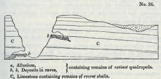
No. 26.
a, Alluvium, containing remains of extinct quadrupeds.
b, b, Deposits in caves, containing remains of extinct quadrupeds.
C, Limestone containing remains of recent shells.
The association in these and other localities of shells of living species with the remains of extinct mammalia is very distinct, and corroborates the inference adverted to in a former chapter, that the longevity of species in the mammalia is, upon the whole, inferior to that of the testacea. This circumstance we are by no means inclined to refer to the intervention of man, and his power of extirpating the larger quadrupeds, for the succession of mammiferous species appears to have been in like manner comparatively rapid throughout the older tertiary periods. Their more limited duration depends, in all probability, on physiological laws which render warm-blooded quadrupeds less capable, in general, of accommodating themselves to a great variety of circumstances, and, consequently, of surviving the vicissitudes to which the earth's surface is exposed in a great lapse of ages. [4]
Caves near Palermo. -- The caves near Palermo exhibit appearances very analogous to those above described, and much curious information has been lately published respecting them. According to Hoffmann, the grotto of Mardolce is distant about two miles from Palermo, and is 20 feet high and 10 wide. It occurs in a secondary limestone, in the Monte Grifone, at the base of a rocky precipice about 180 feet above the sea. From the foot of this precipice an inclined plane, consisting of horizontal tertiary strata, of the newer Pliocene period, extends to the sea, a distance of about a mile.
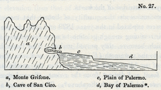
No. 27.
a, Monte Grifone.
b, Cave of San Ciro.
c, Plain of Palermo.
d, Bay of Palermo. [5]
The limestone escarpment was evidently once a sea-cliff, and the ancient beach still remains formed of pebbles of various rocks, many of which must have been brought from places far remote. Broken pieces of coral and shell, especially of oysters and pectens, are seen intermingled with the pebbles. Immediately above the level of this beach serpulae are still found adhering to the face of the rock, and the limestone is perforated by lithodomi. Within the grotto also, at the same level, similar perforations occur, and so numerous are the holes, that the rock is compared by Hoffmann to a target pierced by musket balls. But in order to expose to view these marks of boring-shells in the interior of the cave, it was necessary first to remove a mass of breccia, which consisted of numerous fragments of rock and an immense quantity of bones imbedded in a dark brown calcareous marl. Many of the bones were rolled as if partially subjected to the action of the waves. Below this breccia, which is about 20 feet thick, was found a bed of sand filled with sea-shells of recent species, and underneath the sand again is the secondary limestone of Monte Grifone. The state of the surface of the limestone in the cave above the level of the marine sand is very different from that below it. Above, the rock is jagged and uneven, as is usual in the roofs and sides of limestone caverns; below, the surface is smooth and polished, as if by the attrition of the waves.
So enormous was the quantity of bones, that many shiploads were exported in the years 1829 and 1830, in the hope of their retaining enough gelatine to serve for refining sugar, for which, however, they proved useless. The bones belong chiefly to the mammoth (E. primigenius), and with them are those of an hippopotamus, smaller than the species usually found fossil, and distinct from the recent. Several species of deer were also found with the above. [6] The remains of a bear, also, are said to have been discovered.
It is easy to explain in what manner the cavern of Mardolce was in part filled with sea-sand, and how the surface of the limestone became perforated by lithodomi; but in what manner, when the elevation of the rocks and the ancient beach had taken place, was the superimposed osseous breccia formed? The extraordinary number of the imbedded animal remains precludes, we think, at once the supposition of the whole having been heaped up together by a single catastrophe. Let us suppose that, when the caves were at a moderate elevation above the level of the sea, they were exposed, during a succession of earthquakes, to be inundated again and again by waves rolling in upon the land till they reached the base of an inland cliff, not far from the shore. Reiterated catastrophes may thus have occurred, like that of 1783 in Calabria, when a wave broke in upon the coast, and after sweeping away 1400 of the inhabitants and many cattle, threw in upon the land, on its return, the bodies of men and the carcasses of animals, mingled with sand and pebbles. Caves so flooded might be inhabited by some animals, and others might retreat into them during a period of alarm. We attach no importance, however, to these speculations, but merely throw them out as hints for those who may re-examine these caves and be desirous of collecting additional facts.
Two other caverns are described by Dr. Christie as occurring in Mount Beliemi, about four miles west of Palermo, at a higher elevation than that of Mardolce, being more than 300 feet above the level of the sea. In one of these localities the bones are only found in a talus at the outside of the cavern; in the other, they occur both within the cave and in the talus which slopes from it to the plain below. These caves appear to be situated much above the highest point attained by the tertiary deposits in this neighbourhood, nor is there the slightest appearance in the caves themselves of the sea having been there. [7]
The breccias in these caves may have originated in the manner before suggested, vol. ii. chap. xiii.
Australian Breccias. -- In several parts of Australia, ossifferous breccias have lately been discovered in limestone caverns, and the remains of the fossil mammalia are found to be referrible to species now living in that country, mingled with some relics of extinct animals. Many of' these have been examined by Major Mitchell in the Wellington Valley, about 210 miles west from Sidney, on the river Bell, one of the principal sources of the Macquarrie, and on the Macquarrie itself.
The caverns appear to correspond closely with those which contain similar osseous breccias in Europe; they often branch off in different directions through the rock, widening and contracting their dimensions, the roofs and floors being covered with stalactite. The bones are often broken, but do not appear water-worn. In some caves and fissures they lie imbedded in loose earth, but usually they are included in a breccia, having a red ochreous cement as hard as limestone, and like that of the Mediterranean caves.
The remains found most abundantly are those of the kangaroo. Amongst others, those of the Wombat, Dasyurus, Kaola, and Phalangista, have been recognized. The greater part of them belong to existing, but several to extinct, species. One of the bones is of much greater size than the rest, and is supposed, by Mr. Clift, to belong to an hippopotamus. [8]
In a collection of these bones sent to Paris, Mr. Pentland thought he could recognize a species of Halmaturus of larger size than the largest living kangaroo. [9]
These facts are full of interest, for they prove that the peculiar type of organization which now characterizes the marsupial tribes has prevailed from a remote period in Australia, and that in that continent, as in Europe, North and South America, and India, many species of mammalia have become extinct. It also appears, although the evidence is less complete than we could have wished, that land quadrupeds, far exceeding in magnitude the wild species now inhabiting New Holland, have, at some former period, existed in that country.
Breccias now forming in the Morea. -- Respecting the various ways in which fissures and caverns may become gradually filled up with osseous breccias, we may refer the reader to what we have said in a former volume. [10] It appears, however, from a recent communication of M. Boblaye, that the Morea is, of all the countries hitherto investigated, that which throws the greatest light on the mode in which the Mediterranean breccias may have originated.
In that Peninsula a great many of the rivers and torrents terminate in land-locked hollows, where they are engulphed in chasms which traverse limestone. They sometimes reappear at great distances, but generally they discharge their waters below the level of the sea. 'Numerous bone caverns,' says M. Boblaye, I may thus be filling up in our own times, and the gulphs (katavothrons) of the plain of Tripolitza have swallowed up of late years thousands of human bones, mingled with the same ochreous clay which envelops the osseous remains of higher antiquity.' [11]
NEWER PLIOCENE ALLUVIUMS.
Some writers have attempted to introduce into their classification of geological periods an alluvial epoch, as if the transportation of loose matter from one part of the surface of the land to another had been the work of one particular period.
In our opinion, they might have endeavoured, with equal propriety, to institute a volcanic period, or a period of marine or fresh-water deposits. We believe, on the contrary, that alluvial formations have originated in every age, but more particularly during those periods when land has been raised above its former level, or depressed below it. We defined alluvium to be such transported matter as has been thrown down, either by rivers, floods, or other causes, upon land liable to inundations, or which is not permanently submerged beneath the waters of lakes or seas. [12] As examples of the other causes adverted to in the above definition, we might instance a wave of the sea raised by an earthquake, or a water-spout, or a glacier.
We have said permanently submerged in order to distinguish between alluviums and regular subaqueous deposits. The latter are accumulated in lakes or great submarine receptacles, the former in the channels of rivers and currents, where the materials may be regarded as being still in transitu, or on their way to a place of rest. There may be cases where it is impossible to draw a line of demarcation between these two classes of formations, but these exceptions are rare, and the division is, upon the whole, convenient and natural, the circumstances being very different under which each group originates.
Marine alluvium. -- The term 'marine alluvium' is, perhaps, admissible if confined to banks of shingle thrown up like the Chesil bank, or to materials cast up by a wave of the sea upon the land, or those which a submarine current has left in its track. The kind last mentioned must necessarily, when the bed of the ocean has been laid dry, resemble terrestrial alluviums, with this difference, that if any fragments of organic bodies have escaped destruction they will belong to marine species.
During the gradual rise of a large area, first from beneath the waters, and then to a great height above them, several kinds of superficial gravel must be formed and transported from one place to another. When the first islets begin to appear, and the breakers are foaming upon the new-raised reefs, many rocky fragments are torn off and rolled along the bottom of the sea.
Let the reader recall to mind the action of the tides and currents off the coast of Shetland, described in the first volume, [13] where blocks of granite, gneiss, porphyry, and serpentine, of enormous dimensions, are continually detached from wasting cliffs during storms, and carried in a few hours to a distance of many hundred yards from the parent rocks. Suppose the floor of the ocean not far from the coast to be composed of those secondary strata of which several islands of this group consist. Such a tract, after being strewed over with detached blocks and pebbles of ancient rocks, might be converted into land, and the geologist might then, perhaps, search in vain for the islands whence the fragments were originally derived. For the islands may have wholly disappeared, having been gradually consumed by the waves of the ocean, or submerged by subterranean movements.
Let us farther suppose this new land to be uplifted during successive convulsions to the height of 1000 feet. The marine alluvium before alluded to would be carried upwards on the summits of the bills and on the surface of elevated platforms. It might still constitute the general covering of the country, being wanting only in such valleys and ravines as may have been caused by earthquakes or excavated by the power of running water during the rise of the land. The alluvium in those more modern valleys would consist partly of pebbles washed out of the older gravel before mentioned, but chiefly of fragments derived from the wreck of those rocks which were removed during the erosion of the valleys.
Many of the most widely distributed of the British alluviums may we think be referred to the action of the sea previous to the elevation of the land; and for this reason we never expect to be able to trace all the pebbles to their parent rocks. If it be objected that the high antiquity thus ascribed to many of our superficial deposits seems inconsistent with their actual state of preservation, we may observe, that they are often composed of indestructible materials, such as flint and quartz, and in many cases they have been protected for ages from the corroding action of the atmosphere by an envelope of loam or clay, from which they have been partially and slowly washed out by rain.
It must not, however, be understood that we refer the greater part of the alluviums scattered over our continents to the waves and currents of the sea, but merely some of those which have been justly regarded as most singular and anomalous, both in position and in the discordance of their contents with any known rocks in the adjacent countries.
Grooved surface of rocks. -- We sometimes find the surface of large tracts hollowed out extensively in parallel grooves, such as have been described by Sir James Hall on the summits of the Corstorphine Hills, where I have myself examined them, in company with Dr. Buckland. These grooves may have been caused by the friction of blocks rolled along the floor of the ocean before the country emerged from the deep. The same appearances may be seen on a smaller scale, in the beds of many mountain-streams in Scotland, and I observed them strikingly displayed on Etna, in the defile called the Portella di Calanna, where a hard blue lava of modern date has been furrowed in this manner by the rolling of blocks down a steep declivity.
We have endeavoured, in a former volume, to point out the great power exerted by running water on the land in excavating valleys, at those periods when violent earthquakes derange, from time to time, the regular drainage of a country. [14] We also explained the manner in which temporary lakes are formed, and how the accumulated waters may suddenly escape, when the barriers are rent open by subsequent convulsions.
Erratic blocks. -- Blocks of extraordinary magnitude have been observed at the foot of the Alps, and at a considerable height in some of the valleys of the Jura, exactly opposite the principal openings by which great rivers descend from the Alps. These fragments have been called 'erratic,' and many imaginary causes have been invented to account for their trans portation. Some have talked of chasms opening in the ground immediately below, and of huge fragments having been cast out of them from the bowels of the earth. Others have referred to the deluge,-a convenient agent in which they find a simple solution of every difficult problem exhibited by alluvial phenomena. More recently, the instantaneous rise of mountain-chains has been introduced as a cause which may have given rise to diluvial waves, capable of devastating whole continents, and drifting huge blocks from one part of the earth's surface to another.
M. Elie de Beaumont has indulged in the speculation, that the sudden 'appearance of the Cordillera of the Andes' may have caused 'the historical deluge!' [15] Now, if we were sufficiently acquainted with the Andes to have grounds for assuming that they were not upheaved, like the Alps, at several successive periods; -- if we could assume that they have started up at once, so as to attain their actual height in an instant of time; -- if, in short, we could embrace the theory of 'paroxysmal elevations,' still we should consider the hypothesis of a connexion between the rise of the Andes and the historical deluge, as most extravagant. It cannot be disputed that, if part of the unfathomable ocean were suddenly converted into a shoal, a great body of water would be displaced, and a diluvial wave might then inundate some previously-existing continent. A line of shoals, therefore, or reefs, consisting of shattered and dislocated rocks, and surrounded on all sides by a great depth of sea, ought first to have been pointed out by the paroxysmalist as one of the protruded masses which may have caused a recent deluge. The subsequent upthrow of these same reefs to an additional height of ten, fifteen, or twenty thousand feet, converting them suddenly into a mountain ridge like the Andes, would displace a great volume of atmospheric air, not of water, and if the velocity of the movement were sufficiently great, might occasion a tremendous hurricane.
If it be said that a convulsion sufficiently violent to raise the Andes would probably extend far beyond the immediate range of the mountain chain, we reply that, according to that theory, it was not the Andes, but some other unknown tract, part perhaps of the present bed of the Pacific, which occasioned the flood. And if we indulge in conjectures as to what may have happened in contiguous regions at the time when the Cordillera arose, we ask whether those regions may not have sunk down, so as to cause a subsidence instead of an uplifting of the oceanic waters?
But leaving the farther discussion of these speculative views, let us return to the origin of the larger erratic blocks of Alpine origin. It has been often suggested, that ice may have contributed its aid towards the transfer of these enormous blocks, and, as the transporting power of ice is now so conspicuously displayed in the Alps, the idea is entitled to the fullest consideration.
Those naturalists who have seen the glaciers of Savoy, and who have beheld the prodigious magnitude of some fragments conveyed by them from the higher regions of Mont Blanc to the valleys below, to a distance of many leagues, will be prepared to appreciate the effects which a series of earthquakes might produce in this region, if the peaks or 'needles,' as they are called, of Mont Blanc were shaken as rudely as many parts of the Andes have been in our own times. The glaciers Oi Chamouni would immediately be covered under a prodigious load of rocky masses thrown down upon them. Let us, then, imagine one of the deep narrow gorges in the course of the Arve, between Chamouni and Cluse, to be stopped up by the sliding down of a hill-side (as the Rossberg fell in 1806 [16]), and a lake would fill the valley of Chamouni, and the lower parts of the glaciers would all be laid under water. The streams which flow out of arches, at the termination of each glacier, prove that at the bottom of those icy masses there are vaulted cavities through which the waters flow. Into these hollows the water of the lake would enter, and might thus float up the ice in detached icebergs, for the glaciers are much fissured, and the rents would be greatly increased during a period of earthquakes. Icebergs thus formed might, we conceive, resemble those seen by Captain Scoresby far from land in the Polar seas, which supported fragments of rock and soil, conjectured to be above fifty thousand tons in weight. [17] Let a subsequent convulsion, then, break suddenly the barrier of the lake, and the flood would instantly carry down the icebergs, together with their burden, to the low country at the base of the Alps.
We have stated in the first volume that blocks conveyed on floating icebergs must be deposited in different parts of the bottom of the ocean, in whatever latitudes those icebergs are dissolved. [18]
European alluviums in great part tertiary. -- If those writers who speak of an 'alluvial epoch' intend merely to say that a great part of the European alluviums are tertiary, we fully coincide in that opinion, for the map of Europe, given in our second volume, will show that almost every part of the existing continent of Europe has emerged from beneath the waters during some one or other of the tertiary periods; and it is probable, that even those districts which were land before the commencement of the tertiary epoch, may have shared in the subterranean convulsions by which the levels of adjoining countries have since been altered. During such subterranean movements new alluviums would be formed in great abundance, and those of more ancient date so modified as to retain scarcely any of their original distinguishing characters.
LOCALITIES OF NEWER PLIOCENE ALLUVIUMS.
Sicily. -- Assuming, then, that almost all the European alluviums are tertiary, we have next to inquire which of them belong to the newer Pliocene period. It is clear that when a district, like the Val di Noto, is composed of rocks of this age, all the alluvium upon the surface must necessarily belong either to the newer Pliocene or to the Recent epoch. If, therefore, the elevation of the mountains of the Val di Noto was chiefly accomplished antecedently to the recent epoch, we must at once pronounce alluviums, in the position indicated at a, diagram No. 26 (p. 139), to belong to the newer Pliocene era. I am informed, that gravel so situated occurs at Grammichele in Sicily, containing the bones of the mammoth.
Loess of the Valley of the Rhine. -- There is a remarkable alluvium filled with land-shells of recent species, which overspreads a great part of the valley of the Rhine, between Basle and Cologne, which, as it contains no remains of man or his works, we may refer to the newer Pliocene era. This deposit is provincially termed 'Loess,' or, in Alsace, 'Lehm,' and has been described by many geologists, whose observations we have lately had opportunities of verifying. [19]
According to M. Leonhard the loess consists chiefly of argillaceous matter combined with a sixth part of carbonate of lime and a sixth of quartzose and micaceous sand. It may be described as a pulverulent loam, of a dirty yellowish-grey colour, often containing calcareous sandy concretions or nodules, rarely exceeding the size of a man's head. Its entire thickness, in certain localities, amounts to several hundred-feet; yet no signs of stratification appear in the mass, except here and there at the bottom, where there is a slight intermixture of materials derived from subjacent rocks. No marine remains are anywhere imbedded in it, but land-shells of existing species are extremely common, and the remains of the mammoth, horse, and some other quadrupeds, are said to have been found in it. The general absence of fresh-water shells is very remarkable. I collected a few specimens in the section near the Manheim gate of Heidelberg, and they are mentioned as having been found at a few other spots, by several of the writers above cited.
The loess sometimes rises to the height of 300 feet above the alluvial plain of the Rhine, and to the height of 600 feet above the sea; but it is confined to the valley of the Rhine and its tributary valleys, preserving everywhere the same mineral characters, except where the lowest portion is mixed up, as before-mentioned, with matter derived from the underlying rocks. The loess reposes on every rock, from the granite to the gravel of the plains of the Rhine, and must have been thrown down from some vast body of water, densely charged with sediment, after the country had assumed its present configuration. I am informed by M. Studer, that it does not extend into Switzerland, so that we may suppose the flood to have descended from near the borders of that country, perhaps from the neighbourhood of Basle, into the valley of the Rhine, where one of the first great obstacles to its passage would be the Kaiserstuhl, a small group of volcanic hills which stand almost in the middle of the plains of the Rhine, south of Strasburg, between the chains of the Black Forest and the Vosges. These hills are covered nearly to their summits with loess. But the narrow gorge of Bingen and Andernach would cause the greatest obstruction, even if we suppose that defile to have been open when the flood descended, which was probably the case, since we find the loess lower down the valley, on the flanks of the Siebengebirge.
We have stated that stratification is almost entirely wanting, but the movement of the muddy waters appears in some places to have torn up the subjacent soil, and then to have thrown down again the foreign matter, thus mingled with the loess, in layers and strata. An alternation of gravel and loess has resulted from this cause in the lower part of the section before alluded to at Heidelberg.
I observed a similar blending of the loess, and the variegated sandstone and red marl underlying it at Zeuten and Odenau, in a valley on the right bank of the Rhine, at a short distance from the Bergstrasse, between Wiesloch and Bruchsal, a locality pointed out to me by Professor Bronn. Near Andernach there is a similar intermixture and alternation of the lower beds of loess, with volcanic ejections such as are strewed over that country, a phenomenon from which some observers have too hastily inferred that the volcanic eruptions and the deposition of the loess were contemporaneous.
The Rhine throughout a great part of its course between the lake of Constance to the falls of Schaffhausen traverses a tertiary deposit, called in Switzerland molasse, which consists in some places of stratified yellow loam. At Stein, near OEningen, this loam is 150 feet thick, and resembles exceedingly the loss before described, except in being regularly stratified. If we could suppose the waters of a great lake like that of Constance to have been suddenly let free by an earthquake, and in their descent into the valley of the Rhine to have intersected such strata, we might imagine the waters to have become densely charged with loam, with which they may have parted as soon as their velocity was diminished by spreading over a wider space.
The catastrophe which brought down the loess must, for a time, have desolated the country, but, in the end, it has enriched the soil, constituting the most fertile parts of Alsace and Lorraine, which were previously composed of barren sand and gravel.
The perfect state of preservation of the land-shells in the loess may have arisen from their having been floated in the turbid water in which there were no hard particles to injure them by friction. The occurrence of fresh-water shells is so rare as by no means to warrant the theory adopted by some, that the loss was formed in a lake instead of having been thrown down from a transient flood of muddy water. A few individual shells of aquatic species, the inhabitants, perhaps, of rivers or small ponds, may easily have been washed away and intermingled with the rest during the inundation. The names of fifteen species of recent shells, which I collected from the loss, are given in Appendix II. [20]
_______________
Notes:
1. This fossil was shown me by Signor Riccioli at Rome.
2. Hoffmann, Archiv. fur Mineralogie, p. 393. Berlin, 1831. Dr. Christie, Proceedings of Geol. Soc., No. xxiii. p. 333.
3. Vol. i. chap. xxv.
4. See above, p. 48, and vol. i. chap. vi.
5. This section is given by Dr. Christie, as of the Cave of San Ciro. -- Ed. New Phil. Journ., No. xxiii. Its geographical position and other characters agree so precisely with that of Mardolce, described by M. Hoffmann, that it may be another name for the same cave, or one immediately adjoining.
6. Cuvier, Disc. Prelim., p. 345. 6th Ed.
7. Dr. T. Christie, on certain Newer Deposits in Sicily, &c. -- Jameson, Ed. New Phil. Journ., No. xxiii. p. 1.
8. Mr. Clift, Ed. New Phil. Journ., No. xx. p. 394. -- Major Mitchell, Proceedings of Geol. Soc., 1831, p. 321.
9. Journ. de Geologie, tome iii. p. 291. The bone of au elephant mentioned by Mr. Pentland was the same large bone alluded to by Mr. Clift.
10. Vol. ii. chap. xiii.
11. Journ. de Geologie, tome iii. No. x. p. 165.
12. Vol. ii. chap. xiv.
13. Chapter xv.
14. Vol. i. chap. xxiv.
15. L'Age relatif des Montagnes, sec. x. -- Revue Francaise, No. xv., Mai, 1830, p.55.
16. See above, vol. ii. 1st Ed., p. 229; 2d Ed. p. 235.
17. See above, vol. i. p. 299, 1st Ed.; p. 342, 2d Ed.
18. Vol. i. ibid.
19. Among these we may mention MM. Leonhard, Bronn, Boue, Voltz, Steininger, Merian, Rozet, and Hibbert.
20. M. Bronn of Heidelberg possesses a more extensive collection.
Newer Pliocene fresh – water formations – Valley of the Elsa – Travertins of Rome – Osseous breccias – Sicily – Caves near Palermo – Extinct animals in newer Pliocene breccias – Fossil bones of Marsupial animals in Australian caves – Formation of osseous breccias in the Mores – Newer Pliocene alluviums – Difference between alluviums and regular subaqueous strata – The former of various ages – Marine alluvium – Grooved surface of rocks – Erratic blocks of the Alps – Theory of deluges caused by paroxysmal elevations untenable – How ice may have contributed to transport large blocks from the Alps – European alluviums chiefly tertiary – Newer Pliocene in Sicily – Loss of the Valley of the Rhine – Its origin – Contains recent shells
FRESH-WATER FORMATIONS.
IN this chapter we shall treat of the fresh-water formations, and of the cave breccias and alluviums of the newer Pliocene period.
In regard to the first of these, they must have been formed, in greater or less quantity, in nearly all the existing lakes of the world, in those, at least, of which the basins were formed before the earth was tenanted by man. If the great lakes of' North America originated before that era, the sedimentary strata deposited therein, in the ages immediately antecedent, would, according to the terms of our definition, belong to the newer Pliocene period.
Valley of the Elsa. -- As an example of the strata of this age, which have been exposed to view in consequence of the drainage of a lake, we may mention those of the valley of the Elsa, in Tuscany, between Florence and Sienna, where we meet with fresh-water marls and travertins full of shells, belonging to species which now live in the lakes and rivers of Italy. Valleys several hundred feet deep have been excavated through the lacustrine beds, and the ancient town of Colle stands on a hill composed of them. The subjacent formation consists of marine Subapennine beds, ill which more than half the shells are of recent species. The fresh-water shells which I collected near Colle are in a very perfect state, and the colours of the Neritinae are peculiarly brilliant. The following six species, all of which now inhabit Italy, were identified by M. Deshayes: Paludina impura, Neritina fluviatilis, Succinea amphibia, Limneus auricularis, L. pereger, and Planorbis carinatus.
Travertins of Rome. -- Many of the travertins and calcareous tufas which cap the hills of Rome may also belong to the same period. The terrestrial shells inclosed in these masses are of the same species as those now abounding in the gardens of Rome, and the accompanying aquatic shells are such as are found in the streams and lakes of the Campagna. On Mount Aventine, the Vatican, and the Capitol, we find abundance of vegetable matter, principally reeds encrusted with calcareous tufa, and intermixed with volcanic sand and pumice. The tusk of a mammoth has been procured from this formation, filled in the interior with solid travertin, wherein sparkling crystals of augite are interspersed, so that the bone has all the appearance of having been extracted from a hard crystalline rock. [1]
These Roman tufas and travertins repose partly on marine tertiary strata, belonging, perhaps, to the older Pliocene era, and partly on volcanic tuff of a still later date. They must have been formed in small lakes and marshes, which existed before the excavation of the valleys which divide the seven hills of Rome, and they must originally have occupied the lowest hollows of the country, whereas now we find them placed upon the summit of hills about 200 feet above the alluvial plain of the Tiber. We know that this river has flowed nearly in its present channel ever since the building of Rome, and scarcely any changes in the geographical features of the country have taken place since that era.
When the marine tertiary strata of this district were formed, those of Monte Mario for example, the Mediterranean was already inhabited by a large proportion of the existing species of testacea. At a subsequent period, volcanic eruptions occurred, and tuff's were superimposed. The marine formation then emerged from the deep, and supported lakes wherein the fresh-water groups above described slowly accumulated, at a time when the mammoth abounded in the country. The valley of the Tiber was afterwards excavated, and the adjoining hills assumed their present shape, and then a long interval may, perhaps, have elapsed before the first human settlers arrived. Thus we have evidence of a chain of events all regarded as extremely recent by the geologist, but which, nevertheless, may have preceded, for an immense series of ages, a very remote era in the history of nations.
OSSEOUS BRECCIAS.
Sicily. -- The breccias recently found in several caves in Sicily belong evidently to the period under consideration. We have shown, in the sixth chapter, that the cavernous limestone of the Val di Noto is of very modern date, as it contains a great abundance of fossil shells of recent species. But if any breccias are found in the caverns of this rock they must be of still later origin.
We are informed by M. Hoffmann, that the bones of the mammoth, and of an extinct species of hippopotamus, have been discovered in the stalactite of caves near Sortino, of which the situation is represented in the annexed diagram at b. The same author also describes a breccia, containing the bones of an extinct rhinoceros and hippopotamus, in a cave in the neighbourhood of Syracuse, where the country is composed entirely of the Val di Noto limestone. Some of the fragments in the breccia are perforated by lithodomi, and the whole mass is covered by a deposit of marine clay filled with recent shells. [2] These phenomena may, we think, be explained by supposing such oscillations of level as are known to occur on maritime coasts where earthquakes prevail, such, in fact, as have been witnessed on the shores of the Bay of Baiae within the last three centuries. [3] For it is evident that the temporary submergence of a cave filled with osseous breccia might afford time for the perforation of the rock by boring testacea, and for the deposition upon it of mud, sand, and shells.
No. 26.
a, Alluvium, containing remains of extinct quadrupeds.
b, b, Deposits in caves, containing remains of extinct quadrupeds.
C, Limestone containing remains of recent shells.
The association in these and other localities of shells of living species with the remains of extinct mammalia is very distinct, and corroborates the inference adverted to in a former chapter, that the longevity of species in the mammalia is, upon the whole, inferior to that of the testacea. This circumstance we are by no means inclined to refer to the intervention of man, and his power of extirpating the larger quadrupeds, for the succession of mammiferous species appears to have been in like manner comparatively rapid throughout the older tertiary periods. Their more limited duration depends, in all probability, on physiological laws which render warm-blooded quadrupeds less capable, in general, of accommodating themselves to a great variety of circumstances, and, consequently, of surviving the vicissitudes to which the earth's surface is exposed in a great lapse of ages. [4]
Caves near Palermo. -- The caves near Palermo exhibit appearances very analogous to those above described, and much curious information has been lately published respecting them. According to Hoffmann, the grotto of Mardolce is distant about two miles from Palermo, and is 20 feet high and 10 wide. It occurs in a secondary limestone, in the Monte Grifone, at the base of a rocky precipice about 180 feet above the sea. From the foot of this precipice an inclined plane, consisting of horizontal tertiary strata, of the newer Pliocene period, extends to the sea, a distance of about a mile.
No. 27.
a, Monte Grifone.
b, Cave of San Ciro.
c, Plain of Palermo.
d, Bay of Palermo. [5]
The limestone escarpment was evidently once a sea-cliff, and the ancient beach still remains formed of pebbles of various rocks, many of which must have been brought from places far remote. Broken pieces of coral and shell, especially of oysters and pectens, are seen intermingled with the pebbles. Immediately above the level of this beach serpulae are still found adhering to the face of the rock, and the limestone is perforated by lithodomi. Within the grotto also, at the same level, similar perforations occur, and so numerous are the holes, that the rock is compared by Hoffmann to a target pierced by musket balls. But in order to expose to view these marks of boring-shells in the interior of the cave, it was necessary first to remove a mass of breccia, which consisted of numerous fragments of rock and an immense quantity of bones imbedded in a dark brown calcareous marl. Many of the bones were rolled as if partially subjected to the action of the waves. Below this breccia, which is about 20 feet thick, was found a bed of sand filled with sea-shells of recent species, and underneath the sand again is the secondary limestone of Monte Grifone. The state of the surface of the limestone in the cave above the level of the marine sand is very different from that below it. Above, the rock is jagged and uneven, as is usual in the roofs and sides of limestone caverns; below, the surface is smooth and polished, as if by the attrition of the waves.
So enormous was the quantity of bones, that many shiploads were exported in the years 1829 and 1830, in the hope of their retaining enough gelatine to serve for refining sugar, for which, however, they proved useless. The bones belong chiefly to the mammoth (E. primigenius), and with them are those of an hippopotamus, smaller than the species usually found fossil, and distinct from the recent. Several species of deer were also found with the above. [6] The remains of a bear, also, are said to have been discovered.
It is easy to explain in what manner the cavern of Mardolce was in part filled with sea-sand, and how the surface of the limestone became perforated by lithodomi; but in what manner, when the elevation of the rocks and the ancient beach had taken place, was the superimposed osseous breccia formed? The extraordinary number of the imbedded animal remains precludes, we think, at once the supposition of the whole having been heaped up together by a single catastrophe. Let us suppose that, when the caves were at a moderate elevation above the level of the sea, they were exposed, during a succession of earthquakes, to be inundated again and again by waves rolling in upon the land till they reached the base of an inland cliff, not far from the shore. Reiterated catastrophes may thus have occurred, like that of 1783 in Calabria, when a wave broke in upon the coast, and after sweeping away 1400 of the inhabitants and many cattle, threw in upon the land, on its return, the bodies of men and the carcasses of animals, mingled with sand and pebbles. Caves so flooded might be inhabited by some animals, and others might retreat into them during a period of alarm. We attach no importance, however, to these speculations, but merely throw them out as hints for those who may re-examine these caves and be desirous of collecting additional facts.
Two other caverns are described by Dr. Christie as occurring in Mount Beliemi, about four miles west of Palermo, at a higher elevation than that of Mardolce, being more than 300 feet above the level of the sea. In one of these localities the bones are only found in a talus at the outside of the cavern; in the other, they occur both within the cave and in the talus which slopes from it to the plain below. These caves appear to be situated much above the highest point attained by the tertiary deposits in this neighbourhood, nor is there the slightest appearance in the caves themselves of the sea having been there. [7]
The breccias in these caves may have originated in the manner before suggested, vol. ii. chap. xiii.
Australian Breccias. -- In several parts of Australia, ossifferous breccias have lately been discovered in limestone caverns, and the remains of the fossil mammalia are found to be referrible to species now living in that country, mingled with some relics of extinct animals. Many of' these have been examined by Major Mitchell in the Wellington Valley, about 210 miles west from Sidney, on the river Bell, one of the principal sources of the Macquarrie, and on the Macquarrie itself.
The caverns appear to correspond closely with those which contain similar osseous breccias in Europe; they often branch off in different directions through the rock, widening and contracting their dimensions, the roofs and floors being covered with stalactite. The bones are often broken, but do not appear water-worn. In some caves and fissures they lie imbedded in loose earth, but usually they are included in a breccia, having a red ochreous cement as hard as limestone, and like that of the Mediterranean caves.
The remains found most abundantly are those of the kangaroo. Amongst others, those of the Wombat, Dasyurus, Kaola, and Phalangista, have been recognized. The greater part of them belong to existing, but several to extinct, species. One of the bones is of much greater size than the rest, and is supposed, by Mr. Clift, to belong to an hippopotamus. [8]
In a collection of these bones sent to Paris, Mr. Pentland thought he could recognize a species of Halmaturus of larger size than the largest living kangaroo. [9]
These facts are full of interest, for they prove that the peculiar type of organization which now characterizes the marsupial tribes has prevailed from a remote period in Australia, and that in that continent, as in Europe, North and South America, and India, many species of mammalia have become extinct. It also appears, although the evidence is less complete than we could have wished, that land quadrupeds, far exceeding in magnitude the wild species now inhabiting New Holland, have, at some former period, existed in that country.
Breccias now forming in the Morea. -- Respecting the various ways in which fissures and caverns may become gradually filled up with osseous breccias, we may refer the reader to what we have said in a former volume. [10] It appears, however, from a recent communication of M. Boblaye, that the Morea is, of all the countries hitherto investigated, that which throws the greatest light on the mode in which the Mediterranean breccias may have originated.
In that Peninsula a great many of the rivers and torrents terminate in land-locked hollows, where they are engulphed in chasms which traverse limestone. They sometimes reappear at great distances, but generally they discharge their waters below the level of the sea. 'Numerous bone caverns,' says M. Boblaye, I may thus be filling up in our own times, and the gulphs (katavothrons) of the plain of Tripolitza have swallowed up of late years thousands of human bones, mingled with the same ochreous clay which envelops the osseous remains of higher antiquity.' [11]
NEWER PLIOCENE ALLUVIUMS.
Some writers have attempted to introduce into their classification of geological periods an alluvial epoch, as if the transportation of loose matter from one part of the surface of the land to another had been the work of one particular period.
In our opinion, they might have endeavoured, with equal propriety, to institute a volcanic period, or a period of marine or fresh-water deposits. We believe, on the contrary, that alluvial formations have originated in every age, but more particularly during those periods when land has been raised above its former level, or depressed below it. We defined alluvium to be such transported matter as has been thrown down, either by rivers, floods, or other causes, upon land liable to inundations, or which is not permanently submerged beneath the waters of lakes or seas. [12] As examples of the other causes adverted to in the above definition, we might instance a wave of the sea raised by an earthquake, or a water-spout, or a glacier.
We have said permanently submerged in order to distinguish between alluviums and regular subaqueous deposits. The latter are accumulated in lakes or great submarine receptacles, the former in the channels of rivers and currents, where the materials may be regarded as being still in transitu, or on their way to a place of rest. There may be cases where it is impossible to draw a line of demarcation between these two classes of formations, but these exceptions are rare, and the division is, upon the whole, convenient and natural, the circumstances being very different under which each group originates.
Marine alluvium. -- The term 'marine alluvium' is, perhaps, admissible if confined to banks of shingle thrown up like the Chesil bank, or to materials cast up by a wave of the sea upon the land, or those which a submarine current has left in its track. The kind last mentioned must necessarily, when the bed of the ocean has been laid dry, resemble terrestrial alluviums, with this difference, that if any fragments of organic bodies have escaped destruction they will belong to marine species.
During the gradual rise of a large area, first from beneath the waters, and then to a great height above them, several kinds of superficial gravel must be formed and transported from one place to another. When the first islets begin to appear, and the breakers are foaming upon the new-raised reefs, many rocky fragments are torn off and rolled along the bottom of the sea.
Let the reader recall to mind the action of the tides and currents off the coast of Shetland, described in the first volume, [13] where blocks of granite, gneiss, porphyry, and serpentine, of enormous dimensions, are continually detached from wasting cliffs during storms, and carried in a few hours to a distance of many hundred yards from the parent rocks. Suppose the floor of the ocean not far from the coast to be composed of those secondary strata of which several islands of this group consist. Such a tract, after being strewed over with detached blocks and pebbles of ancient rocks, might be converted into land, and the geologist might then, perhaps, search in vain for the islands whence the fragments were originally derived. For the islands may have wholly disappeared, having been gradually consumed by the waves of the ocean, or submerged by subterranean movements.
Let us farther suppose this new land to be uplifted during successive convulsions to the height of 1000 feet. The marine alluvium before alluded to would be carried upwards on the summits of the bills and on the surface of elevated platforms. It might still constitute the general covering of the country, being wanting only in such valleys and ravines as may have been caused by earthquakes or excavated by the power of running water during the rise of the land. The alluvium in those more modern valleys would consist partly of pebbles washed out of the older gravel before mentioned, but chiefly of fragments derived from the wreck of those rocks which were removed during the erosion of the valleys.
Many of the most widely distributed of the British alluviums may we think be referred to the action of the sea previous to the elevation of the land; and for this reason we never expect to be able to trace all the pebbles to their parent rocks. If it be objected that the high antiquity thus ascribed to many of our superficial deposits seems inconsistent with their actual state of preservation, we may observe, that they are often composed of indestructible materials, such as flint and quartz, and in many cases they have been protected for ages from the corroding action of the atmosphere by an envelope of loam or clay, from which they have been partially and slowly washed out by rain.
It must not, however, be understood that we refer the greater part of the alluviums scattered over our continents to the waves and currents of the sea, but merely some of those which have been justly regarded as most singular and anomalous, both in position and in the discordance of their contents with any known rocks in the adjacent countries.
Grooved surface of rocks. -- We sometimes find the surface of large tracts hollowed out extensively in parallel grooves, such as have been described by Sir James Hall on the summits of the Corstorphine Hills, where I have myself examined them, in company with Dr. Buckland. These grooves may have been caused by the friction of blocks rolled along the floor of the ocean before the country emerged from the deep. The same appearances may be seen on a smaller scale, in the beds of many mountain-streams in Scotland, and I observed them strikingly displayed on Etna, in the defile called the Portella di Calanna, where a hard blue lava of modern date has been furrowed in this manner by the rolling of blocks down a steep declivity.
We have endeavoured, in a former volume, to point out the great power exerted by running water on the land in excavating valleys, at those periods when violent earthquakes derange, from time to time, the regular drainage of a country. [14] We also explained the manner in which temporary lakes are formed, and how the accumulated waters may suddenly escape, when the barriers are rent open by subsequent convulsions.
Erratic blocks. -- Blocks of extraordinary magnitude have been observed at the foot of the Alps, and at a considerable height in some of the valleys of the Jura, exactly opposite the principal openings by which great rivers descend from the Alps. These fragments have been called 'erratic,' and many imaginary causes have been invented to account for their trans portation. Some have talked of chasms opening in the ground immediately below, and of huge fragments having been cast out of them from the bowels of the earth. Others have referred to the deluge,-a convenient agent in which they find a simple solution of every difficult problem exhibited by alluvial phenomena. More recently, the instantaneous rise of mountain-chains has been introduced as a cause which may have given rise to diluvial waves, capable of devastating whole continents, and drifting huge blocks from one part of the earth's surface to another.
M. Elie de Beaumont has indulged in the speculation, that the sudden 'appearance of the Cordillera of the Andes' may have caused 'the historical deluge!' [15] Now, if we were sufficiently acquainted with the Andes to have grounds for assuming that they were not upheaved, like the Alps, at several successive periods; -- if we could assume that they have started up at once, so as to attain their actual height in an instant of time; -- if, in short, we could embrace the theory of 'paroxysmal elevations,' still we should consider the hypothesis of a connexion between the rise of the Andes and the historical deluge, as most extravagant. It cannot be disputed that, if part of the unfathomable ocean were suddenly converted into a shoal, a great body of water would be displaced, and a diluvial wave might then inundate some previously-existing continent. A line of shoals, therefore, or reefs, consisting of shattered and dislocated rocks, and surrounded on all sides by a great depth of sea, ought first to have been pointed out by the paroxysmalist as one of the protruded masses which may have caused a recent deluge. The subsequent upthrow of these same reefs to an additional height of ten, fifteen, or twenty thousand feet, converting them suddenly into a mountain ridge like the Andes, would displace a great volume of atmospheric air, not of water, and if the velocity of the movement were sufficiently great, might occasion a tremendous hurricane.
If it be said that a convulsion sufficiently violent to raise the Andes would probably extend far beyond the immediate range of the mountain chain, we reply that, according to that theory, it was not the Andes, but some other unknown tract, part perhaps of the present bed of the Pacific, which occasioned the flood. And if we indulge in conjectures as to what may have happened in contiguous regions at the time when the Cordillera arose, we ask whether those regions may not have sunk down, so as to cause a subsidence instead of an uplifting of the oceanic waters?
But leaving the farther discussion of these speculative views, let us return to the origin of the larger erratic blocks of Alpine origin. It has been often suggested, that ice may have contributed its aid towards the transfer of these enormous blocks, and, as the transporting power of ice is now so conspicuously displayed in the Alps, the idea is entitled to the fullest consideration.
Those naturalists who have seen the glaciers of Savoy, and who have beheld the prodigious magnitude of some fragments conveyed by them from the higher regions of Mont Blanc to the valleys below, to a distance of many leagues, will be prepared to appreciate the effects which a series of earthquakes might produce in this region, if the peaks or 'needles,' as they are called, of Mont Blanc were shaken as rudely as many parts of the Andes have been in our own times. The glaciers Oi Chamouni would immediately be covered under a prodigious load of rocky masses thrown down upon them. Let us, then, imagine one of the deep narrow gorges in the course of the Arve, between Chamouni and Cluse, to be stopped up by the sliding down of a hill-side (as the Rossberg fell in 1806 [16]), and a lake would fill the valley of Chamouni, and the lower parts of the glaciers would all be laid under water. The streams which flow out of arches, at the termination of each glacier, prove that at the bottom of those icy masses there are vaulted cavities through which the waters flow. Into these hollows the water of the lake would enter, and might thus float up the ice in detached icebergs, for the glaciers are much fissured, and the rents would be greatly increased during a period of earthquakes. Icebergs thus formed might, we conceive, resemble those seen by Captain Scoresby far from land in the Polar seas, which supported fragments of rock and soil, conjectured to be above fifty thousand tons in weight. [17] Let a subsequent convulsion, then, break suddenly the barrier of the lake, and the flood would instantly carry down the icebergs, together with their burden, to the low country at the base of the Alps.
We have stated in the first volume that blocks conveyed on floating icebergs must be deposited in different parts of the bottom of the ocean, in whatever latitudes those icebergs are dissolved. [18]
European alluviums in great part tertiary. -- If those writers who speak of an 'alluvial epoch' intend merely to say that a great part of the European alluviums are tertiary, we fully coincide in that opinion, for the map of Europe, given in our second volume, will show that almost every part of the existing continent of Europe has emerged from beneath the waters during some one or other of the tertiary periods; and it is probable, that even those districts which were land before the commencement of the tertiary epoch, may have shared in the subterranean convulsions by which the levels of adjoining countries have since been altered. During such subterranean movements new alluviums would be formed in great abundance, and those of more ancient date so modified as to retain scarcely any of their original distinguishing characters.
LOCALITIES OF NEWER PLIOCENE ALLUVIUMS.
Sicily. -- Assuming, then, that almost all the European alluviums are tertiary, we have next to inquire which of them belong to the newer Pliocene period. It is clear that when a district, like the Val di Noto, is composed of rocks of this age, all the alluvium upon the surface must necessarily belong either to the newer Pliocene or to the Recent epoch. If, therefore, the elevation of the mountains of the Val di Noto was chiefly accomplished antecedently to the recent epoch, we must at once pronounce alluviums, in the position indicated at a, diagram No. 26 (p. 139), to belong to the newer Pliocene era. I am informed, that gravel so situated occurs at Grammichele in Sicily, containing the bones of the mammoth.
Loess of the Valley of the Rhine. -- There is a remarkable alluvium filled with land-shells of recent species, which overspreads a great part of the valley of the Rhine, between Basle and Cologne, which, as it contains no remains of man or his works, we may refer to the newer Pliocene era. This deposit is provincially termed 'Loess,' or, in Alsace, 'Lehm,' and has been described by many geologists, whose observations we have lately had opportunities of verifying. [19]
According to M. Leonhard the loess consists chiefly of argillaceous matter combined with a sixth part of carbonate of lime and a sixth of quartzose and micaceous sand. It may be described as a pulverulent loam, of a dirty yellowish-grey colour, often containing calcareous sandy concretions or nodules, rarely exceeding the size of a man's head. Its entire thickness, in certain localities, amounts to several hundred-feet; yet no signs of stratification appear in the mass, except here and there at the bottom, where there is a slight intermixture of materials derived from subjacent rocks. No marine remains are anywhere imbedded in it, but land-shells of existing species are extremely common, and the remains of the mammoth, horse, and some other quadrupeds, are said to have been found in it. The general absence of fresh-water shells is very remarkable. I collected a few specimens in the section near the Manheim gate of Heidelberg, and they are mentioned as having been found at a few other spots, by several of the writers above cited.
The loess sometimes rises to the height of 300 feet above the alluvial plain of the Rhine, and to the height of 600 feet above the sea; but it is confined to the valley of the Rhine and its tributary valleys, preserving everywhere the same mineral characters, except where the lowest portion is mixed up, as before-mentioned, with matter derived from the underlying rocks. The loess reposes on every rock, from the granite to the gravel of the plains of the Rhine, and must have been thrown down from some vast body of water, densely charged with sediment, after the country had assumed its present configuration. I am informed by M. Studer, that it does not extend into Switzerland, so that we may suppose the flood to have descended from near the borders of that country, perhaps from the neighbourhood of Basle, into the valley of the Rhine, where one of the first great obstacles to its passage would be the Kaiserstuhl, a small group of volcanic hills which stand almost in the middle of the plains of the Rhine, south of Strasburg, between the chains of the Black Forest and the Vosges. These hills are covered nearly to their summits with loess. But the narrow gorge of Bingen and Andernach would cause the greatest obstruction, even if we suppose that defile to have been open when the flood descended, which was probably the case, since we find the loess lower down the valley, on the flanks of the Siebengebirge.
We have stated that stratification is almost entirely wanting, but the movement of the muddy waters appears in some places to have torn up the subjacent soil, and then to have thrown down again the foreign matter, thus mingled with the loess, in layers and strata. An alternation of gravel and loess has resulted from this cause in the lower part of the section before alluded to at Heidelberg.
I observed a similar blending of the loess, and the variegated sandstone and red marl underlying it at Zeuten and Odenau, in a valley on the right bank of the Rhine, at a short distance from the Bergstrasse, between Wiesloch and Bruchsal, a locality pointed out to me by Professor Bronn. Near Andernach there is a similar intermixture and alternation of the lower beds of loess, with volcanic ejections such as are strewed over that country, a phenomenon from which some observers have too hastily inferred that the volcanic eruptions and the deposition of the loess were contemporaneous.
The Rhine throughout a great part of its course between the lake of Constance to the falls of Schaffhausen traverses a tertiary deposit, called in Switzerland molasse, which consists in some places of stratified yellow loam. At Stein, near OEningen, this loam is 150 feet thick, and resembles exceedingly the loss before described, except in being regularly stratified. If we could suppose the waters of a great lake like that of Constance to have been suddenly let free by an earthquake, and in their descent into the valley of the Rhine to have intersected such strata, we might imagine the waters to have become densely charged with loam, with which they may have parted as soon as their velocity was diminished by spreading over a wider space.
The catastrophe which brought down the loess must, for a time, have desolated the country, but, in the end, it has enriched the soil, constituting the most fertile parts of Alsace and Lorraine, which were previously composed of barren sand and gravel.
The perfect state of preservation of the land-shells in the loess may have arisen from their having been floated in the turbid water in which there were no hard particles to injure them by friction. The occurrence of fresh-water shells is so rare as by no means to warrant the theory adopted by some, that the loss was formed in a lake instead of having been thrown down from a transient flood of muddy water. A few individual shells of aquatic species, the inhabitants, perhaps, of rivers or small ponds, may easily have been washed away and intermingled with the rest during the inundation. The names of fifteen species of recent shells, which I collected from the loss, are given in Appendix II. [20]
_______________
Notes:
1. This fossil was shown me by Signor Riccioli at Rome.
2. Hoffmann, Archiv. fur Mineralogie, p. 393. Berlin, 1831. Dr. Christie, Proceedings of Geol. Soc., No. xxiii. p. 333.
3. Vol. i. chap. xxv.
4. See above, p. 48, and vol. i. chap. vi.
5. This section is given by Dr. Christie, as of the Cave of San Ciro. -- Ed. New Phil. Journ., No. xxiii. Its geographical position and other characters agree so precisely with that of Mardolce, described by M. Hoffmann, that it may be another name for the same cave, or one immediately adjoining.
6. Cuvier, Disc. Prelim., p. 345. 6th Ed.
7. Dr. T. Christie, on certain Newer Deposits in Sicily, &c. -- Jameson, Ed. New Phil. Journ., No. xxiii. p. 1.
8. Mr. Clift, Ed. New Phil. Journ., No. xx. p. 394. -- Major Mitchell, Proceedings of Geol. Soc., 1831, p. 321.
9. Journ. de Geologie, tome iii. p. 291. The bone of au elephant mentioned by Mr. Pentland was the same large bone alluded to by Mr. Clift.
10. Vol. ii. chap. xiii.
11. Journ. de Geologie, tome iii. No. x. p. 165.
12. Vol. ii. chap. xiv.
13. Chapter xv.
14. Vol. i. chap. xxiv.
15. L'Age relatif des Montagnes, sec. x. -- Revue Francaise, No. xv., Mai, 1830, p.55.
16. See above, vol. ii. 1st Ed., p. 229; 2d Ed. p. 235.
17. See above, vol. i. p. 299, 1st Ed.; p. 342, 2d Ed.
18. Vol. i. ibid.
19. Among these we may mention MM. Leonhard, Bronn, Boue, Voltz, Steininger, Merian, Rozet, and Hibbert.
20. M. Bronn of Heidelberg possesses a more extensive collection.
- admin
- Site Admin
- Posts: 36175
- Joined: Thu Aug 01, 2013 5:21 am
Re: Principles of Geology, by Charles Lyell
![]() by admin » Fri Jul 17, 2015 2:25 am
by admin » Fri Jul 17, 2015 2:25 am
CHAPTER 12
Geological monuments of the older Pliocene period – Subapennine formations – Opinions of Brocchi – Different groups termed by him Subapennine are not all of the same age – Mineral composition of the Subapennine formations – Marls – Yellow sand and gravel – Subapennine beds how formed – Illustration derived from the Upper Val d'Arno – Organic remains of Subapennine hills – Older Pliocene strata at the base of the Maritime Alps – Genoa – Savona – Albenga – Nice – Conglomerate of Valley of Magnan – Its origin – Tertiary strata at the eastern extremity of the Pyrenees
OLDER PLIOCENE FORMATIONS.
WE must now carry back our retrospect one step farther, and treat of the monuments of the era immediately antecedent to that last considered. We defined in the fifth chapter, [1] the zoological characters by which the strata of the older Pliocene period may be distinguished, and we shall now proceed at once to describe some of the principal groups which answer to those characters.
Subapennine strata. -- The Apennines, it is well known, are composed chiefly of secondary rocks, forming a chain which branches off from the Ligurian Alps and passes down the middle of the Italian peninsula. At the foot of these mountains, on the side both of the Adriatic and the Mediterranean, arc found a series of tertiary strata, which form, for the most part, a line of low hills occupying the space between the older chain and the sea. Brocchi, the first Italian geologist who described this newer group in detail, gave it the name of the Subapennines, and he classed all the tertiary strata of Italy, from Piedmont to Calabria, as parts of the same system. Certain mineral characters, he observed, were common to the whole, for the strata consist generally of light brown or blue marl, covered by yellow calcareous sand and gravel. There are also, he added, some species of fossil shells which are found in these deposits throughout the whole of Italy.
In a catalogue, published by Lamarck, of 500 species of fossil-shells of the Paris basin, a small number only were enumerated as identical with those of Italy, and only 20 as agreeing with living species. This result, said Brocchi, is wonderful, and very different from that derived from a comparison of the fossil-shells of Italy, more than half of which agree with species now living in the Mediterranean, or in other seas, chiefly of hotter climates. [2]
He also stated, that it appeared from the observations of Parkinson, that the clay of London, like that of the Subapennine hills, was covered by sand (alluding to the Crag), and that in that upper formation of sand in England the species of shells corresponded much more closely with those now living in the ocean than did the species of the subjacent clay. Hence he inferred that an interval of time had separated the origin of the two groups. But in Italy, he goes on to say, the shells found in the marl and superincumbent sand belong entirely to the same group, and must have been deposited under the same circumstances. [3]
Notwithstanding the correctness of these views, Brocchi conceived that the Italian tertiary strata, as a whole, might agree with those of the basins of Paris and London, and he endeavoured to explain the discordance of their fossil contents by remarking, that the testacea of the Mediterranean differ now from those living in the ocean. [4] In attempting thus to assimilate the age of these distinct groups, he was evidently influenced by his adherence to the anciently-received theory of the gradual fall of the level of the ocean, to which, and not to the successive rise of the land, he attributed the emergence of the tertiary strata, all of which he consequently imagined to have remained under water down to a comparatively recent period.
Brocchi was perfectly justified in affirming that there were some species of shells common to all the strata called by him Subapennine; but we have shown that this fact is not inconsistent with the conclusion, that the several deposits may have originated at different periods, for there are species of shells common to all the tertiary eras. He seems to have been aware, however, of the insufficiency of his data, for in giving a list of species universally distributed throughout Italy, he candidly admits his inability to determine whether the shells of Piedmont were all identical with those of Tuscany, and whether those of the northern and southern extremities of Italy corresponded. [5]
We have already satisfactory evidence that the Subapennine beds of Brocchi belonged, at least, to three periods. To the Miocene we can refer a portion of the strata of Piedmont, those of the hill of the Superga, for example; to the older Pliocene belong the greater part of the strata of northern Italy and of Tuscany, and perhaps those of Rome; to the newer Pliocene, the tufaceous formations of Naples, the calcareous strata of Otranto, and probably the greater part of the tertiary beds of Calabria.
That there is a considerable correspondence in the arrangement and mineral composition of these different Italian groups is undeniable; but not that close resemblance which should lead us to assume an exact identity of age, even had the fossil remains been less dissimilar.
Very erroneous notions have been entertained respecting the contrast between the lithological characters of the Italian strata and certain groups of higher antiquity. Dr. Macculloch has treated of the Italian tertiary beds under the general title of 'elevated submarine alluvia,' and the overlying yellow sand and gravel may, according to him, be wholly, or in part, a terrestrial alluvium. [6] Had he visited Italy, we are persuaded that he would never have considered the tertiary strata of London and Paris as belonging to formations of a different order from the Subapennine groups, or as being more regularly stratified. He seems to have been misled by Brocchi's description, who contrasts the more crystalline and solid texture of the older secondary rocks of the Apennines with the loose and incoherent nature of the Subapennine beds, which resemble, he says, the mud and sand now deposited by the sea.
We have endeavoured, in the last chapter, to restrict within definite limits the meaning of the term alluvium; but if the Subapennine beds are to be designated 'marine alluvia,' the same name might, with equal propriety, be applied not only to the argillaceous and sandy groups of the London and Hampshire basins, but to a very great portion of our secondary series where the marls, clays, and sands are as imperfectly consolidated as the tertiary strata of Italy in general.
They who have been inclined to associate the idea of the more stony texture of stratified deposits with a comparatively higher antiquity, should consider how dissimilar, in this respect, are the tertiary groups of London and Paris, although admitted to be of contemporaneous date, or they should visit Sicily and behold a soft brown marl, identical in mineral character with that of the Subapennine beds, underlying a mass of solid and regularly stratified limestone, rivalling the chalk of England in thickness. This Sicilian marl is older than the superincumbent limestone, but newer than the Subapennine marl of the north of Italy; for in the latter the extinct shells rather predominate over the recent, in the former the recent predominate almost to the exclusion of the extinct.
We shall now consider more particularly the characters of those Subapennine beds which we refer to the older Pliocene period.
Subapennine marls. -- The most important member of the Subapennine formation is a marl which varies in colour from greyish brown to blue. It is very aluminous, and usually contains much calcareous matter and scales of mica. It often exhibits no lines of division throughout a considerable thickness, but in other places it is thinly laminated. Near Parma, for example, I have counted thirty distinct laminae in the thickness of an inch. In some of the hills near that city the marl attains, according to Signor Guidotti, a thickness of nearly 2000 feet, and is charged throughout with shells, many of which are such as inhabit a deep sea. They often occur in layers in such a manner as to indicate their slow and gradual accumulation. They are not flattened but are filled with marl. Beds of lignite are sometimes interstratified, as at Medesano, four leagues from Parma; subordinate beds of gypsum also occur in many places, as at Vigolano and Bargone, in the territory of Parma, where they are interstratified with shelly marl and sand. At Lezignano, in the Monte Cerio, the sulphate of lime is found in lenticular crystals, in which unaltered shells are sometimes included. Signor Guidotti, who showed me specimens of this gypsum, remarked, that the sulphuric acid must have been fully saturated with lime when the shells were enveloped, so that it could not act upon the shell. According to Brocchi, the marl sometimes passes from a soft and pulverulent substance into a compact limestone, [7] but it is rarely found in this solid form. It is also occasionally interstratified with sandstone.
The marl constitutes very frequently the surface of the country, having no covering of sand. It is sometimes seen reposing immediately on the Apennine limestone; more rarely gravel intervenes, as in the hills of' San Quirico. [8] Volcanic rocks are here and there superimposed, as at Radicofani, in Tuscany, where a hill composed of marl, with some few shells interspersed, is capped by basalt. Several of the volcanic tuffs in the same place are so interstratified with the marls as to show that the eruptions took place in the sea during the older Pliocene period. At Acquapendente, Viterbo, and other places, hills of the same formation are capped with trachytic lava, and with tuffs which appear evidently to have been subaqueous.
Yellow Sand. -- The other member of the Subapennine group, the yellow sand and conglomerate, constitutes, in most of the places where I have seen it, a border formation near the junction of the tertiary and secondary rocks. In some cases, as near the town of Sienna, we see sand and calcareous gravel resting immediately on the Apennine limestone, without the intervention of any blue marl. Alternations are there seen of beds containing fluviatile shells, with others filled exclusively with marine species; and I observed oysters attached to many of the pebbles of limestone. This locality appears to have been a point where a river, flowing from the Apennines, entered the sea in which the tertiary strata were formed.
Between Florence and Poggibonsi, in Tuscany, there is a great range of conglomerate of the Subapennine beds, which is seen for eleven miles continuously from Casciano to the south of Barberino. The pebbles are chiefly of whitish limestone with some sandstone. On receding from the older Apennine rocks, the conglomerate passes into yellow sand and sandstone, with shells, the whole overlying blue marl. In such cases we may suppose the deltas of rivers and torrents to have gained upon the bed of a sea where blue marl had previously been deposited.
The upper arenaceous group above described sometimes passes into a calcareous sandstone, as at San Vignone. It contains lapidified shells more frequently than the marl, owing probably to the more free percolation of mineral waters, which often dissolve and carry away the original component elements of fossil bodies .and substitute others in their place. In some cases the shells imbedded in this group are silicified, as at San Vitale, near Parma, from whence I saw two species, one freshwater and the other marine (Limnea palustris, and Cytherea concentrica, Lamk.), both recent and perfectly converted into flint.
On the other hand, the shells of Monte Mario, near Rome, which are probably referrible to the same formation, are changed into calcareous spar, the form being preserved notwithstanding the crystallization of the carbonate of lime.
Mode of formation of the Subapennine beds. -- The tertiary strata above described have resulted from the waste of the secondary rocks which now form the Apennines, and which had become dry land before the older Pliocene beds were deposited. In the territory of Placentia we have an opportunity of observing the kind of sediment which the rivers are now bringing down from the Apennines. The tertiary marl of that district being too calcareous to be used for bricks or pottery., a substitute is obtained, by conveying into tanks the turbid waters of the rivers Braganza, Parma, Taro and Enza. In the course of a year a deposit of brown clay, much resembling some of the Subapennine marl., is procured, several feet in thickness, divided into thin laminae of different shades of colour.
In regard to the sand and gravel., we see yellow sand thrown down by the Tiber near Rome, and by the Arno., at Florence. The northern part of the Apennines consists of a grey micaceous sandstone with an argillaceous base, alternating with shale, from the degradation of which brown clay and sand would result. If a river flow through such strata., and some one of its tributaries drains the ordinary limestone of the Apennines, the clay will become marly by the intermixture of calcareous matter. The sand is frequently yellow from being stained by oxide of iron, but this colour is by no means constant.
The similarity in composition of the tertiary strata in the basins of the Po., Arno, and Tiber, is merely such as might be expected to arise from their having been all derived from the disintegration of the same continuous chain of secondary rocks. But it does not follow that the latter rocks were all upheaved and exposed to degradation at the same time. The correspondence of the tertiary groups consists in their being all alike composed of marl, clay, and sand; but we might say the same of the London and Hampshire basins, although the English and Italian groups, thus compared, belong nearly to the two opposite extremes of the tertiary series.
The similarity in mineral character of the lacustrine de posit of the Upper Val d'Arno, and the marine Subapennine hills of northern Italy, ought, we think, to serve as a caution to the geologist, not to infer too hastily a contemporaneous origin from identity of mineral composition. The deposit of the Upper Val d'Arno occurs nearly at the bottom of a deep narrow valley, which is surrounded by precipitous rocks of secondary sandstone and shale (the macigno of the Italians and greywacke of the Germans). Hills of yellow sand, of considerable thickness, appear around the margin of the small basin, while, towards the central parts, where there has been considerable denudation, and where the Arno flows, blue clay is seen underlying the yellow sand. The shells are of freshwater origin, but we shall speak more particularly of them when we discuss the probable age of this formation in the sixteenth chapter. We desire, at present, to call the reader's attention to the fact, that we have here, in an isolated basin, such a formation as would result from the waste of the contiguous .secondary rocks of the Apennines, fragments of which rocks are found in the sand and conglomerate. We should expect that if the freshwater beds were removed, and the barrier of the lake-basin closed up again, similar sediment would be again deposited, for the aqueous agents would operate in the same manner, at whatever period they might be in activity. Now, the only difference, in mineral composition, between the lacustrine deposit above alluded to, and the ordinary marine strata of the Subapennine beds, consists in the absence of calcareous matter from the clay, the torrents flowing into the lake having passed over no limestone rocks.
The lithological character of the Subapennine beds varies in different parts of the peninsula both in colour and degree of solidity. The presence, also, or absence of lignite and gypsum, and the association or non-association of volcanic rocks, are causes of great local discrepancy. The superposition of the sand and conglomerate to the marl, on the other hand, is a general point of agreement, although there are exceptions to the rule, as at San Quirico before mentioned. The cause of this arrangement may be, as we before hinted, that the arenaceous groups were first formed on the coast where rivers entered, and when these pushed their deltas farther out, they threw down the sand upon part of the bed of the sea already occupied by finer and more transportable mud.
Organic Remains. -- I have been informed, by experienced collectors of the Subapennine fossils, that they invariably procure the greatest number in those winters when the rains are most abundant, an annual crop, as it were, being washed out of the soil to replace those which the action of moisture, frost, and the rays of the sun, soon reduce to dust upon the surface.
The shells in general are soft when first taken from the marl, but they become hard when dried. The superficial enamel is often well preserved, and many shells retain their pearly lustre, and even part of their external colour, and the ligament which unites the valves. No shells are more usually perfect than the microscopic, which abound near Sienna, where more than a thousand full-grown individuals are sometimes poured out of the interior of a single univalve of moderate dimensions. In some large tracts of yellow sand it is impossible to detect a single fossil, while in other places they occur in profusion.
The Subapennine testacea are referrible to species and fami lies of which the habits are extremely diversified, some living in deep, others in shallow water, some in rivers or at their mouths. I have seen a specimen of a fresh-water univalve (Limnea palustris), taken from the blue marl near Parma, full of small marine shells. It may have been floated down by the same causes which carried wood and leaves into the ancient sea.
Blocks of Apennine limestone are found in this formation drilled by lithodomous shells. The remains not only of testacea and corals, but of fishes and crabs, are met with, as also those of cetacea, and even of terrestrial quadrupeds.
A considerable list of mammiferous species has been given by Brocchi and some other writers; and, although several mistakes have been made, and the bones of cetacea have sometimes been confounded with those of land animals, it is still indubitable that the latter were carried down into the sea when the Subapennine sand and marl were accumulated. The same causes which drifted skeletons into lakes, such as that of the upper Val d'Arno, may have carried down others into firths or bays of the sea. The femur of an elephant has been disinterred with oysters attached to it, showing that it remained for some time exposed after it was drifted into the sea.
Strata at the base of the Maritime Alps. -- If we pass from the Italian peninsula, and, following the borders of the Mediterranean, examine the tertiary strata at the foot of the Maritime Alps, we find formations agreeing in zoological characters with the Subapennine beds, and presenting many points of analogy in their mineral composition. The Alps, it is well known, terminate abruptly in the sea, between Genoa and Nice, and the steep declivities of that bold coast are continuous below the waters, so that a depth of many hundred fathoms is often found within stone's-throw of the beach. Exceptions occur only where streams and torrents enter the sea, and at these points there is always a low level tract, intervening between the mouth of the stream and the precipitous escarpment of the mountains.
In travelling from France to Genoa, by the new coast-road, we are principally conveyed along a ledge excavated out of the side of a steep slope or precipice, in the same manner as on the roads which traverse the great interior passes of the Alps, such as the Simplon and Mont Cenis, the difference being that, in this case, the traveller has always the sea below him, instead of a river. But we are obliged occasionally to descend by a zig-zag course into those low plains before alluded to, which, when viewed from above, have the appearance of bays deserted by the sea. They are surrounded on three sides by rocky eminences, and the fourth is open to the sea.
These leading features in the physical geography of the country are intimately connected with its geological structure. The rocks composing the Alpine declivities consist partly of primary formations, but more generally of secondary, which have undergone immense disturbance; but when we examine the low tracts before-mentioned, we find the surface covered with great beds of gravel and sand, such as are now annually brought down by torrents and streams in the winter, and which are spread in such quantity over the wide and shifting river-channels as to render the roads for a season impassable. The first idea which naturally suggests itself, on viewing these plains, is to imagine them to be deltas or spaces converted into land by the accumulated sand and gravel brought down from the Alps by rivers. But, on closer inspection, we find that the apparent lowness of the plains, which at first glance might be supposed to be only just raised above the level of the sea, is a deception produced by contrast. The Alps rise suddenly to the height of several thousand feet with a bold and precipitous outline, while the country below is composed of horizontal strata, which have either a flat or gently-undulating surface. These strata consist of gravel, sand, and marl, filled with marine shells. They are considerably elevated, attaining sometimes the height of 200 feet, or even more, above the level of the sea; there must, therefore, have been a rise of the coast since they were deposited, and they are not mere deltas or spaces reclaimed from the sea by rivers. Why, then, are the strata found only at the points where rivers enter?
We must imagine that, after the coast had nearly acquired its present configuration, the streams which flowed down into the Mediterranean produced shoals opposite their mouths by the continual drifting in of gravel, sand, and mud. The Alps were afterwards raised to a sufficient height to cause these shoals to become land, while no perceptible alteration was produced on intervening parts of the coast, where the sea was of great depth near the shore.
The disturbing force appears to have acted very irregularly, and to have produced the least elevation towards the eastern extremity of the Maritime Alps, and a greater amount as we proceed westward. Thus we find the marine tertiary strata attaining the height of about 100 feet at Genoa, 200 and 300 feet farther westward, at Albenga, and 800 or 900 feet in the neighbourhood of Nice.
Genoa. -- At Genoa the tertiary strata consist of blue marls like those of the northern Subapennines, and contain the same shells. On the immediate site of the town they rise to the height of only 20 feet above the sea, but they reach about 80 feet in some parts of the suburbs. At the base of a mountain not far from the suburbs there is an ancient beach, strewed with rounded blocks of Alpine rocks, some of which are drilled by the Modiola lithophaga, Lamk., the whole cemented into a conglomerate, [9] which marks the ancient sea- beach at the height of 100 feet above the present sea.
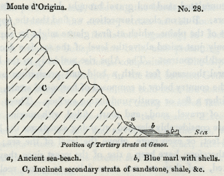
No. 28: Position of Tertiary strata at Genoa.
a, Ancient sea-beach.
b, Blue marl with shells.
C, Inclined secondary strata of sandstone, shale, &c.
Savona. -- At Savona, proceeding westwards, we find deposits of blue marl like those of Genoa, and occupying a corresponding geological position at the base of the mountains near the sea. The shells, collected from these marls by Mr. Murchison and myself, in 1828, were examined by Signor Bonelli, of Turin, and found to agree with Subapennine fossils.
Albenga. -- At Albenga these formations occupy a more extensive tract, forming the plains around that town and the low hills of the neighbourhood, which reach in some spots an elevation of 300 feet. The encircling mountains recalled to my mind those which bound the plain and bay of Palermo, and other bays of the Mediterranean, which are surrounded by bold rocky coasts.
The general resemblance of the Albenga strata to the Subapennine beds is very striking, the lowest division consisting of blue marl, which is covered by sand and yellow clay, and the highest by a mass of stratified shingle, sometimes consolidated into a conglomerate. Dr. Sasso has collected about 200 species of shells from these beds, and it appears, by his catalogue, that they agree, for the most part, with the northern Subapennine fossils, more than half of them belonging to recent species. [10]
Nice. -- At Nice the tertiary strata are upraised to a much greater height, but they may still be said to lie at the base of the Alps which tower above them. Here, also, they consist principally of blue marl and yellow sand, which appear to have been deposited in submarine valleys previously existing in the inclined secondary strata. In one district, a few miles to the west of Nice, the tertiary beds are almost exclusively composed of conglomerate, from the point of their junction with the secondary strata to the sea.
The river Magnan flows in a deep valley which terminates at its upper extremity in a narrow ravine. Nearly vertical precipices are laid open on each side, varying from 200 to 600 feet in height, and composed of inclined beds of shingle, sometimes separated by layers of sand, and more rarely by blue micaceous marl. The pebbles in these stratified shingles agree in composition with those now brought down from the Alps by the Var and other rivers on this coast.
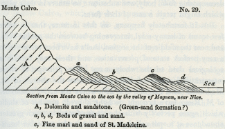
No. 29.
Section from Monte Calvo to the sea by the valley of Magnan, near Nice.
A, Dolomite and sandstone. (Green-sand formation?)
a, b, d, Beds of gravel and sand.
e, Fine marl and sand of St. Madeleine.
The dip of the strata is remarkably uniform, being always southwards, or towards the Mediterranean, at an angle of about 25°. In summer, when the bed of the river is dried up, the geologist has a good opportunity of examining a section of the strata, as the channel crosses for many miles the line of bearing of the beds, which may be traced to the base of Monte Calvo, a distance of about nine miles in a straight line from the Mediterranean. [11] It is usually impossible to determine the exact age of such accumulations of sand and gravel, in consequence of the total absence of organic remains. Their nonexistence may depend chiefly on the disturbed state of the waters, where great beds of shingle are formed, which are known to prevent testacea and fishes from living in Alpine torrents, partly on the destruction of shells by the same friction which rounded the pebbles, and partly on the permeability of the matrix to water, which may carry away the elements of the decomposing fossil body, and substitute no others in their place which might retain a cast of their form.
But it fortunately happens, in this instance, that in some few seams of loamy marl, intervening between the pebble-beds, and near the middle of the section, shells have been preserved in a very perfect state of preservation, and these may furnish a zoological date to the whole mass. The principal of these interstratified masses of loam occurs near the church of St. Madeleine (at c, diagram No. 29), where the active researches of M. Risso have brought to light a great number of shells which agree perfectly with the species found in much greater abundance at a spot called La Trinita, and some other localities nearer to Nice. From these fossils it clearly appears that the formation belongs to the older Pliocene era.
Such alternations of gravel and the usual thin layers of fine sediment may easily be explained, if we reflect that the rivers now flowing from the Maritime Alps are nearly dried up in summer, and have only strength to drift along fine mud to the sea; whereas, in winter, or on the melting of the snow, they roll along large quantities of pebbles. The thicker masses of loam, such as that of St. Madeleine, may have been produced during a longer interval, when the river shifted for a time the direction of its principal channel of discharge, so that nothing but fine mud was for a series of years conveyed to that point in the bed of the sea opposite the delta.
Uniform and continuous as the strata appear, on a general view, in the ravine of the Magnan, we discover, if we attempt to trace anyone of them for some distance, that they thin out and are wedge-shaped. We believe that they were thrown down originally upon a steep slanting bank or talus, which advanced gradually from the base of Monte Calvo to the sea. The distance between these points is, as we have before mentioned, about nine miles, so that the accumulation of superimposed strata would be a great many miles in thickness, if they were placed horizontally upon one another. The strata nearest to Monte Calvo, which may be expressed by a, are certainly older than those at b, and the group b was formed before c. The aggregate thickness, in anyone place, cannot he proved to amount to 1000 feet, although it may, perhaps, be much greater. But it may never exceed three or four thousand feet; whereas, if we did not suppose that the beds were originally deposited in an inclined position, we should be forced to imagine that a sea, many miles in depth, had been filled up by horizontal strata of pebbles thrown down one upon another.
At no great distance on this coast the Var is annually seen to sweep down into the sea a large quantity of gravel, which may be spread out by the waves and currents over a considerable space. The sea at the mouth of this river is now shallow, but it may originally have been 3000 feet deep, as it is now close to the shore at Nice. Here, therefore, a formation resembling that of the Magnan above described may be in progress.
The time required for the accumulation of such a mass of conglomerate as we have just considered must be immense: on what ground such formations have been frequently referred to diluvial waves and to periods of great disturbance, we could never understand, for the causes now in diurnal action at the foot of the Maritime Alps and other analogous situations seem to us quite sufficient to explain their origin.
Tertiary strata at the eastern extremity of the Pyrenees. -- We shall conclude this chapter with one more example derived from a region not far distant. On the borders of the Mediterranean at the eastern extremity of the Pyrenees, in the South of France, a considerable thickness of tertiary strata are seen in the valleys of the rivers Tech, Tet, and Gly. They bear much resemblance to those already described, consisting partly of a great thickness of conglomerate, and partly of clay and sand, with subordinate beds of lignite. They abut against the primary formation of the Pyrenees, which here consists of mica-schist. Between Ceret and Boulon these tertiary strata are seen inclined at an angle of between 20° and 30°. The shells which I procured from several localities were recognized by M. Deshayes as agreeing with Subapennine fossils.
Spain -- Morea. -- It appears from the recent observations of Colonel Silvertop, that marine strata of the older Pliocene period occur in patches at Malaga, and in Granada, in Spain. They have also been discovered by MM. Boblaye and Virlet in the Morea, and the names of many of the shells brought from thence are given in the Appendix No. I.
_______________
Notes:
1. Above, p. 54.
2. Conch. Foss. Subap., tom. i. p. 148.
3. Ibid., p. 147.
4. Ibid., p. 166.
5. Conch. Foss. Subap., tom. i. p. 143.
6. Syst. of Geol., vol. i. chap. xv.
7. Conch. Foss. Subap., tom. i. p. 82.
8. Ibid., p. 78.
9. I have to acknowledge the assistance of Professor Viviani and Dr. Sasso who called my attention to these phenomena when I visited Genoa in Jan. 1829.
10. Giomale Ligustico, Genoa, 1827.
11. I examined this section in company with Mr. Murchison in 1828.
Geological monuments of the older Pliocene period – Subapennine formations – Opinions of Brocchi – Different groups termed by him Subapennine are not all of the same age – Mineral composition of the Subapennine formations – Marls – Yellow sand and gravel – Subapennine beds how formed – Illustration derived from the Upper Val d'Arno – Organic remains of Subapennine hills – Older Pliocene strata at the base of the Maritime Alps – Genoa – Savona – Albenga – Nice – Conglomerate of Valley of Magnan – Its origin – Tertiary strata at the eastern extremity of the Pyrenees
OLDER PLIOCENE FORMATIONS.
WE must now carry back our retrospect one step farther, and treat of the monuments of the era immediately antecedent to that last considered. We defined in the fifth chapter, [1] the zoological characters by which the strata of the older Pliocene period may be distinguished, and we shall now proceed at once to describe some of the principal groups which answer to those characters.
Subapennine strata. -- The Apennines, it is well known, are composed chiefly of secondary rocks, forming a chain which branches off from the Ligurian Alps and passes down the middle of the Italian peninsula. At the foot of these mountains, on the side both of the Adriatic and the Mediterranean, arc found a series of tertiary strata, which form, for the most part, a line of low hills occupying the space between the older chain and the sea. Brocchi, the first Italian geologist who described this newer group in detail, gave it the name of the Subapennines, and he classed all the tertiary strata of Italy, from Piedmont to Calabria, as parts of the same system. Certain mineral characters, he observed, were common to the whole, for the strata consist generally of light brown or blue marl, covered by yellow calcareous sand and gravel. There are also, he added, some species of fossil shells which are found in these deposits throughout the whole of Italy.
In a catalogue, published by Lamarck, of 500 species of fossil-shells of the Paris basin, a small number only were enumerated as identical with those of Italy, and only 20 as agreeing with living species. This result, said Brocchi, is wonderful, and very different from that derived from a comparison of the fossil-shells of Italy, more than half of which agree with species now living in the Mediterranean, or in other seas, chiefly of hotter climates. [2]
He also stated, that it appeared from the observations of Parkinson, that the clay of London, like that of the Subapennine hills, was covered by sand (alluding to the Crag), and that in that upper formation of sand in England the species of shells corresponded much more closely with those now living in the ocean than did the species of the subjacent clay. Hence he inferred that an interval of time had separated the origin of the two groups. But in Italy, he goes on to say, the shells found in the marl and superincumbent sand belong entirely to the same group, and must have been deposited under the same circumstances. [3]
Notwithstanding the correctness of these views, Brocchi conceived that the Italian tertiary strata, as a whole, might agree with those of the basins of Paris and London, and he endeavoured to explain the discordance of their fossil contents by remarking, that the testacea of the Mediterranean differ now from those living in the ocean. [4] In attempting thus to assimilate the age of these distinct groups, he was evidently influenced by his adherence to the anciently-received theory of the gradual fall of the level of the ocean, to which, and not to the successive rise of the land, he attributed the emergence of the tertiary strata, all of which he consequently imagined to have remained under water down to a comparatively recent period.
Brocchi was perfectly justified in affirming that there were some species of shells common to all the strata called by him Subapennine; but we have shown that this fact is not inconsistent with the conclusion, that the several deposits may have originated at different periods, for there are species of shells common to all the tertiary eras. He seems to have been aware, however, of the insufficiency of his data, for in giving a list of species universally distributed throughout Italy, he candidly admits his inability to determine whether the shells of Piedmont were all identical with those of Tuscany, and whether those of the northern and southern extremities of Italy corresponded. [5]
We have already satisfactory evidence that the Subapennine beds of Brocchi belonged, at least, to three periods. To the Miocene we can refer a portion of the strata of Piedmont, those of the hill of the Superga, for example; to the older Pliocene belong the greater part of the strata of northern Italy and of Tuscany, and perhaps those of Rome; to the newer Pliocene, the tufaceous formations of Naples, the calcareous strata of Otranto, and probably the greater part of the tertiary beds of Calabria.
That there is a considerable correspondence in the arrangement and mineral composition of these different Italian groups is undeniable; but not that close resemblance which should lead us to assume an exact identity of age, even had the fossil remains been less dissimilar.
Very erroneous notions have been entertained respecting the contrast between the lithological characters of the Italian strata and certain groups of higher antiquity. Dr. Macculloch has treated of the Italian tertiary beds under the general title of 'elevated submarine alluvia,' and the overlying yellow sand and gravel may, according to him, be wholly, or in part, a terrestrial alluvium. [6] Had he visited Italy, we are persuaded that he would never have considered the tertiary strata of London and Paris as belonging to formations of a different order from the Subapennine groups, or as being more regularly stratified. He seems to have been misled by Brocchi's description, who contrasts the more crystalline and solid texture of the older secondary rocks of the Apennines with the loose and incoherent nature of the Subapennine beds, which resemble, he says, the mud and sand now deposited by the sea.
We have endeavoured, in the last chapter, to restrict within definite limits the meaning of the term alluvium; but if the Subapennine beds are to be designated 'marine alluvia,' the same name might, with equal propriety, be applied not only to the argillaceous and sandy groups of the London and Hampshire basins, but to a very great portion of our secondary series where the marls, clays, and sands are as imperfectly consolidated as the tertiary strata of Italy in general.
They who have been inclined to associate the idea of the more stony texture of stratified deposits with a comparatively higher antiquity, should consider how dissimilar, in this respect, are the tertiary groups of London and Paris, although admitted to be of contemporaneous date, or they should visit Sicily and behold a soft brown marl, identical in mineral character with that of the Subapennine beds, underlying a mass of solid and regularly stratified limestone, rivalling the chalk of England in thickness. This Sicilian marl is older than the superincumbent limestone, but newer than the Subapennine marl of the north of Italy; for in the latter the extinct shells rather predominate over the recent, in the former the recent predominate almost to the exclusion of the extinct.
We shall now consider more particularly the characters of those Subapennine beds which we refer to the older Pliocene period.
Subapennine marls. -- The most important member of the Subapennine formation is a marl which varies in colour from greyish brown to blue. It is very aluminous, and usually contains much calcareous matter and scales of mica. It often exhibits no lines of division throughout a considerable thickness, but in other places it is thinly laminated. Near Parma, for example, I have counted thirty distinct laminae in the thickness of an inch. In some of the hills near that city the marl attains, according to Signor Guidotti, a thickness of nearly 2000 feet, and is charged throughout with shells, many of which are such as inhabit a deep sea. They often occur in layers in such a manner as to indicate their slow and gradual accumulation. They are not flattened but are filled with marl. Beds of lignite are sometimes interstratified, as at Medesano, four leagues from Parma; subordinate beds of gypsum also occur in many places, as at Vigolano and Bargone, in the territory of Parma, where they are interstratified with shelly marl and sand. At Lezignano, in the Monte Cerio, the sulphate of lime is found in lenticular crystals, in which unaltered shells are sometimes included. Signor Guidotti, who showed me specimens of this gypsum, remarked, that the sulphuric acid must have been fully saturated with lime when the shells were enveloped, so that it could not act upon the shell. According to Brocchi, the marl sometimes passes from a soft and pulverulent substance into a compact limestone, [7] but it is rarely found in this solid form. It is also occasionally interstratified with sandstone.
The marl constitutes very frequently the surface of the country, having no covering of sand. It is sometimes seen reposing immediately on the Apennine limestone; more rarely gravel intervenes, as in the hills of' San Quirico. [8] Volcanic rocks are here and there superimposed, as at Radicofani, in Tuscany, where a hill composed of marl, with some few shells interspersed, is capped by basalt. Several of the volcanic tuffs in the same place are so interstratified with the marls as to show that the eruptions took place in the sea during the older Pliocene period. At Acquapendente, Viterbo, and other places, hills of the same formation are capped with trachytic lava, and with tuffs which appear evidently to have been subaqueous.
Yellow Sand. -- The other member of the Subapennine group, the yellow sand and conglomerate, constitutes, in most of the places where I have seen it, a border formation near the junction of the tertiary and secondary rocks. In some cases, as near the town of Sienna, we see sand and calcareous gravel resting immediately on the Apennine limestone, without the intervention of any blue marl. Alternations are there seen of beds containing fluviatile shells, with others filled exclusively with marine species; and I observed oysters attached to many of the pebbles of limestone. This locality appears to have been a point where a river, flowing from the Apennines, entered the sea in which the tertiary strata were formed.
Between Florence and Poggibonsi, in Tuscany, there is a great range of conglomerate of the Subapennine beds, which is seen for eleven miles continuously from Casciano to the south of Barberino. The pebbles are chiefly of whitish limestone with some sandstone. On receding from the older Apennine rocks, the conglomerate passes into yellow sand and sandstone, with shells, the whole overlying blue marl. In such cases we may suppose the deltas of rivers and torrents to have gained upon the bed of a sea where blue marl had previously been deposited.
The upper arenaceous group above described sometimes passes into a calcareous sandstone, as at San Vignone. It contains lapidified shells more frequently than the marl, owing probably to the more free percolation of mineral waters, which often dissolve and carry away the original component elements of fossil bodies .and substitute others in their place. In some cases the shells imbedded in this group are silicified, as at San Vitale, near Parma, from whence I saw two species, one freshwater and the other marine (Limnea palustris, and Cytherea concentrica, Lamk.), both recent and perfectly converted into flint.
On the other hand, the shells of Monte Mario, near Rome, which are probably referrible to the same formation, are changed into calcareous spar, the form being preserved notwithstanding the crystallization of the carbonate of lime.
Mode of formation of the Subapennine beds. -- The tertiary strata above described have resulted from the waste of the secondary rocks which now form the Apennines, and which had become dry land before the older Pliocene beds were deposited. In the territory of Placentia we have an opportunity of observing the kind of sediment which the rivers are now bringing down from the Apennines. The tertiary marl of that district being too calcareous to be used for bricks or pottery., a substitute is obtained, by conveying into tanks the turbid waters of the rivers Braganza, Parma, Taro and Enza. In the course of a year a deposit of brown clay, much resembling some of the Subapennine marl., is procured, several feet in thickness, divided into thin laminae of different shades of colour.
In regard to the sand and gravel., we see yellow sand thrown down by the Tiber near Rome, and by the Arno., at Florence. The northern part of the Apennines consists of a grey micaceous sandstone with an argillaceous base, alternating with shale, from the degradation of which brown clay and sand would result. If a river flow through such strata., and some one of its tributaries drains the ordinary limestone of the Apennines, the clay will become marly by the intermixture of calcareous matter. The sand is frequently yellow from being stained by oxide of iron, but this colour is by no means constant.
The similarity in composition of the tertiary strata in the basins of the Po., Arno, and Tiber, is merely such as might be expected to arise from their having been all derived from the disintegration of the same continuous chain of secondary rocks. But it does not follow that the latter rocks were all upheaved and exposed to degradation at the same time. The correspondence of the tertiary groups consists in their being all alike composed of marl, clay, and sand; but we might say the same of the London and Hampshire basins, although the English and Italian groups, thus compared, belong nearly to the two opposite extremes of the tertiary series.
The similarity in mineral character of the lacustrine de posit of the Upper Val d'Arno, and the marine Subapennine hills of northern Italy, ought, we think, to serve as a caution to the geologist, not to infer too hastily a contemporaneous origin from identity of mineral composition. The deposit of the Upper Val d'Arno occurs nearly at the bottom of a deep narrow valley, which is surrounded by precipitous rocks of secondary sandstone and shale (the macigno of the Italians and greywacke of the Germans). Hills of yellow sand, of considerable thickness, appear around the margin of the small basin, while, towards the central parts, where there has been considerable denudation, and where the Arno flows, blue clay is seen underlying the yellow sand. The shells are of freshwater origin, but we shall speak more particularly of them when we discuss the probable age of this formation in the sixteenth chapter. We desire, at present, to call the reader's attention to the fact, that we have here, in an isolated basin, such a formation as would result from the waste of the contiguous .secondary rocks of the Apennines, fragments of which rocks are found in the sand and conglomerate. We should expect that if the freshwater beds were removed, and the barrier of the lake-basin closed up again, similar sediment would be again deposited, for the aqueous agents would operate in the same manner, at whatever period they might be in activity. Now, the only difference, in mineral composition, between the lacustrine deposit above alluded to, and the ordinary marine strata of the Subapennine beds, consists in the absence of calcareous matter from the clay, the torrents flowing into the lake having passed over no limestone rocks.
The lithological character of the Subapennine beds varies in different parts of the peninsula both in colour and degree of solidity. The presence, also, or absence of lignite and gypsum, and the association or non-association of volcanic rocks, are causes of great local discrepancy. The superposition of the sand and conglomerate to the marl, on the other hand, is a general point of agreement, although there are exceptions to the rule, as at San Quirico before mentioned. The cause of this arrangement may be, as we before hinted, that the arenaceous groups were first formed on the coast where rivers entered, and when these pushed their deltas farther out, they threw down the sand upon part of the bed of the sea already occupied by finer and more transportable mud.
Organic Remains. -- I have been informed, by experienced collectors of the Subapennine fossils, that they invariably procure the greatest number in those winters when the rains are most abundant, an annual crop, as it were, being washed out of the soil to replace those which the action of moisture, frost, and the rays of the sun, soon reduce to dust upon the surface.
The shells in general are soft when first taken from the marl, but they become hard when dried. The superficial enamel is often well preserved, and many shells retain their pearly lustre, and even part of their external colour, and the ligament which unites the valves. No shells are more usually perfect than the microscopic, which abound near Sienna, where more than a thousand full-grown individuals are sometimes poured out of the interior of a single univalve of moderate dimensions. In some large tracts of yellow sand it is impossible to detect a single fossil, while in other places they occur in profusion.
The Subapennine testacea are referrible to species and fami lies of which the habits are extremely diversified, some living in deep, others in shallow water, some in rivers or at their mouths. I have seen a specimen of a fresh-water univalve (Limnea palustris), taken from the blue marl near Parma, full of small marine shells. It may have been floated down by the same causes which carried wood and leaves into the ancient sea.
Blocks of Apennine limestone are found in this formation drilled by lithodomous shells. The remains not only of testacea and corals, but of fishes and crabs, are met with, as also those of cetacea, and even of terrestrial quadrupeds.
A considerable list of mammiferous species has been given by Brocchi and some other writers; and, although several mistakes have been made, and the bones of cetacea have sometimes been confounded with those of land animals, it is still indubitable that the latter were carried down into the sea when the Subapennine sand and marl were accumulated. The same causes which drifted skeletons into lakes, such as that of the upper Val d'Arno, may have carried down others into firths or bays of the sea. The femur of an elephant has been disinterred with oysters attached to it, showing that it remained for some time exposed after it was drifted into the sea.
Strata at the base of the Maritime Alps. -- If we pass from the Italian peninsula, and, following the borders of the Mediterranean, examine the tertiary strata at the foot of the Maritime Alps, we find formations agreeing in zoological characters with the Subapennine beds, and presenting many points of analogy in their mineral composition. The Alps, it is well known, terminate abruptly in the sea, between Genoa and Nice, and the steep declivities of that bold coast are continuous below the waters, so that a depth of many hundred fathoms is often found within stone's-throw of the beach. Exceptions occur only where streams and torrents enter the sea, and at these points there is always a low level tract, intervening between the mouth of the stream and the precipitous escarpment of the mountains.
In travelling from France to Genoa, by the new coast-road, we are principally conveyed along a ledge excavated out of the side of a steep slope or precipice, in the same manner as on the roads which traverse the great interior passes of the Alps, such as the Simplon and Mont Cenis, the difference being that, in this case, the traveller has always the sea below him, instead of a river. But we are obliged occasionally to descend by a zig-zag course into those low plains before alluded to, which, when viewed from above, have the appearance of bays deserted by the sea. They are surrounded on three sides by rocky eminences, and the fourth is open to the sea.
These leading features in the physical geography of the country are intimately connected with its geological structure. The rocks composing the Alpine declivities consist partly of primary formations, but more generally of secondary, which have undergone immense disturbance; but when we examine the low tracts before-mentioned, we find the surface covered with great beds of gravel and sand, such as are now annually brought down by torrents and streams in the winter, and which are spread in such quantity over the wide and shifting river-channels as to render the roads for a season impassable. The first idea which naturally suggests itself, on viewing these plains, is to imagine them to be deltas or spaces converted into land by the accumulated sand and gravel brought down from the Alps by rivers. But, on closer inspection, we find that the apparent lowness of the plains, which at first glance might be supposed to be only just raised above the level of the sea, is a deception produced by contrast. The Alps rise suddenly to the height of several thousand feet with a bold and precipitous outline, while the country below is composed of horizontal strata, which have either a flat or gently-undulating surface. These strata consist of gravel, sand, and marl, filled with marine shells. They are considerably elevated, attaining sometimes the height of 200 feet, or even more, above the level of the sea; there must, therefore, have been a rise of the coast since they were deposited, and they are not mere deltas or spaces reclaimed from the sea by rivers. Why, then, are the strata found only at the points where rivers enter?
We must imagine that, after the coast had nearly acquired its present configuration, the streams which flowed down into the Mediterranean produced shoals opposite their mouths by the continual drifting in of gravel, sand, and mud. The Alps were afterwards raised to a sufficient height to cause these shoals to become land, while no perceptible alteration was produced on intervening parts of the coast, where the sea was of great depth near the shore.
The disturbing force appears to have acted very irregularly, and to have produced the least elevation towards the eastern extremity of the Maritime Alps, and a greater amount as we proceed westward. Thus we find the marine tertiary strata attaining the height of about 100 feet at Genoa, 200 and 300 feet farther westward, at Albenga, and 800 or 900 feet in the neighbourhood of Nice.
Genoa. -- At Genoa the tertiary strata consist of blue marls like those of the northern Subapennines, and contain the same shells. On the immediate site of the town they rise to the height of only 20 feet above the sea, but they reach about 80 feet in some parts of the suburbs. At the base of a mountain not far from the suburbs there is an ancient beach, strewed with rounded blocks of Alpine rocks, some of which are drilled by the Modiola lithophaga, Lamk., the whole cemented into a conglomerate, [9] which marks the ancient sea- beach at the height of 100 feet above the present sea.
No. 28: Position of Tertiary strata at Genoa.
a, Ancient sea-beach.
b, Blue marl with shells.
C, Inclined secondary strata of sandstone, shale, &c.
Savona. -- At Savona, proceeding westwards, we find deposits of blue marl like those of Genoa, and occupying a corresponding geological position at the base of the mountains near the sea. The shells, collected from these marls by Mr. Murchison and myself, in 1828, were examined by Signor Bonelli, of Turin, and found to agree with Subapennine fossils.
Albenga. -- At Albenga these formations occupy a more extensive tract, forming the plains around that town and the low hills of the neighbourhood, which reach in some spots an elevation of 300 feet. The encircling mountains recalled to my mind those which bound the plain and bay of Palermo, and other bays of the Mediterranean, which are surrounded by bold rocky coasts.
The general resemblance of the Albenga strata to the Subapennine beds is very striking, the lowest division consisting of blue marl, which is covered by sand and yellow clay, and the highest by a mass of stratified shingle, sometimes consolidated into a conglomerate. Dr. Sasso has collected about 200 species of shells from these beds, and it appears, by his catalogue, that they agree, for the most part, with the northern Subapennine fossils, more than half of them belonging to recent species. [10]
Nice. -- At Nice the tertiary strata are upraised to a much greater height, but they may still be said to lie at the base of the Alps which tower above them. Here, also, they consist principally of blue marl and yellow sand, which appear to have been deposited in submarine valleys previously existing in the inclined secondary strata. In one district, a few miles to the west of Nice, the tertiary beds are almost exclusively composed of conglomerate, from the point of their junction with the secondary strata to the sea.
The river Magnan flows in a deep valley which terminates at its upper extremity in a narrow ravine. Nearly vertical precipices are laid open on each side, varying from 200 to 600 feet in height, and composed of inclined beds of shingle, sometimes separated by layers of sand, and more rarely by blue micaceous marl. The pebbles in these stratified shingles agree in composition with those now brought down from the Alps by the Var and other rivers on this coast.
No. 29.
Section from Monte Calvo to the sea by the valley of Magnan, near Nice.
A, Dolomite and sandstone. (Green-sand formation?)
a, b, d, Beds of gravel and sand.
e, Fine marl and sand of St. Madeleine.
The dip of the strata is remarkably uniform, being always southwards, or towards the Mediterranean, at an angle of about 25°. In summer, when the bed of the river is dried up, the geologist has a good opportunity of examining a section of the strata, as the channel crosses for many miles the line of bearing of the beds, which may be traced to the base of Monte Calvo, a distance of about nine miles in a straight line from the Mediterranean. [11] It is usually impossible to determine the exact age of such accumulations of sand and gravel, in consequence of the total absence of organic remains. Their nonexistence may depend chiefly on the disturbed state of the waters, where great beds of shingle are formed, which are known to prevent testacea and fishes from living in Alpine torrents, partly on the destruction of shells by the same friction which rounded the pebbles, and partly on the permeability of the matrix to water, which may carry away the elements of the decomposing fossil body, and substitute no others in their place which might retain a cast of their form.
But it fortunately happens, in this instance, that in some few seams of loamy marl, intervening between the pebble-beds, and near the middle of the section, shells have been preserved in a very perfect state of preservation, and these may furnish a zoological date to the whole mass. The principal of these interstratified masses of loam occurs near the church of St. Madeleine (at c, diagram No. 29), where the active researches of M. Risso have brought to light a great number of shells which agree perfectly with the species found in much greater abundance at a spot called La Trinita, and some other localities nearer to Nice. From these fossils it clearly appears that the formation belongs to the older Pliocene era.
Such alternations of gravel and the usual thin layers of fine sediment may easily be explained, if we reflect that the rivers now flowing from the Maritime Alps are nearly dried up in summer, and have only strength to drift along fine mud to the sea; whereas, in winter, or on the melting of the snow, they roll along large quantities of pebbles. The thicker masses of loam, such as that of St. Madeleine, may have been produced during a longer interval, when the river shifted for a time the direction of its principal channel of discharge, so that nothing but fine mud was for a series of years conveyed to that point in the bed of the sea opposite the delta.
Uniform and continuous as the strata appear, on a general view, in the ravine of the Magnan, we discover, if we attempt to trace anyone of them for some distance, that they thin out and are wedge-shaped. We believe that they were thrown down originally upon a steep slanting bank or talus, which advanced gradually from the base of Monte Calvo to the sea. The distance between these points is, as we have before mentioned, about nine miles, so that the accumulation of superimposed strata would be a great many miles in thickness, if they were placed horizontally upon one another. The strata nearest to Monte Calvo, which may be expressed by a, are certainly older than those at b, and the group b was formed before c. The aggregate thickness, in anyone place, cannot he proved to amount to 1000 feet, although it may, perhaps, be much greater. But it may never exceed three or four thousand feet; whereas, if we did not suppose that the beds were originally deposited in an inclined position, we should be forced to imagine that a sea, many miles in depth, had been filled up by horizontal strata of pebbles thrown down one upon another.
At no great distance on this coast the Var is annually seen to sweep down into the sea a large quantity of gravel, which may be spread out by the waves and currents over a considerable space. The sea at the mouth of this river is now shallow, but it may originally have been 3000 feet deep, as it is now close to the shore at Nice. Here, therefore, a formation resembling that of the Magnan above described may be in progress.
The time required for the accumulation of such a mass of conglomerate as we have just considered must be immense: on what ground such formations have been frequently referred to diluvial waves and to periods of great disturbance, we could never understand, for the causes now in diurnal action at the foot of the Maritime Alps and other analogous situations seem to us quite sufficient to explain their origin.
Tertiary strata at the eastern extremity of the Pyrenees. -- We shall conclude this chapter with one more example derived from a region not far distant. On the borders of the Mediterranean at the eastern extremity of the Pyrenees, in the South of France, a considerable thickness of tertiary strata are seen in the valleys of the rivers Tech, Tet, and Gly. They bear much resemblance to those already described, consisting partly of a great thickness of conglomerate, and partly of clay and sand, with subordinate beds of lignite. They abut against the primary formation of the Pyrenees, which here consists of mica-schist. Between Ceret and Boulon these tertiary strata are seen inclined at an angle of between 20° and 30°. The shells which I procured from several localities were recognized by M. Deshayes as agreeing with Subapennine fossils.
Spain -- Morea. -- It appears from the recent observations of Colonel Silvertop, that marine strata of the older Pliocene period occur in patches at Malaga, and in Granada, in Spain. They have also been discovered by MM. Boblaye and Virlet in the Morea, and the names of many of the shells brought from thence are given in the Appendix No. I.
_______________
Notes:
1. Above, p. 54.
2. Conch. Foss. Subap., tom. i. p. 148.
3. Ibid., p. 147.
4. Ibid., p. 166.
5. Conch. Foss. Subap., tom. i. p. 143.
6. Syst. of Geol., vol. i. chap. xv.
7. Conch. Foss. Subap., tom. i. p. 82.
8. Ibid., p. 78.
9. I have to acknowledge the assistance of Professor Viviani and Dr. Sasso who called my attention to these phenomena when I visited Genoa in Jan. 1829.
10. Giomale Ligustico, Genoa, 1827.
11. I examined this section in company with Mr. Murchison in 1828.
- admin
- Site Admin
- Posts: 36175
- Joined: Thu Aug 01, 2013 5:21 am
Who is online
Users browsing this forum: No registered users and 13 guests