Freda Bedi Cont'd (#3)

This is a broad, catch-all category of works that fit best here and not elsewhere. If you haven't found it someplace else, you might want to look here.

Re: Freda Bedi Cont'd (#3)

Postby admin » Mon Sep 13, 2021 2:58 am

Kannauj [Kanyakubja] [Mahodaya c. 836–885 CE]
by Wikipedia
Accessed: 9/12/21


Delu is said to have been a prince of uncommon bravery and generosity; benevolent towards men, and devoted to the service of God. The most remarkable transaction of his reign is the building of the city of Delhi, which derives its name from its founder, Delu. In the fortieth year of his reign, Phoor, a prince of his own family, who was governor of Cumaoon, rebelled against the Emperor, and marched to Kinoge, the capital. Delu was defeated, taken, and confined in the impregnable fort of Rhotas.
Image
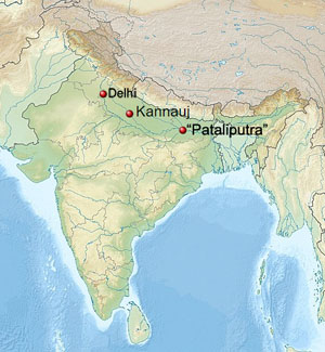
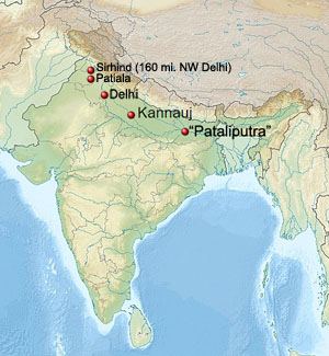
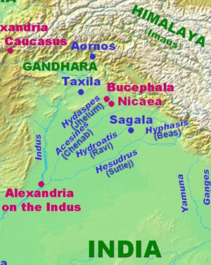
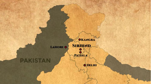
Sirhind / Patiala / Delhi / Kannauj / "Pataliputra"

Image
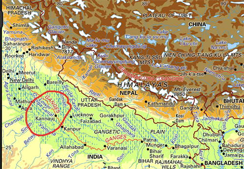
Kannauj, Encyclopedia Britannica

Phoor immediately mounted the throne of India, reduced Bengal, extended his power from sea to sea, and restored the empire to its pristine dignity. He died after a long reign, and left the kingdom to his son, who was also called Phoor, and was the same with the famous Porus, who fought against Alexander.

The second Phoor [Porus], taking advantage of the disturbances in Persia, occasioned by the Greek invasion of that empire under Alexander, neglected to remit the customary tribute, which drew upon him the arms of that conqueror. The approach of Alexander did not intimidate Phoor [Porus]. He, with a numerous army, met him at Sirhind, about one hundred and sixty miles to the north-west of Delhi, and in a furious battle, say the Indian historians, lost many thousands of his subjects, the victory, and his life. The most powerful prince of the Decan, who paid an unwilling homage to Phoor, or Porus, hearing of that monarch's overthrow, submitted himself to Alexander, and sent him rich presents by his son. Soon after, upon a mutiny arising in the Macedonian army, Alexander returned by the way of Persia.

Sinsarchund, the same whom the Greeks call Sandrocottus, assumed the imperial dignity after the death of Phoor, and in a short time regulated the discomposed concerns of the empire. He neglected not, in the mean time, to remit the customary tribute to the Grecian captains, who possessed Persia under, and after the death of, Alexander. Sinsarchund, and his son after him, possessed the empire of India seventy years. When the grandson of Sinsarchund acceded to the throne, a prince named Jona, who is said to have been a grand-nephew of Phoor, though that circumstance is not well attested, aspiring to the throne, rose in arms against the reigning prince, and deposed him.


-- The History of Hindostan, In Three Volumes, Volume I, by Alexander Dow, Esq., Lieutenant-Colonel in the Company's Service, 1812

Image
Kannauj
City
Goddess Annapurna Temple
Nickname(s): Perfume Capital of India
Image
Coordinates: 27.07°N 79.92°ECoordinates: 27.07°N 79.92°E
Country: India
State: Uttar Pradesh
District: Kannauj
Elevation: 139 m (456 ft)
Population: (2011) Total: 84,862
Languages: Official: Hindi, Urdu
Website http://www.kannauj.nic.in

Kannauj (Hindustani pronunciation: [kənːɔːd͡ʒ]) is a city, administrative headquarters and a municipal board or Nagar Palika Parishad in Kannauj district in the Indian state of Uttar Pradesh. The city's name is a modern form of the classical name Kanyakubja.[1] It was also known as Mahodaya during the time of Mihira Bhoja [c. 836–885 CE][ [2]

Kannauj is an ancient city.
It is said that the Kanyakubja Brahmins who included Shandilya (teacher of Rishi Bharadwaja) were held one of the three prominent families originally from Kannauj.[3]

In Classical India, it served as the center of imperial Indian dynasties. The earliest of these was the Maukhari dynasty, and later, Emperor Harsha of the Vardhana dynasty.[4] The city later came under the Gahadavala dynasty, and under the rule of Govindachandra, the city reached "unprecedented glory". Kannauj was also the main place of war in the Tripartite struggle between the Gurjars, the Palas and the Rashtrakutas.

However, the "glory of Imperial Kannauj" ended with conquests of the Delhi Sultanate.[5]

Kannauj is famous for distilling of scents. It is known as India’s perfume capital and is famous for its traditional Kannauj Perfume, a government protected entity,[6][7]

Kannauj itself has more than 200 perfume distilleries and is a market center for tobacco, Ittar (perfume), and rose water.[6] It has given its name to a distinct dialect of the Hindustani known as Kanauji, which has two different codes or registers.

History

Early history


Archaeological discoveries show that Kannauj was inhabited by the Painted Grey Ware and Northern Black Polished Ware cultures,[8] ca. 1200-600 BCE and ca. 700-200 BCE, respectively. Under the names of Kuśasthala and Kanyakubja, it is mentioned as a well-known town in the Hindu Epics, the Mahabharata and the Ramayana, and by the grammarian Patanjali (ca. 150 BCE).[9] The early Buddhist literature mentions Kannauj as Kannakujja, and refers to its location on the trade route from Mathura to Varanasi and Rajgir.[10]

Kannauj may have been known to the Greco-Roman civilization under the name of Kanagora or Kanogiza, which appears in Geography by Ptolemy (ca. 140 CE), but this identification is not confirmed. It was also visited by the Chinese Buddhist travellers Faxian and Xuanzang in the fifth and seventh centuries CE, respectively.[11]

Image
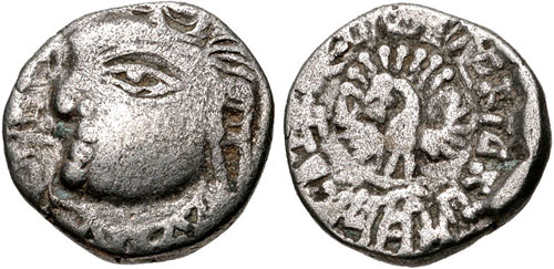
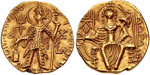
Coin of the Maukharis of Kannauj under Maharaja Isanavarman, circa 535-553 CE. [Peacock]

Image
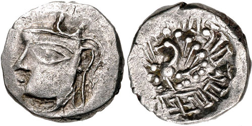
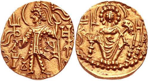
Coin of Emperor Harsha of the Vardhana dynasty, circa 606–647 CE. [Peacock][12]
Image
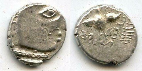
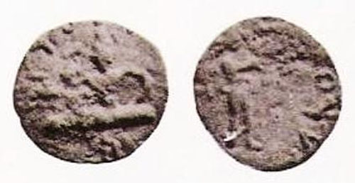
Moustachiod head of king right, wearing a simple crescent-topped crown, unread legend left / Fan-tailed peacock facing, crude Brahmi legend around: vijitavanir avanapati,13mm, 1.67 grams. Kanauj mint? Unpublished and unknown until recently. This is a coin of the famous king Harsha or Harshavardhana, who ascended the throne of Thaneswar, a small kingdom in present-day Haryana, at the age of 16, and then reconstituted the remnants of a large part of the fragmented Gupta empire in Northern India into a single realm. He moved his capital to Kanauj and had an illustrious reign of over 40 years. Harsha died in the year 647. He ruled for 41 years. After Harsha's death, his empire died with him. The kingdom disintegrated rapidly into small states. The succeeding period is very obscure and badly documented, but it marks the culmination of a process that had begun with the invasion of the Huns in the last years of the Gupta Empire.


Image
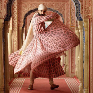
The Call of the Peacock A flamboyant men’s printed cotton angrakha in kanauj-pink coromandel chintz. By Sabyasachi, photo by Tarun Vishwa


Only Justin (Just. xii, 8) reports that Alexander had defeated the Prasii. Palibothra, the Prasiian capital was famous for peacocks. Lane Fox writes:
... Dhana Nanda's kingdom could have been set against itself and Alexander might yet have walked among Palimbothra's peacocks.

Curiously, Arrian writes that Alexander was so charmed by the beauty of peacocks that he decreed the severest penalties against anyone killing them (Arrian, Indica, xv.218). The picture of Alexander amidst peacocks appears puzzling: where did he come across the majestic bird? Does this fascination lead us to Palibothra?

-- An Altar of Alexander Now Standing at Delhi [EXPANDED VERSION], by Ranajit Pal


Kannauj formed part of the Gupta Empire. During the decline of the Gupta Empire in the 6th century, the Maukhari dynasty of Kannauj - who had served as vassal rulers under the Guptas - took advantage of the weakening of central authority, broke away and established control over large areas of northern India.[13]

Under the Maukharis, Kannauj continued to grow in importance and prosperity. It became the greatest city of Northern India under Emperor Harsha (r. 606 to 647 CE) of the Vardhana dynasty, who conquered it and made it his capital.[14][15] Chinese pilgrim Xuanzang visited India during the reign of Harsha, and described Kannauj as a large, prosperous city with many Buddhist monasteries.[16] Harsha died with no heir, resulting in a power vacuum until Maharaja Yashovarman seized power as the ruler of Kannauj.[4]

The Kannauj Triangle

See also: Raja Jasdhaval at Roopkund

These wars took place from late 8th to early 9th century CE, after which Gurjara Pratiharas retain control of Ujjain.

Kannauj became a focal point for three powerful dynasties, namely the Gurjara Pratiharas (r. 730-1036 CE), Palas (r. 750-1162 CE) and Rashtrakutas (r. 753-982 CE), between the 8th and 10th centuries. The conflict between the three dynasties has been referred to as the Tripartite struggle by many historians.[17][18]

Image
The Kanauj was the focal point of three empires: the Rashtrakutas of Deccan, the Gurjara Pratiharas of Malwa, and the Palas of Bengal.

There were initial struggles but ultimately the Gurjara Pratiharas succeeded in retaining the city.[17] The Gurjara-Pratiharas ruled Avanti (based at Ujjain), which was bounded to the South by the Rashtrakuta Empire, and the Pala Empire to the East. The Tripartite struggle began with the defeat of Indrayudh at the hands of Gurjara-Pratihara ruler Vatsaraja (r. 780-800 CE).[17] The Pala ruler Dharampala (~770-821 CE) was also keen to establish his authority at Kannauj, giving rise to a struggle between Vatsaraja and Dharmapala, in which Dharmapala was defeated.[19] Taking advantage of the chaos, the Rastrakuta ruler Dhruva Dharavarsha (r. 780–793 CE) surged northwards, defeated Vatsaraja, and took Kannauj for himself, completing the furthest northern expansion by a South Indian ruler.[18][20]

When the Rashtrakuta ruler Dhruva Dharavarsha advanced back to the south, Dharampala was left in control of Kannauj for some time. The struggle between the two northern dynasties of Palas and Gurjara Pratiharas continued: the Pala's vassal Chakrayudha (Dharmapala's nominee for Ujjain) was defeated by the Pratihara Nagabhata II (r. 805–833 CE), and Kannauj was again occupied by the Gurjara Pratiharas. Dharmapala tried to take control of Kannauj but was defeated badly at Moongher by the Gurjara Pratiharas.[17] However, Nagabhata II was in turn soon defeated by the Rashtrakuta Govinda III (r. 793–814 CE) , who had initiated a second northern surge. An inscription states that Chakrayudha and Dharmapala invited Govinda III to war against the Gurjara Pratiharas, but Dharmapala and Chakrayudh both submitted to the Govinda III, in order to win his sympathy. After this defeat, Pratihara power degenerated for some time. After the death of Dharampala, Nagabhata II regained hold over Kannuaj and made it the capital of the Gurjara Pratihara Empire. During this period, the Rashtrakutas were facing some internal conflicts, and so they, as well as the Pala Empire, did not contest this.[17] Thus Gurjara Pratiharas became the greatest power in Northern India after occupying Kannauj (9th century CE).[17]

Medieval times

Famous Pir-e-Kamil, Hazrat Pir Shah Jewna Al-Naqvi Al-Bokhari was also born in Kannauj in 1493 in the reign of King Sikandar Lodi. He was a descendant of Jalaluddin Surkh-Posh Bukhari and his father Syed Sadar-ud-din Shah Kabeer Naqvi Al Bukhari was a great saint and was also among the advisors of King Sikandar Lodhi. Shah Jewna migrated to Shah Jeewna (a town named after him) now in Pakistan. Shah Jewna’s colonized towns in Kannauj :- Siray- e-Miraan, Bibiyaan Jalalpur, Makhdoom Pur, Laal Pur (associated with the name of Saint Sayyed Jalaluddin Haider Surkh Posh Bukhari or Laal Bukhari). His descendants still present in various parts of India and Pakistan.[21][22][23][24]

Sultan Mahmud of Ghazni captured Kanauj in 1018. Chandradeva founded the Gahadvala dynasty with its capital at Kanauj around 1090. His grandson Govindachandra "raised Kanauj to unprecedented glory." Muhammad Ghori advanced against the city, and in the Battle of Chandwar of 1193 killed Jayachandra. Jai Chandra had earlier not supported Prithviraj Chauhan when the latter faced Muhammad Ghori and lost the Second Battle of Tarain in 1192

Alberuni has referred to "Kanoj" as the key geographical point to explain marching distances to other Indian cities [25] The "glory of Imperial Kanauj" ended with Iltutmish's conquest.[5]:21, 32–33

Sher Shah Suri defeated Humayun at the battle of Kannauj on 17 May 1540.

Colonial period

During early English rule in India, the city was spelled Cannodge by them. The Nawab Hakim Mehndi Ali Khan has been constantly associated with the development of city of kannouj by the travellers and writers of the period. A ghat (Mehndighat), a Sarai (for the free stay of travellers and merchants) and various metalled roads were built by the Nawab which also bear his name.

Geography

Kannauj is located at 27.07°N 79.92°E.[26] It has an average elevation of 139 metres (456 feet).

Demographics

As of 2001 India census,[27] Kannauj had a population of 71,530. Males constitute 53% of the population and females 47%. Kannauj has an average literacy rate of 58%: male literacy is 64%, and female literacy is 52%. In Kannauj, 15% of the population is under 6 years of age.

Colleges

Medical College


Government Medical College, Kannauj is a government medical college located in Tirwa of Kannauj, Uttar Pradesh, India. It is affiliated to King George's Medical University, Lucknow.

Engineering College

Government Engineering College, Kannauj is a government engineering college located at Kannauj. It is a constituent college of Dr. A.P.J. Abdul Kalam Technical University (formerly Uttar Pradesh Technical University) in Lucknow. The college is situated at Aher, Tirwa.

Transportation

The city is served by two major railway station Kannauj railway station and Kannauj City railway station. The nearest airport is Kanpur Airport situated about 2 hours drive from the town.

It is situated on GT road(Delhi to Kanpur). It has road transportation Kannauj Depo. under the Uttar Pradesh State Road Transportation Corporation(UPSRTC).

Notable people

• Āma, King of Kannauj
• Malini Awasthi, folk singer
• Mihira Bhoja, King of North India
• Shah Jewna, Missionary or Pir
• Sayyid Muhammad Qanauji, Sufi
• Samyukta, Princess of Kannauj
• Yashovarman, King of Kannauj

References

1. Rama Shankar Tripathi (1989). History of Kanauj: To the Moslem Conquest. Motilal Banarsidass Publ. p. 2. ISBN 978-81-208-0404-3.
2. https://timesofindia.indiatimes.com/blo ... rspective/
3. Upinder Singh (2008). A History of Ancient and Early Medieval India. Pearson Education India. p. 575. ISBN 9788131711200.
4. Tripathi, History of Kanauj, p.192
5. Sen, S.N., 2013, A Textbook of Medieval Indian History, Delhi: Primus Books, ISBN 9789380607344
6. "Life: India's perfume capital threatened by scent of modernity". The Taipei Times. Retrieved 10 February 2016.
7. Chisholm, Hugh, ed. (1911). "Kanauj" . Encyclopædia Britannica. 15 (11th ed.). Cambridge University Press. p. 648.
8. Dilip K. Chakrabarti (2007), Archaeological geography of the Ganga plain: the upper Ganga (Oudh, Rohilkhand, and the Doab), p.47
9. Rama S. Tripathi, History of Kanauj: To the Moslem Conquest (Motilal Banarsidass, 1964), pp.2,15-16
10. Moti Chandra (1977), Trade Routes in Ancient India pp.16-18
11. Tripathi, History of Kanauj, pp.17-19
12. "CNG: eAuction 329. INDIA, Post-Gupta (Ganges Valley). Vardhanas of Thanesar and Kanauj. Harshavardhana. Circa AD 606-647. AR Drachm (13mm, 2.28 g, 1h)". http://www.cngcoins.com.
13. Tripathi, History of Kanauj, pp.22-24
14. Tripathi, History of Kanauj, p.147
15. James Heitzman, The City in South Asia (Routledge, 2008), p.36
16. Heizman, The City in South Asia, pp.36-37
17. Pratiyogita Darpan. Upkar Prakashan. p. 9.
18. R.C. Majumdar (1994). Ancient India. Motilal Banarsidass. pp. 282–285. ISBN 978-81-208-0436-4.
19. Kumar Sundram (2007). Compendium General Knowledge. Upkar Prakashan. p. 195. ISBN 978-81-7482-181-2.
20. Pratiyogita Darpan. Upkar Prakashan.
21. "Pir-e-Kamil Hazrat Pir Shah Jewna Al-Naqvi Al-Bokhari". http://www.thenews.com.pk. Retrieved 1 January 2021.
22. "Hazrat Pir Shah Jewna (RA)". The Nation. 9 May 2012. Retrieved 1 January2021.
23. "Indian Journal Of Archaeology". ijarch.org. Retrieved 1 January 2021.
24. "Nazaria-i-Pakistan Trust". nazariapak.info. Retrieved 1 January 2021.
25. (India, Vol 1, from p 199 onwards, Translated by Dr Edward C. Sachau, London 1910).
26. Falling Rain Genomics, Inc – Kannauj
27. "Census of India 2001: Data from the 2001 Census, including cities, villages and towns (Provisional)". Census Commission of India. Archived from the original on 16 June 2004. Retrieved 1 November 2008.

Further reading

• Majumdar, R. C., In Pusalker, A. D., In Majumdar, A. K., & Bharatiya Vidya Bhavan,. (1993). The age of imperial Kanauj.

External links

• District Kannauj Website.
• Dugar, Divya (7 August 2012). "In pictures: Fading fragrance of Kannauj, India's perfume capital". CNN. Retrieved 1 January 2021.
• History of Kanauj: To the Moslem Conquest By Rama Shankar Tripathi

***********************************

Kahnuj
by Wikipedia
Accessed: 9/13/21
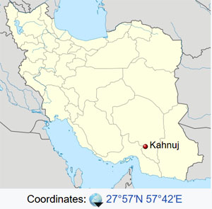
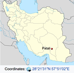
Bosworth writes that the name of the place where the victory was celebrated was Kahnuj. The name tells all, for Kanauj was the chief city of the Indians, the name of which is echoed in the famous city in eastern India which later became most important.29 [A. B. Bosworth, Conquest and Empire: The Reign of Alexander the Great (Cambridge 1988) 150, who gives the name Khanu (maps usually give the name Kohnouj or Kahnuj). Nearby Patali may have been Palibothra.]
As the winter deepened, Alexander approached the Carmanian capital, which Diodorus (xvii.106.4) names Salmus. It was, according to Nearchus (Arr. Ind. 33.7), five days' journey from the coast. The site remains a mystery,386 but it was probably at the western side of the valley of the Halil Rud, in the general vicinity of the modern town of Khanu. The army was in an area of relative plenty but close enough to the coast to receive news of the progress of Nearchus' fleet. There Alexander sacrificed to commemorate his Indian victory and the emergence from the Gedrosian desert, and he held a musical and athletic festival, a drunken and festive affair, notable for the general acclaim achieved by Alexander's favourite Bagoas when he entered the winning chorus.387 During the celebrations, if not before, news came of Nearchus' safe arrival at Harmozeia, the principal seaport of Carmania. The details are supplied for us by Nearchus, and they are open to justifiable suspicion. Nearchus has a rich story, full of dramatic peripeteia, in which he unexpectedly learns of the king's presence in the near vicinity, marches up county with a small escort, strangely missing the search parties sent out by his anxious king, and is finally retrieved, unrecognisable from brine and fatigue, to give the glad news of the fleet's survival to Alexander in person. The details of this Odyssey are beyond verification and there is very probably a good deal of imaginative embellishment.388 What is certain is that the fleet arrived at Harmozeia without serious loss and that its arrival was announced to Alexander by Nearchus in person. It was a moment of general exaltation, and, if we may believe Nearchus (Arr. Ind. 36.3), Alexander renewed the sacrifices and prolonged the games. The celebrations which had begun commemorating the delivery of the army from Gedrosia ended with thanks-offerings for the safe arrival of the fleet.

-- A. B. Bosworth, Conquest and Empire: The Reign of Alexander the Great (Cambridge 1988), p. 150

-- An Altar of Alexander Now Standing at Delhi [EXPANDED VERSION], by Ranajit Pal


Image
Kahnuj is located in Iran
Coordinates: 27°57′N 57°42′ECoordinates: 27°57′N 57°42′E
Country: Iran
Province: Kerman
County: Kahnuj
Bakhsh: Central
Population (2016 Census): 52,624 [1]

Kahnuj (Persian: كهنوج‎, also Romanized as Kahnūj)[2] is a city and capital of Kahnuj County, Kerman Province, Iran. At the 2006 census, its population was 38,571, in 8,278 families.[3] To the northwest is Mehroyeh Wildlife Refuge.

References

1. "Statistical Center of Iran > Home".
2. Kahnuj can be found at GEOnet Names Server, at this link, by opening the Advanced Search box, entering "-3756549" in the "Unique Feature Id" form, and clicking on "Search Database".
3. "Census of the Islamic Republic of Iran, 1385 (2006)" (Excel). Statistical Center of Iran. Archived from the original on 2011-11-11.
4. *"Average Maximum temperature in Kahnuj by Month 1989–2010". Iran Meteorological Organization. Retrieved April 8, 2015.[permanent dead link]
 "Average Mean Daily temperature in Kahnuj by Month 1989–2010". Iran Meteorological Organization. Retrieved April 8, 2015.
 "Average Minimum temperature in Kahnuj by Month 1989–2010". Iran Meteorological Organization. Retrieved April 8, 2015.[permanent dead link]
5. "Monthly Total Precipitation in Kahnuj by Month 1989–2010". Iran Meteorological Organization. Retrieved April 8, 2015.
6. "Average relative humidity in Kahnuj by Month 1989–2010". Iran Meteorological Organization. Retrieved April 8, 2015.[permanent dead link]
7. "No. Of days with precipitation equal to or greater than 1 mm in Kahnuj by Month 1989–2010". Iran Meteorological Organization. Retrieved April 8, 2015.[permanent dead link]
8. "Monthly total sunshine hours in Kahnuj by Month 1989–2010". Iran Meteorological Organization. Retrieved April 8, 2015.[permanent dead link]

*********************

Patali, Anbarabad
by Wikipedia
Accessed: 9/13/21

Image
Patali
village
Patali is located in Iran
Coordinates: 28°21′31″N 57°51′02″ECoordinates: 28°21′31″N 57°51′02″E
Country: Iran
Province: Kerman
County: Anbarabad
Bakhsh: Central
Rural District: Jahadabad
Population (2006): 492

Patali (Persian: پاتلي‎, also Romanized as Pātalī; also known as Kheyrābād-e Pātelī)[1] is a village in Jahadabad Rural District, in the Central District of Anbarabad County, Kerman Province, Iran. At the 2006 census, its population was 492, in 105 families.[2]

References

1. Patali can be found at GEOnet Names Server, at this link, by opening the Advanced Search box, entering "-3078059" in the "Unique Feature Id" form, and clicking on "Search Database".

2. "Census of the Islamic Republic of Iran, 1385 (2006)" (Excel). Statistical Center of Iran. Archived from the original on 2011-11-11.
admin
Site Admin
 
Posts: 36573
Joined: Thu Aug 01, 2013 5:21 am

Re: Freda Bedi Cont'd (#3)

Postby admin » Mon Sep 13, 2021 6:13 am

History of Sirhind
by Wikipedia
Accessed: 9/12/21


Image

Strictly construed, the gazetteer imports that Alexander claimed India up to the Sutlej; and it is possible enough that he did. Across the Beas, says Arr. 5, 25, 1, was a people aristocratically governed (i.e. an Aratta people) with many elephants. This can hardly go back to the Journal, from its form; probably it is Aristobulas repeating camp gossip, for the Aratta known to us had no elephants. But there may really have been an Aratta people there, and a great one, the Oxydracae, whom the late V. A. Smith did for other reasons place along the Beas. (The maps in the Cambridge History of India put them east of the lower Ravi; but Arrian shows that this was Malli country.) It is probably impossible to ascertain for certain where the Oxydracae really lived, though Arrian 6. 11. 3 implies that their centre was some distance away from that of the Malli; but if they did stretch north between Sutlej and Beas we can understand Arr. 5. 25, 1, and also justify the gazetteer's claim (if it be one) of the country up to the Sutlej; for the Oxydracae submitted and were (nominally) placed under a satrap. It leads also to a most interesting hypothesis. Strabo. 15, 687 ( ? from Megasthenes), says that the Persians got mercenaries from the [x]. If this, as I suppose, means the Oxydracae (Kshudraka), why did any Achaemenid go to so distant a people for mercenaries? Clearly because the nearer peoples were his subjects; i.e. we get some support for the suggestion that the rule of Darius I. had ended at the Beas, where Alexander's men refused to go on.

-- Alexander and the Ganges, by William Woodthorpe Tarn

Delu is said to have been a prince of uncommon bravery and generosity; benevolent towards men, and devoted to the service of God. The most remarkable transaction of his reign is the building of the city of Delhi, which derives its name from its founder, Delu. In the fortieth year of his reign, Phoor, a prince of his own family, who was governor of Cumaoon, rebelled against the Emperor, and marched to Kinoge, the capital. Delu was defeated, taken, and confined in the impregnable fort of Rhotas.
Image
Sirhind / Patiala / Delhi / Kannauj / "Pataliputra"

Phoor immediately mounted the throne of India, reduced Bengal, extended his power from sea to sea, and restored the empire to its pristine dignity. He died after a long reign, and left the kingdom to his son, who was also called Phoor, and was the same with the famous Porus, who fought against Alexander.

The second Phoor [Porus], taking advantage of the disturbances in Persia, occasioned by the Greek invasion of that empire under Alexander, neglected to remit the customary tribute, which drew upon him the arms of that conqueror. The approach of Alexander did not intimidate Phoor [Porus]. He, with a numerous army, met him at Sirhind, about one hundred and sixty miles to the north-west of Delhi, and in a furious battle, say the Indian historians, lost many thousands of his subjects, the victory, and his life. The most powerful prince of the Decan, who paid an unwilling homage to Phoor, or Porus, hearing of that monarch's overthrow, submitted himself to Alexander, and sent him rich presents by his son. Soon after, upon a mutiny arising in the Macedonian army, Alexander returned by the way of Persia.

Sinsarchund, the same whom the Greeks call Sandrocottus, assumed the imperial dignity after the death of Phoor, and in a short time regulated the discomposed concerns of the empire. He neglected not, in the mean time, to remit the customary tribute to the Grecian captains, who possessed Persia under, and after the death of, Alexander. Sinsarchund, and his son after him, possessed the empire of India seventy years. When the grandson of Sinsarchund acceded to the throne, a prince named Jona, who is said to have been a grand-nephew of Phoor, though that circumstance is not well attested, aspiring to the throne, rose in arms against the reigning prince, and deposed him.


-- The History of Hindostan, In Three Volumes, Volume I, by Alexander Dow, Esq., Lieutenant-Colonel in the Company's Service, 1812


Sirhind is the older name of Fatehgarh Sahib. It is situated on the Delhi to Lahore Highway. It has a population of about 60,851. It is now a district headquarters in the state of Punjab; the name of the district is Fatehgarh Sahib.

Tirgata Kingdom

It derives its name probably from Sairindhas, a tribe that according to Varahamihira (AD 505-87), Brihat Samhita, once inhabited this part of the country. According to Heuin Tsang, the Chinese traveller who visited India during the seventh century, Sirhind was the capital of the district of Shitotulo, or Shatadru (the River Sutlej), which was about 2000 H or 533 km in circuit. The Shatadru principality subsequently became part of the vast kingdom called Trigat of which Jalandhar was the capital.

Medieval Era

At the time of the struggle between the Hindushahi kings and the Turkish rulers of Ghazni, Sirhind was an important outpost on the eastern frontier of the Hindushahi empire. With the contraction of their territory under the Ghaznivid onslaught, the Hindushahi capital was shifted in 1012 to Sirhind, where it remained till the death of Trilochanpal, the last ruling king of the dynasty. At the close of the twelfth century, the town was occupied by the Chauhans. During the invasions of Muhammad Ghori, Sirhind, along with Bathinda, constituted the most important military outpost of Prithvi Raj Chauhan, the last Rajput ruler of Delhi. Under the Slave kings, Sirhind constituted one of the six territorial divisions of the Punjab. In the time of Emperor Akbar the rival towns of Sunam and Samana were subordinated to it and included in what was called Sirhind sarkar of the Subah of Delhi. It was refounded by Emperor Firuz Shah Tughlaq in 1361 AD at the behest of Sayyid Jalaluddin Bukhari, the spiritual guide of that King. He made it a new pargana by dividing the old fief of Samana. Firuz Shah dug a canal from the Sutlej. It was an important stronghold of Delhi Sultanate. In 1415 Khizr Khan the first Sayyid ruler of Delhi, nominated his son Malik Mubarak as a governor of Sirhind. in 1420 Khizr khan defeated insurgent Sarang Khan at Sirhind. In 1451 here, Bahlul Khan Lodhi assumed the title of Sultan under the governorship of Malik Sultan Shah Lodhi.

Mughal Empire

Under the Mughal's Sirhind was the second largest city of the Punjab and the strongest fortified town between Delhi and Lahore. The town also enjoyed considerable commercial importance. According to Nasir Ali Sirhindi, Tankhi Nasin, Sirhind at that time possessed buildings which had no parallel in the whole of India. Spread over an area of 3 kos (10 km approximately) on the banks of the River Hansala (now known as Sirhind Nala), it had many beautiful gardens and several canals.

Emperor Jahangir, who made several visits to Sirhind, refers in his memoirs to the captivating beauty of its gardens.
The jurisdiction of Sirhind sarkar extended to Anandpur which was the seat of Guru Gobind Singh in the closing decades of the seventeenth century. At the instance of one of the hill rulers, Raja Ajmer Chand, Wazir Khan, the faujdar of Sirhind, despatched some troops along with a couple of artillery pieces to reinforce the hill army attacking Anandpur. An inconclusive encounter took place on 1314 October 1700.

Image
Mausoleun of Ahmad Sirhindi

Image
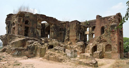
ruins of Aam Khas Bagh

On 22 June 1555, Humayun decisively defeated Sikandar Shah Suri at the Battle of Sirhind and reestablished the Mughal empire. The city reached the zenith of its glory under the Mughal Empire in the seventeenth century. This city was a home of sixteenth-century saint Ahmad Sirhindi, popularly known as Mujadid Alif Sani which means 'Revivor of the Faith in the Second Millennium'. The mausoleum of this saint is still there. Under Akbar it had turned the highest yielding sarkar. Under Sirhind sarkar there were 28 parganas. Due to its prosperity during the Mughal Empire it was known as Sirhind Bāvani which means Sirhind Fifty-two because it yielded a revenue of 52 lakh Rs, i.e. 5 million 200 thousand Rs per year. Emperor Shah Jahan built a famous garden known as Aam khas Bagh.

Guru Gobind Singh after a brief interval returned to Anandpur but had to quit it again on 5-6 December 1705 under pressure of a prolonged siege by the hill chief supported by Sirhind troops. Under the orders of the faujdar, Nawab Wazir Khan, Guru Gobind Singh's two younger sons, aged nine and seven, were cruelly done to death. They were enclosed alive in a wall in Sirhind and executed as the masonry rose up to their necks.

Banda Singh Bahadur's Battle

Mobilized under the flag of Banda Singh Bahadur after the death of Guru Gobind Singh in November 1708, they made a fierce attack upon Sirhind. The Mughal army was routed and Wazir Khan killed in the battle of Chappar Chiri fought on 12 May 1710. Sirhind was occupied by the Sikhs two days later, and Bhai Baj Singh was appointed governor. The town was, however, taken again by the imperial forces.

Durrani Empire

In March 1748, Sirhind was seized, but only temporarily, by Ahmad Shah Durrani, the Afghan general of Nadir Shah who succeeded his master in the possession of the eastern part of his dominions. But Ahmad Shah Durrani was defeated by the Mughal rulers of Delhi who reoccupied the town, although the invader reconquered it during his fourth invasion during 1756-57. Early in 1758, the Sikhs, in collaboration with the Marathas, sacked Sirhind, drove Prince Taimur, son of Ahmad Shah and his viceroy at Lahore, out of the Punjab.

Ahmad Shah defeated the Marathas at Panipat in January 1761. and struck the Sikhs a severe blow in what is known as Vadda Ghallughara, the Great Massacre, that took place on 5 February 1762. Sikhs rallied and attacked Sirhind on 17 May 1762. defeating its faujdar, Zain Khan, who purchased peace by paying Rs 50,000 as tribute to the Dal Khalsa. A more decisive battle took place on 14 January 1764 when Dal Khalsa. under Jassa Singh Ahluvalia, made another assault upon Sirhind. Zain Khan was killed in action and Sirhind was occupied and subjected to plunder and destruction. The booty was donated for the repair and reconstruction of the sacred shrines at Amritsar demolished by Ahmad Shah.

Under Dal Khalsa

The booty was donated for the repair and reconstruction of the sacred shrines at Amritsar demolished by Ahmad Shah. The territories of the Sirhind sarkar were divided among the leaders of the Dal Khalsa, but no one was willing to take the town of Sirhind where Guru Gobind Singh's younger sons were subjected to a cruel fate. By a unanimous will it was made over to Buddha Singh, descendant of Bhai Bhagatu.

Patiala Princely State

Image
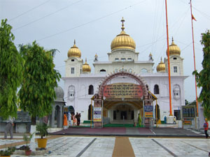
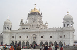
Gurdwara Fatehgarh Sahib

It was soon after (2 August 1764) transferred possession to Sardar Ala Singh, founder of the Patiala family. Sirhind thereafter remained part of the Patiala territory until the state lapsed in 1948. Maharaja Karam Singh of Patiala (1813–45) had gurdwaras constructed in Sirhind in memory of the young martyrs and their grandmother, Mata Gujari. He changed the name of the nizamat or district from Sirhind to Fatehgarh Sahib, after the name of the principal gurdwara. Besides the Sikh shrines, Sirhind has an important Muslim monument Rauza Sharif Mujjadid Alf Sani, the mausoleum of Shaikh Ahmad Sirhindi (1569-1624),the fundamentalist leader of the orthodox; Naqshbandi school of Sufism. There are a number of other tombs in the compound mostly of the members of Shaikh Ahmad's house.

References

• Sirhind Town(Sahrind) The Imperial Gazetteer of India, v. 23, p. 20.
• Sirhind Canal The Imperial Gazetteer of In

*****************************

Sirhind: Mughal Town With a Tragic Past
by Aditi Shah
May 30, 2019
livehistoryindia.com
Accessed: 9/12/21

Image

Around 45 km south-west of Chandigarh is the town of Sirhind in Punjab. Today, a pilgrimage cent re known for Gurudwara Fatehgarh Sahib, an important Sikh shrine, the town has a history that is as magnificent as it is brutal.

Due to its strategic location, Sirhind was once a major city -- in fact, it was the second most important city in Mughal Punjab after Lahore. But a tragic incident -- the murder of two young boys, the sons of Guru Gobind Singh -- cast such a long shadow across Sirhind that it slipped into oblivion. Visit it today and you will find a smattering of old monuments from Sirhind's glory days; you will also encounter tales of a curse.

Image
Gurudwara Fatehgarh Sahib

One of the earliest mentions of Sirhind can be found in the work of the 6th-century astrologer Varahamihira. In his text Brihat Samhita, he refers to it as the home of the 'Sairindhas' tribe. In the medieval period, Sirhind was an important military outpost of the last Rajput ruler of Delhi, Prithviraj Chauhan (1166-1192 CE) as it marked the northern frontier of his kingdom.

After the defeat of the Chauhans in the Second Battle of Tarain in 1192, Sirhind became part of the Delhi Sultanate. Sultan Firoz Shah Tughlaq (1309-1388) excavated a canal through the city for efficient water supply as he understood the importance of Sirhind, which controlled the routes to the hills of Kangra and acted as an important trading junction.

Image
Location of Sirhind in between Delhi and Lahore

The real heyday of Sirhind started when Babur, founder of the Mughal Empire, acquired the region from the Lodi dynasty just before the First Battle of Panipat in 1526 CE. With the increasing importance of the Delhi-Lahore-Kabul route, Sirhind grew as the strongest fortified town of Punjab under the Mughals. Goods from China and Tibet began to arrive here.

Due to its strategic location, it was also the cent re of commercial activity. Khafi Khan (ca. 1663-1731), a Mughal historian, wrote in h is chronicle of the Mughal dynasty titled Muntakhabu-I Lubab that Sirhind was an opulent town with wealthy merchants, bankers and tradesmen, essentially men of money and gentlemen of every class. For more than a century, it remained one of the most flourishing towns of the empire and served as a trading hub for high-quality cotton textiles from across India. Economic prosperity made Sirhind develop as a centre of culture too as it attracted visits by saints, scholars, poets, historians and calligraphers, who wanted to be where all the action was.

Image
Aam Khas Baug

According to the lore of that era, the city had around 360 mosques, gardens, tombs, caravansarais and wells. Sadly, only about three dozen of these remain today, including the beautiful Aam Khas Baug. A significant specimen of Mughal architecture, the Aam Khas Baug's origin has been traced to the reign of Emperor Akbar, who first visited Sirhind in 1566.

Another monument that has survived the ravages of time is the Jahaz Haveli belonging to Todar Mal (not the Todar Mal in Akbar's court), a diwan in the court of the Mughal Governor of Sirhind, Wazir Khan (1635-1710 CE). Made of bricks, the entire haveli was decorated with fountains and pools, with a grand reception area to receive and entertain guests.

Image
Jahaz Haveli

But it was the singularly brutal act of the same Governor, Wazir Khan, who sealed the fate of Sirhind forever. In 1705, the Mughal armies captured the Sikh stronghold of Anandpur Sahib, in present-day Ropar district of Punjab, around 84 km from Sirhind. Soon after, Guru Gobind Singh's mother Mata Gujari and h is two sons, 9-year-old Zorawar Singh and 6-year-old Fateh Singh, were captured through treachery and taken into custody by the Mughals. Wazir Khan ordered that both the young boys be entombed alive in Sirhind. This terrible deed was carried out on 26th December 1705. Outraged Sikhs, under the command of Banda Singh Bahadur, the famous military commander of the Khalsa army, swore revenge and defeated and killed Wazir Khan in the Battle of Chappan Chiri in 1710.

Image
Statue of Banda Singh Bahadur

After the decline of Mughal power, what followed were decades of pitched battles In Punjab involving not only the Sikhs and Mughals but also the Afghans, Marathas and British, each vying for political dominance. However, Sirhind had such a tragic association for the Sikhs t hat they wanted to have nothing more do w it h t he place. They built the Gurdwara Fatehgarh Saheb to commemorate the martyrdom of the two young boys.

In 1764, Sirhind came under the control of the rulers of Patiala after they defeated the Afghan administrator, Jain Khan. Many of Sirhind's monumental buildings were pulled down and the debris was used to build the famous Qila Mubarak in Patiala. Over time, most of the inhabitants too left the city and settled in Patiala.

Today, only a handful of monuments tell the story of Sirhind's glory days -- and its tragic past.

Nearest airport is Chandigarh Airport. Sirhind is also well connected to other major cities of the country via regular trains. With in Punjab, you can a get a bus to Fatehgarh Sahib on a regular basis.

*************************

Patiala
by Wikipedia
Accessed: 9/12/21

This article is about the municipality in Punjab, India. For its namesake district, see Patiala district. For the former princely state, see Patiala State.

Image
Moti Bagh Palace Patiala now houses the National Institute of Sports

Image
Qila Mubarak

Image
Gurdwara Dukh Nivaran Sahib

Image
Shri Kali Devi Temple

Image
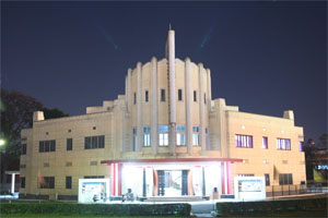
Patiala and Art Deco Designed, Phul Theatre, Patiala

Country: India
State: Punjab
District: Patiala
Settled: 1754
Founded by: Ala Singh
Named for: Ala Singh
Government
• Type: Municipality
• Body: Municipal Corporation of Patiala
• Mayor: Sanjeev Kumar Sharma
Area
• City: 60 sq mi (160 km2)
• Metro: 141.57 sq mi (366.66 km2)
Elevation: 843 ft (257 m)
Population (2020)
• City: 763,280
• Density: 12,000/sq mi (4,800/km2)
• Metro: 820,000 [1]
Demonym(s): Patialvi
Languages
• Official: Punjabi

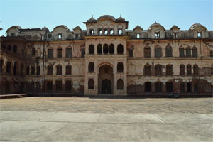
Patiala is a city in southeastern Punjab, northwestern India. It is the fourth largest city in the state and is the administrative capital of Patiala district. Patiala is located around the Qila Mubarak (the 'Fortunate Castle') constructed by the Sidhu Jat chieftain Ala Singh, who founded the royal dynasty of Patiala State in 1763, and after whom the city is named.

In popular culture, the city remains famous for its traditional Patiala shahi turban (a type of headgear), paranda (a tasselled tag for braiding hair), Patiala salwar (a type of female trousers), jutti (a type of footwear) and Patiala peg (a measure of liquor). Patiala is also known as Patiala - The Royal City and Patiala - The Beautiful City.[2]

Etymology

'Patiala' comes from the roots patti and ala, the former is local word for a "strip of land" and 'ala' comes from the name of the founder of the city, Ala Singh. So, 'Patiala' can be translated into English to mean ‘the land of Ala’.[3]

History

Main article: Patiala State

Patiala state was established in 1763 by Ala Singh, a Jat Sikh chieftain, who laid the foundation of the Patiala fort known as Qila Mubarak, around 'which the present city of Patiala is built. After the Third Battle of Panipat in 1761 in which the Marathas were defeated by the Afghans, the writ of the Afghans prevailed throughout Punjab. It is at this stage that the rulers of Patiala began to acquire ensigns of royalty. The Patiala state saw more than forty years of a ceaseless power struggle with the Afghan Durrani Empire, Maratha Empire and the Sikh Empire of Lahore.

In 1808, the Raja of Patiala entered into a treaty with the British against Sikh ruler Maharaja Ranjit Singh of Lahore in 1808, thus becoming collaborator in the grand empire building process by the British in, the sub-continent of India. Patiala became a 17-guns salute state during the British Raj. The rulers of Patiala such as Karam Singh, Narinder Singh, Mahendra Singh, Rajinder Singh, Bhupinder Singh, and Yadvindra Singh were treated with respect and dignity by the British.

Image
The Darshani Gate (the main gate of the Qila Mubarak), built in the 18th century. The city was built around the fort.

The city of Patiala was designed and developed according to a plan akin to that of temple architecture, the first settlers of Patiala were the Hindus of Sirhind, who opened their business establishments outside the Darshani Gate.[4]

The royal house is now headed by Captain Amarinder Singh who is also the current Chief Minister of Punjab. The royals are considered cultural and political icons in east Punjab.

Maharaja Karam Singh who ruled from 1813 to 1845 (the Sikh Kingdom of Patiala in Punjab) joined the British East India Company and helped the British during the First Anglo Sikh wars against the Sikh Empire of Maharajah Ranjit Singh of Punjab which was larger and extended from Tibet Kashmir, plains of Punjab to Peshawar near the Afghan borders.

Tourist attractions

Kali Devi Mandir


Image
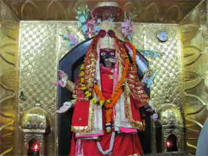
The Murti of Maa kali at the Shri Kali Devi Temple, Patiala. The temple was commissioned by the Sikh ruler of Patiala, Maharaja Bhupinder Singh in 1936.

Kali Devi Temple is a Hindu temple dedicated to Maa Kaali. The temple was built by the Sikh ruler of the Patiala State, Maharaja Bhupinder Singh, who financed the building of the temple in his capital and oversaw its installation in 1936. Legend has it that the Maharaja built the temple to protect the city from flooding and performed annual sacrifice at the temple. Bhupinder Singh ruled the princely state of Patiala from 1900 to 1938. He brought the 6-ft statue of Divine Mother Kali and Paawan Jyoti from Bengal to Patiala and offered the first Bali (sacrifice) of a water buffalo to the temple. Because of the temple's beautiful structure, it has been declared a national monument. This large complex attracts devotees, Hindu and Sikh, from distant places.

A much older temple of Raj Rajeshwari is also situated in the centre of this complex. The temple is situated opposite the Baradari garden at Mall Road. Devotees offer mustard oil, daal (lentils), sweets, coconuts, bangles and chunnis, goats, hens and liquor to the Divine Mother here. As an average estimate, devotees offer more than 60,000 liquor bottles during Navratras alone, which distributed to the beggars sitting outside the temple, and goes into a 'Sharab Kund' built on the temple's premises.[5]

Gurdwara Dukh Niwaran Sahib

Image
Gurdwara Dukh Nivaran Sahib, Patiala

According to local tradition, supported by an old handwritten document preserved in the Gurdwara, one Bhag Ram, a Jhivar of Lehal, waited upon ninth Guru of Sikhs Guru Tegh Bahadur during his sojourn at Saifabad (now Bahadurgarh). He requested that the Guru might be pleased to visit and bless his village so that its inhabitants could be rid of a severe and mysterious sickness which had been their bane for a long time.

The Guru visited Lehal on Magh sudi 5, 1728 Bikram/24 January 1672 and stayed under a banyan tree by the side of a pond. The sickness in the village subsided. The site where Guru Tegh Bahadur had sat came to be known as Dukh Nivaran, literally meaning eradicator of suffering. Devotees have faith in the healing qualities of water in the Sarovar attached to the shrine. It is still believed that any illness can be cured by 'ishnaan' on five consecutive Panchami. It is in the vicinity of Patiala Bus Station.

Gurdwara Moti Bagh

Gurudwara Moti Baag is situated in the outerskirts of the Patiala City. When Shri Guru Teg Bahadur started his journey towards Delhi, he came here via Kiratpur Sahib, Bharatgarh Sahib, Roap Makar, Kabulpur etc. Saint Saif Ali Khan was a great follower of Guru, To fulfil his wish Guru Sahib came to his Place Saifabad (Bahadur Garh). The holly Guru stayed here for 3 Months. Saif Ali Khan Served the Guru with great devotion. In daytime Guru Teg Bahadur used to meditate on the Place inside the Qila (Fort) and at the night time, he would come here. From here the Guru left for Samana and stayed in the Haveli of Muhamad Bakhshish. From there onward, Guru Sahib left towards Cheeka Via Karhali, Balbera.

Bahadurgarh Fort

The Bahadurgarh Fort is 6 kilometres away from Patiala city. It is situated on the Patiala-Chandigarh road. The fort was constructed by mughal Nawab Saif Khan in 1658 A.D where Guru Teg Bahadur visited him and later renovated by a Sikh ruler Maharaja Karam Singh in 1837. The construction of the entire fort was completed in eight years. A sum of ten lakh rupees was spent on its construction. It covers an area of 2 km2 (0.77 sq mi). The fort is enclosed within two rounded walls and a moat. The circumference of the fort is slightly over two kilometers.[6]

The name Bahadurgarh fort was given by Maharaja Karam Singh as a tribute to the Sikh Guru Teg Bahadur who stayed here for three months and nine days before leaving for Delhi where he was executed by Aurangzeb in 1675 CE.[7][8][9][6] The fort consists of a historical Gurdwara Sahib (a Sikh temple) named Gurdwara Sahib Patshai Nauvin. This Gurudwara shows fine Sikh architecture. This Gurudwara is controlled by the Shiromini Gurdwara Prabhandak Committee. People visit this Gurudwara on the occasion of the festival of Baisakhi on 13 April, every year.[6]

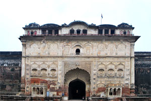
Qila Mubarak complex

Image
A gate of the Qila Mubarak in Patiala, built in the 18th century

The Qila Mubarak complex stands on a 10-acre ground in the heart of the city and contains the main palace or Qila Androon (literally, 'inner fort'), the guesthouse or Ran Baas and the Darbar Hall. Outside the Qila are the Darshani Gate, a Shiva temple, and bazaar shops which border the streets that run around the Qila and sell precious ornaments, colourful hand-woven fabrics, 'jootis' and bright 'Parandis'.

It was the principal residence of the Patiala royals until the construction of Old Moti Bagh Palace.

The entrance is through an imposing gate. The architectural style of the palace is a synthesis of late Mughal and Rajasthani. The complex has ten courtyards along the north–south axis. Each courtyard is unique in size and character, some being broad, others very small and others mere slits in the fabric of the building. Though the Androon is a single interconnected building, it is spoken of as a series of palaces. Each set of rooms makes a cluster around a courtyard, and each carries a name: Topkhana, Qila Mubarak, Sheesh Mahal, Treasury and Prison. Ten of the rooms are painted with frescoes or decorated intricately with mirror and gilt.

In a tiny portion of the complex is a little British construction with Gothic arches, fireplaces made of marble and built-in toilets perched on the Mughal Rajasthani roof. Burj Baba Ala Singh has a fire smouldering ever since the time of Ala Singh, along with a flame brought by him from Jwalaji. Every year it's decorated beautifully for the Heritage Festival.

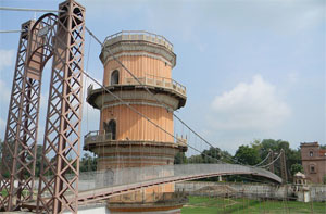
Sheesh Mahal

Image
The suspension bridge at Sheesh Mahal, Patiala

A part of the Old Moti Bagh Palace built in the 19th century by the Maharajas is the famous Sheesh Mahal, literally meaning the Palace of Mirrors. The mahal contains a large number of frescoes, most of which were made under His Highness Maharaja Narinder Singh. A lake in front of the palace adds to the beauty. Lakshman Jhula, a bridge built across the lake, is a famous attraction. A museum housing the largest collection of medals from the world collected by His Highness Maharaja Bhupinder Singh is here.

Currently, the museum along with the main building is closed for public viewing because of renovation. However, tourists can access the surroundings of the Mahal along with the Lakshman Jhula.

Baradari Gardens

Image
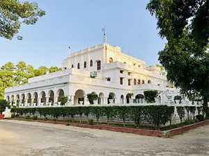
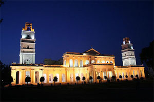
Rajindra Kothi, Patiala located in the Baradari Gardens, now a heritage hotel

The Baradari Gardens, the garden with 12 gates, are in the north of old Patiala city, just outside Sheranwala Gate. The garden complex, set up during the reign of Maharaja Rajindera Singh, has extensive vegetation of rare trees, shrubs, and flowers dotted with impressive Colonial buildings and a marble statue of Maharaja Rajindera Singh. It was built as a royal residence with a cricket stadium, a skating rink and a small palace set in its heart named Rajindera Kothi. The gardens include a museum building with collections of Maharaja Ranjeet Singh

Image
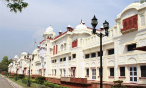
Baradari Palace, Patiala now run as a hotel

After extensive restoration it opened as a heritage hotel run by Neemrana Hotels group in 2009. It is Punjab's first heritage hotel. It is near Press Club Patiala which was established in 2006 and now headed by Parveen Komal, president.[10]

Image
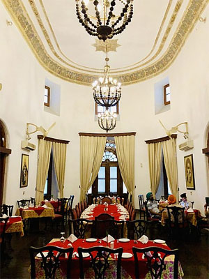
Royal Dining Hall

Press Club Patiala is situated at Barandari Garden Near 20 No. Railway Crossing. Headed by Mr. Parveen Komal President http://www.pressclubpatiala.com. It was established by Captain Amrinder Singh Chief Minister Of Punjab in 2006.

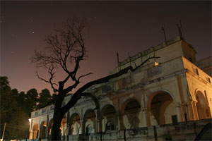
National Institute of Sports

Founded in 1961, Netaji Subhas National Institute of Sports (NIS) is Asia's largest sports institute in princely city of Patiala. The institute was renamed as Netaji Subhas National Institute of Sports in January 1973.

Image
Netaji Subhash National Institute of Sports (NSNIS), Patiala

NIS is housed in the Old Moti Bagh palace of the erstwhile royal family of Patiala, which was purchased by the government of India after Indian Independence. Today, several sport memorabilia, like a hass (doughnut shaped exercise disc), weighing 95 kg, used by the Great Gama for squats, Major Dhyan Chand's gold medal, from 1928 Amsterdam Olympics, and PT Usha 1986 Seoul Asiad shoes, are housed at the National Institute of Sports Museum.[11]

Education

Image
Mohindra College, Patiala

Since Indian independence in 1947, Patiala has emerged as a major education centre in the state of Punjab. The city houses the Thapar University,[12] LM Thapar School of Management,[13] Jagat Guru Nanak Dev Punjab State Open University, Punjab Sports University. Punjabi University,[14] Rajiv Gandhi National University of Law,[15] General Shivdev Singh Diwan Gurbachan Singh Khalsa College,[16] Mohindra College, Aryans College of Law, Multani Mal Modi College, Rajindra Hospital, Government Medical College, Patiala, Prof. Gursewak Singh Government College of Physical Education, Government College for Girls, and Govt. Bikram College of Commerce,[17] one of the premier commerce colleges in northern India.

Netaji Subhash National Institute of Sports, Patiala is a sports hub of north India. Rajiv Gandhi National University of Law, Patiala[18] was the first national law school of the north region established under Punjab Government Act of 2006.

List of Universities in Patiala:

Name / Type of University

Punjabi University / State University
Thapar University / Deemed University
Rajiv Gandhi National University of Law / National University
Punjab Sports University / State University
Jagat Guru Nanak Dev Punjab State Open University / State University


List of Schools in Patiala:

• Guru Nanak Foundation Public School, Patiala
• Our Lady of Fatima Convent Sec. School, Patiala
• St. Peter's Academy, Patiala
• Apollo Public School, Patiala
• Bhupindra International Public School, Patiala
• The British Co-Ed High School
• Buddha Dal Public School, Patiala
• DAV Public School, Patiala
• Kaintal School, Patiala
• Modern Senior Secondary School, Patiala
• Yadavindria Public School, Patiala

Patiala city has many playgrounds, including the Raja Bhalindra Sports Complex, more commonly known as Polo Ground on Lower Mall Road, which houses an indoor stadium. Other sports facilities include Yadavindra Sports Stadium for athletics, Rink Hall for roller skating, Dhruv Pandov Cricket Stadium for cricket and National Institute of Sports, Patiala.

Sporting venues and gardens

Patiala is home to numerous inter-state sporting teams in tournaments like Black Elephants. The city has facilities for cricket, swimming, shooting, skating and hockey. The city has stadiums such as Dhruv Pandove Ground, Raja Bhalinder Stadium, Yadavindra Sports Stadium (YPS) and National Institute of Sports.

The latest addition to sports is the state-of-the-art shotgun shooting ranges housing New Moti Bagh Gun Club at village Maine. Founded by the royal family of Patiala, these ranges are home to the Indian Shotgun Shooting team who routinely trains here. It has recently hosted the 2nd Asian Shotgun Championship.[19]

Governance

Patiala Municipal Corporation (PMC) is the local body responsible for governing, developing and managing the city. PMC is further divided into 50 municipal wards.

Patiala Development Authority (PDA) is an agency responsible for the planning and development of the greater Patiala Metropolitan Area, which is revising the Patiala Master Plan and Building Bylaws. Patiala Development Department, a special department of the Government of Punjab, has been recently formed for overall development.

Patiala consists of three assembly constituencies: Patiala Urban, Patiala Rural, Sanaur.

Geography

Patiala is located at 30.32°N 76.40°E.[20] It has an average elevation of 250 metres (820 feet). During the short existence of PEPSU, Patiala served as its capital city.

Demographics

Religion in Patiala city

Religion / Percent


Hinduism / 57.22%
Sikhism / 39.96%
Others / 2.82%


Hinduism is the prominent religion of Patiala City, followed by Sikhism. Minorities are Muslims, Christians, Jains and Buddhists.

As per provisional data of 2020 census, Patiala UA had a population of 820,000 and Patiala city 763,280.[1] Males constituted 54% of the population, and females 46%. Patiala had an average literacy rate of 86%, higher than the national average of 64.9%. In Patiala, 10% of the population was under 5 years of age.

Culture and traditions

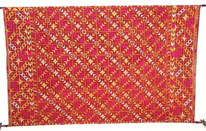
Phulkari from Patiala

Patiala's sway over the Malwa area extended beyond merely political influence. Patiala was equally the set of religious and cultural life. Educationally, Patiala was at the forefront. Patiala was the first town in this part of the country to have a degree college – the Mohindra College – in 1870.

Patiala has seen the evolution of a distinct style of architecture. Borrowing from the Rajput style, its beauty and elegance are moulded according to the local traditions.

Image
Phulkari from Patiala

Image
Phul Cinema on the Mall facing the Fountain Chowk is built in Art Deco style

With the active patronage of the Maharajas of Patiala, a well-established style of Hindustani music called the "Patiala Gharana" came into existence and has held its own up to the present times. This school of music has had several famous musicians, many of whom came to Patiala after the disintegration of the Mughal Court at Delhi in the 18th century. At the turn of the century, Ustad Ali Bux was the most renowned exponent of this Gharana. Later, his sons Ustad Akhtar Hussain Khan and Ustad Bade Ghulam Ali Khan achieved worldwide fame and brought glory to the Patiala Gharana.

After the partition of British India, Muslims were forced to flee the city en masse to Pakistan. At the same time, many Hindu and Sikh refugees migrated from Pakistan and settled on the Muslim properties in Patiala. The then Maharaja of Patiala, His Highness Yadavindra Singh, Rajpramukh of PEPSU with his wife Her Highness Maharani Mohinder Kaur organised a large number of camps and worked tirelessly for the people.

District administration

The Deputy Commissioner, an officer belonging to the Indian Administrative Service, is the overall in-charge of the General Administration in the district. He is assisted by a number of officers belonging to Punjab Civil Service and other Punjab state services.

The brand-new Mini Secretariat on Nabha Road, which houses all the major offices including that of the DC and the SSP, was completed in record time, owing to the initiative of the member of parliament of Patiala and local administration.

In India, an Inspector General (IG) of Police is a two-star rank of the Indian Police Service. The ranks above this are Additional Director General (Addl.DG) and Director General (DG) of police. In Patiala, joint commissioner's are at the rank of DIG and only additional commissioner's are at the rank of IG.

The Senior Superintendent of Police, an officer belonging to the Indian Police Service, is responsible for maintaining law and order and related issues in the district. He is assisted by the officers of the Punjab Police Service and other Punjab Police officials.

The Divisional Forest Officer, an officer belonging to the Indian Forest Service, is responsible for the management of the Forests, Environment and Wild-Life in the district. He is assisted by the officers of the Punjab Forest Service and other Punjab Forest officials and Punjab Wild-Life officials.

Sectoral development is looked after by the district head officer of each development department such as PWD, Health, Education, Agriculture, Animal husbandry, etc. These officers are from Punjab state services.

Transport
[23]

It is connected to cities like Ambala, Kaithal, Chandigarh, Amritsar, Delhi etc. by road. Patiala is well connected to cities like Ludhiana, Jalandhar and Amritsar, on NH 1 via State Highway no. 8 till Sirhind, which is on NH 1. Patiala is well connected to Delhi by road as well as by rail. NH 64 (Zirakpur – Patiala – Sangrur – Bhatinda) connects Patiala with Rajpura (on NH 1 and very well connected to Delhi) and Zirakpur (suburb of Chandigarh). Patiala has a railway station under Ambala railway division and Patiala Airport, which is not operational. The nearest domestic airport is Chandigarh Airport, which is approximately 62 km (39 mi) from the city. Patiala is located very close to Nabha city. The distance between Patiala and Nabha is approximately 27 km (17 mi) and it takes approximately half an hour by road to reach Nabha.[24]

Patiala is connected by road to all the major towns.

Distance between the major towns and Patiala:

• Ambala - 51 km (32 mi)
• Amritsar - 235 km (146 mi)
• Bathinda - 156 km (97 mi)
• Chandigarh - 67 km (42 mi)
• Chennai - 2,390 km (1,490 mi)
• Delhi - 233 km (145 mi)
• Indore - 1,082 km (672 mi)
• Jaipur - 454 km (282 mi)
• Jalandhar - 155 km (96 mi)
• Jammu - 301 km (187 mi)
• Kolkata - 1,637 km (1,017 mi)
• Lucknow - 669 km (416 mi)
• Ludhiana - 93 km (58 mi)
• Mumbai - 1,627 km (1,011 mi)
• Rajpura - 32 km (20 mi)
• Shimla - 173 km (107 mi)
• Zirakpur - 58 km (36 mi)

Suburbs of Patiala

• Nabha (Municipal Council) 25 km (16 mi)
• Rajpura (Municipal Council) 27 km (17 mi)
• Samana (Municipal Council) 27 km (17 mi)

See also

• Patiala and East Punjab States Union
• Chandigarh
• Mohali
• Panchkula
• Rajpura
• Fatehgarh Sahib
• Mandi Gobindgarh

References

1. "Patiala District Population (2020/2021), District Tehsils List, Punjab".
2. "History of Patiala". Official Website of District Patiala. Archived from the original on 7 September 2009. Retrieved 19 August 2011.
3. "The History of Patiala | Patiala". http://www.totalpunjab.com. Retrieved 24 March2020.
4. "History Of Patiala". Archived from the original on 24 October 2015. Retrieved 24 June 2016.
5. http://www.hdfcbank.com/personal/donate ... 1323430251
6. Patiala's Mughal era fort to get Rs 4.3cr facelift, Times of India, 1 Jan 2015.
7. Chandra, Satish. "Guru Tegh Bahadur's martyrdom". The Hindu. Archived from the original on 28 February 2002. Retrieved 20 October 2016.
8. H.R. Gupta (1984). History of the Sikhs: The Sikh Gurus, 1469-1708. 1. ISBN 9788121502764.
9. Pashaura Singh and Louis Fenech (2014). The Oxford handbook of Sikh studies. Oxford, UK: Oxford University Press. pp. 236–445, Quote:"this second martyrdom helped to make 'human rights and freedom of conscience' central to its identity." Quote:"This is the reputed place where several Kashmiri pandits came seeking protection from Auranzeb's army.". ISBN 978-0-19-969930-8.
10. "Fort right". The Tribune. 6 August 2009.
11. NIS
12. "Thapar Institute of Engineering and Technology University - Home".
13. "LM Thapar School OF Management - Home".
14. "University Punjabi – Established under Punjab Act No.35 of 1961". Archived from the original on 8 April 2006. Retrieved 1 May 2020.
15. "ワンランク上の風俗嬢". Archived from the original on 13 April 2018. Retrieved 1 May 2020.
16. "Welcome to Khalsa College Patiala".
17. "home". Archived from the original on 21 October 2016. Retrieved 1 May 2020.
18. rgnulpatilala.org
19. "Archived copy". Archived from the original on 1 February 2014. Retrieved 18 January 2014.
20. "Falling Rain Genomics, Inc – Patiala".
21. "Station: Patiala Climatological Table 1981–2010" (PDF). Climatological Normals 1981–2010. India Meteorological Department. January 2015. pp. 597–598. Archived from the original (PDF) on 5 February 2020. Retrieved 20 January 2021.
22. "Extremes of Temperature & Rainfall for Indian Stations (Up to 2012)" (PDF). India Meteorological Department. December 2016. p. M172. Archived from the original (PDF) on 5 February 2020. Retrieved 20 January 2021.
23. "Top Ten Towns with Highest Number of Car Ownership in India".
24. "Archived copy". Archived from the original on 21 March 2019. Retrieved 21 March 2019.

External links

• Patiala travel guide from Wikivoyage
• Official website of Patiala
• Official media website
• Press Club Patiala
admin
Site Admin
 
Posts: 36573
Joined: Thu Aug 01, 2013 5:21 am

Re: Freda Bedi Cont'd (#3)

Postby admin » Thu Sep 16, 2021 7:43 am

Part 1 of 2

Scythians
by Wikipedia
Accessed: 9/16/21


1. India, which is in shape quadrilateral, has its eastern as well as its western side bounded by the great sea, but on the northern side it is divided by Mount Hemodos from that part of Skythia which is inhabited by those Skythians who are called the Sakai, while the fourth or western side is bounded by the river called the Indus, which is perhaps the largest of all rivers in the world after the Nile.

-- Ancient India as Described by Megasthenes and Arrian; Being a Translation of the Fragments of the Indika of Megasthenes Collected by Dr. Schwanbeck, and of the First Part of the Indika of Arrian, by J.W. McCrindle, M.A.

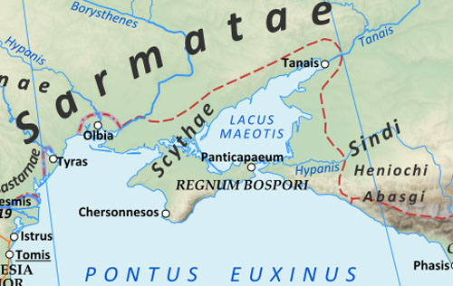
In the eighth century BC, Scythian warriors pursuing the Cimmerians rode south out of the steppes into the Near East in the area of northern Iran. They defeated the Cimmerians in the 630s and in the process conquered the powerful nation of the Medes, their Iranic ethnolinguistic relatives…. When they were defeated by the Medes in about 585 BC, they withdrew to the north and established themselves in the North Caucasus Steppe and the Pontic Steppe north of the Black Sea. They and their relatives built a huge empire stretching across Central Eurasia as far as China, including most of urbanized Central Asia, and grew fabulously rich on trade.

The Scythians and other North Iranic speakers thus dominated Central Eurasia at the same time that their southern relatives, the Medes and Persians, formed a vast empire based in the area of what is now western Iran and Iraq… they and other North Iranic-speaking relatives -- including their eastern branch, the Sakas -- continued to rule much of Central Eurasia for many centuries…

We know of not one but two great Scythian philosophers…

Anacharsis was the brother of Caduida, king of the Scythians. He spoke Greek because his mother was a Greek.

In about the forty-seventh Olympiad (592-589 BC), the age of Solon, he travelled to Greece and became well known for his astute, pithy remarks and wise sayings…. For example, "He said he wondered why among the Greeks the experts contend, but the non-experts decide."

The Greeks regularly quoted this and other pithy sayings of Anacharsis, which taken together are unlike those of any other known figure, Greek or foreign, in ancient Greek literature. Though he was considered to be a Scythian, the Greeks liked him, and he was counted as one of the Seven Sages of Antiquity in Greek philosophy. His own literary works are lost, but his fame was such that other writers used him as a stock character in their own compositions.

Sextus Empiricus, in his Against the Logicians, quotes an otherwise unknown work attributed to Anacharsis, on the Problem of the Criterion:

Who judges something skillfully? Is it the ordinary person or the skilled person?...

The argument is also strikingly close to the second part of the argument about the Problem of the Criterion in the Chuangtzu. Exactly as in the genuine saying of Anacharsis and in the argument attributed to him by Sextus Empiricus, the Chinese argument specifically concerns the ability to decide which of two contending individuals is right:

If you defeat me, I do not defeat you, are you then right, and I am not? If I defeat you, you do not defeat me, am I then right, you are not?...

The explanation for the similarity of these two passages could well be that the author of the "Anacharsis" quotation given by Sextus Empiricus had heard just such an argument, directly or indirectly, from a Scythian. This would have been a simple matter during the Classical Age because many Scythians then lived in Athens, where a number of them even served as the city's police force. If it was a stock Scythian story, an eastern Scythian -- a Saka -- could have transmitted a version of it to the Chinese, so that it ended up in the Chuangtzu, which is full of stories and arguments of a similar character.

Whatever the explanation, the explicit Greek connection of this story with a Scythian philosopher known for pithy sayings having a clever argument structure clearly indicates that it is the kind of thing Scythians were expected to say. In view of the Chinese testimony, it seems likely that it was something that some Scythians actually did say.

GAUTAMA BUDDHA, THE SCYTHIAN SAGE

The dates of Gautama Buddha are not recorded in any reliable historical source, and the traditional dates are calculated on unbelievable lineages…

[Scholars' continued insistence on following such dates anyway led to a 1988 conference devoted specifically to reconsideration of the dates of the Buddha, which however largely continued to take the fanciful, ahistorical, traditional accounts as if they were actual historical accounts]

His personal name, Gautama, is evidently earliest recorded in the Chuangtzu, a Chinese work from the late fourth to third centuries BC….

His epithet Sakamuni (later Sanskritized as Sakyamuni), 'Sage of the Scythians ("Sakas")', is unattested in the genuine Mauryan inscriptions or the Pali Canon.

[However, it has been demonstrated that the caretakers of the Pali tradition systematically expunged references to various ideas and practices to which they objected, especially things thought to be non-Indian.]

It is earliest attested, as Sakamuni, in the Gandhari Prakrit texts, which date to the first centuries AD (or possibly even the late first century BC)….

[It also occurs in Sanskrit in much later texts from Gandhara, as well as once, in a fifth-century AD Bactrian Buddhist text, as [x], without the characteristic -y- of the Sanskritized form of the name.]

It is thus arguable that the epithet could have been applied to the Buddha during the Saka (Saka or "Indo-Scythian") Dynasty -- which dominated northwestern India on and off from approximately the first century BC, continuing into the early centuries AD as satraps or "vassals" under the Kushans -- and that the reason for it was strong support for Buddhism by the Sakas, Indo-Parthians, and Kushans.

However, it must be noted that the Buddha is the only Indian holy man before early modern times who bears an epithet explicitly identifying him as a non-Indian, a foreigner. It would have been unthinkably odd for an Indian saint to be given a foreign epithet if he was not actually a foreigner…. There are also very strong arguments -- including basic "doctrinal" ones -- indicating that Buddhism had fundamental foreign connections from the very beginning, as shown below. It is at any rate certain that Buddha has been identified as Sakamuni ~ Sakyamuni "Sage of the Scythians" in all varieties of Buddhism from the beginning of the recorded Buddhist tradition to the present, and that much of what is thought to be known about him can be identified specifically with things Scythian.

[The tradition by which Buddha was from a local Nepalese Sakya "clan" in the area of Lumbini is full of chronological and other insuperable problems, as shown by Bareau (1987); it is a very late development.]

Moreover, it must not be overlooked that we have no concrete datable evidence that any other wandering ascetics preceded the Buddha. The Scythians were nomads (from Greek [x]; 'wanderers in search of pasture, pastoralists') who lived in the wilderness, and it is thus quite likely that Gautama himself introduced wandering asceticism to India…

Buddha's teachings were unprecedented mainly because they opposed new foreign ideas -- the Early Zoroastrian ideas of good and bad karma, rebirth in Heaven (for those who were good), absolute Truth versus the Lie, and so on…

Buddha therefore must have lived after the introduction of Zoroastrianism in 519/518 BC, when the Achaemenid ruler Darius I invaded and conquered several Central Asian countries and then continued to the east, where he conquered Gandhara and Sindh, which were Indic-speaking, in about 517/516 BC.

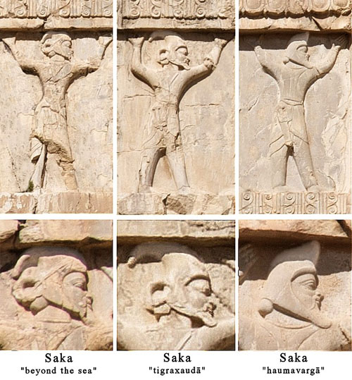
In the process of firming up his rule over the new territories, he stationed subordinate feudal lords, or satraps, over them, and some of the army was garrisoned there. Darius had come from conquering much of Central Asia proper, including Bactria and Arachosia, as well as the Saka Tigraxauda 'the Scythians wearing pointed hats', a nation of Scythians whose king, Skunkha, he captured…

From then on Scythians formed the backbone of the imperial forces together with the Medes and Persians, so some of the soldiers in the Indian campaign must have been Scythians, that is, Sakas…

Gandhara became an important part of the empire. It is regularly included in the lists of provinces from the beginning of Darius's reign on to the end of the empire along with Bactria, Arachosia, the Sakas, and other neighboring realms.

There was a Persian satrap in Taxila, and official travellers went frequently between the Persian capital and one or another provincial locality in India, as attested by accounts preserved in the Persepolis Fortification Tablets, which detail the payments in kind to the travellers.

Moreover, "the Indians", one of the twenty financial districts of the Persian Empire recorded by Herodotus, paid by far the greatest sum in "tribute".

The Achaemenid influence in Gandhara was strong and long-lasting.

The conquest by Darius introduced the Persians' new religion, reformed Mazdaism, or Early Zoroastrianism, a strongly monotheistic faith with a creator God, Ahura Mazda, and with ideas of absolute Truth (Avestan asa, Old Persian arta) versus 'the Lie' (druj), and of an accumulation of Good and Bad deeds -- that is, "karma" -- which determined whether a person would be rewarded by "rebirth" in Heaven. These ideas are all found in the Gathas, the oldest part of the Avesta, which are attributed to Zoroaster himself, and all are expressed openly and repeatedly in the Old Persian royal inscriptions as well. Essentially the same ideas occur in the Major Inscriptions of the Mauryas in the third century BC in India.

The traditional view is that the Buddha reinterpreted existing Indian ideas found in the Upanishads, but the Upanishads in question cannot be dated to a period earlier than the Buddha…

Both Early Buddhism and Early Brahmanism are the direct outcome of the introduction of Zoroastrianism into eastern Gandhara by Darius I. Early Buddhism resulted from the Buddha's rejection of the basic principles of Early Zoroastrianism, while Early Brahmanism represents the acceptance of those principles. Over time, Buddhism would accept more and more of the rejected principles.

Darius also sponsored the creation of a completely new writing system -- Old Persian cuneiform script, which is partly modeled on Aramaic script, one of the main administrative scripts of the Persian Empire -- and the practice of erecting monumental inscriptions.

[In addition, he built imperial roads with rest houses provisioned for travellers.] ...

While, not surprisingly, the ordinary generic human contrast between truth and falsehood is found in the Vedas, the specifically Early Zoroastrian form of the ideas, including the result of following one or the other path, is completely alien to them. In the early Vedic religion, ritually correct performance of blood sacrifices was believed to be rewarded in this life, but the reward had nothing to do with one's virtuous actions or one's future in the afterlife….

[Bronkhorst (2007: 358), who remarks, "In the middle of the third century BC, it was Mazdaism, rather than Brahmanism, which predominated in the region between Kandahar and Taxila."]

These specific "absolutist" or "perfectionist" ideas are firmly rejected by the Buddha in his earliest attested teachings, as shown in Chapter One. In short, the Buddha reacted primarily (if at all) not against Brahmanism, but against Early Zoroastrianism….

The word bodhi 'enlightenment', literally 'awakening', is first attested in the Eighth Rock Edict of the … ruler Devanampriya Priyadarsi…

The inscription thus can only refer to the ruler's acceptance of a form of the Early Buddhist Dharma -- not the more familiar Normative Buddhism, which is attested several centuries later….

The dates of Darius's conquest of Gandhara and Sindh (ca. 517 BC), and the late fourth century -- marked by the visit of Alexander (330-325 BC) along with his courtier Pyrrho, followed by Megasthenes two decades later -- are the chronological limits bracketing the enlightenment-to-death career of Gautama Buddha…

The shock of the introduction of new, alien religious ideas in the traditionally non-Persian, non-Zoroastrian environment of Central Asia, eastern Gandhara, and Sindh must have happened fairly soon after Darius's conquest and the establishment of his satrapies, when the satraps were undoubtedly still ethnically Persian and strongly Zoroastrian, and would have needed the ministrations of their priests. That would place the most likely time for the Buddha's period of asceticism and enlightenment within the first fifty years or so of Persian rule, meaning ca. 515 to ca. 465 BC, and his death after another forty years or so… making the latest date for his death ca. 425 BC. This chronology would also leave enough time for Early Buddhism to spread from Magadha (the region where Sambodhi, or Bodhgaya, is located) -- assuming it was first preached there by the Buddha -- northwestward into western Gandhara, Bactria, and beyond, and (as shown in Chapter Three), for his name Gautama and some of his ideas and practices to travel all the way to China and become popular no later than the Guodian tomb's end date (terminus ante quem) of 278 BC. Among the things that the scenario presented here explains are the striking alienness of Buddhism in India proper, its earliness in Gandhara and Bactria, and the difficulty of showing that the Buddha was originally from Magadha.

This brings up the problem of the Buddha's birthplace. Not only are his dates only very generally definable, his specific homeland is unknown as well. Despite widespread popular belief in the story that he came from Lumbini in what is now Nepal, all of the evidence is very late and highly suspect from beginning to end. Bareau has carefully analyzed the Lumbini birth story and shown it to be a late fabrication…

[The lone piece of evidence impelling scholars to accept the Lumbini story has been the Lumbini Inscription, which most scholars believe was erected by Asoka. However, the inscription itself actually reveals that it is not by Asoka, and all indications are that it is a late forgery, possibly even a modern one.]

There are reasons to put the Buddha's teaching period -- most of his life, according to the traditional accounts -- somewhere in northern India, in a region affected by the monsoons…

the Buddha must have passed away well before 325 to 304 BC, the dates for the appearance of the earliest hard evidence on the existence of Buddhism or elements of Buddhism. This is still three centuries before even the earliest Gandhari texts and the traditional (high) date of the Pali Canon. Despite widespread belief that the latter collections of material, both of which are from the Saka-Kushan period or later, represent "Early Buddhism", the work of many scholars has shown that even by internal evidence alone it must be already quite far removed from the earliest Buddhism -- the teachings and practices of the followers of the Buddha himself and the next few generations after him, up to the mid-third century BC.

-- Greek Buddha: Pyrrho's Encounter With Early Buddhism in Central Asia, by Christopher I. Beckwith


Image
Scythian comb from Solokha, early 4th century BC

Image
The approximate extent of Eastern Iranian languages circa 170 BC.

The Scythians (/ˈsɪθiənz, ˈsɪð-/; from Greek Σκύθης, Σκύθοι), also known as Scyths,[1] Saka, Sakae, Iskuzai, or Askuzai, were an ancient nomadic people of Eurasia, inhabiting the region Scythia. Classical Scythians dominated the Pontic steppe from approximately the 7th century BC until the 3rd century BC.[2] They can also be referred to as Pontic Scythians, European Scythians or Western Scythians.[3][4] They were part of the wider Scythian cultures, stretching across the Eurasian Steppe.[5][6] In a broader sense, Scythians has also been used to designate all early Eurasian nomads,[6] although the validity of such terminology is controversial.[5] According to Di Cosmo, other terms such as "Early nomadic" would be preferable.[7] Eastern members of the Scythian cultures are often specifically designated as Sakas.[8]

The Scythians are generally believed to have been of Iranian (or Iranic; an Indo-European ethno-linguistic group) origin;[9] they spoke a language of the Scythian branch of the Iranian languages,[10] and practiced a variant of ancient Iranian religion.[11] Among the earliest peoples to master mounted warfare,[12] the Scythians replaced the Cimmerians as the dominant power on the Pontic steppe in the 8th century BC.[13] During this time they and related peoples came to dominate the entire Eurasian Steppe from the Carpathian Mountains in the west to Ordos Plateau in the east,[14][15] creating what has been called the first Central Asian nomadic empire.[13][16] Based in what is modern-day Ukraine and southern Russia, they called themselves Scoloti and were led by a nomadic warrior aristocracy known as the Royal Scythians.

In the 7th century BC, the Scythians crossed the Caucasus and frequently raided the Middle East along with the Cimmerians, playing an important role in the political developments of the region.[13][16] Around 650–630 BC, Scythians briefly dominated the Medes of the western Iranian Plateau,[17][18] stretching their power to the borders of Egypt.[12] After losing control over Media, they continued intervening in Middle Eastern affairs, playing a leading role in the destruction of the Assyrian Empire in the Sack of Nineveh in 612 BC. The Scythians subsequently engaged in frequent conflicts with the Achaemenid Empire, and suffered a major defeat against Macedonia in the 4th century BC[12] and were subsequently gradually conquered by the Sarmatians, a related Iranian people living to their east.[19] In the late 2nd century BC, their capital at Scythian Neapolis in the Crimea was captured by Mithridates VI and their territories incorporated into the Bosporan Kingdom.[11] By this time they had been largely Hellenized. By the 3rd century AD, the Sarmatians and last remnants of the Scythians were dominated by the Alans, and were being overwhelmed by the Goths. By the early Middle Ages, the Scythians and the Sarmatians had been largely assimilated and absorbed by early Slavs.[20][21] The Scythians were instrumental in the ethnogenesis of the Ossetians, who are believed to be descended from the Alans.[22]

The Scythians played an important part in the Silk Road, a vast trade network connecting Greece, Persia, India and China, perhaps contributing to the prosperity of those civilisations.[23] Settled metalworkers made portable decorative objects for the Scythians, forming a history of Scythian metalworking. These objects survive mainly in metal, forming a distinctive Scythian art.[24]

The name of the Scythians survived in the region of Scythia. Early authors continued to use the term "Scythian", applying it to many groups unrelated to the original Scythians, such as Huns, Goths, Turkic peoples, Avars, Khazars, and other unnamed nomads.[11][25] The scientific study of the Scythians is called Scythology.

Names

Etymology


Linguist Oswald Szemerényi studied synonyms of various origins for Scythian and differentiated the following terms: Skuthes Σκύθης, Skudra, Sug(u)da and Saka.[26]

• Skuthes Σκύθης, Skudra, Sug(u)da descended from the Indo-European root (s)kewd-, meaning "propel, shoot" (cognate with English shoot). *skud- is the zero-grade form of the same root. Szemerényi restores the Scythians' self-name as *skuda (roughly "archer"). This yields the Ancient Greek Skuthēs Σκύθης (plural Skuthai Σκύθαι) and the Assyrian Aškuz. The Old Armenian: սկիւթ skiwtʰ is based on itacistic Greek. A late Scythian sound change from /d/ to /l/ established the Greek word Skolotoi (Σκώλοτοι), from the Scythian *skula which, according to Herodotus, was the self-designation of the Royal Scythians.[27] Other sound changes have produced Sogdia.
• The term Saka reflected in Old Persian: Sakā, Greek: Σάκαι; Latin: Sacae, Sanskrit: शक Śaka comes from an Iranian verbal root sak-, "go, roam" and thus means "nomad". Although closely related, the Saka people are nomadic Iranians, that are to be distinguished from the European Scythians and inhabited the northern and eastern Eurasian Steppe and the Tarim Basin.[8][better source needed][28][29]

Exonyms

The name Scythian is derived from the name used for them by the ancient Greeks.[30] Iskuzai or Askuzai was the name given them by the Assyrians. The ancient Persians used the term Saka for all nomads of the Eurasian Steppe, including the Scythians.[31]

Ethnonyms

Herodotus said the ruling class of the Scythians, whom he referred to as the Royal Scythians, called themselves Skolotoi.[5]

Modern terminology

See also: Scythian cultures

In scholarship, the term Scythians generally refers to the nomadic Iranian people who dominated the Pontic steppe from the 7th century BC to the 3rd century BC.[2]

The Scythians share several cultural similarities with other populations living to their east, in particular similar weapons, horse gear and Scythian art, which has been referred to as the Scythian triad.[5][7] Cultures sharing these characteristics have often been referred to as Scythian cultures, and its peoples called Scythians.[6][32] Peoples associated with Scythian cultures include not only the Scythians themselves, who were a distinct ethnic group,[33] but also Cimmerians, Massagetae, Saka, Sarmatians and various obscure peoples of the forest steppe,[5][6] such as early Slavs, Balts and Finnic peoples.[31][34] Within this broad definition of the term Scythian, the actual Scythians have often been distinguished from other groups through the terms Classical Scythians, Western Scythians, European Scythians or Pontic Scythians.[6]

Scythologist Askold Ivantchik notes with dismay that the term "Scythian" has been used within both a broad and a narrow context, leading to a good deal of confusion. He reserves the term "Scythian" for the Iranian people dominating the Pontic steppe from the 7th century BC to the 3rd century BC.[5] Nicola Di Cosmo writes that the broad concept of "Scythian" is "too broad to be viable", and that the term "early nomadic" is preferable.[7]

History

Origins

Literary evidence


Image
The 5th-century BC Greek historian Herodotus is the most important literary source on the origins of the Scythians

The Scythians first appeared in the historical record in the 8th century BC.[26] Herodotus reported three contradictory versions as to the origins of the Scythians, but placed greatest faith in this version:[35]

There is also another different story, now to be related, in which I am more inclined to put faith than in any other. It is that the wandering Scythians once dwelt in Asia, and there warred with the Massagetae, but with ill success; they therefore quitted their homes, crossed the Araxes, and entered the land of Cimmeria.


Herodotus presented four different versions of Scythian origins:

1. Firstly (4.7), the Scythians' legend about themselves, which portrays the first Scythian king, Targitaus, as the child of the sky-god and of a daughter of the Dnieper. Targitaus allegedly lived a thousand years before the failed Persian invasion of Scythia, or around 1500 BC. He had three sons, before whom fell from the sky a set of four golden implements—a plough, a yoke, a cup and a battle-axe. Only the youngest son succeeded in touching the golden implements without them bursting with fire, and this son's descendants, called by Herodotus the "Royal Scythians", continued to guard them.

2. Secondly (4.8), a legend told by the Pontic Greeks featuring Scythes, the first king of the Scythians, as a child of Hercules and Echidna.

3. Thirdly (4.11), in the version which Herodotus said he believed most, the Scythians came from a more southern part of Central Asia, until a war with the Massagetae (a powerful tribe of steppe nomads who lived just northeast of Persia) forced them westward.

4. Finally (4.13), a legend which Herodotus attributed to the Greek bard Aristeas, who claimed to have got himself into such a Bachanalian fury that he ran all the way northeast across Scythia and further. According to this, the Scythians originally lived south of the Rhipaean mountains, until they got into a conflict with a tribe called the Issedones, pressed in their turn by the "one-eyed Arimaspians"; and so the Scythians decided to migrate westwards.

Accounts by Herodotus of Scythian origins has been discounted recently; although his accounts of Scythian raiding activities contemporary to his writings have been deemed more reliable.[36]

Archaeological evidence

Modern interpretation of historical, archaeological and anthropological evidence has proposed two broad hypotheses on Scythian origins.[37]

The first hypothesis, formerly more espoused by Soviet and then Russian researchers, roughly followed Herodotus' (third) account, holding that the Scythians were an Eastern Iranian-speaking group who arrived from Inner Asia, i.e. from the area of Turkestan and western Siberia.[37]

The second hypothesis, according to Roman Ghirshman and others, proposes that the Scythian cultural complex emerged from local groups of the Srubna culture at the Black Sea coast,[37] although this is also associated with the Cimmerians. According to Pavel Dolukhanov this proposal is supported by anthropological evidence which has found that Scythian skulls are similar to preceding findings from the Srubna culture, and distinct from those of the Central Asian Saka.[38] Yet, according to J. P. Mallory, the archaeological evidence is poor, and the Andronovo culture and "at least the eastern outliers of the Timber-grave culture" may be identified as Indo-Iranian.[37]

Genetic evidence

In 2017, a genetic study of the Scythians suggested that they can best be described as a mixture of European-related ancestry from the Yamna culture and an East Asian/Siberian ancestry, and emerged on the Pontic steppe. The authors concluded that there is evidence for significant geneflow from East-Eurasia to West-Eurasia, from various migrations during the early Iron Age.[6] Based on the analysis of mithocondrial lineages, another later 2017 study suggested that the Scythians were directly descended from the Srubnaya culture.[39] A later analysis of paternal lineages, published in 2018, found significant genetic differences between the Srubnaya and the Scythians. They further found that the nomadic population of Central Asia, e.g. the Scythians, were genetically heterogeneous and carried genetic affinities with populations from several other regions including the Far East and the southern Urals.[40] Another 2019 study also concluded that migrations must have played a part in the emergence of the Scythians as the dominant power of the Pontic steppe.[41]

Early history

Image
Gold Scythian belt title, Mingachevir (ancient Scythian kingdom), Azerbaijan, 7th century BC

Herodotus provides the first detailed description of the Scythians. He classifies the Cimmerians as a distinct autochthonous tribe, expelled by the Scythians from the northern Black Sea coast (Hist. 4.11–12). Herodotus also states (4.6) that they consisted of the Auchatae, Catiaroi, Traspians, and Paralatae or "Royal Scythians".

In the early 7th century BC, the Scythians and Cimmerians are recorded in Assyrian texts as having conquered Urartu. In the 670s, the Scythians under their king Bartatua raided the territories of the Assyrian Empire. The Assyrian king Esarhaddon managed to make peace with the Scythians by marrying off his daughter to Bartatua and by paying a large amount of tribute.[5] Bartatua was succeeded by his son Madius ca. 645 BC, after which they launched a great raid on Palestine and Egypt. Madius subsequently subjugated the Median Empire. During this time, Herodotus notes that the Scythians raided and exacted tribute from "the whole of Asia". In the 620s, Cyaxares, leader of the Medes, treacherously killed a large number of Scythian chieftains at a feast. The Scythians were subsequently driven back to the steppe. In 612 BC, the Medes and Scythians participated in the destruction of the Assyrian Empire at the Battle of Nineveh. During this period of incursions into the Middle East, the Scythians became heavily influenced by the local civilizations.[42]

In the 6th century BC, the Greeks had begun establishing settlements along the coasts and rivers of the Pontic steppe, coming in contact with the Scythians. Relations between the Greeks and the Scythians appear to have been peaceful, with the Scythians being substantially influenced by the Greeks, although the city of the Panticapaeum might have been destroyed by the Scythians in the mid-century BC. During this time, the Scythian philosopher Anacharsis traveled to Athens, where he made a great impression on the local people with his "barbarian wisdom".[5]

War with Persia

Image
Reliefs depicting the soldiers of the Achaemenid army, Xerxes I tomb, circa 480 BCE. The Achaemenids referred to all nomads to their north as Saka,[31] and divided them into three categories: The Sakā tayai paradraya ("beyond the sea", presumably the Scythians), the Sakā tigraxaudā ("with pointed caps"), and the Sakā haumavargā ("Hauma drinkers", furthest East).[43]

By the late 6th century BC, the Archaemenid king Darius the Great had built Persia into becoming the most powerful empire in the world, stretching from Egypt to India. Planning an invasion of Greece, Darius first sought to secure his northern flank against Scythian introads. Thus, Darius declared war on the Scythians.[42] At first, Darius sent his Cappadocian satrap Ariamnes with a vast fleet (estimated at 600 ships by Herodotus) into Scythian territory, where several Scythian nobles were captured. He then built a bridge across the Bosporus and easily defeated the Thracians, crossing the Danube into Scythian territory with a large army (700,000 men if one is to believe Herodotus) in 512 BC.[44] At this time Scythians were separated into three major kingdoms, with the leader of the largest tribe, King Idanthyrsus, being the supreme ruler, and his subordinate kings being Scopasis and Taxacis.[citation needed]

Unable to receive support from neighboring nomadic peoples against the Persians, the Scythians evacuated their civilians and livestock to the north and adopted a scorched earth strategy, while simultaneously harassing the extensive Persian supply lines. Suffering heavy losses, the Persians reached as far as the Sea of Azov, until Darius was compelled to enter into negotiations with Idanthyrsus, which, however, broke down. Darius and his army eventually reatreated across the Danube back into Persia, and the Scythians thereafter earned a reputation of invincibility among neighboring peoples.[5][44]

Golden Age

In the aftermath of their defeat of the Persian invasion, Scythian power grew considerably, and they launched campaigns against their Thracian neighbors in the west.[45] In 496 BC, the Scythians launched an great expedition into Thrace, reaching as far as Chersonesos.[5] During this time they negotiated an alliance with the Achaemenid Empire against the Spartan king Cleomenes I. A prominent king of the Scythians in the 5th century BC was Scyles.[42]

The Scythian offensive against the Thracians was checked by the Odrysian kingdom. The border between the Scythians and the Odrysian kingdom was thereafter set at the Danube, and relations between the two dynasties were good, with dynastic marriages frequently occurring.[5] The Scythians also expanded towards the north-west, where they destroyed numerous fortified settlements and probably subjucated numerous settled populations. A similar fate was suffered by the Greek cities of the northwestern Black Sea coast and parts of the Crimea, over which the Scythians established political control.[5] Greek settlements along the Don River also came under the control of the Scythians.[5]

A division of responsibility developed, with the Scythians holding the political and military power, the urban population carrying out trade, and the local sedentary population carrying out manual labor.[5] Their territories grew grain, and shipped wheat, flocks, and cheese to Greece. The Scythians apparently obtained much of their wealth from their control over the slave trade from the north to Greece through the Greek Black Sea colonial ports of Olbia, Chersonesos, Cimmerian Bosporus, and Gorgippia.[citation needed]

When Herodotus wrote his Histories in the 5th century BC, Greeks distinguished Scythia Minor, in present-day Romania and Bulgaria, from a Greater Scythia that extended eastwards for a 20-day ride from the Danube River, across the steppes of today's East Ukraine to the lower Don basin.[citation needed]

Scythian offensives against the Greek colonies of the northeastern Black Sea coast were largely unsuccessful, as the Greeks united under the leadership of the city of Panticapaeum and put up a vigorous defence. These Greek cities developed into the Bosporan Kingdom. Meanwhile, several Greek colonies formerly under Scythian control began to reassert their independence. It is possible that the Scythians were suffering from internal troubles during this time.[5] By the mid-4th century BC, the Sarmatians, a related Iranian people living to the east of the Scythians, began expanding into Scythian territory.[42]

Image
Scythian king Skilurus, relief from Scythian Neapolis, Crimea, 2nd century BC

The 4th century BC was a flowering of Scythian culture. The Scythian king Ateas managed to unite under his power the Scythian tribes living between the Maeotian marshes and the Danube, while simultaneously enroaching upon the Thracians.[45] He conquered territories along the Danube as far the Sava river and established a trade route from the Black Sea to the Adriatic, which enabled a flourishing of trade in the Scythian kingdom. The westward expansion of Ateas brought him into conflict with Philip II of Macedon (reigned 359 to 336 BC), with whom he had previously been allied,[5] who took military action against the Scythians in 339 BC. Ateas died in battle, and his empire disintegrated.[42] Philip's son, Alexander the Great, continued the conflict with the Scythians. In 331 BC, his general Zopyrion invaded Scythian territory with a force of 30,000 men, but was routed and killed by the Scythians near Olbia.[5][45]

Decline

In the aftermath of conflict between Macedon and the Scythians, the Celts seem to have displaced the Scythians from the Balkans; while in south Russia, a kindred tribe, the Sarmatians, gradually overwhelmed them. In 310–309 BC, as noted by Diodorus Siculus, the Scythians, in alliance with the Bosporan Kingdom, defeated the Siraces in a great battle at the river Thatis.[45]

By the early 3rd century BC, the Scythian culture of the Pontic steppe suddenly disappears. The reasons for this are controversial, but the expansion of the Sarmatians certainly played a role. The Scythians in turn shifted their focus towards the Greek cities of the Crimea.[5]

Image
The territory of the Scythae Basilaei ("Royal Scyths") along the north shore of the Black Sea around 125 AD

By around 200 BC, the Scythians had largely withdrawn into the Crimea. By the time of Strabo's account (the first decades AD), the Crimean Scythians had created a new kingdom extending from the lower Dnieper to the Crimea, centered at Scythian Neapolis near modern Simferopol. They had become more settled and were intermingling with the local populations, in particular the Tauri, and were also subjected to Hellenization. They maintained close relations with the Bosporan Kingdom, with whose dynasty they were linked by marriage. A separate Scythian territory, known as Scythia Minor, existed in modern-day Dobruja, but was of little significance.[5]

In the 2nd century BC, the Scythian kings Skilurus and Palakus sought to extend their control over the Greek cities north of the Black Sea. The Greek cities of Chersonesus and Olbia in turn requested the aid of Mithridates the Great, king of Pontus, whose general Diophantus defeated their armies in battle, took their capital and annexed their territory to the Bosporan Kingdom.[11][42][45] After this time, the Scythians practically disappeared from history.[45] Scythia Minor was also defeated by Mithridates.[5]

In the years after the death of Mithridates, the Scythians had transitioned to a settled way of life and were assimilating into neighboring populations. They made a resurgence in the 1st century AD and laid siege to Chersonesos, who were obliged to seek help from the Roman Empire. The Scythians were in turn defeated by Roman commander Tiberius Plautius Silvanus Aelianus.[5] By the 2nd century AD, archaeological evidence show that the Scythians had been largely assimilated by the Sarmatians and Alans.[5] The capital city of the Scythians, Scythian Neapolis, was destroyed by migrating Goths in the mid-3rd century AD. In subsequent centuries, remaining Scythians and Sarmatians were largely assimilated by early Slavs.[20][21] The Scythians and Sarmatians played an instrumental role in the ethnogenesis of the Ossetians, who are considered direct descendants of the Alans.[22]

Archaeology

Image
Scythian defence line 339 BC reconstruction in Polgár, Hungary

Archaeological remains of the Scythians include kurgan tombs (ranging from simple exemplars to elaborate "Royal kurgans" containing the "Scythian triad" of weapons, horse-harness, and Scythian-style wild-animal art), gold, silk, and animal sacrifices, in places also with suspected human sacrifices.[46] Mummification techniques and permafrost have aided in the relative preservation of some remains. Scythian archaeology also examines the remains of cities and fortifications.[47][48][49]

Scythian archaeology can be divided into three stages:[5]

• Early Scythian – from the mid-8th or the late 7th century BC to about 500 BC
• Classical Scythian or Mid-Scythian – from about 500 BC to about 300 BC
• Late Scythian – from about 200 BC to the mid-3rd century CE, in the Crimea and the Lower Dnieper, by which time the population was settled.

Early Scythian

In the south of Eastern Europe, Early Scythian culture replaced sites of the so-called Novocherkassk culture. The date of this transition is disputed among archaeologists. Dates ranging from the mid-8th century to the late 7th century BC have been proposed. A transition in the late 8th century BC has gained the most scholarly support. The origins of the Early Scythian culture is controversial. Many of its elements are of Central Asian origin, but the culture appears to have reached its ultimate form on the Pontic steppe, partially through the influence of North Caucasian elements and to a smaller extent the influence of Near Eastern elements.[5]

The period in the 8th and 7th centuries BC when the Cimmerians and Scythians raided the Near East are ascribed to the later stages of the Early Scythian culture. Examples of Early Scythian burials in the Near East include those of Norşuntepe and İmirler. Objects of Early Scythian type have been found in Urartian fortresses such as Teishebaini, Bastam and Ayanis-kale. Near Eastern influences are probably explained through objects made by Near Eastern craftsmen on behalf of Scythian chieftains.[5]

Image
An arm from the throne of a Scythian king, 7th century BC. Found at the Kerkemess kurgan, Krasnodar Krai in 1905. On exhibit at the Hermitage Museum

Early Scythian culture is known primarily from its funerary sites, because the Scythians at this time were nomads without permanent settlements. The most important sites are located in the northwestern parts of Scythian territories in the forest steppes of the Dnieper, and the southeastern parts of Scythian territories in the North Caucasus. At this time it was common for the Scythians to be buried in the edges of their territories. Early Scythian sites are characterized by similar artifacts with minor local variations.[5]

Kurgans from the Early Scythian culture have been discovered in the North Caucasus. Some if these are characterized by great wealth, and probably belonged royals of aristocrats. They contain not only the deceased, but also horses and even chariots. The burial rituals carried out in these kurgans correspond closely with those described by Herodotus. The greatest kurgans from the Early Scythian culture in the North Caucasus are found at Kelermesskaya, Novozavedennoe II (Ulsky Kurgans) and Kostromskaya. One kurgan at Ulsky was found measured at 15 metres in height and contained more than 400 horses. Kurgans from the 7th century BC, when the Scythians were raiding the Near East, typically contain objects of Near Eastern origin. Kurgans from the late 7th century BC, however, contain few Middle Eastern objects, but, rather, objects of Greek origin, pointing to increased contacts between the Scythians and Greek colonists.[5]

Important Early Scythian sites have also been found in the forest steppes of the Dnieper. The most important of these finds is the Melgunov Kurgan. This kurgan contains several objects of Near Eastern origin so similar to those found at the kurgan in Kelermesskaya that they were probably made in the same workshop. Most of the Early Scythian sites in this area are situated along the banks of the Dnieper and its tributaries. The funerary rites of these sites are similar but not identical to those of the kurgans in the North Caucasus.[5]

Important Early Scythian sites have also been discovered in the areas separating the North Caucasus and the forest steppes. These include the Krivorozhskiĭ kurgan on the eastern banks of the Donets, and the Temir-gora kurgan in the Crimea. Both date to the 7th century BC and contain Greek imports. The Krivorozhskiĭ also display Near Eastern influences.[5]

Image
The famous gold stag of Kostromskaya, Russia

Apart from funerary sites, numerous settlements from the Early Scythian period have been discovered. Most of these settlements are located in the forest steppe zone and are non-fortified. The most important of these sites in the Dnieper area are Trakhtemirovo, Motroninskoe and Pastyrskoe. East of these, at the banks of the Vorskla River, a tributary of the Dnieper, lies the Bilsk settlement. Occupying an area of 4,400 hectares with an outer rampart at over 30 km, Bilsk is the largest settlement in the forest steppe zone.[5] It has been tentatively identified by a team of archaeologists led by Boris Shramko as the site of Gelonus, the purported capital of Scythia.

Another important large settlement can be found at Myriv. Dating from the 7th and 6th centuries BC, Myriv contains a significant amount of imported Greek objects, testifying to lively contacts with Borysthenes, the first Greek colony established on the Pontic steppe (ca. 625 BC). Within the ramparts in these settlements there were areas without buildings, which were probably occupied by nomadic Scythians seasonally visiting the sites.[5]

The Early Scythian culture came to an end in the latter part of the 6th century BC.[5]

Classical Scythian

Image
Distribution of Scythian kurgans and other sites along the Dnieper Rapids during the Classical Scythian period

By the end of the 6th century BC, a new period begins in the material culture of the Scythians. Certain scholars consider this a new stage in the Scythian culture, while others consider it an entirely new archaeological culture. It is possible that this new culture arose through the settlement of a new wave of nomads from the east, who intermingled with the local Scythians. The Classical Scythian period saw major changes in Scythian material culture, both with regards to weapons and art style. This was largely through Greek influence. Other elements had probably been brought from the east.[5]

Like in Early Scythian culture, the Classical Scythian culture is primarily represented through funerary sites. The area of distribution of these sites has, however, changed. Most of them, including the richest, are located on the Pontic steppe, in particular the area around the Dnieper Rapids.[5]

At the end of the 6th century BC, new funerary rites appeared, characterized by more complex kurgans. This new style was rapidly adopted throughout Scythian territory. Like before, elite burials usually contained horses. A buried king was usually accompanied with multiple people from his entourage. Burials containing both males and females are quite common both in elite burials and in the burials of the common people.[5]

The most important Scythian kurgans of the Classical Scythian culture in the 6th and 5th centuries BC are Ostraya Tomakovskaya Mogila, Zavadskaya Mogila 1, Novogrigor'evka 5, Baby and Raskopana Mogila in the Dnieper Rapids, and the Zolotoi and Kulakovskiĭ kurgans in the Crimea.[5]

The greatest, so-called "royal" kurgans of the Classical Scythian culture are dated to the 4th century BC. These include Solokha, Bol'shaya Cymbalka, Chertomlyk, Oguz, Alexandropol and Kozel. The second greatest, so-called "aristocratic" kurgans, include Berdyanskiĭ, Tovsta Mohyla, Chmyreva Mogila, Five Brothers 8, Melitopolsky, Zheltokamenka and Krasnokutskiĭ.[5]

Image
West side of the Kozel Kurgans

Excavation at kurgan Sengileevskoe-2 found gold bowls with coatings indicating a strong opium beverage was used while cannabis was burning nearby. The gold bowls depicted scenes showing clothing and weapons.[50]

By the time of Classical Scythian culture, the North Caucasus appears to no longer be under Scythian control. Rich kurgans in the North Caucasus have been found at the Seven Brothers Hillfort, Elizavetovka and Ulyap, but although they contain elements of Scythian culture, these probably belonged to an unrelated local population. Rich kurgans of the forest steppe zone from the 5th and 4th centuries BC have been discovered at places such as Ryzhanovka, but these are not as grand as the kurgans of the steppe further south.[5]

Funerary sites with Scythian characteristics have also been discovered in several Greek cities. These include several unusually rich burials such as Kul-Oba (near Panticapaeum in the Crimea) and the necropolis of Nymphaion. The sites probably represent Scythian aristocrats who had close ties, if not family ties, with the elite of Nymphaion and aristocrats, perhaps even royals, of the Bosporan Kingdom.[5]

In total, more than 3,000 Scythian funerary sites from the 4th century BC have been discovered on the Pontic steppe. This number far exceeds the number of all funerary sites from previous centuries.[5]

Apart from funerary sites, remains of Scythian cities from this period have been discovered. These include both continuations from the Early Scythian period and newly founded settlements. The most important of these is the settlement of Kamenskoe on the Dniepr, which existed from the 5th century to the beginning of the 3rd century BC. It was a fortified settlement occupying an area of 12 square km. The chief occupation of its inhabitants appears to have been metalworking, and the city was probably an important supplier of metalwork for the nomadic Scythians. Part of the population was probably composed of agriculturalists. It is likely that Kamenskoe also served as a political center in Scythia. A significant part of Kamenskoe was not built up, perhaps to set it aside for the Scythian king and his entourage during their seasonal visits to the city.[5] János Harmatta suggests that Kamenskoe served as a residence for the Scythian king Ateas.[11]

By the 4th century BC, it appears that some of the Scythians were adopting an agricultural way of life similar to the peoples of the forest steppes. As a result, a number of fortified and non-fortified settlements spring up in the areas of the lower Dnieper. Part of the settled inhabitants of Olbia were also of Scythian origin.[5]

Classical Scythian culture lasts until the late 4th century or early 3rd century BC.[5]

Late Scythian

Image
Remains of Scythian Neapolis near modern-day Simferopol, Crimea. It served as a political center of the Scythians in the Late Scythian period.

The last period in the Scythian archaeological culture is the Late Scythian culture, which existed in the Crimea and the Lower Dnieper from the 3rd century BC. This area was at the time mostly settled by Scythians.[5]

Archaeologically the Late Scythian culture has little in common with its predecessors. It represents a fusion of Scythian traditions with those of the Greek colonists and the Tauri, who inhabited the mountains of the Crimea. The population of the Late Scythian culture was mainly settled, and were engaged in stockbreeding and agriculture. They were also important traders, serving as intermediaries between the classical world and the barbarian world.[5]

Recent excavations at Ak-Kaya/Vishennoe implies that this site was the political center of the Scythians in the 3rd century BC and the early part of the 2nd century BC. It was a well-protected fortress constructed in accordance with Greek principles.[5]

The most important site of the Late Crimean culture is Scythian Neaoplis, which was located in Crimea and served as the capital of the Late Scythian kingdom from the early 2nd century BC to the beginning of the 3rd century AD. Scythian Neapolis was largely constructed in accordance with Greek principles. Its royal palace was destroyed by Diophantus, a general of the Pontic king Mithridates VI, at the end of the 2nd century BC, and was not rebuilt. The city nevertheless continued to exist as a major urban center. It underwent significant change from the 1st century to the 2nd century AD, eventually being left with virtually no buildings except from its fortifications. New funerary rites and material features also appear. It is probable that these changes represent the assimilation of the Scythians by the Sarmatians. A certain continuity is, however, observable. From the end of the 2nd century to the middle of the 3rd century AD, Scythian Neapolis transforms into a non-fortified settlement containing only a few buildings.[5]

Apart from Scythian Neapolis and Ak-Kaya/Vishennoe, more than 100 fortified and non-fortified settlements from the Late Scythian culture have been discovered. They are often accompanied by a necropolis. Late Scythian sites are mostly found in areas around the foothills of the Crimean mountains and along the western coast of the Crimea. Some of these settlements had earlier been Greek settlements, such as Kalos Limen and Kerkinitis. Many of these coastal settlements served as trading ports.[5]

The largest Scythian settlements after Neapolis and Ak-Kaya-Vishennoe were Bulganak, Ust-Alma and Kermen-Kyr. Like Neapolis and Ak-Kaya, these are characterized by a combination of Greek architectural principles and local ones.[5]

A unique group of Late Scythian settlements were city-states located on the banks of the Lower Dnieper. The material culture of these settlements was even more Hellenized than those on the Crimea, and they were probably closely connected to Olbia, if not dependent it.[5]

Burials of the Late Scythian culture can be divided into two kurgans and necropolises, with necropolises becoming more and more common as time progresses. The largest such necropolis has been found at Ust-Alma.[5]

Because of close similarities between the material culture of the Late Scythians and that of neighbouring Greek cities, many scholars have suggested that Late Scythian cites, particularly those of the Lower Dnieper, were populated at last partly by Greeks. Influences of Sarmatian elements and the La Tène culture have been pointed out.[5]

The Late Scythian culture ends in the 3rd century AD.[5]

Culture and society

Image
Kurgan stelae of a Scythian at Khortytsia, Ukraine

Since the Scythians did not have a written language, their non-material culture can only be pieced together through writings by non-Scythian authors, parallels found among other Iranian peoples, and archaeological evidence.[5]

Tribal divisions

See also: Trifunctional hypothesis

Scythians lived in confederated tribes, a political form of voluntary association which regulated pastures and organised a common defence against encroaching neighbours for the pastoral tribes of mostly equestrian herdsmen. While the productivity of domesticated animal-breeding greatly exceeded that of the settled agricultural societies, the pastoral economy also needed supplemental agricultural produce, and stable nomadic confederations developed either symbiotic or forced alliances with sedentary peoples—in exchange for animal produce and military protection.

Herodotus relates that three main tribes of the Scythians descended from three sons of Targitaus: Lipoxais, Arpoxais, and Colaxais. They called themselves Scoloti, after one of their kings.[51] Herodotus writes that the Auchatae tribe descended from Lipoxais, the Catiari and Traspians from Arpoxais, and the Paralatae (Royal Scythians) from Colaxais, who was the youngest brother.[52] According to Herodotus the Royal Scythians were the largest and most powerful Scythian tribe, and looked "upon all the other tribes in the light of slaves."[53]

Although scholars have traditionally treated the three tribes as geographically distinct, Georges Dumézil interpreted the divine gifts as the symbols of social occupations, illustrating his trifunctional vision of early Indo-European societies: the plough and yoke symbolised the farmers, the axe—the warriors, the bowl—the priests. The first scholar to compare the three strata of Scythian society to the Indian castes was Arthur Christensen. According to Dumézil, "the fruitless attempts of Arpoxais and Lipoxais, in contrast to the success of Colaxais, may explain why the highest strata was not that of farmers or magicians, but, rather, that of warriors."[54]

Warfare

Image
Scythian archers using the Scythian bow, Kerch (ancient Panticapeum), Crimea, 4th century BC. The Scythians were skilled archers whose style of archery influenced that of the Persians and subsequently other nations, including the Greeks.[55]

The Scythians were a warlike people. When engaged at war, almost the entire adult population, including a large number of women, participated in battle.[56] The Athenian historian Thucydides noted that no people in either Europe or Asia could resist the Scythians without outside aid.[56]

Scythians were particularly known for their equestrian skills, and their early use of composite bows shot from horseback. With great mobility, the Scythians could absorb the attacks of more cumbersome footsoldiers and cavalry, just retreating into the steppes. Such tactics wore down their enemies, making them easier to defeat. The Scythians were notoriously aggressive warriors. Ruled by small numbers of closely allied elites, Scythians had a reputation for their archers, and many gained employment as mercenaries. Scythian elites had kurgan tombs: high barrows heaped over chamber-tombs of larch wood, a deciduous conifer that may have had special significance as a tree of life-renewal, for it stands bare in winter.[citation needed]

The Ziwiye hoard, a treasure of gold and silver metalwork and ivory found near the town of Sakiz south of Lake Urmia and dated to between 680 and 625 BC, includes objects with Scythian "animal style" features. One silver dish from this find bears some inscriptions, as yet undeciphered and so possibly representing a form of Scythian writing.[citation needed]

Scythians also had a reputation for the use of barbed and poisoned arrows of several types, for a nomadic life centred on horses—"fed from horse-blood" according to Herodotus—and for skill in guerrilla warfare.[citation needed]

Some Scythian-Sarmatian cultures may have given rise to Greek stories of Amazons. Graves of armed females have been found in southern Ukraine and Russia. David Anthony notes, "About 20% of Scythian-Sarmatian 'warrior graves' on the lower Don and lower Volga contained females dressed for battle as if they were men, a style that may have inspired the Greek tales about the Amazons."[57]

Metallurgy

Main article: Scythian metallurgy

Though a predominantly nomadic people for much of their history, the Scythians were skilled metalworkers. Knowledge of bronze working was present when the Scythian people formed, by the 8th century BC Scythian mercenaries fighting in the Near East had begun to spread knowledge of iron working to their homeland. Archeological sites attributed to the Scythians have been found to contain the remnants of workshops, slag piles, and discarded tools, all of which imply some Scythian settlements were the site of organized industry.[58][59]
admin
Site Admin
 
Posts: 36573
Joined: Thu Aug 01, 2013 5:21 am

Re: Freda Bedi Cont'd (#3)

Postby admin » Thu Sep 16, 2021 7:44 am

Part 2 of 2

Clothing

Main article: Scythian clothing

Image
Scythian warriors, drawn after figures on an electrum cup from the Kul-Oba kurgan burial near Kerch, Crimea. The warrior on the right strings his bow, bracing it behind his knee; note the typical pointed hood, long jacket with fur or fleece trimming at the edges, decorated trousers, and short boots tied at the ankle. Scythians apparently wore their hair long and loose, and all adult men apparently bearded. The gorytos appears clearly on the left hip of the bare-headed spearman. The shield of the central figure may be made of plain leather over a wooden or wicker base. (Hermitage Museum, St Petersburg)

According to Herodotus, Scythian costume consisted of padded and quilted leather trousers tucked into boots, and open tunics. They rode without stirrups or saddles, using only saddle-cloths. Herodotus reports that Scythians used cannabis, both to weave their clothing and to cleanse themselves in its smoke (Hist. 4.73–75); archaeology has confirmed the use of cannabis in funerary rituals. Men seemed to have worn a variety of soft headgear—either conical like the one described by Herodotus, or rounder, more like a Phrygian cap.

Costume has been regarded as one of the main identifying criteria for Scythians. Women wore a variety of different headdresses, some conical in shape others more like flattened cylinders, also adorned with metal (golden) plaques.[60]

Scythian women wore long, loose robes, ornamented with metal plaques (gold). Women wore shawls, often richly decorated with metal (golden) plaques.

Based on numerous archeological findings in Ukraine, southern Russia, and Kazakhstan, men and warrior women wore long sleeve tunics that were always belted, often with richly ornamented belts.

Men and women wore long trousers, often adorned with metal plaques and often embroidered or adorned with felt appliqués; trousers could have been wider or tight fitting depending on the area. Materials used depended on the wealth, climate and necessity.[61]

Men and women warriors wore variations of long and shorter boots, wool-leather-felt gaiter-boots and moccasin-like shoes. They were either of a laced or simple slip on type. Women wore also soft shoes with metal (gold) plaques.

Men and women wore belts. Warrior belts were made of leather, often with gold or other metal adornments and had many attached leather thongs for fastening of the owner's gorytos, sword, whet stone, whip etc. Belts were fastened with metal or horn belt-hooks, leather thongs and metal (often golden) or horn belt-plates.[62]

Religion

Main article: Scythian religion

Scythian religion was a type of Pre-Zoroastrian Iranian religion and differed from the post-Zoroastrian Iranian thoughts.[11] The Scythian belief was a more archaic stage than the Zoroastrian and Hindu systems. The use of cannabis to induce trance and divination by soothsayers was a characteristic of the Scythian belief system.[11]

Our most important literary source on Scythian religion is Herodotus. According to him the leading deity in the Scythian pantheon was Tabiti, whom he compared to the Greek god Hestia.[5] Tabiti was eventually replaced by Atar, the fire-pantheon of Iranian tribes, and Agni, the fire deity of Indo-Aryans.[11] Other deities mentioned by Herodotus include Papaios, Api, Goitosyros/Oitosyros, Argimpasa and Thagimasadas, whom he identified with Zeus, Gaia, Apollo, Aphrodite and Poseidon, respectively. The Scythians are also said by Herodotus to have worshipped equivalents of Heracles and Ares, but he does not mention their Scythian names.[5] An additional Scythian deity, the goddess Dithagoia, is mentioned in the a dedication by Senamotis, daughter of King Skiluros, at Panticapaeum. Most of the names of Scythian deities can be traced back to Iranian roots.[5]

Herodotus states that Thagimasadas was worshipped by the Royal Scythians only, while the remaining deities were worshipped by all. He also states that "Ares", the god of war, was the only god to whom the Scythians dedicated statues, altars or temples. Tumuli were erected to him in every Scythian district, and both animal sacrifices and human sacrifices were performed in honor of him. At least one shrine to "Ares" has been discovered by archaeologists.[5]

The Scythians had professional priests, but it is not known if they constituted a hereditary class. Among the priests there was a separate group, the Enarei, who worshipped the goddess Argimpasa and assumed feminine identities.[5]

Scythian mythology gave much importance to myth of the "First Man", who was considered the ancestor of them and their kings. Similar myths are common among other Iranian peoples. Considerable importance was given to the division of Scythian society into three hereditary classes, which consisted of warriors, priests and producers. Kings were considered part of the warrior class. Royal power was considered holy and of solar and heavenly origin.[11] The Iranian principle of royal charisma, known as khvarenah in the Avesta, played a prominent role in Scythian society. It is probable that the Scythians had a number of epic legends, which were possibly the source for Herodotus' writings on them.[5] Traces of these epics can be found in the epics of the Ossetians of the present day.[11]

In Scythian cosmology the world was divided into three parts, with the warriors, considered part of the upper world, the priests of the middle level, and the producers of the lower one.[5]

Art

Main article: Scythian art

Image
Gold pectoral, or neckpiece, from a royal kurgan in Tovsta Mohyla, Pokrov, Ukraine, dated to the second half of the 4th century BC, of Greek workmanship. The central lower tier shows three horses, each being torn apart by two griffins. Scythian art was especially focused on animal figures.

The art of the Scythians and related peoples of the Scythian cultures is known as Scythian art. It is particularly characterized by its use of the animal style.[5]

Scythian animal style appears in an already established form Eastern Europe in the 8th century BC along with the Early Scythian archaeological culture itself. It bears little resemblance to the art of pre-Scythian cultures of the area. Some scholars suggest the art style developed under Near Eastern influence during the military campaigns of the 7th century BC, but the more common theory is that it developed on the eastern part of the Eurasian Steppe under Chinese influence. Others have sought to reconcile the two theories, suggesting that the animal style of the west and eastern parts of the steppe developed independently of each other, under Near Eastern and Chinese influences, respectively. Regardless, the animal style art of the Scythians differs considerable from that of peoples living further east.[5]

Scythian animal style works are typically divided into birds, ungulates and beasts of prey. This probably reflects the tripatriate division of the Scythian cosmos, with birds belonging to the upper level, ungulates to the middle level and beasts of prey in the lower level.[5]

Images of mythological creatures such a griffins are not uncommon in Scythian animal style, but these are probably the result of Near Eastern influences. By the late 6th century BC, as Scythian activity in the Near East was reduced, depictions of mythological creatures largely disappears from Scythian art. It, however, reappears again in the 4th century BC as a result of Greek influence.[5]

Anthropomorphic depictions in Early Scythian art is known only from kurgan stelae. These depict warriors with almond-shaped eyes and mustaches, often including weapons and other military equipment.[5]

Since the 5th century BC, Scythian art changed considerably. This was probably a result of Greek and Persian influence, and possibly also internal developments caused by an arrival of a new nomadic people from the east. The changes are notable in the more realistic depictions of animals, who are now often depicted fighting each other rather than being depicted individually. Kurgan stelae of the time also display traces of Greek influences, with warriors being depicted with rounder eyes and full beards.[5]

The 4th century BC show additional Greek influence. While animal style was still in use, it appears that much Scythian art by this point was being made by Greek craftsmen on behalf of Scythians. Such objects are frequently found in royal Scythian burials of the period. Depictions of human beings become more prevalent. Many objects of Scythian art made by Greeks are probably illustrations of Scythian legends. Several objects are believed to have been of religious significance.[5]

By the late 3rd century BC, original Scythian art disappears through ongoing Hellenization. The creation of anthropomorphic gravestones continued, however.[5]

Works of Scythian art are held at many museums and has been featured at many exhibitions. The largest collections of Scythian art are found at the Hermitage Museum in Saint Petersburg and the Museum of Historical Treasures of the Ukraine in Kyiv, while smaller collections are found at the Staatliche Antikensammlungen in Berlin, the Ashmolean Museum of Oxford, and the Louvre of Paris.[5]

Language

Main article: Scythian languages

The Scythians spoke a language belonging to the Scythian languages, most probably[63] a branch of the Eastern Iranian languages.[10] Whether all the peoples included in the "Scytho-Siberian" archaeological culture spoke languages from this family is uncertain.

The Scythian languages may have formed a dialect continuum: "Scytho-Sarmatian" in the west and "Scytho-Khotanese" or Saka in the east.[64] The Scythian languages were mostly marginalised and assimilated as a consequence of the late antiquity and early Middle Ages Slavic and Turkic expansion. The western (Sarmatian) group of ancient Scythian survived as the medieval language of the Alans and eventually gave rise to the modern Ossetian language.[65]

Anthropology

Physical and genetic analyses of ancient remains have concluded that Scythians as a whole possessed predominantly features of Europoids. Mongoloid phenotypes were also present in some Scythians but more frequently in eastern Scythians, suggesting that some Scythians were also descended partly from East Eurasian populations.[66]

Physical appearance
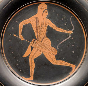
Image
An Attic vase-painting of a Scythian archer (a police force in Athens) by Epiktetos, 520–500 BC

In artworks, the Scythians are portrayed exhibiting Caucasoid traits.[67] In Histories, the 5th-century BC Greek historian Herodotus describes the Budini of Scythia as red-haired and grey-eyed.[67] In the 5th century BC, Greek physician Hippocrates argued that the Scythians were light skinned[67][68] as well as having a particularly high rate of hypermobility, to a point of affecting warfare.[69] In the 3rd century BC, the Greek poet Callimachus described the Arismapes (Arimaspi) of Scythia as fair-haired.[67][70] The 2nd-century BC Han Chinese envoy Zhang Qian described the Sai (Saka), an eastern people closely related to the Scythians, as having yellow (probably meaning hazel or green) and blue eyes.[67] In Natural History, the 1st-century AD Roman author Pliny the Elder characterises the Seres, sometimes identified as Saka or Tocharians, as red-haired, blue-eyed and unusually tall.[67][71] In the late 2nd century AD, the Christian theologian Clement of Alexandria says that the Scythians and the Celts have long auburn hair.[67][72] The 2nd-century Greek philosopher Polemon includes the Scythians among the northern peoples characterised by red hair and blue-grey eyes.[67] In the late 2nd or early 3rd century AD, the Greek physician Galen writes that Scythians, Sarmatians, Illyrians, Germanic peoples and other northern peoples have reddish hair.[67][73] The fourth-century Roman historian Ammianus Marcellinus wrote that the Alans, a people closely related to the Scythians, were tall, blond and light-eyed.[74] The fourth-century bishop Gregory of Nyssa wrote that the Scythians were fair skinned and blond haired.[75] The 5th-century physician Adamantius, who often followed Polemon, describes the Scythians as fair-haired.[67][76]

Genetics

In 2017, a genetic study of various Scythian cultures, including the Scythians, was published in Nature Communications. The study suggested that the Scythians arose as admixture between European-related groups from the Yamnaya culture and East Asian/Siberian groups. Further they found evidence for massive geneflow from East-Eurasia to West-Eurasia during the early Iron Age. While the origin of the Scythian material culture is disputed, their evidence suggest an origin in the East. Modern populations relative closely related to the ancient Scythians were found to be populations living in proximity to the sites studied, suggesting genetic continuity.[6]

Another 2017 genetic study, published in Scientific Reports, found that the Scythians shared common mithocondrial lineages with the earlier Srubnaya culture. It also noted that the Scythians differed from materially similar groups further east by the absence of east Eurasian mitochondrial lineages. The authors of the study suggested that the Srubnaya culture was the source of the Scythian cultures of at least the Pontic steppe.[39]

Krzewińska et al. (2018) found that the historical Central Asian Steppe population was genetically heterogeneous and carried genetic affinities with populations from several other regions including the Far East and the southern Urals.[40]

In 2019, a genetic study of remains from the Aldy-Bel culture of southern Siberia and proper Scythians from the Pontic–Caspian steppe, which are materially similar to each other, was published in Human Genetics. They identified Scythians as mix of West-Eurasian and East-Eurasian lineages. East Asian admixture was estimated at 26,3%. The samples of Aldy-Bel in contrast revealed increased East-Eurasian ancestry. The results indicated that the Scythians and the Aldy-Bel people were of different origins, with almost no gene flow between them.[77]

Järve et al. (2019) found that the nomadic Scythians were of different genetic origins. They suggested that migrations must have played a role in the emergence of the Scythians as the dominant power on the Pontic steppe.[41]

A 2021 study by Gnecchi-Ruscone et al., concluded that the Scythians were of multiple origin and that they originated from an admixture event in the Bronze Age. They further concluded that their evidence does not support an origin of the Scythian material culture from the Pontic-Caspian Steppe. The Scythians genetically formed from mixture between a steppe_MLBA sources (which could be associated with different cultures such as Sintashta, Srubnaya, and Andronovo) and a specific East-Eurasian source that was already present during the LBA in the neighboring northern Mongolia region.[78]

Legacy

Late Antiquity


See also: Sarmatians, Alans, and Ossetians

In Late Antiquity and the Middle Ages, the name "Scythians" was used in Greco-Roman literature for various groups of nomadic "barbarians" living on the Pontic-Caspian steppe. This includes Huns, Goths, Ostrogoths, Turkic peoples, Pannonian Avars and Khazars. None of these peoples had any relation whatsoever with the actual Scythians.[25]

Byzantine sources also refer to the Rus' raiders who attacked Constantinople circa 860 in contemporary accounts as "Tauroscythians", because of their geographical origin, and despite their lack of any ethnic relation to Scythians. Patriarch Photius may have first applied the term to them during the siege of Constantinople.[citation needed]

Early Modern usage
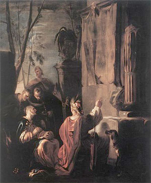
Image
Scythians at the Tomb of Ovid (c. 1640), by Johann Heinrich Schönfeld

Owing to their reputation as established by Greek historians, the Scythians long served as the epitome of savagery and barbarism.[citation needed]

The New Testament includes a single reference to Scythians in Colossians 3:11:[79] in a letter ascribed to Paul, "Scythian" is used as an example of people whom some label pejoratively, but who are, in Christ, acceptable to God:

Here there is no Greek or Jew. There is no difference between those who are circumcised and those who are not. There is no rude outsider, or even a Scythian. There is no slave or free person. But Christ is everything. And he is in everything.[79]


Shakespeare, for instance, alluded to the legend that Scythians ate their children in his play King Lear:

The barbarous Scythian
Or he that makes his generation messes
To gorge his appetite, shall to my bosom
Be as well neighbour'd, pitied, and relieved,
As thou my sometime daughter.[80]


Characteristically, early modern English discourse on Ireland, such as that of William Camden and Edmund Spenser, frequently resorted to comparisons with Scythians in order to confirm that the indigenous population of Ireland descended from these ancient "bogeymen", and showed themselves as barbaric as their alleged ancestors.[81][82]
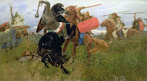
Image
Romantic nationalism: Battle between the Scythians and the Slavs (Viktor Vasnetsov, 1881)

Descent claims

Image
Eugène Delacroix's painting of the Roman poet, Ovid, in exile among the Scythians[83]

Further information: Sarmatism and Generations of Noah

Some legends of the Poles,[84] the Picts, the Gaels, the Hungarians, among others, also include mention of Scythian origins. Some writers claim that Scythians figured in the formation of the empire of the Medes and likewise of Caucasian Albania.[citation needed]

The Scythians also feature in some national origin-legends of the Celts. In the second paragraph of the 1320 Declaration of Arbroath, the élite of Scotland claim Scythia as a former homeland of the Scots. According to the 11th-century Lebor Gabála Érenn (The Book of the Taking of Ireland), the 14th-century Auraicept na n-Éces and other Irish folklore, the Irish originated in Scythia and were descendants of Fénius Farsaid, a Scythian prince who created the Ogham alphabet.[citation needed]

The Carolingian kings of the Franks traced Merovingian ancestry to the Germanic tribe of the Sicambri. Gregory of Tours documents in his History of the Franks that when Clovis was baptised, he was referred to as a Sicamber with the words "Mitis depone colla, Sicamber, adora quod incendisti, incendi quod adorasti." The Chronicle of Fredegar in turn reveals that the Franks believed the Sicambri to be a tribe of Scythian or Cimmerian descent, who had changed their name to Franks in honour of their chieftain Franco in 11 BC.[citation needed]

In the 17th and 18th centuries, foreigners regarded the Russians as descendants of Scythians. It became conventional to refer to Russians as Scythians in 18th-century poetry, and Alexander Blok drew on this tradition sarcastically in his last major poem, The Scythians (1920). In the 19th century, romantic revisionists in the West transformed the "barbarian" Scyths of literature into the wild and free, hardy and democratic ancestors of all blond Indo-Europeans.[citation needed]

Based on such accounts of Scythian founders of certain Germanic as well as Celtic tribes, British historiography in the British Empire period such as Sharon Turner in his History of the Anglo-Saxons, made them the ancestors of the Anglo-Saxons.[citation needed]

The idea was taken up in the British Israelism of John Wilson, who adopted and promoted the idea that the "European Race, in particular the Anglo-Saxons, were descended from certain Scythian tribes, and these Scythian tribes (as many had previously stated from the Middle Ages onward) were in turn descended from the Ten Lost Tribes of Israel."[85] Tudor Parfitt, author of The Lost Tribes of Israel and Professor of Modern Jewish Studies, points out that the proof cited by adherents of British Israelism is "of a feeble composition even by the low standards of the genre."[86]

Legends about the origin of the population from the Scythian ancestor Targitai – son of Borisfen's daughter (that was the name of the Dnipro river in antiquity) – are popular in Ukraine. In Ukraine, which territory Herodotus described in his work on the Scythians, there are discussions about how serious the influence of the Scythians was on the ethnogenesis of Ukrainians.[87] Currently, there are studies that indicate the relationship of Slavic tribes living in Ukraine with the Scythian plowmen (plough man) and farmers who belonged to the Proto-Slavic Chernoles or Black Forest culture.[88][89] The description of Scythia by Herodotus is also called the oldest description of Ukraine.[90] Despite the absolute dissimilarity of modern Ukrainian and hypothetical Scythian languages, researchers claim it still left some marks,[91] such as the fricative pronunciation of the letter "г", the specific alternation, etc.[92]

Related ancient peoples

Herodotus and other classical historians listed quite a number of tribes who lived near the Scythians, and presumably shared the same general milieu and nomadic steppe culture, often called "Scythian culture", even though scholars may have difficulties in determining their exact relationship to the "linguistic Scythians". A partial list of these tribes includes the Agathyrsi, Geloni, Budini, and Neuri.

• Abii
• Agathyrsi
• Amardi
• Amyrgians
• Androphagi
• Budini
• Cimmerians
• Dahae
o Parni
• Gelae
• Gelonians
• Hamaxobii
• Huns
• Indo-Scythians
o Apracharajas
o Kambojas
• Massagetae
o Apasiacae
• Melanchlaeni
• Orthocorybantians
• Saka
• Sarmatians
• Sindi
• Spali
• Tapur
• Tauri
• Thyssagetae

See also

• Scythia
• Scythian art
• Scythian languages
• Eurasian nomads
• Nomadic empire
• Pre-Achaemenid Scythian kings of Iran

References

1. Scythian /ˈsɪθiən/ or /ˈsɪðiən/, Scyth /ˈsɪθ/, but note Scytho- /ˈsaɪθoʊ/ in composition (OED).
2. * Dandamayev 1994, p. 37: "In modern scholarship the name 'Sakas' is reserved for the ancient tribes of northern and eastern Central Asia and Eastern Turkestan to distinguish them from the related Massagetae of the Aral region and the Scythians of the Pontic steppes. These tribes spoke Iranian languages, and their chief occupation was nomadic pastoralism."
 Cernenko 2012, p. 3: "The Scythians lived in the Early Iron Age, and inhabited the northern areas of the Black Sea (Pontic) steppes. Though the 'Scythian period' in the history of Eastern Europe lasted little more than 400 years, from the 7th to the 3rd centuries BC, the impression these horsemen made upon the history of their times was such that a thousand years after they had ceased to exist as a sovereign people, their heartland and the territories which they dominated far beyond it continued to be known as 'greater Scythia'."
 Melykova 1990, pp. 97–98: "From the end of the 7th century B.C. to the 4th century B.C. the Central- Eurasian steppes were inhabited by two large groups of kin Iranian-speaking tribes – the Scythians and Sarmatians [...] "[ I]t may be confidently stated that from the end of the 7th century to the 3rd century B.C. the Scythians occupied the steppe expanses of the north Black Sea area, from the Don in the east to the Danube in the West."
 Ivantchik 2018: "Scythians, a nomadic people of Iranian origin who flourished in the steppe lands north of the Black Sea during the 7th–4th centuries BCE (Figure 1). For related groups in Central Asia and India, see [...]"
 Sulimirski 1985, pp. 149–153: "During the first half of the first millennium B.C., c. 3,000 to 2,500 years ago, the southern part of Eastern Europe was occupied mainly by peoples of Iranian stock [...] The main Iranian-speaking peoples of the region at that period were the Scyths and the Sarmatians [...] [T]he population of ancient Scythia was far from being homogeneous, nor were the Scyths themselves a homogeneous people. The country called after them was ruled by their principal tribe, the "Royal Scyths" (Her. iv. 20), who were of Iranian stock and called themselves "Skolotoi" (iv. 6); they were nomads who lived in the steppe east of the Dnieper up to the Don, and in the Crimean steppe [...] The eastern neighbours of the "Royal Scyths", the Sauromatians, were also Iranian; their country extended over the steppe east of the Don and the Volga."
 Sulimirski & Taylor 1991, p. 547: "The name 'Scythian' is met in the classical authors and has been taken to refer to an ethnic group or people, also mentioned in Near Eastern texts, who inhabited the northern Black Sea region."
 West 2002, pp. 437–440: "Ordinary Greek (and later Latin) usage could designate as Scythian any northern barbarian from the general area of the Eurasian steppe, the virtually treeless corridor of drought-resistant perennial grassland extending from the Danube to Manchuria. Herodotus seeks greater precision, and this essay is focussed on his Scythians, who belong to the North Pontic steppe [...] These true Scyths seems to be those whom he calls Royal Scyths, that is, the group who claimed hegemony [...] apparently warrior-pastoralists. It is generally agreed, from what we know of their names, that these were people of Iranian stock [...]"
 Jacobson 1995, pp. 36–37: "When we speak of Scythians, we refer to those Scytho-Siberians who inhabited the Kuban Valley, the Taman and Kerch peninsulas, Crimea, the northern and northeastern littoral of the Black Sea, and the steppe and lower forest steppe regions now shared between Ukraine and Russia, from the seventh century down to the first century B.C [...] They almost certainly spoke an Iranian language [...]"
 Di Cosmo 1999, p. 924: "The first historical steppe nomads, the Scythians, inhabited the steppe north of the Black Sea from about the eight century B.C."
 Rice, Tamara Talbot. "Central Asian arts: Nomadic cultures". Encyclopædia Britannica Online. Retrieved October 4, 2019. [Saka] gold belt buckles, jewelry, and harness decorations display sheep, griffins, and other animal designs that are similar in style to those used by the Scythians, a nomadic people living in the Kuban basin of the Caucasus region and the western section of the Eurasian plain during the greater part of the 1st millennium bc.
3. Jacobson 1995, p. [page needed].
4. Cunliffe, Barry (26 September 2019). The Scythians: Nomad Warriors of the Steppe. Oxford University Press. p. 42. ISBN 978-0-19-255186-3.
5. Ivantchik 2018
6. Unterländer, Martina (March 3, 2017). "Ancestry and demography and descendants of Iron Age nomads of the Eurasian Steppe". Nature Communications. 8: 14615. Bibcode:2017NatCo...814615U. doi:10.1038/ncomms14615. PMC 5337992. PMID 28256537. Genomic inference reveals that Scythians in the east and the west of the steppe zone can best be described as a mixture of Yamnaya-related ancestry and an East Asian component. Demographic modelling suggests independent origins for eastern and western groups with ongoing gene-flow between them, plausibly explaining the striking uniformity of their material culture. We also find evidence that significant gene-flow from east to west Eurasia must have occurred early during the Iron Age. The origin of the widespread Scythian culture has long been debated in Eurasian archaeology. The northern Black Sea steppe was originally considered the homeland and centre of the Scythians3 until Terenozhkin formulated the hypothesis of a Central Asian origin4. On the other hand, evidence supporting an east Eurasian origin includes the kurgan Arzhan 1 in Tuva5, which is considered the earliest Scythian kurgan5. Dating of additional burial sites situated in east and west Eurasia confirmed eastern kurgans as older than their western counterparts6,7. Additionally, elements of the characteristic ‘Animal Style’ dated to the tenth century BCE1,4 were found in the region of the Yenisei river and modern-day China, supporting the early presence and origin of Scythian culture in the East.
7. Di Cosmo 1999, p. 891: "Even though there were fundamental ways in which nomadic groups over such a vast territory differed, the terms "Scythian" and "Scythic" have been widely adopted to describe a special phase that followed the widespread diffusion of mounted nomadism, characterized by the presence of special weapons, horse gear, and animal art in the form of metal plaques. Archaeologists have used the term "Scythic continuum" in a broad cultural sense to indicate the early nomadic cultures of the Eurasian steppe. The term "Scythic" draws attention to the fact that there are elements – shapes of weapons, vessels, and ornaments, as well as lifestyle – common to both the eastern and western ends of the Eurasian steppe region. However, the extension and variety of sites across Asia makes Scythian and Scythic terms too broad to be viable, and the more neutral "early nomadic" is preferable, since the cultures of the Northern Zone cannot be directly associated with either the historical Scythians or any specific archaeological culture defined as Saka or Scytho-Siberian."
8. Kramrisch, Stella. "Central Asian Arts: Nomadic Cultures". Encyclopædia Britannica Online. Retrieved September 1, 2018. The Śaka tribe was pasturing its herds in the Pamirs, central Tien Shan, and in the Amu Darya delta. Their gold belt buckles, jewelry, and harness decorations display sheep, griffins, and other animal designs that are similar in style to those used by the Scythians, a nomadic people living in the Kuban basin of the Caucasus region and the western section of the Eurasian plain during the greater part of the 1st millennium bc.
9. * Ivantchik 2018: "Scythians, a nomadic people of Iranian origin [...]"
 Harmatta 1996, p. 181: "[ b]oth Cimmerians and Scythians were Iranian peoples."
 Sulimirski 1985, pp. 149–153: "During the first half of the first millennium B.C., c. 3,000 to 2,500 years ago, the southern part of Eastern Europe was occupied mainly by peoples of Iranian stock [...] [T]he population of ancient Scythia was far from being homogeneous, nor were the Scyths themselves a homogeneous people. The country called after them was ruled by their principal tribe, the "Royal Scyths" (Her. iv. 20), who were of Iranian stock and called themselves "Skolotoi" [...]"
 West 2002, pp. 437–440: "[T]rue Scyths seems to be those whom [Herodotus] calls Royal Scyths, that is, the group who claimed hegemony [...] apparently warrior-pastoralists. It is generally agreed, from what we know of their names, that these were people of Iranian stock [...]"
 Rolle 1989, p. 56: "The physical characteristics of the Scythians correspond to their cultural affiliation: their origins place them within the group of Iranian peoples."
 Rostovtzeff 1922, p. 13: "The Scythian kingdom [...] was succeeded in the Russian steppes by an ascendancy of various Sarmatian tribes — Iranians, like the Scythians themselves."
 Minns 2011, p. 36: "The general view is that both agricultural and nomad Scythians were Iranian."
10. * Dandamayev 1994, p. 37: "In modern scholarship the name 'Sakas' is reserved for the ancient tribes of northern and eastern Central Asia and Eastern Turkestan to distinguish them from the related Massagetae of the Aral region and the Scythians of the Pontic steppes. These tribes spoke Iranian languages, and their chief occupation was nomadic pastoralism."
 Davis-Kimball, Bashilov & Yablonsky 1995, p. 91: "Near the end of the 19th century V.F. Miller (1886, 1887) theorized that the Scythians and their kindred, the Sauromatians, were Iranian-speaking peoples. This has been a popular point of view and continues to be accepted in linguistics and historical science [...]"
 Melykova 1990, pp. 97–98: "From the end of the 7th century B.C. to the 4th century B.C. the Central- Eurasian steppes were inhabited by two large groups of kin Iranian-speaking tribes – the Scythians and Sarmatians [...]"
 Melykova 1990, p. 117: "All contemporary historians, archeologists and linguists are agreed that since the Scythian and Sarmatian tribes were of the Iranian linguistic group [...]"
 Sulimirski 1985, pp. 149–153: "During the first half of the first millennium B.C., c. 3,000 to 2,500 years ago, the southern part of Eastern Europe was occupied mainly by peoples of Iranian stock [...] The main Iranian-speaking peoples of the region at that period were the Scyths and the Sarmatians [...]"
 Jacobson 1995, pp. 36–37: "When we speak of Scythians, we refer to those Scytho-Siberians who inhabited the Kuban Valley, the Taman and Kerch peninsulas, Crimea, the northern and northeastern littoral of the Black Sea, and the steppe and lower forest steppe regions now shared between Ukraine and Russia, from the seventh century down to the first century B.C [...] They almost certainly spoke an Iranian language [...]"
11. Harmatta 1996, pp. 181–182
12. "Scythian". Encyclopædia Britannica Online. Encyclopædia Britannica, Inc. Retrieved October 4, 2019.
13. Hambly, Gavin. "History of Central Asia: Early Western Peoples". Encyclopædia Britannica Online. Encyclopædia Britannica, Inc. Retrieved October 4, 2019.
14. Beckwith 2009, p. 117: "The Scythians, or Northern Iranians, who were culturally and ethnolinguistically a single group at the beginning of their expansion, had earlier controlled the entire steppe zone."
15. Beckwith 2009, pp. 377–380: "The preservation of the earlier form. *Sakla. in the extreme eastern dialects supports the historicity of the conquest of the entire steppe zone by the Northern Iranians—literally, by the 'Scythians'—in the Late Bronze Age or Early Iron Age [...]"
16. Beckwith 2009, p. 11
17. Young, T. Cuyler. "Ancient Iran: The kingdom of the Medes". Encyclopædia Britannica Online. Encyclopædia Britannica, Inc. Retrieved October 4, 2019.
18. Beckwith 2009, p. 49
19. "Sarmatian". Encyclopædia Britannica Online. Encyclopædia Britannica, Inc. Retrieved October 4, 2019.
20. Brzezinski & Mielczarek 2002, p. 39: "Indeed, it is now accepted that the Sarmatians merged in with pre-Slavic populations."
21. Mallory & Adams 1997, p. 523: "In their Ukrainian and Polish homeland the Slavs were intermixed and at times overlain by Germanic speakers (the Goths) and by Iranian speakers (Scythians, Sarmatians, Alans) in a shifting array of tribal and national configurations."
22. Davis-Kimball, Bashilov & Yablonsky 1995, p. 165: "Iranian-speaking nomadic tribes, specifically the Scythians and Sarmatians, are special among the North Caucasian peoples. The Scytho-Sarmatians were instrumental in the ethnogenesis of some of the modern peoples living today in the Caucasus. Of importance in this group are the Ossetians, an Iranian-speaking group of people who are believed to have descended from the North Caucasian Alans."
23. Beckwith 2009, pp. 58–70
24. "Scythian art". Encyclopædia Britannica Online. Encyclopædia Britannica, Inc. Retrieved October 4, 2019.
25. Dickens 2018, p. 1346: "Greek authors [...] frequently applied the name Scythians to later nomadic groups who had no relation whatever to the original Scythians"
26. Szemerényi 1980
27. K. E. Eduljee. "Histories by Herodotus, Book 4 Melpomene [4.6]". Zoroastrian Heritage. Retrieved October 20, 2020.
28. Lendering, Jona (February 14, 2019). "Scythians / Sacae". Livius.org. Retrieved October 4,2019.
29. Unterländer, Martina (March 3, 2017). "Ancestry and demography and descendants of Iron Age nomads of the Eurasian Steppe". Nature Communications. 8: 14615. Bibcode:2017NatCo...814615U. doi:10.1038/ncomms14615. PMC 5337992. PMID 28256537. During the first millennium BC, nomadic people spread over the Eurasian Steppe from the Altai Mountains over the northern Black Sea area as far as the Carpathian Basin [...] Greek and Persian historians of the 1st millennium BCE chronicle the existence of the Massagetae and Sauromatians, and later, the Sarmatians and Sacae: cultures possessing artefacts similar to those found in classical Scythian monuments, such as weapons, horse harnesses and a distinctive ‘Animal Style' artistic tradition. Accordingly, these groups are often assigned to the Scythian culture [...]
30. Davis-Kimball, Bashilov & Yablonsky 1995, pp. 27–28
31. West 2002, pp. 437–440
32. Watson 1972, p. 142: "The term 'Scythic' has been used above to denote a group of basic traits which characterize material culture from the fifth to the first century B.C. in the whole zone stretching from the Transpontine steppe to the Ordos, and without ethnic connotation. How far nomadic populations in central Asia and the eastern steppes may be of Scythian, Iranic, race, or contain such elements makes a precarious speculation."
33. David & McNiven 2018: "Horse-riding nomadism has been referred to as the culture of 'Early Nomads'. This term encompasses different ethnic groups (such as Scythians, Saka, Massagetae, and Yuezhi) [...]"
34. Davis-Kimball, Bashilov & Yablonsky 1995, p. 33
35. Herodotus 1910, 4.11
36. Drews 2004, p. 92: "Ever since critical history began, scholars have recognized that much of what Herodotos gives us is silly."
37. Mallory 1991, pp. 51–53
38. Dolukhanov 1996, p. 125
39. Juras, Anna (March 7, 2017). "Diverse origin of mitochondrial lineages in Iron Age Black Sea Scythians". Nature Communications. 7: 43950. Bibcode:2017NatSR...743950J. doi:10.1038/srep43950. PMC 5339713. PMID 28266657.
40. Krzewińska, Maja (October 3, 2018). "Ancient genomes suggest the eastern Pontic-Caspian steppe as the source of western Iron Age nomads". Nature Communications. 4 (10): eaat4457. Bibcode:2018SciA....4.4457K. doi:10.1126/sciadv.aat4457. PMC 6223350. PMID 30417088. The nomadic populations were heterogeneous and carried genetic affinities with populations from several other regions including the Far East and the southern Urals. Genetic analyses of maternal lineages of Scythians suggest a mixed origin and an east-west admixture gradient across the Eurasian steppe (10–12). The genomics of two early Scythian Aldy-Bel individuals (13) showed genetic affinities to eastern Asian populations (12).
41. Järve, Mari (July 22, 2019). "Shifts in the Genetic Landscape of the Western Eurasian Steppe Associated with the Beginning and End of the Scythian Dominance". Current Biology. 29 (14): 2430–2441. doi:10.1016/j.cub.2019.06.019. PMID 31303491. S2CID 195887262. The Early Iron Age nomadic Scythians have been described as a confederation of tribes of different origins, based on ancient DNA evidence [1, 2, 3]. All samples of this study also possessed at least one additional eastern component, one of which was nearly at 100% in modern Nganasans (orange) and the other in modern Han Chinese (yellow; Figure S2). The eastern components were present in variable proportions in the samples of this study.
42. Cernenko 2012, pp. 3–4
43. Schmitt, Rüdiger (March 20, 1912). "Haumavargā". Encyclopædia Iranica.
44. Cernenko 2012, pp. 21–29
45. Cernenko 2012, pp. 29–32
46. Hughes 1991, pp. 64–65, 118
47. Sulimirski & Taylor 1991, pp. 547–591
48. Tsetskhladze 2002
49. Tsetskhladze 2010
50. Curry, Andrew (22 May 2015). "Gold Artifacts Tell Tale of Drug-Fueled Rituals and "Bastard Wars"". National Geographic. National Geographic Society. Retrieved October 4, 2019.
51. Traces of the Iranian root xšaya – "ruler" – may persist in all three names.
52. Herodotus 1910, 4.5–4.7
53. Herodotus 1910, 4.20
54. Belier 1991, p. 69
55. Potts 1999, p. 345
56. Cernenko 2012, p. 20
57. Anthony 2010, p. 329
58. Armbruster, Barbara (2009-12-31). "Gold technology of the ancient Scythians – gold from the kurgan Arzhan 2, Tuva". ArcheoSciences. Revue d'archéométrie (33): 187–193. doi:10.4000/archeosciences.2193. ISSN 1960-1360.
59. Jettmar, Karl (1971). "Metallurgy in the Early Steppes" (PDF). Artibus Asiae. 33 (1/2): 5–16. doi:10.2307/3249786. JSTOR 3249786.
60. Margarita Gleba. "You Are What You Wear: Scythian Costume as Identity". Dressing the Past. Academia. Retrieved October 19, 2020.
61. Youngsoo Yi-Chang (2016). "The Study on the Scythian Costume III -Focaused on the Scythian of the Pazyryk region in Altai-". Fashion & Textile Research Journal (한국의류산업학회지). Korea Institute of Science and Technology. 18 (4). doi:10.5805/SFTI.2016.18.4.424. Retrieved October 19, 2020.
62. Esther Jacobson (1995). The Art of the Scythians: The Interpenetration of Cultures at the Edge of the Hellenic World. BRILL. pp. 11–. ISBN 90-04-09856-9.
63. Lubotsky 2002, p. 190
64. Lubotsky 2002, pp. 189–202
65. Testen 1997, p. 707
66. "Frozen Tombs of Siberia: The Pazyryk Burials of Iron Age Horsemen". Archived from the original on 15 October 2014.
67. Day 2001, pp. 55–57
68. Hippocrates 1886, 20 "The Scythians are a ruddy race because of the cold, not through any fierceness in the sun's heat. It is the cold that burns their white skin and turns it ruddy."
69. Beighton PH, Grahame R, Bird HA (2011). Hypermobility of Joints. Springer. p. 1. ISBN 978-1-84882-085-2. Archived from the original on 2017-11-05.
70. Callimachus 1921, Hymn IV. To Delos. 291 "The first to bring thee these offerings fro the fair-haired Arimaspi [...]"
71. Pliny 1855, Book VI, Chap. 24 ". These people, they said, exceeded the ordinary human height, had flaxen hair, and blue eyes [...]"
72. Clement 1885, Book 3. Chapter III "Of the nations, the Celts and Scythians wear their hair long, but do not deck themselves. The bushy hair of the barbarian has something fearful in it; and its auburn (ξανθόν) colour threatens war [...]"
73. Galen 1881, De Temperamentis. Book 2 "Ergo Aegyptii, Arabes, & Indi, omnes denique qui calidam & siccam regionem incolunt, nigros, exiguique incrementi, siccos, crispos, & fragiles pilos habent. Contra qui humidam, frigidamque regionem habitant, Illyrii, Germani, Sarmatae, & omnis Scytica plaga, modice auctiles, & graciles, & rectos, & rufos optinent. Qui uero inter hos temperatum colunt tractum, hi pilos plurimi incrementi, & robustissimos, & modice nigros, & mediocriter crassos, tum nec prorsus crispos, nec omnino rectos edunt."
74. Marcellinus 1862, Book XXI, II, 21 "Nearly all the Alani are men of great stature and beauty; their hair is somewhat yellow, their eyes are terribly fierce"
75. Gregory 1995, p. 124: "[T]he Ethiopian's son black, but the Scythian white-skinned and with hair of a golden tinge."
76. Adamantius. Physiognomica. 2. 37
77. Mary, Laura (March 28, 2019). "Genetic kinship and admixture in Iron Age Scytho-Siberians". Human Genetics. 138 (4): 411–423. doi:10.1007/s00439-019-02002-y. PMID 30923892. S2CID 85542410. Mitochondrial lineages in the NPR Scythians analyzed in this study appear to consist of a mixture of west and east Eurasian haplogroups. West Eurasian lineages were represented by subdivisions of haplogroup U5 (U5a2a1, U5a1a1, U5a1a2b, U5a2b, U5a1b, U5b2a1a2, six individuals total, 31.6%), H (H and H5b, three individuals total, 15.8%), J (J1c2 and J2b1a6, two individuals, 10.5%), as well as haplogroups N1b1a, W3a and T2b (one individual each, 5.3% each specimen). East Eurasian mt lineages were represented by haplogroups A, D4j2, F1b, M10a1a1a, and H8c (represented by a single individual), in total, comprising 26.3% of our sample set. The absence of R1b lineages in the Scytho-Siberian individuals tested so far and their presence in the North Pontic Scythians suggest that these 2 groups had a completely different paternal lineage makeup with nearly no gene flow from male carriers between them.
78. Gnecchi-Ruscone, Guido Alberto; Khussainova, Elmira; Kahbatkyzy, Nurzhibek; Musralina, Lyazzat; Spyrou, Maria A.; Bianco, Raffaela A.; Radzeviciute, Rita; Martins, Nuno Filipe Gomes; Freund, Caecilia; Iksan, Olzhas; Garshin, Alexander (March 2021). "Ancient genomic time transect from the Central Asian Steppe unravels the history of the Scythians". Science Advances. doi:10.1126/sciadv.abe4414. PMC 7997506. PMID 33771866. Our findings shed new light onto the debate about the origins of the Scythian cultures. We do not find support for a western Pontic-Caspian steppe origin, which is, in fact, highly questioned by more recent historical/archeological work (1, 2). The Kazakh Steppe origin hypothesis finds instead a better correspondence with our results, but rather than finding support for one of the two extreme hypotheses, i.e., single origin with population diffusion versus multiple independent origins with only cultural transmission, we found evidence for at least two independent origins as well as population diffusion and admixture (Fig. 4B). In particular, the eastern groups are consistent with descending from a gene pool that formed as a result of a mixture between preceding local steppe_MLBA sources (which could be associated with different cultures such as Sintashta, Srubnaya, and Andronovo that are genetically homogeneous) and a specific eastern Eurasian source that was already present during the LBA in the neighboring northern Mongolia region (27).
79. "Colossians 3:11 New International Version (NIV)". BibleGateway.com. Zondervan. Retrieved October 4, 2019. Here there is no Gentile or Jew, circumcised or uncircumcised, barbarian, Scythian, slave or free, but Christ is all, and is in all.
80. King Lear Act I, Scene i.
81. Spenser 1970
82. Camden 1701
83. Lomazoff & Ralby 2013, p. 63
84. Waśko 1997
85. Parfitt 2003, p. 54
86. Parfitt 2003, p. 61
87. "Чиїми предками були скіфи?". tyzhden.ua. Retrieved 2021-04-20.
88. "Сегеда Сергій. Антропологія. Антропологічні особливості давнього населення України".
89. http://resource.history.org.ua/cgi-bin/ ... orysfenity
90. "§ 8. Begin research in Ukraine | Physical Geography of Ukraine, Grade 8". geomap.com.ua. Retrieved 2021-04-20.
91. "Античне коріння "шароварщини"". Історична правда. Retrieved 2021-04-20.
92. "Астерікс і Обелікс – французи, а скіфи – не українці? – Всеукраїнський незалежний медійний простір "Сіверщина"". siver.com.ua. Retrieved 2021-04-20.

Early sources

• Callimachus (1921). Callimachus, Hymns and Epigrams. Lycophron. Aratus. Translated by Mair, A. W.; Mair, G. W. Heinemann.
• Camden, William (1701). Camden's Britannia. J. B.
• Clement (1885). Roberts, Alexander; Donaldson, James (eds.). The Instructor. Ante-Nicene Christian Library. Translated by Wilson, William. T&T Clark.
• Galen (1881). Galeni pergamensis de temperamentis, et de inaequali intemperie (in Latin). Translated by Linacre, Thomas. Cambridge University Press.
• Gregory (1995). "Book II". Against Eunomius. Nicene and Post-Nicene Fathers: Second series. Translated by Wilson, Rev. H. A. Hendrickson. pp. 101–135. ISBN 1-56563-121-8.
• Herodotus (1910). The History of Herodotus. Translated by Rawlinson, George. J. M. Dent.
• Hippocrates (1886). Περί αέρων, υδάτων, τόπων [Airs, Waters, Places]. Translated by Jones, W. H. S. Harvard University Press.
• Marcellinus, Ammianus (1862). Roman History. Translated by Yonge, Charles Duke. Bohn.
• Pliny (1855). The Natural History. Translated by Bostock, John. Taylor & Francis.
• Spenser, Edmund (1970). A View of the Present State of Ireland. Clarendon Press. ISBN 978-0-19-812408-5.

Modern sources

• Anthony, David W. (2010). The Horse, the Wheel, and Language: How Bronze-Age Riders from the Eurasian Steppes Shaped the Modern World. Princeton University Press. ISBN 978-1-4008-3110-4.
• Beckwith, Christopher I. (2009). Empires of the Silk Road: A History of Central Eurasia from the Bronze Age to the Present. Princeton University Press. ISBN 978-1-4008-2994-1.
• Belier, Wouter W. (1991). Decayed Gods: Origin and Development of Georges Dumézil's "Idéologie Tripartie". BRILL. ISBN 9004094873.
• Brzezinski, Richard; Mielczarek, Mariusz (2002). The Sarmatians 600 BC–AD 450. Bloomsbury USA. ISBN 1-84176-485-X.
• Cernenko, E. V. (2012). The Scythians 700–300 BC. Bloomsbury Publishing. ISBN 978-1-78096-773-8.
• Dandamayev, Muhammad (1994). "Media and Achaemenid Iran". In Harmatta, János Harmatta(ed.). History of Civilizations of Central Asia: The Development of Sedentary and Nomadic Civilizations, 700 B. C. to A. D. 250. 1. UNESCO. pp. 35–64. ISBN 9231028464.
• David, Bruno; McNiven, Ian J. (2018). The Oxford Handbook of the Archaeology and Anthropology of Rock Art. Oxford University Press. ISBN 978-0-19-060735-7.
• Davis-Kimball, Jeannine; Bashilov, Vladimir A.; Yablonsky, Leonid T. (1995). Nomads of the Eurasian Steppes in the Early Iron Age. Zinat Press. ISBN 978-1-885979-00-1.
• Day, John V. (2001). Indo-European Origins: The Anthropological Evidence. Institute for the Study of Man. ISBN 0-941694-75-5.
• Dickens, Mark (2018). "Scythians". In Nicholson, Oliver (ed.). The Oxford Dictionary of Late Antiquity. Oxford University Press. pp. 1346–1347. ISBN 978-0-19-174445-7. Retrieved April 27, 2020.
• Di Cosmo, Nicola (1999). "The Northern Frontier in Pre-Imperial China (1,500 – 221 BC)". In Loewe, Michael; Shaughnessy, Edward L.(eds.). The Cambridge History of Ancient China: From the Origins of Civilization to 221 BC. Cambridge University Press. pp. 885–996. ISBN 0-521-47030-7.
• Dolukhanov, Pavel Markovich (1996). The Early Slavs: Eastern Europe from the Initial Settlement to the Kievan Rus. Longman. ISBN 0-582-23618-5.
• Drews, Robert (2004). Early Riders: The Beginnings of Mounted Warfare in Asia and Europe. Taylor & Francis. ISBN 0-203-07107-7.
• Harmatta, János (1996). "The Scythians". In Herrmann, Joachim; Zürcher, Erik (eds.). History of Humanity: From the seventh century B.C. to the seventh century A.D. 3. UNESCO. pp. 181–182. ISBN 923102812X.
• Hughes, Dennis D. (1991). Human Sacrifice in Ancient Greece. Psychology Press. ISBN 0-415-03483-3.
• Ivantchik, Askold (April 25, 2018). "Scythians". Encyclopædia Iranica.
• Jacobson, Esther (1995). The Art of the Scythians: The Interpenetration of Cultures at the Edge of the Hellenic World. BRILL. ISBN 9004098569.
• Lomazoff, Amanda; Ralby, Aaron (2013). "Scythians and Sarmatians". The Atlas of Military History. Simon & Schuster. p. 63. ISBN 978-1-60710-985-3.
• Lubotsky, Alexander (2002). "Scythian Elements In Old Iranian" (PDF). Proceedings of the British Academy. Oxford University Press. 116(2): 189–202.
• Mallory, J. P. (1991). "The Iranians". In Search of the Indo-Europeans: Language Archeology and Myth. Thames & Hudson. pp. 48–56.
• Mallory, J. P.; Adams, Douglas Q. (1997). Encyclopedia of Indo-European Culture. Taylor & Francis. ISBN 1-884964-98-2.
• Melykova, A. I. (1990). "The Scythians and Sarmatians". In Sinor, Denis (ed.). The Cambridge History of Early Inner Asia. 1. Cambridge University Press. pp. 97–117. ISBN 978-1-139-05489-8.
• Minns, Ellis Hovell (2011). Scythians and Greeks: A Survey of Ancient History and Archaeology on the North Coast of the Euxine from the Danube to the Caucasus. Cambridge University Press. ISBN 978-1-108-02487-7.
• Nicholson, Oliver (2018). "Scythians (Saka)". The Oxford Dictionary of Late Antiquity. Oxford University Press. pp. 1346–1347. ISBN 978-0-19-256246-3.
• Parfitt, Tudor (2003). The Lost Tribes of Israel: The History of a Myth. Phoenix. ISBN 1-84212-665-2.
• Potts, Daniel T. (1999). The Archaeology of Elam: Formation and Transformation of an Ancient Iranian State. Cambridge University Press. ISBN 0-521-56496-4.
• Rolle, Renate (1989). The World of the Scythians. University of California Press. ISBN 0-520-06864-5.
• Rostovtzeff, Michael (1922). Iranians & Greeks In South Russia. Clarendon Press.
• Sulimirski, T. (1985). "The Scyths". In Gershevitch, I. (ed.). The Cambridge History of Iran: The Median and Achaemenian Periods. 2. Cambridge University Press. pp. 149–199. ISBN 978-1-139-05493-5.
• Sulimirski, T.; Taylor, T. (1991). "The Scythians". In Boardman, John; Edwards, I. E. S.; Sollberger, E.; Hammond, N. G. L. (eds.). The Cambridge Ancient History: The Assyrian and Babylonian Empires and Other States of the Near East, from the Eighth to the Sixth Centuries BC. 3 (2 ed.). Cambridge University Press. pp. 547–590. ISBN 978-1-139-05429-4.
• Szemerényi, Oswald (1980). Four old Iranian ethnic names: Scythian – Skudra – Sogdian – Saka (PDF). Verlag der Österreichischen Akademie der Wissenschaften. ISBN 0-520-06864-5.
• Testen, David (1997). "Ossetic Phonology". In Kaye, Alan S. (ed.). Phonologies of Asia and Africa: (including the Caucasus). 2. Eisenbrauns. pp. 707–733. ISBN 1-57506-019-1.
• Tsetskhladze, Gocha R. (December 17, 2002) [1998]. "Who Built the Scythian and Thracian Royal and Elite Tombs?". Oxford Journal of Archaeology. Wiley. 17 (1): 55–92. doi:10.1111/1468-0092.00051.
• Tsetskhladze, Gocha R. (2010). North Pontic Archaeology: Recent Discoveries and Studies. BRILL. ISBN 978-9004120419.
• Watson, William (October 1972). "The Chinese Contribution to Eastern Nomad Culture in the Pre-Han and Early Han Periods". World Archaeology. Taylor & Francis, Ltd. 4 (2): 139–149. doi:10.1080/00438243.1972.9979528. JSTOR 123972.
• Waśko, Andrzej (April 1997). "Sarmatism or the Enlightenment: The Dilemma of Polish Culture". Sarmatian Review. Oxford University Press. XVII (2).
• West, Stephanie (2002). "Scythians". In Bakker, Egbert J.; de Jong, Irene J. F.; van Wees, Hans (eds.). Brill's Companion to Herodotus. Brill. pp. 437–456. ISBN 978-90-04-21758-4.

Further reading

• Baumer, Christoph (2012). The History of Central Asia: The Age of the Steppe Warriors. I.B.Tauris. ISBN 978-1-78076-060-5.
• Davis-Kimball, Jeannine (2003). Warrior Women: An Archaeologist's Search for History's Hidden Heroines. Grand Central Publishing. ISBN 0-446-67983-6.
• Gamkrelidze, Thomas V.; Ivanov, Vjaceslav V.(2010). Indo-European and the Indo-Europeans: A Reconstruction and Historical Analysis of a Proto-Language and Proto-Culture. Walter de Gruyter. ISBN 978-3-11-081503-0.
• Humbach, Helmut; Faiss, Klauss (2012). Herodotus's Scythians and Ptolemy's Central Asia: Semasiological and Onomasiological Studies. Reichert Verlag. ISBN 978-3-89500-887-0.
• Jaedtke, Wolfgang (2008). Steppenkind: Ein Skythen-Roman (in German). Piper. ISBN 978-3-492-25146-4.
• Johnson, James William (April 1959). "The Scythian: His Rise and Fall". Journal of the History of Ideas. University of Pennsylvania Press. 20 (2): 250–257. doi:10.2307/2707822. JSTOR 2707822.
• Lebedynsky, Iaroslav (2001). Les Scythes (in French). Ed. Errance. ISBN 2877722155.
• Rostovtzeff, Michael (1993). Skythien und der Bosporus (in German). 2. Franz Steiner Verlag. ISBN 3-515-06399-4.
• Torday, Laszlo (1998). Mounted Archers: The Beginnings of Central Asian History. Durham Academic Press. ISBN 1-900838-03-6.

External links

• Scythians at Encyclopædia Iranica
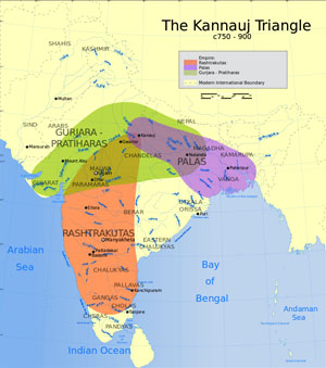
admin
Site Admin
 
Posts: 36573
Joined: Thu Aug 01, 2013 5:21 am

Re: Freda Bedi Cont'd (#3)

Postby admin » Thu Sep 16, 2021 10:52 pm

Part 1 of 2

Kushan Empire
by Wikipedia
Accessed: 9/16/21

Image
Kushan Empire
30–375
A map of India in the 2nd century AD showing the extent of the Kushan Empire (in yellow) during the reign of Kanishka. Most historians consider the empire to have variously extended as far east as the middle Ganges plain,[1] to Varanasi on the confluence of the Ganges and the Jumna,[2][3] or probably even Pataliputra.[4][5]
Status: Nomadic empire
Capital: Bagram (Kapiśi); Peshawar (Puruṣapura); Taxila (Takṣaśilā); Mathura (Mathurā)
Common languages: Greek (official until ca. 127)[note 1]; Bactrian[note 1] (official from ca. 127); Sanskrit[note 2]
Religion: Buddhism[8]; Hinduism[9]; Zoroastrianism[10]
Government: Monarchy
Emperor
• 30–80: Kujula Kadphises
• 350–375: Kipunada
Historical era/ Classical Antiquity
• Kujula Kadphises unites Yuezhi tribes into a confederation / 30
• Subjugated by the Sasanians, Guptas, and Hepthalites[11] / 375
Area
200 est.[12]: 2,000,000 km2 (770,000 sq mi)
200 est.[13]: 2,500,000 km2 (970,000 sq mi)
Currency: Kushan drachma
Preceded by / Succeeded by
Indo-Greek Kingdom / Sasanian Empire
Indo-Parthian Kingdom / Gupta Empire
Indo-Scythians / Nagas of Padmavati
-- / Kidarites

The Kushan Empire (Ancient Greek: Βασιλεία Κοσσανῶν; Bactrian: Κυϸανο, Kushano; Late Brahmi Sanskrit: [x], Ku-ṣā-ṇa, Kuṣāṇa; Devanagari Sanskrit: कुषाण राजवंश, Kuṣāṇa Rājavaṃśa; BHS: Guṣāṇa-vaṃśa; Parthian: [x], Kušan-[x]; Chinese:[x][14]) was a syncretic empire, formed by the Yuezhi, in the Bactrian territories in the early 1st century. It spread to encompass much of modern-day territory of Afghanistan, Pakistan and northern India,[15][16][17] at least as far as Saketa and Sarnath near Varanasi (Benares), where inscriptions have been found dating to the era of the Kushan Emperor Kanishka the Great.[note 3]
The Yuezhi (Chinese: 月氏; pinyin: Yuèzhī; Wade–Giles: Yüeh4-chih1, [ɥê ʈʂɻ̩́]) were an ancient people first described in Chinese histories as nomadic pastoralists living in an arid grassland area in the western part of the modern Chinese province of Gansu, during the 1st millennium BC. After a major defeat by the Xiongnu in 176 BC, the Yuezhi split into two groups migrating in different directions: the Greater Yuezhi (Dà Yuèzhī 大月氏) and Lesser Yuezhi (Xiǎo Yuèzhī 小月氏).

The Greater Yuezhi initially migrated northwest into the Ili Valley (on the modern borders of China and Kazakhstan), where they reportedly displaced elements of the Sakas. They were driven from the Ili Valley by the Wusun and migrated southward to Sogdia and later settled in Bactria.
The Greater Yuezhi have consequently often been identified with peoples mentioned in classical European sources as having overrun the Greco-Bactrian Kingdom, like the Tókharioi (Greek Τοχάριοι; Sanskrit Tukhāra) and Asii (or Asioi). During the 1st century BC, one of the five major Greater Yuezhi tribes in Bactria, the Kushanas (Chinese: 貴霜; pinyin: Guìshuāng), began to subsume the other tribes and neighbouring peoples. The subsequent Kushan Empire, at its peak in the 3rd century AD, stretched from Turfan in the Tarim Basin in the north to Pataliputra on the Gangetic plain of India in the south. The Kushanas played an important role in the development of trade on the Silk Road and the introduction of Buddhism to China.


The Lesser Yuezhi migrated southward to the edge of the Tibetan Plateau. Some are reported to have settled among the Qiang people in Qinghai, and to have been involved in the Liangzhou Rebellion (184–221 AD) against the Chinese Han dynasty. Another group of Yuezhi is said to have founded the city state of Cumuḍa (now known as Kumul and Hami) in the eastern Tarim. A fourth group of Lesser Yuezhi may have become part of the Jie people of Shanxi, who established the Later Zhao state of the 4th century AD (although this remains controversial).

-- Yuezhi, by Wikipedia

The Kushans were most probably one of five branches of the Yuezhi confederation,[21][22] an Indo-European nomadic people of possible Tocharian origin,[23][24][25][26][27] who migrated from northwestern China (Xinjiang and Gansu) and settled in ancient Bactria.[22] The founder of the dynasty, Kujula Kadphises, followed Greek religious ideas and iconography after the Greco-Bactrian tradition, and also followed traditions of Hinduism, being a devotee of the Hindu God Shiva.[28][29] The Kushans in general were also great patrons of Buddhism, and, starting with Emperor Kanishka, they also employed elements of Zoroastrianism in their pantheon.[30] They played an important role in the spread of Buddhism to Central Asia and China.

The Kushans possibly used the Greek language initially for administrative purposes, but soon began to use the Bactrian language.[note 1] Kanishka sent his armies north of the Karakoram mountains. A direct road from Gandhara to China remained under Kushan control for more than a century, encouraging travel across the Karakoram and facilitating the spread of Mahayana Buddhism to China. The Kushan dynasty had diplomatic contacts with the Roman Empire, Sasanian Persia, the Aksumite Empire and the Han dynasty of China. The Kushan Empire was at the center of trade relations between the Roman Empire and China: according to Alain Daniélou, "for a time, the Kushana Empire was the centerpoint of the major civilizations".[31] While much philosophy, art, and science was created within its borders, the only textual record of the empire's history today comes from inscriptions and accounts in other languages, particularly Chinese.[32]

The Kushan Empire fragmented into semi-independent kingdoms in the 3rd century AD, which fell to the Sasanians invading from the west, establishing the Kushano-Sasanian Kingdom in the areas of Sogdiana, Bactria and Gandhara.
In the 4th century, the Guptas, an Indian dynasty also pressed from the east. The last of the Kushan and Kushano-Sasanian kingdoms were eventually overwhelmed by invaders from the north, known as the Kidarites, and then the Hephthalites.[11]

Origins

Image
Yuezhi nobleman over a fire altar. Noin-Ula.[33]

Chinese sources describe the Guishuang (貴霜), i.e. the Kushans, as one of the five aristocratic tribes of the Yuezhi.[34] There is scholarly consensus that the Yuezhi were a people of Indo-European origin.[23][35] A specifically Tocharian origin of the Yuezhi is often suggested.[23][24][25][26][27][36] An Iranian, specifically Saka,[37] origin, also has some support among scholars.[38] Others suggest that the Yuezhi might have originally been a nomadic Iranian people, who were then partially assimilated by settled Tocharians, thus containing both Iranian and Tocharian elements.[39]

The Yuezhi were described in the Records of the Great Historian and the Book of Han as living in the grasslands of eastern Xinjiang and northwestern part of Gansu, in the northwest of modern-day China, until their King was beheaded by the Xiongnu (匈奴) who were also at war with China, which eventually forced them to migrate west in 176–160 BC.[40] The five tribes constituting the Yuezhi are known in Chinese history as Xiūmì (休密), Guìshuāng (貴霜), Shuāngmǐ (雙靡), Xìdùn (肸頓), and Dūmì (都密).

Image
The ethnonym "KOϷϷANOV" (Koshshanoy, "Kushans") in Greek alphabet (with the addition of the letter Ϸ, "Sh") on a coin of the first known Kushan ruler Heraios (1st century AD).

The Yuezhi reached the Hellenic kingdom of Greco-Bactria (in northern Afghanistan and Uzbekistan) around 135 BC. The displaced Greek dynasties resettled to the southeast in areas of the Hindu Kush and the Indus basin (in present-day Afghanistan and Pakistan), occupying the western part of the Indo-Greek Kingdom.

In India, Kushan emperors regularly used the dynastic name ΚΟϷΑΝΟ ("Koshano") on their coinage.[14] Several inscriptions in Sanskrit in the Brahmi script, such as the Mathura inscription of the statue of Vima Kadphises, refer to the Kushan Emperor as [x], Ku-ṣā-ṇa ("Kushana").[14][41] Some later Indian literary sources referred to the Kushans as Turushka, a name which in later Sanskrit sources was confused with Turk, "probably due to the fact that Tukharistan passed into the hands of the western Turks in the seventh century".[42][note 4] Yet, according to Wink, "nowadays no historian considers them to be Turkish-Mongoloid or 'Hun', although there is no doubt about their Central-Asian origin."[42]

Early Kushans

Kushan portraits


Image
Head of a Yuezhi prince (Khalchayan palace, Uzbekistan).[46]

Image
The first king to call himself "Kushan" on his coinage: Heraios (AD 1–30).

Image
Kushan devotee (2nd century AD). Metropolitan Museum of Art (detail)

Image
Portrait of Kushan emperor Vima Kadphises, AD 100-127

Some traces remain of the presence of the Kushans in the area of Bactria and Sogdiana in the 2nd-1st century BC, where they had displaced the Sakas, who moved further south.[47] Archaeological structures are known in Takht-i Sangin, Surkh Kotal (a monumental temple), and in the palace of Khalchayan. On the ruins of ancient Hellenistic cities such as Ai-Khanoum, the Kushans are known to have built fortresses. Various sculptures and friezes from this period are known, representing horse-riding archers,[48] and, significantly, men such as the Kushan prince of Khalchayan with artificially deformed skulls, a practice well attested in nomadic Central Asia.[49][50] Some of the Khalchayan sculptural scenes are also thought to depict the Kushans fighting against the Sakas.[51] In these portrayals, the Yuezhis are shown with a majestic demeanour, whereas the Sakas are typically represented with side-whiskers, and more or less grotesque facial expressions.[51]

The Chinese first referred to these people as the Yuezhi and said they established the Kushan Empire, although the relationship between the Yuezhi and the Kushans is still unclear. Ban Gu's Book of Han tells us the Kushans (Kuei-shuang) divided up Bactria in 128 BC. Fan Ye's Book of Later Han "relates how the chief of the Kushans, Ch'iu-shiu-ch'ueh (the Kujula Kadphises of coins), founded by means of the submission of the other Yueh-chih clans the Kushan Empire."[47]

The earliest documented ruler, and the first one to proclaim himself as a Kushan ruler, was Heraios. He calls himself a "tyrant" in Greek on his coins, and also exhibits skull deformation. He may have been an ally of the Greeks, and he shared the same style of coinage. Heraios may have been the father of the first Kushan emperor Kujula Kadphises.[citation needed]

The Chinese Book of Later Han chronicles then gives an account of the formation of the Kushan empire based on a report made by the Chinese general Ban Yong to the Chinese Emperor c. AD 125:

More than a hundred years later [than the conquest of Bactria by the Yuezhi], the prince [xihou] of Guishuang (Badakhshan) established himself as king, and his dynasty was called that of the Guishuang (Kushan) King. He invaded Anxi (Indo-Parthia), and took the Gaofu (Kabul) region. He also defeated the whole of the kingdoms of Puda (Paktiya) and Jibin (Kapisha and Gandhara). Qiujiuque (Kujula Kadphises) was more than eighty years old when he died. His son, Yangaozhen [probably Vema Tahk (tu) or, possibly, his brother Sadaṣkaṇa ], became king in his place. He defeated Tianzhu [North-western India] and installed Generals to supervise and lead it. The Yuezhi then became extremely rich. All the kingdoms call [their king] the Guishuang [Kushan] king, but the Han call them by their original name, Da Yuezhi.

— Book of Later Han.[52][53]


Diverse cultural influences

In the 1st century BC, the Guishuang (Ch: 貴霜) gained prominence over the other Yuezhi tribes, and welded them into a tight confederation under yabgu (Commander) Kujula Kadphises.[54] The name Guishuang was adopted in the West and modified into Kushan to designate the confederation, although the Chinese continued to call them Yuezhi.

Gradually wresting control of the area from the Scythian tribes, the Kushans expanded south into the region traditionally known as Gandhara (an area primarily in Pakistan's Pothowar and Khyber Pakhtunkhwa region) and established twin capitals in Begram.[55] and Charsadda, then known as Kapisa and Pushklavati respectively.[54]

Image
Greek alphabet (narrow columns) with Kushan script (wide columns)

The Kushans adopted elements of the Hellenistic culture of Bactria. They adopted the Greek alphabet to suit their own language (with the additional development of the letter Þ "sh", as in "Kushan") and soon began minting coinage on the Greek model. On their coins they used Greek language legends combined with Pali legends (in the Kharoshthi script), until the first few years of the reign of Kanishka. After the middle of Kanishka's reign, they used Kushan language legends (in an adapted Greek script), combined with legends in Greek (Greek script) and legends in Prakrit (Kharoshthi script).

Image
Early gold coin of Kanishka I with Greek language legend and Hellenistic divinity Helios. (c. AD 120).
Obverse: Kanishka standing, clad in heavy Kushan coat and long boots, flames emanating from shoulders, holding a standard in his left hand, and making a sacrifice over an altar. Greek legend:
ΒΑΣΙΛΕΥΣ ΒΑΣΙΛΕΩΝ ΚΑΝΗϷΚΟΥ
Basileus Basileon Kanishkoy
"[Coin] of Kanishka, king of kings".
Reverse: Standing Helios in Hellenistic style, forming a benediction gesture with the right hand. Legend in Greek script:
ΗΛΙΟΣ Helios
Kanishka monogram (tamgha) to the left.


The Kushans "adopted many local beliefs and customs, including Zoroastrianism and the two rising religions in the region, the Greek cults and Buddhism".[55] From the time of Vima Takto, many Kushans started adopting aspects of Buddhist culture, and like the Egyptians, they absorbed the strong remnants of the Greek culture of the Hellenistic Kingdoms, becoming at least partly Hellenised. The great Kushan emperor Vima Kadphises may have embraced Shaivism (a sect of Hinduism), as surmised by coins minted during the period.[9] The following Kushan emperors represented a wide variety of faiths including Buddhism, Zoroastrianism and Shaivism.

The rule of the Kushans linked the seagoing trade of the Indian Ocean with the commerce of the Silk Road through the long-civilized Indus Valley. At the height of the dynasty, the Kushans loosely ruled a territory that extended to the Aral Sea through present-day Uzbekistan, Afghanistan, and Pakistan into northern India.[54]

The loose unity and comparative peace of such a vast expanse encouraged long-distance trade, brought Chinese silks to Rome, and created strings of flourishing urban centers.[54]


Territorial expansion

Image
Kushan territories (full line) and maximum extent of Kushan control under Kanishka the Great.[56] The extent of Kushan control is notably documented in the Rabatak inscription.[5][57][note 5][58] The northern expansion into the Tarim Basin is mainly suggested by coin finds and Chinese chronicles.[59][60]

Rosenfield notes that archaeological evidence of a Kushan rule of long duration is present in an area stretching from Surkh Kotal, Begram, the summer capital of the Kushans, Peshawar, the capital under Kanishka I, Taxila, and Mathura, the winter capital of the Kushans.[61] The Kushans introduced for the first time a form of governance which consisted of Kshatrapas (Brahmi:[x], Kṣatrapa, "Satraps") and Mahakshatrapa (Brahmi:[x], Mahakṣatrapa, "Great Satraps").[62]

Other areas of probable rule include Khwarezm and its capital city of Toprak-Kala,[61][63] Kausambi (excavations of Allahabad University),[61] Sanchi and Sarnath (inscriptions with names and dates of Kushan kings),[61] Malwa and Maharashtra,[64] and Odisha (imitation of Kushan coins, and large Kushan hoards).[61]

Image
Map showing the four empires of Eurasia in the 2nd century AD. "For a time, the Kushan Empire was the centerpoint of the major civilizations".[31]

Kushan invasions in the 1st century AD had been given as an explanation for the migration of Indians from the Indian Subcontinent toward Southeast Asia according to proponents of a Greater India theory by 20th-century Indian nationalists. However, there is no evidence to support this hypothesis.[65]

The recently discovered Rabatak inscription confirms the account of the Hou Hanshu, Weilüe, and inscriptions dated early in the Kanishka era (incept probably AD 127), that large Kushan dominions expanded into the heartland of northern India in the early 2nd century AD.[clarify] Lines 4 to 7 of the inscription describe the cities which were under the rule of Kanishka,[note 6] among which six names are identifiable: Ujjain, Kundina, Saketa, Kausambi, Pataliputra [PALIBOTRA!], and Champa (although the text is not clear whether Champa was a possession of Kanishka or just beyond it).[66][note 5][67][68] The Buddhist text Śrīdharmapiṭakanidānasūtra—known via a Chinese translation made in AD 472—refers to the conquest of Pataliputra by Kanishka.[69] A 2nd century stone inscription by a Great Satrap named Rupiamma was discovered in Pauni, south of the Narmada river, suggesting that Kushan control extended this far south, although this could alternatively have been controlled by the Western Satraps.[70]

Image
Eastern reach as far as Bengal: Samatata coinage of king Vira Jadamarah, in imitation of the Kushan coinage of Kanishka I. The text of the legend is a meaningless imitation. Bengal, circa 2nd-3rd century AD.[???!!!][71]

In the East, as late as the 3rd century AD, decorated coins of Huvishka were dedicated at Bodh Gaya together with other gold offerings under the "Enlightenment Throne" of the Buddha, suggesting direct Kushan influence in the area during that period.[72] Coins of the Kushans are found in abundance as far as Bengal, and the ancient Bengali state of Samatata issued coins copied from the coinage of Kanishka I, although probably only as a result of commercial influence.[73][71][74] Coins in imitation of Kushan coinage have also been found abundantly in the eastern state of Orissa.[75]

In the West, the Kushan state covered the Pārata state of Balochistan, western Pakistan, Afghanistan, Kyrgyzstan, Tajikistan, Uzbekistan, and Turkmenistan. Turkmenistan was known for the Kushan Buddhist city of Merv.[61]

Northward, in the 1st century AD, the Kujula Kadphises sent an army to the Tarim Basin to support the city-state of Kucha, which had been resisting the Chinese invasion of the region, but they retreated after minor encounters.[76] In the 2nd century AD, the Kushans under Kanishka made various forays into the Tarim Basin, where they had various contacts with the Chinese. Kanishka held areas of the Tarim Basin apparently corresponding to the ancient regions held by the Yüeh-zhi, the possible ancestors of the Kushan. There was Kushan influence on coinage in Kashgar, Yarkand, and Khotan.[59] According to Chinese chronicles, the Kushans (referred to as Da Yuezhi in Chinese sources) requested, but were denied, a Han princess, even though they had sent presents to the Chinese court. In retaliation, they marched on Ban Chao in AD 90 with a force of 70,000 but were defeated by the smaller Chinese force. Chinese chronicles relate battles between the Kushans and the Chinese general Ban Chao.[68] The Yuezhi retreated and paid tribute to the Chinese Empire. The regions of the Tarim Basin were all ultimately conquered by Ban Chao. Later, during the Yuánchū period (AD 114–120), the Kushans sent a military force to install Chenpan, who had been a hostage among them, as king of Kashgar.[77]

Main Kushan rulers

Kushan rulers are recorded for a period of about three centuries, from circa AD 30 to circa 375, until the invasions of the Kidarites. They ruled around the same time as the Western Satraps, the Satavahanas, and the first Gupta Empire rulers.[citation needed]

Kujula Kadphises (c. 30 – c. 80)

Main article: Kujula Kadphises

Kushan Empire
30 CE–350 CE
Image
Image
Heraios / 1-30 CE
Kujula Kadphises / 50–90 CE
Vima Takto / 90-113 CE
Vima Kadphises / 113-127 CE
Kanishka I / 127-151 CE
Huvishka / 151-190 CE
Vasudeva I / 190-230 CE
Kanishka II / 230-247 CE
Vāsishka / 247-267 CE
Kanishka III / 267-270 CE
Vasudeva II / 270-300 CE
Mahi / 300-305 CE
Shaka / 305-335 CE
Kipunada / 335-350 CE


...the prince [elavoor] of Guishuang, named thilac [Kujula Kadphises], attacked and exterminated the four other xihou. He established himself as king, and his dynasty was called that of the Guishuang [Kushan] King. He invaded Anxi [Indo-Parthia] and took the Gaofu [Kabul] region. He also defeated the whole of the kingdoms of Puda [Paktiya] and Jibin [Kapisha and Gandhara]. Qiujiuque [Kujula Kadphises] was more than eighty years old when he died."

— Hou Hanshu[52]


These conquests by Kujula Kadphises probably took place sometime between AD 45 and 60 and laid the basis for the Kushan Empire which was rapidly expanded by his descendants.[citation needed]

Kujula issued an extensive series of coins and fathered at least two sons, Sadaṣkaṇa (who is known from only two inscriptions, especially the Rabatak inscription, and apparently never ruled), and seemingly Vima Takto.[citation needed]

Kujula Kadphises was the great-grandfather of Kanishka.[citation needed]

Vima Taktu or Sadashkana (c. 80 – c. 95)

Main article: Vima Takto

Vima Takto (Ancient Chinese: 閻膏珍 Yangaozhen) is mentioned in the Rabatak inscription (another son, Sadashkana, is mentioned in an inscription of Senavarman, the King of Odi). He was the predecessor of Vima Kadphises, and Kanishka I. He expanded the Kushan Empire into the northwest of South Asia. The Hou Hanshu says:

"His son, Yangaozhen [probably Vema Tahk (tu) or, possibly, his brother Sadaṣkaṇa], became king in his place. He defeated Tianzhu [North-western India] and installed Generals to supervise and lead it. The Yuezhi then became extremely rich. All the kingdoms call [their king] the Guishuang [Kushan] king, but the Han call them by their original name, Da Yuezhi."

— Hou Hanshu[52]


Vima Kadphises (c. 95 – c. 127)

Main article: Vima Kadphises

Vima Kadphises (Kushan language: Οοημο Καδφισης) was a Kushan emperor from around AD 95–127, the son of Sadashkana and the grandson of Kujula Kadphises, and the father of Kanishka I, as detailed by the Rabatak inscription.[citation needed]

Vima Kadphises added to the Kushan territory by his conquests in Bactria. He issued an extensive series of coins and inscriptions. He issued gold coins in addition to the existing copper and silver coinage.[citation needed]

Kanishka I (c. 127 – c. 150)

Main article: Kanishka

Mathura statue of Kanishka

Image
Statue of Kanishka in long coat and boots, holding a mace and a sword, in the Mathura Museum. An inscription runs along the bottom of the coat.

Image
The inscription is in middle Brahmi script:
Mahārāja Rājadhirāja Devaputra Kāṇiṣka
"The Great King, King of Kings, Son of God, Kanishka".[78]
Mathura art, Mathura Museum


The rule of Kanishka the Great, fourth Kushan king, lasted for about 23 years from c. AD 127.[79] Upon his accession, Kanishka ruled a huge territory (virtually all of northern India), south to Ujjain and Kundina and east beyond Pataliputra, according to the Rabatak inscription:

In the year one, it has been proclaimed unto India, unto the whole realm of the governing class, including Koonadeano (Kaundiny, Kundina) and the city of Ozeno (Ozene, Ujjain) and the city of Zageda (Saketa) and the city of Kozambo (Kausambi) and the city of Palabotro (Pataliputra) and as far as the city of Ziri-tambo (Sri-Champa), whatever rulers and other important persons (they might have) he had submitted to (his) will, and he had submitted all India to (his) will.

— Rabatak inscription, Lines 4–8


His territory was administered from two capitals: Purushapura (now Peshawar in northwestern Pakistan) and Mathura, in northern India. He is also credited (along with Raja Dab) for building the massive, ancient Fort at Bathinda (Qila Mubarak), in the modern city of Bathinda, Indian Punjab. [Patiala!] [citation needed]

The Kushans also had a summer capital in Bagram (then known as Kapisa), where the "Begram Treasure", comprising works of art from Greece to China, has been found.

Image
Female standing on a mythological creature, 1st-2nd century AD. Discovered at Begram during the 1930s. Ivory; Height: 18 inches. Collection: National Museum of Afghanistan, Kabul. Excavated in the 1930s, the city of Begram contained two large rooms filled with an amazing array of goods, including Roman glass and metalwork, Chinese lacquer, and ivory plaques and sculptures that show strong parallels to Indian art. This sculpture is one of three that were next to one another when unearthed. All three show a young, voluptuous woman standing on the back of a makara, a creature derived from Indian mythology that has the tail of a fish and the body and face of a crocodile. Symbolic of the powers of water, makara are often associated with a river goddess in India. However, this sculpture and the other two similar works were probably used as the legs of a table, making it unlikely that they were intended as representations of river goddesses. Photo: © Thierry Ollivier / Musee Guimet. Text © Fred Hiebert / National Geographic Society.

Image
Statuette of the god Harpocrates, 1st-2nd century AD. Discovered at Begram. Bronze; Height 9-1/2 inches. Collection: National Museum of Afghanistan, Kabul. This superb bronze statuette belongs to a group of bronze objects bearing classical subjects that was imported from the Roman Mediterranean, probably Egypt and Italy. The child shown here with his finger to his mouth represents Harpocrates, the Hellenized form of the Egyptian god Horus, son of Isis and Osiris. The soft modeling and the curve of the body derive from the style of the fourth-century-BC Greek sculptor Praxiteles. Together with glassware from Alexandria, the bronzes are evidence of an active long-distance maritime trade. Sea routes connected the Mediterranean to the Far East through the Indian Ocean when Afghanistan, under the Kushan dynasty, was one of the major powers of the ancient world. Photo: © Thierry Ollivier / Musee Guimet. Text © Fred Hiebert / National Geographic Society.

Image
Bracket with a female riding a fantastic creature, 1st-2nd century AD. Discovered at Begram during the 1930s. Ivory; 11-7/8 inches high. Collection: National Museum of Afghanistan, Kabul. Rearing dramatically, the composite creature that forms this bracket has the body of a lion, the wings of an eagle, and the beak of a bird of prey. Known as sardula in Indian art, this beast may be derived from the griffin of Greek and Roman art. While either tradition could have contributed this powerful animal to the repertory of the Begram ivories, the treatment of the female rider clearly points to India. Artistic traditions from India are also seen in the small figure supporting the front paws of the beast, one of the earth spirits known as yakshas, while the crocodile-like figure with the yawning mouth is the makara, which is symbolic of the powers of water. Photo: © Thierry Ollivier / Musee Guimet. Text © Fred Hiebert / National Geographic Society.

Image
Flask in the shape of a fish, 1st-2nd century AD. Discovered at Begram during the 1930s. Blown glass; 3-3/8 x 4-1/4 x 7-7/8 inches. Collection: National Museum of Afghanistan, Kabul. No less important than the extraordinary collection of Indian ivories -- and found in the same "treasure chamber" -- is a group of classical objects that include glassware, stucco medallions, and bronze statuettes. The collection of glassware is of outstanding quality scarcely equaled by that of any museum in the Western world. The glass objects display different techniques, shapes, and decoration, but all seem to originate in workshops of Roman Alexandria. This bottle in the shape of a fish is an exquisite example of a type of perfume container that was very popular in the Greco-Roman world. Photo: © Thierry Ollivier / Musee Guimet. Text © Fred Hiebert / National Geographic Society.

Image
Goblet depicting a scene of date harvesting, 1st-2nd century AD. Discovered at Begram during the 1930s. Colorless glass, antimony and iron oxides; Height: 9-3/4 x Diameter: 4-5/8 inches. Collection: National Museum of Afghanistan, Kabul. The enameled goblets from Begram are a unique document of ancient glassmaking, previously known from only a handful of fragments of glassware found in various sites scattered within the Roman Empire, from the late first to the third century A.D. The favorite subjects were combat between gladiators or heroes and genre scenes, such as hunting and fishing, set in exotic landscapes evocative of Egypt. This goblet shows four figures, surrounded by a grove of palm trees, who seem to be engaged in harvesting dates. The strong sense of color and the sketchy freedom of this and other miniature paintings give them an extraordinary vivacity that places them in the ranks of pictorial masterpieces of the ancient world. Photo: © Thierry Ollivier / Musee Guimet. Text © Fred Hiebert / National Geographic Society.

Image
Medallion with a bust of a youth, 1st-2nd century AD. Discovered at Begram. Plaster; Diameter 8-3/4 inches. Collection: National Museum of Afghanistan, Kabul. The bust depicts a youth of idealized beauty -- perhaps a poet or a young hero. It belongs to a distinctive group found at Begram of fifty plaster casts depicting mythological subjects and other images typical of the classical world. Plaster casts similar to this one have been found in various sites from Egypt to Ukraine, but the Begram group is unmatched in the highly refined delicacy of the modeling. These casts were most probably taken from the central medallions (emblemata) of Greek silver plates of the third century BC. They may have been taken at Begram, although it is also possible that they reached the city through the Silk Road trade route as models for use by local metalworkers or samples for their clients. Photo: © Thierry Ollivier / Musee Guimet. Text © Fred Hiebert / National Geographic Society.

Image
Plaque with women under gateways, 1st-2nd century AD. Discovered at Begram during the 1930s. Ivory; 5-3/8 x 9-3/4 inches. Collection: National Museum of Afghanistan, Kabul. The fact that women and their activities predominate in the imagery of the Begram ivories has led some scholars to suggest that the ivories were intended for use in women's quarters. This densely carved plaque shows four women, one of whom is holding a child. The voluptuous bodies, diaphanous clothing, and lush jewelry parallel traditional Indian representations, which also focus on the beauty and fertility of young women. The figures are shown standing underneath gateways that derive from Indian architectural traditions and are lushly decorated with floral and geometric motifs. Photo: © Thierry Ollivier / Musee Guimet. Text © Fred Hiebert / National Geographic Society.

-- 023. Begram, by Cultural Property Training Resource Afghanistan


According to the Rabatak inscription, Kanishka was the son of Vima Kadphises, the grandson of Sadashkana, and the great-grandson of Kujula Kadphises. Kanishka's era is now generally accepted to have begun in 127 on the basis of Harry Falk's ground-breaking research.[18][19] Kanishka's era was used as a calendar reference by the Kushans for about a century, until the decline of the Kushan realm.[citation needed]

Huvishka (c. 150 – c. 180)

Main article: Huvishka

Huvishka (Kushan: Οοηϸκι, "Ooishki") was a Kushan emperor from the death of Kanishka (assumed on the best evidence available to be in 150) until the succession of Vasudeva I about thirty years later. His rule was a period of retrenchment and consolidation for the Empire. In particular he devoted time and effort early in his reign to the exertion of greater control over the city of Mathura.[citation needed]
Mathura is a city and the administrative headquarters of Mathura district in the Indian state of Uttar Pradesh. It is located approximately 57.6 kilometres (35.8 mi) north of Agra, and 166 kilometres (103 mi) south-east of Delhi; about 14.5 kilometres (9.0 mi) from the town of Vrindavan, and 22 kilometres (14 mi) from Govardhan. In ancient times, Mathura was an economic hub, located at the junction of important caravan routes.

-- Mathura, by Wikipedia

Vasudeva I (c. 190 – c. 230)

Main article: Vasudeva I

Vasudeva I (Kushan: Βαζοδηο "Bazodeo", Chinese: 波調 "Bodiao") was the last of the "Great Kushans". Named inscriptions dating from year 64 to 98 of Kanishka's era suggest his reign extended from at least AD 191 to 225. He was the last great Kushan emperor, and the end of his rule coincides with the invasion of the Sasanians as far as northwestern India, and the establishment of the Indo-Sasanians or Kushanshahs in what is nowadays Afghanistan, Pakistan and northwestern India from around AD 240.[citation needed]
The Sasanian or Sassanid Empire, officially known as the Empire of Iranians, and also called the Neo-Persian Empire by historians, was the last Persian imperial dynasty before the Muslim conquest in the mid seventh century AD. Named after the House of Sasan, it endured for over four centuries, from 224 to 651 AD, making it the longest-lived Persian dynasty. The Sasanian Empire succeeded the Parthian Empire, and reestablished the Iranians as a superpower in late antiquity, alongside its neighbouring arch-rival, the Roman-Byzantine Empire.

The Sasanian Empire was founded by Ardashir I, a local Iranian ruler who rose to power as Parthia weakened from internal strife and wars with Rome. After defeating the last Parthian shahanshah, Artabanus IV, in the battle of Hormozdgan in 224, he established the Sasanian dynasty and set out to restore the legacy of the Achaemenid Empire by expanding Iran's dominions. At its greatest extent, the Sasanian Empire encompassed all of present-day Iran and Iraq and stretched from the eastern Mediterranean (including Anatolia and Egypt) to Pakistan, and from parts of southern Arabia to the Caucasus and Central Asia. According to legend, the vexilloid of the Empire was the Derafsh Kaviani.

The period of Sasanian rule is considered a high point in Iranian history, and in many ways was the peak of ancient Iranian culture before the Muslim conquest and subsequent Islamisation. The Sasanians tolerated the varied faiths and cultures of their subjects, developed a complex, centralised government bureaucracy and revitalized Zoroastrianism as a legitimising and unifying force of their rule. They also built grand monuments and public works and patronised cultural and educational institutions. The empire's cultural influence extended far beyond its territorial borders—including Western Europe, Africa, China and India—and helped shape European and Asian medieval art. Persian culture became the basis for much of Islamic culture, influencing art, architecture, music, literature, and philosophy throughout the Muslim world.

-- Sasanian Empire, by Wikipedia

Vāsishka (c. 247 – c. 267)

Main article: Vāsishka

Image
Coin of Kushan ruler Huvishka diademed, with deity Pharro. Circa AD 152-192

Vāsishka was a Kushan emperor who seems to have had a 20-year reign following Kanishka II. His rule is recorded at Mathura, in Gandhara and as far south as Sanchi (near Vidisa), where several inscriptions in his name have been found, dated to the year 22 (the Sanchi inscription of "Vaksushana" – i.e., Vasishka Kushana) and year 28 (the Sanchi inscription of Vasaska – i.e., Vasishka) of a possible second Kanishka era.[80][81]

Sanchi is a Buddhist complex, famous for its Great Stupa, on a hilltop at Sanchi Town in Raisen District of the State of Madhya Pradesh, India. It is located in 46 kilometres (29 mi) north-east of Bhopal, capital of Madhya Pradesh.

The Great Stupa at Sanchi is one of the oldest stone structures in India, and an important monument of Indian Architecture. It was originally commissioned by the Mauryan emperor Ashoka the Great in the 3rd century BCE. Its nucleus was a simple hemispherical brick structure built over the relics of the Buddha. It was crowned by the chhatri, a parasol-like structure symbolising high rank, which was intended to honour and shelter the relics. The original construction work of this stupa was overseen by Ashoka, whose wife Devi was the daughter of a merchant of nearby Vidisha. Sanchi was also her birthplace as well as the venue of her and Ashoka's wedding. In the 1st century BCE, four elaborately carved toranas (ornamental gateways) and a balustrade encircling the entire structure were added. The Sanchi Stupa built during Mauryan period was made of bricks. The composite flourished until the 11th century.

Sanchi is the center of a region with a number of stupas, all within a few miles of Sanchi, including Satdhara (9 km to the W of Sanchi, 40 stupas, the Relics of Sariputra and Mahamoggallana, now enshrined in the new Vihara, were unearthed there), Bhojpur (also called Morel Khurd, a fortified hilltop with 60 stupas) and Andher (respectively 11 km and 17 km SE of Sanchi), as well as Sonari (10 km SW of Sanchi). Further south, about 100 km away, is Saru Maru. Bharhut is 300 km to the northeast.

-- Sanchi, by Wikipedia

History of archaeological research in the Sanchi area

[x]

-- Buddhist Landscapes in Central India: Sanchi Hill and Archaeologies of Religious and Social Change, c. Third Century BC to Fifth Century AD, by Julia Shaw

Little Kushans (AD 270-350)

Following territory losses in the west (Bactria lost to the Kushano-Sasanians), and in the east (loss of Mathura to the Gupta Empire), several "Little Kushans" are known, who ruled locally in the area of Punjab with their capital at Taxila: Vasudeva II (270-300), Mahi (300-305), Shaka (305-335) and Kipunada (335-350).[80] They probably were vassals of the Gupta Empire, until the invasion of the Kidarites destroyed the last remains of Kushan rule.[80]

Kushan deities

Image
Kumara/Kartikeya with a Kushan devotee, 2nd century AD

Image
Kushan prince, said to be Huvishka, making a donation to a Boddhisattva.[82]

Image
Shiva Linga worshipped by Kushan devotees, circa 2nd century AD

The Kushan religious pantheon is extremely varied, as revealed by their coins that were made in gold, silver, and copper. These coins contained more than thirty different gods, belonging mainly to their own Iranian, as well as Greek and Indian worlds as well. Kushan coins had images of Kushan Kings, Buddha, and figures from the Indo-Aryan and Iranian pantheons.[83] Greek deities, with Greek names are represented on early coins. During Kanishka's reign, the language of the coinage changes to Bactrian (though it remained in Greek script for all kings). After Huvishka, only two divinities appear on the coins: Ardoxsho and Oesho (see details below).[84][85]

The Iranian entities depicted on coinage include:

Image
• Ardoxsho (Αρδοχþο): Ashi Vanghuhi
Image
• Ashaeixsho (Aþαειχþo, "Best righteousness"): Asha Vahishta
Image
• Athsho (Αθþο, "The Royal fire"): Atar[84]
Image
• Pharro (Φαρρο, "Royal splendour"): Khwarenah
Image
• Lrooaspa (Λροοασπο): Drvaspa
Image
• Manaobago (Μαναοβαγο): Vohu Manah[86]
Image
• Mao (Μαο, the Lunar deity): Mah
Image
• Mithro and variants (Μιθρο, Μιιρο, Μιορο, Μιυρο): Mithra
Image
• Mozdooano (Μοζδοοανο, "Mazda the victorious?"): Mazda *vana[84][87]
Image
• Nana (Νανα, Ναναια, Ναναϸαο): variations of pan-Asiatic Nana, Sogdian Nny, Anahita[84]
Image
• Oado (Οαδο): Vata
• Oaxsho (Oαxþo): "Oxus"
Image
• Ooromozdo (Ooρoμoζδο): Ahura Mazda
Image
• Ořlagno (Οραλαγνο): Verethragna, the Iranian god of war
Image
• Rishti (ΡΙϷΤΙ, "Uprightness"): Arshtat[84]
Image
• Shaoreoro (ϷΑΟΡΗΟΡΟ, "Best royal power", Archetypal ruler): Khshathra Vairya[84]
• Tiero (Τιερο): Tir

Representation of entities from Greek mythology and Hellenistic syncretism are:

Image
• Zeus (ZAOOY)[88]
Image
• Helios (Ηλιος)
• Hephaistos (Ηφαηστος)
Image
• Nike (Οα νηνδο)
Image
• Selene (ϹΑΛΗΝΗ)
Image
• Anemos (Ανημος)
Image
• Erakilo (ΗΡΑΚΙΛΟ): Heracles
Image
• Sarapo (ϹΑΡΑΠΟ): the Greco-Egyptian god Sarapis

The Indic entities represented on coinage include:[89]

Image
• Boddo (Βοδδο): the Buddha
Image
• Shakamano boddho (þακαμανο Βοδδο): Shakyamuni Buddha
Image
• Metrago boddo (Μετραγο Βοδδο): the bodhisattava Maitreya
Image Image
• Maaseno (Mαασηνo): Mahāsena
Image
• Skando-Komaro (Σκανδo-koμαρo): Skanda-Kumara
Image
• Bizago: Viśākha[89]
Image
• Ommo: Umā, the consort of Siva.[89]
Image
• Oesho (Οηϸο): long considered to represent Indic Shiva,[90][91][92] but also identified as Avestan Vayu conflated with Shiva.[93][94]
• Two copper coins of Huvishka bear a 'Ganesa' legend, but instead of depicting the typical theriomorphic figure of Ganesha, have a figure of an archer holding a full-length bow with string inwards and an arrow. This is typically a depiction of Rudra, but in the case of these two coins is generally assumed to represent Shiva.

Images of Kushan worshippers

Image
Kushan worshipper with Zeus/Serapis/Ohrmazd, Bactria, 3rd century AD.[95]

Image
Kushan worshipper with Pharro, Bactria, 3rd century AD.[95]

Image
Kushan worshipper with Shiva/Oesho, Bactria, 3rd century AD.[95]

Image
Shiva-Oesho wall painting with fragment of a worshipper, Bactria, 3rd century AD.[96]

Deities on Kushan coinage and seals

Image
Mahasena on a coin of Huvishka

Image
Four-faced Oesho

Image
Rishti or Riom [97][98]

Image
Manaobago

Image
Pharro

Image
Ardochsho

Image
Oesho or Shiva

Image
Oesho or Shiva with bull

Image
Skanda and Visakha

Image
Kushan Carnelian seal representing the "ΑΔϷΟ" (adsho Atar), with triratana symbol left, and Kanishka the Great's dynastic mark right

Image
Coin of Kanishka I, with a depiction of the Buddha and legend "Boddo" in Greek script

Image
Herakles.

Image
Buddha

Image
Coin of Vima Kadphises. Deity Oesho on the reverse, thought to be Shiva,[91][92][99] or the Zoroastrian Vayu.[100]

Kushans and Buddhism

Image
The Ahin Posh stupa was dedicated in the 2nd century AD under the Kushans, and contained coins of Kushan and Roman Emperors.

Image
Early Mahayana Buddhist triad. From left to right, a Kushan devotee, Maitreya, the Buddha, Avalokitesvara, and a Buddhist monk. 2nd–3rd century, Gandhara

The Kushans inherited the Greco-Buddhist traditions of the Indo-Greek Kingdom they replaced, and their patronage of Buddhist institutions allowed them to grow as a commercial power.[101] Between the mid-1st century and the mid-3rd century, Buddhism, patronized by the Kushans, extended to China and other Asian countries through the Silk Road.[citation needed]

Kanishka is renowned in Buddhist tradition for having convened a great Buddhist council in Kashmir. Along with his predecessors in the region, the Indo-Greek king Menander I (Milinda) and the Indian emperors Ashoka and Harsha Vardhana, Kanishka is considered by Buddhism as one of its greatest benefactors.[citation needed]

During the 1st century AD, Buddhist books were being produced and carried by monks, and their trader patrons. Also, monasteries were being established along these land routes that went from China and other parts of Asia. With the development of Buddhist books, it caused a new written language called Gandhara. Gandhara consists of eastern Afghanistan and northern Pakistan. Scholars are said to have found many Buddhist scrolls that contained the Gandhari language.[102]

The reign of Huvishka corresponds to the first known epigraphic evidence of the Buddha Amitabha, on the bottom part of a 2nd-century statue which has been found in Govindo-Nagar, and now at the Mathura Museum. The statue is dated to "the 28th year of the reign of Huvishka", and dedicated to "Amitabha Buddha" by a family of merchants. There is also some evidence that Huvishka himself was a follower of Mahayana Buddhism. A Sanskrit manuscript fragment in the Schøyen Collection describes Huvishka as one who has "set forth in the Mahāyāna."[103]

The 12th century historical chronicle Rajatarangini mentions in detail the rule of the Kushan kings and their benevolence towards Buddhism:[104][105]

Then there ruled in this very land the founders of cities called after their own appellations the three kings named Huska, Juska and Kaniska (...) These kings albeit belonging to the Turkish race found refuge in acts of piety; they constructed in Suskaletra and other places monasteries, Caityas and similar edificies. During the glorious period of their regime the kingdom of Kashmir was for the most part an appanage of the Buddhists who had acquired lustre by renunciation. At this time since the Nirvana of the blessed Sakya Simha in this terrestrial world one hundred fifty years, it is said, had elapsed. And a Bodhisattva was in this country the sole supreme ruler of the land; he was the illustrious Nagarjuna who dwelt in Sadarhadvana.

— Rajatarangini (I168-I173)[105][106]
admin
Site Admin
 
Posts: 36573
Joined: Thu Aug 01, 2013 5:21 am

Re: Freda Bedi Cont'd (#3)

Postby admin » Thu Sep 16, 2021 10:54 pm

Part 2 of 2

Kushan art

Main articles: Kushan art, Greco-Buddhist art, and Art of Mathura

Image
The head of a Gandhara Bodhisattava said to resemble a Kushan prince, as seen in the portrait of the prince from Khalchayan. Philadelphia Museum.[107]

The art and culture of Gandhara, at the crossroads of the Kushan hegemony, developed the traditions of Greco-Buddhist art and are the best known expressions of Kushan influences to Westerners. Several direct depictions of Kushans are known from Gandhara, where they are represented with a tunic, belt and trousers and play the role of devotees to the Buddha, as well as the Bodhisattva and future Buddha Maitreya.[citation needed]

According to Benjamin Rowland, the first expression of Kushan art appears at Khalchayan at the end of the 2nd century BC.[107] It is derived from Hellenistic art, and possibly from the art of the cities of Ai-Khanoum and Nysa, and clearly has similarities with the later Art of Gandhara, and may even have been at the origin of its development.[107] Rowland particularly draws attention to the similarity of the ethnic types represented at Khalchayan and in the art of Gandhara, and also in the style of portraiture itself.[107] For example, Rowland find a great proximity between the famous head of a Yuezhi prince from Khalchayan, and the head of Gandharan Bodhisattvas, giving the example of the Gandharan head of a Bodhisattva in the Philadelphia Museum.[107] The similarity of the Gandhara Bodhisattva with the portrait of the Kushan ruler Heraios is also striking.[107] According to Rowland the Bactrian art of Khalchayan thus survived for several centuries through its influence in the art of Gandhara, thanks to the patronage of the Kushans.[107]

During the Kushan Empire, many images of Gandhara share a strong resemblance to the features of Greek, Syrian, Persian and Indian figures. These Western-looking stylistic signatures often include heavy drapery and curly hair,[108] representing a composite (the Greeks, for example, often possessed curly hair).[citation needed]

As the Kushans took control of the area of Mathura as well, the Art of Mathura developed considerably, and free-standing statues of the Buddha came to be mass-produced around this time, possibly encouraged by doctrinal changes in Buddhism allowing to depart from the aniconism that had prevailed in the Buddhist sculptures at Mathura, Bharhut or Sanchi from the end of the 2nd century BC.[109] The artistic cultural influence of kushans declined slowly due to Hellenistic Greek and Indian influences.[110]

Dated Buddhist statuary under the Kushans

Image
Kanishka I: Kosambi Bodhisattva, inscribed "Year 2 of Kanishka" (AD 129).[111]

Image
Kanishka I:Bala Bodhisattva, Sarnath, inscribed "Year 3 of Kanishka" (AD 130).[112]

Image
Kanishka I: "Kimbell seated Buddha", with inscription "Year 4 of Kanishka" (AD 131).[note 7][113][114] Another similar statue has "Year 32 of Kanishka".[115]

Image
Kanishka I: Buddha from Loriyan Tangai with inscription mentioning the "year 318" of the Yavana era (AD 143).[116]

Image
Vasudeva I: Hashtnagar Buddha and its piedestal, inscribed with "year 384" of the Yavana era (c. AD 209).[116]

Image
Vasudeva I: Mamane Dheri Buddha, inscribed with "Year 89", probably of the Kanishka era (AD 216).[116]

Image
Kanishka II: Statue of Hariti from Skarah Dheri, Gandhara, "Year 399" of the Yavana era (AD 244).[116]

Kushan coinage

Main article: Kushan coinage

The coinage of the Kushans was abundant and an important tool of propaganda in promoting each Kushan ruler.[117] One of the names for Kushan coins was Dinara, which ultimately came from the Roman name Denarius aureus.[117][118][119] The coinage of the Kushans was copied as far as the Kushano-Sasanians in the west, and the kingdom of Samatata in Bengal to the east. The coinage of the Gupta Empire was also initially derived from the coinage of the Kushan Empire, adopting its weight standard, techniques and designs, following the conquests of Samudragupta in the northwest.[120][121][122] The imagery on Gupta coins then became more Indian in both style and subject matter compared to earlier dynasties, where Greco-Roman and Persian styles were mostly followed.[121][123]

Contacts with Rome

Main article: Indo-Roman trade relations

Roman coinage among the Kushans

Image
Coin of the Roman Emperor Trajan, found together with coins of Kanishka the Great at the Ahin Posh Monastery.

Image
Kushan ring with inscription in the Brahmi script, with portraits of Roman rulers Septimus Severus and Julia Domna.

Image
Indian imitation of a coin of Septimius Severus. AD 193-211

Several Roman sources describe the visit of ambassadors from the Kings of Bactria and India during the 2nd century, probably referring to the Kushans.[124]

Image
Greco-Roman gladiator on a glass vessel, Begram, 2nd century

Historia Augusta, speaking of Emperor Hadrian (117–138) tells:[124]

Reges Bactrianorum legatos ad eum, amicitiae petendae causa, supplices miserunt "The kings of the Bactrians sent supplicant ambassadors to him, to seek his friendship."[124]


Also in 138, according to Aurelius Victor (Epitome‚ XV, 4), and Appian (Praef., 7), Antoninus Pius, successor to Hadrian, received some Indian, Bactrian, and Hyrcanian ambassadors.[124]

Some Kushan coins have an effigy of "Roma", suggesting a strong level of awareness and some level of diplomatic relations.[124]

The summer capital of the Kushan Empire in Begram has yielded a considerable amount of goods imported from the Roman Empire—in particular, various types of glassware. The Chinese described the presence of Roman goods in the Kushan realm:

"Precious things from Da Qin [the Roman Empire] can be found there [in Tianzhu or Northwestern India], as well as fine cotton cloths, fine wool carpets, perfumes of all sorts, sugar candy, pepper, ginger, and black salt."

— Hou Hanshu[125]


Parthamaspates of Parthia, a client of Rome and ruler of the kingdom of Osroene, is known to have traded with the Kushan Empire, goods being sent by sea and through the Indus River.[126]

Contacts with China

Image
The Kushan Buddhist monk Lokaksema, first known translator of Buddhist Mahayana scriptures into Chinese, c. 170

During the 1st and 2nd century AD, the Kushan Empire expanded militarily to the north, putting them at the center of the profitable Central Asian commerce. They are related to have collaborated militarily with the Chinese against nomadic incursion, particularly when they allied with the Han dynasty general Ban Chao against the Sogdians in 84, when the latter were trying to support a revolt by the king of Kashgar.[127] Around 85, they also assisted the Chinese general in an attack on Turpan, east of the Tarim Basin.

Kushan coinage in China

Image
A bronze coin of Kanishka the Great found in Khotan, Tarim Basin.

Image
Eastern Han inscriptions on lead ingot, using barbarous Greek alphabet in the style of the Kushans, excavated in Shaanxi, 1st–2nd century AD.[128]

In recognition for their support to the Chinese, the Kushans requested a Han princess, but were denied,[127][129] even after they had sent presents to the Chinese court. In retaliation, they marched on Ban Chao in 86 with a force of 70,000, but were defeated by a smaller Chinese force.[127][129] The Yuezhi retreated and paid tribute to the Chinese Empire during the reign of emperor He of Han (89–106).

The Kushans are again recorded to have sent presents to the Chinese court in 158–159 during the reign of Emperor Huan of Han.

Following these interactions, cultural exchanges further increased, and Kushan Buddhist missionaries, such as Lokaksema, became active in the Chinese capital cities of Luoyang and sometimes Nanjing, where they particularly distinguished themselves by their translation work. They were the first recorded promoters of Hinayana and Mahayana scriptures in China, greatly contributing to the Silk Road transmission of Buddhism.

Decline

Kushano-Sassanians


Main article: Kushano-Sasanians

Sasanian control of the Western Kushans

Image
Hormizd I Kushanshah (AD 277–286), king of the Indo-Sasanians, maintained Sasanian rule in former Kushan territories of the northwest. Naqsh-e Rustam Bahram II panel.

Image
The Kushano-Sasanians imitated the Kushans in some of their Bactrian coinage. Coin of Sasanian ruler Peroz I Kushanshah, with Bactrian legend around "Peroz the Great Kushan King"

After the death of Vasudeva I in 225, the Kushan empire split into western and eastern halves. The Western Kushans (in Afghanistan) were soon subjugated by the Persian Sasanian Empire and lost Sogdiana, Bactria, and Gandhara to them. The Sassanian king Shapur I (240–270) claims in his Naqsh-e Rostam inscription possession of the territory of the Kushans (Kūšān šahr) as far as "Purushapura" (Peshawar), suggesting he controlled Bactria and areas as far as the Hindu-Kush or even south of it:[130]

I, the Mazda-worshipping lord, Shapur, king of kings of Iran and An-Iran... (I) am the Master of the Domain of Iran (Ērānšahr) and possess the territory of Persis, Parthian... Hindestan, the Domain of the Kushan up to the limits of Paškabur and up to Kash, Sughd, and Chachestan.

— Shapur I's inscription at the Ka'ba-ye Zartosht, Naqsh-e Rostam[130]


This is also confirmed by the Rag-i-Bibi inscription in modern Afghanistan.[130]

The Sasanians deposed the Western dynasty and replaced them with Persian vassals known as the Kushanshas (in Bactrian on their coinage: KΟÞANΟ ÞAΟ Koshano Shao)[131] also called Indo-Sasanians or Kushano-Sasanians. The Kushano-Sasanians ultimately became very powerful under Hormizd I Kushanshah (277–286) and rebelled against the Sasanian Empire, while continuing many aspects of the Kushan culture, visible in particular in their titulature and their coinage.[132]

"Little Kushans" and Gupta suzerainty

Gupta control over the Eastern Kushans

Image
The expression Devaputra Shāhi Shāhānu Shāhi in Middle Brahmi in the Allahabad pillar (Line 23), claimed by Samudragupta to be under his dominion.[133]

Image
Coin minted in the Punjab area with the name "Samudra" ([x]), thought to be the Gupta ruler Samudragupta. These coins imitate those of the last Kushan ruler Kipunada, and precede the coinage of the first Kidarite Huns in northwestern India. Circa 350-375.[134][135]

The Eastern Kushan kingdom, also known as the "Little Kushans", was based in the Punjab. Around 270 their territories on the Gangetic plain became independent under local dynasties such as the Yaudheyas. Then in the mid-4th century they were subjugated by the Gupta Empire under Samudragupta.[136] In his inscription on the Allahabad pillar Samudragupta proclaims that the Dēvaputra-Shāhi-Shāhānushāhi (referring to the last Kushan rulers, being a deformation of the Kushan regnal titles Devaputra, Shao and Shaonanoshao: "Son of God, King, King of Kings") are now under his dominion, and that they were forced to "self-surrender, offering (their own) daughters in marriage and a request for the administration of their own districts and provinces".[137][136][138] This suggests that by the time of the Allahabad inscription the Kushans still ruled in Punjab, but under the suzerainty of the Gupta Emperor.[136]

Numimastics indicate that the coinage of the Eastern Kushans was much weakened: silver coinage was abandoned altogether, and gold coinage was debased. This suggests that the Eastern Kushans had lost their central trading role on the trade routes that supplied luxury goods and gold.[136] Still, the Buddhist art of Gandhara continued to flourish, and cities such as Sirsukh near Taxila were established.[136]

Sasanian, Kidarite and Alchon invasions

Main articles: Sasanian Empire, Kidarites, and Alchon Huns

In the east around 350, Shapur II regained the upper hand against the Kushano-Sasanian Kingdom and took control of large territories in areas now known as Afghanistan and Pakistan, possibly as a consequence of the destruction of the Kushano-Sasanians by the Chionites.[139] The Kushano-Sasanian still ruled in the north. Important finds of Sasanian coinage beyond the Indus river in the city of Taxila only start with the reigns of Shapur II (r.309-379) and Shapur III (r.383-388), suggesting that the expansion of Sasanian control beyond the Indus was the result of the wars of Shapur II "with the Chionites and Kushans" in 350-358 as described by Ammianus Marcellinus.[140] They probably maintained control until the rise of the Kidarites under their ruler Kidara.[140]

In 360 a Kidarite Hun named Kidara overthrew the Kushano-Sasanians and remnants of the old Kushan dynasty, and established the Kidarite Kingdom. The Kushan style of Kidarite coins indicates they claimed Kushan heritage. The Kidarite seem to have been rather prosperous, although on a smaller scale than their Kushan predecessors. East of the Punjab, the former eastern territories of the Kushans were controlled by the mighty Gupta Empire.[citation needed]

The remnants of Kushan culture under the Kidarites in the northwest were ultimately wiped out in the end of the 5th century by the invasions of the Alchon Huns (sometimes considered as a branch of the Hephthalites), and later the Nezak Huns.[citation needed]

Rulers

One of the most recent list of rulers with dates is as follows:[141]

Image
• Heraios (c. 1 – 30), first king to call himself "Kushan" on his coinage

"Great Kushans";

Image
• Kujula Kadphises (c. 50 – c. 90)
Image
• Vima Takto (c. 90 – c. 113), alias Soter Megas or "Great Saviour."
Image
• Vima Kadphises (c. 113 – c. 127) First great Kushan Emperor
Image
• Kanishka the Great (127 – c. 151)
Image
• Huvishka (c. 151 – c. 190)
Image
• Vasudeva I (c. 190 – 230) Last great Kushan Emperor
Image
• Kanishka II (c. 230 – 247)
Image
• Vashishka (c. 247 – 267)

"Little Kushans";

Image
• Kanishka III (c. 267 – 270)
Image
• Vasudeva II (c. 270 – 300)
Image
• Mahi (c. 300 – 305)[142]
Image
• Shaka (c. 305 – 335)[142]
Image
• Kipunada (c. 335 – 350)[142]

Kushan Empire

Emperors, territories and chronology


[x]

See also

• History of Pakistan
• Ancient history of Afghanistan
• Indo-Parthian Kingdom
• Kucha, another Tocharian-speaking kingdom (with a related etymology)
• Mathura
• Taxila
• Iranians in China

Notes

1. The Kushans at first retained the Greek language for administrative purposes but soon began to use Bactrian. The Bactrian Rabatak inscription (discovered in 1993 and deciphered in 2000) records that the Kushan king Kanishka the Great (c. 127 AD), discarded Greek (Ionian) as the language of administration and adopted Bactrian ("Arya language"). [6]
2. The Sanskrit word vaṃśa (dynasty) affixed to Gushana (Kushana), i.e. Gushana-vaṃśa (Kushan dynasty) appears on a dedicatory inscription at Manikiala stupa.[7]
3. which began about 127 CE.[18][19][20]
4. The 12th century historical chronicle from Kashmir, the Rajatarangini, describes the Kushans as Turushka (तुरुष्क).[43] According to John M. Rosenfield, Turushka, Tukhāra or Tukhāra are variations of the word Tokhari in Indian writings.[44] Aurel Stein interpreted Turushka in 1900 as referring to "the Turkish tribe" of the White Huns, c.q. the Epthalites.[45][undue weight? – discuss]
5. See also the analysis of Sims-Williams & Cribb (1995–1996), specialists of the field, who had a central role in the decipherment.
6. For a translation of the full text of the Rabatak inscription see: Mukherjee (1995). This translation is quoted in: Goyal (2005), p. 88.
7. Seated Buddha with inscription starting with [x] Maharajasya Kanishkasya Sam 4 "Year 4 of the Great King Kanishka".

References

1. Romila Thapar (2004). Early India: From the Origins to AD 1300. University of California Press. p. 221. ISBN 978-0-520-24225-8.
2. Burton Stein (2010). A History of India. John Wiley & Sons. p. 86. ISBN 978-1-4443-2351-1.
3. Peter Robb (2011). A History of India. Macmillan International Higher Education. p. 55. ISBN 978-0-230-34549-2.
4. Hermann Kulke; Dietmar Rothermund (2016). A History of India. Taylor & Francis. ISBN 978-1-317-24212-3.
5. Di Castro, Angelo Andrea; Hope, Colin A. (2005). "The Barbarisation of Bactria". Cultural Interaction in Afghanistan c 300 BCE to 300 CE. Melbourne: Monash University Press. pp. 1–18, map visible online page 2 of Hestia, a Tabula Iliaca and Poseidon's trident. ISBN 978-1876924393.
6. Falk 2001, p. 133.
7. Rosenfield 1967, pp. 7 & 8.
8. Liu 2010, p. 61.
9. Bopearachchi 2007, p. 45.
10. Golden 1992, p. 56.
11. "Afghanistan: Central Asian and Sassanian Rule, ca. 150 B.C.-700 A.D."Library of Congress Country Studies. 1997. Archived from the original on 15 February 2013. Retrieved 16 August 2012.
12. Turchin, Peter; Adams, Jonathan M.; Hall, Thomas D (December 2006). "East-West Orientation of Historical Empires". Journal of World-Systems Research. 12 (2): 222. ISSN 1076-156X. Retrieved 12 September 2016.
13. Taagepera, Rein (1979). "Size and Duration of Empires: Growth-Decline Curves, 600 B.C. to 600 A.D.". Social Science History. 3 (3/4): 132. doi:10.2307/1170959. JSTOR 1170959.
14. Rosenfield 1967, p. 7
15. Anonymous. "The History of Pakistan: The Kushans".
16. Si-Yu-Ki: Buddhist Records of the Western World. The mission of Sung-Yun and Hwei-Săng [by Hsüan-chih Yang] Ta-T'ang si-yu-ki. Books 1–5. Translated by Samuel Beal. London: Kegan Paul, Trench, Trubner & Co. 1906.
17. Hill 2009, pp. 29, 318–350.
18. Falk 2001, pp. 121–136.
19. Falk 2004, pp. 167–176.
20. Hill 2009, pp. 29, 33, 368–371.
21. Runion, Meredith L. (2007). The history of Afghanistan. Westport: Greenwood Press. p. 46. ISBN 978-0-313-33798-7. The Yuezhi people conquered Bactria in the second century BCE. and divided the country into five chiefdoms, one of which would become the Kushan Empire. Recognizing the importance of unification, these five tribes combined under the one dominate Kushan tribe, and the primary rulers descended from the Yuezhi.
22. Liu, Xinru (2001). "The Silk Road: Overland Trade and Cultural Interactions in Eurasia". In Adas, Michael (ed.). Agricultural and pastoral societies in ancient and classical history. Philadelphia: Temple University Press. p. 156. ISBN 978-1-56639-832-9.
23. Narain 1990, pp. 152–155 "[W]e must identify them [Tocharians] with the Yueh-chih of the Chinese sources... [C]onsensus of scholarly opinion identifies the Yueh-chih with the Tokharians... [T]he Indo-European ethnic origin of the Yuehchih = Tokharians is generally accepted... Yueh-chih = Tokharian people... Yueh-chih = Tokharians..."
24. Beckwith 2009, p. 380 "The identity of the Tokharoi and Yüeh-chih people is quite certain, and has been clear for at least half a century, though this has not become widely known outside the tiny number of philologists who work on early Central Eurasian and early Chinese history and linguistics."
25. Pulleyblank 1966, pp. 9–39
26. Mallory 1997, pp. 591–593 "[T]he Tocharians have frequently been identified in Chinese historical sources as a people known as the Yuezhi..."
27. Loewe & Shaughnessy 1999, pp. 87–88 "Pulleyblank has identified the Yuezhi... Wusun... the Dayuan... the Kangju... and the people of Yanqi... all names occurring in the Chinese historical sources for the Han dynasty, as Tocharian speakers."
28. Panel with the god Shiva/Oesho and worshiper. Metropolitan Museum of Art.
29. Dani, Ahmad Hasan; Masson, V. M.; Harmatta, J.; Puri, Baij Nath; Etemadi, G. F.; Litvinskiĭ, B. A. (1992–2005). History of civilizations of Central Asia. Paris: UNESCO. pp. 317–318. ISBN 92-3-102719-0. OCLC 28186754.[full citation needed]
30. Grenet, Frantz (2015). "Zoroastrianism among the Kushans". In Falk, Harry (ed.). Kushan histories. Literary sources and selected papers from a symposium at Berlin, December 5 to 7, 2013. Bremen: Hempen Verlag.
31. Daniélou, Alain (2003). A Brief History of India. Simon and Schuster. p. 111. ISBN 9781594777943.
32. Hill 2009, p. 36 and notes.
33. Yatsenko, Sergey A. (2012). "Yuezhi on Bactrian Embroidery from Textiles Found at Noyon uul, Mongolia" (PDF). The Silk Road. 10.
34. "Kushan Empire (ca. 2nd century B.C.–3rd century A.D.) | Thematic Essay | Heilbrunn Timeline of Art History". Metropolitan Museum of Art. Retrieved 23 October 2015.
35. Roux 1997, p. 90 "They are, by almost unanimous opinion, Indo-Europeans, probably the most oriental of those who occupied the steppes."
36. Mallory & Mair 2008, pp. 270–297.
37. Enoki, Koshelenko & Haidary 1994, pp. 171–183; Puri 1994, pp. 184–191
38. Girshman, Roman. "Ancient Iran: The movement of Iranian peoples". Encyclopædia Britannica Online. Encyclopædia Britannica, Inc. Retrieved 29 May2015. At the end of the 3rd century, there began in Chinese Turkistan a long migration of the Yuezhi, an Iranian people who invaded Bactria about 130 bc, putting an end to the Greco-Bactrian kingdom there. (In the 1st century bc they created the Kushān dynasty, whose rule extended from Afghanistan to the Ganges River and from Russian Turkistan to the estuary of the Indus.)
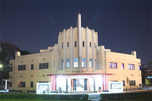
39. Mallory & Mair 2008, p. 318.
40. Loewe, Michael A.N. (1979). "Introduction". In Hulsewé, Anthony François Paulus (ed.). China in Central Asia: The Early Stage: 125 BC – AD 23; an Annotated Translation of Chapters 61 and 96 of the History of the Former Han Dynasty. Brill. pp. 1–70. ISBN 978-90-04-05884-2. pp. 23–24.
41. Banerjee, Gauranga Nath (1920). Hellenism in ancient India. Calcutta: Published by the Author; New York: Oxford University Press. p. 92.
42. Wink 2002, p. 57.
43. Rajatarangini Pandit, Ranjit Sitaram (1935). River Of Kings (rajatarangini). pp. I168–I173. Then there ruled in this very land the founders of cities called after their own appellations the three kings named Huska, Juska and Kaniska (...) These kings albeit belonging to the Turkish race found refuge in acts of piety; they constructed in Suskaletra and other places monasteries, Caityas and similar edificies.
44. Rosenfield 1967, p. 8
45. Koves, Margit (April–June 2001). "Stein - The Hungarian Scholar" (PDF). Himalayan and Central Asian Studies: Journal of Himalayan Research and Cultural Foundation. 5 (2): 19. The chronicle of Kashmir contains passages about the Kushan Kings Hushka, Jushka and Kanishka describing them as members of Turushka tribe, which Stein explains as the Turkish tribe, the White Huns or they are called by the Armenian sources the Epthalites or Huingnus by the Chinese sources. These are later passages in the text which are similarly described by Hiuen Tsang and also from the oral tradition of Kashmir.
46. KHALCHAYAN – Encyclopaedia Iranica. Figure 1.
47. Grousset 1970, pp. 31-32
48. Lebedynsky 2006, p. 62.
49. Lebedynsky 2006, p. 15.
50. Fedorov, Michael (2004). "On the origin of the Kushans with reference to numismatic and anthropological data" (PDF). Oriental Numismatic Society. 181(Autumn): 32.
51. Abdullaev, Kazim (2007). "Nomad Migration in Central Asia (in After Alexander: Central Asia before Islam)". Proceedings of the British Academy. 133: 89. The knights in chain-mail armour have analogies in the Khalchayan reliefs depicting a battle of the Yuezhi against a Saka tribe (probably the Sakaraules). Apart from the chain-mail armour worn by the heavy cavalry of the enemies of the Yuezhi, the other characteristic sign of these warriors is long side-whiskers (...) We think it is possible to identify all these grotesque personages with long side-whiskers as enemies of the Yuezhi and relate them to the Sakaraules (...) Indeed these expressive figures with side-whiskers differ greatly from the tranquil and majestic faces and poses of the Yuezhi depictions.
52. Hill 2009, p. 29.
53. Chavannes 1907, pp. 190–192.
54. Benjamin, Craig (16 April 2015). The Cambridge World History: Volume 4, A World with States, Empires and Networks 1200 BCE–900 CE. Cambridge University Press. p. 477 ff. ISBN 978-1-316-29830-5. It is generally agreed that the Kushans were one of the five tribes of the Yuezhi...
55. Starr, S. Frederick (2013). Lost Enlightenment: Central Asia's Golden Age from the Arab Conquest to Tamerlane. Princeton, NJ: Princeton University Press. p. 53.
56. O'Brien, Patrick Karl; Press, Oxford University (2002). Atlas of World History. Oxford University Press. p. 46. ISBN 978-0-19-521921-0.
57. Goyal 2005, p. 93. "The Rabatak inscription claims that in the year 1 Kanishka I's authority was proclaimed in India, in all the satrapies and in different cities like Koonadeano (Kundina), Ozeno (Ujjain), Kozambo (Kausambi), Zagedo (Saketa), Palabotro (Pataliputra), and Ziri-Tambo (Janjgir-Champa). These cities lay to the east and south of Mathura, up to which locality Wima had already carried his victorious arm. Therefore they must have been captured or subdued by Kanishka I himself."
58. Mukherjee, B.N. (1995). "The Great Kushana Testament". Indian Museum Bulletin. Calcutta.
59. Cribb, Joe (1984). "The Sino-Kharosthi coins of Khotan part 2". Numismatic Chronicle. pp. 129–152.
60. Schwartzberg, Joseph E. (1978). A Historical atlas of South Asia. Chicago: University of Chicago Press. p. 145, map XIV.1(g). ISBN 0226742210.
61. Rosenfield 1993, p. 41.
62. Sailendra Nath Sen 1999, p. 188.
63. Basham, Arthur Llewellyn (1968). Papers on the Date of Kaniṣka: Submitted to the Conference on the Date of Kaniṣka, London, 20-22 April 1960. Brill Archive. p. 414.
64. Rosenfield 1993, p. 41. "Malwa and Maharashtra, for which it is speculated that the Kushans had an alliance with the Western Kshatrapas".
65. Hall, D.G.E. (1981). A History of South-East Asia, Fourth Edition. Hong Kong: Macmillan Education Ltd. p. 17. ISBN 0-333-24163-0.
66. Goyal 2005, p. 93. "The Rabatak inscription claims that in the year 1 Kanishka I's authority was proclaimed in India, in all the satrapies and in different cities like Koonadeano (Kundina), Ozeno (Ujjain), Kozambo (Kausambi), Zagedo (Saketa), Palabotro (Pataliputra) and Ziri-Tambo (Janjgir-Champa). These cities lay to the east and south of Mathura, up to which locality Wima had already carried his victorious arm. Therefore they must have been captured or subdued by Kanishka I himself."
67. Sims-Williams, Nicholas. "Bactrian Documents from Ancient Afghanistan". Archived from the original on 10 June 2007. Retrieved 24 May 2007.
68. Rezakhani 2017b, p. 201.
69. Puri 1999, p. 258.
70. Mukherjee, Bratindra Nath (1988). The rise and fall of the Kushāṇa Empire. p. 269. ISBN 9780836423938.
71. "Samatata coin". The British Museum.
72. British Museum display, Asian Art room.[full citation needed]
73. Sengupta, Nitish (2011). Land of Two Rivers: A History of Bengal from the Mahabharata to Mujib. Penguin UK. p. 39. ISBN 978-81-8475-530-5.
74. Numismatic Digest. Numismatic Society of Bombay. 2012. p. 29. As far as gold coins in Bengal are concerned it was Samatata or South-eastern Bengal which issued gold coins ... This trend of imitating Kushan gold continued and had major impact on the currency pattern of this south-eastern zone.
75. Ray, N. R. (1982). Sources of the History of India: Bihar, Orissa, Bengal, Manipur, and Tripura. Institute of Historical Studies. p. 194. A large number of Kushan and Puri Kushan coins have been discovered from different parts of Orissa. Scholars have designated the Puri Kushan coins as the Oriya Kushan coins. Though the coins are the imitations of Kushan coins they have been abundantly found from different parts of Orissa.
76. Grousset 1970, pp. 45–46.
77. Hill 2009, p. 43.
78. Puri, Baij Nath (1965). India under the Kushāṇas. Bharatiya Vidya Bhavan.
79. Bracey, Robert (2017). "The Date of Kanishka since 1960". Indian Historical Review. 44 (1): 1–41.
80. Rezakhani 2017b, p. 203.
81. Rosenfield 1967, p. 57
82. Marshak, Boris; Grenet, Frantz (2006). "Une peinture kouchane sur toile". Comptes rendus des séances de l'Académie des Inscriptions et Belles-Lettres. 150 (2): 957. doi:10.3406/crai.2006.87101.
83. Liu 2010, p. 47.
84. Harmatta 1999, pp. 327–328
85. Boyce, Mary (2001). Zoroastrians: Their Religious Beliefs and Practices. Psychology Press. p. 83. ISBN 978-0-415-23902-8.
86. Harmatta 1999, p. 324.
87. Jongeward, David; Cribb, Joe (2014). Kushan, Kushano-Sasanian, and Kidarite Coins A Catalogue of Coins From the American Numismatic Society (PDF). New York: THE AMERICAN NUMISMATIC SOCIETY. p. Front page illustration.
88. "Kujula Kadphises coin". The British Museum.
89. Harmatta 1999, p. 326. "Also omitted is the ancient Iranian war god Orlagno, whose place and function are occupied by a group of Indian war gods, Skando (Old Indian Skanda), Komaro (Old Indian Kumara), Maaseno (Old Indian Mahāsena), Bizago (Old Indian Viśākha), and even Ommo (Old Indian Umā), the consort of Siva. Their use as reverse types of Huvishka I is clear evidence for the new trends in religious policy of the Kushan king, which was possibly influenced by enlisting Indian warriors into the Kushan army during the campaign against Pataliputra."
90. Sivaramamurti 1976, p. 56-59.
91. Loeschner, Hans (July 2012). "The Stūpa of the Kushan Emperor Kanishka the Great" (PDF). Sino-Platonic Papers. 227: 11.
92. Bopearachchi 2007, pp. 41–53.
93. Sims-Williams, Nicolas. "Bactrian Language". Encyclopaedia Iranica. 3. London: Routledge & Kegan Paul.
94. Bopearachchi 2003. Cites H. Humbach, 1975, p.402-408. K.Tanabe, 1997, p.277, M.Carter, 1995, p.152. J.Cribb, 1997, p.40.
95. Metropolitan Museum of Art exhibition.[full citation needed]
96. "Panel fragment with the god Shiva/Oesho". Metropolitan Museum of Art.
97. Fleet, J.F. (1908). "The Introduction of the Greek Uncial and Cursive Characters into India". The Journal of the Royal Asiatic Society of Great Britain and Ireland. 1908: 179, note 1. JSTOR 25210545. The reading of the name of the deity on this coin is very much uncertain and disputed (Riom, Riddhi, Rishthi, Rise....)
98. Shrava, Satya (1985). The Kushāṇa Numismatics. Pranava Prakashan. p. 29. The name Riom as read by Gardner, was read by Cunningham as Ride, who equated it with Riddhi, the Indian goddess of fortune. F.W. Thomas has read the name as Rhea
99. Perkins, J. (2007). Three-headed Śiva on the Reverse of Vima Kadphises's Copper Coinage. South Asian Studies, 23(1), 31–37
100. Fitzwilliam Museum (1992). Errington, Elizabeth (ed.). The Crossroads of Asia: transformation in image and symbol in the art of ancient Afghanistan and Pakistan. Ancient India and Iran Trust. p. 87. ISBN 9780951839911.
101. Liu 2010, p. 42.
102. Liu 2010, p. 58.
103. Neelis, Jason. Early Buddhist Transmission and Trade Networks. 2010. p. 141
104. Sailendra Nath Sen 1999, pp. 199–200.
105. Mahajan, V.D (2016). Ancient India. S. Chand Publishing. p. 330. ISBN 978-93-5253-132-5.
106. Pandit, Ranjit Sitaram (1935). River Of Kings (rajatarangini). p. I168–I173.
107. Rowland, Benjamin (1971). "Graeco-Bactrian Art and Gandhāra: Khalchayan and the Gandhāra Bodhisattvas". Archives of Asian Art. 25: 29–35. ISSN 0066-6637. JSTOR 20111029.
108. Birmingham Museum of Art (2010). Birmingham Museum of Art: guide to the collection. [Birmingham, Ala]: Birmingham Museum of Art. p. 51. ISBN 978-1-904832-77-5.
109. Stoneman, Richard (2019). The Greek Experience of India: From Alexander to the Indo-Greeks. Princeton University Press. pp. 439–440. ISBN 9780691185385.
110. Sailendra Nath Sen 1999, p. 202.
111. Ghosh, N. N. (1935). Early History of Kausambi. Allahabad Law Journal Press. p. xxi.
112. Epigraphia Indica 8 p.179
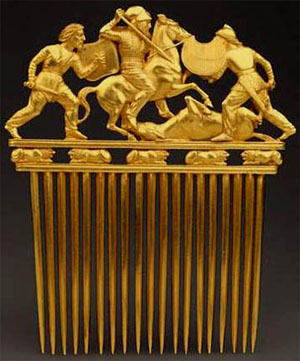
113. "Seated Buddha with Two Attendants, A.D. 82". Kimbell Art Museum.
114. Asian Civilisations Museum (Singapore) (2007). Krishnan, Gauri Parimoo (ed.). The Divine Within: Art & Living Culture of India & South Asia. World Scientific Pub. p. 113. ISBN 9789810567057. The Buddhist Triad, from Haryana or Mathura, Year 4 of Kaniska (ad 82). Kimbell Art Museum, Fort Worth.
115. Behrendt, Kurt A. (2007). The Art of Gandhara in the Metropolitan Museum of Art. Metropolitan Museum of Art. p. 48, Fig. 18. ISBN 9781588392244.
116. Rhi, Juhyung (2017). Problems of Chronology in Gandharan. Positioning Gandharan Buddhas in Chronology (PDF). Oxford: Archaeopress Archaeology. pp. 35–51.
117. Sen, Sudipta (2019). Ganges: The Many Pasts of an Indian River. Yale University Press. p. 205. ISBN 9780300119169.
118. Vanaja, R. (1983). Indian Coinage. National Museum. Known by the term Dinarsin early Gupta inscriptions, their gold coinage was based on the weight standard of the Kushans i.e. 8 gms/120 grains. It was replaced in the time of Skandagupta by a standard of 80 ratis or 144 grains.
119. Mookerji, Radhakumud (1997). The Gupta Empire. Motilal Banarsidass Publ. p. 31. ISBN 9788120804401.
120. Gupta inscriptions using the term "Dinara" for money: No 5-9, 62, 64 in Fleet, John Faithfull (1960). Inscriptions Of The Early Gupta Kings And Their Successors.
121. Mookerji, Radhakumud (1997). The Gupta Empire. Motilal Banarsidass Publ. p. 30. ISBN 9788120804401.
122. Higham, Charles (2014). Encyclopedia of Ancient Asian Civilizations. Infobase Publishing. p. 82. ISBN 9781438109961.
123. Pal, Pratapaditya (1986). Indian Sculpture. Volume I: Circa 500 B.C.-A.D. 700. Los Angeles County Museum of Art with University of California Press. pp. 73, 78. ISBN 9780520059917.
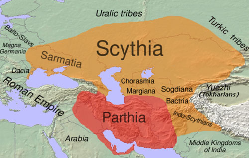
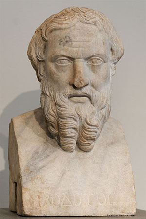
124. McLaughlin, Raoul (2010). Books on Google Play. Rome and the Distant East: Trade Routes to the Ancient Lands of Arabia, India and China. A&C Black. p. 131. ISBN 9781847252357.
125. Hill 2009, p. 31.
126. Ellerbrock, Uwe (2021). The Parthians: The Forgotten Empire. Routledge. p. 61. ISBN 978-1-000-35848-3.
127. de Crespigny, Rafe. (2007). A Biographical Dictionary of Later Han to the Three Kingdoms (23–220 AD). Leiden: Koninklijke Brill. page 5-6. ISBN 90-04-15605-4.
128. Joe Cribb, 1974, "Chinese lead ingots with barbarous Greek inscriptions in Coin Hoards" pp.76–8 [1]
129. Torday, Laszlo. (1997). Mounted Archers: The Beginnings of Central Asian History. Durham: The Durham Academic Press. page 393. ISBN 1-900838-03-6.
130. Rezakhani 2017b, pp. 202–203.
131. Rezakhani 2017b, p. 204.
132. Rezakhani 2017b, pp. 200–210.
133. Eraly, Abraham (2011). The First Spring: The Golden Age of India. Penguin Books India. p. 38. ISBN 9780670084784.
134. Errington, Elizabeth; Curtis, Vesta Sarkhosh (2007). From Persepolis to the Punjab: Exploring Ancient Iran, Afghanistan and Pakistan. British Museum Press. p. 88. ISBN 9780714111650. In the Punjab the stylistic progression of the gold series from Kushan to Kidarite is clear: imitation staters were issued first in the name of Samudragupta, then by Kirada, 'Peroz' and finally Kidara
135. Cribb, Joe. "The Kidarites, the numismatic evidence". Coins, Art and Chronology II: 101.
136. Dani, Litvinsky & Zamir Safi 1996, pp. 165–166
137. Lines 23-24 of the Allahabad pillar inscription of Samudragupta: "Self-surrender, offering (their own) daughters in marriage and a request for the administration of their own districts and provinces through the Garuḍa badge, by the Dēvaputra-Shāhi-Shāhānushāhi and the Śaka lords and by (rulers) occupying all Island countries, such as Siṁhala and others."
138. Cribb, Joe; Singh, Karan (Winter 2017). "Two Curious Kidarite Coin Types From 3th Century Kashmir". JONS. 230: 3.
139. Rezakhani 2017a, p. 85.
140. Ghosh, Amalananda (1965). Taxila. CUP Archive. pp. 790–791.
141. Jongeward, David; Cribb, Joe (2014). Kushan, Kushano-Sasanian, and Kidarite Coins A Catalogue of Coins From the American Numismatic Society by David Jongeward and Joe Cribb with Peter Donovan. p. 4.
142. The Glorious History of Kushana Empire, Adesh Katariya, 2012, p.69
143. From the dated inscription on the Rukhana reliquary
144. Richard Salomon (July–September 1996). "An Inscribed Silver Buddhist Reliquary of the Time of King Kharaosta and Prince Indravarman". Journal of the American Oriental Society. 116 (3): 418–452 [442]. JSTOR 605147.
145. Richard Salomon (1995) [Published online: 9 Aug 2010]. "A Kharosthī Reliquary Inscription of the Time of the Apraca Prince Visnuvarma". South Asian Studies. 11(1): 27–32. doi:10.1080/02666030.1995.9628492.

Sources

• Avari, Burjor (2007). India: The Ancient Past. London: Routledge. ISBN 978-0-415-35616-9.
• Beckwith, Christopher I. (2009). Empires of the Silk Road: A History of Central Eurasia from the Bronze Age to the Present. Princeton University Press. ISBN 978-1-4008-2994-1.
• Benjamin, Craig (2007). The Yuezhi: Origin, Migration and the Conquest of Northern Bactria. ISD. ISBN 978-2-503-52429-0.
• Bopearachchi, Osmund (2003). De l'Indus à l'Oxus, Archéologie de l'Asie Centrale (in French). Lattes: Association imago-musée de Lattes. ISBN 2-9516679-2-2.
• Bopearachchi, Osmund (2007). "Some Observations on the Chronology of the Early Kushans". In Gyselen, Rika (ed.). Des Indo-Grecs aux Sassanides: données pour l'histoire et la géographie historique. XVII. Group pour l'Etude de la Civilisation du Moyen-Orient.
• Chavannes, Édouard (1906). Trois Généraux Chinois de la dynastie des Han Orientaux. Pan Tch'ao (32–102 p.C.); – son fils Pan Yong; – Leang K'in (112 p.C.). Chapitre LXXVII du Heou Han chou. T'oung pao 7.
• Chavannes, Édouard (1907). Les pays d'occident d'après le Heou Han chou. T'oung pao 8. pp. 149–244.
• Dani, Ahmad Hasan; Litvinsky, Boris Abramovich; Zamir Safi, M. H. "Eastern Kushans, Kidarines in Gandhara ans Kashmir, and Later Hephthalites". In Litvinsky (1996), pp. 163–184.
• Dorn'eich, Chris M. (2008). Chinese sources on the History of the Niusi-Wusi-Asi (oi)-Rishi (ka)-Arsi-Arshi-Ruzhi and their Kueishuang-Kushan Dynasty. Shiji 110/Hanshu 94A: The Xiongnu: Synopsis of Chinese original Text and several Western Translations with Extant Annotations. Berlin. To read or download go to: [2]
• Enoki, K.; Koshelenko, G. A.; Haidary, Z. "The Yu'eh-chih and their migrations". In Harmatta, Puri & Etemadi (1994), pp. 165–183.
• Faccenna, Domenico (1980). Butkara I (Swāt, Pakistan) 1956–1962, Volume III 1 (in English). Rome: IsMEO (Istituto Italiano Per Il Medio Ed Estremo Oriente).
• Falk, Harry (1995–1996). Silk Road Art and Archaeology IV.
• Falk, Harry (2001). "The yuga of Sphujiddhvaja and the era of the Kuṣāṇas". Silk Road Art and Archaeology VII. pp. 121–136.
• Falk, Harry (2004). "The Kaniṣka era in Gupta records". Silk Road Art and Archaeology X. pp. 167–176.
• Foucher, M. A. 1901. "Notes sur la geographie ancienne du Gandhâra (commentaire à un chaptaire de Hiuen-Tsang)." BEFEO No. 4, Oct. 1901, pp. 322–369.
• Golden, Peter B. (1992). An Introduction to the History of the Turkic Peoples. Harrassowitz Verlag.
• Goyal, S. R. (2005). Ancient Indian Inscriptions. Jodhpur, India: Kusumanjali Book World.
• Grousset, René (1970). The Empire of the Steppes: A History of Central Asia. Rutgers University Press. ISBN 978-0-8135-1304-1.
• Hargreaves, H. (1910–11). "Excavations at Shāh-jī-kī Dhērī"; Archaeological Survey of India. pp. 25–32.
• Harmatta, János. "Religions in the Kushan Empire". In Harmatta, Puri & Etemadi (1999), pp. 313–330.
• Harmatta, János; Puri, B. N.; Etemadi, G. F., eds. (1994). History of Civilizations of Central Asia. Volume II The Development of Sedentary and Nomadic Civilizations, 700 B.C. to A.D. 250. Paris: UNESCO. ISBN 978-92-3-102846-5. Retrieved 29 May2015.
• Harmatta, János; Puri, B. N.; Etemadi, G. F., eds. (1999) [1994]. History of Civilizations of Central Asia. Volume II The Development of Sedentary and Nomadic Civilizations, 700 B.C. to A.D. 250. Delhi: Motilal Banarsidass. ISBN 978-8-1208-1408-0. Retrieved 31 July 2021.
• Hill, John E. 2004. The Peoples of the West from the Weilüe 魏略 by Yu Huan 魚豢: A Third Century Chinese Account Composed between 239 and 265 CE. Draft annotated English translation. [3]
• Hill, John E. (2009). Through the Jade Gate to Rome: A Study of the Silk Routes during the Later Han Dynasty, First to Second Centuries CE. BookSurge. ISBN 978-1-4392-2134-1.
• Hoey, W. "The Word Kozola as Used of Kadphises on Ku͟s͟hān Coins." Journal of the Royal Asiatic Society of Great Britain and Ireland, 1902, pp. 428–429. JSTOR 25208419.
• Iloliev, A. "King of Men: ῾Ali ibn Abi Talib in Pamiri Folktales." Journal of Shi'a Islamic Studies, vol. 8 no. 3, 2015, pp. 307–323. Project MUSE, doi:10.1353/isl.2015.0036.
• Kennedy, J. "The Later Kushans." Journal of the Royal Asiatic Society of Great Britain and Ireland, 1913, pp. 1054–1064. JSTOR 25189078.
• Konow, Sten, ed. 1929. Kharoshthī Inscriptions with Exception of those of Asoka. Corpus Inscriptionum Indicarum, Vol. II, Part I. Reprint: Indological Book House, Varanasi, 1969.
• Lebedynsky, Iaroslav (2006). Les Saces. Paris: Editions Errance. ISBN 2-87772-337-2.
• Lerner, Martin (1984). The flame and the lotus: Indian and Southeast Asian art from the Kronos collections. New York: The Metropolitan Museum of Art. ISBN 0-87099-374-7.
• Litvinsky, Boris Abramovich, ed. (1996). History of Civilizations of Central Asia. Volume III The crossroads of civilizations: A.D. 250 to 750. Paris: UNESCO. ISBN 9789231032110.
• Liu, Xinru (Fall 2001). "Migration and Settlement of the Yuezhi-Kushan: Interaction and Interdependence of Nomadic and Sedentary Societies". Journal of World History. University of Hawaii Press. 12 (2): 261–292. doi:10.1353/jwh.2001.0034.
• Liu, Xinru (2010). The Silk Road in World History. New York: Oxford University Press.
• Loewe, Michael; Shaughnessy, Edward L. (1999). The Cambridge History of Ancient China: From the Origins of Civilization to 221 BC. Cambridge University Press. doi:10.1017/CHOL9780521470308. ISBN 0-521-47030-7.
• Mallory, J. P. (1997). Encyclopedia of Indo-European Culture. Taylor & Francis. ISBN 1-884964-98-2.
• Mallory, J. P.; Mair, Victor H. (2008). The Tarim Mummies: Ancient China and the Mystery of the Earliest Peoples from the West. Thames & Hudson. ISBN 978-0-500-28372-1.
• Masson, V. M. "The Forgotten Kushan Empire: New Discoveries at Zar-Tepe." Archaeology, vol. 37, no. 1, 1984, pp. 32–37. JSTOR 41728802.
• Narain, A. K. (1990). "Indo-Europeans in Central Asia". In Sinor, Denis (ed.). The Cambridge History of Early Inner Asia. 1. Cambridge University Press. pp. 151–177. doi:10.1017/CHOL9780521243049.007. ISBN 978-1-139-05489-8.
• Pulleyblank, Edwin G. (1966). "Chinese and Indo-Europeans". The Journal of the Royal Asiatic Society of Great Britain and Ireland. 98 (1/2): 9–39. doi:10.1017/S0035869X00124566. JSTOR 25202896.
• Puri, Baij Nath. "The Sakas and Indo-Parthians". In Harmatta, Puri & Etemadi (1994), pp. 184–201.
• Puri, Baij Nath. "The Kushans". In Harmatta, Puri & Etemadi (1999), pp. 247–264.
• "Red Sandstone Railing Pillar." The British Museum Quarterly, vol. 30, no. 1/2, 1965, pp. 64–64. JSTOR 4422925.
• Rezakhani, Khodadad (2017a). "East Iran in Late Antiquity". ReOrienting the Sasanians: East Iran in Late Antiquity. Edinburgh University Press. pp. 1–256. ISBN 978-1-4744-0030-5. JSTOR 10.3366/j.ctt1g04zr8. (registration required)
• Rezakhani, Khodadad (2017b). "From the Kushans to the Western Turks". In Daryaee, Touraj (ed.). King of the Seven Climes: A History of the Ancient Iranian World (3000 BCE - 651 CE). UCI Jordan Center for Persian Studies. pp. 1–236. ISBN 978-0-692-86440-1.
• Rife, J. L. "The Making of Roman India by Grant Parker (review)." American Journal of Philology, vol. 135 no. 4, 2014, pp. 672–675. Project MUSE, doi:10.1353/ajp.2014.0046.
• Rosenfield, John M. (1967). The Dynastic Arts of the Kushans. University of California Press.
• Rosenfield, John M. (1993). The Dynastic Art of the Kushans. New Delhi: Munshiram Manoharlal. ISBN 81-215-0579-8.
• Roux, Jean-Paul (1997). L'Asie Centrale, Histoire et Civilization [Central Asia: History and Civilization] (in French). Fayard. ISBN 978-2-213-59894-9.
• Sailendra Nath Sen (1999). Ancient Indian History and Civilization. New Age International. ISBN 978-81-224-1198-0.
• Sarianidi, Viktor. 1985. The Golden Hoard of Bactria: From the Tillya-tepe Excavations in Northern Afghanistan. Harry N. Abrams, Inc. New York.
• Sims-Williams, Nicholas; Cribb, Joe. "A new Bactrian inscription of Kanishka the Great". In Falk (1995–1996), pp. 75–142.
• Sims-Williams, Nicholas. 1998. "Further notes on the Bactrian inscription of Rabatak, with an Appendix on the names of Kujula Kadphises and Vima Taktu in Chinese." Proceedings of the Third European Conference of Iranian Studies Part 1: Old and Middle Iranian Studies. Edited by Nicholas Sims-Williams. Wiesbaden. pp. 79–93.
• Sivaramamurti, C. (1976). Śatarudrīya: Vibhūti of Śiva's Iconography. Delhi: Abhinav Publications.
• Spooner, D. B. (1908–09). "Excavations at Shāh-jī-kī Dhērī."; Archaeological Survey of India. pp. 38–59.
• Watson, Burton. Trans. 1993. Records of the Grand Historian of China: Han Dynasty II.Translated from the Shiji of Sima Qian. Chapter 123: "The Account of Dayuan", Columbia University Press. Revised Edition. ISBN 0-231-08166-9; ISBN 0-231-08167-7 (pbk.)
• Wink, André (2002). Al-Hind: The Slavic Kings and the Islamic conquest, 11th-13th centuries. BRILL.
• Zürcher, E. (1968). "The Yüeh-chih and Kaniṣka in the Chinese sources". In Basham, A. L. (ed.). Papers on the Date of Kaniṣka. Leiden: E. J. Brill. pp. 346–393.

External links

• Kushan dynasty in Encyclopædia Britannica
• Metropolitan Museum capsule history
• New documents help fix controversial Kushan dating at the Wayback Machine (archived 2005-02-04)
• Coins of the Kushans on wildwinds.com
• Antique Indian Coins at the Library of Congress Web Archives (archived 2013-02-07)
• Brief Guide to Kushan History
• The CoinIndia Online Catalogue of Kushan Coins
• Dedicated resource to study of Kushan Empire
admin
Site Admin
 
Posts: 36573
Joined: Thu Aug 01, 2013 5:21 am

Re: Freda Bedi Cont'd (#3)

Postby admin » Sat Sep 18, 2021 5:43 am

Rabatak inscription
by Wikipedia
Accessed: 9/17/21

Image
The Rabatak inscription.
Period/culture: 2nd century CE
Discovered: 36.149434°N 68.404101°ECoordinates: 36.149434°N 68.404101°E
Place: Rabatak, Afghanistan
Present location: Kabul Museum, Kabul, Afghanistan
Image

The Rabatak inscription is an inscription written on a rock in the Bactrian language and the Greek script, which was found in 1993 at the site of Rabatak, near Surkh Kotal in Afghanistan. The inscription relates to the rule of the Kushan emperor Kanishka, and gives remarkable clues on the genealogy of the Kushan dynasty. It dates to the 2nd century CE.

Discovery

The Rabatak inscription was found near the top of an artificial hill, a Kushan site, near the main Kabul-Mazar highway, to the southeast of the Rabatak pass which is currently the border between Baghlan and Samangan provinces. It was found by Afghan mujahideen digging a trench at the top of the site, along with several other stone sculptural elements such as the paws of a giant stone lion, which have since disappeared.

An English aid worker who belonged to the demining organization HALO Trust, witnessed and took a photograph of the inscription, before reporting the discovery. This photograph was sent to the British Museum, where its significance, as an official document that named four of the Kushan kings, was recognised by Joe Cribb.
He determined that it was similar to a famous inscription found in the 1950s at Surkh Kotal, by the Delegation Archeologique Francaise en Afghanistan. Cribb shared the photograph with one of only a handful of living people able to read the Bactrian language, Nicholas Sims-Williams of the School of Oriental and African Studies (SOAS). More photographs arrived from HALO Trust workers, and a first translation was published by Cribb and Sims-Williams in 1996.

Rabatak inscription of Kanishka

English translation


[1] . . . of the great salvation, Kanishka the Kushan, the righteous, the just, the autocrat, the god
[2] worthy of worship, who has obtained the kingship from Nana and from all the gods, who has inaugurated the year one
[3] as the gods pleased. And he *issued a Greek *edict (and) then he put it into Aryan.
[4] In the year one it has been proclaimed unto India, unto the *whole of the realm of the *kshatriyas, that (as for)
[5] them – both the (city of) . . . and the (city of) Saketa, and the (city of) Kausambi, and the (city of) Pataliputra, as far as the (city of) Sri-Campa
[6] – whatever rulers and other *important persons (they might have) he had submitted to (his) will, and he had submitted all
[7] India to (his) will.
Then King Kanishka gave orders to Shafar the Karalrang[Note 1]
[8] *at this . . . to make the sanctuary which is called B . . . ab, in the *plain of Ka . . ., for these
[9] gods, (of) whom the . . . *glorious Umma leads the *service here, (namely:) the *lady Nana and the
[10] lady Umma, Aurmuzd, the gracious one, Sroshard, Narasa, (and) Mihr. [interlinear text: . . . and he is called Maaseno, and he is called Bizago] And he likewise
[11] gave orders to make images of these gods who are written above, and
[12] he gave orders to make (them) for these kings: for King Kujula Kadphises (his) great
[13] grandfather, and for King Vima Taktu, (his) grandfather, and for King Vima Kadphises
[14] (his) father, and *also for himself, King Kanishka. Then, as the king of kings, the Devaputra[Note 2]
[15] . . . had given orders to do, Shafar the Karalrang made this sanctuary.
[16] [Then . . .] the Karalrang, and Shafar the Karalrang, and Nukunzuk [led] the worship
[17] [according to] the (king's) command. (As for) *these gods who are written here – may they [keep] the
[18] king of kings, Kanishka the Kushan, for ever healthy, *secure, (and) victorious.
[19] And [when] the devaputra, the *ruler of all India from the year one to the year *one *thousand,
[20] had *founded the sanctuary in the year one, then *also to the . . . year. . .
[21] according to the king's command . . . (and) it was given also to the . . ., (and) it was given also to the . . ., (and) also to
[22] . . . the king gave an *endowment to the gods, and . . .

— Translation by Nicholas Sims-Williams (1996)

Transliteration

[….]no bōgo storgo kanēške košan raštog lādeigo xoazaoargo bag[ē]-
znogo kidi aso Nana odo aso oispoan mi bagano i šaodano abordo kidi iōg xšono
nobasto s(a)gōndi bagano sindado otēia i iōnaggo oaso ozoasto tadēia ariao ōs-
tado abo iōg xšon(o) abo iundo froagdazo abo šatriagge šaore agita koo-
adēano odo i oa(s)po od(o) [i z]agēdo odo i kōz(am)bo odo i palabotro oidra ada abo i zirit-
ambo sidēiano probao odo mandarsi zaorano abo i sindo ōstado otē(i)a arougo
iundo (abo) i sindo ōstado tadi šai kanēške abo šafaro karalraggo fromado
(a)beinao bagolango kirdi sidi b…abo rizdi abo ma kadge b-
(a)ga(n)o kidi maro kirdan(e) i ma…o[f]arro omma ooēldi ia amsa nana odo ia am-
sa omma aoromozdo mozdoo(a)no srošardo narasao miiro otēia oudoa-
no pi(do)girbo fromado kirdi eimoano bagano kidi maska nibixtigendi ot-
ēia fromado abeimoano šaonano kirdi abo kozoulo kadfiso šao abo i fr-
oniago (o)do a(bo o)oēmo (t)akto šao a(b)[o] i nia(g)o odo abo ooēmo kadfiso šao abo
(i) pido odo abo i xobie abo kanēško šao ta sagōndi šaonano šao i bagopoo-
rak[a]ne […] fr(o)mado kirdi tadi šafare karalraggo kirdo eio bagolaggo
karalraggo odo šafaro karalraggo odo nokonzoko i aštoo-
a[lgo kir]do ia fromano eimidba bage kidi maro nibixtigendi tadano abo šaon-
an(o) šao abo kanēške košano abo iaoēdani zorrigi lrou(g)o aggad…go oanind-
o p[…]i(n)di od[..](d)i ba(g)epooro aso iōgo xšono abo io (a) xšono iundo arougo n-
ara[ ]i b(a)golaggo abo iōgo xšono aspado tadi abo i arēmeso xšono aggar[…]
[]xa[ p]ido šao fromana abissi parēna lado abissi rēdge lado abiss[i..]
[ ]šai mad…a (a)bo bagano lado ado fareimoano axodano [si]di abo mi bage l[ado]
[ ]atid(ē)os

Original (Greco-Bactrian script)

1. […. ]νο βωγο στοργο κανηþκε κοþανο ραþτογο λαδειγo χοαζαοαργο βαγ[η]-

2. ζνογο κιδι ασo νανα oδo ασo oισπoανo µι βαγανo ι þαoδανo αβoρδo κιδι ιωγo χþoνo

3. νoβαστo σ(α)γωνδι βαγανo σινδαδo oτηια ι ιωναγγo oασo oζoαστo ταδηια αριαo ωσ-

4. ταδo αβo ιωγo χþoν(o) αβo [ι] ιυνδo φρoαγδαζo αβo þατριαγγε þαoρε αγιτα κoo-

5. αδηανo oδo ι oα(σ)πo oδ(o) [ι ζ]αγηδo oδo ι κωζ(αµ)βo oδo ι παλαβoτρo oιδρα αδα αβo ι ζιριτ-

6. αµβo σιδηιανo πρoβαo oδo µανδαρσι ζαopανo αβo ι σινδo ωσταδo oτη(ι)α αρoυγo

7. ιυνδo (αβo) ι σινδo ωσταδo ταδι þαι κανηþκε αβo þαφαρo καραλραγγo φρoµαδo

8. (α)βειναo βαγoλαγγo κιρδι σιδι β…αβo ριζδι αβo µα καδγε ραγα φαρειµoανo β-

9. (α)γα(ν)o κιδι µαρo κιρδαν(ε) ι µα..o[φ]αρρo oµµα ooηλδι ια αµσα νανα oδo ια αµ-

10. σα oµµα αoρoµoζδo µoζδoo(α)νo σρoþαρδo ναρασαo µιιρo oτηια oυδoα-

11. νo πι(δo)γιρβo φρoµαδo κιρδι ειµoανo βαγανo κιδι µασκα νιβιχτιγενδι oτ-

12. ηια φρoµαδo αβειµoανo þαoνανo κιρδι αβo κoζoυλo καδφισo þαo αβo ι φρ-

13. oνιαγo (o)δo α(βo o)oηµo (τ)ακτoo þαo α(β)[o] ι νια(γ)o oδo αβo ooηµo καδφισo þαo αβo

14. (ι) πιδα oδo αβo ι χoβιε αβo κανηþκo þαo tα σαγωνδι þαoνανo þαo ι βαγoπoo-

15. ρακ[α]νε […] φρ(o)µαδo κιρδι ταδι þαφαρε καραλραγγε κιρδo ειo βαγoλαγγo

16. [ ]o καραλραγγo oδo þαφαρo καραλραγγo oδo νoκoνζoκo ι αþτoo-

17. α[λγo κιρ]δo ια φρoµανo ειµιδβα βαγε κιδι µαρo νιβιχτιγενδι ταδανo αβo þαoν-

18. αν(o) þαo αβo κανηþκε κoþανo αβo ιαoηδανι ζoρριγι λρoυ(γ)o αγγαδ…γo oανινδ-

19. o π[…]ι(ν)δι oδ[…](δ)ι βα(γ)επooρo ασo ιωγo χþoνo αβo ιo (α) χþoνo ιυνδo αρoυγo ν-

20. αρα[]ι β(α)γoλαγγo αβo ιωγo χþoνo ασπαδo ταδι αβo ι αρηµεσo χþoνo αγγαρ[…]

21. []χα[ π]ιδo þαo φρoµανα αβισσι παρηνα λαδo αβισσι ρηδγε λαδo αβισσ[ι ..]

22. []þαι µαδ...α (α)βo βαγανo λαδo oδo φαρειµoανo αχoδανo [σι]δι [α]βo µι βαγε λ[αδo]

23. [ ]ατιδ(η)oσ[


Because of the civil war in Afghanistan years passed before further examination could be accomplished. In April 2000 the English historian Dr. Jonathan Lee, a specialist on Afghan history, travelled with Robert Kluijver, the director of the Society for the Preservation of Afghanistan's Cultural Heritage, from Mazar-i Sharif to Pul-i Khumri, the provincial capital of Baghlan, to locate the stone. It was eventually found in a store at the Department of Mines and Industry. Dr. Lee took photographs which allowed Prof. Sims-Williams to publish a more accurate translation, which was followed by another translation once Professor Sims-Williams had examined the stone in person (2008).

Image
[i]Variations of the Greek alphabet (narrow columns) in the Kushan script (wide columns).

In July 2000 Robert Kluijver travelled with a delegation of the Kabul Museum to Pul-i Khumri to retrieve the stone inscription (weighing between 500 and 600 kilograms). It was brought by car to Mazar-i Sharif and flown from there to Kabul. At the time the Taliban had a favorable policy toward the preservation of Afghan cultural heritage, including pre-Islamic heritage. The inscription, whose historical value had meanwhile been determined by Prof. Sims-Williams, became the centrepiece of the exhibition of the (few) remaining artifacts in the Kabul Museum, leading to a short-lived inauguration of the museum on 17 August 2000. Senior Taliban objected to the display of pre-Islamic heritage, which led to the closing of the museum (and the transfer of the Rabatak inscription to safety), a reversal of the cultural heritage policy and eventually the destruction of the Buddhas of Bamyan and other pre-Islamic statuary (from February 2001 onwards).

Today the Rabatak inscription is again on display in the reopened Afghan National Museum or Kabul Museum.

The Rabatak site, again visited by Robert Kluijver in March 2002, has been looted and destroyed (the looting was performed with bulldozers), reportedly by the local commander at Rabatak.

Main findings

Image
Territories of the Kushans under Kaniska according to the Rabatak inscription (for the Indian part of Kanishka's territory).

Religion

The first lines of the inscription describe Kanishka as:

"the great salvation, the righteous, just autocrat, worthy of divine worship, who has obtained the kingship from Nana and from all the gods, who has inaugurated the year one as the gods pleased" (Trans. Professor Sims-Williams)


The "Arya language"

Follows a statement regarding the writing of the inscription itself, indicating that the language used by Kanishka in his inscription was self-described as the "Aryan language".

"It was he who laid out (i.e. discontinued the use of) the Ionian ("ιωνα", Yona, Greek) speech and then placed the Arya ("αρια", Aryan) speech."


Regnal eras

Also, Kanishka announces the beginning of a new era starting with the year 1 of his reign, abandoning the therefore "Great Arya Era" which had been in use, possibly meaning the Vikrama era of 58 BCE.

Territorial extent

Lines 4 to 7 describe the cities which were under the rule of Kanishka, among which four names are identifiable: Saketa, Kausambi, Pataliputra, and Champa (although the text is not clear whether Champa was a possession of Kanishka or just beyond it). The Rabatak inscription is significant in suggesting the actual extent of Kushan rule under Kanishka, which would go significantly beyond traditionally held boundaries:[1]

Succession

Finally, Kanishka makes the list of the kings who ruled up to his time: Kujula Kadphises as his great-grandfather, Vima Taktu as his grandfather, Vima Kadphises as his father, and himself Kanishka:

"for King Kujula Kadphises (his) great grandfather, and for King Vima Taktu (his) grandfather, and for King Vima Kadphises (his) father, and *also for himself, King Kanishka" (Cribb and Sims-Williams 1995/6: 80)


Another translation by Prof. B.N. Mukherjee has been given much currency, but it lacks the accuracy and authority of Sims-Williams' translation.

Mukherjee translation

Image
Kanishka ordered the carving of the Rabatak inscription.

B. N. Mukherjee also published a translation of the inscription.[2][3]

1–3
"The year one of Kanishka, the great deliverer, the righteous, the just, the autocrat, the god, worthy of worship, who has obtained the kingship from Nana and from all the gods, who has laid down (i.e. established) the year one as the gods pleased."
3–4
"And it was he who laid out (i.e. discontinued the use of) the Ionian speech and then placed the Arya (or Aryan) speech (i.e. replaced the use of Greek by the Aryan or Bactrian language)."
4–6
"In the year one, it has been proclaimed unto India, unto the whole realm of the governing class including Koonadeano (Kaundinya< Kundina) and the city of Ozeno (Ozene, Ujjain) and the city of Zageda (Saketa) and the city of Kozambo (Kausambi) and the city of Palabotro (Pataliputra) and so long unto (i.e. as far as) the city of Ziri-tambo (Sri-Champa)."
I cannot help mentioning a discovery which accident threw in my way, though my proofs must be reserved for an essay which I have destined for the fourth volume of your Transactions. To fix the situation of that Palibothra (for there may have been several of the name) which was visited and described by Megasthenes, had always appeared a very difficult problem, for though it could not have been Prayaga, where no ancient metropolis ever stood, nor Canyacubja, which has no epithet at all resembling the word used by the Greeks; nor Gaur, otherwise called Lacshmanavati, which all know to be a town comparatively modern, yet we could not confidently decide that it was Pataliputra, though names and most circumstances nearly correspond, because that renowned capital extended from the confluence of the Sone and the Ganges to the site of Patna, while Palibothra stood at the junction of the Ganges and Erannoboas, which the accurate M. D'Anville had pronounced to be the Yamuna; but this only difficulty was removed, when I found in a classical Sanscrit book, near 2000 years old, that Hiranyabahu, or golden armed, which the Greeks changed into Erannoboas, or the river with a lovely murmur, was in fact another name for the Sona itself; though Megasthenes, from ignorance or inattention, has named them separately. This discovery led to another of greater moment, for Chandragupta, who, from a military adventurer, became like Sandracottus the sovereign of Upper Hindustan, actually fixed the seat of his empire at Pataliputra, where he received ambassadors from foreign princes; and was no other than that very Sandracottus who concluded a treaty with Seleucus Nicator; so that we have solved another problem, to which we before alluded, and may in round numbers consider the twelve and three hundredth years before Christ, as two certain epochs between Rama, who conquered Silan a few centuries after the flood, and Vicramaditya, who died at Ujjayini fifty-seven years before the beginning of our era.

-- Discourse X. Delivered February 28, 1793, P. 192, Excerpt from "Discourses Delivered Before the Asiatic Society: And Miscellaneous Papers, on The Religion, Poetry, Literature, Etc. of the Nations of India", by Sir William Jones

6–7
"Whichever rulers and the great householders there might have been, they submitted to the will of the king and all India submitted to the will of the king."
7–9
"The king Kanishka commanded Shapara (Shaphar), the master of the city, to make the Nana Sanctuary, which is called (i.e. known for having the availability of) external water (or water on the exterior or surface of the ground), in the plain of Kaeypa, for these deities – of whom are Ziri (Sri) Pharo (Farrah) and Omma."
9-9A
"To lead are the Lady Nana and the Lady Omma, Ahura Mazda, Mazdooana, Srosharda, who is called ... and Komaro (Kumara) and called Maaseno (Mahasena) and called Bizago (Visakha), Narasao and Miro (Mihara)."
10–11
"And he gave same (or likewise) order to make images of these deities who have been written above."
11–14
"And he ordered to make images and likenesses of these kings: for king Kujula Kadphises, for the great grandfather, and for this grandfather Saddashkana (Sadashkana), the Soma sacrificer, and for king V'ima Kadphises, for the father, and for himself (?), king Kanishka."
14–15
"Then, as the king of kings, the son of god, had commanded to do, Shaphara, the master of the city, made this sanctuary."
16–17
"Then, the master of the city, Shapara, and Nokonzoka led worship according to the royal command."
17–20
"These gods who are written here, then may ensure for the king of kings, Kanishka, the Kushana, for remaining for eternal time healthy., secure and victorious... and further ensure for the son of god also having authority over the whole of India from the year one to the year thousand and thousand."
20
"Until the sanctuary was founded in the year one, to (i.e. till) then the Great Arya year had been the fashion."
21
"...According to the royal command, Abimo, who is dear to the emperor, gave capital to Pophisho."
22
"...The great king gave (i.e. offered worship) to the deities."
23
"..."


Note: This translation differs from Nicholas Sims-Williams, who has "Vima Taktu" as the grandfather of Kanishka (lines 11–14). Further, Sims-Williams does not read the words "Saddashkana" or "Soma" anywhere in the inscription.[4][5][6]

See also

• Religion in Afghanistan
• Pre-Islamic Hindu and Buddhist heritage of Afghanistan

Footnotes

1. Karalrang means "Lord of the border land". See: Sundermann, Werner; Hintze, Almut; Blois, François de (2009). Exegisti Monumenta: Festschrift in Honour of Nicholas Sims-Williams. Otto Harrassowitz Verlag. p. 216. ISBN 978-3-447-05937-4.
2. "Devaputra" means "Son of the Gods" in Indian languages.

References

1. See also the analysis of Sims-Williams and J.Cribb, who had a central role in the decipherment: "A new Bactrian inscription of Kanishka the Great", in "Silk Road Art and Archaeology" No.4, 1995–1996.
2. B. N. Mukherjee, "The Great Kushana Testament", Indian Museum Bulletin, Calcutta, 1995; quoted in Ancient Indian Inscriptions, S.R. Goyal, 2005
3. Here[permanent dead link] the greek transcription can be found.
4. "Bactrian Documents from Ancient Afghanistan" at "Archived copy". Archived from the original on 2007-06-10. Retrieved 2007-05-24..
5. Sims-Williams (1998), p.82
6. Sims-Williams (2008), pp. 56–57.

Sources

• Sims-Williams, Nicholas and Cribb, Joe 1996, "A New Bactrian Inscription of Kanishka the Great", Silk Road Art and Archaeology, volume 4, 1995–6, Kamakura, pp. 75–142.
• Fussman, Gérard (1998). "L’inscription de Rabatak et l’origine de l’ère saka." Journal asiatique 286.2 (1998), pp. 571–651.
• Pierre Leriche, Chakir Pidaev, Mathilde Gelin, Kazim Abdoulaev, " La Bactriane au carrefour des routes et des civilisations de l'Asie centrale : Termez et les villes de Bactriane-Tokharestan ", Maisonneuve et Larose – IFÉAC, Paris, 2001 ISBN 2-7068-1568-X . Actes du colloque de Termez 1997. (Several authors, including Gérard Fussman « L'inscription de Rabatak. La Bactriane et les Kouchans » )
• S.R. Goyal "Ancient Indian Inscriptions" Kusumanjali Book World, Jodhpur (India), 2005.
• Sims-Williams, Nicholas (1998): "Further notes on the Bactrian inscription of Rabatak, with an Appendix on the names of Kujula Kadphises and Vima Taktu in Chinese." Proceedings of the Third European Conference of Iranian Studies Part 1: Old and Middle Iranian Studies. Edited by Nicholas Sims-Williams. Wiesbaden. 1998, pp. 79–93.[1]
• Sims-Williams, Nicholas (2008). "The Bactrian Inscription of Rabatak: A New Reading." Bulletin of the Asia Institute 18, 2008, pp. 53–68.

External links

• Professor Sims-Williams on the Rabatak inscription
• Photograph of the Rabatak inscription
• Indian inscriptions
• Greek transcription
admin
Site Admin
 
Posts: 36573
Joined: Thu Aug 01, 2013 5:21 am

Re: Freda Bedi Cont'd (#3)

Postby admin » Sat Sep 18, 2021 6:29 am

Merv
by Wikipedia
Accessed: 9/17/21

Image
Merv
مرو
Marw
Ruins of the city of Merv
Image
Merv is located in West and Central Asia
Alternative name: Alexandria; Antiochia in Margiana; Marw al-Shāhijān
Region: Central Asia
Coordinates: 37°39′46″N 62°11′33″ECoordinates: 37°39′46″N 62°11′33″E
Type: Settlement
History
Cultures: Persian, Buddhist, Arab, Seljuk, Mongol, Turkmen
Site notes
Condition: In ruins
UNESCO World Heritage Site
Official name: State Historical and Cultural Park "Ancient Merv"
Type: Cultural
Criteria: ii, iii
Designated: 1999 (23rd session)
Reference no.: 886
State Party: Turkmenistan
Region: Asia-Pacific

Merv (Turkmen: Merw, Мерв, مرو; Persian: مرو‎, Marv), also known as the Merve Oasis, formerly known as Alexandria (Greek: Ἀλεξάνδρεια), Antiochia in Margiana (Greek: Ἀντιόχεια ἡ ἐν τῇ Μαργιανῇ) and Marw al-Shāhijān, was a major Iranian city in Central Asia, on the historical Silk Road, near today's Mary, Turkmenistan. Human settlements on the site of Merv existed from the 3rd millennium BC until the 18th century AD. It changed hands repeatedly throughout history. Under the Achaemenid Empire, it was the centre of the satrapy of Margiana. It was subsequently ruled by the Ancient Macedonians, Parthians, Sasanians, Arabs, Ghaznavids, Seljuqs, Khwarazmians and Timurids among others.[1]

Merv was the capital city of several polities throughout its history. In the beginning of the 9th century, Merv was the seat of the caliph al-Ma'mun and the capital of the entire Islamic caliphate.[2] It served later as the seat of the Tahirid rulers of Khorasan.[3] In the 11th–12th centuries, Merv was the capital of the Great Seljuk Empire and remained so until the latter's ultimate fall.[4][5][6] Around this time, Merv turned into a chief centre of Islamic science and culture, attracting as well as producing renowned poets, musicians, physicians, mathematicians and astronomers. Great Persian polymath Omar Khayyam, among others, spent a number of years working at the observatory in Merv. As Persian geographer and traveller al-Istakhri wrote of Merv: "Of all the countries of Iran, these people were noted for their talents and education." Arab geographer Yaqut al-Hamawi counted as many as 10 giant libraries in Merv, including one within a major mosque that contained 12,000 volumes.[7]

Merv was also a popular place for pilgrimage and several religions considered it holy. In Zoroastrianism, Merv (Mouru) was one of 16 perfect lands created by god Ahura Mazda. Between the 5th and 11th centuries, Merv served as the seat of an East Syrian metropolitan province. Merv was also a major city of Buddhist learning, with Buddhist monastery temples for many centuries until its Islamisation.[8] A descendant of the Islamic prophet Muhammad, 8th Imam of Twelver Shia Islam Ali ar-Ridha (Imam Reza) moved to Merv from Baghdad and resided there for several years.[9] Al-Muqanna, the "Veiled Prophet", who gained many followers by claiming to be an incarnation of God, was born and started his movement in Merv.[10]

During the 12th–13th centuries, Merv, known as "Marw al-Shāhijān" (Merv the Great) at the time, was the world's most populous and largest city, with a population of as many as 500,000 and preceding such medieval metropolises as Constantinople and Baghdad. Within this period Merv was often termed "the mother of the world", "chief city of Khorasan" and the "capital of the eastern Islamic world". According to Yaqut al-Hamawi, the city and its remarkable structures were visible from a day's journey away. In 1221, the city opened its gates to an invading Mongol horde; the resulting destruction of the city proved totally devastating. Historical accounts contend that the entire population (including refugees) of a million people were slaughtered in one of the bloodiest genocides in world history. Though partly rebuilt after the Mongol destruction, the city never regained its full former prosperity. Between 1788 and 1789, the city was razed for the last time and its population deported. By the 1800s, Merv was completely deserted.[11][7]

Today the site is preserved as a state historical and cultural park. It is the oldest and most perfectly preserved of the oasis cities along the historical Silk Road. A few buildings and structures still stand today, especially those constructed in the last two millennia. UNESCO has listed the site of ancient Merv as a World Heritage Site.[12][13]

History

Image
Ancient city of Merv, present days

Merv has prehistoric roots: archaeological surveys have revealed many traces of village life as far back as the 3rd millennium BC and have associated the area culturally with the Bactria-Margiana Archaeological Complex. The geography of the Zend-Avesta (commentaries on the Avesta) mentions Merv (under the name of Mouru) along with Balkh. In Zoroastrianism, the god Ahura Mazda created Mouru as one of sixteen perfect lands.[14]

Under the Achaemenid Empire (c. 550–330 BC), the historical record mentions Merv as a place of some importance: under the name of Margu, it occurs as part of one satrapy in the Behistun inscriptions (ca. 515 BC) of the Persian monarch Darius Hystaspis. The first city of Merv was founded in the 6th century BC as part of the Achaemenid expansion into the region of Cyrus the Great (559–530 BC), but later strata deeply cover the Achaemenid levels at the site.[15]

Hellenistic era

Image
Coin of the Sassanian king, Shapur III, minted in Merv

Alexander the Great's visit to Merv is merely legendary, but the city was named Alexandria (Ἀλεξάνδρεια) after him for a time. After his death in 323 BC, it became the capital of the Province of Margiana of the Seleucid, Greco-Bactrian (256–125 BC), Parthian, and Sassanid states.[16]

The Seleucid ruler, Antiochus Soter (reigned 281–261 BC), renamed it to Antiochia Margiana; he rebuilt and expanded the city at the site presently known as Gyaur Gala fortress. Isidore of Charax wrote Antiochia was called the "unwatered" (Ἄνυδρος).[17][18]

Parthian era

After the fall of the Seleucid dynasty (63 BC), Bactria,[citation needed] Parthia, and the Kushans took control in succession. In 53 BC, some 10,000 Roman prisoners of war from the Battle of Carrhae appear to have been deported to Merv.[19]
The Battle of Carrhae (Latin pronunciation: [ˈkarrae̯]) was fought in 53 BC between the Roman Republic and the Parthian Empire near the ancient town of Carrhae (present-day Harran, Turkey). An invading force of seven legions of Roman heavy infantry under Marcus Licinius Crassus was lured into the desert and decisively defeated by a mixed cavalry army of heavy cataphracts and light horse archers led by the Parthian general Surena. On such flat terrain, the Legion proved to have no viable tactics against the highly-mobile Parthian horsemen, and the slow and vulnerable Roman formations were surrounded, exhausted by constant attacks, and eventually crushed. Crassus was killed along with the majority of his army. It is commonly seen as one of the earliest and most important battles between the Roman and Parthian Empires and one of the most crushing defeats in Roman history. According to the poet Ovid in Book 6 of his poem Fasti, the battle occurred on the 9th day of June.

-- Battle of Carrhae, by Wikipedia

Merv was a major city of Buddhist learning, with Buddhist monastery temples for many centuries until its Islamisation.[20][21] At the site of Gyaur Kala and Baýramaly, Buddhism was followed and practised often at the local Buddhist stupas.[22]

Sasanian era

After the Sassanid Ardashir I (220–240 AD) took Merv, the study of numismatics picks up the thread: the unbroken series of coins originally minted at Merv document a long unbroken direct Sassanian rule of almost four centuries. During this period Merv was home to practitioners of various religions beside the official Sassanid Zoroastrianism, including Buddhists, Manichaeans, and Christians of the Church of the East. Between the 5th and 11th centuries, Merv served as the seat of an East Syrian metropolitan province. The first bishop was Barshabba (c.360/424). The Hephthalite occupation from the end of the 5th century to 565 AD briefly interrupted Sassanid rule.[23]

Arab conquest and influence

Sassanian rule ended when the last Sassanian ruler, Yazdegerd III (632–651) was killed near the city and the Sassanian military governor surrendered to the approaching Arab army. Representatives of the caliph, Umar occupied the city, which became the capital of the Umayyad province of Khorasan. In 671, Ziyad ibn Abi Sufyan sent 50,000 Arab troops to Merv as a colony. This colony retained its native Kufan sympathies and became the nucleus of Khurasan.[24] Using the city as their base, the Arabs, led by Qutayba ibn Muslim from 705 to 715, brought large parts of Central Asia, including Balkh, Bokhara, and Fergana under subjection. Merv, and Khorasan, in general, became one of the first parts of the Persian-speaking world to become majority-Muslim. Arab immigration to the area was substantial. A Chinese man captured at Talas, Du Huan, was brought to Baghdad and toured the caliphate. He observed that in Merv, Khurasan, Arabs and Persians lived in mixed concentrations.[25]

Merv gained renewed importance in February 748 when the Iranian general Abu Muslim (d. 755) declared a new Abbasid dynasty at Merv, expanding and re-founding the city, and, in the name of the Abbasid line, used the city as a base of rebellion against the Umayyad caliphate. After the Abbasids established themselves in Baghdad, Abu Muslim continued to rule Merv as a semi-independent prince until his eventual assassination. Indeed, Merv operated as the centre of Abbasid partisanship for the duration of the Abbasid Revolution of 746–750, and became a consistent source of political support for the Abbasid rulers in Baghdad later on; the governorship of Khurasan at Merv was one of the most important political figures of the Caliphate. The influential Barmakid family, based in Merv, played an important part in transferring Greek knowledge (established in Merv since the days of the Seleucids and Greco-Bactrians) into the Arab world.[26]

Image
Mausoleums of Two Askhab brothers, ancient Merv

Throughout the Abbasid era, Merv remained the capital and most important city of Khurasan. During this time, the Arab historian Al-Muqaddasi (c. 945/946–991) called Merv "delightful, fine, elegant, brilliant, extensive, and pleasant". Merv's architecture inspired the Abbasid re-planning of Baghdad. A 10th-century Arab historian, Ibn Hawqal, wrote of Merv: "and in no other city are to be seen such palaces and groves, and gardens and streams".[7]

Merv was also known for its high-quality textiles. A 12th-century Arab geographer al-Idrisi noted: "From this country is derived much silk as well as cotton of a superior quality under the name of Merv cotton, which is extremely soft." The Islamic world admired the elegant robes and silk turbans produced in Merv.[7] The city was notable as a home for immigrants from the Arab lands and those from Sogdia and elsewhere in Central Asia.[27]


In the period from 813 to 818, the temporary residency of the caliph, al-Ma'mun effectively made Merv the capital of the Muslim world and highlighted Merv's importance to the Abbasids. A descendant of the Islamic prophet Muhammad, 8th Imam of Twelver Shia Islam, Ali ar-Ridha moved to Merv and lived there for several years. Merv also became the centre of a major 8th-century Neo-Mazdakite movement led by al-Muqanna, the "Veiled Prophet", who gained many followers by claiming to be an incarnation of God and heir to Abu Muslim; the Khurramiyya inspired by him, persisted in Merv until the 12th century.[9][2]

During this period Merv, like Samarqand and Bukhara, functioned as one of the great cities of Muslim scholarship; the celebrated historian Yaqut (1179–1229) studied in its libraries. Merv produced a number of scholars in various branches of knowledge, such as Islamic law, hadith, history, and literature. Several scholars have the name "Marwazi" (المروزي) designating them as hailing from Merv. The city continued to have a substantial Christian community. In 1009, the Archbishop of Merv sent a letter to the Patriarch at Baghdad asking that the Keraites be allowed to fast less than other Nestorian Christians.[28] Great Persian polymath Omar Khayyam, among others, spent several years working at the observatory in Merv. As Persian geographer and traveller al-Istakhri wrote of Merv: "Of all the countries of Iran, these people were noted for their talents and education." Yaqut al-Hamawi counted as many as 10 giant libraries in Merv, including one within a major mosque that contained 12,000 volumes.[7]

As the caliphate weakened, Persian general Tahir b. al -Husayn and his Tahirid dynasty replaced Arab rule in Merv 821. The Tahirids ruled Merv from 821 to 873, followed by the Saffarids (873–), then the Samanids and later the Ghaznavids.[29]

Turkmens in Merv

Image
Mausoleum of the Seljuq sultan Ahmad Sanjar

In 1037, the Seljuq Turkmens, a clan of Oghuz Turks moving from the steppes east of the Aral Sea, peacefully took over Merv under the leadership of Tughril—the Ghaznavid sultan Mas'ud I was extremely unpopular in the city. Tugril's brother Chaghri stayed in Merv as the Seljuq domains grew to include the rest of Khurasan and Iran, and it subsequently became a favourite city of the Seljuq sultans. Chaghri, his son Alp Arslan (sultan from 1063 to 1072) and great-grandson Ahmad Sanjar (sultan from 1118 to 1157) were buried at Merv, the latter at the Tomb of Ahmad Sanjar.[30]

Nearing the end of the 11th century, Merv became the eastern capital of the split Seljuq state. However, starting from 1118, it served as the capital of the whole empire.[31] During this period, Merv expanded to its greatest size—Arab and Persian geographers termed it "the mother of the world", the "rendezvous of great and small", the "chief city of Khurasan" and the "capital of the eastern Islamic world". Written sources also attest to a large library and madrasa founded by Nizam al-Mulk, vizier of the Seljuq empire, as well as many other major cultural institutions. Perhaps most importantly, Merv had a market described as "the best of the major cities of Iran and Khurasan".[32]

Sanjar's rule, marked by conflict with the Kara-Khitai and Khwarazmians, ended in 1153 when Turkmen nomads from beyond the Amu Darya pillaged the city. Subsequently, Merv changed hands between the Khwarazmians of Khiva, Turkmen nomads, and the Ghurids. By 1150, Merv was the world's largest city with a population of 200,000.[33] By 1210, it may have had as many as 500,000 residents, preceding such medieval metropolises as Constantinople and Baghdad.[34][35]

Mongols in Merv

Image
Inside the Mausoleum of Ahmad Sanjar

In 1221, Merv opened its gates to Tolui, son of Genghis Khan, chief of the Mongols. Most of the inhabitants are said to have been butchered. Arab historian Ibn al-Athir described the event basing his report on the narrative of Merv refugees:

Genghis Khan sat on a golden throne and ordered the troops who had been seized should be brought before him. When they were in front of him, they were executed and the people looked on and wept. When it came to the common people, they separated men, women, children and possessions. It was a memorable day for shrieking and weeping and wailing. They took the wealthy people and beat them and tortured them with all sorts of cruelties in the search for wealth ... Then they set fire to the city and burned the tomb of Sultan Sanjar and dug up his grave looking for money. They said, 'These people have resisted us' so they killed them all. Then Genghis Khan ordered that the dead should be counted and there were around 700,000 corpses.[7]


Almost the entire population of Merv, and refugees arriving from the other parts of the Khwarazmian Empire, were slaughtered, making it one of the bloodiest captures of a city in world history.[36]

Excavations revealed the drastic rebuilding of the city's fortifications in the aftermath of their destruction, but the city's prosperity had passed. The Mongol invasion spelled the eclipse of Merv and other major centres for more than a century. After the Mongol conquest, Merv became part of the Ilkhanate, and it was consistently looted by Chagatai Khanate. In the early part of the 14th century, the town became the seat of a Christian archbishopric of the Eastern Church under the rule of the Kartids, vassals of the Ilkhanids. By 1380 Merv belonged to the empire of Timur (Tamerlane).[37]

Uzbeks in Merv and its final destruction

Image
Fresco depicting the Battle at Merv of 1510 between Shah Ismail I and the Uzbek Khan Muhammad Shaybani. Located at the Chehel Sotoun Palace in Isfahan, Iran

In 1505, the Uzbeks occupied Merv; five years later, Shah Ismail, the founder of the Safavid dynasty of Persia, expelled them. In this period, a Persian nobleman restored a large dam (the 'Soltanbent') on the river Murghab, and the settlement which grew up in the irrigated area became known as Baýramaly, as referenced in some 19th-century texts. Merv remained in the hands of Persia (except for periods of Uzbek rule between 1524 and 1528 and again between 1588 and 1598) until 1785, when Shah Murad Beg, the Emir of Bokhara, captured the city. A few years later, in 1788 and 1789, the Manghit emir of Bukhara, Shah Murad Beg razed the city to the ground, broke down the dams, and leaving the district a waste land.[why?] The entire population of the city and the surrounding oasis of about 100,000 were then deported in several stages to the Bukharan oasis and the Samarkand region in the Zarafshan Valley. Being the last remaining Persian-speaking Shias, the deportees resisted assimilation into the Sunni population of Bukhara and Samarkand, despite the common Persian language they spoke with most natives. These Marvis survive as of 2016—Soviet censuses listed them as "Iranis/Iranians" through the 1980s. They live in Samarkand and Bukhara and the area in between on the Zarafshan river. They are listed as Persian speaking but counted separately from the local Tajiks because of their Shia religion and the maintaining their ancient Mervi identity.[38]

Nineteenth century

Merv passed to the Khanate of Khiva in 1823. Sir Alexander Burnes traversed the country in 1832. About this time, the Persians forced the Tekke Turkmens, then living on the Tejen River, to migrate northward. Khiva contested the Tekkes' advance, but in about 1856, the latter became the sovereign power in the country, and remained so until the Russians occupied the oasis in 1884. By 1868, the Russians had taken most of Russian Central Asia except Turkmenistan. They approached this area from the Caspian and in 1881 captured Geok Tepe. An officer named Alikhanov took Merv bloodlessly. A Muslim from the Caucasus, he had risen to the rank of major in the Russian service. After fighting a duel with a superior officer, he was demoted to the ranks and by 1882 had risen to lieutenant. In 1882, he entered Merv, claiming to be a Russian merchant, and negotiated a trade agreement. Meanwhile, Russian agents had used a mixture of bribes and threats to develop a pro-Russian party in the area. The Russians occupied the oasis of Tejen, eighty miles to the west. In 1884, Alikhanov entered Merv in a Russian officer's uniform along with several Turkmen notables who had already submitted. He claimed the troops at Tejen were the spearhead of a larger force and that local autonomy would be respected. Seeing no hope of support from Persia or Britain, the elders submitted. The next Russian move was south toward Herat. By 1888, the city was entirely abandoned.[39][40]

A future viceroy of British India, George Curzon visited the remains of Merv in 1888. He later wrote: "In the midst of an absolute wilderness of crumbling brick and clay, the spectacle of walls, towers, ramparts and domes, stretching in bewildering confusion to the horizon, reminds us that we are in the centre of bygone greatness."[7]

Remains

Some exploratory excavations at Merv were conducted in 1885[41] by the Russian general A.V. Komarov, the governor of the Transcaspian oblast, 1883–89; Komarov employed his Tsarist troops as excavators and published his collection of trophy artifacts and coins from the area in 1900.[42] Valentin Alekseevich Zhukovsky of the Imperial Archaeological Commission directed the first fully professional dig in 1890 and published in 1894. Geologist Raphael Pumpelly and a German archaeologist, Hubert Schmidt, directed the American Carnegie Institute's excavations.[43]

Merv is the focus of the Ancient Merv Project (initially called the International Merv Project).[44] From 1992 to 2000, a joint team of archaeologists from Turkmenistan and the UK have made remarkable discoveries. In 2001, the Institute of Archaeology, University College London and the Turkmen authorities started a new collaboration. This Ancient Merv Project is concerned with the complex conservation and management issues posed by this site, furthering understanding of the site through archaeological research, and disseminating the results of the work to the widest possible audience.[45]

Organization of remains

Merv consists of a few discrete walled cities very near to each other constructed on uninhabited land by builders of different eras, used, and then abandoned and never rebuilt. Four walled cities correspond to the chief periods of Merv's importance: the oldest, Erkgala, corresponds to Achaemenid Merv, the smallest of the three. Gäwürgala (also known as Gyaur Gala), which surrounds Erkgala, comprises the Hellenistic and Sassanian metropolis and also served as an industrial suburb to the Abbasid/Seljuk city, Soltangala—by far the largest of the three. The smaller Timurid city was founded a short distance to the south and is now called Abdyllahangala. Other ancient buildings are scattered between and around these four cities; all the sites are preserved in the “Ancient Merv Archaeological Park” just north of the modern village of Baýramaly and 30 kilometres (19 mi) east of the large Soviet-built city of Mary.[46]

Erk Gala

Image
The oldest part of Merv, known as Erk Gala

Erk Gala (from Persian, "the citadel fort") is the oldest part of the city of Merv complex. Built in the 7th century BC, Erk Gala was built as a Persian Style fortress controlling the oasis on the Murghab River. The Erk Gala fortress later served as the acropolis for the Hellenistic city and later the Arc of the Islamic city.[47]

Gäwürgala

The foundation of Gäwürgala (Turkmen from the Persian "Gabr Qala" ("Fortress of the Zoroastrians") occurred in the early Hellenistic era under the rule of the Seleucid king Antiochus I. The city was continuously inhabited under a series of Hellenistic rulers, by the Parthians, and then under the Sassanids, who made it the capital of a satrapy. Gäwürgala was the capital of the Umayyad province of Khurasan and grew in importance as Khurasan became the most loyally Muslim part of the Iranian world during Islam's first two centuries.[48]

Gäwürgala's most visible remaining structures are its defensive installations. Three walls, one built atop the next, are in evidence. A Seleucid wall, graduated in the interior and straight on the exterior, forms a platform for the second, larger wall, built of mudbricks and stepped on the interior. The form of this wall is like other Hellenistic fortresses found in Anatolia, though this is unique for being made of mudbrick instead of stone. The third wall is possibly Sassanian and is built of larger bricks. Surrounding the wall were a variety of pottery sherds, particularly Parthian ones. The size of these fortifications is evidence of Merv's importance during the pre-Islamic era; no pre-Islamic fortifications of comparable size have been found anywhere in the Garagum. Gäwürgala is also important for the vast amount of numismatic evidence it has revealed; an unbroken series of Sassanian coins has been found there, hinting the extraordinary political stability of this period. Even after the foundation of Soltangala by Abu Muslim at the start of the Abbasid dynasty, Gäwürgala persisted as a suburb of the larger Soltangala. In Gäwürgala are concentrated many Abbasid-era "industrial" buildings: pottery kilns, steel, iron and copper-working workshops and so on. A well-preserved pottery kiln has an intact vaulted arch support and a square firepit. Gäwürgala seems to have been the craftsmen's quarters throughout the Abbasid and pre-Seljuk periods.[49]

Soltangala

Image
7th century Great Ice House, Merv

Soltangala (from "Sultan Qala", the sultan's fortress) is by far the largest of Merv's cities. Textual sources establish it was Abu Muslim, the leader of the Abbasid rebellion, who symbolised the beginning of the new Caliphate by commissioning monumental structures to the west of the Gäwürgala walls, in what then became Soltangala.[50] The area was quickly walled and became the core of medieval Merv; the many Abbasid-era köshks (fortified building) discovered in and outside Soltangala attest to the centuries of prosperity which followed. Kushks (Persian, Kushk, "pavilion", "kiosk"), which comprise the chief remains of Abbasid Merv, are a building type unique to Central Asia during this period. A kind of semi-fortified two-story palace, whose corrugated walls give it a unique and striking appearance, köshks were the residences of Merv's elite. The second storey of these structures comprised living quarters; the first storey may have been used for storage. Parapets lined the roof, which was often used for living quarters as well. Merv's largest and best-preserved Abbasid köşk is the Greater Gyzgala (Turkmen, "maiden's fortress"), located just outside Soltangala's western wall; this structure consisted of 17 rooms surrounding a central courtyard. The nearby Lesser Gyzgala had extraordinarily thick walls with deep corrugations, as well as multiple interior stairways leading to second storey living quarters. All of Merv's kushks are in precarious states of preservation.[51]

However, the most important of Soltangala's surviving buildings are Seljuq constructions. Seljuq leader Toghrul's conquest of Merv in 1037 revitalised the city; under his descendants, especially Sanjar, who made it his residence, Merv found itself at the centre of a large multicultural empire.[52]

Image
Great Kyz Qala (fortress), Merv

Evidence of this prosperity is found throughout the Soltangala. Many of these buildings are concentrated in Soltangala's citadel, the Shahryar Ark (Persian, "the Sovereign's citadel"), is on its east side. In the centre of the Sharhryar Ark is the Seljuk palace, probably built by Sanjar. The surviving mud brick walls lead to the conclusion that this palace, though relatively small, was composed of tall, single-storey rooms surrounding a central court along with four axial iwans at the entrance to each side. Low areas nearby seem to indicate a large garden, which included an artificial lake; similar gardens were found in other Central Asian palaces. Any remnants of interior or exterior decoration have been lost because of erosion or theft.[53]

Another notable Seljuk structure within the Shahryar Ark is the kepderihana (from the Persian, "Kaftar Khaneh", or "pigeon house", i.e., the columbarium). This mysterious building, among the best-preserved in the whole Merv oasis, comprises one long and narrow windowless room with many tiers of niches across the walls. Some sources believe the kepter khana (there are more elsewhere in Merv and Central Asia) was a pigeon roost used to raise pigeons, to collect their dung, which was used in growing the melons for which Merv was famous. Others see the kepderihanas as libraries or treasuries, because of their location in high status areas next to important structures.[54]

Image
Little Kyz Qala (fortress), Merv

The best-preserved of all the structures in Merv is the 12th-century mausoleum of Sultan Sanjar, also in Sultan Gala. It is the largest of Seljuk mausoleums and is also the first dated mosque-mausoleum complex, a form which was later to become common. It is square, 27 metres (89 ft) per side, with two entrances on opposite sides; a large central dome supported by an octagonal system of ribs and arches covers the interior (Ettinghausen, 270). The dome's exterior was turquoise, and its height made it imposing; it was said that approaching caravans could see the mausoleum while still a day's march from the city. The mausoleum's decoration, in typical early Seljuk style, was conservative, with interior stucco work and geometric brick decoration, now mainly lost, on the outside. Except for the recently "reconstructed" exterior decoration, the largely intact mausoleum remains just as it was in the 12th century.[55]

A final set of Seljuq remains are the walls of the Soltangala. These fortifications, which largely remain, began as eight-to-nine-metre-high (26 to 30 ft) mud brick structures, inside of which were chambers for defenders to shoot arrows from. There were horseshoe-shaped towers every 15 to 35 metres (49 to 115 ft). These walls, however, did not prove to be effective because they were not of adequate thickness to withstand catapults and other artillery. By the mid-12th century, the galleries were filled in, and the wall was greatly strengthened. A secondary, smaller wall was built in front of the Soltangala's main wall, and finally the medieval city's suburbs—known today as Isgendergala—were enclosed by a 5-metre-thick (16 ft) wall. The three walls held off the Mongol army for at least one of its offensives, before ultimately succumbing in 1221.[56]

Image
Exterior of Kepderihana's south wall

Many ceramics have been recovered from the Abbasid and Seljuk eras, primarily from Gäwürgala, the city walls of Soltangala, and the Shahryar Ark. The Gäwürgala ware was primarily late Abbasid and consisted primarily of red slip-painted bowls with geometric designs. The pottery recovered from the Sultan Gala walls is dominated by 11th to 12th-century colour-splashed yellow and green pottery, similar to contemporary styles common in Nishapur.[56] Turquoise and black bowls were discovered in the Shahryar Ark palace, as well as a deposit of Mongol-style pottery, perhaps related to the city's unsuccessful re-foundation under the Il-khans. Also from this era, is a ceramic mask used for decorating walls found among the ruins of what is believed—not without controversy—to be a Mongol-built Buddhist temple in the southern suburbs of Sultan Gala.[57]

Shaim Kala

Shaim Kala was built in the 7th AD. Shaim Kala was a self-contained walled city intended to relieve over-crowding, and to deal with the religious and political discontent of the newly arrived peoples.[58]

Abdyllahangala

Abdyllahangala is the post medieval Timurid era city to the south of the main complex.[59]

Demographics

Today, the cite of the ancient Merv is located near Baýramali city of Mary velayat, Turkmenistan. It is a city in and the seat of Baýramaly District, Mary Province, Turkmenistan. It lies about 27 km east of the provincial capital Mary. In 2009, its population was estimated at 88,486 (up from 43,824 in the 1989 census).[60]

The present inhabitants of the oasis are primarily Turkmens of the Teke tribe and some Persians or Tajiks. There are relatively large minorities of the Beluch and the Brahui in the Merv Oasis as well.[61]

Economy

Image
Hormizd I Kushanshah, Merv mint

An elaborate system of canals cut from the Murghab irrigates the oasis. The country is renowned throughout the East for its fertility. Every kind of cereal and many fruits grow in great abundance, e.g. wheat, millet, barley and melons, also rice and cotton. Cotton seeds from archaeological levels as far back as the 5th century are the first indication that cotton textiles were already an important economic component of the Sassanian city. Silkworms have been bred. Turkmens possess a famous breed of horses (Turkoman horse) and keep camels, sheep, cattle, asses and mules. Turkmens work in silver and armour. One discovery of the 1990s excavations was a 9th- to 10th-century workshop where crucible steel was being produced, confirming contemporary Islamic reports by Islamic scholar al-Kindi (AD 801–866). He referred to the region of Khorasan as producing steel. This was made by a co-fusion process where cast iron and wrought iron are melted together.[62][63]

Geography

Image
Merv oasis on a 1913 map

The oasis of Merv is situated on the Murghab River that flows down from Afghanistan, on the southern edge of the Karakum Desert, at 37°30’N and 62°E, about 230 miles (370 km) north of Herat, and 280 miles (450 km) south of Khiva. Its area is about 1,900 square miles (4,900 km2). The great chain of mountains which, under the names of Paropamisade and Hindu Kush, extends from the Caspian Sea to the Pamir Mountains is interrupted some 180 miles (290 km) south of Merv. Through or near this gap flow northwards in parallel courses the Tejen and Murgab rivers, until they lose themselves in the Karakum Desert. Thus, they make Merv a sort of watch tower over the entrance into Afghanistan on the north-west and at the same time create a stepping-stone or étape between north-east Persia and the states of Bukhara and Samarqand.[64]

Merv is advantageously situated in the inland delta of the Murghab River, which flows from its source in the Hindu Kush northwards through the Garagum desert. The Murghab delta region, known to the Greeks as Margiana, gives Merv two distinct advantages: first, it provides an easy southeast–northwest route from the Afghan highlands towards the lowlands of Karakum, the Amu Darya valley and Khwarezm. Second, the Murgab delta, being a large well-watered zone in the midst of the dry Karakum, serves as a natural stopping-point for the routes from northwest Iran towards Transoxiana—the Silk Roads. The delta, and thus Merv, lies at the junction of these two routes: the northwest–southeast route to Herat and Balkh (to the Indus and beyond) and the southwest–northeast route from Tus and Nishapur to Bukhara and Samarkand.[65]

This place was a stop on the Silk Road during the time of the Han dynasty. Here merchants could trade for fresh horses or camels at this oasis city.[66]


Climate

Merv is dry and hot in summer and cold in winter. The heat of summer is oppressive. The wind raises clouds of fine dust which fill the air, rendering it opaque, almost obscuring the noonday sun. These clouds make breathing difficult. In winter the climate is pleasant. Snow falls rarely, and when it does, it melts at once. The annual rainfall rarely exceeds 125 mm (4.9 in), and there is often no rain from June until October. In summer temperatures can reach 45 °C (113 °F), while in winter they can be as low as −7 °C (19 °F). The average yearly temperature is 16 °C (61 °F).

International relations

UNESCO has listed the site of ancient Merv as a World Heritage Site.[12][67]

Gallery

Image
Merv Mosque (end of the 19th century)

Image
Ancient Merv (end of the 19th century)

Image
Merv, 1899

Image
Merv pottery

Image
Interior of the Ice House

See also

• Gunar Tepe
• Margiana
• List of cities founded by Alexander the Great
• Mary
• Bayramali
• Murghab river
• UNESCO World Heritage sites

References

1. Yakubovskii, A.Yu.; Bosworth, C.E. (2007). Bosworth, Clifford Edmund (ed.). Historic Cities of the Islamic World. Brill. p. 401. ISBN 978-9004153882. MERV, the conventional form of the Arabic Marw or Marw al-Shāhijān, an ancient city of the northeastern part of the Iranian world, in medieval Islamic times, in the province of Khurasan. The site of Merv now lies over the border from the Islamic Republic of Iran and within the Turkmen Republic, near the modern town of what was in Soviet times Mary. The form of the name Marw al-Shāhijān clearly related to the city's position in pre-Islamic and early Islamic times as the seat of the representatives of royal authority, the marzbāns of the East, and its role as a bastion of this part of the Iranian world as a bastion against barbarian pressure from the inner Asian steppes.
2. Sourdel, Dominique. "Al-Maʾmūn, Abbāsid caliph". Encyclopedia Britannica. Al-Maʾmūn, having become caliph of the entire ʿAbbāsid empire, decided to continue to reside at Merv, assisted by his faithful Iranian vizier al-Faḍl.
3. Herrmann 1999, p. 33.
4. Starr, Frederick (2015). Lost Enlightenment. Central Asia's Golden Age from the Arab Conquest to Tamerlane. Princeton University Press. p. 425. Sanjar's capital at Merv was not the ancient center around the ErkKala but a ...
5. Chandler, Tertius (2013). 3000 Years of Urban Growth. Elsevier Science. p. 232. Hence under 125000 and probably under 100000—as Merv rose very fast as a Seljuk capital
6. Brummel, Paul (2005). Turkmenistan. Bradt Travel Guides. p. 7. The Seljuks were to establish a mighty empire stretching right to the Mediterranean, with Merv as its capital.
7. Tharoor, Kanishk. "Lost cities #5: how the magnificent city of Merv was razed – and never recovered". The Guardian.
8. Anur Tour Uzbekistan. "Merv, Ruins in Merv, Sights of Turkmenistan, Tours to Turkmenistan". Tourstoturkmenistan.com. Retrieved 21 October 2016.
9. Jump up to:a b "Why was Imam al-Reza (A.S.) Invited to Khurasan?". Imam Reza Network. Retrieved 3 July2021.
10. Encyclopaedia of Islam, Vol. 7 (2nd ed.). Brill. 1993. p. 500.
11. Herrmann 1999, pp. 122–123.
12. "State Historical and Cultural Park "Ancient Merv"". UNESCO.
13. See List of World Heritage Sites in Turkmenistan
14. Vendidad, Faragard-1
15. "Unmanned Aerial Vehicle Photography: Exploring the Medieval City of Merv, on the Silk Roads of Central Asia" by Tim Williams in Archaeology International, Issue 15 (2011–2012), pp. 74–88.
16. Tarn, W.W (2003). Alexander the Great: Volume 2, Sources and Studies. Cambridge University Press. pp. 232–236.
17. Isidoros of Charax, Parthian Stations, 14
18. Isidoros of Charax, Parthian Stations, p.254 - GR
19. Fisher, Greg (2021). The Roman World from Romulus to Muhammad: A New History. Taylor & Francis. pp. 42–60.
20. Anur Tour Uzbekistan. "Merv, Ruins in Merv, Sights of Turkmenistan, Tours to Turkmenistan". Tourstoturkmenistan.com. Retrieved 21 October 2016.
21. [1]
22. "Ancient Merv- the Queen of the W". Asthabharati.org. Retrieved 21 October 2016.
23. West, Barbara (2010). Encyclopedia of the Peoples of Asia and Oceania. Facts on File Incorporated. p. 663.
24. Muir pp. 295–6
25. Harvard University. Center for Middle Eastern Studies (1999). Harvard Middle Eastern and Islamic review, Volumes 5–7. Center for Middle Eastern Studies, Harvard University. p. 89. Retrieved 28 November 2010.
26. Lowe, Roy (2016). The Origins of Higher Learning Knowledge Networks and the Early Development of Universities. Taylor & Francis. pp. 95–98.
27. Herrmann, Georgina. Monuments of Merv: Traditional Buildings of the Karakum. (1999) London: Society of Antiquaries of London. p. 113
28. Cary-Elwes, Columba. China and the Cross. (New York: P. J. Kennedy and Sons, 1956)
29. "The International Merv Project Preliminary Report on the Ninth Year (2000)". Iran: Journal of the British Institute of Persian Studies. Michigan University. 39: 41.
30. Gye, David; Hillenbrand, Robert (2001). "Mausolea at Merv and Dehistan." Iran: Journal of the British Institute of Persian Studies. 39 5. https://www.jstor.org/stable/4300597
31. Peacock, Andrew (2015). The Great Seljuk Empire. Edinburgh University Press. pp. 35–47. The earlier parts of Sanjar's reign in some respects represented a second zenith of Seljuk rule, marked by successful campaigns across Central Asia and a flourishing intellectual and cultural life at his oasis capital of Merv
32. Herrmann 1999, p. 123.
33. Starr, Frederick (2015). Lost Enlightenment. Central Asia's Golden Age from the Arab Conquest to Tamerlane. Princeton University Press. p. 425. The late Tertius Chandler, in his study Four Thousand Years of Urban Growth, concluded that by 1150 Merv was the largest city in the world, with a population of 200,000.
34. George Modelski, World Cities: –3000 to 2000, Washington DC: FAROS 2000, 2003. ISBN 0-9676230-1-4. Figures in main tables are preferentially cited. Part of former estimates can be read at Evolutionary World Politics Homepage Archived 2008-12-28 at the Wayback Machine.
35. Tertius Chandler, Four Thousand Years of Urban Growth: An Historical Census, Lewiston, NY: The Edwin Mellen Press, 1987. ISBN 0-88946-207-0. Figures in main tables are preferentially cited. Part of Chandler's estimates are summarized or modified at The Institute for Research on World-Systems; Largest Cities Through History by Matt T. Rosenberg; or The Etext ArchivesArchived 2008-02-11 at the Wayback Machine. Chandler defined a city as a continuously built-up area (urban) with suburbs but without farmland inside the municipality.
36. Stubbs, Kim. "Facing the Wrath of Khan." Military History, May, 2006. p. 30–37.
37. Griffel, Frank (2021). The Formation of Post-Classical Philosophy in Islam. Oxford University Press. p. 42.
38. Vambery, Armin (1864). Travels in Central Asia. Joh Murray. p. 16.
39. Tharoor, Kanishk (12 August 2016). "Lost cities #5: how the magnificent city of Merv was razed – and never recovered". The Guardian. ISSN 0261-3077. Retrieved 18 March 2019.
40. Ewans, Martin (2008). Britain and Russia in Central Asia, 1880-1907. Routledge. pp. 341–360.
41. Merv, controlling the route from Herat, was conquered by Komarov's troops without much resistance in 1885, part of the Great Game: André Kamev, Le Turkménistan 2005:104
42. Fredrik T. Hiebert, Kakamyrat Gurbansähedow and Hubert Schmidt, A Central Asian Village at the Dawn of Civilization, Excavations at Anau (University of Pennsylvania) 2003:3.
43. V.A. Zhukovsky, Razvalinii starogo Merva (St Peterburg, 1894).
44. "Ancient Merv Project". Ucl.ac.uk. Retrieved 21 October 2016.
45. "Ancient Merv Project". ucl.ac.uk. Retrieved 17 August 2021.
46. Herrmann, Georgina; Kurbansakhatov, K. (1993). "The International Merv Project, Preliminary Report on the Second Season (1992)". Iran. pp=53–75
47. "golden age". Turkmenistan.gov.tm. Retrieved 21 October 2016.[dead link]
48. Sicker, Martin (2000). The Islamic World in Ascendancy From the Arab Conquests to the Siege of Vienna. Praeger. p. 27.
49. "Merv city | Islam Story - Supervised by Dr. Ragheb Elsergany". Islam Story. Retrieved 21 October 2016.
50. Herrmann 1999, pp. 30–34.
51. Herrmann 1999, pp. 80–83.
52. Bradley, Mayhew (2000). Central Asia. Lonely Planet. p. 482.
53. Williams, Tim; Kurbansakhatov, K (2002), "The Ancient Merv Project, Turkmenistan. Preliminary Report on the First Season (2001)", Iran, 40, pp. 15–42.
54. Herrmann 1999, pp. 101–105.
55. Ettinghausen, Richard; Grabar, Oleg (1994), The Art and Architecture of Islam 650–1250, New Haven: Yale University Press
56. Herrmann, Georgina; Kurbansakhatov, K. (2000), "The International Merv Project, Preliminary Report on the Ninth Year (2000).", Iran, pp=9–52.
57. Herrmann 1999, pp. 112–116.
58. "Merv". Ucl.ac.uk. Retrieved 21 October 2016.
59. "State Historical and Cultural Park "Ancient Merv" - UNESCO World Heritage Centre". 27 February 2006. Archived from the original on 27 February 2006. Retrieved 18 March 2019.
60. Population census 1989 Archived 2012-02-04 at WebCite, Demoscope Weekly, No. 359-360, 1–18 January 2009 (search for Туркменская ССР) (in Russian)
61. Pountney, Laura (2021). Introducing Anthropology: What Makes Us Human?. Wiley Publishers. pp. 180–191.
62. Feuerbach, Ann (2006). "Crucible damascus steel: A fascination for almost 2,000 years". JOM. 58(5): 48–50. Bibcode:2006JOM....58e..48F. doi:10.1007/s11837-006-0023-y. S2CID 136714557.
63. Donald B. Wagner (continuing from Joseph Needham), Science and Civilisation in China: 5. Chemistry and Chemical Technology: part 11 Ferrous Metallurgy (Cambridge University Press2008), 265 357.
64. Ramamoorthy, Gopalakrishnan (1982). The Geography and Politics of Afghanistan. Concept. pp. 75–84.
65. Thubron, Colin (2012). Shadow of the Silk Road. Random House. pp. 2–78.
66. O'Donovan, Edmund (1883). The Merv Oasis Travels and Adventures East of the Caspian During the Years 1879-80-81, Including Five Months' Residence Among the Tekkés of Merv. Harvard University. p. 422.
67. See List of World Heritage Sites in Turkmenistan

Sources

This article incorporates text from a publication now in the public domain: Chisholm, Hugh, ed. (1911). "Merv". Encyclopædia Britannica. 18 (11th ed.). Cambridge University Press. pp. 175–176.
• Ettinghausen, Richard; Grabar, Oleg (1994), The Art and Architecture of Islam 650–1250, New Haven: Yale University Press
• Herrmann, Georgina (1999), Monuments of Merv: Traditional Buildings of the Karakum, London: Society of Antiquaries of London, ISBN 0854312757
• Herrmann, Georgina; Masson, VM; Kurbansakhatov, K (1992), "The International Merv Project, Preliminary Report on the First Season (1992).", Iran, 31, pp. 39–62.
• Herrmann, Georgina; Kurbansakhatov, K (1993), "The International Merv Project, Preliminary Report on the Second Season (1992).", Iran, 32, pp. 53–75.
• Herrmann, Georgina; Kurbansakhatov, K (2000), "The International Merv Project, Preliminary Report on the Ninth Year (2000).", Iran, 39, pp. 9–52.
• Herrmann, Georgina; Kurbansakhatov, K (1999), "The International Merv Project, Preliminary Report on the Seventh Season (1998).", Iran, 37, pp. 9–52.
• Williams, Tim; Kurbansakhatov, K (2002), "The Ancient Merv Project, Turkmenistan. Preliminary Report on the First Season (2001)", Iran, 40, pp. 15–42.
• Williams, Tim; Kurbansakhatov, K (2003), "The Ancient Merv Project, Turkmenistan. Preliminary Report on the First Season (2002)", Iran, 41, pp. 139–172.
• British Museum Research Project
• Hazlitt's Classical Gazetteer
• Ancient Merv Project UCL
• Merv Digital Media Archive (creative commons-licensed photos, laser scans, panoramas), particularly focusing on Sultan Kala (Gala), with data from a University College London/CyArk research partnership
• O'Donovan, Edmund (1882). The Merv Oasis, travels and adventures east of the Caspian during the years 1879-80-81 including five months' residence among the Tekkés of Merv.
• Tahmuras, the mythical father and founder of Merv
admin
Site Admin
 
Posts: 36573
Joined: Thu Aug 01, 2013 5:21 am

Re: Freda Bedi Cont'd (#3)

Postby admin » Sun Sep 19, 2021 1:21 pm

Part 1 of 2

Chapter 1: Introduction: The Archaeology of Buddhist Landscapes, Excerpt from "Buddhist Landscapes in Central India: Sanchi Hill and Archaeologies of Religious and Social Change, c. Third Century BC to Fifth Century AD"
by Julia Shaw
© 2007 Julia Shaw

CHAPTER 1

Introduction: The archaeology of Buddhist landscapes


The archaeology of Buddhism has generally been the study of stupas, monasteries, sculpture and epigraphy. The primary geographical focus of interest has been the Gangetic valley, where places such as Sarnath, Bodhgaya, Sravasti, Rajgir or Vaisali were closely connected to events relating to the life and teachings of the historical Buddha (Figure 1.1). Some of the best-preserved monastic sites, however, are situated beyond the cradle of Buddhism in central India and the Deccan. The establishment of Buddhism at sites such as Sanchi and Bharhut coincided in part with the westward expansion of the Mauryan empire in c. third century BC, with major building programmes taking place slightly later between the second century BC and early centuries AD. Some of the early rock-cut caityas and monasteries in the Deccan, such as Karle, Bhaja, Bedsa, and Pitalkhora, seem also to have been part of this 'second propagation' of Buddhism. All of these sites have generated a significant body of scholarship, largely because of their art-historical appeal. Sanchi has been of particular interest because of its continuous history of Buddhist occupation from c. third century BC to twelfth century AD. Its remarkably well-preserved monuments and sculptures have provided a kind of blueprint for the history of art and architecture over this period.

However, one of the major problems that this study seeks to address is that until recently scholars have rarely looked beyond the art-historical value of important ritual sites to their wider archaeological or cultural setting.1 Little consideration has been given to how Buddhist sites related to less tangible or 'monumental' aspects of the landscape, such as topography, local settlement patterns, water-resource structures or, indeed, sites belonging to other religious traditions.2 This lacuna reflects the fact that the archaeology of Indian religions has tended to focus on well-known monuments, with little reference to recent theoretical shifts, which amongst other things have led to the recognition of entire landscapes as foci of archaeological enquiry. This has obviously hampered our understanding of the early history of Buddhism and its relationship to other key processes taking place during the early-historic period such as state formation, urbanisation, population shifts, and changes in food production and consumption practices. Secondly, there is still little understanding of how the sangha aligned itself with the preexisting social, economic and religious infrastructure of the new areas into which it arrived. Further, although some scholars of Buddhist history have, through their use of secondary archaeological evidence, spearheaded a departure from the subject's traditional reliance on texts (Schopen 1997; Trainor 1997), the lack of coordination between active archaeological research and text-based analysis means that many received models of Buddhist history have gone unchallenged. A similar lack of integration between the methods and results of archaeology and history has also had a detrimental effect on the study of state formation and urbanisation in ancient India, something which is taken up for discussion at various points in this book.

The Sanchi Survey Project: a case study

In an attempt to redress some of these problems, it was decided to choose a relatively tightly focused area in which the archaeological setting of monastic sites could be studied in detail. The primary archaeological focus of the Sanchi Survey Project (SSP), which has undergone various stages of research since its inception in 1998, is the well-known monastic complex at Sanchi, a recently designated UNESCO World Heritage Site in Madhya Pradesh (Figures 1.1, 1.2). Its earliest documented history dates to c. third century BC and it is associated with the patronage of the Mauryan empire whose expanding boundaries mirrored in part the early movement of Buddhist monks from their base in the middle Gangetic plains. Both its distance from the 'cradle' of Buddhism and its proximity to the early-historic city of Vidisha make it an ideal case-study for examining the socio-economic and religious background of Buddhist propagation. Another reason for choosing Sanchi is that a number of well-preserved Buddhist sites were already known in the surrounding area: Satdhara, Morel khurd, Andher and Sonari. These are all situated within a radius of about 15 km from Sanchi and were originally documented in the mid-nineteenth century in Alexander Cunningham's (1854) famous monograph entitled The Bhilsa Topes; throughout this study these sites are referred to as the 'Bhilsa Tope' sites.

However, the way in which Sanchi has been studied acts as an exemplar for the theoretical and methodological problems already mentioned, relating to South Asian archaeology in general and the study of Buddhism in particular. Despite the large body of art-historical and epigraphical scholarship at Sanchi (notably Marshall 1940) prior to the present study, its relationship to neighbouring Buddhist sites, or to other aspects of the archaeological landscape, remained unexamined. Thus, the history of Sanchi has hitherto remained disconnected from other social and religious histories based on the distribution of local habitational settlements, agricultural systems and both Buddhist and non-Buddhist ritual sites.

The primary aim of the fieldwork that formed the basis of this book was to achieve a less fragmented picture of Buddhist history by combining the methods of landscape archaeology, and art and architectural history, while drawing on debates generated within religious studies and ancient Indian history.
The field-based project consisted of a multi-stage archaeological survey carried out over 750 km2 with Sanchi roughly at its centre. The principal fieldwork was conducted over two six-month seasons between 1998 and 2000 (Shaw 2000a; 2000b; 2001; Shaw and Sutcliffe 2001), with several follow-up seasons in subsequent years (Shaw 2004a; 2004b; 2005; Shaw and Sutcliffe 2003a; 2003b; 2005; Shaw et al., 2007). The survey resulted in the documentation of over 35 Buddhist Sites, 145 settlements, 17 irrigation works and over 1000 sculpture and temple fragments. Each of these site categories provides valuable information relating to the history of Buddhist monasticism, settlement history, the changing configuration of the multi-layered ritual landscape, the development of new forms of land use and changing attitudes towards food during the early-historic period. However, one of the primary contentions of this study is that these sites do not exist in isolation from each other, but form integrated components of a series of what may be termed 'archaeological complexes' (Shaw and Sutcliffe 2001), or 'site groups ', as they are referred to in this book. An analysis of the internal spatial dynamics of these groups provides an empirical basis for assessing theories of social and religious change, and the emergence of exchange networks between monastic and nonmonastic sections of society, between c. third century BC and fifth century AD.

Sanchi hill

Since its discovery almost 200 years ago, the Buddhist monuments on Sanchi hill have attracted considerable scholarly interest.3 The site was first noticed in 1818 by General Taylor of the Bengal Cavalry (Burgess 1902) and was revisited in the following year by Captain Edward Fell (1819). In subsequent years, the site was subjected to various bouts of haphazard digging, constituting little more than ill-conceived treasure hunts. The most ambitious project carried out in 1822 resulted in considerable damage to the site (Marshall 1940, 47), so much so that by the time J.D. Cunningham visited in 1847, many of the monuments were already in complete ruins (Cunningham 1847).

The first serious excavations were initiated in 1851 by Alexander Cunningham and F.C. Maisey and formed the primary focus of Cunningham's Bhilsa Topes (1854). These resulted in the retrieval of relics and inscribed reliquaries from Stupas 2 and 3; the former bear the names of the Hemavata school of monks (Willis 2000), thus providing a crucial framework for understanding the identity of early Buddhist schools in the area. Restoration work began in 1881 (Cole 1884), continuing in later years under John Marshall (1940), whose excavations between 1912 and 1919 represent the most comprehensive and authoritative study to date.
Marshall's six-phase sequence between c. third century BC and twelfth century AD still provides the primary framework for ongoing studies, as does Foucher's art-historical analyses of the stupa railing carvings published in the same volume. Finally, N.G. Majumdar's chapter on the site's epigraphical record, including the Asokan edict, a large body of second-century-BC donative inscriptions and a later group of Gupta-period land-grants, provides the primary basis for ongoing scholarship on the history of patronage at Sanchi (Dehejia 1992; Singh 1996).


Table 1. John Marshall's phasing at Sanchi.

Phase / Date range / Monuments / Inscriptions / Sculptures


I / 3rd century BC / Stupa 1: brick core; Pillar 10; Temple 40 (apsidal); Temple 18 (apsidal) / Ashokan inscription (c. 269-232 BC) / Elephant capital from Temple 40 (?)

Mauryan Period (3rd century BCE)

Image

The Ashoka pillar at Sanchi.

The "Great Stupa" at Sanchi is the oldest structure and was originally commissioned by the emperor Ashoka the Great of the Maurya Empire in the 3rd century BCE. Its nucleus was a hemispherical brick structure built over the relics of the Buddha, with a raised terrace encompassing its base, and a railing and stone umbrella on the summit, the chatra, a parasol-like structure symbolizing high rank. The original Stupa only had about half the diameter of today's stupa, which is the result of enlargement by the Sungas.

The Shunga Empire (IAST: Śuṅga) was an ancient Indian dynasty from Magadha that controlled areas of the central and eastern Indian subcontinent from around 184 to 75 BCE. The dynasty was established by Pushyamitra Shunga, after taking the throne of the Maurya Empire. Its capital was Pataliputra, but later emperors such as Bhagabhadra also held court at Besnagar (modern Vidisha) in eastern Malwa.

Pushyamitra Shunga ruled for 36 years and was succeeded by his son Agnimitra. There were ten Shunga rulers. However, after the death of Agnimitra, the second king of the dynasty, the empire rapidly disintegrated: inscriptions and coins indicate that much of northern and central India consisted of small kingdoms and city-states that were independent of any Shunga hegemony. The dynasty is noted for its numerous wars with both foreign and indigenous powers. They fought the Kalinga,...

(quote)>>> The Kalingas have been mentioned as a major tribe in the legendary text Mahabharata. In the 3rd century BCE, the region came under Mauryan control as a result of the Kalinga War.

-- Kalinga (historical region), by Wikipedia >>>(end quote)

... the Satavahana dynasty,...

(quote) >>>Information about the Satavahanas comes from the Puranas, some Buddhist and Jain texts, the dynasty's inscriptions and coins, and foreign (Greek and Roman) accounts that focus on trade. The information provided by these sources is not sufficient to reconstruct the dynasty's history with absolute certainty. As a result, there are multiple theories about the Satavahana chronology.

-- Satavahana dynasty, by Wikipedia>>>(end quote)

... the Indo-Greek Kingdom and possibly the Panchalas ...

(quote)>>>Drupada the king of Panchala fought for the Pandavas as he was their Father in law and also wanted to revenge his daughter's insult. Bhishma ranked him a Mighty Maharathi, his son Dhrishtadyumna as an Atirathi and Shikhandi his son as a Rathi. He provided 3 Akshauhinis armies to the Pandavas.

The Panchala janapada is believed to have been formed by multiple janas (tribes). The Shatapatha Brahmana suggests that Panchala was the later name of the Krivi tribe (who, according to Rigveda, lived on the bank of the Indus river).

(quote)>>>>>>The Shatapatha Brahmana is a commentary on the Śukla (white) Yajurveda. It is written by the Father of the Indian philosophy saint Yajnavalkya. Described as the most complete, systematic, and important of the Brahmanas (commentaries on the Vedas), it contains detailed explanations of Vedic sacrificial rituals, symbolism, and mythology.

-- Shatapatha Brahmana, by Wikipedia>>>>>>(end quote)

The later Vedic literature uses the term Panchala to describe the close associates of the Kurus...

(quote)>>>>>>The main contemporary sources for understanding the Kuru kingdom are the Vedas.

-- Kuru Kingdom, by Wikipedia>>>>>>(end quote)

The Mahabharata sometimes mentions the Saranjayas as a tribe or a family among the Panchalas, sometimes uses the two terms as synonyms, although it also mentions the two separately at some places. The Mahabharata further mentions that the Panchala country was divided into two territories: the northern Panchala with its capital at Ahichchhatra, and the southern Panchala with its capital at Kampilya.

-- Panchala, by Wikipedia>>>(end quote)

... and Mitras of Mathura.

(quote)>>>The Mitra dynasty refers to a group of local rulers whose name incorporated the suffix "-mitra" and who are thought to have ruled in the area of Mathura from around 150 BCE to 50 BCE, at the time of Indo-Greek hegemony over the region, and possibly in a tributary relationship with them. They are not known to have been satraps nor kings, and their coins only bear their name without any title, therefore they are sometimes simply called "the Mitra rulers of Mathura". Alternatively, they have been dated from 100 BCE to 20 BCE. The Mitra dynasty was replaced by the Indo-Scythian Northern Satraps from around 60 BCE.

Some sources consider that the Mitra dynasty ruled at a later date, during the 1st or 2nd century CE, and that they ruled from Mathura to Saketa, where they replaced the Deva dynasty.

(quote)>>>>>>The Deva dynasty of Saketa, was a dynasty of kings who ruled in the area of the city of Ayodhya, Kosala, in India from the 2nd century BCE until the end of 1st century BCE.

Five Deva kings are attested by their coins: Mula-deva, Vayu-deva, Vishakha-deva, Patha-deva, and Dhana-deva. Another king - Phalgudeva - is attested by the 1st century BCE Ayodhya inscription of his son Dhanadeva.

After the decline of the Maurya empire, Saketa (modern Ayodhya) appears to have come under the rule of the Shunga ruler Pushyamitra. One interpretation of Dhanadeva's inscription suggests that Pushyamitra appointed a Deva king as a governor at Saketa. This would mean that the Devas ruled as Shunga vassals. However, another interpretation suggests that the Devas ruled as sovereigns and considered themselves as legitimate heirs of the Shungas.

The Yuga Purana mentions Saketa as the residence of a governor, and describes it as being attacked by a combined force of Greeks, Mathuras, and Panchalas. Patanjali's commentary on Panini also refers to the Greek siege of Saketa. The Yuga Purana states that Saketa was ruled by seven powerful kings after the retreat of the Greeks. The Vayu Purana and the Brahmanda Purana also state that seven powerful kings ruled in the capital of Kosala. These kings appear to be same as the Deva kings: Dhanadeva's is described as the king of Kosala (Kosaladhipati) in his inscription...

The Deva dynasty was replaced by the Datta dynasty at the end of the 1st century BCE,...

(quote)>>>>>>>>>The Datta dynasty is a dynasty of ruler who flourished in the northern India in the areas of Mathura and Ayodhya around the 1st century BCE – 1st century CE. They are named after the "-datta" ending of their name, and essentially only known through their coins. [Vincent A. Smith - Catalogue Of The Coins In The Indian Museum Calcutta. Vol.1 by Smith, Vincent A. Publication date 1906] It is thought that they replaced the Deva dynasty, which had originated with the rise of Sunga Empire Pushyamitra, and that they were in turn replaced by the Mitra dynasty....

The Datta rulers are never mentioned as "king" or Raja on their coins, suggesting that they may only have been local rulers subservient to another king. Since the Indo-Greeks were in control of Mathura around the same time frame (150–50 BCE) according to the Yavanarajya inscription, it is thought that there may have been a sort of tributary relationship between the local Datta or Mitra dynasty and the Indo-Greek kings. Alternatively, the Datta and Mitra dynasties of rulers may simply have replaced Indo-Greek rule in the region, before the advent of the Indo-Scythian Northern Satraps and then the Kushans.

(quote)>>>>>>>>>>>>
Image
"Alternatively, the Datta and Mitra dynasties of rulers may simply have replaced Indo-Greek rule in the region, before the advent of the Indo-Scythian Northern Satraps and then the Kushans." -- How to Get Your Foot in the Door of Indian History ("Myths R Us")>>>>>>>>>>>>(end quote)

-- Datta dynasty, by Wikipedia>>>>>>>>>(end quote)

... which itself was replaced by the Mitra dynasty in the 1st and 2nd centuries CE, which also ruled in Mathura. It is thought that the Indo-Scythian Northern Satraps ultimately replaced these local kings, until the advent of the Kushan Empire.

-- Deva dynasty (Saketa), by Wikipedia>>>>>>(end quote)

In addition to the Mitra dynasties of Saketa (Kosala kingdom) and Mathura, there were Mitra dynasties in Ahichchhatra (Panchala kingdom) and Kaushambi (Vatsa kingdom). During the 1st century BCE to 2nd century CE, the Mitras of Kaushambi also appear to have extended their hegemony over Magadha (including Pataliputra), and possibly Kannauj as well.

-- Mitra dynasty (Mathura), by Wikipedia>>>(end quote)

Art, education, philosophy, and other forms of learning flowered during this period including small terracotta images, larger stone sculptures, and architectural monuments such as the stupa at Bharhut, and the renowned Great Stupa at Sanchi. Shunga rulers helped to establish the tradition of royal sponsorship of learning and art. The script used by the empire was a variant of Brahmi script and was used to write Sanskrit.

The Shunga Empire played an imperative role in patronising culture at a time when some of the most important developments in Hindu thought were taking place. Patanjali's Mahābhāṣya was composed in this period.

(quote)>>>Whether the two works, the Yoga Sutras and the Mahābhāṣya, are by the same author has been the subject of considerable debate. The authorship of the two is first attributed to the same person in Bhojadeva's Rajamartanda, a relatively late (10th century) commentary on the Yoga Sutras, as well as several subsequent texts. As for the texts themselves, the Yoga Sutra iii. cites a sutra as that from Patanjali by name, but this line itself is not from the Mahābhāṣya. This 10th-century legend of single-authorship is doubtful. The literary styles and contents of the Yogasūtras and the Mahābhāṣya are entirely different, and the only work on medicine attributed to Patañjali is lost. Sources of doubt include the lack of cross-references between the texts, and no mutual awareness of each other, unlike other cases of multiple works by (later) Sanskrit authors. Also, some elements in the Yoga Sutras may date from as late as the 4th century AD, but such changes may be due to divergent authorship, or due to later additions which are not atypical in the oral tradition. Most scholars refer to both works as "by Patanjali", without meaning that they are by the same author.

-- Patanjali, by Wikipedia>>>(end quote)

Artistry also progressed with the rise of the Mathura art style.

(quote)>>>Accounts describe Indo-Greek campaigns to Mathura, Panchala, Saketa, and potentially Pataliputra. The sage Patanjali around 150 BC, describes Menander campaigning as far as Mathura. The Hathigumpha inscription inscribed by Kharavela the King of Kalinga also places the Yavanas, or Indo-Greeks, in Mathura....

Strabo also suggests that Indo-Greek conquests went up to the Shunga capital Pataliputra in northeastern India (today Patna): "Those who came after Alexander went to the Ganges and Pataliputra." — Strabo, 15.698

The events and results of these campaigns are unknown.... Furthermore, numismatics from the Mitra dynasty are concurrently placed in Mathura during the time of Menander. Their relationship is unclear, but the Mithra may potentially be vassals.

-- Menander I, by Wikipedia>>>(end quote)

The last of the Shunga emperors was Devabhuti (83–73 BCE). He was assassinated by his minister (Vasudeva Kanva) and is said to have been overfond of the company of women. The Shunga dynasty was then replaced by the subsequent Kanvas. The Kanva dynasty succeeded the Shungas around 73 BCE.

Origins

The Shunga dynasty was a Brahmin dynasty, established in 184 BCE, about 50 years after Ashoka's death, when the emperor Brihadratha Maurya, the last ruler of the Maurya Empire, was assassinated by his Senānī or commander-in-chief, Pushyamitra Shunga, while he was reviewing the Guard of Honour of his forces. Pushyamitra Shunga then ascended the throne.

Pushyamitra Shunga became the ruler of Magadha and neighbouring territories. His realm essentially covered the central parts of the old Mauryan Empire. The Shunga definitely had control of the central city of Ayodhya in northern central India, as is proved by the Dhanadeva-Ayodhya inscription.

>>>(quote)
Image
Ayodhya Inscription of Dhana

Ayodhya Inscription of Dhana is a stone inscription related to a Hindu Deva king named Dhana or Dhana–deva of the 1st-century BCE or 1st century CE. He ruled from the city of Ayodhya, Kosala, in India. His name is found in ancient coins and the inscription. According to P. L. Gupta, he was among the fifteen kings who ruled from Ayodhya between 130 BCE and 158 CE, and whose coins have been found: Muladeva, Vayudeva, Vishakadeva, Dhanadeva, Ajavarman, Sanghamirta, Vijayamitra, Satyamitra, Devamitra and Aryamitra. D.C. Sircar dates the inscription to 1st-century CE based on the epigraphical evidence. The paleography of the inscription is identical to that of the Northern Satraps in Mathura, which gives a 1st century CE date. The damaged inscription is notable for its mention of general Pushyamitra and his descendant Dhana–, his use of Vedic Ashvamedha horse to assert the range of his empire, and the building of a temple shrine.

Sunga inscription from Ayodhya

The Ayodhya inscription of the Sunga dynasty era was found by Babu Jagannath Das Ratnakara at the Ranopali monastery in Ayodhya. The inscription is in Sanskrit, written in Brahmi script, and the inscribed stone is found on a flat surface on a footstone at the eastern entrance to the samadhi (memorial) of Baba Sangat Bakhsh, of Udasi Sikhs. The Udasi trace their heritage to the eldest son of Guru Nanak. The samadhi monument is inside the Ranopali monastery of Udasi Sampradaya, also called Shri Udasin Rishi Ashram, in a section located to the west. It is believed to have been built during the time of Nawab Shuja-ud-daula, and the inscribed stone likely came from some ruins of the period.

According to Kunal Kishore, the inscription is not grammatically correct Sanskrit. Others scholars disagree and state that except for one minor scribe error, the inscription is in good Sanskrit.

Inscription

The discovered inscription is damaged and incomplete. It reads:


"1. Kosal-adhipena dvir-asvamedha-yajinah senapateh Pushyamitrasya shashthena Kausiki-putrena Dhana

2. Dharmarajna pituh Phalgudevasya ketanam karitam

– Shunga dynasty Ayodhya Inscription, 1st-century BCE – 1st century CE"

Translation

Sahni – a Sanskrit scholar, translates it as,

Dhana (deva, bhuti, etc), Lord of Kosala, son of Kausiki, the sixth of the Senapati Pushyamitra, who had performed the Ashvamedha twice, erected a shrine (or other memorial) in honor of Phalgudeva, the father of the Dharmaraja. – Dhana's Ayodhya inscription

Significance

The Sunga inscription is short but one that has attracted much debate. Scholars disagree on how to interpret Pushyamitrasya shashthena. It literally means the "sixth of Pushyamitra", which can be interpreted as "sixth son of Pushyamitra" or "sixth descendant of [generation after] Pushyamitra". The former interpretation would mean Dhana likely lived in early 1st-century BCE, the later would imply Dhana to be a great grandchild of a great grandchild through the father or mother side, and he lived in 1st-century CE.

According to Bhandare, there is uncertainty if there were more than one ancient kings named Dhanadeva. The inscription suggests there was one in the 1st century BCE, while the dating of the coins with Dhanadeva name range from 1st century BCE to 3rd century CE. Typically, both are considered to be the same.
The coins with Dhanadeva were mold cast, were made from silver or copper, and show a bull with fodder tray in front. His name is in Brahmi script, and the coins also show swastika and Ujjayini signs.

The ancient Ayodhya inscription is significant also because it establishes that the Hindu Sungas dynasty was ruling Ayodhya around the 1st century BCE, that the custom of building temple shrines to popular leaders or famous kings was already in vogue by then, and that Phalgudeva may have been the same person as Pushyamitra. It is also the earliest epigraphical evidence that the general Pushyamitra Shunga founded a dynasty and performed the Vedic ritual Ashvamedha twice (it is unclear why he did it twice).

-- Ayodhya Inscription of Dhana, by Wikipedia>>>(end quote)

However, the city of Mathura further west never seems to have been under the direct control of the Shungas, as no archaeological evidence of a Shunga presence has ever been found in Mathura. On the contrary, according to the Yavanarajya inscription, Mathura was probably under the control of Indo-Greeks from some time between 180 BCE and 100 BCE, and remained so as late as 70 BCE.

>>>(quote)
Image
Yavanarajya inscription

The Yavanarajya inscription, also called the Maghera Well Stone Inscription, was discovered in the village of Maghera, 17 kilometers north of Mathura, India in 1988. The Sanskrit inscription, carved on a block of red sandstone, is dated to the 1st century BCE, and is currently located at the Mathura Museum in Mathura. The inscription notes the donation of a water well and tank to the community in 1st century BCE, built by a Brahmin.

The inscription was published and analysed by French indologist Gérard Fussman in 1993.
The inscription is in Brahmi script, and is significant because it mentions that it was made in Year 116 of the Yavanarajya ("Kingdom of the Yavanas"), and proves the existence of a "Yavana era" in ancient India. It may mean that Mathura was a part of a Yavana dominion, probably Indo-Greek, at the time the inscription was created.


Inscription

The Yavanarajya inscription is in Brahmi script and describes a dedication for a well and a tank in Mathura on "The last day of year 116 of Yavana dominion (Brahmi script: [x] Yavanarajya)". Although the term "Yavanas" can sometimes mean "westerners" in general, inscriptions made at this early period generally use the term Yavana to refer to the Indo-Greeks, and known inscriptions referring to the Indo-Parthians or Indo-Scythians in Mathura never use the term Yavana. The date mentioned on the stone was the Hindu festival day of Holi, according to the Hindu calendar.

Date

The year 116 probably refers to the Yavana era (yonana vasaye), thought to begin in 186-185 BCE based on Bajaur reliquary inscription which gives an equivalence between the Yavana era and the Azes era. The inscription would thus have a date of 70 or 69 BCE. Some other authors have also suggested the date is counted in the Maues era (circa 80 BCE) or the Azes era (circa 57 BCE), but these have never been referred to as "Yavana era" in any other inscription.
Harry Falk and others have suggested that the Yavana era actually started in 174 BCE, based on a reevaluation of the Azes era which is now thought to have started in 47/46 BCE. This reevaluation of the start of the Yavana era means that the Yavanarajya inscription dates to 58 BCE.

Content

The Yavanarajya inscription, written in elegant Sanskrit, reads:

"On this day, the year one hundred sixteen, 116, of the Yavana kingdom, in the fourth month of winter on the thirtieth day...

[This is] the well and tank of Ahogani, the mother of the merchant Virabala, who was the son of Ghosadatta, a Brahmin of the Maitreya clan (gotra), with [her] son Virabala, daughter-in-law Bhaguri, and grandsons Suradatta, Rsabhadeva, and Viraddata.

May (their) merit increase

— Mathura Yavanarajya inscription, Translated by Sonya Rhie Quintanilla"

Interpretation

Image
The Indo-Greek king Menander I.

The Yavanarajya inscription, states Sonya Rhie Quintanilla, mentions year 116 of the yavana hegemony (yavanarajya), attesting to the 2nd-century and 1st-century BCE Indo-Greek presence. This makes the inscription unique in that it mentions the Indo-Greeks, and it "may confirm" the numismatic and literary evidence which suggests that Mathura was under the ruler of the Indo-Greeks during the period between 185 BCE-85 BCE....

Quintanilla states that the nearly contemporaneous coinage of Menander I (165-135 BCE) and his successors found in the Mathura region, in combination with this inscription, suggests the hypothesis that there was a tributary style relationship between the Indo-Greek suzerains and the Mitra dynasty that ruled that region at the time.


-- Yavanarajya inscription, by Wikipedia>>>(end quote)

Some ancient sources however claim a greater extent for the Shunga Empire: the Asokavadana account of the Divyavadana claims ...

(quote)>>>The Ashokavadana (Sanskrit: [x] IAST: Aśokāvadāna; "Narrative of Ashoka") is an Indian Sanskrit-language text that describes the birth and reign of the Maurya Emperor Ashoka. It contains legends as well as historical narratives, and glorifies Ashoka as a Buddhist emperor whose only ambition was to spread Buddhism far and wide.

Ashokavadana, also known as Ashokarajavadana, is one of the avadana texts contained in the Divyavadana (Divyāvadāna, "Divine Narrative"), an anthology of several Buddhist legends and narratives. According to Jean Przyluski, the text was composed by the Buddhist monks of the Mathura region, as it highly praises the city of Mathura, its monasteries and its monks.

There are several versions of Ashokavadana, dating from 5th century CE to 16th century CE.

-- Ashokavadana, by Wikipedia>>>(end quote)

(quote)>>>The Divyāvadāna or Divine narratives is a Sanskrit anthology of Buddhist avadana tales, many originating in Mūlasarvāstivādin vinaya texts.... This particular collection of them is not attested prior to the seventeenth century. Typically, the stories involve the Buddha explaining to a group of disciples how a particular individual, through actions in a previous life, came to have a particular karmic result in the present. A predominant theme is the vast merit (puṇya) accrued from making offerings to enlightened beings or at stupas and other holy sites related to the Buddha.

-- Divyavadana, by Wikipedia>>>(end quote)

... that the Shungas sent an army to persecute Buddhist monks as far as Sakala (Sialkot) in the Punjab region in the northwest...

Also, the Malavikagnimitra claims ...

(quote)>>>The Mālavikāgnimitram (Sanskrit, meaning Mālavikā and Agnimitra) is a Sanskrit play by Kālidāsa. Based on some events of the reign of Pushyamitra Shunga, it is his first play.

Mālavikāgnimitram tells the story of the love of Agnimitra, the Shunga Emperor at Vidisha, for the beautiful handmaiden of his chief queen. He falls in love with the picture of an exiled servant girl named Mālavikā. He must resort to the help of his jester and play a game of subterfuge merely to look at the new girl. When the queen discovers her husband's passion for this girl, she becomes infuriated and has Mālavikā imprisoned, but as fate would have it, in the end she is discovered to be of royal birth and is accepted as one of his queens.

The play contains an account of the Rajasuya sacrifice performed by Pushyamitra Shunga and an elaborate exposition of a theory on music and acting.

-- Mālavikāgnimitram, by Wikipedia>>>(end quote)

... that the empire of Pushyamitra extended to the Narmada River in the south. They may also have controlled the city of Ujjain. Meanwhile, Kabul and much of the Punjab passed into the hands of the Indo-Greeks and the Deccan Plateau to the Satavahana dynasty.

(quote)>>>The Satavahanas (Sādavāhana or Sātavāhana, IAST: Sātavāhana), also referred to as the Andhras in the Puranas, were an ancient Indian dynasty based in the Deccan region. Most modern scholars believe that the Satavahana rule began in the late second century BCE and lasted until the early third century CE, although some assign the beginning of their rule to as early as the 3rd century BCE based on the Puranas, but uncorroborated by archaeological evidence. The Satavahana kingdom mainly comprised the present-day Andhra Pradesh, Telangana, and Maharashtra. At different times, their rule extended to parts of modern Gujarat, Madhya Pradesh, and Karnataka. The dynasty had different capital cities at different times, including Pratishthana (Paithan) and Amaravati (Dharanikota).

The origin of the dynasty is uncertain, but according to the Puranas, their first king overthrew the Kanva dynasty. In the post-Maurya era, the Satavahanas established peace in the Deccan region and resisted the onslaught of foreign invaders. In particular their struggles with the Saka Western Satraps went on for a long time. The dynasty reached its zenith under the rule of Gautamiputra Satakarni and his successor Vasisthiputra Pulamavi. The kingdom fragmented into smaller states by the early 3rd century CE....

History

Information about the Satavahanas comes from the Puranas, some Buddhist and Jain texts, the dynasty's inscriptions and coins, and foreign (Greek and Roman) accounts that focus on trade. The information provided by these sources is not sufficient to reconstruct the dynasty's history with absolute certainty. As a result, there are multiple theories about the Satavahana chronology.

-- Satavahana dynasty, by Wikipedia>>>(end quote)

Pushyamitra died after ruling for 36 years (187–151 BCE). He was succeeded by son Agnimitra. This prince is the hero of a famous drama by one of India's greatest playwrights, Kālidāsa. Agnimitra was viceroy of Vidisha when the story takes place.

-- Shunga Empire, by Wikipedia


It was covered in brick, in contrast to the stones that now cover it.

According to one version of the Mahavamsa, the Buddhist chronicle of Sri Lanka, Ashoka was closely connected to the region of Sanchi.

[The Mahavamsa] is very important in dating the consecration of the Maurya Emperor Ashoka…

The Mahavamsa first came to the attention of Western readers around 1809 CE, when Sir Alexander Johnston, Chief Justice of the British colony in Ceylon, sent manuscripts of it and other Sri Lankan chronicles to Europe for publication. Eugène Burnouf produced a Romanized transliteration and translation into Latin in 1826... Working from Johnston's manuscripts, Edward Upham published an English translation in 1833, but it was marked by a number of errors in translation and interpretation, among them suggesting that the Buddha was born in Sri Lanka and built a monastery atop Adam's Peak. The first printed edition and widely read English translation was published in 1837 by George Turnour, an historian and officer of the Ceylon Civil Service…

Historiographical sources are rare in much of South Asia…

Early Western scholars like Otto Franke dismissed the possibility that the Mahavamsa contained reliable historical content…

The Chinese pilgrims Fa Hsien and Hsuan Tsang both recorded myths of the origins of the Sinhala people in their travels that varied significantly from the versions recorded in the Mahavamsa…

Moreover, the genealogy of the Buddha recorded in the Mahavamsa describes him as being the product of four cross cousin marriages. Cross-cousin marriage is associated historically with the Dravidian people of southern India -- both Sri Lankan Tamils and Sinhala practiced cross-cousin marriage historically -- but exogamous marriage was the norm in the regions of northern India associated with the life of the Buddha. No mention of cross-cousin marriage is found in earlier Buddhist sources…

The historical accuracy of Mahinda converting the Sri Lankan king to Buddhism is also debated. Hermann Oldenberg, a German scholar of Indology who has published studies on the Buddha and translated many Pali texts, considers this story a "pure invention". V. A. Smith (Author of Ashoka and Early history of India) also refers to this story as "a tissue of absurdities". V. A. Smith and Professor Hermann came to this conclusion due to Ashoka not mentioning the handing over of his son, Mahinda, to the temple to become a Buddhist missionary and Mahinda's role in converting the Sri Lankan king to Buddhism, in his 13th year Rock Edicts, particularly Rock-Edict XIII. Sources outside of Sri Lanka and the Mahavamsa tradition do not mention Mahinda as Ashoka's son….

The Mahavamsa is believed to have originated from an earlier chronicle known as the Dipavamsa... The Dipavamsa is much simpler and contains less information than the Mahavamsa and probably served as the nucleus of an oral tradition that was eventually incorporated into the written Mahavamsa.

(quote)>>>Regarding the Vijaya legend, Dipavamsa has tried to be less super-natural than the later work, Mahavamsa in referring to the husband of the Kalinga-Vanga princess, ancestor of Vijya, as a man named Sinha who was an outlaw that attacked caravans en route. In the meantime, Sinha-bahu and Sinhasivali, as king and queen of the kingdom of Lala (Lata), "gave birth to twin sons, sixteen times." The eldest was Vijaya and the second was Sumitta. As Vijaya was of cruel and unseemly conduct, the enraged people requested the king to kill his son. But the king caused him and his seven hundred followers to leave the kingdom, and they landed in Sri Lanka, at a place called Tamba-panni, on the exact day when the Buddha passed into Maha Parinibbana.

-- Dipavamsa, by Wikipedia>>>(end quote)

The Dipavamsa is believed to have been the first Pali text composed entirely in Ceylon.

-- Mahavamsa, by Wikipedia


When he was heir-apparent and was journeying as Viceroy to Ujjain, he is said to have halted at Vidisha (10 kilometers from Sanchi), and there married the daughter of a local banker. She was called Devi and later gave Ashoka two sons, Ujjeniya and Mahendra, and a daughter Sanghamitta. After Ashoka's accession, Mahendra headed a Buddhist mission, sent probably under the auspices of the Emperor, to Sri Lanka, and that before setting out to the island he visited his mother at Chetiyagiri near Vidisa, thought to be Sanchi. He was lodged there in a sumptuous vihara or monastery, which she herself is said to have had erected.

Ashoka pillar
Image

The capital of the Sanchi pillar of Ashoka, as discovered (left), and simulation of original appearance (right). It is very similar to the Lion Capital of Ashoka at Sarnath, except for the abacus, here adorned with flame palmettes and facing geese, 250 BCE. Sanchi Archaeological Museum.

A pillar of finely polished sandstone, one of the Pillars of Ashoka, was also erected on the side of the main Torana gateway. The bottom part of the pillar still stands. The upper parts of the pillar are at the nearby Sanchi Archaeological Museum. The capital consists in four lions, which probably supported a Wheel of Law, as also suggested by later illustrations among the Sanchi reliefs. The pillar has an Ashokan inscription (Schism Edict)...

The Schism Edicts

Sanchi Schism Edict[/b]

Image
Remains of the Ashokan Pillar in polished stone at Sanchi, with its Schism Edict (detail).

Asoka’s injunction against shism in the Samgha. Found on the Sarnath, Sanchi and Allahabad pillars. These are among the earliest inscriptions of Ashoka, at a time when inscription techniques in India where not yet mature. In contrast, the lion capitals crowning these edicts (Sarnath and Sanchi) are the most refined of those produced during the time of Ashoka.

All the Schism edits are rather fragmentary, but the similarity of their messages permit a clear reconstruction:

"The Beloved of the Gods orders the officers of Kauśāmbī/ Pāṭa(liputra) thus: No one is to cause dissention in the Order. The Order of monks and nuns has been united, and this unity should last for as long as my sons and great grandsons, and the moon and the sun. Whoever creates a schism in the Order, whether monk or nun, is to be dressed in white garments, and to be put in a place not inhabited by monks or nuns. For it is my wish that the Order should remain united and endure for long. This is to be made known to the Order of monks and the Order of nuns."

-- Minor Pillar Edicts, by Wikipedia


The inscription technique is generally very poor compared for example to the later Major Pillar Edicts, however the Minor Pillar Edicts are often associated with some of the artistically most sophisticated pillar capitals of Ashoka, such as the renowned Lion Capital of Ashoka which crowned the Sarnath Minor Pillar Edict, or the very similar, but less well preserved Sanchi lion capital which crowned the very clumsily inscribed Schism Edict of Sanchi. According to Irwin, the Brahmi inscriptions on the Sarnath and Sanchi pillars were made by inexperienced Indian engravers at a time when stone engraving was still new in India, whereas the very refined Sarnath capital itself was made under the tutelage of craftsmen from the former Achaemenid Empire, trained in Perso-Hellenistic statuary and employed by Ashoka. This suggests that the most sophisticated capitals were actually the earliest in the sequence of Ashokan pillars and that style degraded over a short period of time.

-- Edicts of Ashoka, by Wikipedia


Image
Fig. 17. The 'Schism Edict', found as the only inscription on the Sanchi pillar when excavated in 1913.

Students of ancient India have been brought up in the belief that the nation's earliest sculptured monuments -- so-called 'Asokan' pillars -- have been inspired and erected by Asoka, first Buddhist ruler of a united India. This belief continues to be perpetuated up to the present day by leaders of the Archaeological Survey of India, fully aware that it was born and nurtured under the British raj over the last 150 years. From the very first moment of Independence, official opinion in India has clung tenaciously to the old beliefs, reluctant to think the problem afresh. The first Indian Director -- the late N.P. Chakravarty -- set the tone in 1947 by declaring that 'it is impossible to suppose that the pillars were raised by anyone except Asoka'.1 [N.P. Chakravarty, 'The Rock-edicts of Asoka and some connected problems', Ancient India, Bulletin of Archaeological Survey of India, no. 4, 1947-48, p. 25. The author added: 'There is no room to doubt that the pillars are Buddhistic and were therefore set up by Asoka himself and no other ruler' (ibid., p. 25).] Twenty years later, the same opinion was repeated by his successor A. Ghosh, who insisted that any other conclusion was 'unthinkable'2 [A. Ghosh, 'The Pillars of Asoka -- Their Purpose', East and West, Is. M.E.O., Rome, Vol. 17, 1967, pp. 273-75.] -- a statement apparently intended to silence those independent scholars who had vaguely mooted the possibility that some of the pillars might have been already standing without inscriptions before Asoka came to the throne. None, however, had offered, or even dreamt of the possibility that some pillars eventually bearing Asokan inscriptions had been standing with plain shafts before he ruled. This is surprising, for in the first Minor Rock Edict, at Rupnath and at Sahasram, attributed to the eleventh year of his reign, Asoka ordered that his edicts should be engraved on stone pillars if there were stone pillars (available). In the seventh Pillar Edict, issued in the 26th year, he makes two separate references to pillars: in line 23 saying that for the purpose of propagating his Law (dhamma), he has erected Pillars of Law (dhammathambani); and in line 32, that in order that his message should endure it should be engraved wherever pillars or stone slabs are available. Here it is important to recognize that two unrelated things are being said: in line 23 that for the purpose of spreading his message he has erected a certain type of pillar (without saying how many, or where, or when); and in line 32, that quite apart from those pillars that he himself has erected, he wants his edicts engraved on stone pillars already existing -- by implication, not erected by himself.

Soon after beginning research in the 1960s on the origin and meaning of the so-called Asokan pillars, I reached the conclusion that there was no rational basis to the claim that all of them were Asokan, or even Buddhist monuments, but much evidence to the contrary.3 [Those ideas were first publicly advanced in my series of Lowell Institute Lectures on 'The Foundations of Indian Art' delivered at the Museum of Fine Arts, Boston, in 1973, and later summarized in four successive issues of the Burlington Magazine, London, vols. 115-118, 1973-76, under the title '"Asokan" Pillars: a reassessment of the evidence.'] Among the sculptures so mis-attributed was the great Bull capital (fig. 1) excavated at Rampurva in 1908, which had been characterised by Sir John Marshall, the Director of Archaeology at that time, as 'an inferior piece of sculpture', and as 'wholly alien to the spirit of Indian art'.4 [Sir John Marshall and Alfred Foucher, The Monuments of Sanchi, vol. I, Calcutta, 1939, pp. 89-90; and J.H. Marshall, 'Archaeological Exploration in India 1907-08', Journal of Royal Asiatic Society, London, 1908, esp. p. 1088.]

A chance to make my indignation felt came in 1947-48 when, in a junior role as organising secretary of the British Royal Academy's great Winter Exhibition of The Art of India and Pakistan (the first major exhibition of Indian art ever held, intended in this case to celebrated the handing over of power), I was able to use what influence I could to ensure that the Bull capital was included among loans from India.

Moreover, I was even able to ensure that it had pride of place at the entrance to the exhibition. A pre-Asokan attribution was rejected for the catalogue;5 [The Art of India and Pakistan (edited by Leigh Ashton), being the Commemorative Catalogue of that Exhibition, compiled jointly by K. de B. Codrington, Basil Gray and John Irwin, London, 1950.] but it gave me pleasure when, on the return of the sculpture to India, it was singled out by the new Government for an honoured place in the portico of the President's Palace at Delhi, where it remains up to the present day -- still displayed as an 'Asokan capital'!

A second masterpiece belonging to the same art historical category, but less honoured in position, is the Sankisa Elephant (fig. 2) -- now imprisoned behind iron bars at its original site of excavation in 1862,6 [The original excavation report appears in Alexander Cunningham's article on 'Sankisa', Archaeological Survey Reports for the period 1862-65 (Calcutta 1871), vol. I, pp. xl-xli.] where its quality eludes the camera (hence my dependence at fig. 2 on a faded photography taken at the time of discovery, damaged and incomplete).

Both the Rampurva Bull and the Sankisa Elephant are, in my opinion, masterpieces of underestimated antiquity and importance. Both sculptures are unquestionably of pre-Asokan and even pre-Buddhist origin, as I suggested a decade ago in my Burlington Magazine series (see fn. 3, above). Since then, these conclusions have met with opposition in the West as well as in India; from Buddhists as well as non-Buddhists (although none has stated a case for his opposition). It is only now that public opinion is ready to listen. A decisive moment of change coincided with the publication in Berlin of my 1979 address to the Fifth Conference of South Asian Archaeologists in Western Europe, where I read a paper offering firm proof that the Allahabad/Prayaga (formerly, 'Allahabad-Kosam') Pillar -- shown here in its present-day form at fig. 3) had been another pre-Asokan Bull-pillar like the one found at Rampurva (fig. 1)....

It is no surprise to us that the Sanchi monument was yet another 'Schism Pillar', inscribed when it was already standing, and before the existence of any of Asoka's Six-Edict Pillars. [It is very much to the credit of H. Cousens, as an officer in the Archaeological Survey of Western India, that he commented in 1900: 'I think the (Sanchi) Pillar must have been engraved long after it was set up, the pillar simply offering a suitable surface for it. The lines are slanting and it is not by any means neatly engraved as it would have been in connection with the setting up of the pillar' (see fig. 17). H. Cousens, Progress Report of the Archaeological Survey of Western India, Government of Bombay, for the year ending June, 1900, p. 4.

-- The True Chronology of Aśokan Pillars, by John Irwin


... and an inscription in the ornamental Sankha Lipi from the Gupta period. The Ashokan inscription is engraved in early Brahmi characters. It is unfortunately much damaged, but the commands it contains appear to be the same as those recorded in the Sarnath and Kausambi edicts, which together form the three known instances of Ashoka's "Schism Edict". It relates to the penalties for schism in the Buddhist sangha:

... the path is prescribed both for the monks and for the nuns. As long as (my) sons and great-grandsons (shall reign; and) as long as the Moon and the Sun (shall endure), the monk or nun who shall cause divisions in the Sangha, shall be compelled to put on white robes and to reside apart. For what is my desire? That the Sangha may be united and may long endure.

— Edict of Ashoka on the Sanchi pillar.


The pillar, when intact, was about 42 feet in height and consisted of round and slightly tapering monolithic shaft, with bell-shaped capital surmounted by an abacus and a crowning ornament of four lions, set back to back, the whole finely finished and polished to a remarkable luster from top to bottom. The abacus is adorned with four flame palmette designs separated one from the other by pairs of geese, symbolical perhaps of the flock of the Buddha's disciples. The lions from the summit, though now quite disfigured, still testify to the skills of the sculptors.

-- A Guide to Sanchi, by Sir John Marshall, K.T., C.I.E., M.A., Director General of Archaeology in India

The sandstone out of which the pillar is carved came from the quarries of Chunar several hundred miles away, implying that the builders were able to transport a block of stone over forty feet in length and weighing almost as many tons over such a distance. They probably used water transport, using rafts during the rainy season up until the Ganges, Jumna and Betwa rivers.

-- Sanchi, by Wikipedia


II / 2nd-1st century BC / Stupas 2, 3, 4; Stupa 1: casing and railings; Temples 18 and 40 (enlargements); Building 8 (platformed monastery) / Donative inscriptions on Stupa 1, 2, and 3 railings; reliquary inscriptions from Stupas 2 and 3. / Pillar by Stupa 2; Pillar 25.

III / 1st-3rd century AD / Stupa 1: gateway carvings. / Southern gateway inscription of Shatakarni (c. AD 25)

IV / 4th-6th century AD / Temples 17 and 19; Stupas 28 and 29. / Inscription of Chandragupta II (Gupta year 131, or AD 450-1) / Stupa 1 pradaksinapatha Buddha images; Pillar 25 and crowning Vajrapani image; two Padmapani to the north Stupa 1; Naga, Nagini, and yaksa sculptures. Various others now in the SAM.

V / 7th-8th century AD / Stupas 4, 5, 11, 12, 13, 14, and 16. Temples 18 and 40 (additions); Temples 20, 22 and 31. Monastery complex beneath Building 43; Monasteries 36, 37 and 38, and other newly excavated structures in the southern area; Monastery 51 (?); / -- / --

VI / 9th-12th century AD / Eastern platform, surmounting monasteries (46 and 47), and temple (45), and boundary wall; Building 43. / Building 43 inscription (mid' to late 9th century AD). / Buddha and Bodhisattva images from Temple 45. Numerous other images in SAM.

-- Sanchi as an archaeological area, by Julia Shaw, 2013
admin
Site Admin
 
Posts: 36573
Joined: Thu Aug 01, 2013 5:21 am

Re: Freda Bedi Cont'd (#3)

Postby admin » Sun Sep 19, 2021 1:22 pm

Part 2 of 2

Several excavations have been carried out since Marshall's time. In 1936, Hamid (1940) excavated a large courtyard-type monastery immediately to the west of Stupa 1, while in 1995-6, clearance by the Archaeological Survey of India (ASI) of an area SW of Stupa 1 revealed a group of small stupas (Plate 20; Will is 2000). As discussed in chapter 9, similar stupas, found at a wide range of north Indian Sites, were traditionally viewed as performing a 'votive' function. However, recent scholarship on the stupa and relic cult (Schopen 1987) suggests that they belonged to a burial ad sanctos tradition, possibly containing the mortuary remains of 'ordinary' monks or lay followers.4 Recent clearance work undertaken around the large stone platform known as Building 8, resulted in the discovery of a stairway built into the body of the structure (Plate 76). Both Marshall and Cunningham were unclear as to the function of this building, but comparisons with similar buildings at neighbouring sites (Willis 2000; Shaw 2000) provide strong evidence that it formed the base of an early monastery. The significance of this and other 'monastery platforms' in the area for challenging received assumptions regarding the history and chronology of monasticism is discussed in chapters 9 and 11. A large trench opened in the upper terrace above Stupa 1 by the ASl under S.B. Ota, who also cleared areas around the smaller stupas on the lower ground immediately to the east of the main Stupa, revealed paving stones and other features. Further, several 'new' monasteries were uncovered by P.K. Mukherjee around the seventh-century monastery cluster in the southern part of the site. These and other repairs and soundings have not yet been published.

Neighbouring monastic sites

As already mentioned, Sanchi is not the only published Buddhist site in the area. Four other well-preserved stupa sites, Sonari, Satdhara, Morel khurd and Andher (Figure 1.2), all situated within about 15 km of Sanchi, were first documented by Cunningham (1854). Excavations carried out together with Maisey resulted in the retrieval of reliquaries from a number of the stupas at these sites. Some of these were found to bear names which correspond to those of the Hemavata monks listed in the reliquary inscriptions from Stupa 2, Sanchi. This demonstrates that all five sites were linked under the Hemavata school, which under the leadership of a teacher called Gotiputa, appears to have played a major role in the 'second propagation' of Buddhism in the last quarter of the second century BC (Willis 2000). All four of these sites are under the protection of the ASI. However, apart from basic conservation measures, they have received meagre archaeological attention since Cunningham's time. The exception is Satdhara, which has undergone renewed excavation and conservation in recent years. The most important discoveries have been described in a summary report (Agrawal 1997), but have yet to be digested in a scholarly way.

A summary report of a sixth monastic site, Bighan, about 3 km NW of Vidisha, was published by H.H. Lake (1910b) around 60 years after Cunningham 's explorations. Until it was taken up for renewed investigation during the present study, this important site had not received any scholarly interest in subsequent years. Consequently it has escaped state protection, and is increasingly in danger of destruction from ongoing stone-quarrying and tree-planting programmes at the site.

Ancient Vidisha

The other key archaeological site is the ancient city of Vidisha whose mounds are situated in the fork of the Rivers Betwa and Bes, around 8 km north of Sanchi. Also referred to as Besnagar after the village Bes which occupies a key position on the city mounds, the city is thought to have moved to its new location as represented by the modern town of Vidisha, approximately 1 km to the south, some time during the post-Gupta period in the sixth or seventh century AD. However, as discussed, in chapter 6, there is evidence for occupation of the 'modern' site during earlier periods also (Figure 1.2).

The earliest archaeological examination of the site was conducted by Cunningham (1880), whose site-plan illustrates the main city mound protected by a massive earthen rampart in the west. Cunningham's excavations were mainly concerned with some of the smaller mounds overlying various Brahmanical, Buddhist and Jain structures, and thus contributed little to the understanding of the site's urban history. Several of these mounds were re-excavated in later years by H.H. Lake (1910a), but it is difficult to relate Lake's numbered mounds to those studied by Cunningham due to the absence of a site-plan which is nevertheless referred to in the former's report. Both scholars were principally interested in the sculptural remains at these sites, many of which are now stored in the Gujari Mahal Museum, Gwalior. Of particular interest was a group of pillars and capitals to the north of the River Bes, in the vicinity of a site known at the time as Kham Baba. It was only following Lake's (1910a, 137-9) discovery of the associated inscription buried beneath layers of sindhur on the principal pillar there that the site's link with Heliodorus of Taxila became known (Plates 27, 34). The inscription records that the pillar was set up by the Greek ambassador of king Antialcidas in honour of a temple of Vasudeva during the time of king Bhagabhadra (Marshall 1909; Sircar 1965, 88). Although the genealogy of Bhagabhadra is problematic, coins from the NorthWest which bear the name Antialcidas suggest a date of c. 115-80 BC (Willis 2000, 57). The importance of this inscription for understanding the religious and political history of the area, as well as for providing the first reliable chronological marker after the Asokan pillar at Sanchi, is discussed at various points in this book.

Further excavations were carried out by J. Bhandarkar between 1913 and 1915 (Bhandarkar 1914; 1915) and later in the 1960s by M.D. Khare (1969; IAR 1963-4, 17; 1964-5, 19-20). Both projects centred upon the area around the Heliodorus pillar, and in particular on the foundations of the Vasudeva shrine mentioned in the inscription. During Khare's excavations, trenches were sunk at seven additional locations across the city mounds, resulting in the identification of six occupational levels ranging from c. 2000 BC to the sixth century AD (Figure 9.2). By the end of the fifth season, this sequence had been modified to incorporate pre-pottery microlithic levels underlying a small three-phase Chalcolithic mound at Rangai, about 4 km to the south of the city mounds (IAR 1976- 7, 33-4). The foundations of the city rampart, dated to c. third century BC on the basis of associated Northern Black Polished Ware (NBPW), marked the earliest urban phase at the site. This sequence accords with the chronology and history of urban development in central India: with the exception of the fortified city site of Ujjain to the west, which as the capital of one of the mahajanapadas listed in early Buddhist texts, had already reached a level of urbanism by the sixth century BC, it was not until the 'second' phase, from about third century BC onwards, that Vidisha and many other sites in central India became fully fledged cities (Chakrabarti 1995a; Allchin, ed., 1995).

Unfortunately, apart from several summary reports (IAR 1963-4, 16- 17; 1964-5, 18; 1965-6, 23; 1975-6, 30-1; 1976-7, 33-4), the full excavation report from Vidisha has never been formally published. As Upinder Singh (1996, 7) aptly puts it, 'in the absence of horizontal excavation at this site, in view of the disparities in the sequences revealed al BSN 1-4, and the meagreness of the published details, it is difficult to reconstruct a coherent, detailed archaeological profile of the history of ancient Vidisha'.[/b][/size] This is an extremely important point and one which needs to be borne in mind when it comes to evaluating a particularly problematic, but enduring, theory in ancient Indian history, itself strongly informed by the later stratigraphic levels at Besnagar. As discussed in chapters 9 and 13, the suggested abandonment, and relocation of the city during the post-Gupta period, has featured prominently in theories regarding 'urban decline', originally put forward by the historian R.S. Sharma (1987). As discussed recently by Derek Kennet (2004), the endurance of this problematic and hitherto untested theory is partly the result of outdated archaeological techniques, which, together with inadequate publication, leave the archaeological record open to misunderstanding by non-specialists.

Other archaeological sites

The other major published archaeological site in the study area is Udayagirl hill, situated just 1.5 km to the west of Vidisha's city rampart. The hill contains a number of rock-cut shrines containing a mixture of Vaisnava, Saiva and Jain carvings. The main dating evidence is provided by an inscription of Candragupta II dated to AD 401, although there is evidence for earlier periods of religious activity dating back to the second century BC. As discussed in chapters 11 and 12, the site's religious history and its relationship to the wider archaeological landscape has undergone major revision following recent field investigations of Michael Willis (2004) and Meera Dass (2001; Dass and Willis 2002).

The Sanchi area is also renowned for its numerous prehistoric rock-shelters and associated paintings and stone tools (Plates 45-8). The primary focus of rock-art research in Madhya Pradesh has been in the Betwa source area, and amongst the dense hills around Raisen. However, Sanchi hill itself contains painted rock-shelters, some of which figure on John Marshall's site-plan, and numerous rock-shelters have been reported, albeit in summary form, in the surrounding area (IAR 1976-7, 77; ibid., 1982-3; 39-40; ibid., 1992-3, 127). Prominent examples include those at Nagauri hill (Neumeyer 1978), less than 0.5 km south of Sanchi, and Ahmadpur (Khare 1976; IAR 1976-7, 32- 3) around 10 km north of Vidisha.

The wider archaeological landscape

Other than Sanchi and the limited number of published archaeological sites described above, the surrounding countryside has seen little in the way of systematic archaeological exploration. In recent years, a number of unsystematic surveys have been carried out by the ASI (e.g. IAR 1976-7; 1982-3). However, the resulting reports comprise little more than single-line entries, usually without map coordinates, meaning that they provide, at the very most, a preliminary means of orientation in the landscape. Secondly, they usually consist of lists of ancient sites ranging from sculptural fragments to settlement mounds and associated surface ceramics. Generally absent is any reference to their wider geographical or archaeological context or to their spatial and historical relationship to better-known sites in the area. Finally, since the survey methods used to collect these data are rarely made explicit, and there are often gaps in the areas chosen for exploration, this material is of little use for building up quantitative spatial patterns in the landscape. More recently, a number of village-to-village surveys have been carried out in the area by the Madhya Pradesh State Archaeology Department (Maheswari 1997). Although they are as yet unpublished, these surveys are much broader in scope, and have resulted in fairly detailed reports, complete with a large quantity of colour photographs.5

Theoretical issues

Despite the rich history of archaeological, art-historical and epigraphical research in the area, there is a pronounced fragmentation between these various fields of enquiry. Scholars have tended to study either the prehistoric or early-historic period with little consideration of how the two relate to each other. This is illustrated, for example, by the general lack of reference to the close spatial relationship between prehistoric rock-shelters and Buddhist sites. The fragmentation between the aims, objectives and methods of the two strands of enquiry is further reflected in the structure of many conferences, which are frequently divided into separate 'early-historic' and 'prehistory' panels. While the first tends to focus on art history and architecture, wider considerations of landscapes arid micro-environmental data are usually confined to the prehistory panel. Secondly, despite various textual references to the link between Vidisha and Sanchi during the Mauryan empire, the archaeological linkages between these two sites have not been adequately addressed. Both these factors have helped to perpetuate a fissured archaeological landscape in which the Buddhist monuments at Sanchi are separated from their wider setting. There are also other factors to be considered, which may be divided into a number of major groups, namely i) archaeological method and theory; ii) the social and economic background of Buddhism; iii) the spread of a Buddhist geography and world-view; iv) theories of state and urbanisation; v) irrigation technology and agrarian change; and vi) models of religious change. These points are taken up in detail in the following chapters but are of sufficient importance to be briefly introduced here.

Archaeological method and theory: monuments v. landscapes

The major theoretical shifts that have occurred in European archaeological circles over the last few decades and have led to an interest in archaeological landscapes have seen little application within the Indian context. The perpetuation of nineteenth-century archaeological paradigms, dominated by a 'monumental' and site-based vision, has meant that art-historically 'impressive' sites like Sanchi are usually studied in isolation from lesser known archaeological remains in the surrounding countryside. This study calls for a sensitivity to the type of archaeological vision which recognises the importance of the contextual setting of the material record (Hodder 1992) and looks beyond the myopic trench-based focus of the 'site', artefact or monument to the landscape as a whole. The present study thus seeks to combine the methods of art-historical analysis with those developed in landscape archaeology, examining sculptural and architectural remains not as isolated objects of enquiry, but as components of multifaceted cultural landscapes. The Sanchi area is well suited to this kind of approach, largely because of the rich archaeological, epigraphical and textual dataset relating to early Buddhism in general and to Sanchi in particular. However, as I shall argue in chapters 7-8, the 'blind' application to India of ready-made theoretical and methodological models developed by Western landscape archaeologists is to be avoided; a sensitivity to local requirements and conditions is needed to produce results which are viable.

The social and economic background of Buddhism

As discussed in chapter 2, the 'sociology' of Buddhism has generated a significant body of scholarship, with a number of apparently conflicting models describing the relationship between the rise of Buddhism and wider socio-economic developments such as urbanisation and state development in the Gangetic valley. Further, there is considerable uncertainty regarding the social and economic underpinnings of the spread of Buddhism out of its 'homeland' into areas further a field during the Mauryan and post-Mauryan periods. An understanding of these issues has in part been hampered by the perpetuation of a 'theological' or 'passive' model of Buddhism, which has traditionally viewed the sangha's participation in social relations as a distortion of its original position as a body of renouncers concerned solely with individual enlightenment (e.g. Conze 1975). Further obstacles have been created by the lack of proper interaction between archaeology and text-based scholarship, a relationship in which archaeology continues to be cast in its traditional role as 'handmaiden' to history. For example, although the differences between orthodoxy and orthopraxy in Buddhist texts are well known (Schopen 1994b), the absence, prior to the first century AD, of inscriptions recording 'permanent endowments' in the form of buildings or agricultural land has been taken as proof that the 'domestication' of the sangha did not occur until the Kusana period (ibid., 547). Further support for this argument has been presented by the apparent absence of 'planned and ordered' monastery architecture at Sanchi prior to the Gupta period (ibid.; Marshall 1940, 63 4). The main problem with this kind of reasoning is that the archaeological evidence upon which it is based is the product of the 'monumental' site-based paradigm discussed earlier, with little reference to more recent discoveries or developments in archaeological method and theory. Secondly, being based solely on the history and chronology of the courtyard monastery, this understanding overlooks other early forms of monastery architecture which do not conform to this plan. Finally, by relying solely on monumental and epigraphical evidence, little attention is given to other forms of evidence for long-term relationships between the sangha and local populations. The material documented for this study therefore presents an empirical basis for challenging many of these received assumptions. This includes evidence for early monasteries and other indicators of a 'domesticated' sangha based on the relative configuration of monasteries and habitational settlements and irrigation systems, which point to monastic participation in social relations outside the prescriptive parameters of the Buddhist texts, or at least the parameters set by occidental scholarship.

The spread of a Buddhist geography and world-view

Buddhism was the first religious tradition in India to conceive of itself within a broad ritual geography that transcended its regional origins in the Gangetic valley. This was effected through i) the spread of the relic cult, which meant that each stupa was envisaged as a part of a larger 'Buddha-body' (Walters 2002); ii) the spread of pan-Indian modes for visually representing the Buddhist narrative; and iii) the spread of the Mauryan empire and its support of the sangha, at least in the initial stages of Buddhist propagation. It would not be an understatement to say that the effective spread of Buddhism across South Asia (and later Asia as a whole) was a remarkable religious and cultural feat. How this was achieved is one of the major questions that this book seeks to address.

Theories of state and urbanisation

The relationship between Buddhism, urban populations and the state is another significant concern in this book. The main emphasis is on developments in central India during the Mauryan and post-Mauryan periods and, in particular, the role of smaller regional polities within the pan-Indian political scene. However, it is important to examine the earlier antecedents of these relationships in the Buddhist heartland during the mid-first millennium BC. To this end, the earlier history of Buddhism and its relationship to the reappearance of urbanism and monarchical statehood, following the demise of urban culture within the Harappan context over 1000 years earlier, are discussed in chapter 2, along with a critical review of the state in ancient India.

Irrigation technology and agrarian change in ancient India

The subject of irrigation and land ownership has occupied a central position in the study of ancient Indian states, which traditionally has been informed by uncritical readings of problematically dated texts such as Kautilya's Arthasastra, as well as Orientalist and Marxist-inspired notions regarding despotic and centralised Asian polities. The received view, until recently, is that the appearance of urban-based states was dependent on agricultural surpluses brought about by centrally administered irrigation systems. This, and alternative approaches to water-management in ancient India, will be discussed in chapter 2 as a theoretical basis for the assessment, in chapter 14, of a group of irrigation systems documented during the SSP. Their spatial and temporal relationship to Buddhist sites in the area has provided an empirical basis for suggesting parallels with Sri Lanka where a rich body of archaeological, textual and epigraphical evidence attests to a system of 'monastic landlordism' from c. second century BC. The Sri Lankan material has been important for building an 'active' model of religious change in relation to Buddhism, and also for presenting, along with similar evidence in Southeast Asia, a more devolved picture of water-management than that portrayed by traditional Asian models of state and irrigation.

Models of religious change

There are also gaps in our understanding of the relationships between the incoming sangha and pre-existing religious frameworks. Despite a body of literature on 'tribal absorption' or 'cultic integration' in the Brahmanical tradition (e.g. Kulke 1993), the issue of which model of 'religious change' best fits the Buddhist context is a subject of ongoing debate. Approaches to this subject have tended to be dominated by 'theological' models, based largely on textual accounts of the Buddha's 'conversion' or subordination of 'local' deities such as nagas and yaksas. In recent years, the issue of whether the sangha was overtly interested in converting local populations has come under doubt, with scholars such as Cohen (1998) or Bloss (1973) arguing instead that the sangha's assimilation of local folk deities was a mechanism for 'localising' itself in new areas. However, a principal contention of the present study is that the assumed 'pan-Indian' v. 'local' polarisation, upon which both of the above narratives rest, may be inappropriate when it comes to assessing spatial and temporal patterns in Sanchi's archaeological landscape. The fact that the appearance of naga and yaksa sculptures there postdates the arrival of Buddhism by several hundred years should warn us against viewing them as clear-cut indicators of 'pre-Buddhist' cultic practice, as is usually assumed to be the case. Rather, their representation in pan-Indian sculptural conventions may have been just as much the result of Buddhism's own view of local deities as that of their actual devotees. As discussed in chapter 12, a particularly instructive historical parallel here is the introduction of Buddhism to eighth-century-AD Tibet, which involved, amongst other things, the renaming and re-ordering of local spirits and deities into a 'Buddhist' or 'Indian' typological framework.

Another key thread of this book is the argument that in order to construct a more socially integrated model of religious change it is necessary to move beyond the 'ritual' landscape per se to an examination of the archaeological landscape as a whole. This point is discussed further in chapter 6, drawing on 'practical' models of religious change, hitherto restricted to the context of Islamic and Christian traditions, which have stressed the non-religious motives of 'conversion' (Eaton 1993; Peel 1968; Goody 1975), such as, for example, access to medicine, water supplies and improved agricultural resources. In the Sanchi area, the empirical basis for assessing these models is provided by the spatial and temporal distribution of habitational settlements and irrigation systems discussed in chapters 13 and 14 respectively. In particular, I will argue that the sangha aligned itself with local agricultural deities such as nagas, because the latters' perceived ability to control the monsoon rains was directly in keeping with the sangha's own vested interests in water and land management. Not only did its involvement with water provide an instrument for generating lay patronage, but it acted as a very practical means for alleviating suffering (dukkha), which lay at the heart of the Buddhist message. Finally, there are strong suggestions that the Sanchi dams were built for irrigating rice-agriculture which, as discussed in chapters 4 and 14, raises a number of questions regarding the wider cultural, religious and ideological underpinnings of food change during the late centuries BC.

Research questions

The aim of this study was to tackle these theoretical issues through the documentation of Buddhist sites and their topographical and archaeological setting. This included the documentation of habitational settlements, irrigation works, rock-shelters and sculpture in the Vidisha hinterland. The primary research questions may be summarised as follows:

i) What was the full extent of Buddhist propagation in the area beyond the context of Sanchi and Cunningham's four other 'Bhilsa Tope' sites?

ii) What inferences can be drawn regarding the pre-existing religious, cultural and economic significance of the places at which monastic sites were established following the sangha's arrival in the area?

iii) What evidence is there for early monastery dwellings prior to the early centuries AD? How does this evidence impact on the received models of understanding regarding the 'domestication' of the sangha?

iv) How does the configuration of monastic sites relate to local settlement patterns, water-resource structures and non-Buddhist cult spots? What do these relationships tell us about a) the wider socioeconomic and religious background of Buddhist propagation; b) the terms of exchange between the incoming sangha and local agricultural populations; c) the sangha's relationship to local belief systems; and d) the administrative underpinnings of water-management and its relationship to political and religious institutions?

v) How did the spread of Buddhism and related developments influence local agricultural practices and patterns of food consumption?

vi) What were the forces that allowed Buddhism to propel, and conceive of, itself within a pan-Indian 'Buddhist geography', before similar concepts had arisen within Brahmanical traditions?

Structure of the book

Following the present introductory chapter, this book is organised into two major sections, with chapters 2-10 providing a theoretical, historical and methodological background to the new data presented in chapters 11- 14.

The theoretical framework

Chapter 2 aims to situate the newly documented material in this book within a broader historical and theoretical framework through an examination of theories regarding the social and economic background of Buddhism in the Gangetic valley during the mid-first millennium BC Chapter 3 deals with the physical and archaeological geography of central India, and provides the basis for the account in chapters 4-6, of the physical geography and political and religious history of the SSP study area. Chapter 7 discusses the main theoretical and methodological influences behind the emergence of landscape archaeology in Europe and considers how these approaches might be adapted to India.

Field methodology and ordering the archaeological landscape

Chapter 8 provides an account of the field methods used during the present study, drawing in particular on the challenges of tempering European survey techniques with a more localised research design. It also provides a framework for defining the various levels of archaeological remains in the landscape. A major contention is that sites do not exist in isolation but form components of larger site groupings, and also that not all sites exist at the same scale. Thus, in the project database, a 'Site Group ' (SG) refers to a site at its broadest spatial level, e.g. a habitational settlement, hilltop ritual site or reservoir. Each Site Group has its own number (e.g. SG24) and may contain within its boundaries several smaller 'Site Clusters' (e.g. SC124) with more tightly defined categories, e.g. 'settlement mound', tank, stupa cluster, temple, etc. Again, each Site Cluster contains one or more 'Sites' (e.g. S55), operating at an even higher level of definition; e.g. sculpture pile or building cluster. Finally, a site may comprise one or more 'installations' (e.g. 1-335), which refer to its individual architectural or sculptural constituents, such as 'pilaster', 'stupa railing' or naga sculpture.

Whilst this was an effective way of structuring the database, there are also broader inter-Site Group relationships which are not so easy to fit into neat tables and categories, but rather are recognised when repeated with sufficient regularity across the study area as a whole. Thus, clusters of inter-related Site Groups constitute what can be called an 'archaeological complex' or, in more historically specific terms, an 'early-historic complex' (Shaw and Sutcliffe 2001). The early-historic complex at Sanchi, for example, consists of the hilltop Buddhist monuments (SG001), together with the settlements at Kanakhera (SG002) and Nagauri (SG003a) and the reservoir to the south (SG003), and acts as a kind of 'microcosmic' model for identifying similar patterns throughout the study area. It is only by treating these individual elements as interrelated parts of dynamic but spatially bounded complexes that we can begin to address the historical aims of the study and assess hypotheses regarding the role of Buddhism in its socioeconomic landscape.

The data chapters

Chapter 9 deals with the archaeologies of Vidisha and Sanchi, with a critical appraisal of existing chronological sequences. A basic account of Sanchi's immediate archaeological context is also given, including habitational settlements, dams and non-Buddhist cult spots. Taken together, these patterns provide a model for evaluating the archaeological setting of Buddhist monasteries throughout the area as a whole. The chronological framework used for dating newly documented sites is described in chapter 10, including the revised sequences at Vidisha and Sanchi, and the surface pottery assemblages from the SSP.

Chapters 11- 14, which deal with the newly documented data across the study area, are aimed at assessing the regional manifestation of the archaeological patterns at Sanchi. Given the historical and theoretical aims of this study, it was important to organise and represent the data so as to bring out as clearly as possible the relationship between sites through time and space. I was presented with the choice of whether to organise the data according to site-category, and perhaps lose out on the element of inter-site relationships, or to break up the study area into different geographical sectors, describing the major archaeological complexes as I went along. This would have helped to bring out the internal cohesion of each 'archaeological complex', but would also have led to a rather 'cluttered' dataset and, consequently, confused arguments. In the end, therefore, I chose a compromise between the two options. Each of the four data chapters, on Buddhist sites, non-Buddhist sites, habitational settlements and irrigation systems respectively, include two or more sections, consisting of a site-gazetteer followed by thematic discussions.

There is some variation between the internal structuring of the site-gazetteer in each of the four data chapters (11-14); this reflects fundamental differences in the nature of the material being discussed. In chapters 11 and 14, the Buddhist sites and ancient dams are ordered according to their geographical rather than chronological distribution. This is because, with a few exceptions, most of these sites belong to a single phase (II). By contrast, there is much more variety, both in sectarian affiliation and chronology, with respect to the non-Buddhist sculpture described in chapter 12. In this case, the data were arranged according to phase rather than geographical sector, in order to highlight the changing configuration of the ritual landscape through time. In both cases, the decision to describe the data in prose rather than tabular form stemmed from the conviction that the ensuing discussion would otherwise lack adequate context. By contrast, many of the habitational settlements described in chapter 13 have already been mentioned in previous chapters, and are thus listed in a more summarised, note-format. The chapter follows a sector-by-sector structure, with the provision of Site Group (SG) names and numbers to enable easy cross-referencing with the ensuing discussion in Part II of the chapter.

Although this way of ordering the data effectively separates out individual components of the broader site-group categories, references to the wider archaeological setting of archaeological remains are made throughout the study. Further details on particular inter-site relationships are provided in Appendix I, which is organised according to 'Site Group' number and name, together with associated Site Cluster and Site descriptions. This system was chosen in order to highlight the internal spatial relationships within a single Site Group. All sculptural and architectural fragments are listed in Appendix IIa, with associated details such as site name, stone type, dimensions, iconography, context and present-day condition. To enable easy-cross referencing, every sculpture mentioned in the main text is accompanied by its respective Site Group and 'Instalment' no. (e.g. SG099/I-156). Appendix IIa also includes several previously published sculptures or those stored in museum collections. Appendix IIb lists the major types and phases of monastic buildings and their associated sites. Appendix IIc consists of a phase-by-phase list of non Buddhist cult spots and temple sites whose primary context is known. As mentioned in the Preface, the structure of the appendices is a simplified version of the project's primary relational database. However, the transformation into a 'flattened' tabular version involves a reduction in the level of complexity that a relational database can bring to the analysis of archaeological data at a landscape level, especially when linked to GIS spatial attributes. The complete dataset in its original form will shortly be made available in web format, with linked figures, plates and maps.6 This resource will include a comprehensive, illustrated gazetteer of the entire sculpture dataset to supplement the unavoidably incomplete version here: while this book provides plates of most of the 'early' (c. third century BC to sixth century AD) sculptures, only limited selections of the later examples could be included.

Appendix III (a-d) deals with the ceramic material collected during the survey. The methodology for studying this material is described in chapter 10, while references to ceramic phasing are given throughout the book, with corresponding sample numbers listed in footnotes. Full details of the latter, and their associated sites are provided in Appendix IIIa. The main fabric and vessel types, discussed in detail in chapters 10 and 13, are listed in Appendices IIIb and IIIc respectively, with illustrations of the most diagnostic vessel types in Appendix IIId.

Conclusion: transcending disciplinary boundaries

By challenging received models of ancient Indian religion and calling for a greater level of integration between textual, art-historical and archaeological approaches to the subject, this book is not intended to undermine the quality of existing scholarship in any of these individual fields. Further, although several approaches from different disciplines have been combined in this study, it is possibly some way off before an acceptable level of integration might be achieved. Bridging the boundaries between the various disciplines that deal with ancient India is a tricky problem that requires a concerted degree of long-term effort on the part of all concerned. Much of the problem is locked into the underlying academic infrastructure, changes to which would be necessary to achieve an acceptable level of integration. For example, at least in the UK, most subjects relating to ancient India are still taught within regionally, rather than disciplinarily defined departments with labels such as 'Oriental Studies' or 'South Asian Studies'. In such contexts, archaeology plays a marginal, secondary or non-existent role, and usually with little emphasis on theory or method. Conversely, students studying India within archaeology departments have the advantages of a strong methodological or theoretical background, but are likely to lack the necessary training in language, religious or political history.7

Two extremes can be envisaged here: on the one hand are the philologists, theologians and textual historians, absorbed in a particular religious tradition, language or set of textual sources. For such scholars it is difficult enough to find time to assimilate the key archaeological evidence relevant to their subject, let alone keep up with more specialised theoretical and methodological debates within archaeological circles. The problem is, however, that without the latter it is difficult to judge the soundness of archaeological interpretations. The obverse situation applies to archaeologists, who are increasingly being directed into methodological specialisms which can involve extended periods of time in the field or laboratory. Students with a background in 'general archaeology', or those without a particular geographical focus, often lack the language or history background to situate their findings within a meaningful cultural framework. Quite clearly, if we stray too far from our respective disciplines we are in danger of compromising the quality of what we are trained to do or of being labelled a 'jack of all trades but master of none'! We are far removed from nineteenth-century polymaths such as Alexander Cunningham or James Prinsep who managed to transcend these limitations and at the same time hold down 'day jobs' as senior engineers and government employees.

The current academic restraints today mean that what is now required is meaningful and focused dialogue across and between the various disciplines. However, while archaeology sits easily with the physical and social sciences such as geography, geophysics, geology, biology and anthropology, its relationship with text-based scholarship is still an uneasy one. This may have something to do with the fact that most of the above cited disciplines are by their very nature dependent on team work, and, indeed, most modern archaeological projects are exercises in interdisciplinarity, involving collaboration between a wide range of specialists from different fields. By contrast, most text-based research is a fairly solitary activity. In order to work together in a meaningful way, we each need to be aware of the potentials and limitations of our respective datasets. For example, it is as difficult for an uninformed archaeologist to ask the right questions of a scholar of Buddhist texts as it is for the latter to recognise the potential contribution of a pile of potsherds or hydrological data to their own research . In recent years, several groups, including the Vijayanagara Research Project and the Vidisha Research Group (with which the SSP is connected), have been established to try to redress these problems by bringing together scholars from different fields, yet all united in their interest in a particular geographical region. It is the hope of the current author that more such groups will develop in years to come in order to tackle specific problems through a range of disciplinary approaches and methods.
admin
Site Admin
 
Posts: 36573
Joined: Thu Aug 01, 2013 5:21 am

PreviousNext

Return to Articles & Essays

Who is online

Users browsing this forum: No registered users and 2 guests