The Meghwan [Meghna: Wiki] is the Magone [Magon] of Megasthenes, as cited by Arrian, as one of the rivers that fell into the Ganges.
The next river is the Damura[???] or Dumbura[???], for the letter M easily admits B and P after it. In the lower part of its course it is called the Carmaphulli [Karnaphuli/Khawthlanguipui: Wiki], and falls into the sea at Chatganh; but Ptolemy has carried its mouth, and that of the Doanas, into the gulf of Siam. According to the Cshetra-samasa, it is the eastern boundary of Traipura or Tippera, and fourteen Yojanas, or about 105 British miles from Agratola, now Nur-nagar, and formerly the capital of that country. Dumura is a very common name in India, and in the spoken dialects generally pronounced Dumri, Dumriya, Dumroy, &c. It is the river Dorias of Ptolemy, for Domrias. He has placed its source in some country to the south of Salhala or Silhet, and he mentions two towns on its banks: Pandassa in the upper part of its course but unknown; in the lower part Rangiberi, now Rangamati near Chatganh, and Reang is the name of the country on its banks. On the lesser Dumura, the river Chingree of the Bengal atlas, and near its source is a town called there Reang. Rangamati and Ranga-bati, to be pronounced Ranghari, imply nearly the same thing.
The next river is the Pavani [Mythical: the united stream of the Sarasvati and the Ghaggar, which is called by the name of Sarasvati, the most sacred river in ancient India: The Geographical Dictionary of Ancient & Medieval India, by Nundo Lal Dey] from Pavana, which in lexicons, as in the Amara-cosa, becomes in a derivative form Pavaman or Pauman. I believe it is so called because it flows through the country of Pama-hang* [Du Halde's China, Vol. 1st. p. 63.[???]] or Burma, which according to Dr. F. Buchanan is also called Pummay. Hence it is that the first Portuguese writers called one of the supposed branches of the Cayan river, flowing through the Burman country, Cay-pumo, and by Pliny it is called Pumas, or Puman. The Pauranics, as usual, searched for a Sanscrit origin for it, and derived it from Pavana, which signifies wind. In the Cshetra-samasa it is called Su-bhadra, or the beautiful and great river. The river Brahmotari, says the author, flows by Mani-pura, and going toward the east it falls into the Su-bhadra. The Pavani, or Pauman, called also Su-bhadra, is the Airavati, which flows by Amara-pura. It forms the upper or northern part of the river, which Ptolemy calls Serus, the lower part of which is the Menan which flows by Siam. The true spelling of the name of this river, and its Sanscrit origin, if derived from that language, are rather obscure, as it is not mentioned in any book that I have seen. I suspect, however, that it is hinted in the Garuda-purana, in a curious route performed by the souls of all those who die, at least in this part of the world. These souls, having assumed a pygmy form no bigger than the thumb, which is completed in twelve days after the decease, on the thirteenth, are seized by the servants of Yama and carried through the air to Yama-puri, or Yama-cota, on the high grounds in the center of the Malayan peninsula, and called Giam-cout (Jama-cota) by Muselman writers. There they remain one month, and thence go by land to Dharma-puri in the N.W. quarter of the world, on the shores of the western ocean, there to be judged by Yama with the countenance of the Dharma-Raja, or king of justice; for he has two countenances: one remains at Dharma-puri, and the other at Yama-puri. There are two roads: one for good men called Saumya, or beautiful, the other Cashtamarga, or the painful road: for now they travel on foot.
In fifteen days they reach Sauri-pur where rules Jangama with the dreadful countenance. When they see the town and its ruler they are much afraid, and there they eat the funeral repast of the third pacsha, or of the first month and half, offered by their sons.
Thence they proceed through dreadful forests to Varendra-nagara, where they eat the funeral oblation of the second month and receive some clothes, and then they set off for the next stage. The district of Varendra in Bengal, between Gauda and Dhacca, is well known.
Of the kingdom of Jangama we have some knowledge, and it is about half way between the Malayan peninsula and Varendra.[!!!] Its name is written Jangoma or Jangomay by European writers, and it is a great way to the north of Siam. It has the Laos to the east, and the country of Ava, or the Burman empire to the west. Its capital, Sauri, still unknown to us, is upon a river called I suppose after its name, Saura, or Sauri [???!!!].
Ptolemy has delineated tolerably well the two branches of the river of Ava, and the relative situation of two towns upon them which still retain their ancient names, only they are transposed. These two towns are Urathena and Nardos, or Nardon; Urathena is Radhana, the ancient name of Amara-pur, and Nardon is Nartenh, on the Kayn-dween.* [Embassy to Ava, Vol. 1st, p. 180.] For Nardon is a town according to Ptolemy, and by no means the name of a well known plant, and which I believe does not grow in that country. He says that it was situated in the country of Rhandamar-cota, literally, the fort of Randamar, after which the whole country was denominated: but of the town itself he takes no notice whatever.
The Sanscrit name of this country is Casara, and Hedamba or Hidamba, the king of which was killed by Bhim, who fell in love with his sister Hidamba, and remained with her a whole year. From this union are descended the present Rajas of that country who come occasionally to Benares to worship. Hidamba and his subjects were cannibals, and he and his sister wanted very much to eat Bhima as he was fat and plump. Hidamba was also called† [Commentary on the Maha-bharata, section the third.] Runda-munda, because whenever he could catch any unfortunate traveller, he made his body Runda, or headless; and also he made his head Munda, that is to say, he cut it off and separated it from the body, for it is customary with men-eaters to cut off the head immediately and to throw it away. It was enough to call him Runda, or the Runda-raja, because this necessarily implies the other; but Runda-munda is an alliteration, highly delightful in the ears of Hindus, who are great admirers of such a jingle of words. However, a field of battle, though strewed both with Runda and Munda, is simply called Rundica, instead of Runda-mundica, because the beauty of the alliteration is entirely lost by this compound assuming a derivative form. Runda was the name of every Raja of Hedamba to the last who was killed by Bhima, who for that reason was, I believe, surnamed Runda-mara, or he who killed Runda: thus the famous king Dhundha-mara was so called, because he killed the Daitya Dhundhu. Runda-mara-cota signifies the fort of him who killed Runda. Runda was a Daitya [Asura], and a native of Sonit-pura, near Gwal-para, on the borders of Asama, and that place was the metropolis of the Daityas or devils, whilst the gods or followers of Brahma, lived to the westward of the Brahma-putra.[!!!] The country of the Daityas extended from that river eastward, to the banks of the Iravati, and was parcelled out amongst several chiefs; but he of Hedamba conquered them all, and Hillola and Vatapi, two Daityas, who resided at Sonitpura, were so much afraid of him that they left their country and fled to distant places; for he was remarkably fierce and cruel. His kingdom was very extensive, and was three months in extent from north to south.* [Cshetra-samasa, section of Hedamba.] Pliny calls the river of Ava, Pumas or Puman, in the objective case; and says that many nations in that part of the country were called in general Brachmanoe, it should be Barmanoe. One is particularly noticed by him, "the Maccocalingoe, with two rivers called Pumas, and Cainas; both navigable, but the Cainas alone, says he, fall into the Ganges." It is therefore the Cayana, or Brahma-putra. The Maga-calingas are the Magas or Mugs, living near the sea shore in Chat'ganh, and Aracan.
Having thus described the heads of such rivers toward the east as were known to the Pauranics, let us now proceed to the sea shores.
Ptolemy says that the easternmost branch of the Ganges was called Antibole[???] at Airradon. This last is from the Sanscrit Hradana, and is the name of the Brahma-putra. Antibole was the name of a town situated at the confluence of several large rivers to the S.E. of Dhacca, and now called Fringy-bazar. It is the Antomela of Pliny, and its Sanscrit name is Hasti-malla, in the spoken dialects Hathi-malla. In the Swarodaya-mahatmya[???], Hasti-malla, as well as the country about it, is called Hastibandh, because the elephants of the Raja were picketted there or in its vicinity. It was, says Pliny, situated at the confluence of five rivers, and on that account it is called Panchanada-nagara in the Harivansa.
Shiva Swarodaya is an ancient Sanskrit tantric text. A comment and translation termed as swara yoga has been made by Satyananda Saraswati in 1983. It is also termed "Phonetical astrology": the "sound of one's own breath" and is written as a conversation between Shiva and Parvati. This ancient scripture has 395 sutras.
-- Shiva Swarodaya, by Wikipedia
The next is the Phani [Feni/Pheni Nadi: Wiki] or serpent river: it is mentioned in the Maha-bharat under the name of Airavat, a large sort of serpent. On its banks lived the famous Ulupi, daughter of Airavat, or Pannaga, or the serpent king: from her and Arjuna, the Pandwan[???], are descended the present Rajas of Trai-pura or Camillah. This river is the Fenny of the maps.
Let us now pass to the Carma-phalli, or Chatganh river. It is mentioned in the Scanda-purana, in several Tantras, and Geographical Tracts. In the Bhuvana-cosa it is declared that it is so called because there Carma, or good works, do blossom and flourish most luxuriantly, so as to produce fruit most abundantly. In short, every thing on its bank flourishes in that manner, such as Dharma, or religious doctrine; Carma, religious deeds; Punya, or righteousness; even the very spot, or grama, flowers in that wonderful manner; for Chatgram [Chattagram/Karnaphuli River] is called in the Purunas Phulla-grama. Chatta is a royal mat spread under a tree in those times of simplicity of manners: Patta, or Pitha, any seat, with the addition of Phulli, implies a blessing to the royal mat, to the royal seat. This explanation of the meaning of Carma-phulli and Chatta-grama is in the Bhuvana-cosa.
In the Scanda-purana,* [Section of the bridge of Rama.] the words Patta and Chatta are acknowledged as the names of Chatganh, but with another meaning. Devi, having destroyed there, the Daitya Mahishasura; his bones, the flesh being rotten, appeared upon the ground like immense flag stones, or Pattana in Sanscrit, and Chattana in Hindi. The right, or southern point at the mouth of the river, is called Pengui because it is towards Pengu, or Pegu; the left, or northern point, on the side on which the town is situated, is called to this day Pattanh. There can hardly be any doubt, in my humble opinion, but that this town is the Pente-polis of Ptolemy, for Patta, or Pattan-phulli, the flourishing seat.
The Carma-phulli is also called, though rarely, Carna-phulli, and it is the Carnabul of the Edrissi, who wrote about the year 1194: but that geographer has bestowed that name rather upon the town of Chatganh, because situated on its banks.
The Carma-phulli, as I observed before, is called in the upper part of its course Dumbura, Dumura, or Dumriya: on its passing through the hills it assumes the name of Carma-phulli: but its original name is Bayuli or Bayula.* [Cshetra-samasa and Bhuvana-cosa.] In the Bhuvana-cosa it is declared that it flows through the country of Ari-rajya, or kingdom of Ari, where it assumes the name of Nabhi, according to the Cshetra-samasa, and is commonly called the Naf, and Teke-naf. This river is called in the Bhuvana-cosa, Hema, or golden river, probably because it comes from the golden mountains, styled Hema, Canchana, Canaca &c., which signify gold. In general all the rivers of this country are considered as branches of the Carma-phulli, some are actually so, others are so only in a mystical sense. This accounts for the inland communications between the Carma-phulli and the Aracan river, as delineated in former maps. It is not to be traced, as yet, beyond Raneu or Ramu, though it may exist still farther south. In the first map of the Bengal atlas, this inland communication by water is well delineated from Chatganh to Chacoriya; and Mr. BARTHOLEMEW PLAISTED, Marine Surveyor, carries it as far as Ramu.† [See New Directions, &c. by Benjamin Lacam, p. 20. Mr. B. Plaisted, whilst surveying some parts of the Sunderbunds, was carried away by an alligator, which he mistook for the rotten trunk of a tree. This was written at the end of his survey, where he thus left off, in the Surveyor General's Office, where I saw it about 40 years ago.] In the Cshetra-samasa it is asserted that the river to the south of Ramu, about two Yojanas, or eight Cos, is an arm of the Carma-phulli, and the boundary of the Barma country, or Aracan; and the author says that there are in that country five rivers, or branches, of the Carma: the Ichhamati, which flows by Ramuna or Ramu; the Sancha, the Sunkar of the maps; the Srimati; the Swarnachari, called in the spoken dialects, according to our author, Sonachari, but these two are unknown to me. The last is the Cesara, in the spoken dialects Cachhara, and on its banks is Havila-dara-grama, commonly called Ranguna, which is inhabited by Magas, and is situated amongst hills; and from it this river is called Havildara in the maps.
The river we mentioned before, two Yojanas to the south of Ramu, is called Rajju[???], which in Sanscrit signifies both a rope and a bamboo. Rajju is also synonymous with Guna and Dama; which last is the name of several places on that coast. Perhaps these words imply that there was either a cable, or a boom of bamboos lashed together, laid across the river. There the king of Sonitpur, Naraca, placed the Linga, or Phala of Maha-deva, under the name of Adya-natha, or Adi-natha, the primeval lord, Linga and Phallus. In the Bhuvana-cosa, it is said, that this place was laid waste by the Yavanas, or Muselmans. Another name for it was Phalgunagar, or town of Phalguna, having been built by Arjuna, called also Phalguna. In the Cshetra-samasa it is said that it was near a river, and that it was built by a man of that name, and it is, says our author, commonly called Phanguna or Phalgun. Another name for it, he adds, is Pharwagara, and this, in my opinion, is the Baracura of Ptolemy. Phalgun is called Palong in the maps, with the epithet of Burra, or the great, which might have been the case formerly.
To the south of the Rajjoo, about forty miles, is the river Nabhi [Naf: Wiki], vulgarly Naf, because it proceeds from the navel of a certain god, who resides amongst the hills. It is more generally called Teke-naf, and in official reports made to Government I understand that it is generally so called. Teke-naf implies that it flows through the country of Teke, written in some Sanscrit books Tecu, and Teceu, to be pronounced Tecoo and Tekyou.
It is now the boundary of Aracan, and in some maps it is called the Dombac river, from a place of that name situated on its banks. The Sanscrit name of Aracan is Barma, Barman, and Barmanaca proper; by the people of Pegu it is called Takain. Dr. F. Buchanan* [Asiatick Researches, Vol. VI. p. 229.] says that Thoek is the name of a tribe living on the eastern branch of the river Naaf, and who sent a colony to the upper parts of the Carna-fulli; and this circumstance is recorded in the Bhuvana-cosa in these words: "at Carcandaca, in the woods, will come a Tecu-raja, who will abolish all distinctions of casts; but Nagarjuna will destroy him." In the Cshetra-samasa it is called Carcandu, near the Carma-phulli, and its present name is Cacundi, says our author. It is also in the country of Cemuca, commonly called Ceu or Ceunca, and its inhabitants Ceuci or Kookies. A respectable native of Rangoon who came some years ago to Benares with many persons of that country informed me that he had been at Aracan, and that he understood that the bulk of the inhabitants were of a tribe called Tek or Teke, and from it the country was called Tekain or Takain. He suspected that Tecain, Yecain and Recain, might be the same name differently pronounced, and indeed Dr. Buchanan says that indistinct articulation is fashionable through the Burman empire and the adjacent countries.
The next river is the Maha-nadi [Mahanadi: Wiki], or great river, which flows by Aracan. There is Sila or Saila-pattuna, or the stone city, the seat or throne of the Maga Rajas.
In the account of Bhagalpur I have supposed, that although Jarasandha is usually called king of Magadha, that Madhyadesa was the proper denomination of his empire, and that the term Magadha was not given to the territory of his family until its extent was reduced by his overthrow; but even after that event the kingdom seems to have been more extensive than that to which the term Magadha is ever applied. The most rational derivation of the term Magadha is that given by Major Wilford (As. Res. vol. 9, p. 32). Samba, the son of Krishna, in order to cure himself of a disease, introduced a colony of Magas or Brahmans from a country called Saka. But Krishna being contemporary with Jarasandha, the introduction of the Magas by his son Samba must have been after the death of Jarasandha. Nor can we suppose that a small colony of physicians should at once change the name of a powerful kingdom in which they settled. It is farther worthy of remark, that the term Madhyadesa seems to have been applied to this country so late as the birth of Gautama (542 years before Christ); for in the account of that lawgiver, collected by Captain Mahony in Ceylon, he is said to have been born in Madda Dese, and he was undoubtedly born in the district of Behar.
These Magas are supposed to have introduced the worship of the sun, and there are many traces to show that the worship of this luminary is here of great antiquity; although I suspect that it was rather introduced by the conquests of the Persians under Darius than by the Magas or Brahmans.
-- Chapter II. History of the Province of Behar, From "The History, Antiquities, Topography, and Statistics of Eastern India; Comprising the Districts of Behar, Shahabad, Bhagulpoor, Goruckpoor, Dinajepoor, Puraniya, Rungpoor & Assam, in Relation to their Geology, Mineralogy, Botany, Agriculture, Commerce, Manufactures, Fine Arts, Population, Religion, Education, Statistics, Etc., Surveyed Under the Orders of the Supreme Government and Collated from the Original Documents at the East India House, With the Permission of the Honourable Court of Directors, by Montgomery Martin, 1838
There in the Maha-nadi is Venu-gartta, or the bamboo fort; but the sea overflowing will destroy it, and leave in many places shoals, and sand banks. This is the second inundation of the sea, which will do so much mischief to the whole country. The first, it appears from our author, affected chiefly the shores of Chatganh. This bamboo fort, I suppose, has been rebuilt more inland, for it still exists and is mentioned in a French map by the Sr. Robert in the year 1751, where it is called Fort de Bamboux. In a sketch of the mouth of the river of Aracan by D’Anville it is inserted, but without a name. It is placed there about sixteen miles to N.E. of the pagoda, at the entrance of the river on the left side.
Venugartta is literally a bamboo pit in Sanscrit, but in Hindi it is either Venu-gar or Venu-gara: the first signifies a bamboo fort; the second a bamboo-pit, which last is hardly admissible. The town of Aracan may be called with great propriety the stone city, being surrounded by steep craggy rocks, cut artificially like fortifications.
The Aracan river, in the Bhuvan-cosa, is called Maha-nadi, or the great river; but its real name among the natives is unknown. Ptolemy calls it Tocosanna, the true pronunciation of which is, I believe Teku-shan or Teke-shan, and we have in that country the Teke-naf: the inhabitants of Aracan are of the Tekeu tribe, and the country is called Takain, and the word shan is certainly obvious in Rau-shan, another name for Aracan, and I believe that Ru or Yu, Rai, Yai, are the names of a tribe in that country, for, says Dr. Buchanan, what is written Roe is pronounced Yoe in that country. The meaning of Shan is unknown; but I take it to be an honorable title. It is, says Captain Symes, a very comprehensive term given to different nations, whether independent or not.* [Embassy to Ava, Vol. 2d. p. 258.] It appears to me that Teku-shan was pronounced by the Portuguese Touascan, for Teke-shan, or Tecwa-shan, in a derivative form from Tecu-shan. Portuguese writers mention also another district called Co-Dowascan, which I suppose to be Cu-Tecwa-shan, and to allude to the invasion of the Cu, or Cuci country, by the Thoeke tribe, as mentioned by Dr. Buchanan. Mr. D’ Anville, in his map of India of the year 1752, mentions four places in the district of Chatganh: three of which belong to Aracan; the fourth, or Cu-Tecwa-shan, belongs to Chatganh, being situated in the upper parts of the Carma-phulli. The three other places are Towascan, or the town of Aracan; Sundar, or the town of the moon in the dialect of that country, and called Vidhu in the Cshetra-samasa synonymous with Chandra, or Sundar, is somewhere near the Teke-naf; the last is Sore, probably the town of Zara mentioned by Portuguese writers as belonging to Aracan; its situation is unknown, but it is probably to the south of Aracan.
With Portuguese writers Towascan is not the name of a river but of a town, which I conceive is no other than Aracan, the metropolis of the Teke-shan tribes. Ptolemy places on the Tocosanna the metropolis of the country, and calls it Tri-lingon, a true Sanscrit appellation. Another name for it, says our author, was Tri-glypton, which is an attempt to render into Greek the meaning of Tri-linga or Trai-linga, the three Lingas of Maha-deva, and of which the Tri-sul, or trident, is the emblem.
It is often represented by three perpendicular cuts parallel to each other, and this, in Greek, is called Tri-glypton. Aracan is part of an extensive district called Tri-pura, or Trai-pura in the Puranas, or the three towns and townships first inhabited by three Daityas, the maternal uncles of Ravana. These three districts were Camilla, Chattala and Barmanaca, or Rasang, to be pronounced Ra-shanh, or nearly so; it is now Aracan. Maha-deva destroyed these three giants and fixed his Tri-sul in Camilla, which alone retains the name of Tripura, the two other districts having been wrested from the head Raja. The kings of Aracan and of Camilla were constantly striving for the mastery, and the former even conquered the greatest part of Bengal, hence, to this day, they assume the title of lords of the twelve Bhuniyas, Bhattis, or principalities of Bengal. At such times Aracan was the metropolis of the Trai-puras, and of course it became the seat or place of the Tri-linga, or three fold energy of Maha-deva, the emblems of which are the Tri-sul, and the three perpendicular cuts. Ptolemy says that in the country of Tri-linga, there were white ravens, white parrots, and bearded cocks.
The white parrot is the Cacatwa; white ravens are to be seen occasionally in India, as well as in Europe, and their appearance is considered in this country as most inauspicious. Some say that this white colour might have been artificial, and the result of a certain liquid preparation, which after the removal of the old feathers is poured upon the new ones. The colour will last, of course, as long as these feathers do, but will disappear with them at the next moulting season. (Muselmans in this country very often dye their beards likewise.) The bearded cocks have, as it were, a collar of ravened feathers round the neck and throat, and there only, which gives it the appearance of a beard. These are found only in the houses of native princes, from whom I procured three or four; and am told that they come originally from the hills in the N.W. parts of India. We have also bearded eagles in Europe.
The Maha-nadi, or river of Aracan, is the last on that coast in our Sanscrit records, and the district of Sandowy, called also Thayndwa or Saindwa by Dr. Buchanan, and declared by him and* [Asiatick Researches, Vol. 6th. 199 and 201.] Captain Symes, to be the southernmost division of Aracan, is also the most southerly district of the empire of the followers of Brahma, or India, along that coast, ending in about eighteen degrees of latitude north. In the Bhuvana-cosa it is called Sandwipa, but I believe it should be Sandwi. In that district is a river and a town, called in modern maps, Sedoa for Saindwa, and in Ptolemy Sadus and Sada. Between this river and Aracan there is another large one, concealed behind the island of Cheduba, and the name of which is Cata-baida, or Cata-baiza. This is the river Catar-beda of Ptolemy, which, it is true, he has placed erroneously to the north of Aracan; but, as it retains its name to this day among the natives, and as it is an uncommon one in that country, we can hardly be mistaken.
As that part of the country is very little frequented by seafaring people, the Cata-baida is not noticed in any map or sea chart whatever. It was first brought to light by the late Mr. Reuben Burrow, an able Astronomer, and who visited that part of the coast by order of government.* [Asiatick Researches Vol. 4. p. 326.] In the language of that county, Cata is a fort, and Byeitza, or Baidza, is the name of a tribe in that country,† [Asiatick Researches, Vol. 5. 224.] Thus Cata-baiza is Fort baidza, and Baidza-Cata is the Baiza-fort.
The island of Cheduba, opposite to this river, is called very properly Bazacata by Ptolemy, and Dr. Buchanan informs us that the letters T, D, Th, and S, Z, are almost used indiscriminately in that country, where even indistinct pronunciation is fashionable.
In the countries of Chattala and Barmanaca, Rama-chandra began his first bridge in his intended expedition against Ravana. The abutment took up the whole of these countries; and then Rama-chandra carried on his works directly towards Subela, or Sumatra, and had nearly reached that island when, by the advice of Vibhishan, king of that country, he left off and began another bridge at Rameswara, in the south of India. Of the former bridge seven piers are still to be seen which form the archipelagos of the Andaman and Nicobar islands, exhibiting vast ruins consisting of all the rocks which surrounded them. The Hindus fancy that all ledges of rocks, and all islands placed in a line, are the remains of bridges made either by the gods or by the devils, for some particular purposes, generally unknown to us at present.
The Portuguese maps exhibit only four rivers on that coast: that of Chatganh; the Chocoria, to be pronounced Khocoria; the river and gulf of Rameu; and the river of Aracan. The gulf of Ramu, now called the bay of Cruzcool, has a considerable river that falls into it called Mushcolley, after which is denominated the opposite island, but called by our seafaring people Mascal, this appellation being more familiar to them; but in the Portuguese maps there is no name affixed to it. The name of the island to the north of this is Cuccura-dwipa, but in the spoken dialects Cuccur-diva, or Cuccur-dia, or the island of dogs. In these dialects a dog is generally called Cuta; and from Cuta-dwip I suspect they have made Cuttub-dea. There is a place in it called Cukera-hansera, which, the pilots say, signifies Dog-swimming Creek. It is called Quoqor-diva by Lindschot in his map of India, and Cuccuri-diva by F. Monserrat.* [In an autograph MS. of the author, in my possession. The Padre wrote about the year 1590 in the prisons of Senna in Arabia.]
The course of the Ganges has not been traced beyond Gangautri, for the stream a little farther is entirely concealed under a glaciere, or iceberg, and is supposed to be inaccessible. Be this as it may, the source of the Ganges is supposed to be in a basin called Cunda, because it is in the shape of a drinking vessel so called in Sanscrit, and Piyala in Hindi. Thus the source of the Nile, and that of the Jordan, was called Phiala, or the cup in Greek, because in that shape, and the water, forcing its way at the bottom, re-appeared at a considerable distance through subterraneous channels.
This is supposed to be the case with our Cunda, which is said to be deep, and that water is constantly oozing and dripping from its steep and guttered sides, forming many little streams which are called the hundred weepers from the manner in which they fall, and also from the noise they make. These falling to the bottom form a considerable stream, which they say forces its way through channels, either under ground or under the glaciere. This place is said to be inaccessible to mortals, and that the above particulars were revealed to certain Munis.* [They have, however, been revealed to Capt. Hodgson, see page 117 of this volume -- the account here given is so correct that it proves the actual visitation of the spot by the Hindus. -- H.H.W.] This stream re-appears at Gangautri, where is a fall of no great magnitude. Below the fall, in the middle of the river, is a rock styled the head, or top, of the Linga of Maha-deva. The Ganges tumbles over it, hence this stone is called, from that circumstance, Patacni, or Patcani. From thence the river goes to the Awartta of the Ganges, or of Hara, Hari, and Brahma; and thus we have Gangawartta, Brahmawartta, &c.; but it is more generally called Hara-dwara, the gate or pass of Hara. Awartta literally signifies an enclosed place of a circular form, and is more particularly applied to places of worship; but in general these places are circumscribed by an imaginary line only.
The Pauranics declare that the Ganges, issuing from under the feet of Vishnu under the pole, flies through the air, brushing the summits of the highest mountains, and falls into the Cunda of Brahma, which is acknowledged to be the lake of Mana-sarovara, and from thence through the air again it alights upon the head of Maha-deva, and remains entangled in the lock of hair on his head, from which it drops continually into a bason beneath called Bindu-sarovara, or the dripping pool, but this cannot be the same with our dripping Cunda.
This curious account of the origin of the Ganges was not unknown to our ancient writers, for Pliny says that the Ganges, after such fatiguing a journey, brushing the tops of mountains in its way, as Curtius says, rests itself at last in a lake. Mr. James Fraser of the Civil Service, in his survey of the source of the Ganges, saw the peaks which surround this hollow, but the road to this holy Cunda was impracticable, and this holy place remains inaccessible to this day.* [See Asiatick Researches, Vol. XIII.] Below Haradwara the Ganges sends forth several branches, which rejoin the parent stream at various distances. These branches are in general the remains of old beds of the river at different periods.
On the western side they form an almost uninterrupted chain as far as Furruckabad, according to the latest surveys of that country.
These branches have various names, but in general they are called by the country people Buri-Ganga, or the old Ganges. Another name is Ban-ganga, or the reed river, because, whenever the Ganges, or any other river forsakes its old bed, this old bed and its banks are soon overrun with Bana, or reeds, which form numberless thickets, in Sanscrit Saraban; and these two denominations are used by the learned, particularly the latter.
It is by no means an uncommon name in India, as well as Saravati, or abounding with reeds. It has also the name of the Rama-ganga, to the eastward of the Ganges.
The only branch of that name, which can attract our notice, is to the westward, springs out at Hardwar, and rejoins the Ganges at Banghatt. This part is well delineated in the general map of India. It springs out again, according to the late surveys, at Succur-taul, passes to the eastward of the ruins of Hastina-pur, and rejoins the Ganges at Gur-mucteswar. This Ban, or Saraban river, was formerly the bed of the Ganges, and the present bed to the eastward was also once the Ban or Saraban river.
This Ptolemy mistook for the Rama-ganga, called also the Ban, Saraban, and Saravati river. For the four towns, which he places on its banks, are either on the old, or on the new bed of the Ganges. Storna and Sapotus are Hastnaura, or Hastina-nagara on the old bed; and Sabal, now in ruins, on the eastern bank of the new bed, and is commonly called Sabulgur. Hastina-pur is twenty-four miles S.W. of Dara-nagar, and eleven to the west of the present Ganges, and it is called Hastnawer in the Ayin Acberi.* [Vol. 3d. p. 57.] Eorta is the Awartta we mentioned before, or Hardwar. It is called Arate in the Peuting tables, and by the Anonymous of Ravenna.
In the immense plains of Anu-Gangam, or the Gangetic provinces, there are two declivities or descents. One towards the east, and the other from the northern mountains towards the south. This precipitates the waters of the Ganges against its right bank, towards the south, and makes them strike with violence against the Padanta, or Padantica, the foot’s end of the mountains to the south, and which begins at Chunar and ends at Raj-mahl. The soil of the country to the south of the Ganges consists entirely of native earth, stiff, of a reddish colour, and strongly fortified with huge rocks and stones of various sizes. The soil of the country to the north, as far as the mountains, is entirely alluvial, with large tabular concretions of Cancar, or Tophus aquatilis. The depth is unknown, as excavations have been made to the depth of about 108 feet without coming at the bottom or to the native earth. In the upper parts of the course of the Ganges, as far down as the pass of Sancrigali, its aberrations and wanderings are confined within narrow limits, and its encroachments and devastations are comparatively trifling. It is a female deity, and in her watery form is of a most restless disposition, seemingly bent on mischief, and often doing much harm. This unrelenting disposition of hers to encroach is greatly impeded, and checked, by the Padanti, or the foot of the mountains, with its rocky points projecting into the stream such as Chunar, Mudgir, Sultan-gunge, Pattergotta, Pointy, Sancri-gali, and Raj-mahl.
The word Padanti is pronounced Ponty in the spoken dialects, and is spelt Paentee by Dr. Hunter, in his Dictionary. But by Pointy we generally understand now that rocky point, which is near Patter-gotta.
The Sanscrit name of Chunar is Charanadri, or Charana-giri, which is nearly synonymous with Padantica. This last is mentioned in the Ratna-cosa, and in some Puranas, where it is called Padapa.
Between these huge rocky points the Ganges is constantly at work, excavating deep bays and gulfs, which, after long periods, she fills up entirely, and then scoops them out again. Even the huge rocky points I just mentioned, have by no means escaped her unrelenting activity. They are cut down almost perpendicularly from top to bottom; and it is written in the Purunas, that the Ganges has carried away the half of the hills of Chunar, and Mudgir; but there was no occasion for any written authority in the present case.
It is written in the Vayu and Vishnu-puranas, that Hastina-pur was destroyed by the Ganges early in the Cali-yuga. The Vayu places this event in the sixth generation after the great war, and the Vishnu-purana in the eighth; that is between eleven or twelve hundred years before our era; and it is recorded there that the seat of empire was transferred to Causambi near Allahabad. It is well known that the old site of Patali-putra, or Patna, has been entirely carried away by the Ganges, and in its room several sand banks were formed, and which are delineated in Major Rennell's map of the course of the Ganges with his usual accuracy. However Colonel Colebrooke [Robert Hyde Colebrooke], Surveyor General, having made a new survey of the river, found that these several sand banks were consolidated into an island about sixteen miles long, and which masks entirely the mouth of the Gandaci, nay it has forced it in an oblique direction about six miles below Patna, whilst in Major Rennell’s time it was due north from the N.W. corner of that town, and in sight of it.
The most ancient town of Bali-gur, or Balini-gur, close and opposite to Bhagal-pur, was entirely destroyed by the Ganges in the beginning of the thirteenth century, according to the Cshetra-samasa. Its place is wholly filled up with sand and loose earth, many villages are now upon it. This spot at some future period will be scooped out again, and so on alternately.
As the Ganges is a most favourite deity of the Hindus, they have in various shapes applied to it the ineffable and mysterious number THREE, the type of the Hindi triad. It comes down from heaven in a threefold stream, which upon earth forms a Triveni, or three plaited locks. This stream at Prayag, meeting Yamuna and Saraswati, forms here a second Triveni, and the two last rivers near Hoogly, forsaking the Ganges, form a third Triveni. Besides these illustrious streams, the Ganges receives many inferior ones divided into various classes. Seven belong to the first, one hundred to the second, and one thousand to the third. All these having joined the Ganges to pay their respects to her, part from her as they approach the sea. Hence the Ganges is said to rush into the ocean through three, seven, one hundred, and even one thousand mouths. This beautiful arrangement conveys but little geographical information.
The Ganges has also three Gangautris[falls/rapids???]: one in the north, which is well known; the second is at Hardwar; and the third near Patter-gotta.
The two last are certainly falls, but of that kind only called rapids in America. The last was well known in the twelfth and thirteenth centuries, and a considerable town at the mouth of the Causici with the surrounding district, was from that circumstance called Gangautri.* [History of Bengal, by Major Stewart, p. 52.]
There are several inferior rapids in the Ganges which are called by the natives Patacni, Patcni, and Patcanya. The last Gangautri begins at Patter-gotta, and ends at Sancri-gali, and is certainly a dangerous rapid where many accidents happen. It was formerly much dreaded, not only on account of the violence of the current, of the many rocks and sands in the bed of the river, but also, on account of the thievish and cruel disposition of the natives on both sides.
Hence I am told that poets sometimes called it the reach, stream, or rapid of the blessed or departed, Nirvana-vaha, answering to the American phrase of Rapid des Noyes, or des Trepasses.
There were also three remarkable Charanadris, or Padantis [rocky point]: Chunar, Mudgir and Pointy, each of which had a Gala, Gali, a pass, or Gully. The last is called Sancri-gali, from the Sanscrit Sancirna-gali, or the intricate and narrow pass.
The two other Padantis with their passes or Gullies are Srigala, another name for Chunar, and the Sagala of Ptolemy: the other is Sachala, or Mudgir, and called Sigala by our ancient geographer.
Let us now pass to the lower parts of the Ganges, in its course towards the sea through the Antarvedi, or Delta of the Ganges. Ptolemy reckons five mouths, which luckily he describes with tolerable accuracy.
The first mouth is the Cambuson, now the Suvarna-recha, or Pipley river, which was considered as the westernmost mouth of the Ganges, till the country was surveyed under the inspection of Major Rennell.
The next or second mouth, which is that of the Bhagirathi, is called in Sanscrit Vriddhamanteswara-Samudra, literally the swelling lord Oceanus, alluding to the Bore which makes its appearance in this branch of the river. It begins at Fulta, and reaches sometimes as far as Nadiya. Phulla-gram is the Sanscrit name of Fulta, and is so called because Sumudra swells with joy at the sight of his beloved son Lunus, and his heart, like a flower, opens and expands at the sight of him. Vriddhamanta implies increase, either in bulk, consequence, or wealth, &c. In the spoken dialects it is called the Buddmanteswara, and simply the Manteswari river. It is said in the Cshetra-samasa to consist of three channels: one leads toward Hijjili and was called the old moorish, or western channel formerly, for the present western channel, to the eastward of the former, is very different. The old moorish channel, I believe, is no longer used. The second goes toward Ganga-sagara: this is the eastern channel; and the third, in the middle, is called Ragi-masana. These channels are formed by sand banks, denominated in some places braces, and in others reefs and flats. The Ragi-masana is along that sand, corruptly called by seafaring people the mizen-sand, Ragi signifies lusting after, greediness of prey. Masuna is supposed to be derived from the Sanscrit Masi, which signifies a change of form: but Masan in the spoken dialects, when speaking of the water of the Ganges, implies a particular part of the channel where the stream puts on a new form, and which looks like a gentle boiling of the water with sand rising up and falling down. That part of the Channel is carefully avoided by boatmen, as it shews that there is a quicksand which causes this appearance. I am assured that it is also called Ran-masan, nay some insist that this is the true reading. Rana implies a tumultuous struggling attended with a quick motion and running, and answers here to the English word race, as used by seafaring people.
This mouth is thus called on account of its size, and of the tremendous appearance of the Bore in it, Samudra is Oceanus, Sagara is Pontus, Narayena is Nereus or Nereon, and Varuna, called also Naupati, or Naupatin, or the lord of ships, is Neptune, and perhaps the Nephtyn of the Egyptians. This is the Ostium magnum, the second mouth of the Ganges, according to Ptolemy. The third mouth, called by him Camberikhon, is that of the river Cambaraca, the true Sanscrit name of which is Cumaraca according to the Cshetra-samasa. It is called in the spoken dialects Cambadac, or Cabbadac, and by our early writers Gundruc, probably for Gumbruc; and also Gaudet, which is a mistake, for this is the Godupa called in the spoken dialects Godui and Godavahi, and in the maps Gorroy to the eastward of Bhushna.* [See also Geog. Dict. of And. Brice, of Exeter voce Jesual.]
The Cumaraca and Ichhamati are branches of the Bhairava, or Boyrub in the spoken dialects, and which proceeds from the sweat of Maha-deva.
The fourth is called the false mouth by Ptolemy, probably because it is so broad and extensive, that it was often mistaken for the easternmost branch of the Ganges which lies concealed behind numerous islands. Its Sanscrit name, according to Cavi-Rama’s Commentary[???], is Trina-cachha, on account of its banks being covered with luxuriant grass, and of course abounding with Harina, deers, and antelopes, for which reason it is also called Harina-ghatta from their frequently making their appearance at the landing places, or Ghatts.
Ptolemy’s description of the Delta is by no means a bad one if we reject the longitudes and latitudes, as I always do, and adhere solely to his narrative, which is plain enough. He begins with the western branch of the Ganges, or Bhagirathi, and say, that it sends one branch to the right, or towards the west, and another towards the east, or to the left. This takes place at Tri-veni, so called from three rivers parting in three different directions, and it is a most sacred place. The branch which goes towards the right is the famous Saraswati, and Ptolemy says that it flows into the Cambusan mouth, or the mouth of the Jellasore river, called in Sanscrit Sactimati, synonimous with Cambu, or Cambuj, or the river of shells. This communication does not exist, but it was believed to exist, till the country was surveyed. This branch sends another arm, says our author, which affords a passage into the great mouth, or that of the Bhagirathi, or Ganges. This supposed branch is the Rupanarayana, which, if the Saraswati ever flowed into the Cambuson mouth, must of course have sprung from it, and it was then natural to suppose that it did so. Mr. D’Anville has brought the Saraswati into the Jellasore river in his maps, and supposed that the communication took place a little above a village called Danton, and if we look into the Bengal Atlas we shall perceive that during the rains at least, it is possible to go by water from Hoogly, through the Saraswati, and many other rivers, to within a few miles of Danton and the Jellasore river.
The river, which according to Ptolemy, branches out towards the east, or to the left, and goes into the Cambarican mouth, is the Jumna, called in Bengal Jubuna. For the Ganges, the Jumna and the Saraswati unite at the northern Triveni, or Allahabad, and part afterwards at this Triveni near Hoogly. It was known to the ancients, for it is called Tropina by Pliny, and by the Portuguese Trippini, and in the spoken dialects they say Terboni. Though the Jumna flows into the Camberican mouth it does by no means form it, for it obviously derives its name from the Cambadaca, or Cambarac river, as I observed before. But let us proceed: Ptolemy says that the Ganges sends an arm toward the east, or to the left, directly to the false mouth or Harinaghatta. From this springs another branch to Antiboli, which of course is the Dhacca branch, called the Padma, or Pudda-ganga. There is a mistake, but of no great consequence, as the outlines remain the same. It is the Padda or Dhacca branch, which sends an arm into the Harina-ghatta. The branching out is near Custee, and Comercolly, and under various appellations it goes into the Harina-ghatta mouth.
It was my intention to have described the western boundary of Anugangam [Ganges: Wiki] in the same manner as I have described the others, but I find it impossible, at least for the present. A description of the country on both sides of the said boundary would certainly prove very interesting, but the chief difficulty is that the natives of these countries insist that the Setlej formerly ran into the Caggar, or Drishadvati, and formed a large river called in Sanscrit Dhutpapa, and by Megasthenes Tutapus. This is also my opinion, but I am not sufficiently prepared at present to lay an account of it before the society.
As the Caggar, or some river falling into it, is supposed by our ancient writers to have been also the boundary of the excursions of the gold making ants toward the east, I shall give an account of them, as possibly I may not have hereafter an opportunity of resuming the subject; the legends are certainly puerile and absurd, but as they occupy a prominent place in the writings of the naturalists and geographers of classical antiquity, they may be regarded as worthy of our attention, and it may at least be considered as a not uninteresting enquiry to endeavour to ascertain their source.
Our ancient authors in the west mention certain ants in India, which were possessed of much gold in desert places amongst mountains, and which they watched constantly with the utmost care. Some even asserted that these ants were of the size of a fox, or of a Hyrcanian dog, and Pliny gives them horns and wings.
These gold making ants are not absolutely unknown in India, but the ant in the shape and of the size of a Hyrcanian dog was known only on the borders of India and in Persia. The gold making ants of the Hindus are truly ants, and of that sort called Termites. To those, however, birds are generally substituted in India; they are mentioned in the institutes of Menu* [P. 353.] and there called Hemacaras, or gold makers. They are represented as of a vast size, living in the mountains to the N.W. of India, and whose dung, mixing with a sort of sand peculiar to that country, the mixture becomes gold. The learned here made the same observation to me as they did to Ctesias formerly, that these birds, having no occasion for gold, did not care for it, and of course did not watch it; but that the people, whose business it was to search for gold, were always in imminent danger from the wild and ferocious animals which infested the country. This was also the opinion of St. Jerome in one of his epistles to Rusticus.
These birds are called Hemacaras, or gold makers; but Garuda, or the eagle, is styled Swarna-chura, or he who steals gold, in common with the tribes of magpies and crows who will carry away gold, silver, and any thing bright and shining.
Garuda is often represented somewhat like a griffin with the head, and wings of an eagle, the body and legs of a man, but with the talons of the eagle. He is often painted upon the walls of houses, and generally about the size of a man. This is really the griffin of the Hindus, but he is never even suspected of purloining the gold of the Hemacara birds.
The large ant of the size of a fox, or of a Hyrcanian dog, is the Yuz of the Persians, in Sanscrit Chittraca-Vyaghra, or spotted tyger in Hindi Chitta, which denomination has some affinity with Cheunta, or Chyonta, a large ant. This has been, in my opinion, the cause of this ridiculous and foolish mistake of some of our ancient writers. The Yuz is thus described in the Ayin Acberi.(3) "This animal, who is remarkable for his provident and circumspect conduct, is an inhabitant of the wilds, and has three different places of resort. They feed in one place, rest in another, and sport in another, which is their most frequent resort. This is generally under the shade of a tree, the circuit of which they keep very clean, and enclose it with their dung. Their dung, in the Hindovee language, is called Akhir.”
Abul-Fazil, it is true, does not say positively that their dung, mixing with sand, becomes gold, and probably he did not believe it. However, when he says that this dung was called Akhir in Hindi, it implies the transmutation of the mixture into gold. Akhir is for Chir in the spoken dialects, from the Sanscrit Cshira; from this are derived the Arabic words Acsir, and El-acsir-Elixir is water, milk also, and a liquid in general. To effect this transmutation of bodies the Hindus have two powerful agents, one liquid called emphatically Cshir, or the water. The other is solid, and is called Mani, or the jewel; and this is our philosopher’s stone, generally called Spars a-mani, the jewel of wealth; Hiranya-mani, the golden jewel. There are really lumps of gold dust, consolidated together by some unknown substance, which was probably supposed to be the indurated dung of large birds.
I cannot help mentioning a discovery which accident threw in my way, though my proofs must be reserved for an essay which I have destined for the fourth volume of your Transactions. To fix the situation of that Palibothra (for there may have been several of the name) which was visited and described by Megasthenes, had always appeared a very difficult problem, for though it could not have been Prayaga, where no ancient metropolis ever stood, nor Canyacubja, which has no epithet at all resembling the word used by the Greeks; nor Gaur, otherwise called Lacshmanavati, which all know to be a town comparatively modern, yet we could not confidently decide that it was Pataliputra, though names and most circumstances nearly correspond, because that renowned capital extended from the confluence of the Sone and the Ganges to the site of Patna, while Palibothra stood at the junction of the Ganges and Erannoboas, which the accurate M. D'Anville had pronounced to be the Yamuna; but this only difficulty was removed, when I found in a classical Sanscrit book, near 2000 years old, that Hiranyabahu, or golden armed, which the Greeks changed into Erannoboas, or the river with a lovely murmur, was in fact another name for the Sona itself; though Megasthenes, from ignorance or inattention, has named them separately. This discovery led to another of greater moment, for Chandragupta, who, from a military adventurer, became like Sandracottus the sovereign of Upper Hindustan, actually fixed the seat of his empire at Pataliputra, where he received ambassadors from foreign princes; and was no other than that very Sandracottus who concluded a treaty with Seleucus Nicator...
-- Discourse X. Delivered February 28, 1793, P. 192, Excerpt from "Discourses Delivered Before the Asiatic Society: And Miscellaneous Papers, on The Religion, Poetry, Literature, Etc. of the Nations of India", by Sir William Jones
These are to be met with in the N.W. of India, where gold dust is to be found. They contain much gold, it is said, and are sold by the weight.
In Sanscrit these lumps are called Swarna-macshicas, because they are supposed to be the work of certain Macshicas, or flies, called by us flying ants, because in the latter end of the rains they spring up from the ground in the evening, flying about in vast numbers, so as to fill up every room in which there are candles lighted, to the great annoyance of the people in them. These flies are one of the three orders of termites, apparently of a very different, though really of the same, species. This third order consists of winged and perfect insects, which alone are capable of propagation. These never work, nor fight, and of course if they can be said to make gold it must be through the agency of their own offspring, the labourers, or working termites, which in countries abounding with gold dust are supposed to swallow some of this dust and to void it, either along with their excrements, or to throw it up again at the mouth. According to the Geographical Comment on the Maha-Bharata, the Suvarna-Macshica mountains are on the banks of the Vitasta. There are also Macshicas producing silver, brass, &c. I never saw any, but Mr. Wilson informs me that they are only pyrites, and indeed, according to Pliny, there were gold and silver and copper pyrites. Alchemists, who see gold everywhere, pretended formerly that there was really gold and silver in them, though not easily extracted. If so, it must have been accidentally. These were called Pyrites auriferi, argentei, and Chalco-pyrites. The pyrites argentei are called, in a more modern language, Marcassita-argentea.
These gold making birds, flies, and spotted tygers, are by the Hindus confined to the N.W. parts of India; and the Yuz, according to the Ayin Acberi, begins to be seen about forty Cos beyond Agra. Elian is of that opinion also, when he says that the gold making ants never went beyond the river Campylis, and Ctesias, I believe, with MEGASTHENES likewise, places them in that part of India. The Campylis,* [AElian-de-animal, Lib. 3. C. 4.] now Cambali, is a considerable stream, four miles to the west of Ambala toward Sirhind, and it falls into the Drishadvati, now the Caggar, which is the common boundary of the east and north-west divisions of India, according to a curious passage from the commentaries on the Vedas, and kindly communicated to me by Mr. Colebrooke, our late President.
Scholar-Shit!
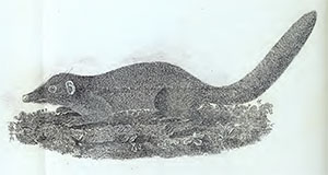
Plate IX