Re: Freda Bedi Cont'd (#3)
Kannauj
by Wikipedia
Accessed: 9/12/21
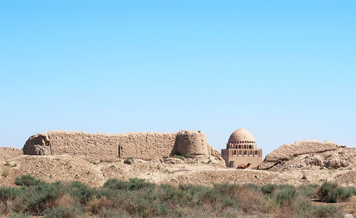
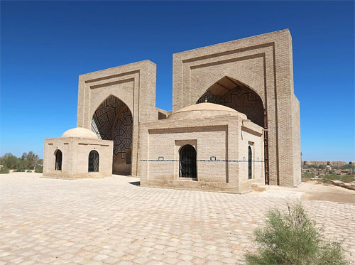
Kannauj
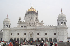
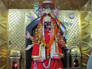
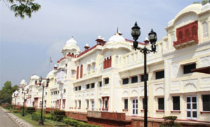
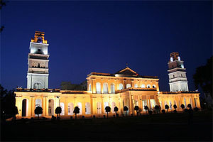
City
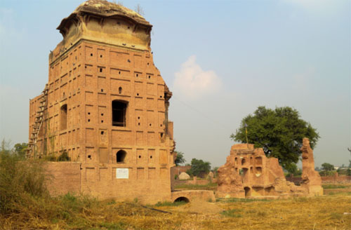
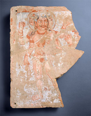
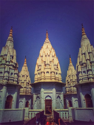
Goddess Annapurna Temple
Nickname(s): Perfume Capital of India
Coordinates: 27.07°N 79.92°ECoordinates: 27.07°N 79.92°E
Country: India
State: Uttar Pradesh
District: Kannauj
Elevation: 139 m (456 ft)
Population: (2011) Total: 84,862
Languages: Official: Hindi, Urdu
Website http://www.kannauj.nic.in
Kannauj (Hindustani pronunciation: [kənːɔːd͡ʒ]) is a city, administrative headquarters and a municipal board or Nagar Palika Parishad in Kannauj district in the Indian state of Uttar Pradesh. The city's name is a modern form of the classical name Kanyakubja.[1] It was also known as Mahodaya during the time of Mihira Bhoja[2]
Kannauj is an ancient city. It is said that the Kanyakubja Brahmins who included Shandilya (teacher of Rishi Bharadwaja) were held one of the three prominent families originally from Kannauj.[3]
In Classical India, it served as the center of imperial Indian dynasties. The earliest of these was the Maukhari dynasty, and later, Emperor Harsha of the Vardhana dynasty.[4] The city later came under the Gahadavala dynasty, and under the rule of Govindachandra, the city reached "unprecedented glory". Kannauj was also the main place of war in the Tripartite struggle between the Gurjars, the Palas and the Rashtrakutas.
However, the "glory of Imperial Kannauj" ended with conquests of the Delhi Sultanate.[5]
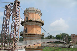
Kannauj is famous for distilling of scents. It is known as India’s perfume capital and is famous for its traditional Kannauj Perfume, a government protected entity,[6][7]
Kannauj itself has more than 200 perfume distilleries and is a market center for tobacco, Ittar (perfume), and rose water.[6] It has given its name to a distinct dialect of the Hindustani known as Kanauji, which has two different codes or registers.
History
Early history
Archaeological discoveries show that Kannauj was inhabited by the Painted Grey Ware and Northern Black Polished Ware cultures,[8] ca. 1200-600 BCE and ca. 700-200 BCE, respectively. Under the names of Kuśasthala and Kanyakubja, it is mentioned as a well-known town in the Hindu Epics, the Mahabharata and the Ramayana, and by the grammarian Patanjali (ca. 150 BCE).[9] The early Buddhist literature mentions Kannauj as Kannakujja, and refers to its location on the trade route from Mathura to Varanasi and Rajgir.[10]
Kannauj may have been known to the Greco-Roman civilization under the name of Kanagora or Kanogiza, which appears in Geography by Ptolemy (ca. 140 CE), but this identification is not confirmed. It was also visited by the Chinese Buddhist travellers Faxian and Xuanzang in the fifth and seventh centuries CE, respectively.[11]
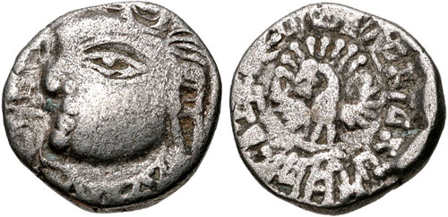
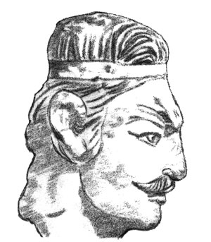
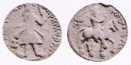
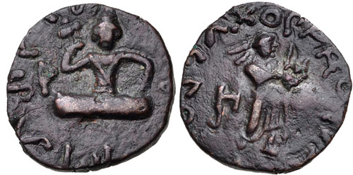
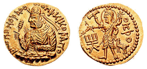
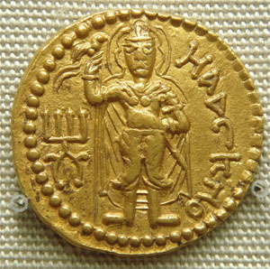
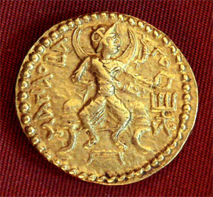
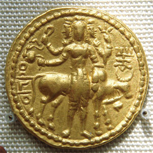
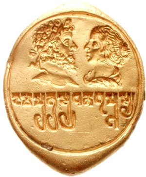
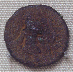
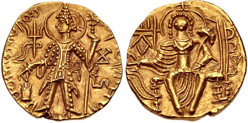
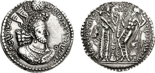
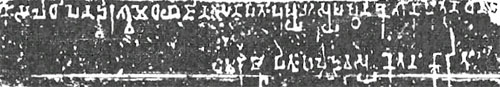
Coin of the Maukharis of Kannauj under Maharaja Isanavarman, circa 535-553 CE. [Peacock]
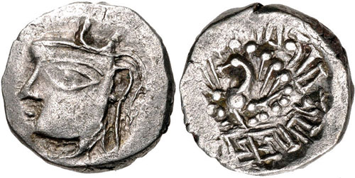
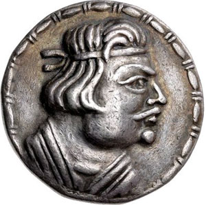
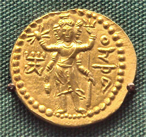
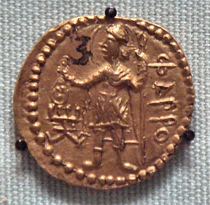
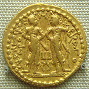
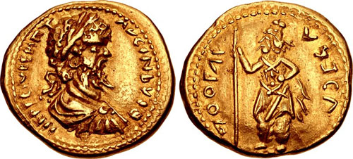
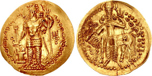
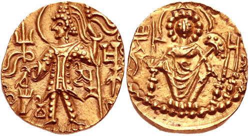
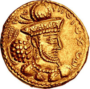
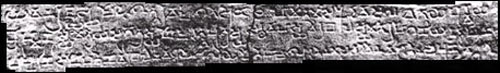
Coin of Emperor Harsha of the Vardhana dynasty, circa 606–647 CE. [Peacock][12]
Kannauj formed part of the Gupta Empire. During the decline of the Gupta Empire in the 6th century, the Maukhari dynasty of Kannauj - who had served as vassal rulers under the Guptas - took advantage of the weakening of central authority, broke away and established control over large areas of northern India.[13]
Under the Maukharis, Kannauj continued to grow in importance and prosperity. It became the greatest city of Northern India under Emperor Harsha (r. 606 to 647 CE) of the Vardhana dynasty, who conquered it and made it his capital.[14][15] Chinese pilgrim Xuanzang visited India during the reign of Harsha, and described Kannauj as a large, prosperous city with many Buddhist monasteries.[16] Harsha died with no heir, resulting in a power vacuum until Maharaja Yashovarman seized power as the ruler of Kannauj.[4]
The Kannauj Triangle
See also: Raja Jasdhaval at Roopkund
These wars took place from late 8th to early 9th century CE, after which Gurjara Pratiharas retain control of Ujjain.
Kannauj became a focal point for three powerful dynasties, namely the Gurjara Pratiharas (r. 730-1036 CE), Palas (r. 750-1162 CE) and Rashtrakutas (r. 753-982 CE), between the 8th and 10th centuries. The conflict between the three dynasties has been referred to as the Tripartite struggle by many historians.[17][18]
The Kanauj was the focal point of three empires: the Rashtrakutas of Deccan, the Gurjara Pratiharas of Malwa, and the Palas of Bengal.
There were initial struggles but ultimately the Gurjara Pratiharas succeeded in retaining the city.[17] The Gurjara-Pratiharas ruled Avanti (based at Ujjain), which was bounded to the South by the Rashtrakuta Empire, and the Pala Empire to the East. The Tripartite struggle began with the defeat of Indrayudh at the hands of Gurjara-Pratihara ruler Vatsaraja (r. 780-800 CE).[17] The Pala ruler Dharampala (~770-821 CE) was also keen to establish his authority at Kannauj, giving rise to a struggle between Vatsaraja and Dharmapala, in which Dharmapala was defeated.[19] Taking advantage of the chaos, the Rastrakuta ruler Dhruva Dharavarsha (r. 780–793 CE) surged northwards, defeated Vatsaraja, and took Kannauj for himself, completing the furthest northern expansion by a South Indian ruler.[18][20]
When the Rashtrakuta ruler Dhruva Dharavarsha advanced back to the south, Dharampala was left in control of Kannauj for some time. The struggle between the two northern dynasties of Palas and Gurjara Pratiharas continued: the Pala's vassal Chakrayudha (Dharmapala's nominee for Ujjain) was defeated by the Pratihara Nagabhata II (r. 805–833 CE), and Kannauj was again occupied by the Gurjara Pratiharas. Dharmapala tried to take control of Kannauj but was defeated badly at Moongher by the Gurjara Pratiharas.[17] However, Nagabhata II was in turn soon defeated by the Rashtrakuta Govinda III (r. 793–814 CE) , who had initiated a second northern surge. An inscription states that Chakrayudha and Dharmapala invited Govinda III to war against the Gurjara Pratiharas, but Dharmapala and Chakrayudh both submitted to the Govinda III, in order to win his sympathy. After this defeat, Pratihara power degenerated for some time. After the death of Dharampala, Nagabhata II regained hold over Kannuaj and made it the capital of the Gurjara Pratihara Empire. During this period, the Rashtrakutas were facing some internal conflicts, and so they, as well as the Pala Empire, did not contest this.[17] Thus Gurjara Pratiharas became the greatest power in Northern India after occupying Kannauj (9th century CE).[17]
Medieval times
Famous Pir-e-Kamil, Hazrat Pir Shah Jewna Al-Naqvi Al-Bokhari was also born in Kannauj in 1493 in the reign of King Sikandar Lodi. He was a descendant of Jalaluddin Surkh-Posh Bukhari and his father Syed Sadar-ud-din Shah Kabeer Naqvi Al Bukhari was a great saint and was also among the advisors of King Sikandar Lodhi. Shah Jewna migrated to Shah Jeewna (a town named after him) now in Pakistan. Shah Jewna’s colonized towns in Kannauj :- Siray- e-Miraan, Bibiyaan Jalalpur, Makhdoom Pur, Laal Pur (associated with the name of Saint Sayyed Jalaluddin Haider Surkh Posh Bukhari or Laal Bukhari). His descendants still present in various parts of India and Pakistan.[21][22][23][24]
Sultan Mahmud of Ghazni captured Kanauj in 1018. Chandradeva founded the Gahadvala dynasty with its capital at Kanauj around 1090. His grandson Govindachandra "raised Kanauj to unprecedented glory." Muhammad Ghori advanced against the city, and in the Battle of Chandwar of 1193 killed Jayachandra. Jai Chandra had earlier not supported Prithviraj Chauhan when the latter faced Muhammad Ghori and lost the Second Battle of Tarain in 1192
Alberuni has referred to "Kanoj" as the key geographical point to explain marching distances to other Indian cities [25] The "glory of Imperial Kanauj" ended with Iltutmish's conquest.[5]:21, 32–33
Sher Shah Suri defeated Humayun at the battle of Kannauj on 17 May 1540.
Colonial period
During early English rule in India, the city was spelled Cannodge by them. The Nawab Hakim Mehndi Ali Khan has been constantly associated with the development of city of kannouj by the travellers and writers of the period. A ghat (Mehndighat), a Sarai (for the free stay of travellers and merchants) and various metalled roads were built by the Nawab which also bear his name.
Geography
Kannauj is located at 27.07°N 79.92°E.[26] It has an average elevation of 139 metres (456 feet).
Demographics
As of 2001 India census,[27] Kannauj had a population of 71,530. Males constitute 53% of the population and females 47%. Kannauj has an average literacy rate of 58%: male literacy is 64%, and female literacy is 52%. In Kannauj, 15% of the population is under 6 years of age.
Colleges
Medical College
Government Medical College, Kannauj is a government medical college located in Tirwa of Kannauj, Uttar Pradesh, India. It is affiliated to King George's Medical University, Lucknow.
Engineering College
Government Engineering College, Kannauj is a government engineering college located at Kannauj. It is a constituent college of Dr. A.P.J. Abdul Kalam Technical University (formerly Uttar Pradesh Technical University) in Lucknow. The college is situated at Aher, Tirwa.
Transportation
The city is served by two major railway station Kannauj railway station and Kannauj City railway station. The nearest airport is Kanpur Airport situated about 2 hours drive from the town.
It is situated on GT road(Delhi to Kanpur). It has road transportation Kannauj Depo. under the Uttar Pradesh State Road Transportation Corporation(UPSRTC).
Notable people
• Āma, King of Kannauj
• Malini Awasthi, folk singer
• Mihira Bhoja, King of North India
• Shah Jewna, Missionary or Pir
• Sayyid Muhammad Qanauji, Sufi
• Samyukta, Princess of Kannauj
• Yashovarman, King of Kannauj
References
1. Rama Shankar Tripathi (1989). History of Kanauj: To the Moslem Conquest. Motilal Banarsidass Publ. p. 2. ISBN 978-81-208-0404-3.
2. https://timesofindia.indiatimes.com/blo ... rspective/
3. Upinder Singh (2008). A History of Ancient and Early Medieval India. Pearson Education India. p. 575. ISBN 9788131711200.
4. Tripathi, History of Kanauj, p.192
5. Sen, S.N., 2013, A Textbook of Medieval Indian History, Delhi: Primus Books, ISBN 9789380607344
6. "Life: India's perfume capital threatened by scent of modernity". The Taipei Times. Retrieved 10 February 2016.
7. Chisholm, Hugh, ed. (1911). "Kanauj" . Encyclopædia Britannica. 15 (11th ed.). Cambridge University Press. p. 648.
8. Dilip K. Chakrabarti (2007), Archaeological geography of the Ganga plain: the upper Ganga (Oudh, Rohilkhand, and the Doab), p.47
9. Rama S. Tripathi, History of Kanauj: To the Moslem Conquest (Motilal Banarsidass, 1964), pp.2,15-16
10. Moti Chandra (1977), Trade Routes in Ancient India pp.16-18
11. Tripathi, History of Kanauj, pp.17-19
12. "CNG: eAuction 329. INDIA, Post-Gupta (Ganges Valley). Vardhanas of Thanesar and Kanauj. Harshavardhana. Circa AD 606-647. AR Drachm (13mm, 2.28 g, 1h)". http://www.cngcoins.com.
13. Tripathi, History of Kanauj, pp.22-24
14. Tripathi, History of Kanauj, p.147
15. James Heitzman, The City in South Asia (Routledge, 2008), p.36
16. Heizman, The City in South Asia, pp.36-37
17. Pratiyogita Darpan. Upkar Prakashan. p. 9.
18. R.C. Majumdar (1994). Ancient India. Motilal Banarsidass. pp. 282–285. ISBN 978-81-208-0436-4.
19. Kumar Sundram (2007). Compendium General Knowledge. Upkar Prakashan. p. 195. ISBN 978-81-7482-181-2.
20. Pratiyogita Darpan. Upkar Prakashan.
21. "Pir-e-Kamil Hazrat Pir Shah Jewna Al-Naqvi Al-Bokhari". http://www.thenews.com.pk. Retrieved 1 January 2021.
22. "Hazrat Pir Shah Jewna (RA)". The Nation. 9 May 2012. Retrieved 1 January2021.
23. "Indian Journal Of Archaeology". ijarch.org. Retrieved 1 January 2021.
24. "Nazaria-i-Pakistan Trust". nazariapak.info. Retrieved 1 January 2021.
25. (India, Vol 1, from p 199 onwards, Translated by Dr Edward C. Sachau, London 1910).
26. Falling Rain Genomics, Inc – Kannauj
27. "Census of India 2001: Data from the 2001 Census, including cities, villages and towns (Provisional)". Census Commission of India. Archived from the original on 16 June 2004. Retrieved 1 November 2008.
Further reading
• Majumdar, R. C., In Pusalker, A. D., In Majumdar, A. K., & Bharatiya Vidya Bhavan,. (1993). The age of imperial Kanauj.
External links
• District Kannauj Website.
• Dugar, Divya (7 August 2012). "In pictures: Fading fragrance of Kannauj, India's perfume capital". CNN. Retrieved 1 January 2021.
• History of Kanauj: To the Moslem Conquest By Rama Shankar Tripathi
***********************************
Kahnuj
by Wikipedia
Accessed: 9/13/21
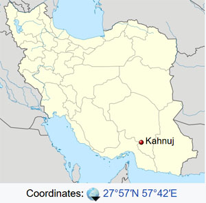
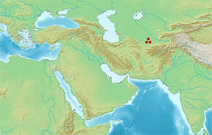
Kahnuj is located in Iran
Coordinates: 27°57′N 57°42′ECoordinates: 27°57′N 57°42′E
Country: Iran
Province: Kerman
County: Kahnuj
Bakhsh: Central
Population (2016 Census): 52,624 [1]
Kahnuj (Persian: كهنوج, also Romanized as Kahnūj)[2] is a city and capital of Kahnuj County, Kerman Province, Iran. At the 2006 census, its population was 38,571, in 8,278 families.[3] To the northwest is Mehroyeh Wildlife Refuge.
References
1. "Statistical Center of Iran > Home".
2. Kahnuj can be found at GEOnet Names Server, at this link, by opening the Advanced Search box, entering "-3756549" in the "Unique Feature Id" form, and clicking on "Search Database".
3. "Census of the Islamic Republic of Iran, 1385 (2006)" (Excel). Statistical Center of Iran. Archived from the original on 2011-11-11.
4. *"Average Maximum temperature in Kahnuj by Month 1989–2010". Iran Meteorological Organization. Retrieved April 8, 2015.[permanent dead link]
"Average Mean Daily temperature in Kahnuj by Month 1989–2010". Iran Meteorological Organization. Retrieved April 8, 2015.
"Average Minimum temperature in Kahnuj by Month 1989–2010". Iran Meteorological Organization. Retrieved April 8, 2015.[permanent dead link]
5. "Monthly Total Precipitation in Kahnuj by Month 1989–2010". Iran Meteorological Organization. Retrieved April 8, 2015.
6. "Average relative humidity in Kahnuj by Month 1989–2010". Iran Meteorological Organization. Retrieved April 8, 2015.[permanent dead link]
7. "No. Of days with precipitation equal to or greater than 1 mm in Kahnuj by Month 1989–2010". Iran Meteorological Organization. Retrieved April 8, 2015.[permanent dead link]
8. "Monthly total sunshine hours in Kahnuj by Month 1989–2010". Iran Meteorological Organization. Retrieved April 8, 2015.[permanent dead link]
*********************
Patali, Anbarabad
by Wikipedia
Accessed: 9/13/21
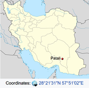
Patali
village
Patali is located in Iran
Coordinates: 28°21′31″N 57°51′02″ECoordinates: 28°21′31″N 57°51′02″E
Country: Iran
Province: Kerman
County: Anbarabad
Bakhsh: Central
Rural District: Jahadabad
Population (2006): 492
Patali (Persian: پاتلي, also Romanized as Pātalī; also known as Kheyrābād-e Pātelī)[1] is a village in Jahadabad Rural District, in the Central District of Anbarabad County, Kerman Province, Iran. At the 2006 census, its population was 492, in 105 families.[2]
References
1. Patali can be found at GEOnet Names Server, at this link, by opening the Advanced Search box, entering "-3078059" in the "Unique Feature Id" form, and clicking on "Search Database".
2. "Census of the Islamic Republic of Iran, 1385 (2006)" (Excel). Statistical Center of Iran. Archived from the original on 2011-11-11.
by Wikipedia
Accessed: 9/12/21
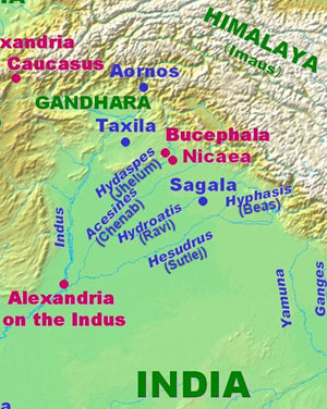
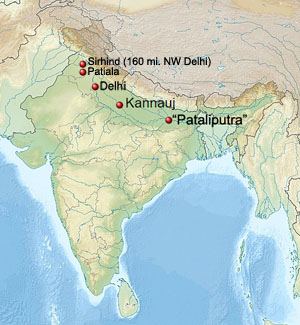
Delu is said to have been a prince of uncommon bravery and generosity; benevolent towards men, and devoted to the service of God. The most remarkable transaction of his reign is the building of the city of Delhi, which derives its name from its founder, Delu. In the fortieth year of his reign, Phoor, a prince of his own family, who was governor of Cumaoon, rebelled against the Emperor, and marched to Kinoge, the capital. Delu was defeated, taken, and confined in the impregnable fort of Rhotas.
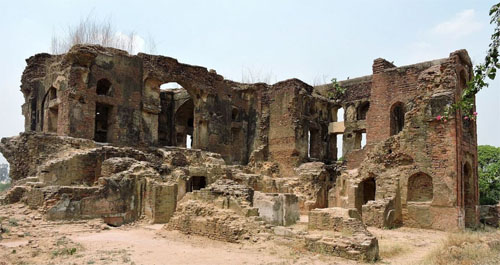
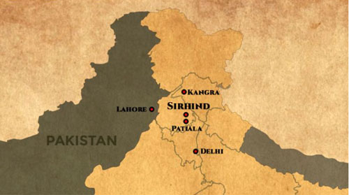
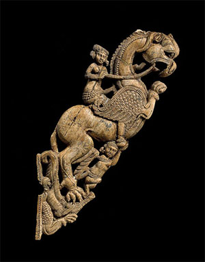
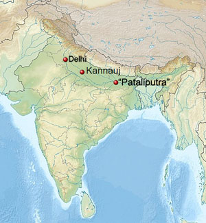
Sirhind / Patiala / Delhi / Kannauj / "Pataliputra"
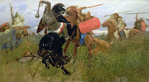
Phoor immediately mounted the throne of India, reduced Bengal, extended his power from sea to sea, and restored the empire to its pristine dignity. He died after a long reign, and left the kingdom to his son, who was also called Phoor, and was the same with the famous Porus, who fought against Alexander.
The second Phoor [Porus], taking advantage of the disturbances in Persia, occasioned by the Greek invasion of that empire under Alexander, neglected to remit the customary tribute, which drew upon him the arms of that conqueror. The approach of Alexander did not intimidate Phoor [Porus]. He, with a numerous army, met him at Sirhind, about one hundred and sixty miles to the north-west of Delhi, and in a furious battle, say the Indian historians, lost many thousands of his subjects, the victory, and his life. The most powerful prince of the Decan, who paid an unwilling homage to Phoor, or Porus, hearing of that monarch's overthrow, submitted himself to Alexander, and sent him rich presents by his son. Soon after, upon a mutiny arising in the Macedonian army, Alexander returned by the way of Persia.
Sinsarchund, the same whom the Greeks call Sandrocottus, assumed the imperial dignity after the death of Phoor, and in a short time regulated the discomposed concerns of the empire. He neglected not, in the mean time, to remit the customary tribute to the Grecian captains, who possessed Persia under, and after the death of, Alexander. Sinsarchund, and his son after him, possessed the empire of India seventy years. When the grandson of Sinsarchund acceded to the throne, a prince named Jona, who is said to have been a grand-nephew of Phoor, though that circumstance is not well attested, aspiring to the throne, rose in arms against the reigning prince, and deposed him.
-- The History of Hindostan, In Three Volumes, Volume I, by Alexander Dow, Esq., Lieutenant-Colonel in the Company's Service, 1812
Kannauj
City
Goddess Annapurna Temple
Nickname(s): Perfume Capital of India
Coordinates: 27.07°N 79.92°ECoordinates: 27.07°N 79.92°E
Country: India
State: Uttar Pradesh
District: Kannauj
Elevation: 139 m (456 ft)
Population: (2011) Total: 84,862
Languages: Official: Hindi, Urdu
Website http://www.kannauj.nic.in
Kannauj (Hindustani pronunciation: [kənːɔːd͡ʒ]) is a city, administrative headquarters and a municipal board or Nagar Palika Parishad in Kannauj district in the Indian state of Uttar Pradesh. The city's name is a modern form of the classical name Kanyakubja.[1] It was also known as Mahodaya during the time of Mihira Bhoja[2]
Kannauj is an ancient city. It is said that the Kanyakubja Brahmins who included Shandilya (teacher of Rishi Bharadwaja) were held one of the three prominent families originally from Kannauj.[3]
In Classical India, it served as the center of imperial Indian dynasties. The earliest of these was the Maukhari dynasty, and later, Emperor Harsha of the Vardhana dynasty.[4] The city later came under the Gahadavala dynasty, and under the rule of Govindachandra, the city reached "unprecedented glory". Kannauj was also the main place of war in the Tripartite struggle between the Gurjars, the Palas and the Rashtrakutas.
However, the "glory of Imperial Kannauj" ended with conquests of the Delhi Sultanate.[5]
Kannauj is famous for distilling of scents. It is known as India’s perfume capital and is famous for its traditional Kannauj Perfume, a government protected entity,[6][7]
Kannauj itself has more than 200 perfume distilleries and is a market center for tobacco, Ittar (perfume), and rose water.[6] It has given its name to a distinct dialect of the Hindustani known as Kanauji, which has two different codes or registers.
History
Early history
Archaeological discoveries show that Kannauj was inhabited by the Painted Grey Ware and Northern Black Polished Ware cultures,[8] ca. 1200-600 BCE and ca. 700-200 BCE, respectively. Under the names of Kuśasthala and Kanyakubja, it is mentioned as a well-known town in the Hindu Epics, the Mahabharata and the Ramayana, and by the grammarian Patanjali (ca. 150 BCE).[9] The early Buddhist literature mentions Kannauj as Kannakujja, and refers to its location on the trade route from Mathura to Varanasi and Rajgir.[10]
Kannauj may have been known to the Greco-Roman civilization under the name of Kanagora or Kanogiza, which appears in Geography by Ptolemy (ca. 140 CE), but this identification is not confirmed. It was also visited by the Chinese Buddhist travellers Faxian and Xuanzang in the fifth and seventh centuries CE, respectively.[11]
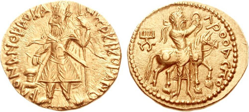
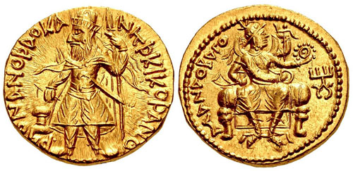
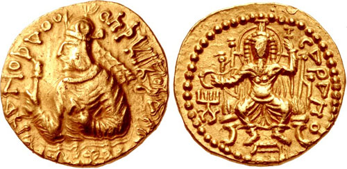
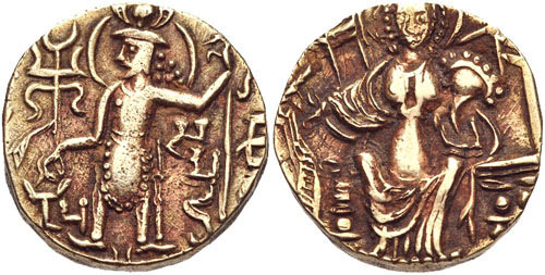
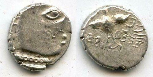
Coin of the Maukharis of Kannauj under Maharaja Isanavarman, circa 535-553 CE. [Peacock]
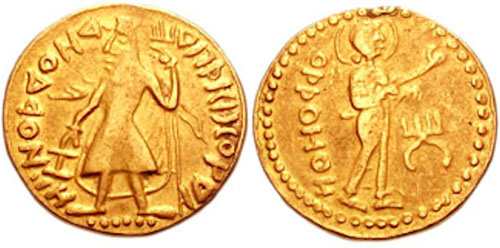
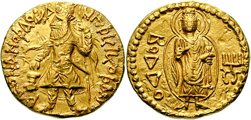
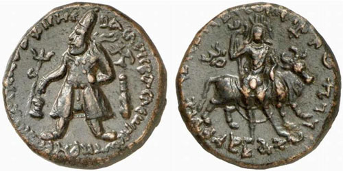
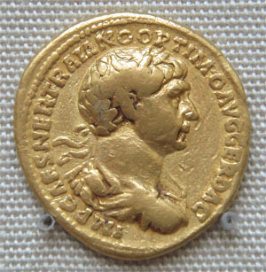
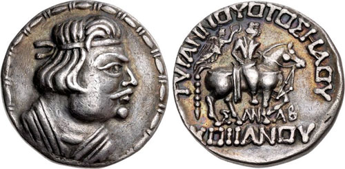
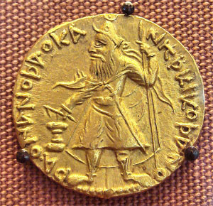
Coin of Emperor Harsha of the Vardhana dynasty, circa 606–647 CE. [Peacock][12]
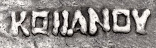
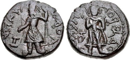
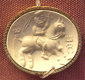
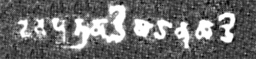
Moustachiod head of king right, wearing a simple crescent-topped crown, unread legend left / Fan-tailed peacock facing, crude Brahmi legend around: vijitavanir avanapati,13mm, 1.67 grams. Kanauj mint? Unpublished and unknown until recently. This is a coin of the famous king Harsha or Harshavardhana, who ascended the throne of Thaneswar, a small kingdom in present-day Haryana, at the age of 16, and then reconstituted the remnants of a large part of the fragmented Gupta empire in Northern India into a single realm. He moved his capital to Kanauj and had an illustrious reign of over 40 years. Harsha died in the year 647. He ruled for 41 years. After Harsha's death, his empire died with him. The kingdom disintegrated rapidly into small states. The succeeding period is very obscure and badly documented, but it marks the culmination of a process that had begun with the invasion of the Huns in the last years of the Gupta Empire.
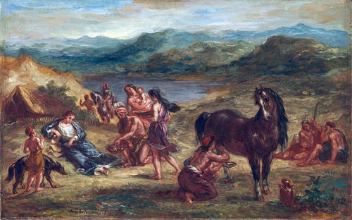
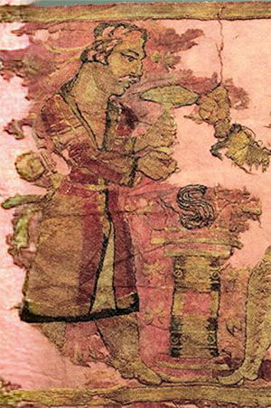
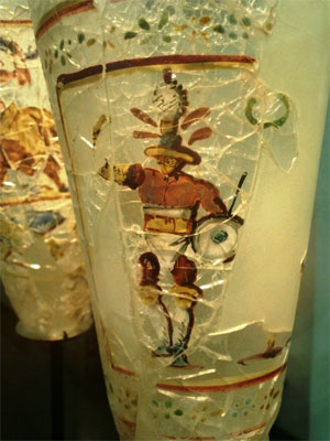
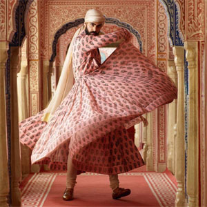
The Call of the Peacock A flamboyant men’s printed cotton angrakha in kanauj-pink coromandel chintz. By Sabyasachi, photo by Tarun Vishwa
Only Justin (Just. xii, 8) reports that Alexander had defeated the Prasii. Palibothra, the Prasiian capital was famous for peacocks. Lane Fox writes:... Dhana Nanda's kingdom could have been set against itself and Alexander might yet have walked among Palimbothra's peacocks.
Curiously, Arrian writes that Alexander was so charmed by the beauty of peacocks that he decreed the severest penalties against anyone killing them (Arrian, Indica, xv.218). The picture of Alexander amidst peacocks appears puzzling: where did he come across the majestic bird? Does this fascination lead us to Palibothra?
-- An Altar of Alexander Now Standing at Delhi [EXPANDED VERSION], by Ranajit Pal
Kannauj formed part of the Gupta Empire. During the decline of the Gupta Empire in the 6th century, the Maukhari dynasty of Kannauj - who had served as vassal rulers under the Guptas - took advantage of the weakening of central authority, broke away and established control over large areas of northern India.[13]
Under the Maukharis, Kannauj continued to grow in importance and prosperity. It became the greatest city of Northern India under Emperor Harsha (r. 606 to 647 CE) of the Vardhana dynasty, who conquered it and made it his capital.[14][15] Chinese pilgrim Xuanzang visited India during the reign of Harsha, and described Kannauj as a large, prosperous city with many Buddhist monasteries.[16] Harsha died with no heir, resulting in a power vacuum until Maharaja Yashovarman seized power as the ruler of Kannauj.[4]
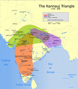
The Kannauj Triangle
See also: Raja Jasdhaval at Roopkund
These wars took place from late 8th to early 9th century CE, after which Gurjara Pratiharas retain control of Ujjain.
Kannauj became a focal point for three powerful dynasties, namely the Gurjara Pratiharas (r. 730-1036 CE), Palas (r. 750-1162 CE) and Rashtrakutas (r. 753-982 CE), between the 8th and 10th centuries. The conflict between the three dynasties has been referred to as the Tripartite struggle by many historians.[17][18]
The Kanauj was the focal point of three empires: the Rashtrakutas of Deccan, the Gurjara Pratiharas of Malwa, and the Palas of Bengal.
There were initial struggles but ultimately the Gurjara Pratiharas succeeded in retaining the city.[17] The Gurjara-Pratiharas ruled Avanti (based at Ujjain), which was bounded to the South by the Rashtrakuta Empire, and the Pala Empire to the East. The Tripartite struggle began with the defeat of Indrayudh at the hands of Gurjara-Pratihara ruler Vatsaraja (r. 780-800 CE).[17] The Pala ruler Dharampala (~770-821 CE) was also keen to establish his authority at Kannauj, giving rise to a struggle between Vatsaraja and Dharmapala, in which Dharmapala was defeated.[19] Taking advantage of the chaos, the Rastrakuta ruler Dhruva Dharavarsha (r. 780–793 CE) surged northwards, defeated Vatsaraja, and took Kannauj for himself, completing the furthest northern expansion by a South Indian ruler.[18][20]
When the Rashtrakuta ruler Dhruva Dharavarsha advanced back to the south, Dharampala was left in control of Kannauj for some time. The struggle between the two northern dynasties of Palas and Gurjara Pratiharas continued: the Pala's vassal Chakrayudha (Dharmapala's nominee for Ujjain) was defeated by the Pratihara Nagabhata II (r. 805–833 CE), and Kannauj was again occupied by the Gurjara Pratiharas. Dharmapala tried to take control of Kannauj but was defeated badly at Moongher by the Gurjara Pratiharas.[17] However, Nagabhata II was in turn soon defeated by the Rashtrakuta Govinda III (r. 793–814 CE) , who had initiated a second northern surge. An inscription states that Chakrayudha and Dharmapala invited Govinda III to war against the Gurjara Pratiharas, but Dharmapala and Chakrayudh both submitted to the Govinda III, in order to win his sympathy. After this defeat, Pratihara power degenerated for some time. After the death of Dharampala, Nagabhata II regained hold over Kannuaj and made it the capital of the Gurjara Pratihara Empire. During this period, the Rashtrakutas were facing some internal conflicts, and so they, as well as the Pala Empire, did not contest this.[17] Thus Gurjara Pratiharas became the greatest power in Northern India after occupying Kannauj (9th century CE).[17]
Medieval times
Famous Pir-e-Kamil, Hazrat Pir Shah Jewna Al-Naqvi Al-Bokhari was also born in Kannauj in 1493 in the reign of King Sikandar Lodi. He was a descendant of Jalaluddin Surkh-Posh Bukhari and his father Syed Sadar-ud-din Shah Kabeer Naqvi Al Bukhari was a great saint and was also among the advisors of King Sikandar Lodhi. Shah Jewna migrated to Shah Jeewna (a town named after him) now in Pakistan. Shah Jewna’s colonized towns in Kannauj :- Siray- e-Miraan, Bibiyaan Jalalpur, Makhdoom Pur, Laal Pur (associated with the name of Saint Sayyed Jalaluddin Haider Surkh Posh Bukhari or Laal Bukhari). His descendants still present in various parts of India and Pakistan.[21][22][23][24]
Sultan Mahmud of Ghazni captured Kanauj in 1018. Chandradeva founded the Gahadvala dynasty with its capital at Kanauj around 1090. His grandson Govindachandra "raised Kanauj to unprecedented glory." Muhammad Ghori advanced against the city, and in the Battle of Chandwar of 1193 killed Jayachandra. Jai Chandra had earlier not supported Prithviraj Chauhan when the latter faced Muhammad Ghori and lost the Second Battle of Tarain in 1192
Alberuni has referred to "Kanoj" as the key geographical point to explain marching distances to other Indian cities [25] The "glory of Imperial Kanauj" ended with Iltutmish's conquest.[5]:21, 32–33
Sher Shah Suri defeated Humayun at the battle of Kannauj on 17 May 1540.
Colonial period
During early English rule in India, the city was spelled Cannodge by them. The Nawab Hakim Mehndi Ali Khan has been constantly associated with the development of city of kannouj by the travellers and writers of the period. A ghat (Mehndighat), a Sarai (for the free stay of travellers and merchants) and various metalled roads were built by the Nawab which also bear his name.
Geography
Kannauj is located at 27.07°N 79.92°E.[26] It has an average elevation of 139 metres (456 feet).
Demographics
As of 2001 India census,[27] Kannauj had a population of 71,530. Males constitute 53% of the population and females 47%. Kannauj has an average literacy rate of 58%: male literacy is 64%, and female literacy is 52%. In Kannauj, 15% of the population is under 6 years of age.
Colleges
Medical College
Government Medical College, Kannauj is a government medical college located in Tirwa of Kannauj, Uttar Pradesh, India. It is affiliated to King George's Medical University, Lucknow.
Engineering College
Government Engineering College, Kannauj is a government engineering college located at Kannauj. It is a constituent college of Dr. A.P.J. Abdul Kalam Technical University (formerly Uttar Pradesh Technical University) in Lucknow. The college is situated at Aher, Tirwa.
Transportation
The city is served by two major railway station Kannauj railway station and Kannauj City railway station. The nearest airport is Kanpur Airport situated about 2 hours drive from the town.
It is situated on GT road(Delhi to Kanpur). It has road transportation Kannauj Depo. under the Uttar Pradesh State Road Transportation Corporation(UPSRTC).
Notable people
• Āma, King of Kannauj
• Malini Awasthi, folk singer
• Mihira Bhoja, King of North India
• Shah Jewna, Missionary or Pir
• Sayyid Muhammad Qanauji, Sufi
• Samyukta, Princess of Kannauj
• Yashovarman, King of Kannauj
References
1. Rama Shankar Tripathi (1989). History of Kanauj: To the Moslem Conquest. Motilal Banarsidass Publ. p. 2. ISBN 978-81-208-0404-3.
2. https://timesofindia.indiatimes.com/blo ... rspective/
3. Upinder Singh (2008). A History of Ancient and Early Medieval India. Pearson Education India. p. 575. ISBN 9788131711200.
4. Tripathi, History of Kanauj, p.192
5. Sen, S.N., 2013, A Textbook of Medieval Indian History, Delhi: Primus Books, ISBN 9789380607344
6. "Life: India's perfume capital threatened by scent of modernity". The Taipei Times. Retrieved 10 February 2016.
7. Chisholm, Hugh, ed. (1911). "Kanauj" . Encyclopædia Britannica. 15 (11th ed.). Cambridge University Press. p. 648.
8. Dilip K. Chakrabarti (2007), Archaeological geography of the Ganga plain: the upper Ganga (Oudh, Rohilkhand, and the Doab), p.47
9. Rama S. Tripathi, History of Kanauj: To the Moslem Conquest (Motilal Banarsidass, 1964), pp.2,15-16
10. Moti Chandra (1977), Trade Routes in Ancient India pp.16-18
11. Tripathi, History of Kanauj, pp.17-19
12. "CNG: eAuction 329. INDIA, Post-Gupta (Ganges Valley). Vardhanas of Thanesar and Kanauj. Harshavardhana. Circa AD 606-647. AR Drachm (13mm, 2.28 g, 1h)". http://www.cngcoins.com.
13. Tripathi, History of Kanauj, pp.22-24
14. Tripathi, History of Kanauj, p.147
15. James Heitzman, The City in South Asia (Routledge, 2008), p.36
16. Heizman, The City in South Asia, pp.36-37
17. Pratiyogita Darpan. Upkar Prakashan. p. 9.
18. R.C. Majumdar (1994). Ancient India. Motilal Banarsidass. pp. 282–285. ISBN 978-81-208-0436-4.
19. Kumar Sundram (2007). Compendium General Knowledge. Upkar Prakashan. p. 195. ISBN 978-81-7482-181-2.
20. Pratiyogita Darpan. Upkar Prakashan.
21. "Pir-e-Kamil Hazrat Pir Shah Jewna Al-Naqvi Al-Bokhari". http://www.thenews.com.pk. Retrieved 1 January 2021.
22. "Hazrat Pir Shah Jewna (RA)". The Nation. 9 May 2012. Retrieved 1 January2021.
23. "Indian Journal Of Archaeology". ijarch.org. Retrieved 1 January 2021.
24. "Nazaria-i-Pakistan Trust". nazariapak.info. Retrieved 1 January 2021.
25. (India, Vol 1, from p 199 onwards, Translated by Dr Edward C. Sachau, London 1910).
26. Falling Rain Genomics, Inc – Kannauj
27. "Census of India 2001: Data from the 2001 Census, including cities, villages and towns (Provisional)". Census Commission of India. Archived from the original on 16 June 2004. Retrieved 1 November 2008.
Further reading
• Majumdar, R. C., In Pusalker, A. D., In Majumdar, A. K., & Bharatiya Vidya Bhavan,. (1993). The age of imperial Kanauj.
External links
• District Kannauj Website.
• Dugar, Divya (7 August 2012). "In pictures: Fading fragrance of Kannauj, India's perfume capital". CNN. Retrieved 1 January 2021.
• History of Kanauj: To the Moslem Conquest By Rama Shankar Tripathi
***********************************
Kahnuj
by Wikipedia
Accessed: 9/13/21
Bosworth writes that the name of the place where the victory was celebrated was Kahnuj. The name tells all, for Kanauj was the chief city of the Indians, the name of which is echoed in the famous city in eastern India which later became most important.29 [A. B. Bosworth, Conquest and Empire: The Reign of Alexander the Great (Cambridge 1988) 150, who gives the name Khanu (maps usually give the name Kohnouj or Kahnuj). Nearby Patali may have been Palibothra.]As the winter deepened, Alexander approached the Carmanian capital, which Diodorus (xvii.106.4) names Salmus. It was, according to Nearchus (Arr. Ind. 33.7), five days' journey from the coast. The site remains a mystery,386 but it was probably at the western side of the valley of the Halil Rud, in the general vicinity of the modern town of Khanu. The army was in an area of relative plenty but close enough to the coast to receive news of the progress of Nearchus' fleet. There Alexander sacrificed to commemorate his Indian victory and the emergence from the Gedrosian desert, and he held a musical and athletic festival, a drunken and festive affair, notable for the general acclaim achieved by Alexander's favourite Bagoas when he entered the winning chorus.387 During the celebrations, if not before, news came of Nearchus' safe arrival at Harmozeia, the principal seaport of Carmania. The details are supplied for us by Nearchus, and they are open to justifiable suspicion. Nearchus has a rich story, full of dramatic peripeteia, in which he unexpectedly learns of the king's presence in the near vicinity, marches up county with a small escort, strangely missing the search parties sent out by his anxious king, and is finally retrieved, unrecognisable from brine and fatigue, to give the glad news of the fleet's survival to Alexander in person. The details of this Odyssey are beyond verification and there is very probably a good deal of imaginative embellishment.388 What is certain is that the fleet arrived at Harmozeia without serious loss and that its arrival was announced to Alexander by Nearchus in person. It was a moment of general exaltation, and, if we may believe Nearchus (Arr. Ind. 36.3), Alexander renewed the sacrifices and prolonged the games. The celebrations which had begun commemorating the delivery of the army from Gedrosia ended with thanks-offerings for the safe arrival of the fleet.
-- A. B. Bosworth, Conquest and Empire: The Reign of Alexander the Great (Cambridge 1988), p. 150
-- An Altar of Alexander Now Standing at Delhi [EXPANDED VERSION], by Ranajit Pal
Kahnuj is located in Iran
Coordinates: 27°57′N 57°42′ECoordinates: 27°57′N 57°42′E
Country: Iran
Province: Kerman
County: Kahnuj
Bakhsh: Central
Population (2016 Census): 52,624 [1]
Kahnuj (Persian: كهنوج, also Romanized as Kahnūj)[2] is a city and capital of Kahnuj County, Kerman Province, Iran. At the 2006 census, its population was 38,571, in 8,278 families.[3] To the northwest is Mehroyeh Wildlife Refuge.
References
1. "Statistical Center of Iran > Home".
2. Kahnuj can be found at GEOnet Names Server, at this link, by opening the Advanced Search box, entering "-3756549" in the "Unique Feature Id" form, and clicking on "Search Database".
3. "Census of the Islamic Republic of Iran, 1385 (2006)" (Excel). Statistical Center of Iran. Archived from the original on 2011-11-11.
4. *"Average Maximum temperature in Kahnuj by Month 1989–2010". Iran Meteorological Organization. Retrieved April 8, 2015.[permanent dead link]
"Average Mean Daily temperature in Kahnuj by Month 1989–2010". Iran Meteorological Organization. Retrieved April 8, 2015.
"Average Minimum temperature in Kahnuj by Month 1989–2010". Iran Meteorological Organization. Retrieved April 8, 2015.[permanent dead link]
5. "Monthly Total Precipitation in Kahnuj by Month 1989–2010". Iran Meteorological Organization. Retrieved April 8, 2015.
6. "Average relative humidity in Kahnuj by Month 1989–2010". Iran Meteorological Organization. Retrieved April 8, 2015.[permanent dead link]
7. "No. Of days with precipitation equal to or greater than 1 mm in Kahnuj by Month 1989–2010". Iran Meteorological Organization. Retrieved April 8, 2015.[permanent dead link]
8. "Monthly total sunshine hours in Kahnuj by Month 1989–2010". Iran Meteorological Organization. Retrieved April 8, 2015.[permanent dead link]
*********************
Patali, Anbarabad
by Wikipedia
Accessed: 9/13/21
Patali
village
Patali is located in Iran
Coordinates: 28°21′31″N 57°51′02″ECoordinates: 28°21′31″N 57°51′02″E
Country: Iran
Province: Kerman
County: Anbarabad
Bakhsh: Central
Rural District: Jahadabad
Population (2006): 492
Patali (Persian: پاتلي, also Romanized as Pātalī; also known as Kheyrābād-e Pātelī)[1] is a village in Jahadabad Rural District, in the Central District of Anbarabad County, Kerman Province, Iran. At the 2006 census, its population was 492, in 105 families.[2]
References
1. Patali can be found at GEOnet Names Server, at this link, by opening the Advanced Search box, entering "-3078059" in the "Unique Feature Id" form, and clicking on "Search Database".
2. "Census of the Islamic Republic of Iran, 1385 (2006)" (Excel). Statistical Center of Iran. Archived from the original on 2011-11-11.