Cappadocia (Excerpt from "Turkey, Gate to the Orient")
by Turhan Can
NOTICE: THIS WORK MAY BE PROTECTED BY COPYRIGHT
YOU ARE REQUIRED TO READ THE COPYRIGHT NOTICE AT THIS LINK BEFORE YOU READ THE FOLLOWING WORK, THAT IS AVAILABLE SOLELY FOR PRIVATE STUDY, SCHOLARSHIP OR RESEARCH PURSUANT TO 17 U.S.C. SECTION 107 AND 108. IN THE EVENT THAT THE LIBRARY DETERMINES THAT UNLAWFUL COPYING OF THIS WORK HAS OCCURRED, THE LIBRARY HAS THE RIGHT TO BLOCK THE I.P. ADDRESS AT WHICH THE UNLAWFUL COPYING APPEARED TO HAVE OCCURRED. THANK YOU FOR RESPECTING THE RIGHTS OF COPYRIGHT OWNERS.
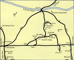
MAP OF CAPPADOCIA
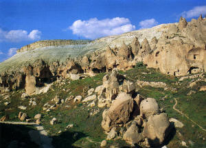
Cappadocia has an indescribably beautiful and interesting landscape, where snow and rain, wind and sun hollowed out tuffs, and formed thousands of pyramid-like formations which changed the nature of the whole region to a bizarre and dreamlike landscape. 50 km south of this area is the former volcano, 3,916m high Mount Erciyes (previously Argaeus). The violent eruption of these volcanoes caused sedimentation of enormous ash layers in the area of these mountains. These ash masses were consolidated later, during which time, rivers and brooks gouged grooves which were buried in the tuff layers; at the same time, forests extended to the south coast of the Kizilirmak (Halys) river. Sometimes the cones are scattered here and there, sometimes they are pressed into tight masses with sharp points. Some of them wear a hat of harder stone which can better resist erosion.
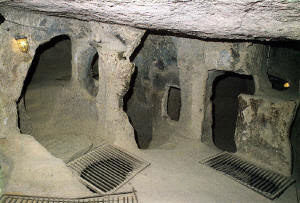
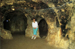
The beauty and the geographical charm of the landscape is also a part of its interesting history. At the base of rock walls or inside the cones, homes and churches were hewn out. Earlier, it was a place of refuge for the Christian population of Anatolia before the invasion of the Arabs (7th-13 centuries A.D.). It is known that the apostle St. Paul was in great need of a refuge because he was being pursued, and he established the first Christian colony in this region with his friends.
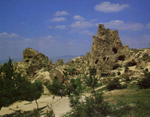
Open air museum at Goreme
GOREME
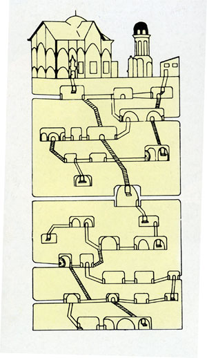
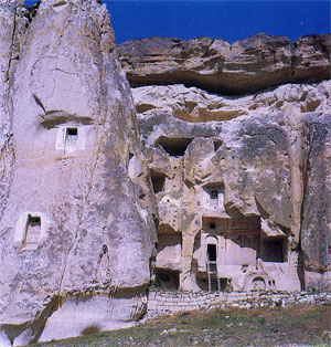
When the Christians settled in cappadocia, St. Basil from Kayseri established a cloister, and had missionaries educated in order to disseminate the religion. Thus, the first cloister was established in Goreme valley under the leadership fo St. Basil. Earlier, Goreme was an important rock settlement, but people left the area a long time ago. In the cones and rock walls the cloister order had their homes and churches. Today, an open-air museum has been made in this region and we shall visit it.
Nunnery
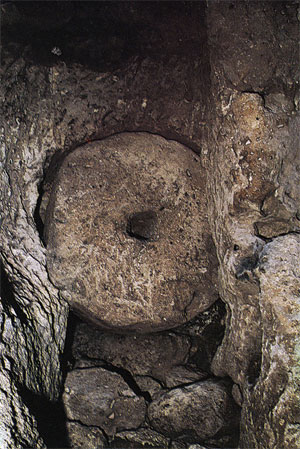
The first floor of the nunnery served as a cellar, a kitchen and a living-room. On the third floor there was a church, established in the 11th century. The remaining three floors served as a place of refuge. Opposite the nunnery stood a monastery.
Elmali Church (Apple Church) 11th century.
This is the smallest and the most recent of the pillared churches in the region. It has a cross-form ground plan. Four columns support the dome. All sections were hewn from rock. The important frescoes are: Christ Pantocrator, the archangel, the nativity, the transfiguration, the raising of Lazarus, the journey to Jerusalem, the last supper, the betrayal of Christ, the crucifixion, and the entombment.
The Church of St. Barbara 11th century.
This small church with two columns was carved on a rock block like Elmali-Church. Its frescoes depict St. Theodore, St. George with the dragons, and the flight to Egypt. The decorations in symbolic red are from the iconoclastic period.
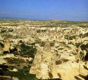
Goreme Valley
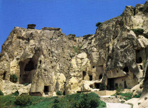
Rock Churches of Goreme
Yilanli Church (Snake Church) 11th century.
This small tomb-church consists of a long vaulted nave and a low ceiling. Across the entrance, a Christ figure with the founder of the chapel has been depicted in fresco form. On the right wall we see St. Basil and St. Thomas. Close to them is St. Onouphrios, the hermit, whose genitals were hidden by foliage. According to the legend, this female saint was changed into a man. On the left wall Saint Theodore is shown struggling with the snake (the name of the church derives from this) and Emperor Constantine and his mother Helen are shown supporting the cross in their hands.
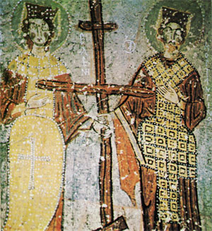
Constantine and Helen (Yilanli Kilise)
Karanlik Church (Dark Church) 11th century.
This church is the best example of 11th century Byzantine art; it is also the best preserved one of the region. The only source of light is an opening in the vestibule, by means of which the frescoes could be kept in good condition. The fresco scenes are: Christ Pantocrator, the betrayal of Christ, the nativity, the last supper, the crucifixion, the apprehension of Christ, the raising of Lazarus, the baptism of Christ, four evangelists, and others.
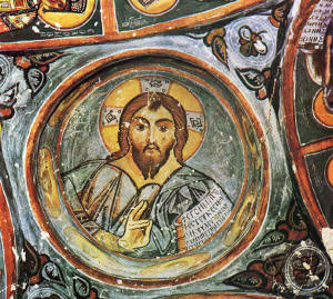
Christ Pantocrator (Karanlik Kilise)
Carikli Church (Sandal Church)
This church has a cross form, and it is divided by two columns and two corner buttresses. It can be easily recognized by its iron staircase. The church derived its name from the footprints on the floor. The themes of the frescoes are taken from the New Testament and they are similar to those in the Elmali and Karanlik churches.
Tokali Church (Church-with-a-Shield)
This is to the right of the main road to Avcilar and is one hundred metres from the parking place. This church is the largest rock-church of Cappadocia, and with its frescoes it is the most important one of the area. Its name was derived from a shield which was once hanging from the ceiling. The shield does not exist any more, but its place, where once it was attached, is still noticeable. The church has a long vestibule which is connected to the nave with a barrel-vault. At the eastern end of this nave there are four columns connected by arches. Beyond these columns there is an elevated corridor with one large apse and two small apses.
The frescoes have figures similar to the other rock-churches. Here one can see the termination scenes of St. Basil, the saint who was considered a martyr, bishops and monks.
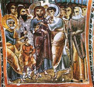
The Betrayal of Christ (Karanlik Kilise)
CAVUSIN
On the right of the Goreme-Avanos road, lies Cavusin village. It was newly established after the collapse of a slope. In the old Cavusin village which is partly buried, collapsed slope, stands the Church of St. John the Baptist, which is the oldest one of the region, dating from the 8th century. It can be easily noticed from the street with its frescoes and iron staircase. It consists of a nave with a barrel-vault and three apses. The themes of its frescoes were taken from the New Tetament.
Church of Cavusin
ZELVE
This valley is one of the most picturesque corners of Cappadocia. Because of the dilapidated condition of the rocks, a New Zelve had to be set up nearby in 1952.
The old Zelve village was carved in a narrow valley in the steep mountains, in rocks. Once, the village served as a hiding place and was an important church and cloister centre. This village (old Zelve) was almost totally destroyed, but the remains can be visited today.
The most important churches are" Uzumlu kilise (Church-with-Grapes) and Geyikli kilise (Church-with-Deer). In these churches mostly cross motifs were used.
Zelve
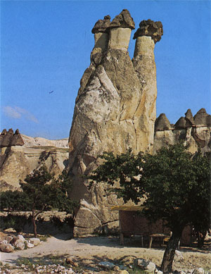
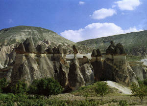
PASABAG
Near Zelve lies the vineyard of Pasabag, which is called Monks' Valley. The name was derived from some cones carved in tuff stones which stand apart. Some of them split into smaller cones in their upper sections, in which stylites and hermits once hid. The hermitage of Simeon monks was also here.
Pasabag
--Casa Battlo, "Antonio Gaudi, Master Architect," by Juan Bassegoda Nonell, photography by Melba Levick
Pasabag
AVANOS
Avanos is situated along both sides of the Kizilirmak (Halys), the longest river in Turkey (1,335km). In the past this small town was called Vanessa, and it is famous for its pottery made of the local red clay. The most important industries apart from pottery are hand-knotted carpets and viniculture.
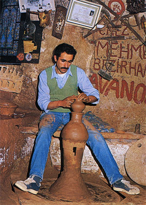
Potter in Avanos
URGUP
Urgup lies at the foot of steep rocks, which were once thoroughly inundated by people making their homes in them. The highest homes were later deserted, and the others now serve as sheds. According to 10th century documents, Urgup was the bishops' residence of the Middle Ages. The route Urgup-Ortahisar is a picturesque corner with innumerable rock-pyramids partly grouped together and partly with tuff caps.
Urgup
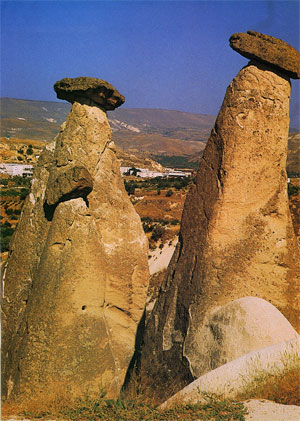
Rock Formation of Urgup
ORTAHISAR
This place also lies at the foot of a rock-block shape with a lot of rock-hollows. The first inhabitants of the village probably lived in these hollows, which are used as storerooms nowadays. In the area near Cambazli Church there is a cross-domed chapel and Harim Church, which is now used as a shed for equipment.
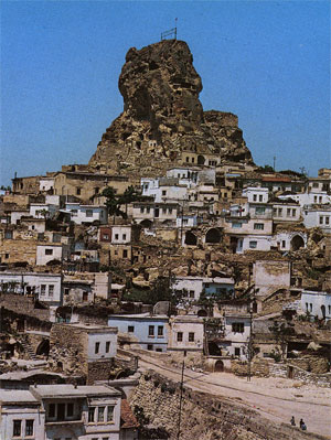
Ortahisar
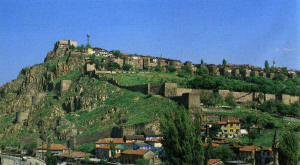
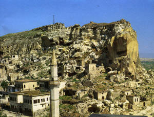
UCHISAR
This place resembles a castle from a distance. The village lies at the root of the rock-blocks, which are perforated in the usual manner. From the top there is a magnificent panorama of the plateau. In the afternoon, the light is ideal for panoramic pictures.
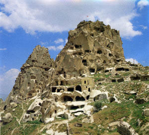
Uchisar
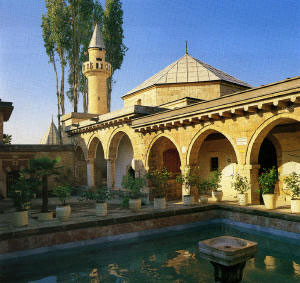
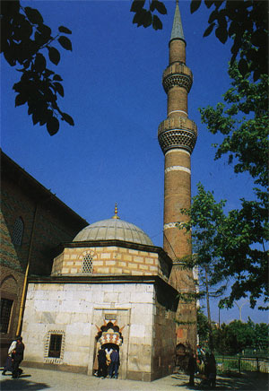
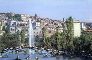
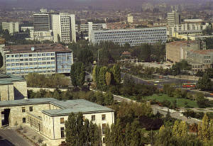
NEVSEHIR
Nevsehir was formed on the western end of the famous tuff landscape of Cappadocia. The old name of this central Anatolian city was Nissa and it had a population of 150,000. It lies on the slopes of a hill, on whose summit rises the citadel of the Seljuks.
Kursunlu camii (Mosque-with-Lead), which was built in 1726 by the Grand Vizier Damat Ibrahim Pasa, the citadel of the Seljuks, and Kaya camii (Rock Mosque) are all worth seeing.